
Anville, Jean Baptiste Bourguignon d'
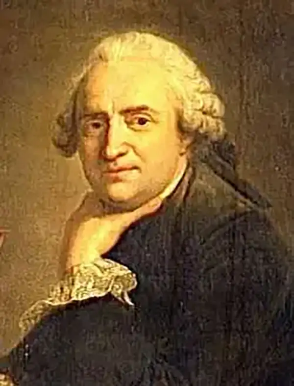
Jean Baptiste Bourguignon d'Anville (1697 - 1782) was perhaps the most important and prolific cartographer of the 18th century. D'Anville's passion for cartography manifested during his school years when he amused himself by composing maps for Latin texts. There is a preserved manuscript dating to 1712, Graecia Vetus, which may be his earliest surviving map - he was only 15 when he drew it. He would retain an interest in the cartography of antiquity throughout his long career and published numerous atlases to focusing on the ancient world. At twenty-two D'Anville, sponsored by the Duke of Orleans, was appointed Geographer to the King of France. As both a cartographer and a geographer, he instituted a reform in the general practice of cartography. Unlike most period cartographers, D'Anville did not rely exclusively on earlier maps to inform his work, rather he based his maps on intense study and research. His maps were thus the most accurate and comprehensive of his period - truly the first modern maps. Thomas Basset and Philip Porter write: "It was because of D'Anville's resolve to depict only those features which could be proven to be true that his maps are often said to represent a scientific reformation in cartography." (The Journal of African History, Vol. 32, No. 3 (1991), pp. 367-413). In 1754, when D'Anville turned 57 and had reached the height of his career, he was elected to the Academie des Inscriptions. Later, at 76, following the death of Philippe Buache, D'Anville was appointed to both of the coveted positions Buache held: Premier Geographe du Roi, and Adjoint-Geographer of the Academie des Sciences. During his long career D'Anville published some 211 maps as well as 78 treatises on geography. D'Anville's vast reference library, consisting of over 9000 volumes, was acquired by the French government in 1779 and became the basis of the Depot Geographique - though D'Anville retained physical possession his death in 1782. Remarkably almost all of D'Anville's maps were produced by his own hand. His published maps, most of which were engraved by Guillaume de la Haye, are known to be near exact reproductions of D'Anville' manuscripts. The borders as well as the decorative cartouche work present on many of his maps were produced by his brother Hubert-Francois Bourguignon Gravelot. The work of D'Anville thus marked a transitional point in the history of cartography and opened the way to the maps of English cartographers Cary, Thomson and Pinkerton in the early 19th century.
Expansion of Dahomey and the high-point of the Atlantic Slave Trade.
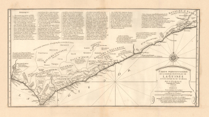
Carte Particuliere de la Partie Principale de la Guinée située entra Issini et Ardra.
$1,800.00
Acquire
- Digital Map Information
- Suitable for large format printing
- File Size: 11.05 MB
- File Type: ZIP / TIFF
- ICC color profile embedded
- Delivered instantly via download link
This is J. B. B. d'Anville's scarce, separately-issued 1729 map of 'Guinée', comprising the west African coast in what is today Ghana, Togo, and parts of Benin. Much of the region, when this map was made, was dominated by the slave-trading empire of Dahomey, which captured Whydah (here as Juda) at the eastern extreme of the map in 1729 - likely influencing the creation of this map. The capture of Whydah gave the warlike Dahomey access to European slave markets, placing them at the center of propagating the Atlantic Slave Trade. (more details)
Reporting on the Jesuit Missions in South America.
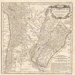
Le Paraguay, où les R.R.P.P. de la Compagnie de Jesus ont répandu leurs missions.
$500.00
Acquire
- Digital Map Information
- Suitable for large format printing
- Full resolution TIFF file
- ICC color profile embedded
- Delivered instantly via download link
This is J. B. B. d'Anville's attractive, detailed map of Paraguay, Uruguay, part of Chile, and northern Argentina based on the reports of Jesuit missionaries, and intended for inclusion in a collection of those reports. It updates D'Avila's 1726 map of the Jesuit Provinces, covering the area now comprising parts of Chile, Paraguay, Bolivia, Peru, Brazil, Uruguay, and Argentina. The rivers of the region are shown in detail and mountains are indicated pictorially. Towns and villages are marked. A key indicates the presence of destroyed missions and villages, and the locations of tribes contacted by the Jesuits. The map's elegant cartouche is surmounted by the Jesuit arms. It should be noted that in the period between the execution of the map in 1733 and the printing of this 1781 edition, the Jesuits had been expelled from South America: from Portuguese territories in 1759 and the Spanish territories in 1767. (more details)
Based on Chinese Sources.
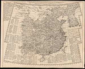
A Map of China, drawn from those of the particular provinces made on the spot by the Jesuit missionaries...
$3,500.00
Acquire
- Digital Map Information
- Suitable for large format printing
- DPI: 600
- File Size: 63.06 MB
- File Type: ZIP / TIFF
- ICC color profile embedded
- Delivered instantly via download link
This is Emanuel Bowen's rare 1738 map of China and Korea, derived from the geography of Jean Baptiste Bourguignon d'Anville. It is not a direct copy of D'Anville's maps but rather is a distillation of Chinese provincial maps included in Du Halde's 1737 Nouvel atlas de la Chine, which Bowen reproduced in the 1738 English edition of that work. Via D'Anville, this is one of the best 18th-century maps of China originating from Chinese sources. (more details)
Best French mapping of North America.

Amérique Septentrionale.
$1,800.00
Acquire
- Digital Map Information
- Suitable for large format printing
- Full resolution TIFF file
- ICC color profile embedded
- Delivered instantly via download link
This is the 1746 wall map of North America composed by Jean-Baptiste Bourguignon d'Anville, considered the finest French map of North America predating the French and Indian War (1754 - 1763). Nearly a century of French mapmaking and exploration in North America preceded this work, granting the map precedence, longevity, and a lasting influence. It was copied by Thomas Jefferys as the basis for his own 1755 map of North America. More than half a century later, it was among the maps consulted by Nicholas King for his seminal manuscript map of western North America compiled for the Lewis and Clark expedition. (more details)
First Accurate English Map of Tibet.
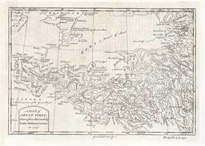
A Map of Great Tibet, drawn from that made by Lama Mathematicians in 1717.
$650.00
Acquire
- Digital Map Information
- Suitable for large format printing
- DPI: 600
- File Size: 9.69 MB
- File Type: ZIP / TIFF
- ICC color profile embedded
- Delivered instantly via download link
This is the earliest English map of Tibet, engraved for Braddock Mead's 1747 A New General Collection of Voyages and Travels, published under his pseudonym 'John Green' by Thomas Astley. It is one of the few maps of the region to rely (ultimately) on local sources - although the mapmaker's claim that the map was 'drawn from that made by Lama Mathematicians' does not include the chain of Jesuit missionaries and French cartographers linking the 'Lama Mathematicians' to the 'English engraver'. (more details)
D'Anville's influential mapping of Africa.
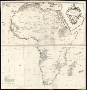
Afrique Publiée sous les Auspices de Monseigneur le Duc D'Orléans Prémier Prince du Sang.
$2,000.00
Acquire
- Digital Map Information
- Suitable for large format printing
- File Size: 73.62 MB
- File Type: ZIP / TIFF
- ICC color profile embedded
- Delivered instantly via download link
This is Jean-Baptiste Bourguignon d’Anville's 1749 map of Africa, one of the largest and most influential maps of the continent to appear in the 18th century. (more details)
A little known region mapped.
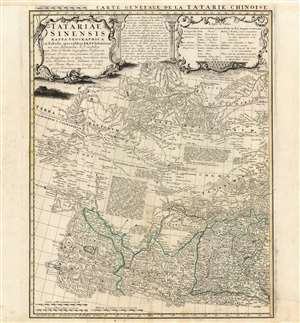
Tartariae Sinensis mappa Geographica...
$750.00
Acquire
- Digital Map Information
- Suitable for large format printing
- Full resolution TIFF file
- ICC color profile embedded
- Delivered instantly via download link
This is a handsome 1749 Homann Heirs map of western China, Mongolia and the extreme southeastern border with Russia. It was produced in order to accompany a German translation of P. Du Halde's 1732 Description de la Chine. As such, it is a faithful copy of J. B. D'Anville's Carte Generale de la Tartarie Chinoise which accompanied Du Halde's original text and the definitive mapping of this little-known and ill-mapped region. D'Anville's map - and Du Halde's data - were derived from Jesuit sources. Jesuits, with the blessing of the Qing Emperor Kangxi, produced at a map of the Chinese Empire's frontiers between 1708 and 1717. (more details)
Finest obtainable Colonial Era map of the Gulf Coast around the Mississippi Delta and Louisiana.
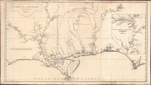
Carte de la Louisiane.
$1,400.00
Acquire
- Digital Map Information
- Suitable for large format printing
- DPI: 600
- File Size: 933.1 MB
- File Type: ZIP / TIFF
- ICC color profile embedded
- Delivered instantly via download link
A lovely example of the important 1732/52 map of the Gulf Coast and lower Mississippi River Valley by Jean Baptiste Bourguignon d'Anville. The map is significant as the largest and most comprehensive map of the Gulf littoral to appear during the French period of Louisiana. (more details)
State-of-the-art 18th Century Cartography.
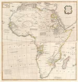
Africa, Performed by the Sr. D'Anville under the Patronage of the Duke of Orleans.
$1,000.00
Acquire
- Digital Map Information
- Suitable for large format printing
- Full resolution TIFF file
- ICC color profile embedded
- Delivered instantly via download link
This large and evocative four-sheet 1755 wall map of Africa captures a transitional period in European understanding of African geography. It was bound, in its four separate sheets, in the second volume of Malachy Postlethwayte's The Universal Dictionary of Trade and Commerce. The map is the work of Solomon Boulton, who drafted the map as a largely faithful translation of the illustrious French cartographer Jean-Baptiste Bourguignon d’Anville's 1749 map of the continent. D'Anville was an extremely careful mapmaker, meticulous in detail and scrupulous in the data presented in his work, and for the most part Boulton preserves these qualities while translating the original text and adding an attractive rococo cartouche. (more details)
The British Colonies on the cusp of Revolution.
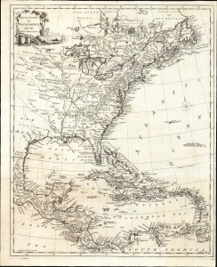
British Empire in North America with the West India Isles.
$2,400.00
Acquire
- Digital Map Information
- Suitable for large format printing
- File Size: 15.2 MB
- File Type: ZIP / TIFF
- ICC color profile embedded
- Delivered instantly via download link
This is Thomas Kitchin's 1770 map of the British Empire in North America, presenting the state-of-the-art mapping of the Colonies on the cusp of the American Revolutionary War (1775 - 1783). It combines the foundational cartography of John Mitchell (north) with the still-authoritative work of Jean-Baptiste Bourguignon d'Anville (south). (more details)
Sea of Korea and the Pratas Islands.
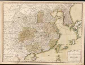
The Empire of China, with its Principal Divisions; Drawn from the Surveys mad by the Jesuits: with Improvements and Additions, from the Maps of Monsr. D'Anville.
$800.00
Acquire
- Digital Map Information
- Suitable for large format printing
- Full resolution TIFF file
- ICC color profile embedded
- Delivered instantly via download link
This is a large, elegant 1823 map of China and Korea, produced by Robert Laurie. Initially published in 1775, the map features updates executed over the course of the subsequent decades. Among its notable features is the naming of the body of water between Korea and Japan as the 'Corean Sea'. (more details)
Essential French and Indian War Map, Made Relevant to the Revolution.
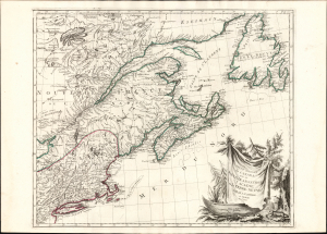
Partie Orientale du Canada avec la Nouvelle Angleterre, l'Acadie, et la Terre-Neuve.
$1,500.00
Acquire
- Digital Map Information
- Suitable for large format printing
- Full resolution TIFF file
- ICC color profile embedded
- Delivered instantly via download link
This is Paolo and Francesco Santini's 1776 map of eastern Canada, New England, Acadia, and Newfoundland. Produced to satisfy European interest in the events of the American Revolutionary War (1775 - 1783), it drew on the best French mapping of the region produced during the French and Indian War (1754 - 1763). (more details)
Coastal Brazil.
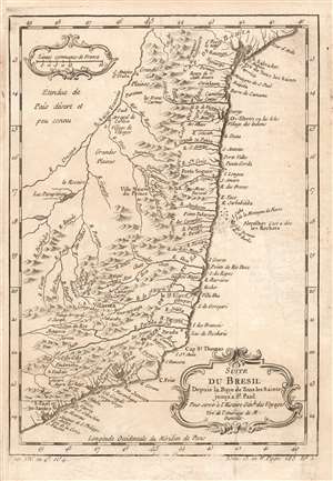
Suite du Bresil Depuis la Baye de Tous les Saints jusqu' a St. Paul. Pour servir à l'Histoire Génle. des Voyages Tiré de l'Amerique de M. Danville.
$150.00
Acquire
- Digital Map Information
- Suitable for large format printing
- Full resolution TIFF file
- ICC color profile embedded
- Delivered instantly via download link
This is a 1780 map of coastal Brazil, showing the Captaincies of Bahia, Ilheús, Porto Seguro, Espirito Santo, Rio de Janeiro and part of Sao Paolo. These were coastal colonies, and the map's detail does not extend beyond the Rio São Francisco, apart from the descriptive text Étendue de País désert et peu connu (This extent of the country is deserted and little known.) Although composed and engraved by Nicolas Bellin, the cartography is drawn from D'Anville's 1748 Amerique Meridionale, which still represented the most up-to-date cartography in 1753, when this map was engraved. (more details)
Best obtainable Colonial Era map of the Mississippi Delta, in an English Edition.
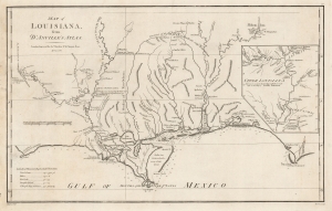
Map of Louisiana, From D'Anville's Atlas.
$950.00
Acquire
- Digital Map Information
- Suitable for large format printing
- DPI: 600
- File Size: 33.16 MB
- File Type: ZIP / TIFF
- ICC color profile embedded
- Delivered instantly via download link
This is a handsome example of the scarce 1788 English edition of Jean Baptiste Bourguignon d'Anville's map of the Gulf Coast and Lower Mississippi River Valley, engraved by Thomas Bowen for John Harrison. This is the best obtainable map of the Lower Mississippi at the time of publication - here in a rare English edition. (more details)
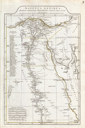
Aegyptus Antiqua Mandato Serenissimi Delphini Publici Juris Facta.
$300.00
Acquire
- Digital Map Information
- Suitable for large format printing
- Full resolution TIFF file
- ICC color profile embedded
- Delivered instantly via download link
A large and dramatic 1794 J. B. B. D'Anville map of Ancient Egypt Covers from the Nile Delta and Gaza south as far as Aswan. Details mountains, rivers, cities, roadways, and lakes with political divisions highlighted in outline color. Features both ancient and ... (more details)
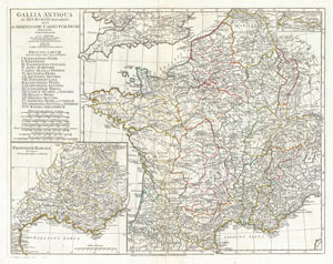
Gallia Antiqua ex Aevi Romani Monumentis eruta et Serenissimi Carnutum Ducis Munificentia Publicijuris Facta.
$350.00
Acquire
- Digital Map Information
- Suitable for large format printing
- DPI: 300
- File Size: 16.79 MB
- File Type: ZIP / TIFF
- ICC color profile embedded
- Delivered instantly via download link
A large and dramatic J. B. B. D'Anville map of Gallia or France in ancient Roman times. Covers from the southern part of England (Britannia) to the Pyrenees and the Mediterranean. Details mountains, rivers, cities, roadways, and lakes with political divisions ... (more details)
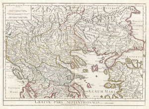
Graeciae Pars Septentrionalis.
$450.00
Acquire
- Digital Map Information
- Suitable for large format printing
- DPI: 300
- File Size: 19.22 MB
- File Type: ZIP / TIFF
- ICC color profile embedded
- Delivered instantly via download link
A large and dramatic Delisle map of the northern Greece, the Balkans, and Macedonia. Covers from Dalmatia east to the Black Sea (Pontus Euxinus) and south as far as Achaia, Cyprus, and Asia Minor. Includes much of the Aegean Sea and parts of the Adriatic ... (more details)
Best English Wall Map of Asia of the 18th Century.
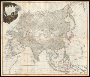
Asia and its Islands According to d'Anville; Divided into Empires, Kingdoms, States, Regions, and ca. with the European possessions and settlements in the East Indies and an exact delineation of all the discoveries made in the eastern parts by the English under Capt. Cook.
$1,500.00
Acquire
- Digital Map Information
- Suitable for large format printing
- Full resolution TIFF file
- ICC color profile embedded
- Delivered instantly via download link
A monumental 1794 wall map of Asia by Laurie and Whittle. Following the cartography of French mapmaker Jean Baptiste Bourguignon d'Anville, this is the best general map of Asia to be issued by a British cartographer in the 18th century. (more details)
'Captain Hook discovered these islands' - no kidding.
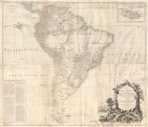
A Map of South America containing Tierra-Firma, Guayana, New Granada, Amazonia, Brasil, Peru, Paraguay, Chaco, Tucuman, Chili and Patagonia from M. D'Anville with Several Improvements and Additions, and The Newest Discoveries.
$1,000.00
Acquire
- Digital Map Information
- Suitable for large format printing
- DPI: 300
- File Size: 56.86 MB
- File Type: ZIP / TIFF
- ICC color profile embedded
- Delivered instantly via download link
This is probably the most important large format wall map of South America produced in the 18th century. Largely based upon the earlier D'Anville map, this map has been enlarged and expanded by the English publishing house of Laurie and Whittle. Depicts the continent in full with an inset of the Falkland Islands. This map is unique in that it is a serious attempt to compile all of the accurate scientific knowledge of the South American continent available at the time, this offering a smorgasbord of factual, speculative, and historical detail. (more details)