
Dower, John James (sold)

John James Dower (June 1, 1825 - 1901) was a well-respected mapmaker, print seller, and publisher based in London, England. Dower is the heir to the more prominent London engraver and mapmaker John Crane Dower (1791 - 1847). Dower worked with many prominent middle to late 19th century London map publishers including Weller, Cassell, Bacon, Petermann, and others. He was elected to the Royal Geographical Society in 1854. Dower also published on maps his own account including one atlas and various school geographies. In addition to his cartographic work, Dower is well known as an engraver of military scenes.
The last days of Gran Colombia.
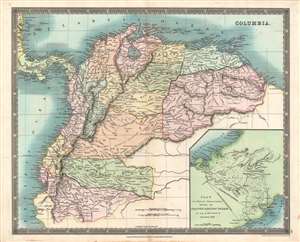
Columbia.
sold
- Digital Map Information
- Suitable for large format printing
- DPI: 600
- File Size: 40.15 MB
- File Type: ZIP / TIFF
- ICC color profile embedded
- Delivered instantly via download link
This is a beautiful 1831 John Dower and Henry Teesdale map of Gran Colombia, published in their A New General Atlas of the World. It depicts the state of Gran Colombia, which dissolved the same year this map was published, resulting in the creation of Venezuela, Ecuador, and a rump Republic of New Granada. (more details)
The building blocks of German unification.
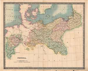
Prussia.
sold
- Digital Map Information
- Suitable for large format printing
- DPI: 600
- File Size: 35.54 MB
- File Type: ZIP / TIFF
- ICC color profile embedded
- Delivered instantly via download link
This is a fine example of Henry Teesdale and John Dower's 1831 map of Prussia published in their A New General Atlas of the World. It depicts the Kingdom of Prussia as it emerged from the Napoleonic Wars and the Congress of Vienna, larger and more powerful than before, poised to challenge Austria for preeminence in the German lands. (more details)
The Caribbean on the cusp of emancipation.
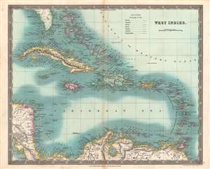
West Indies.
sold
- Digital Map Information
- Suitable for large format printing
- DPI: 600
- File Size: 44.63 MB
- File Type: ZIP / TIFF
- ICC color profile embedded
- Delivered instantly via download link
This is an especially vivid example of John Dower and Henry Teesdale's 1831 map of the West Indies published in their A New General Atlas of the World. This map was published when the region was undergoing rapid transformations resulting from the end of the slave trade and the institution of slavery itself. (more details)
A beautiful map of the Eastern Hemisphere.
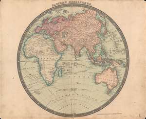
The Eastern Hemisphere.
sold
- Digital Map Information
- Suitable for large format printing
- DPI: 600
- File Size: 34.6 MB
- File Type: ZIP / TIFF
- ICC color profile embedded
- Delivered instantly via download link
This is a beautifully-colored 1831 Henry Teesdale / John Dower map of the Eastern Hemisphere published in their A New General Atlas of the World. It reflects the latest geographical knowledge available at that time and charts the voyages of Captain James Cook. (more details)
A beautiful map of the Holy Land in ancient times.
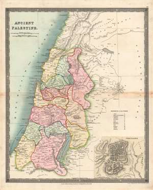
Ancient Palestine.
sold
- Digital Map Information
- Suitable for large format printing
- DPI: 600
- File Size: 34.32 MB
- File Type: ZIP / TIFF
- ICC color profile embedded
- Delivered instantly via download link
Here is Henry Teesdale / John Dower's 1831 map of the Holy Land as it appeared in ancient times, published in A New General Atlas of the World. It illustrates the location of the Twelve Tribes of Ancient Israel, as discussed in the Bible, in particular the Book of Joshua. (more details)
The early days of British Australia.
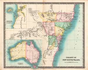
Colony of New South Wales, Swan River Settlement, Australia.
sold
- Digital Map Information
- Suitable for large format printing
- DPI: 600
- File Size: 34.8 MB
- File Type: ZIP / TIFF
- ICC color profile embedded
- Delivered instantly via download link
This is the Teesdale / John Dower's brilliantly colored 1831 map of Australia, with a focus on the Colony of New South Wales. It illustrates the territory as it was rapidly developing and transitioning from a penal colony to a society of free settlers. (more details)
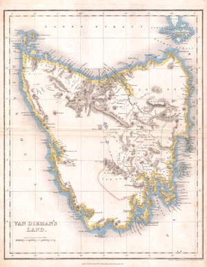
Van Dieman's Land.
sold
- Digital Map Information
- Suitable for large format printing
- Full resolution TIFF file
- ICC color profile embedded
- Delivered instantly via download link
A very rare and unusual example of John Dower's 1837 map of Tasmania or Van Dieman's Land. Depicts the island in considerable detail with good notes on geographical features, especially along the coast. Maps of Tasmania are exceptionally rare and this one is no ... (more details)
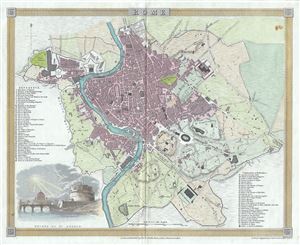
Rome.
sold
- Digital Map Information
- Suitable for large format printing
- Full resolution TIFF file
- ICC color profile embedded
- Delivered instantly via download link
This is a beautiful 1840 map of the city of Rome, Italy by John Dower. It covers the walled center of Rome in incredible detail, reveling individual streets, parks, rivers, ancient ruins, and historic buildings. A list of important landmarks is referenced along ... (more details)
Showing the border as of thr Treaty Ending the Mexican-American War
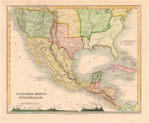
California, Mexico, Guatimala etc.
sold
- Digital Map Information
- Suitable for large format printing
- DPI: 600
- File Size: 5.67 MB
- File Type: ZIP / TIFF
- ICC color profile embedded
- Delivered instantly via download link
This is John Dower's 1850 map of Mexico, Texas, Central America and Western North America. Includes Texas in its post-statehood, pre-'Compromise of 1850' configuration, with full borders extending west beyond Santa Fe and north to include a small ill-defined stovepipe. The map has been updated to show the 1848 border as per the Treaty of Guadalupe Hidalgo; Mexico's lost claims north of the new border are collectively named 'Upper New California' on the map. This region, in particular, has been extensively re-worked, showing abundant mountain ranges not present in earlier issues of this map. (more details)
Fascinating Chronological Chart of the Bible following Bishop Ussher's schemata.
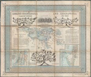
Leonard's Chronological and Geographical Family Guide to the Holy Bible.
sold
- Digital Map Information
- Suitable for large format printing
- DPI: 300
- File Size: 27.13 MB
- File Type: ZIP / TIFF
- ICC color profile embedded
- Delivered instantly via download link
A charming c. 1850 map, chart, and chronological guide to the Holy Land issued by C. W. Leonard. Following the schemata devised by Bishop Ussher of Ireland this chart illustrates the history of the Bible from October 23, 4004 BC, the supposed exact date of ... (more details)
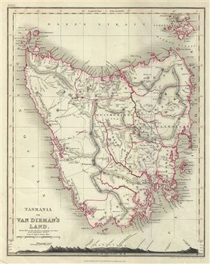
Tasmania or Van Dieman's Land.
sold
- Digital Map Information
- Suitable for large format printing
- Full resolution TIFF file
- ICC color profile embedded
- Delivered instantly via download link
A fine 1860 map of Tasmania or Van Diemen's Land by John Dower. The map covers the entire island of Tasmania in considerable detail noting towns, lakes, mountain ranges and other topographical features. The bottom of the map contains an elevation profile. ... (more details)
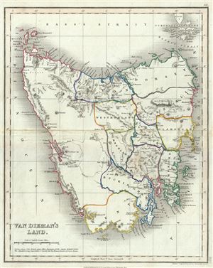
Van Dieman's Land.
sold
- Digital Map Information
- Suitable for large format printing
- Full resolution TIFF file
- ICC color profile embedded
- Delivered instantly via download link
This is a beautiful 1860 map of Van Diemen's Land or Tasmania, issued by John Dower. The map covers the entire island of Tasmania in considerable detail noting towns, lakes, mountain ranges and other topographical features. Van Diemen's Land, was ... (more details)
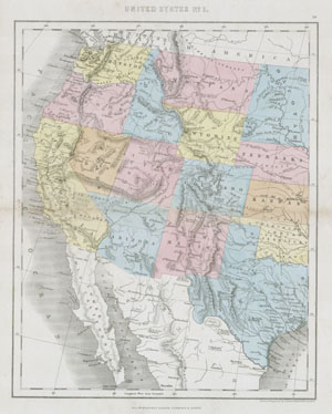
United States No. 2.
sold
- Digital Map Information
- Suitable for large format printing
- File Size: 1.92 MB
- File Type: ZIP / TIFF
- ICC color profile embedded
- Delivered instantly via download link
This hand colored map depicts the western half of the United States including Texas, Arizona, California, Utah and Nevada. The map was made in 1864 by the English mapmaker Mackenzie. It shows Arizona extending into what is today Southern Nevada. ... (more details)
The largest original map of Victorian London obtainable.
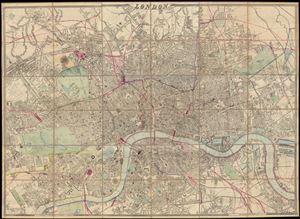
London.
sold
- Digital Map Information
- Suitable for large format printing
- File Size: 25.36 MB
- File Type: ZIP / TIFF
- ICC color profile embedded
- Delivered instantly via download link
A remarkable and monumental map of London, this is Weller and Cassell's 1866 wall map of London. When it was first issued in 1861 this was the largest scale map of London yet produced. Cassell was justly proud of his map bragging, 'as well as ... (more details)