
Greenleaf, Jeremiah (sold)

Jeremiah Greenleaf (1791 - 1864) is a little known but highly admired American cartographer of the early 19th century. He published from roughly 1830 to 1850. His most important work is A New Universal Atlas; Comprising of all the Principal Empires, Kingdoms, and States Throughout the World and Forming a distinct Atlas of the United States, published in several editions in the 1840s. Many of his maps are reformatted versions of his contemporary David Burr's much admired cartographic works. Greenleaf's maps are extremely rare and admired for their stunningly vivid pastel color washes.
One of only a handful of maps to show Leigh Read County.
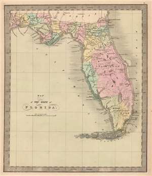
Map of the State of Florida.
sold
- Digital Map Information
- Suitable for large format printing
- DPI: 600
- File Size: 23.84 MB
- File Type: ZIP / TIFF
- ICC color profile embedded
- Delivered instantly via download link
This is Jeremiah Greenleaf’s 1848 map of Florida, notable as being one of the few maps to include the ephemeral Leigh Read County (Mosquito County). The map depicts Florida in full, from the Perdido River to the Atlantic Ocean and from Georgia and Alabama to Key West. Roads connecting the towns, forts, and other settlements are illustrated, along with railroads (there were only 2 at the time) and canals. In addition, the map includes 'Fleming's Grant' on the San Sabastian River, considered a potential new homeland for Irish displaced by the Potato Famine (1845 - 1849). (more details)
Republic of Texas, United Provinces of Central America, Independent Yucatán.
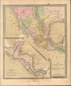
The United States of Mexico. / Guatemala or the United Provinces of Central America.
sold
- Digital Map Information
- Suitable for large format printing
- File Size: 7.69 MB
- File Type: ZIP / TIFF
- ICC color profile embedded
- Delivered instantly via download link
This is Jeremiah Greenleaf's 1842 map of Mexico and Central America. The map reflects the original boundaries of the Republic of Texas, the short-lived United Provinces of Central America (Guatemala), and the Yucatán Federalist Movement. (more details)
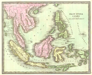
East India Isles
sold
- Digital Map Information
- Suitable for large format printing
- Full resolution TIFF file
- ICC color profile embedded
- Delivered instantly via download link
This hand colored map is a lithographic engraving of the East Indies, dating to 1842. Depicts all of Southeast Asia and the East Indies including Sumatra, Java, Borneo and the Philippines. On the mainland it shows the Kingdoms of Siam (Thailand), Tonquin ... (more details)
One of the Earliest and Best Depictions of the Republic of Texas

Texas Compiled from the latest and best Authorities.
sold
- Digital Map Information
- Suitable for large format printing
- DPI: 600
- File Size: 7.77 MB
- File Type: ZIP / TIFF
- ICC color profile embedded
- Delivered instantly via download link
This is Jeremiah Greenleaf’s 1842 map of the Republic of Texas. This highly sought-after map is one of the best depictions of the Republic produced during its brief existence. Rivers and topography are elegantly engraved, trails and forts well detailed, and the Republic's counties are presented with stippled borders and original wash color. Austin - founded in 1839 - is shown as the capital; with the old capital of San Felipe de Austin is also identified. Houston, Galveston, Victoria, Richmond, and San Antonio are all noted. Perhaps unsurprisingly, the eastern portion of the Republic of Texas is well detailed. The west is virtually devoid of settlement indicating 'the progress of settlement and the nearly total lack of information in the west, a region that was to remain primarily the domain of the Comanche and the coyote for another thirty years.' (Martin and Martin) The locations of various Indian tribes are shown as well. The map includes parts of Arkansas, Louisiana, and Mexico, and the southern part of the Indian Territory. The actual outer borders of the Republic are ambiguous, perhaps deliberately, with regard to the border with Mexico. (more details)
Republic of Texas at its height.
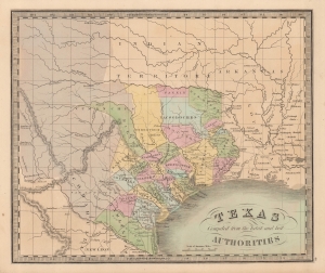
Texas Compiled from the latest and best Authorities.
sold
- Digital Map Information
- Suitable for large format printing
- DPI: 600
- File Size: 23.9 MB
- File Type: ZIP / TIFF
- ICC color profile embedded
- Delivered instantly via download link
This is Jeremiah Greenleaf’s 1842 map of the Republic of Texas. This highly sought-after map is one of the best depictions of the Republic produced during its brief existence. (more details)
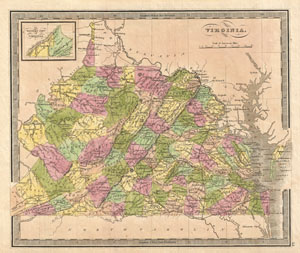
Virginia.
sold
- Digital Map Information
- Suitable for large format printing
- DPI: 300
- File Size: 5.47 MB
- File Type: ZIP / TIFF
- ICC color profile embedded
- Delivered instantly via download link
A fine example of J Greenleaf's 1848 map of Virginia. This map covers all of what is today Virginia and West Virginia as well as the entire Chesapeake Bay and adjacent parts of Ohio, Pennsylvania North Carolina and Maryland. Greenleaf's cartographically ... (more details)
Pre-Civil War - Post Trail of Tears.
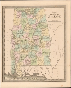
Map of the State of Alabama.
sold
- Digital Map Information
- Suitable for large format printing
- DPI: 600
- File Size: 18.83 MB
- File Type: ZIP / TIFF
- ICC color profile embedded
- Delivered instantly via download link
This is Jeremiah Greenleaf's 1849 map of Alabama. The map illustrates Alabama during a period of economic growth, political stability, and cultural vibrancy, at the height of the states pre-Civil War railroad boom. (more details)
New nations emerge.
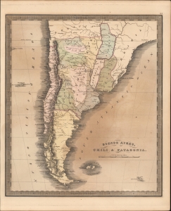
Buenos Ayres, Chili and Patagonia.
sold
- Digital Map Information
- Suitable for large format printing
- DPI: 600
- File Size: 19.84 MB
- File Type: ZIP / TIFF
- ICC color profile embedded
- Delivered instantly via download link
This is Jeremiah Greenleaf's 1849 map of Argentina, Chile, Uruguay, and Paraguay. (more details)
Just before the Gold Rush.
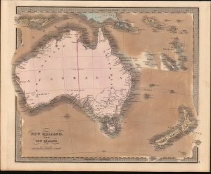
New Holland, And New Zealand.
sold
- Digital Map Information
- Suitable for large format printing
- DPI: 600
- File Size: 21.43 MB
- File Type: ZIP / TIFF
- ICC color profile embedded
- Delivered instantly via download link
This is Jeremiah Greenleaf's 1849 map of Australia and New Zealand. This map features numerous minor updates over earlier editions reflecting the rapid exploration of the Australian interior between 1835 and 1849. (more details)
Maine Northern Boundary Dispute.
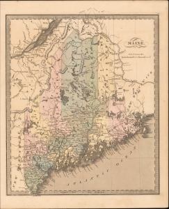
Maine.
sold
- Digital Map Information
- Suitable for large format printing
- DPI: 600
- File Size: 206.78 MB
- File Type: ZIP / TIFF
- ICC color profile embedded
- Delivered instantly via download link
This is Jeremiah Greenleaf's 1849 map of Maine. (more details)
Early railroad development.
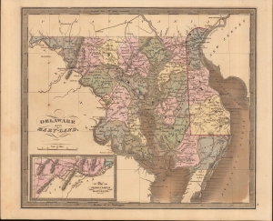
Delaware and Mary-Land.
sold
- Digital Map Information
- Suitable for large format printing
- DPI: 600
- File Size: 207.63 MB
- File Type: ZIP / TIFF
- ICC color profile embedded
- Delivered instantly via download link
This is Jeremiah Greenleaf's 1849 map of Maryland, Delaware, and Washington D.C. (more details)
Republic of Texas and United Provinces of Central America.
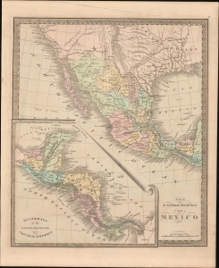
The United States of Mexico. / Guatemala or the United Provinces of Central America.
sold
- Digital Map Information
- Suitable for large format printing
- DPI: 600
- File Size: 206.96 MB
- File Type: ZIP / TIFF
- ICC color profile embedded
- Delivered instantly via download link
This is Jeremiah Greenleaf's 1849 map of Mexico and Central America. The map reflects the original boundaries of the Republic of Texas and the short-lived United Provinces of Central America (Guatemala). (more details)
A new take on Michigan (not in Karpinski).
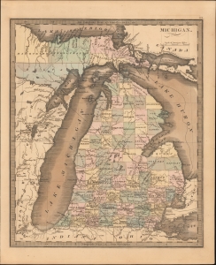
Michigan.
sold
- Digital Map Information
- Suitable for large format printing
- DPI: 600
- File Size: 206.82 MB
- File Type: ZIP / TIFF
- ICC color profile embedded
- Delivered instantly via download link
This is Jeremiah Greenleaf's 1849 map of Michigan. This map represents a complete remapping of Michigan not seen in earlier Greenleaf or Burr atlases. The famously distended form of lake Michigan has here been partially modified to greater accuracy. (more details)
The center of the pre-Civil War progressive Politics.
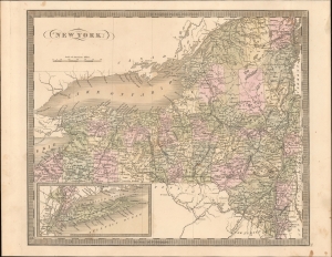
New York.
sold
- Digital Map Information
- Suitable for large format printing
- DPI: 600
- File Size: 20.74 MB
- File Type: ZIP / TIFF
- ICC color profile embedded
- Delivered instantly via download link
This is Jeremiah Greenleaf's 1849 map of New York State. It is one of the most well-developed and detailed maps from the atlas due to the precursor map being by David Burr, who was not only a New Yorker, but Surveyor General of New York under Governor Simeon De Witt. When this map was issued, New York was the hub of American progressive politics and the driving force behind the Abolitionist Movement. (more details)
Resolution of the Oregon Question.
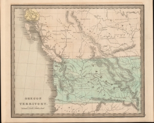
Oregon Territory.
sold
- Digital Map Information
- Suitable for large format printing
- DPI: 600
- File Size: 207.34 MB
- File Type: ZIP / TIFF
- ICC color profile embedded
- Delivered instantly via download link
This is Jeremiah Greenleaf's 1849 map of Oregon Territory. The map reflects the resolution of the Oregon Question, with a fixed boundary at the 49th parallel. It is one of the few atlas maps of Oregon Territory to appear prior to 1850. (more details)
Blending the modern, the ancient, and the biblical.
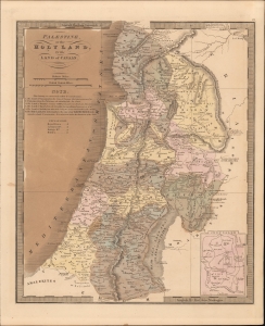
Palestine, or the Holy Land, or the Land of Canaan.
sold
- Digital Map Information
- Suitable for large format printing
- DPI: 600
- File Size: 11.19 MB
- File Type: ZIP / TIFF
- ICC color profile embedded
- Delivered instantly via download link
This is Jeremiah Greenleaf's 1849 map of Palestine, the Holy Land, or modern-day Israel. (more details)
Don't Mess with Denmark.
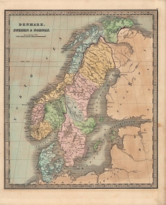
Denmark, Sweden and Norway.
sold
- Digital Map Information
- Suitable for large format printing
- Full resolution TIFF file
- ICC color profile embedded
- Delivered instantly via download link
A lovely map of Scandinavia (Denmark, Sweden, and Norway) published in the 1849 edition of Jeremiah Greenleaf's Universal Atlas. (more details)
The East Indies.
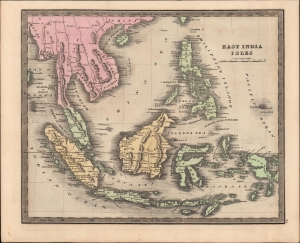
East India Isles.
sold
- Digital Map Information
- Suitable for large format printing
- DPI: 600
- File Size: 23.96 MB
- File Type: ZIP / TIFF
- ICC color profile embedded
- Delivered instantly via download link
This is Jeremiah Greenleaf's 1849 map of the East Indies and Southeast Asia. (more details)
Border confusion over new states and territories.
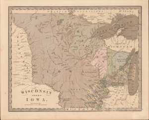
Wisconsin and Iowa.
sold
- Digital Map Information
- Suitable for large format printing
- DPI: 600
- File Size: 203.85 MB
- File Type: ZIP / TIFF
- ICC color profile embedded
- Delivered instantly via download link
This is the 1849 J. Greenleaf map of Iowa Territory (Minnesota) and Wisconsin. The map reveals early border disagreements relating to the western limits of Iowa and Wisconsin and a pre-Minnesota Territory (March 3, 1849) configuration. (more details)