
Jaillot, Alexis-Hubert (sold)
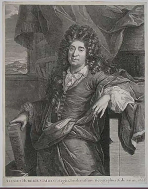
Alexis-Hubert Jaillot (c. 1632 - 1712) followed Nicholas Sanson (1600 - 1667) and his descendants in ushering in the great age of French Cartography in the late 17th and 18th century. The publishing center of the cartographic world gradually transitioned from Amsterdam to Paris following the disastrous inferno that destroyed the preeminent Blaeu firm in 1672. Hubert Jaillot was born in Franche-Comte and trained as a sculptor. When he married the daughter of the Enlumineur de la Reine, Nicholas I Berey (1610 - 1665), he found himself positioned to inherit a lucrative map and print publishing firm. When Nicholas Sanson, the premier French cartographer of the day, died, Jaillot negotiated with his heirs, particularly Guillaume Sanson (1633 - 1703), to republish much of Sanson's work. Though not a cartographer himself, Jaillot's access to the Sanson plates enabled him to publish numerous maps and atlases with only slight modifications and updates to the plates. As a sculptor and an artist, Jaillot's maps were particularly admired for their elaborate and meaningful allegorical cartouches and other decorative elements. Jaillot used his allegorical cartouche work to extol the virtues of the Sun King Louis IV, and his military and political triumphs. These earned him the patronage of the French crown who used his maps in the tutoring of the young Dauphin. In 1686, he was awarded the title of Geographe du Roi, bearing with it significant prestige and the yearly stipend of 600 Livres. Jaillot was one of the last French map makers to acquire this title. Louis XV, after taking the throne, replaced the position with the more prestigious and singular title of Premier Geographe du Roi. Jaillot died in Paris in 1712. His most important work was his 1693 Le Neptune Francois. Jalliot was succeeded by his son, Bernard-Jean-Hyacinthe Jaillot (1673 - 1739), grandson, Bernard-Antoine Jaillot (???? – 1749), and the latter's brother-in-law, Jean Baptiste-Michel Renou de Chauvigné-Jaillot (1710 - 1780).
The first appearance of the Marquette-Joliet Mississippi River cartography.
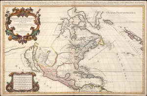
Amerique septentrionale divisée en ses principales parties, ou sont distingués les vns des autres les estats suivant qu'ils appartiennent presentemet aux Francois, Castillans, Anglois, Suedois, Danois, Hollandois, tirée des relations de toutes ces nations par le S. Sanson, geographe ordinaire du roy. 1674.
sold
- Digital Map Information
- Suitable for large format printing
- Full resolution TIFF file
- ICC color profile embedded
- Delivered instantly via download link
An impressive and scarce 1674 map of North America issued by Alexis-Hubert Jaillot, offered here in its first edition, and likely exhibiting preliminary data from the 1673 Marquette-Joliet Expedition. The map covers North America and Central America from Baffin Bay to the Spanish Main. It extends westward past an Insular California to include Terre de Iesso (a speculative mapping of Hokkaido) and eastwards past the Azores to include the British Isles. It includes a striking mapping the Mississippi (Chucagua), that while inaccurate in the southernmost regions, likely reflects Joliet's verbal reports from the seminal 1673 Marquette-Joliet Expedition. (more details)
Remarkable first editon of Jaillot's important map of America showing California as an Island.
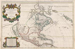
Amerique septentrionale divisee en ses principales parties, ou sont distingues les vns des autres les estats suivant qu'ils appartiennent presentemet aux Francois, Castillans, Anglois, Suedois, Danois, Hollandois, tiree des relations de toutes ces nations par le S. Sanson, geographe ordinaire du roy. 1674.
sold
- Digital Map Information
- Suitable for large format printing
- Full resolution TIFF file
- ICC color profile embedded
- Delivered instantly via download link
A large, impressive, and scarce 1674 map of North America issued by Alexis-Hubert Jaillot offered here in its first edition. The map covers all of North America and Central America from Baffin Bay to the Spanish Main. The map extends westward to past an Insular ... (more details)
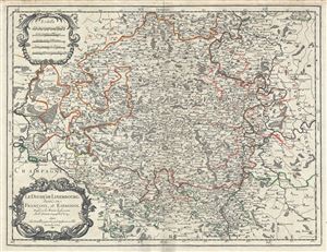
Le Duche de Luxembourg, divise en Francois, et Espagnol.
sold
- Digital Map Information
- Suitable for large format printing
- DPI: 300
- File Size: 17.83 MB
- File Type: ZIP / TIFF
- ICC color profile embedded
- Delivered instantly via download link
This is a scarce 1674 map of the Duchy of Luxembourg by Alexis-Hubert Jaillot. It covers Luxembourg along with parts of neighboring Belgium, France and Germany from Revin in France east to Blankenheim in Germany and from Spa in Belgium, south as far as ... (more details)
Remarkable edition of Jaillot's important map of America showing California as an Island.
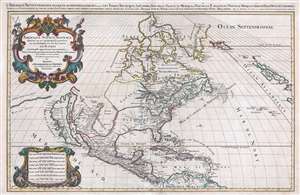
Amerique septentrionale divisee en ses principales parties, ou sont distingues les vns des autres les estats suivant qu'ils appartiennent presentemet aux Francois, Castillans, Anglois, Suedois, Danois, Hollandois, tiree des relations de toutes ces nations par le S. Sanson, geographe ordinaire du roy. 1674.
sold
- Digital Map Information
- Suitable for large format printing
- DPI: 300
- File Size: 23.77 MB
- File Type: ZIP / TIFF
- ICC color profile embedded
- Delivered instantly via download link
An impressive and scarce 1696 elephant-folio map of North America issued by Alexis-Hubert Jaillot on a massive scale. The map covers all of North America and Central America from Baffin Bay to the Spanish Main. It extends westward to past an Insular California to include Terre de Iesso (a speculative mapping of Hokkaido) and eastwards past the Azores to include the British Isles. (more details)
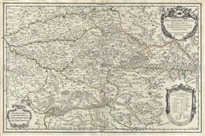
Diocese de Castres.
sold
- Digital Map Information
- Suitable for large format printing
- DPI: 300
- File Size: 18.51 MB
- File Type: ZIP / TIFF
- ICC color profile embedded
- Delivered instantly via download link
This is a fine 1690 map of Castres, located in the department of Tran, France by Alexis Hubert Jaillot. Centered on Brassac, the map covers the region from Albi south as far as Olonzac and from Saint-Sulpic east to Saint-Gervais-sur-Mare. The map ... (more details)
Richly-Decorative Double-Hemisphere World Map.
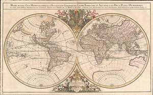
Mappe-monde Geo-Hydrographique ou Description Generale du Globe Terrestre et Aquatique en Deux-Plans-Hemipsheres ou son Exactement Remarquees en General Toutes les Parties de la Terre et de L'Eau, suivant les Relations les plus Nouvelles, par le S. Sanson Geographe Ordinaire du Roy.
sold
- Digital Map Information
- Suitable for large format printing
- DPI: 600
- File Size: 42.4 MB
- File Type: ZIP / TIFF
- ICC color profile embedded
- Delivered instantly via download link
One of the most beautiful, large - format maps of the 17th century, this is Alexis-Hubert Jaillot's 1691 map of the world on a double hemisphere projection. It is an enlarged, richly decorative depiction of the world according to Nicolas Sanson, the great French geographical authority of the 17th century. The map is dedicated to the Dauphin (the eldest son of the King of France;) the dedicatory cartouche at the bottom center is surmounted by a beautiful, gilded Fleur-de-lis and flanked by two mer-men; opposite the dedicatory above the two hemispheres the Dauphin's arms are displayed, flanked by two putti riding stylized dolphins. (more details)
Monumental world map showing California as an Island.
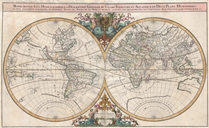
Mappe-monde Geo-Hydrographique ou Description Generale du Globe Terrestre et Aquatique en Deux-Plans-Hemipsheres ou son Exactement Remarquees en General Toutes les Parties de la Terre et de L'Eau, suivant les Relations les plus Nouvelles, par le S. Sanson Geographe Ordinaire du Roy.
sold
- Digital Map Information
- Suitable for large format printing
- DPI: 300
- File Size: 26.26 MB
- File Type: ZIP / TIFF
- ICC color profile embedded
- Delivered instantly via download link
An extraordinary map of monumental proportions, this Sanson and Jaillot's c.1691 decorative map of the world on a double hemisphere projection. Covers the entire world according to its 17th century conception of Nicolas Sanson. Elaborate ... (more details)
Monumental world map showing California as an Island.
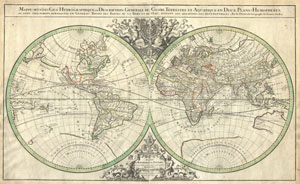
Mappe-monde Geo-Hydrographique ou Description Generale du Globe Terrestre et Aquatique en Deux-Plans-Hemipsheres ou son Exactement Remarquees en General Toutes les Parties de la Terre et de L'Eau, suivant les Relations les plus Nouvelles, par le S. Sanson Geographe Ordinaire du Roy.
sold
- Digital Map Information
- Suitable for large format printing
- DPI: 300
- File Size: 27.92 MB
- File Type: ZIP / TIFF
- ICC color profile embedded
- Delivered instantly via download link
An extraordinary map of monumental proportions, this Sanson and Jaillot's c.1691 decorative map of the world on a double hemisphere projection. Covers the entire world according to its 17th century conception. Elaborate allegorical ... (more details)
A stunning map with gold foiling. Made for kings.
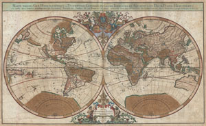
Mappe-monde Geo-Hydrographique ou Description Generale du Globe Terrestre et Aquatique en Deux-Plans-Hemipsheres ou son Exactement Remarquees en General Toutes les Parties de la Terre et de L'Eau, suivant les Relations les plus Nouvelles, par le S. Sanson Geographe Ordinaire du Roy 1691.
sold
- Digital Map Information
- Suitable for large format printing
- DPI: 300
- File Size: 30.64 MB
- File Type: ZIP / TIFF
- ICC color profile embedded
- Delivered instantly via download link
An extraordinary map of monumental proportions, this Sanson and Jaillot's 1691 decorative map of the world on a double hemisphere projection. This is the first state of the fourth plate of this map. Covers the entire world ... (more details)
Home of yellow wine (vin jaune) and comté cheese.
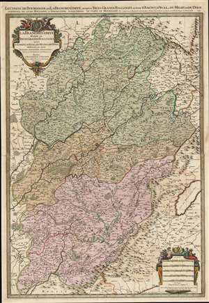
Le Comté de Bourgogne, ou La Franche Comté, Divisée en Trois Grands Balliages, Scavoir d'Amont, d'Aval, et du Milieu, ou de Dole, Subdivisés en Leurs Balliages, et Jurisdictions Subalternes.
sold
- Digital Map Information
- Suitable for large format printing
- Full resolution TIFF file
- ICC color profile embedded
- Delivered instantly via download link
This is a 1692 Alexis-Hubert Jaillot map of Burgundy and Franche-Comté, France. Beautifully engraved and hand colored, myriad cities, towns, and villages are labeled throughout the region, including Besançon, Dole, Vesoul, and Belfort. The Doubs, Saone, and Lougnon Rivers are illustrated and labeled as well. A wonderful title cartouche adorns the upper left corner and a second cartouche on the lower right contains the map's scales. (more details)
Monumental North America maps with incomplete Great Lake and Califorina as an Island.
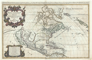
Amerique septentrionale divisee en ses principales parties, ou sont distingues les vns des autres les estats suivant qu'ils appartiennent presentemet aux Francois, Castillans, Anglois, Suedois, Danois, Hollandois, tiree des relations de toutes ces nations par le S. Sanson, geographe ordinaire du roy. 1692.
sold
- Digital Map Information
- Suitable for large format printing
- DPI: 300
- File Size: 23.55 MB
- File Type: ZIP / TIFF
- ICC color profile embedded
- Delivered instantly via download link
An impressive and scarce 1692 map of North America issued by Alexis-Hubert Jaillot on a massive scale. The map covers all of North America and Central America from Baffin Bay to the Spanish Main. The map extends westward ... (more details)
Impressive large format nautical chart from the finest 17th century European nautical atlas.
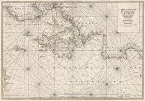
Carte Generale Des Costes De L'Europe Sur L'Ocean Comprises depuis Drontheim en Norvege Jusques au Detroit de Gibraltar. Levée et Gravée par Ordre du Roy à Paris 1693.
sold
- Digital Map Information
- Suitable for large format printing
- DPI: 300
- File Size: 23.32 MB
- File Type: ZIP / TIFF
- ICC color profile embedded
- Delivered instantly via download link
A stunning elephant folio nautical chart or maritime map of the western European coast issued in 1693 by Pierre Mortier and Alexis Hubert Jaillot. Oriented to the west and centered on the British Isles, the chart covers ... (more details)
A most decorative early Map of Ireland.
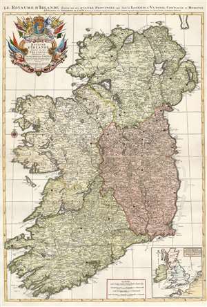
Le Royaume d'Irlande divisé en ses provinces, subdivisé en Shireries ou Comtes...
sold
- Digital Map Information
- Suitable for large format printing
- Full resolution TIFF file
- ICC color profile embedded
- Delivered instantly via download link
Hubert Jaillot's 1693 map of Ireland is among the largest and most beautiful atlas maps of Ireland produced in the 17th century. A sculptor-turned-mapmaker, Jaillot's maps were mostly based on geographical scholarship of the great French mapmaker Nicolas Sanson. Where Sanson's maps tended to be Spartan academic works, Jaillot intended his maps to be 'Bel et Utilite', beautiful as well as informative. Also, while Sanson's maps were printed to single folio sheets or smaller formats, Jaillot printed his maps to two folio sheets, meant to be joined into impressive large-scale maps. The map is superbly detailed, with towns, cities, and roads plainly visible. Topography is shown pictorially. An inset map in the lower right situates Ireland in relation to England, France, and the Netherlands, placing the island in the context of the greater conflict. (more details)
Includes the earliest acquirable European mapping of Korea based on firsthand report.
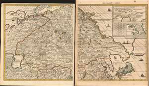
[Carte Nouvelle de la Grande Tartarie].
sold
- Digital Map Information
- Suitable for large format printing
- Full resolution TIFF file
- ICC color profile embedded
- Delivered instantly via download link
This is Pierre Mortier's 1696 two-sheet map of northern Asia, Siberia and Tartary. It is drawn primarily from two sources: Hubert Jaillot's 1695 six-sheet wall map of Asia, and Nicolaes Witsen's 1687 map of Tartary. As a result, this map represents the most up-to-date cartography of central and northeastern Asia of the seventeenth century, which would not be significantly improved upon until the maps of Strahlenberg. (more details)
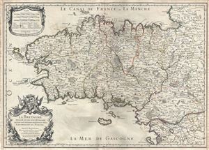
La Bretagne Divisee en ses neuf Evesches qui font aussi l'estendue des Receptes de la Generalite de Nantes.
sold
- Digital Map Information
- Suitable for large format printing
- DPI: 300
- File Size: 16.06 MB
- File Type: ZIP / TIFF
- ICC color profile embedded
- Delivered instantly via download link
This is a scarce 1706 map of Brittany, France by Alexis-Hubert Jaillot. It covers the former province of Brittany from Granville south to Noirmoutier-en-l'lle and from the Celtic Sea inland as far as Craon. The region ... (more details)
Magnificent Brittany.
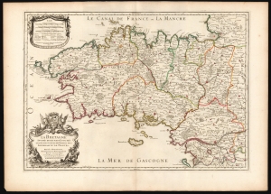
La Bretagne Divisée en ses neuf Eveschés qui font aussi l'estendue des Receptes de la Generalité de Nantes.
sold
- Digital Map Information
- Suitable for large format printing
- DPI: 600
- File Size: 82.82 MB
- File Type: ZIP / TIFF
- ICC color profile embedded
- Delivered instantly via download link
This is Alexis-Hubert Jaillot's map of Brittany, France, in its 1706 edition. It is among the largest atlas maps of the region, here in a superb example with bright original outline color. (more details)
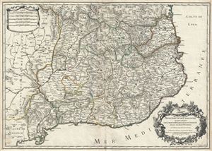
Principaute de Catalogne ou sont compris les Comtes de Roussillon, et de Cerdagne, divisees en leurs Vigueries.
sold
- Digital Map Information
- Suitable for large format printing
- DPI: 300
- File Size: 19.84 MB
- File Type: ZIP / TIFF
- ICC color profile embedded
- Delivered instantly via download link
This is a scarce 1706 map of Catalonia, Spain by Alexis-Hubert Jaillot. It covers the northeastern Iberian Peninsula from Sigean in France to Peniscola on the Mediterranean coast. The principality of Catalonia at the ... (more details)
Beautiful and rare map of the British Isles.
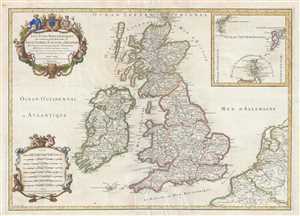
Les Isles Britanniques qui contiennent les Royaumes d'Angleterre, Escosse, et Irlande distingués en leurs principales Provinces : subdivisées en leurs Shireries ou Comtés.
sold
- Digital Map Information
- Suitable for large format printing
- DPI: 300
- File Size: 14.68 MB
- File Type: ZIP / TIFF
- ICC color profile embedded
- Delivered instantly via download link
This is a rare 1709 Hubert Jaillot map of the British Isles. The map depicts the region from the Atlantic Ocean to the North Sea and from the Orkney Islands to the Pas de Calais and Normandy in northern France. ... (more details)
Monumental twelve panel map of Paris.
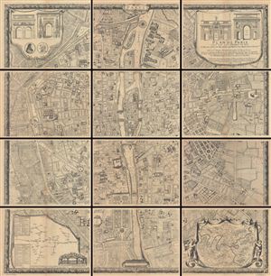
Plan De Paris, Leve Par Les Ordres Du Roy Et Par Les Soins De Messieurs Les Prevost Des Marchands Et Eschevins.
sold
This majestic twelve panel map or plan of Paris is the c. 1900 Taride reissue of an important map originally prepared by Pierre Bullet, Francois Blonde, A. Bonnardt, and Bernard J. H. Jaillot. Like many early ... (more details)
California reattached! The important final state of Jaillot's classic map.
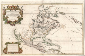
Amerique septentrionale divisee en ses principales parties, ou sont distingues les vns des autres les estats suivant qu'ils appartiennent presentemet aux Francois, Castillans, Anglois, Suedois, Danois, Hollandois, tiree des relations de toutes ces nations par le S. Sanson, Geographe Ordinaire du Roy.
sold
- Digital Map Information
- Suitable for large format printing
- DPI: 600
- File Size: 36.69 MB
- File Type: ZIP / TIFF
- ICC color profile embedded
- Delivered instantly via download link
A scarce 1719 elephant folio map of North America issued by Alexis-Hubert Jaillot on an impressive scale. This is the scarce final edition of Jaillot's map featuring numerous updates to California, the Mississippi Valley, and the Eastern Seaboard. After the first edition, it is considered the most important due to its many significant changes that reflect the most up-to-date discoveries and speculations. The map covers all of North America and Central America, from Baffin Bay to the Spanish Main. It extends westward to include a highly speculative California and eastwards past the Azores to include the British Isles. (more details)
Stunning and uncommon Italian map of Corsica.

Carte Particuliere de L'Isle de Corse Divisee par ses Dix Provinces ou Juridictions et ses quatre Fiefs.
sold
- Digital Map Information
- Suitable for large format printing
- DPI: 300
- File Size: 22.45 MB
- File Type: ZIP / TIFF
- ICC color profile embedded
- Delivered instantly via download link
A fine Italian issue map of Corsica published in 1780 by the Venetian cartographer Francesco Santini. Oriented to the east, this map covers all of Corsica with the northern most extension, Capo Corso, ... (more details)
Unique constructed manuscript plan to renovate Paris by the architect of the Odéon.
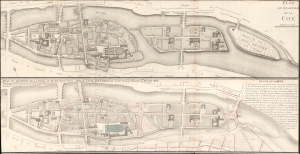
Plan du Quartier de la Cité. / Plan due Quartier de la Cité, de sa Reunion avec L'Isle St. Louis, d'une Garre et d'une Place Consacre a, Louis XVI.
sold
- Digital Map Information
- Suitable for large format printing
- File Size: 14.15 MB
- File Type: ZIP / TIFF
- ICC color profile embedded
- Delivered instantly via download link
A most unique and intriguing 1789 map of the Cité quarter, Paris, with copious manuscript, illustrating the bold plan of French 'Architecte du Roi' and designer of the Odéon, Charles de Wailly, to unite Paris's Île de la Cité with neighboring Île Saint-Louis. The plan, though greeted at the 1789 Paris Salon with much enthusiasm, floundered due to unfortunate timing: it was proposed at the outbreak of the French Revolution (1789 - 1799). It is an epic 'could-have-been' by one of Paris's most famous and influential architects. (more details)