
Merian, Matthäus (sold)
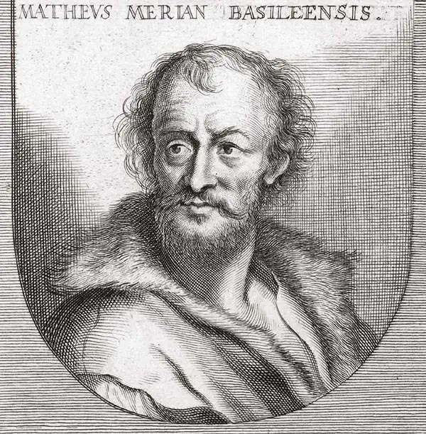
Matthäus Merian (September 22, 1593 - June 19, 1650), sometimes referred to as 'the Elder' to distinguish from his son, was an important Swiss engraver and cartographer active in the early to mid 17th century. Merian was born in Basel and studied engraving in the centers of Zurich, Strasbourg, Nancy and Paris. In time Merian was drawn to the publishing mecca of Frankfurt, where he met Johann Theodor de Bry, son of the famed publisher Theodor de Bry (1528 - 1598) . Merian and De Bry produced a number of important joint works and, in 1617, Merian married De Bry's daughter Maria Magdalena. In 1623 De Bry died and Merian inherited the family firm. Merian continued to publish under the De Bry's name until 1626. Around this time, Merian became a citizen of Frankfurt as such could legally work as an independent publisher. The De Bry name is therefore dropped from all of Merian's subsequent work. Of this corpus, which is substantial, Merian is best known for his finely engraved and highly detailed town plans and city views. Merian is considered one of the grand masters of the city view and a pioneer of the axonometric projection. Merian died in 1650 following several years of illness. He was succeeded in the publishing business by his two sons, Matthäus (1621 - 1687) and Caspar (1627 - 1686), who published his great works, the Topographia and Theatrum Europeaum, under the designation Merian Erben (Merian Heirs). Merian's daughter, Anna Maria Sibylla Merian, became an important naturalist and illustrator. Today the German Travel Magazine Merian is named after the famous engraver.
A view of Lisbon before the devastating earthquake of 1755 which destroyed almost the entire city.
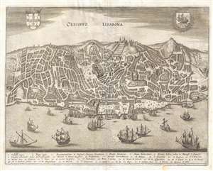
Olisippo Lisabona.
sold
- Digital Map Information
- Suitable for large format printing
- DPI: 300
- File Size: 5.87 MB
- File Type: ZIP / TIFF
- ICC color profile embedded
- Delivered instantly via download link
This is a 1635 Matthäus Merian view of Lisbon, Portugal before the Great Earthquake of 1755. Looking toward the city from the Tagus River, individual buildings are illustrated, presenting an incredible level of detail. Thirty-four different locations are ... (more details)
Identifies six buildings within Copenhagen, including the Royal Castle and St. Peter's Church.
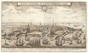
Hafnia Metropolis et Portus Celeberrimus Daniæ. Coppenhagen.
sold
- Digital Map Information
- Suitable for large format printing
- DPI: 300
- File Size: 3.94 MB
- File Type: ZIP / TIFF
- ICC color profile embedded
- Delivered instantly via download link
This is a 1638 Matthaus Merian view of Copenhagen, Denmark. The view, oriented from the harbor, depicts the city in some detail. Several large sailing ships, too big to moor alongside a wharf, are anchored in the harbor, while numerous small rowboats ... (more details)
A lively and detailed panorama of Istanbul, Turkey.
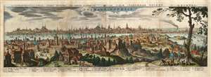
Constantinopolitanae urbis effigies ad vivum expressa, quam turcae Stampoldam vocant, Ao. MDCXXXV.
sold
- Digital Map Information
- Suitable for large format printing
- Full resolution TIFF file
- ICC color profile embedded
- Delivered instantly via download link
This is a 1638 (dated 1635) Matthaus Merian view of Constantinople, or Istanbul, Turkey. The view is oriented to the south. The Beyoğlu district - then known as 'Pera' - is in the foreground, while a panorama of Istanbul proper can be seen as a distant skyline beyond the Golden Horn. A legend at the bottom names twenty nine structures pictured in the view, with a number key indicating the named buildings on the view - predominantly mosques. It is a beautiful example of Merian's superb engraving. The panorama is artfully framed with lifelike trees and other flora, and is filled with depictions of the city's denizens going about everyday life: walking and talking with one another, sitting and conversing, and bringing the dogs back home from the hunt. (more details)
The world's most beautiful skyline.
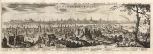
Constantinopolitanae urbis effigies ad vivum expressa, quam turcae Stampoldam vocant, Ao. MDCXXXV.
sold
- Digital Map Information
- Suitable for large format printing
- Full resolution TIFF file
- ICC color profile embedded
- Delivered instantly via download link
This is a 1638 (dated 1635) Matthäus Merian view of Constantinople, or Istanbul, Turkey. The view is oriented to the south. The Beyoğlu district - then known as 'Pera' - is in the foreground, while a panorama of Istanbul proper can be seen as a distant skyline beyond the Golden Horn. A legend at the bottom names twenty nine structures, with a key indicating the named buildings on the view - predominantly mosques. It is a beautiful example of Merian's superb engraving. The panorama is artfully framed with lifelike trees and other flora, and is filled with depictions of the city's denizens going about everyday life: walking and talking with one another, sitting and conversing, and bringing the dogs back home from the hunt. (more details)
Best Acquirable View of London Prior to the Great Fire.
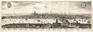
London.
sold
- Digital Map Information
- Suitable for large format printing
- Full resolution TIFF file
- ICC color profile embedded
- Delivered instantly via download link
This is a Matthäus Merian view of London, engraved in 1638 for inclusion in his Archontologia cosmica. It was based on an earlier, 1616 panorama of the city by Claes Visscher (1587 - 1652.) The four-sheet, nearly seven-foot-long Visscher is an all but unobtainable rarity, with only a handful of known copies in institutional and private hands. (An example sold at Christies in 2018 for nearly $150,000.) The Merian expertly reduces the image, preserving much of its detail and elegance. The detail and recognizability of the image are particularly remarkable, given that neither Merian nor Visscher ever had visited London; Visscher's view was based on traditional printed maps (possibly including John Norden's Civitas Londini, which survives in a single copy in the Royal Library in Stockholm) and the reports of visitors at the turn of the century. Visscher's publisher, Jodocus Hondius, lived in London from 1587 to 1593, and he may have been consulted. Thus, despite being engraved during the reign of Charles I, the view is a depiction of Elizabethan London c. 1600; it remains one of the very few acquirable views of the city as it stood prior to the 1666 Great Fire of London. (more details)
First plate of the elder Merian's self-referential panorama of Paris.
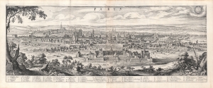
Parys.
sold
- Digital Map Information
- Suitable for large format printing
- Full resolution TIFF file
- ICC color profile embedded
- Delivered instantly via download link
This is a 1638 Matthaus Merian view of Paris, France - arguably the most desirable of Merian's panoramas in that it is also a self-portrait. (more details)
First plate of the elder Merian's self-referential panorama of Paris.
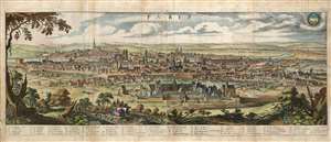
Parys.
sold
- Digital Map Information
- Suitable for large format printing
- Full resolution TIFF file
- ICC color profile embedded
- Delivered instantly via download link
This is a 1638 Matthaus Merian view of Paris, France - arguably the most desirable of Merian's panoramas, in that it is also a self-portrait. The view is oriented to the southwest, showcasing the Hôpital Saint-Louis with the city laid out beyond it. The view was probably drawn from atop the Chauve-mont, now the site of Paris' Parc des Buttes Chaumont; it was almost certainly drawn by Merian himself: the view bears the Latin inscription Math. Merian as vivum delineav. To underline this, Merian has included himself in the picture, seated upon a rock sketching the view before him. Rather than border the view with stylized or fanciful floral decoration, Merian has chosen to frame the panorama in realistic semi-wild trees and bracken of the hillside from which he drew the view, again emphasize that it was drawn from life.
And it is a remarkable view! Fifty-six structures and places are listed below the view with a number key: Notre Dame can be easily found, as can be La Bastille, and other structures both inside and outside the city walls. The Seine can be seen, winding through the city and off into the distance. Diminuitive figures can be seen moving along the roads and on the grounds of the Hôpital Saint-Louis, on foot, horseback and carriage. (more details)
And it is a remarkable view! Fifty-six structures and places are listed below the view with a number key: Notre Dame can be easily found, as can be La Bastille, and other structures both inside and outside the city walls. The Seine can be seen, winding through the city and off into the distance. Diminuitive figures can be seen moving along the roads and on the grounds of the Hôpital Saint-Louis, on foot, horseback and carriage. (more details)
First plate of the elder Merian's self-referential panorama of Paris.
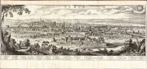
Parys.
sold
- Digital Map Information
- Suitable for large format printing
- File Size: 30.67 MB
- File Type: ZIP / TIFF
- ICC color profile embedded
- Delivered instantly via download link
This is a superb example of Matthaus Merian's view of Paris, France - arguably the most desirable of Merian's panoramas in that it is also a self-portrait. (more details)
Pre-Baroque Rome!
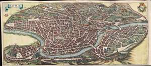
Roma.
sold
- Digital Map Information
- Suitable for large format printing
- Full resolution TIFF file
- ICC color profile embedded
- Delivered instantly via download link
An important and stunning c. 1642 bird's eye view and map of Rome by Matthäus Merian. Merian's panoramic view of Rome, based on the eastward oriented model established in 1593 by Antonio Tempesta, reveals the city at the height of the Italian Renaissance. The view looks on Rome from the northwest - thus looking roughly southwest. This map follows shortly after Pope Sixtus V's ambitious civic redesign of Rome and yet predates the massive rebuilding that occurred during the Baroque Period, thus encapsulating the city during an ephemeral but significant period. The axonometric projection that Merian utilizes lends this map a special significance to historians and architects who can thus visualize many buildings that were demolished or fell into ruin during the subsequent era. (more details)
The height of Venetian culture.
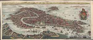
Venetia.
sold
- Digital Map Information
- Suitable for large format printing
- Full resolution TIFF file
- ICC color profile embedded
- Delivered instantly via download link
This is a beautiful full-color example of Matthäus Merian c. 1642 view of Venice at the height of its prosperity. The view looks directly north on Venice from a fictional highpoint in the Adriatic just south of Giudecca. The Piazza San Marco appears at center, with the Grand Canal winding its way through the neighboring islands Murano, Burano, Torcello, and Mazorbo, among others. The harbor is particularly bustling, with ships of all sizes and shapes waiting to dock. The armorial crest of the Republic of Venice appears in the upper right, crowned by the Doge's cap and the winged Lion of Venice at center. (more details)
An Attractive 16th Century Bird's Eye View of Salzburg, Austria
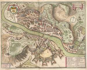
Salzburg.
sold
- Digital Map Information
- Suitable for large format printing
- DPI: 600
- File Size: 12.32 MB
- File Type: ZIP / TIFF
- ICC color profile embedded
- Delivered instantly via download link
This is Merian’s 1644 bird’s eye view of Salzburg, Austria. The beautifully engraved southern-oriented view centers upon the city’s cover bridge across the Salzach (the present Staatsbrücke is the tenth bridge to occupy the same location) linking the two pats of Salzburg's Altstadt, then the entirety of the walled city. Twenty four major structures - monasteries, fortifications, churches, and palaces - are marked with letters and linked to a key. The Cathedral (Thum Kirch) is noted and recognizable. The northern (east bank) of the river is dominated by the forested Kapuzinerberg hill - today, the city's main green space. Though the fortress walls of the northern part of he old city shown here can now only be guessed at by the route of the Franz-Josef Strasse, the gardens of the Schloss Mirabell and the University Mozarteum can be easily found on the plan. (more details)
Richly decorative map of the Africa.
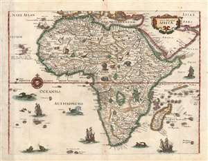
Nova descriptio Africae.
sold
- Digital Map Information
- Suitable for large format printing
- Full resolution TIFF file
- ICC color profile embedded
- Delivered instantly via download link
This is a scarce 1638 Matthias Merian map of Africa, built upon the geographic model of Willem Blaeu's 1617 'Africae nova descriptio'. Blaeu's details are presented here faithfully (though dispensing with Blaeu's decorative borders). This choice is consistent with Merian's decision to copy Blaeu's world and Americas maps for his 1638 Neuwe Archontologia cosmica. In addition to adopting Blaeu's cartography, Merian has filled the seas around Africa with ships and sea monsters; likewise the land teems with elephants, ostriches, lions, and other beasts. (more details)
The discoveries of Le Maire and Schouten.
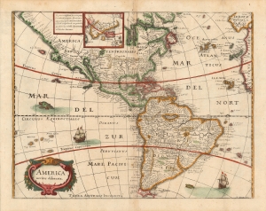
America noviter delineata.
sold
- Digital Map Information
- Suitable for large format printing
- Full resolution TIFF file
- ICC color profile embedded
- Delivered instantly via download link
This is a scarce 1638 Matthias Merian map of the Americas. Merian had already, in 1631 produced a larger-format map of America, based on Jansson’s 1623 America noviter delineata. Merian's source for the present map was not, as Burden suggests, Jodocus Hondius Jr.'s 1618 map of the same title, but Blaeu's Americae Nova Tabula whose detail here is presented with a high degree of faithfulness (although dispensing with Blaeu's decorative borders). It is an interesting choice, but appears to be consistent with Merian's decision to copy Blaeu's world map in this volume. (more details)
Discoveries of Le Maire and Schouten.
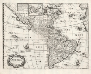
America noviter delineata.
sold
- Digital Map Information
- Suitable for large format printing
- DPI: 600
- File Size: 11.26 MB
- File Type: ZIP / TIFF
- ICC color profile embedded
- Delivered instantly via download link
This is a scarce 1638 Matthais Merian map of the Americas. The map offers a wealth of interesting cartographic tropes and ideas of the early 17th century: El Dorado, Norumbega, new islands in the Pacific, and more. (more details)
A scarce and elegant map showing the route to the Spice Islands and an early glimpse of Australia.
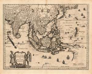
India Orientalis et Insulae Adiecentes.
sold
- Digital Map Information
- Suitable for large format printing
- DPI: 600
- File Size: 11.33 MB
- File Type: ZIP / TIFF
- ICC color profile embedded
- Delivered instantly via download link
This is a scarce 1638 Matthais Merian map of India, Southeast Asia, China, and Japan, including some of the earliest mapped portions of Australia. The map is beautifully engraved, decorated with nine sailing ships, a sea monster, and an elegant compass rose; the title cartouche is flanked by soldiers in Mogul garb. The mapping of India appears to be largely consistent with that of Linschoten. The Philippines are shown in sharp detail, albeit exaggerated in size. New Guinea is shown according to Le Maire's charting. (more details)
Attractive map on the dominant projection of the early 17th century.
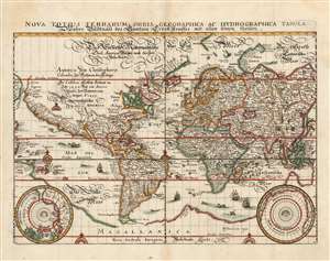
Nova Totius Terrarum Orbis Geographica Ac Hydrographica Tabula...
sold
- Digital Map Information
- Suitable for large format printing
- Full resolution TIFF file
- ICC color profile embedded
- Delivered instantly via download link
This is a scarce 1646 map of the world on the Mercator Projection, produced for inclusion in the 1646 edition of Matthias Merian's Neuwe Archontologia cosmica. It is a meticulous and beautiful reduced version of Blaeu's similarly-titled 1606 map, which remained the dominant depiction of the world using that projection - appearing in all of Blaeu's successful atlas editions up through the 1640s. While this map does not retain the decorative borders of its source, the cartographic detail is reproduced faithfully, including the polar projections in the lower corners. (more details)
Attractive map on the dominant projection of the early 17th century.
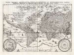
Nova Totius Terrarum Orbis Geographica Ac Hydrographica Tabula...
sold
- Digital Map Information
- Suitable for large format printing
- DPI: 600
- File Size: 10.86 MB
- File Type: ZIP / TIFF
- ICC color profile embedded
- Delivered instantly via download link
This is a scarce 1646 map of the world on the Mercator Projection, produced for inclusion in the 1646 edition of Matthias Merian's Neuwe Archontologia cosmica. It is a meticulous and beautiful reduced version of Blaeu's similarly-titled 1606 map, which remained the dominant depiction of the world using that projection - appearing as it did in all of Blaeu's successful atlas editions up through the 1640s. While this map does not retain the decorative borders of its source, the cartographic detail is reproduced faithfully, including the polar projections shown in the lower corners of the map. (more details)
Rome, Florence, and their Ruling Families!
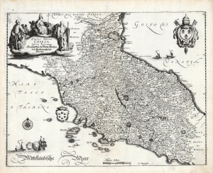
Stato Della Chiesa, Con la Toscana. Herschafften der Röm. Kirchen, und Großhertzogthumb Florentz.
sold
- Digital Map Information
- Suitable for large format printing
- Full resolution TIFF file
- ICC color profile embedded
- Delivered instantly via download link
This is Matthias Merian's 1646 map of Tuscany and the Papal States, the territories in the Italian peninsula under the direct sovereign rule of the Pope. The region was bounded in the north by the Venetian Republic, and in the south by the Kingdom of Naples. The map presents the Stato Dell Chiesa during an extended period of increasing temporal power there: in the north, the Duchy of Ferrara is encompassed, as well as the Duchy of Urbino which had been re-absorbed in 1631. (more details)
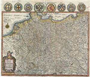
Nova Totius Germaniae.
sold
- Digital Map Information
- Suitable for large format printing
- DPI: 300
- File Size: 9.15 MB
- File Type: ZIP / TIFF
- ICC color profile embedded
- Delivered instantly via download link
This is a beautiful example of Matthuas Merian's c. 1649 decorative map of the Holy Roman Empire. It covers the include the modern day countries of Germany, Poland, Switzerland, Austria, Netherlands, Belgium, Czech Republic and parts of Poland and ... (more details)
The oldest known map of Berlin.
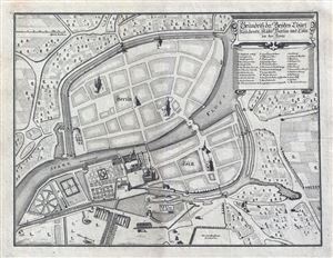
Grundriss der Beyden Churf: Residentz Statte Berlin und Colln an der Spree.
sold
- Digital Map Information
- Suitable for large format printing
- Full resolution TIFF file
- ICC color profile embedded
- Delivered instantly via download link
Drawn in 1652 by Johann Gregor Memhardt, and thus known as the Mamhardt Plan, this is the earliest known map of Berlin. Menhardt prepared this plan while employed by Frederick William, the Great Elector, to restore and rebuild the royal ... (more details)
Spectacular late Renaissance Map and View of Rome.
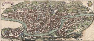
Roma.
sold
- Digital Map Information
- Suitable for large format printing
- DPI: 300
- File Size: 16.07 MB
- File Type: ZIP / TIFF
- ICC color profile embedded
- Delivered instantly via download link
An important and stunning c. 1642 bird's eye view and map of Rome by Matthus Merian. Merian's panoramic view of Rome, based on the eastward oriented model established in 1593 by Antonio Tempesta, reveals the city at the height of the ... (more details)
Bucolic Panorama of Paris and her Countryside.
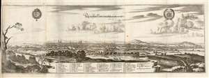
Prosp. der Statt Parys wie solche an ietzo an zusehen.
sold
- Digital Map Information
- Suitable for large format printing
- Full resolution TIFF file
- ICC color profile embedded
- Delivered instantly via download link
This is a 1655 Caspar Merian view of Paris, France - a superbly executed view showing that in artistry Caspar was indeed his father's son. The view is oriented to the west-south-west, from a perspective both further from the city and more to the east than the elder Merian's 1638 view. Rather than border the view with stylized or fanciful floral decoration, Caspar Merian has - following the lead of his father - chosen to frame the panorama in realistic semi-wild trees and bracken of the hillside from which the view was drawn, which has the effect of emphasizing that it was drawn from life. (more details)
Beautiful, Historical Perspective View of Paris.
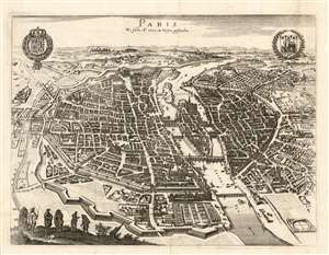
Paris Wie wie solche Ao. 1620 im Wessen gestanden.
sold
- Digital Map Information
- Suitable for large format printing
- Full resolution TIFF file
- ICC color profile embedded
- Delivered instantly via download link
This is a 1655 Caspar Merian bird's eye view of Paris, France. It appeared in Merian's Topographiae Gallae,, published in Frankfurt in 1655. The view is oriented to the north-east, looking up the Seine towards Notre Dame (at center). Boats can be seen plying the river (whose direction of flow is indicated with arrows.) The walled city has 290 of its principal structures numbered to a key which appeared in the text.* The title of the view indicates that it portrays Paris 'as it stood in 1620,' perhaps in order to imply it was composed by the elder Merian to accompany his famous panorama which was executed in and around that time. This was misleading on Caspar's part: this view is in fact a reduced and embellished version, not of a Merian plan of 1615, but the 1635 edition Melchior Tavernier's bird's eye view of Paris. The Tavernier lacks Merian's decorative flourishes: the coats-of-arms of Paris and of France; the figures in the garb of Parisians of various stations depicted in the lower left; and the helpfully-placed compass shown in the lower right-hand corner of the view.
*the first leaf of the text list is present with the map, with the remainder present in reproduction. (more details)
*the first leaf of the text list is present with the map, with the remainder present in reproduction. (more details)
Exquisitely detailed map and view of Recife, Brazil.
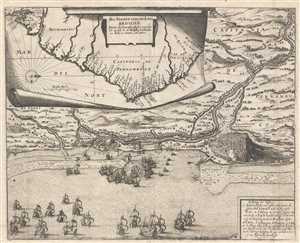
Das Norder Theil des Lands Brasilien.
sold
- Digital Map Information
- Suitable for large format printing
- DPI: 300
- File Size: 9.36 MB
- File Type: ZIP / TIFF
- ICC color profile embedded
- Delivered instantly via download link
This is a stunningly engraved 1655 Matthaeus Merian map of the coast of Brazil and a view of Olinda and Recife in Pernambuco, Brazil. The inset map, shown as if being unrolled on a piece of parchment, shows the coast of Brazil, and ... (more details)
Exquisitely detailed map and view of Recife, Brazil.
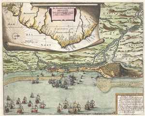
Das Norder Theil des Lands Brasilien.
sold
- Digital Map Information
- Suitable for large format printing
- DPI: 300
- File Size: 8.15 MB
- File Type: ZIP / TIFF
- ICC color profile embedded
- Delivered instantly via download link
This is a stunningly engraved 1655 Matthaeus Merian map of the coast of Brazil and a view of Olinda and Recife in Pernambuco, Brazil. The inset map, shown as if being unrolled on a piece of parchment, shows the coast of Brazil, and ... (more details)
Beautiful, Minutely Detailed Plan of Paris.
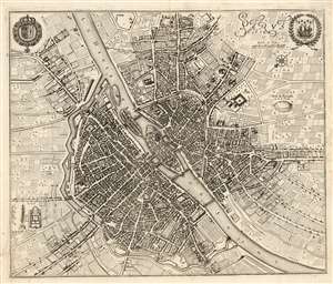
Parys Ao. 1654.
sold
- Digital Map Information
- Suitable for large format printing
- Full resolution TIFF file
- ICC color profile embedded
- Delivered instantly via download link
This is a 1655 Caspar Merian plan, or map of Paris, France. It appeared in Merian's Topographiae Gallae, published in Frankfurt in 1655. The plan is oriented to the south-east, centered on the Île de la Cité and Notre Dame Cathedral. The younger Merian includes in the upper corners the coats-of-arms of Paris and of France. The walled city has 793 streets, parks, and principal structures numbered to a key which appeared in the text, and which is included in full with this plan (three leaves, double-sided letterpress.) The title of the view implies that it portrays Paris 'in 1654,' and indeed it is a faithful reproduction of the four-sheet (and all-but unobtainable) Boisseau Plan général de la ville, cité, université, isles et faubourgs de Paris, which was not published until 1657 despite being dated 1648. (more details)