
Mortier, Pierre (sold)
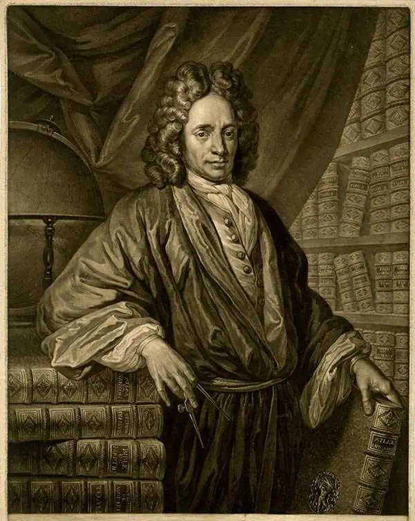
Pierre Mortier (January 26, 1661 - February 18, 1711) or Pieter Mortier was a cartographer, engraver, and print seller active in Amsterdam during the later 17th and early 18th centuries. Mortier, then known as Pieter, was born in Leiden. He relocated to Paris from 1681 to 1685, adopting the French name Pierre, which he retained throughout his career. While in France, he developed deep French connections by bringing sophisticated Dutch printing technology and experience to nascent French map publishers such as Guillaume De L'Isle (1675 - 1726), Alexis-Hubert Jaillot (c. 1632 - 1712), and Nicholas de Fer (1646 - 1720). Consequently, much of Mortier's business was built upon issuing embellished high quality editions of contemporary French maps - generally with the permissions of their original authors. In the greater context of global cartography, this was a significant advantage as most Dutch map publishes had, at this point, fallen into the miasma of reprinting their own outdated works. By contrast, the cartographers of France were producing the most accurate and up to date charts anywhere. Mortier's cartographic work culminated in the magnificent nautical atlas, Le Neptune Francois. He was awarded the Privilege, an early form of copyright, in 1690. Upon Pierre's death in 1711 this business was inherited by his widow. In 1721, his son Cornelius Mortier took over the day to day operation of the firm. Cornelius partnered with his brother-in-law Jean Covens to form one of history's great cartographic partnerships - Covens and Mortier - which continued to publish maps and atlases until about 1866.
A quintessential pirate's nautical map.

Ocean Atlantique ou Mer du Nord.
sold
- Digital Map Information
- Suitable for large format printing
- DPI: 300
- File Size: 20.75 MB
- File Type: ZIP / TIFF
- ICC color profile embedded
- Delivered instantly via download link
This is a rare and remarkable 1693 nautical chart of the Atlantic Ocean by Pierre Mortier. Covers the North Atlantic from rough 5 degree south latitude to roughly 56 degrees north latitude. Includes much of North America, all of the West Indies and Caribbean, ... (more details)
Monumental North America maps with incomplete Great Lake and Califorina as an Island.
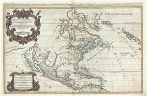
Amerique septentrionale divisee en ses principales parties, ou sont distingues les vns des autres les estats suivant qu'ils appartiennent presentemet aux Francois, Castillans, Anglois, Suedois, Danois, Hollandois, tiree des relations de toutes ces nations par le S. Sanson, geographe ordinaire du roy. 1692.
sold
- Digital Map Information
- Suitable for large format printing
- DPI: 300
- File Size: 23.55 MB
- File Type: ZIP / TIFF
- ICC color profile embedded
- Delivered instantly via download link
An impressive and scarce 1692 map of North America issued by Alexis-Hubert Jaillot on a massive scale. The map covers all of North America and Central America from Baffin Bay to the Spanish Main. The map extends westward to past an Insular California to ... (more details)
A beautiful maritime chart of southern England.
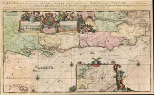
Carte Nouvelle des Costes d'Angleterre depuis la Riviere de la Tamise jusques à Portland, et des Isles Voisines: Ou l'on voit tous les Ports de Mer, Bancs de Sable et Rochers. A l'Usage des Armées de sa Majesté Britannique.
sold
- Digital Map Information
- Suitable for large format printing
- Full resolution TIFF file
- ICC color profile embedded
- Delivered instantly via download link
This is a 1693 Romeyn de Hooghe map of the southern coast of England including the Thames estuary and London. The map depicts from the Isle of Portland east to the Thames estuary and from London to Aldernay, including the Isle of Wight. Cities and towns are labeled throughout. An inset along the bottom border focuses on southeastern England and the North Sea along with northeastern France around Calais and Dunkirk. A decorative cartouche appears in the upper left quadrant and includes views of Portsmouth and Rochester. Wonderfully decorated with compass roses and rhumb lines, this chart is part of a group of nine charts created by de Hooghe and published by Mortier, all of which are regarded as the most decorative sea charts of the 17th century. (more details)
Impressive large format nautical chart from the finest 17th century European nautical atlas.
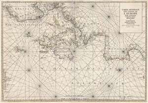
Carte Generale Des Costes De L'Europe Sur L'Ocean Comprises depuis Drontheim en Norvege Jusques au Detroit de Gibraltar. Levée et Gravée par Ordre du Roy à Paris 1693.
sold
- Digital Map Information
- Suitable for large format printing
- DPI: 300
- File Size: 23.32 MB
- File Type: ZIP / TIFF
- ICC color profile embedded
- Delivered instantly via download link
A stunning elephant folio nautical chart or maritime map of the western European coast issued in 1693 by Pierre Mortier and Alexis Hubert Jaillot. Oriented to the west and centered on the British Isles, the chart covers from Trondheim (Dronthem), Norway ... (more details)
Includes the earliest acquirable European mapping of Korea based on firsthand report.
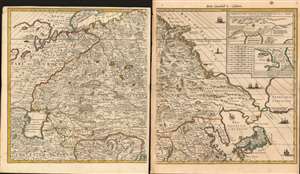
[Carte Nouvelle de la Grande Tartarie].
sold
- Digital Map Information
- Suitable for large format printing
- Full resolution TIFF file
- ICC color profile embedded
- Delivered instantly via download link
This is Pierre Mortier's 1696 two-sheet map of northern Asia, Siberia and Tartary. It is drawn primarily from two sources: Hubert Jaillot's 1695 six-sheet wall map of Asia, and Nicolaes Witsen's 1687 map of Tartary. As a result, this map represents the most up-to-date cartography of central and northeastern Asia of the seventeenth century, which would not be significantly improved upon until the maps of Strahlenberg. (more details)
First editon of Pierre Mortier's fascinating world map based upon Sanson.
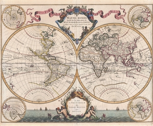
Mappe-Monde Dresse sur les Observations de Mrs. De L'Academie Royale des Sciences et quelques autres et sur les memories les plus recens.
sold
- Digital Map Information
- Suitable for large format printing
- DPI: 300
- File Size: 13.15 MB
- File Type: ZIP / TIFF
- ICC color profile embedded
- Delivered instantly via download link
Published by Pierre Mortier and attributed to the venerable Nicolas Sanson, this scarce first edition is a beautiful 1696 map of the world in two hemispheres. The map consists of two central hemispheres, eastern and western, surrounded by four smaller ... (more details)
Up-to-Date, if fictitious.
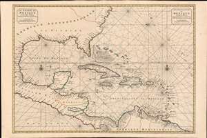
Le Golfe de Mexique et les Isles Voisine Dressé sr les Relations les plus Nouvelles. / Archipelague du Mexique, ou sont les Isles de Cuba, Espagnola, Jamaica, et c. Dressé sur les relations les plus Nouvelles.
sold
- Digital Map Information
- Suitable for large format printing
- DPI: 600
- File Size: 46.72 MB
- File Type: ZIP / TIFF
- ICC color profile embedded
- Delivered instantly via download link
A scarce and striking 1700 Pierre Mortier nautical map embracing Florida, the Gulf of Mexico, Central America, the West Indies, and the Caribbean. Presented on two sheets, joined at center by the publisher, it is centered on Cuba, but extends broadly from Cape Lookout to the Gulf of Darien and from Mexico to Bermuda, Surinam, and Barbados. (more details)
Suggesting a Northwest Passage via Hudson Bay.
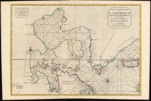
Carte Particuliere de L'Amerique Septentrionale ou sont Compris Le Destroit de Davids, le Destroit de Hudson, etc. Dresse sur les Relations les plus Nouvelles.
sold
- Digital Map Information
- Suitable for large format printing
- DPI: 600
- File Size: 97.48 MB
- File Type: ZIP / TIFF
- ICC color profile embedded
- Delivered instantly via download link
This is a superb, original-color first-state example of Pierre Mortier's 1700 chart of the North Atlantic and Arctic Canada. The map is significant for embodying European hopes for the Northwest Passage. (more details)
Large early nautical chart of the world showing Californai as an island and embryonic Australia.
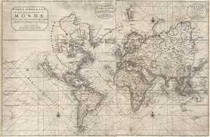
Carte Generale de Toutes Les Costes Du Monde et Les Pays Nouvellement Decouvert, Dresse sur les Relations les Plus Nouvelles Et Principalement sur la Carte que Monsieur N Witsen, a done au Public. / Carte Generale des costes de L'Amerique sur L'Ocean, et les Pays Nouvellement decouvert, Dresse sur les Relations les plus Nouvelles. / Partie Orientale du Monde, qui Contiennent L'Europe, L'Asie, et L'Afrique.
sold
- Digital Map Information
- Suitable for large format printing
- DPI: 300
- File Size: 19.72 MB
- File Type: ZIP / TIFF
- ICC color profile embedded
- Delivered instantly via download link
This is Pierre Mortier's 1703 large format nautical chart of the world on a Mercator Projection. Centered on the Atlantic, this impressive chart covers the entire world as it was then known. Rhumb lines appear throughout and the coastlines are ... (more details)
Superbly Engraved view of Naples.
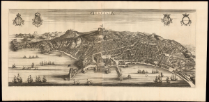
Napoli.
sold
- Digital Map Information
- Suitable for large format printing
- Full resolution TIFF file
- ICC color profile embedded
- Delivered instantly via download link
This is Pierre Mortier's 1704 edition of Joan Blaeu's magnificent two-sheet panorama of Naples, one of the grandest portrayals of the great seaport created in the 17th century. (more details)
Uncommon early map of Crimea and the Kerch Strait.
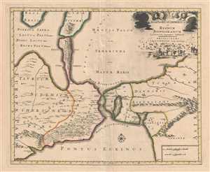
Bosphorus Cimmerius et Regnum Bosphoranum.
sold
- Digital Map Information
- Suitable for large format printing
- DPI: 300
- File Size: 10.5 MB
- File Type: ZIP / TIFF
- ICC color profile embedded
- Delivered instantly via download link
This is a beautiful 1705 of the Kerch Strait issued by Pierre Mortier. The map covers the Kerch Strait between the Sea of Azov and the Black Sea, including the regions of southern Ukraine and the Crimean Peninsula and Krasnodar Krai in Southwest ... (more details)
Second-earliest example of one of the most important and enduring maps of Canada - with fine original color.
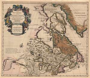
Carte du Canada ou de la Nouvelle France et des Decouverts qui y ont été faites...
sold
- Digital Map Information
- Suitable for large format printing
- Full resolution TIFF file
- ICC color profile embedded
- Delivered instantly via download link
This is the 1708 Pierre Mortier old-color issue of Guillaume de l'Isle's map of northern North America - one of the most important and influential maps of this region. (more details)
De l'Isle's State-of-the-art cartography, ludicrously misattributed.
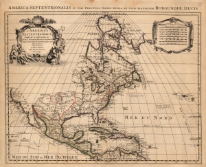
America Septentrionalis in suas Praecipuas Partes Divisa, Ad Usum Serenissimi Burgundiae Ducis/ L'Amerique Septentrionale Dressee sur les Observations de Mrs. de l'Academie Royale des Sciences et quelques autres, et sur les Memoires les plus recens Par N. Sanson.
sold
- Digital Map Information
- Suitable for large format printing
- Full resolution TIFF file
- ICC color profile embedded
- Delivered instantly via download link
This is Peter Mortier's 1708 edition of De L'Isle's foundational 1700 mapping of North America. De l'Isle's map was the first to begin correcting the California-as-an-island myth, however tentatively. The map embraces North America from Baffin's Bay southwards as far as the Spanish Main, westwards to Cape Mendocino, and eastwards to include the Azores and the Sargasso Sea. Cartographically this map is faithful to the De L'Isle, differing mainly in the positioning of the title cartouche and the mileage scales. (more details)
Engraved at the Height of the Golden Age of Dutch Cartography
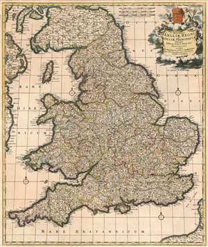
Accuratissima Angliae Regnum et Walliae Principatus Descriptio Distincté Divisa in Omnes Suas Provincias.
sold
- Digital Map Information
- Suitable for large format printing
- DPI: 600
- File Size: 37.19 MB
- File Type: ZIP / TIFF
- ICC color profile embedded
- Delivered instantly via download link
This is Frederic De Wit's superbly engraved 1662 map of England and Wales, in one of its most complete states. De Wit's last, fifth state of the map (coinciding with his being granted his privilege, in 1689) exhibits the totality of its maker's aesthetic changes. De Wit completely re-engraved the cartouche and the scales at that time, with its four splendid putti and the crowned Royal Arms of England. The maps produced in Amsterdam in the latter part of the 17th century enjoyed both technological advances both in printing technology (resulting in larger presses, hence larger plates and larger maps) and in the art of engraving (resulting in finer and more dense geographical detail and toponymy.) Hence both as geographical documents and works of art, they represent great steps forward. (more details)