
Neele, Samuel John (sold)

Samuel John Neele (July 29, 1758 - May 13, 1824) was a prolific British map engraver active in the late 18th and early 19th centuries. Neele apprenticed as a printer and engraver with Harry Ashby from about 1781 to 1782 before establishing himself independently in 1785 at 352 Strand, London. The combination of business acumen and technical skill made Neele extremely successful, with literally hundreds of maps to his credit. His vast corpus was composed of notable maps by most major English publishers of the period, including Haywood, Faden, Wallis, Stockdale, Arrowsmith, Thomson, Pinkerton, and Greenwood, among others. He operated from 352 Strand, London. Neele's sons, James and Josiah Neele, also engravers, took over their father's business around 1818, both becoming notable in their own right.
An early map of the California and Oregon coasts.
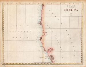
Chart of the North West Coast of America Explored by the Boussole and Astrolabe in 1786. 3rd Sheet.
sold
- Digital Map Information
- Suitable for large format printing
- Full resolution TIFF file
- ICC color profile embedded
- Delivered instantly via download link
An important early chart of the coasts of Northern California and Oregon, undertaken by the ill-fated French voyage led by La Perouse in 1786. This rare hand-colored example of the map came from the first English edition of the text and plates recounting La Perouse's voyage, published in London by J. and G. Robinson in 1798. (more details)
Early, English Edition of the First Acquirable Chart of San Francisco Bay.
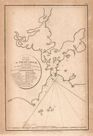
Plan of Port St. Francisco in California.
sold
- Digital Map Information
- Suitable for large format printing
- Full resolution TIFF file
- ICC color profile embedded
- Delivered instantly via download link
This is the 1798 English edition of La Pérouse's seminal 1797 map of San Francisco Bay. It is the first acquirable chart of these waters to be printed in English; La Pérouse's original of the previous year is the earliest acquirable overall. The 1798 John Robinson (1752 - 1813) edition of La Pérouse's travels was one of the earliest, and best, works to bring to English audiences the discoveries of this French circumnavigator's ill-fated voyage. (more details)
Largest 19th century map of Malta - issued by an ex-Knight when the Order of St. John was nearly destroyed.

A New Sea and Land Chart of the Sovereign Principality of Malta; laid down from the best Authorities and the different Manuscript Maps communicated to the Chevr. Louis de Boisgelin under whose particular inspection this Chart has been planned.
sold
- Digital Map Information
- Suitable for large format printing
- Full resolution TIFF file
- ICC color profile embedded
- Delivered instantly via download link
This 1804 production is the largest and most detailed map of Malta and Gozo to appear in the 19th century. The map was produced by Pierre Marie Louis de Boisgelin de Kerdu and Samuel John Neele based upon Boisgelin's life in Malta as a member of the knightly Order of St. John. The map is matched in dimensions and sophistication only by the Carte Generale de la Principaute Souveraine des Isles de Malte et du Goze (53.1 x 22.8 inches), made by Gervais de Palmeus in 1752. (more details)
Considered to be the first scientific mapping of South Africa.
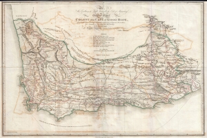
To His Excellence the Right Honorable Earl of Macartney This General Chart of the Colony of the Cape of Good Hope, Constructed from bearing, estimation of distances and Frequent observations for Latitudes in Travelling throu' the Country in the Years 1797 and 1798 is Humbly Inscribe, by his Obedient and Faithful Servant, John Barrow.
sold
- Digital Map Information
- Suitable for large format printing
- DPI: 300
- File Size: 13.04 MB
- File Type: ZIP / TIFF
- ICC color profile embedded
- Delivered instantly via download link
Considered to be the first scientific mapping of South Africa, this is a fine example of John Barrow's scarce 1805 General Chart of the Colony of the Cape of Good Hope. (more details)
A world in transition.
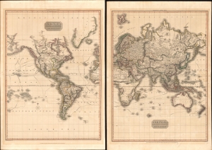
The World on Mercator's Projection Western Part. / The World on Mercator's Projection Eastern Part.
sold
- Digital Map Information
- Suitable for large format printing
- Full resolution TIFF file
- ICC color profile embedded
- Delivered instantly via download link
This is John Pinkerton's 1812 map of the world on Mercator's projection, here in two folio sheets. (more details)
The Ottomans Try to Keep It Together.
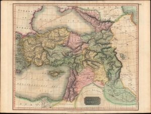
Asiatic Turkey.
sold
- Digital Map Information
- Suitable for large format printing
- Full resolution TIFF file
- ICC color profile embedded
- Delivered instantly via download link
A fine example of John Thomson's vibrant hand-colored 1814 map of 'Asiatic Turkey,' that is, the Asian portion of the Ottoman Empire, published in his New General Atlas in 1815. (more details)
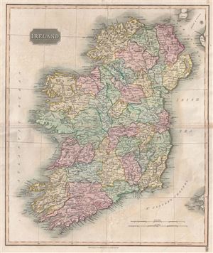
Ireland.
sold
- Digital Map Information
- Suitable for large format printing
- DPI: 300
- File Size: 3.7 MB
- File Type: ZIP / TIFF
- ICC color profile embedded
- Delivered instantly via download link
This is an attractive example of John Thomson's 1816 map of Ireland. The whole is beautifully engraved in the minimalist English style pioneered in the London and Edinburgh during early part of the 19th century. It depicts the entire Emerald Isle, divided into ... (more details)
Before the famine.
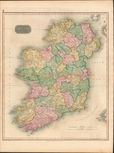
Ireland.
sold
- Digital Map Information
- Suitable for large format printing
- DPI: 600
- File Size: 723.33 MB
- File Type: ZIP / TIFF
- ICC color profile embedded
- Delivered instantly via download link
This is John Thomson's 1815 map of Ireland divided into counties. (more details)
Circling the Globe.
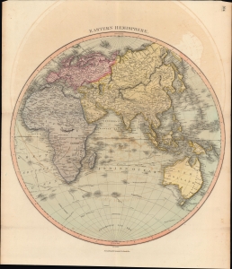
Eastern Hemisphere.
sold
- Digital Map Information
- Suitable for large format printing
- DPI: 600
- File Size: 61.44 MB
- File Type: ZIP / TIFF
- ICC color profile embedded
- Delivered instantly via download link
A lovely, hand-colored map of the Eastern Hemisphere, prepared by John Thomson for his New General Atlas. Among other features, it traces the voyages of exploration and circumnavigation of the late 18th century, including Cook, Vancouver, and La Perouse. (more details)
Highlighting Cook's enduring significance.
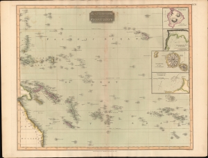
Map of the Islands in the Pacific Ocean.
sold
- Digital Map Information
- Suitable for large format printing
- Full resolution TIFF file
- ICC color profile embedded
- Delivered instantly via download link
This is John Thomson's 1817 map of the Pacific islands, highlighting the continuing importance of Cook's voyages nearly four decades after his death. Its four insets highlight Hawaii and Tahiti, pairing each island with the harbor most closely associated with Cook: Kealakekua Bay, where he was killed, and Matavai Bay, where he observed the transit of Venus. Their prominent treatment nearly four decades after Cook's death underscores the enduring influence of his discoveries on the European conception of the Pacific. (more details)
Key River to Humboldt's Explorations of the Orinoco system.
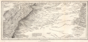
Map of the Course of the Rio Meta, and a part of the Eastern Chain of the Mountains of New Granada.
sold
- Digital Map Information
- Suitable for large format printing
- File Size: 8.59 MB
- File Type: ZIP / TIFF
- ICC color profile embedded
- Delivered instantly via download link
This is an 1818 Alexander von Humboldt map of the Rio Meta (Meta River) in Colombia and Venezuela. The Meta was one of the key waterways that Humboldt navigated while studying the intricate river systems of the Orinoco Basin. His observations and detailed descriptions of the Río Meta’s geography, flora, and fauna contributed to his broader understanding of South America’s natural environment. The map was compiled to illustrate Humboldt's epic voyage through South America, resulting in his Cosmos, an era-defining scientific work. (more details)
Revealing portrait of European geographical uncertainty in East Asia.
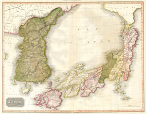
Japan.
sold
- Digital Map Information
- Suitable for large format printing
- Full resolution TIFF file
- ICC color profile embedded
- Delivered instantly via download link
This is the 1818 American edition of John Pinkerton's map of Japan and Korea, published in Philadelphia by Thomas Dobson for A Modern Atlas. The map captures a transitional moment in the cartography of East Asia, combining established 18th-century geographical conventions with new information derived from contemporary Pacific exploration. Faced with conflicting reports from different navigators and cartographers, Pinkerton sometimes maps competing interpretations of the same geographical feature, effectively allowing the reader to judge between rival authorities. Elsewhere, the map incorporates significant advances over earlier European representations, particularly in its treatment of Jeju Island (Quelpaert), while retaining much of the established D'Anville geography of Korea and Japan. (more details)