
Petermann, Augustus Heinrich (sold)
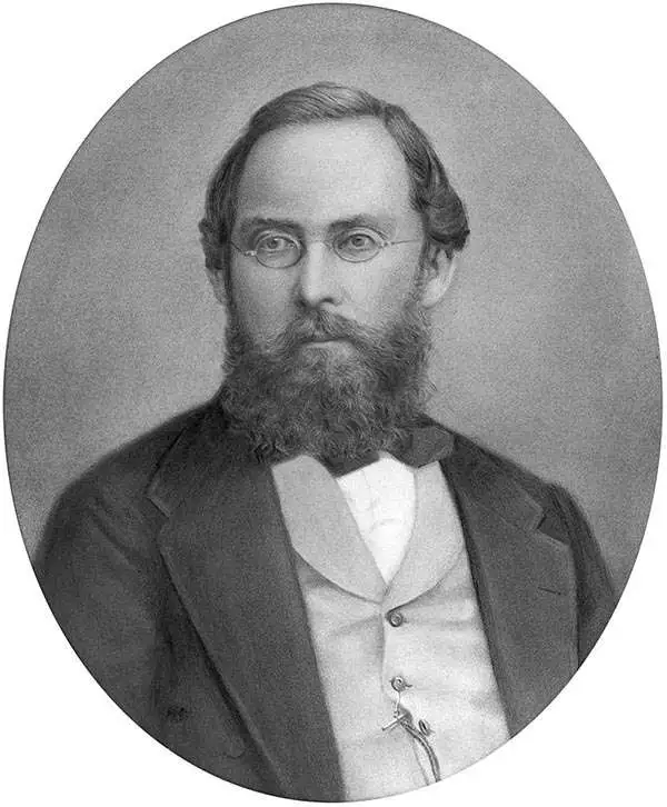
August Heinrich Petermann (1822 - 1878) was a German cartographer. Petermann attended the 'Geographische Kuntschule' (Geographica School of Art), which was started by Heinrich Berghaus with the support of Alexander von Humboldt, in Potsdam beginning in 1839. Students at the school were obliged to work on many of the school's contracts, including maps for several different atlases. Following his time in Potsdam, Petermann relocated to Edinburgh and London from 1845 to 1854, where he gained insight into the commercial aspects of the cartography business. In 1854, Petermann returned to Gotha, Germany and began working with the Perthes brothers publishers. While working with the Perthes brothers, Petermann founded the journal Petermanns Geographische Mitteilungen, published from 1855 until 2014, long one of the most prominent German-language geography journals.
Exploring the Arctic and Antarctic.
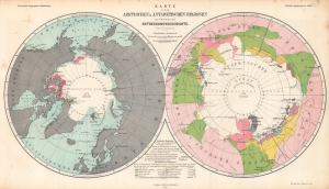
Karte der Arktischen und Antarktischen Regionen zur Übersicht der Entdeckungsgeschichte. / Map of the Arctic and Antarctic Regions for the Overview of the History of Discovery.
sold
- Digital Map Information
- Suitable for large format printing
- File Size: 25.7 MB
- File Type: ZIP / TIFF
- ICC color profile embedded
- Delivered instantly via download link
Consisting of two polar projection maps on one sheet, this is an 1865 Augustus Petermann map of the Arctic and Antarctic. Both maps highlight areas recorded by European explorers beginning in the 1770s through the 1860s. Islands, straits, bays, seas, and other locations are noted in both regions. A key explaining the various colors employed is situated at bottom center. (more details)
Starring the Global Telegraph Network.
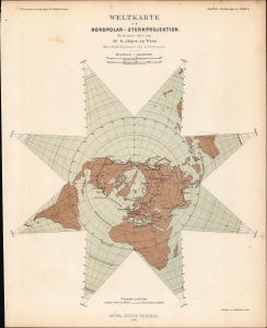
Weltkarte in Nordpolar-Sternprojektion nach einer Idee von G. Jäger, in Wien.
sold
- Digital Map Information
- Suitable for large format printing
- File Size: 8.37 MB
- File Type: ZIP / TIFF
- ICC color profile embedded
- Delivered instantly via download link
A fascinating star-shaped polar projection, prepared by Augustus Petermann in 1865 for Petermann's Geographische Mitteheilungen. Aside from demonstrating a sophisticated polar projection, the map is notable for reflecting the global telegraph network at the time. (more details)
German interest in the Transvaal?
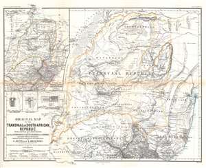
Original Map of the Transvaal or South-African Republic.
sold
- Digital Map Information
- Suitable for large format printing
- File Size: 26.44 MB
- File Type: ZIP / TIFF
- ICC color profile embedded
- Delivered instantly via download link
This is an 1868 Frederick Jeppe and Augustus Petermann map of the Transvaal, South Africa. Composed in English but published by a German publishing house (likely to capitalize on a British audience), the map details the emerging Transvaal Republic and surrounding region. The Transvaal Republic is outlined in orange and the 'limit of the tsetse fly' is emphasized by light green. The treks of eight explorers active 1844 until 1867 are traced and highlighted. Cities, towns, and villages are labeled, including Pretoria and Potchefstroom. A large inset in the upper left situates the Transvaal Republic within the greater region and labels numerous surrounding polities, including the Oranje River Freestate. Smaller inset maps detail Rustenburg, Pretoria, and Potchefstroom. (more details)
Landstraßen...
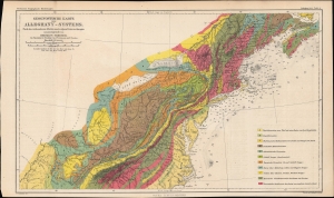
Geognostische Karte des Alleghany-Systems. Nach den vorhandenen Arbeiten sowie eignen Untersuchungen zusammengestellt von Herman Credner.
sold
- Digital Map Information
- Suitable for large format printing
- File Size: 10.45 MB
- File Type: ZIP / TIFF
- ICC color profile embedded
- Delivered instantly via download link
A colorful geologic map of the Appalachian Mountains, produced in 1871 by Augustus Petermann and published by Justus Perthes for his Petermann's geographische Mitteilungen, a leading German geographical journal of the era. (more details)
Talking polar bears anyone?
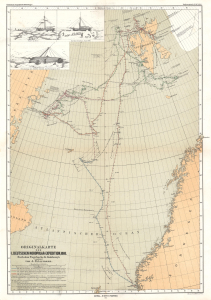
Originalkarte der I. Deutschen Nordpolar-Expedition, 1868.
sold
- Digital Map Information
- Suitable for large format printing
- File Size: 12.29 MB
- File Type: ZIP / TIFF
- ICC color profile embedded
- Delivered instantly via download link
This is an 1871 Augustus Petermann map of Svalbard and the Arctic Ocean. The map records the 1868 First German North Polar Expedition, which, to this day, maintains the records for the highest northern latitude reached by a sailing ship without auxiliary drive. (more details)
Colonial competition in the Chad Basin.
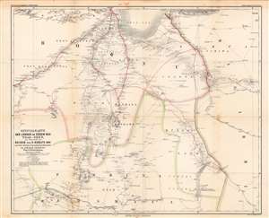
Specialkarte der Länder im Süden des Tsad-See's...
sold
- Digital Map Information
- Suitable for large format printing
- File Size: 60.93 MB
- File Type: ZIP / TIFF
- ICC color profile embedded
- Delivered instantly via download link
This is August Petermann's 1872 map of what is today the Borno (or Bornu) region of Nigeria and neighboring territories, sitting at the meeting point of Nigeria, Cameroon, and Chad along the southern banks of Lake Chad. In the years and decades following this map's publication, this region would play an important role in the Scramble for Africa. (more details)
Where all the people live.
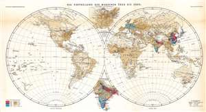
Die Vertheilung der Menschen über die Erde.
sold
- Digital Map Information
- Suitable for large format printing
- File Size: 24.68 MB
- File Type: ZIP / TIFF
- ICC color profile embedded
- Delivered instantly via download link
An effective combination of statistics and geography, this is Ernst Behm and Fr. Henemann's map of global population density, published in an 1873 supplement to Petermann's geographische Mittheilungen. It displays the world divided into hemispheres and uses chromolithographic printing to differentiate areas of high and low population density. (more details)
The mining heartland of the Russian empire.
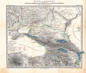
Karte von Kaukasien zur Übersicht der physikalisch-geographischen Grundzüge und der wichtigsten Minerale.
sold
- Digital Map Information
- Suitable for large format printing
- File Size: 50.46 MB
- File Type: ZIP / TIFF
- ICC color profile embedded
- Delivered instantly via download link
Here is a nicely engraved map of the Caucasus region drawn by Augustus Petermann and published by Justus Perthes in 1874. It highlights mineral deposits in a period when mining, railways, and the oil industry were rapidly developing and drastically changing the region. (more details)
Depicts the entire area of conflict during The Great Game.
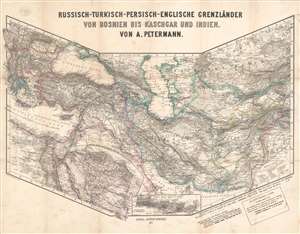
Russisch-Turkisch-Persisch-Englische Grenzländer von Bosnien vis Kaschgar und Indien.
sold
- Digital Map Information
- Suitable for large format printing
- File Size: 34.97 MB
- File Type: ZIP / TIFF
- ICC color profile embedded
- Delivered instantly via download link
This is a scarce and unusual 1877 Augustus Petermann map of the Middle East and Central Asia at the height of The Great Game, a decades-long diplomatic duel between the British and Russian Empires. Detailing the entire theater of war, the map's polyconic projection covers from the Balkans to British India; Crimea to the Persian Gulf and Indian Ocean. The Russian Empire stretches across the top of the map, an ever-expanding threat to countries to the south with deep water ports on the Mediterranean Sea and Indian Ocean. Throughout the 19th century, the Russian drive southward led to several wars with Persia and Turkey, which also embroiled British and French interests, staging Russia as 'the great enemy'. (more details)
Map of Korea and blueprint for foreign control.
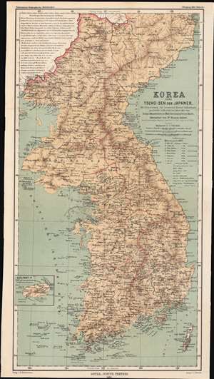
Korea oder Tscho-sen der Japaner / [Korea, or Japanese Chōsen].
sold
- Digital Map Information
- Suitable for large format printing
- File Size: 14.84 MB
- File Type: ZIP / TIFF
- ICC color profile embedded
- Delivered instantly via download link
This is an 1883 map of the eight provinces of Chosŏn Korea, partially translated into German from an English-language map, which in turn was based on a map made by the Japanese military in 1875. The convoluted history of this map shows both the curiosity about the 'hermit kingdom' and the competing imperial interests that would be at play once Korea was forcibly opened to greater foreign influence. (more details)
German map depicting the journeys of Nikolai Przewalski, and Qinghai Lake, the largest lake in China.
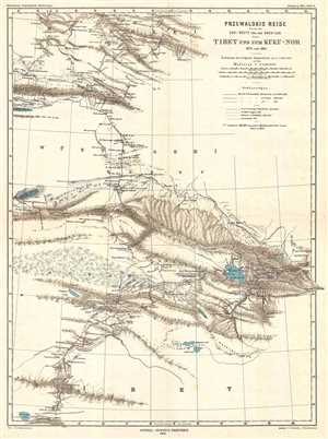
Przewalski's Reise durch die Gobi-Wüste und den Kwen-Lun nach Tibet und zum Kuku-Nor 1879 und 1880.
sold
- Digital Map Information
- Suitable for large format printing
- File Size: 5.28 MB
- File Type: ZIP / TIFF
- ICC color profile embedded
- Delivered instantly via download link
This is an 1883 German map which was published in Petermanns Geographische Mitteilungen . The map depicts the journeys of Russian explorer Nikolay Mikhaylovich Przhevalsky from Mongolia into northern Tibet and parts of western China. Three different routes taken by ... (more details)
A fascinating botanical map of Guatemala.
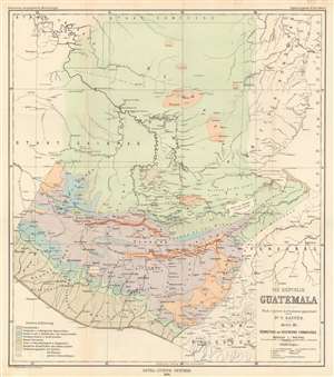
Die Republik Guatemala nach eigenen Aufnahmen gezichnet. Karte III : Verbreitung der Vegetations Formationen.
sold
- Digital Map Information
- Suitable for large format printing
- File Size: 18.59 MB
- File Type: ZIP / TIFF
- ICC color profile embedded
- Delivered instantly via download link
This is an 1894 Bruno Hassenstein vegetation map of Guatemala. Hassenstein uses colors to differentiate between zones, allowing a viewer to easily discern Guatemala's incredible botanical diversity. These colors represent ten different botanical zones, including littoral forests, tropical and subtropical rainforests, damp deciduous and coniferous forests, dry oak and pine forests, tree savannas and grass and shrub steppes and chaparrals. The final three focus on the distribution of pine trees, Taxisco (Taxixcó) trees (a tree indigenous to Guatemala), and large Cereus, a genus of cacti. Aside from this fascinating botanical content, cities and towns throughout Guatemala are identified, as are rivers and lakes. (more details)
A detailed map of the Rio Polochic which empties into Lake Izabel.
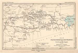
Das Flussgebiet des Rio Polochic.
sold
- Digital Map Information
- Suitable for large format printing
- File Size: 2.91 MB
- File Type: ZIP / TIFF
- ICC color profile embedded
- Delivered instantly via download link
This is an 1894 Hassenstein map of the Rio Polochic (Polochic River) in Guatemala. The map depicts the region west of Lake Izabel and details not only the Rio Polochic but most of the river system, which consists of the Rio Cajabon and numerous smaller rivers and tributaries, many of which are illustrated and labeled. Towns and villages throughout the region are also identified, and Dr. Sapper's travels through the region are traced by solid red lines. (more details)
Illustrates Guatemala's watershed.
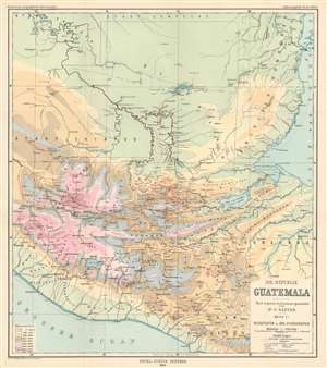
Die Republik Guatemala Nach eigenen Aufnahmen gezeichnet von Dr. C. Sapper. Karte I: Reiserouten und Oro-Hydrographie
sold
- Digital Map Information
- Suitable for large format printing
- File Size: 19.45 MB
- File Type: ZIP / TIFF
- ICC color profile embedded
- Delivered instantly via download link
This is an 1894 Hassenstein orohydrographic map of Guatemala. Orohydrography is the study of the relationship between mountains and water drainage patterns, thus an orohydrographic map illustrates a region's topography and how that topography effects its watersheds. Here, Hassenstein has employed nine different colors to highlight different areas separated by altitude, which allows the viewer to more easily understand how water would run downhill. Orohydrographic maps also illustrate flowing-water (rivers) and standing-water (lakes), in order to provide a complete understanding of the region's hydrography. Dr. Sapper's routes through the region are also traced, with the solid red line tracing overland sections and dashed lines marking parts of his journey made over water. (more details)