
A remarkable early manuscript of Hokkaido predating the official 1785-6 Ezochi expedition. An example of early Japanese censorship.
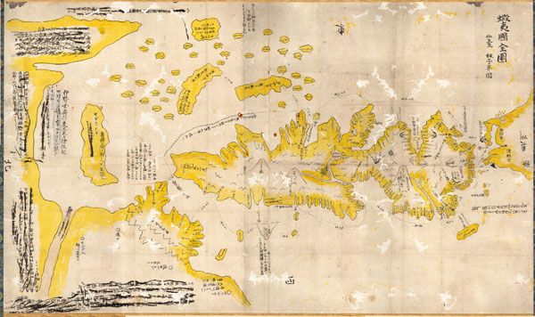
Ezo No Kuni Zenzu (Map of the Ezo Region)
sold
- Digital Map Information
- Suitable for large format printing
- Full resolution TIFF file
- ICC color profile embedded
- Delivered instantly via download link
This is an unusual 1785 manuscript map of the island of Hokkaido by the Japanese cartographer Hayashi Shihei. Oriented to the east, Shiehi has drawn Hokkaido in an unusual form, elongated on the north-south axis, such that it is barely recognizable to our modern ... (more details)
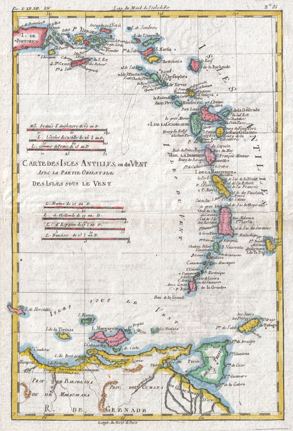
Carte Des Isles Antilles Ou Du Vent Avec La Partie Orientale Des Isles Sous Le Vent
sold
- Digital Map Information
- Suitable for large format printing
- DPI: 300
- File Size: 4.32 MB
- File Type: ZIP / TIFF
- ICC color profile embedded
- Delivered instantly via download link
A fine example of Rigobert Bonne and Guillaume Raynal's 1780 map of the Lesser Antilles, West Indies. Covers the entire chain from Porto Rico to Trinidad, along with parts of the Spanish Main. Includes Porto Rico, St. Croix, Barbados, St. Lucia, St. martin, ... (more details)

Guinea. (Gvinea.)
sold
- Digital Map Information
- Suitable for large format printing
- Full resolution TIFF file
- ICC color profile embedded
- Delivered instantly via download link
This is an extraordinary 1670 map of West Africa by English cartographer John Ogilby. Depicts the African Gold Coast, Ivory Coast, and Slave Coast from Guniea south through the modern nations of, Sierra Leone, Liberia, Mali, Burkina Faso, Cote D'Ivoire, ... (more details)
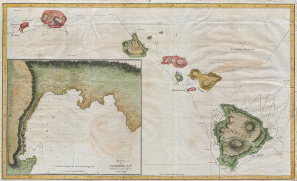
Chart of the Sandwich Islands.
sold
- Digital Map Information
- Suitable for large format printing
- DPI: 300
- File Size: 3.97 MB
- File Type: ZIP / TIFF
- ICC color profile embedded
- Delivered instantly via download link
Offered here is an extraordinary and important map of the Hawaiian Islands (Sandwich Islands) printed by G. Nicol and T. Cadell for the 1785 edition of Captain James Cook and James King's, A Voyage to the Pacific Ocean…in the Years 1776, 1777, 1778, ... (more details)

Carte Des Isles Brittaniques Contenant Royaumes D'Angleterre, D'Ecosse, Et D'Irlande.
sold
- Digital Map Information
- Suitable for large format printing
- DPI: 300
- File Size: 4.71 MB
- File Type: ZIP / TIFF
- ICC color profile embedded
- Delivered instantly via download link
A fine example of Rigobert Bonne and Guillaume Raynal's 1780 map of the British Isles. Covers Ireland, Scotland, Wales, England, Isle of Man, and the Channel Islands. Highly detailed, showing towns, rivers, some topographical features, important ... (more details)
The finest example of Homann's significant map of New England.
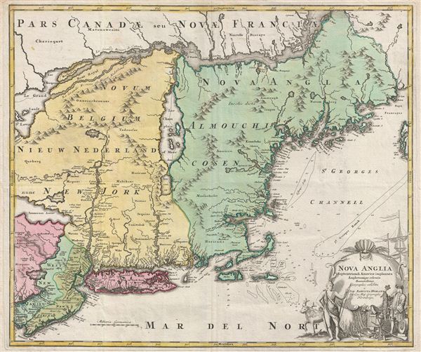
Nova Anglia Septentrionali Americae Implantata Anglorumque Coloniis Florentissima Geographice Exhibita a Joh. Baptista Homann.
sold
- Digital Map Information
- Suitable for large format printing
- DPI: 300
- File Size: 2.51 MB
- File Type: ZIP / TIFF
- ICC color profile embedded
- Delivered instantly via download link
A significant though often overlooked piece, this is J. B. Homann's c. 1716 map of New England, New York, and New Jersey. Though titled 'Nova Anglia,' (New England) Homann's map actually covers a much broader area from New France (Canada) to the Delaware Bay, and from Philadelphia to Nova Scotia, inclusive of all of New England, New York, and New Jersey, as well as parts of adjacent Canada and Pennsylvania. The map identifies both European and American Indian settlements, differentiating between the two by rendering indigenous settlements as pictorial villages, huts and all, and European towns as small circles, major cities like Philadelphia and Boston being the exception. (more details)
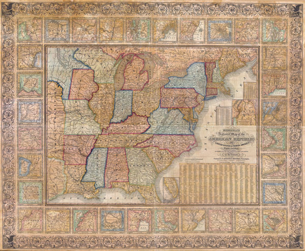
Mitchell’s National Map of the American Republic or The United States of North America. Together with Maps of the Vicinities of Thirty-Two Principal Cities and Towns in the Union
sold
- Digital Map Information
- Suitable for large format printing
- Full resolution TIFF file
- ICC color profile embedded
- Delivered instantly via download link
The S. A Mitchell firm published this map, both in wall and folding pocket format, from 1843 to 1850. It is considered a highly important work of mid 19th century American cartography. Through its multiple issues historians can follow the ... (more details)

Carte De L'Empire De Russie, En Europe Et En Asie.
sold
- Digital Map Information
- Suitable for large format printing
- DPI: 300
- File Size: 4.5 MB
- File Type: ZIP / TIFF
- ICC color profile embedded
- Delivered instantly via download link
A fine example of Rigobert Bonne and Guillaume Raynal's 1780 map of the Russian Empire. Shows entire Russian Empire stretching from Europe to the Behring Strait, as well as parts of Eastern Europe and Tartary. Cartographically the ... (more details)
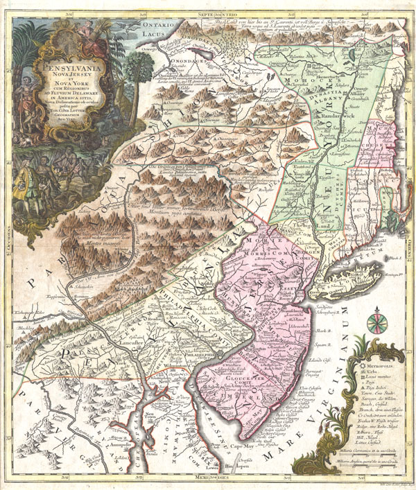
Pensylvania Nova Jersey et Nova York cum Regionibus Ad Fluvium Delaware In America Sitis, Nova Delinatione ob oculos posita . . .
sold
- Digital Map Information
- Suitable for large format printing
- DPI: 300
- File Size: 10.35 MB
- File Type: ZIP / TIFF
- ICC color profile embedded
- Delivered instantly via download link
A fine and rare 1756 example of Tobias Conrad Lotter's important map of the Middle Atlantic and New England regions during the British colonial period. One of the most desirable, interesting and attractive pre-Revolutionary maps of ... (more details)
The most important map of Africa printed in the 18th century.
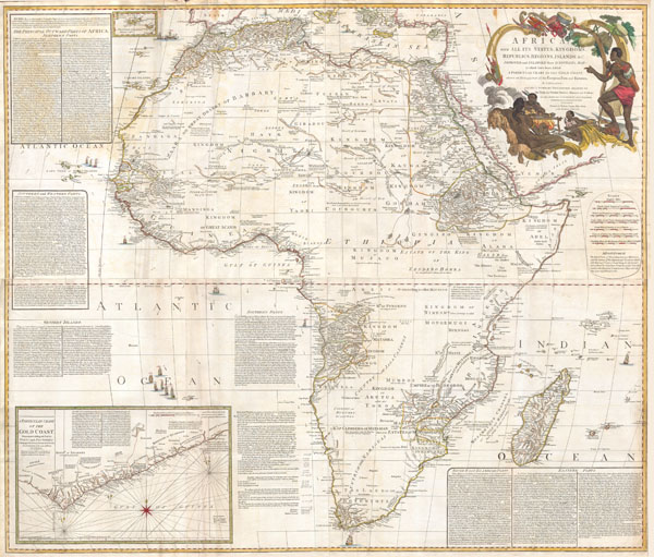
Africa, with all its States, Kingdoms, republics, Regions, Islands, & cca. Improved and Inlarged form D’Anville’s Map to which has been added A particular Chart of the Gold Coast wherein are Distinguished all the European Forts, and Factories by S. Boulton.
sold
- Digital Map Information
- Suitable for large format printing
- Full resolution TIFF file
- ICC color profile embedded
- Delivered instantly via download link
This is most likely the most important map of Africa produced in the 18th century. Printed at the height of the slave trade in 1787 by the Robert Sayer firm of London, England. Largely based upon the earlier D'Anville map, this map ... (more details)
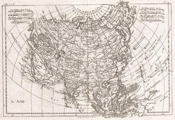
L'Asie.
$175.00
Acquire
- Digital Map Information
- Suitable for large format printing
- DPI: 300
- File Size: 4.56 MB
- File Type: ZIP / TIFF
- ICC color profile embedded
- Delivered instantly via download link
A fine example of Rigobert Bonne and Guillaume Raynal's 1780 map of Asia. Offers considerable detail considering the size, showing the tradewinds in the Pacific and Indian Oceans as well as numerous Silk Route cities in Central ... (more details)
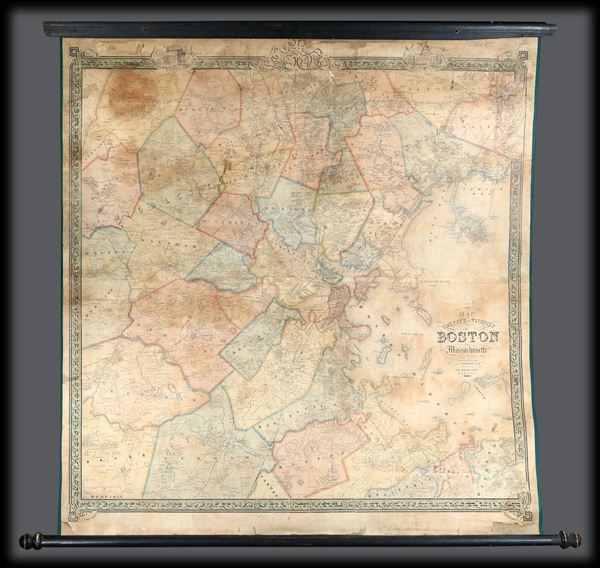
Map of the City and Vicinity of Boston, Massachusetts.
sold
An extremely scarce and dramatic 1852 wall map of Boston, Massachusetts and vicinity. Depicts the greater Boston area from Dover in the southwest to part of Concord in the northwest to Hingham southeast and to Danvers ... (more details)
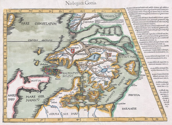
Norbegia & Gottia.
sold
- Digital Map Information
- Suitable for large format printing
- DPI: 300
- File Size: 5.91 MB
- File Type: ZIP / TIFF
- ICC color profile embedded
- Delivered instantly via download link
A masterpiece. This is an important early map of Scandinavia by cartographer Martin Waldseemuller. It is heavily based on the similar map by Claudius Clavus, which appeared in the 1425 Ulm edition of Ptolemy's ... (more details)

L'Europe.
sold
- Digital Map Information
- Suitable for large format printing
- DPI: 300
- File Size: 4.59 MB
- File Type: ZIP / TIFF
- ICC color profile embedded
- Delivered instantly via download link
A fine example of Rigobert Bonne and Guillaume Raynal's 1780 map of Europe. Covers from Spain to teh Caspiean Sea and from Iceland to North Africa. Highly detailed, showing towns, rivers, some topographical ... (more details)

Les Isles Vierges, Supplement pour Les Isles Antilles Extrait des Cartes Angloises.
sold
- Digital Map Information
- Suitable for large format printing
- DPI: 300
- File Size: 3.78 MB
- File Type: ZIP / TIFF
- ICC color profile embedded
- Delivered instantly via download link
A fine example of Rigobert Bonne and Guilleme Raynal's 1780 map of the Antilles or West Indies. Essentially 10 maps in one. Uppermost map is the largest and details the region from Porto Rico to St. ... (more details)

Fujimi Junsanshu Yochi No Zenzu [Map of the 13 Provinces from which Mt. Fiji is Visible]
sold
- Digital Map Information
- Suitable for large format printing
- File Size: 37.52 MB
- File Type: ZIP / TIFF
- ICC color profile embedded
- Delivered instantly via download link
This extraordinary item is a hand colored 1843 (Tienpo 14) Edo or Tokugawa Period woodcut map of the thirteen states form which Mt. Fuji is Visible. Staggering size and detail, this map was produced ... (more details)

Les Isles de la Guadeloupe, De Marie Galante, De La Desirade, et Celles Des Saintes: Colonie Francoise dans les Antilles.
sold
- Digital Map Information
- Suitable for large format printing
- DPI: 300
- File Size: 3.34 MB
- File Type: ZIP / TIFF
- ICC color profile embedded
- Delivered instantly via download link
A fine example of Rigobert Bonne and Guilleme Raynal's 1780 map of the Guadeloupe Islands, West Indies. Includes the islands of Marie-Galante, Basse-Terre, Grande-Terre, Les Saintes, and La ... (more details)
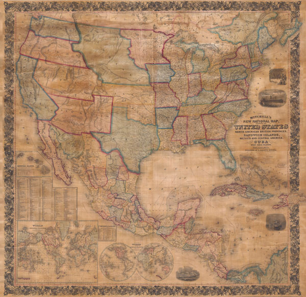
Mitchell's New National Map of the United States, North American British Provinces, Sandwich Islands, Mexico and Central America together with Cuba and other West India Islands.
sold
- Digital Map Information
- Suitable for large format printing
- File Size: 11.91 MB
- File Type: ZIP / TIFF
- ICC color profile embedded
- Delivered instantly via download link
This is the first edition of Mitchell's important 1856 wall map of the United States, Mexico and the West Indies. Depictss the entire nation from Atlantic to Pacific with inset maps of the ... (more details)

Carte de L'Isle de la Jamaique.
sold
- Digital Map Information
- Suitable for large format printing
- DPI: 300
- File Size: 3.64 MB
- File Type: ZIP / TIFF
- ICC color profile embedded
- Delivered instantly via download link
A fine example of Rigobert Bonne and Guilleme Raynal's 1780 map of Jamaica. Highly detailed, showing towns, rivers, some topographical features, political boundaries and important ports. ... (more details)

Colton’s Texas.
sold
- Digital Map Information
- Suitable for large format printing
- File Size: 4.12 MB
- File Type: ZIP / TIFF
- ICC color profile embedded
- Delivered instantly via download link
An extremely rare and unusual map pocket map of Texas by G.W. and C.B. Colton. This rare map of Texas was issued in 1870 based upon Jacob de Cordova's important 1849 map of Texas. ... (more details)