
Introducing numbered highways.
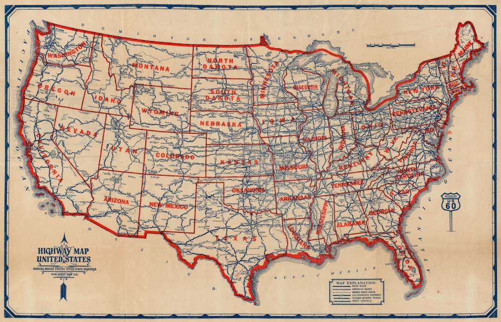
Highway Map of the United States Showing United States Inter-State Highways.
sold
- Digital Map Information
- Suitable for large format printing
- Full resolution TIFF file
- ICC color profile embedded
- Delivered instantly via download link
This is a c. 1930 Mid-West Map Company highway map of the United States. The map marks the early days of the interstate highway system following the introduction of numbered highways just four years earlier in 1926. (more details)
Reservation System.
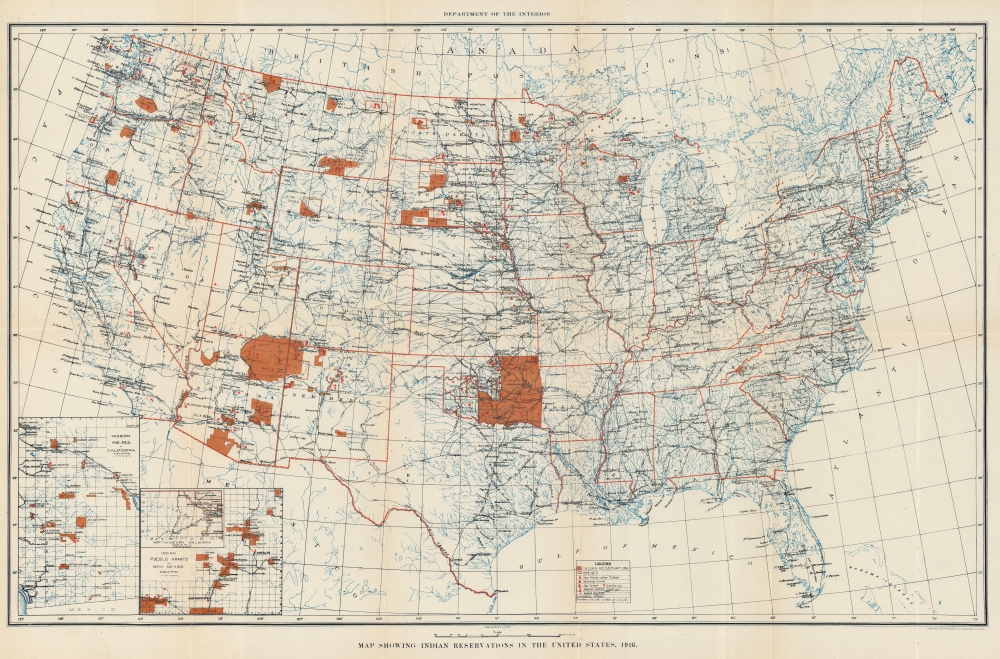
Map Showing Indian Reservations in the United States, 1916.
sold
- Digital Map Information
- Suitable for large format printing
- File Size: 25.6 MB
- File Type: ZIP / TIFF
- ICC color profile embedded
- Delivered instantly via download link
This is a 1916 U.S. Department of the Interior Map of Indian Reservations across the United States. In the early 20th century, the reservation system was a contentious network of territories that primarily served as a mechanism for the Federal government to control and assimilate tribes to Eurocentric cultural norms. (more details)
Extremely rare, separately issued.
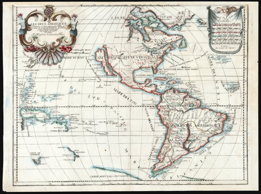
Les Deus Ameriques Divisées en leurs principales Parties, et tirees de toutes les Relations qui ont Par Louis de Lepine Presentee A Monsieur de Chevalier Mari.
sold
- Digital Map Information
- Suitable for large format printing
- File Size: 50.18 MB
- File Type: ZIP / TIFF
- ICC color profile embedded
- Delivered instantly via download link
This is an extremely rare, separately published c. 1695 map of the Western Hemisphere by Louis de Lépine, featuring California as an island. The map also presents the limits of the Pacific Ocean, showing parts of Tasmania, the west coast of New Zealand, part of Japan, and the coastline of the conjectural Terra de Iesso. (more details)
Foundational Map of the American West.
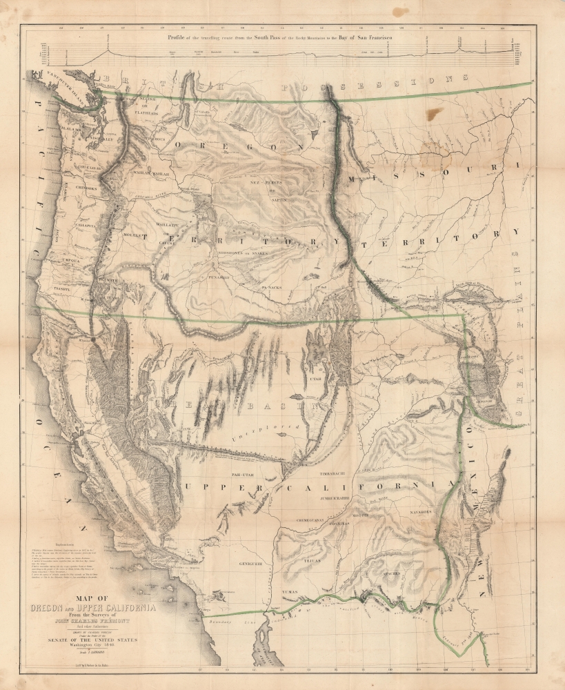
Map of Oregon and Upper California From the Surveys of John Charles Frémont.
sold
- Digital Map Information
- Suitable for large format printing
- DPI: 600
- File Size: 128 MB
- File Type: ZIP / TIFF
- ICC color profile embedded
- Delivered instantly via download link
A landmark 1848 map of the American West by John C. Frémont and Carl Preuss. In the words of Carl Wheat,
More than any other persons, John Charles Fremont and Charles Preuss dominate the cartography of the American West during the three years before the Gold Rush and brought a human tide surging into that land which had so long lain beyond the ken of most Americans. (Wheat, C. I., Mapping of the Transmississippi West, 1540 – 1861, 523).(more details)
Regal Europe!
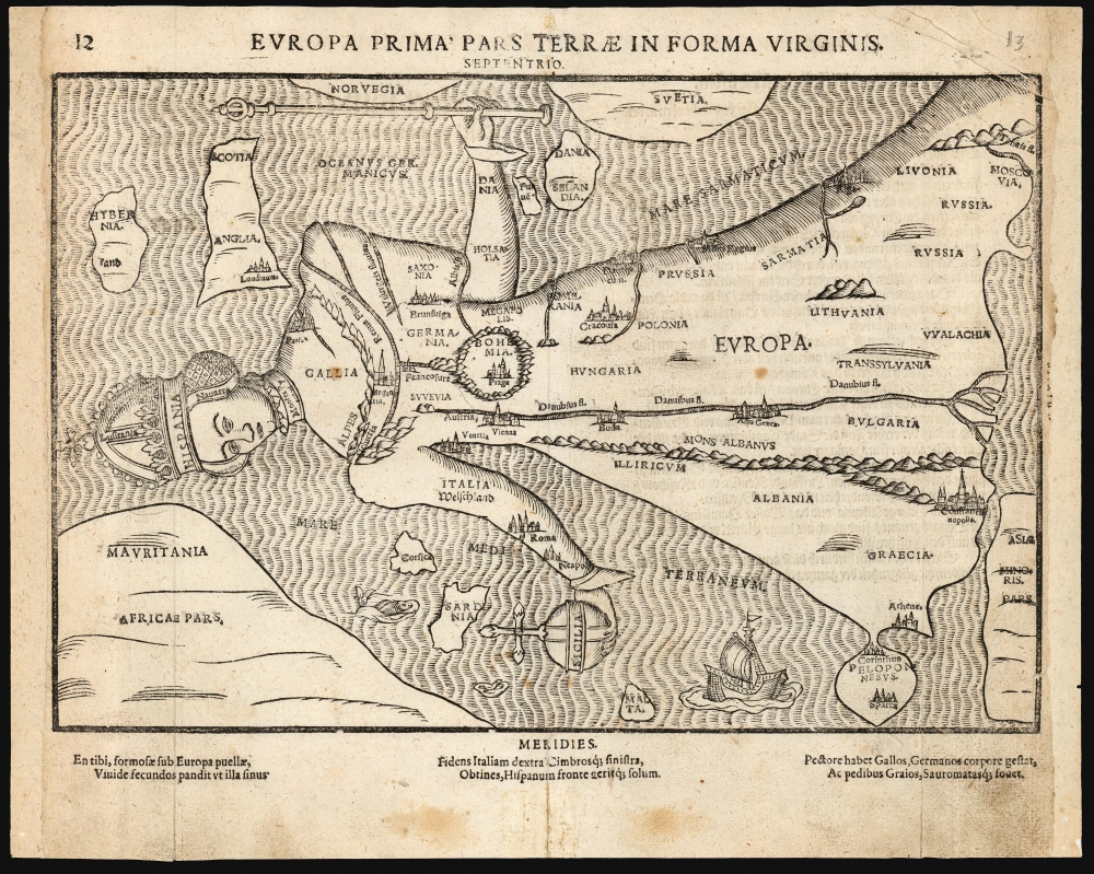
Europa Prima Pars Terrae In Forma Virginis.
sold
- Digital Map Information
- Suitable for large format printing
- Full resolution TIFF file
- ICC color profile embedded
- Delivered instantly via download link
This is Heinrich Bünting's 1589 / 1597 Europa Regina: a map of the continent of Europe, in the form of a woman. This striking woodcut appeared in Bünting's Itinerarium Sacrae, the first and for many years the only complete work of biblical geography. (more details)
Getting reinforcements to the front line during World War II.

53rd Reinf. Bn. Operations Map.
sold
- Digital Map Information
- Suitable for large format printing
- File Size: 27.43 MB
- File Type: ZIP / TIFF
- ICC color profile embedded
- Delivered instantly via download link
This is an extremely rare c. 1945 World War II 53rd Reinforcement Battalion route map of Europe. This map follows the 53rd Reinforcement Battalion from Chard, England, to Bamberg, Germany, from January 13, 1944, through July 13, 1945. It also informs on the numbers of reinforcements it processed, illustrating the important role this battalion played in winning World War II. (more details)
Homann Presents the Revelations of Christiaan Huygens.
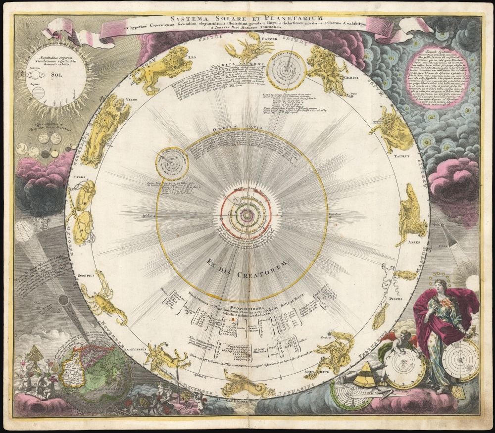
Systema Solare Et Planetarium ex hypothesi Copernicana secundum elegantissimas Illustrissimi quondam Hugenij deductiones novissime collectum et exhibitum.
sold
- Digital Map Information
- Suitable for large format printing
- DPI: 600
- File Size: 68.12 MB
- File Type: ZIP / TIFF
- ICC color profile embedded
- Delivered instantly via download link
This is a scarce, early example of Johann Baptist Homann's 1707 celestial chart displaying the solar system following the Copernican, sun-centered model - using the calculations appearing in Dutch astronomer and mathematician Christiaan Huygens' Cosmotheros, published posthumously in 1698. (more details)
Second Opium War.
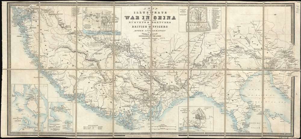
A Map to Illustrate the War in China compiled from Surveys and Sketches of British Officers and Other Information.
sold
- Digital Map Information
- Suitable for large format printing
- DPI: 300
- File Size: 9.84 MB
- File Type: ZIP / TIFF
- ICC color profile embedded
- Delivered instantly via download link
A rare 1842 separately-issued thematic map published in London by James Wyld to illustrate the primary theater of the First Opium War (1839 - 1842) as it progressed. It was this war that set the launched the Unequal Treaties and set the stage for nearly 100 years of foreign extraterritoriality in China. With an unusual east facing orientation, the map covers the coast of China from Canton (Guangzhou) and Macao (near modern day Hong Kong) as far north as Beijing, and inland as far as Nanjing (Nanking). (more details)
Winston Churchill's travels during World War II.
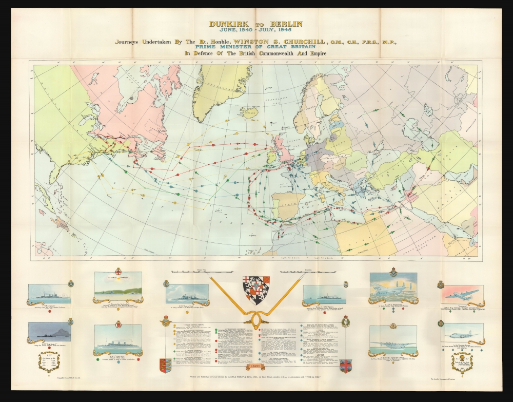
Dunkirk to Berlin June 1940 - July, 1945. Journeys Undertaken By The Rt. Honble. Winston S. Churchill, O.M., C.H., F.R.S., M.P., Prime Minister of Great Britain In Defense of the British Commonwealth and Empire.
sold
This is a 1956 Frank A. de Vine Hunt and George Philip map of Winston Churchill's travels as Prime Minister between June 1940 and July 1945. (more details)
Japan's Horrific Victory at Nanjing.

最新南京地圖 / 最新實測南京地圖 / [Latest (Surveyed) Map of Nanjing].
sold
- Digital Map Information
- Suitable for large format printing
- File Size: 32.95 MB
- File Type: ZIP / TIFF
- ICC color profile embedded
- Delivered instantly via download link
A scarce, highly detailed c. 1938 city plan of Nanjing, China, produced by Idemitsu Mamoru soon after the city's capture by Japanese forces in the Second Sino-Japanese War (World War II). This map was issued in the immediate aftermath of the Rape of Nanjing. (more details)
Restoring America's oldest working canal after the Civil War.
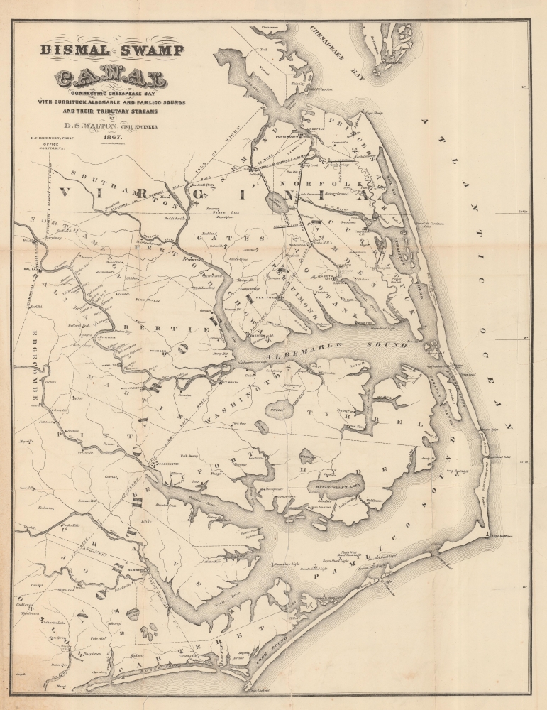
Dismal Swamp Canal Connecting Chesapeake Bay with Currituck, Albemarle and Pamlico Sounds and Their Tributary Streams.
sold
- Digital Map Information
- Suitable for large format printing
- File Size: 38.19 MB
- File Type: ZIP / TIFF
- ICC color profile embedded
- Delivered instantly via download link
A fascinating 1867 David Smith Walton map of eastern Virginia and North Carolina illustrating the route of the Dismal Swamp Canal - America's oldest continuously operating canal. The map was issued as a part of the Dismal Swamp Canal Company's efforts to restore the canal after years of neglect during the American Civil War (1861 - 1865). (more details)
World War II as experienced by the soldiers of the III Corps.

III Corps Campaigns.
sold
- Digital Map Information
- Suitable for large format printing
- File Size: 31.26 MB
- File Type: ZIP / TIFF
- ICC color profile embedded
- Delivered instantly via download link
This is a 1945 Al Beaudry III Corps World War II pictorial route map of Europe. Highlighting the corps' movements, its successes, and its assigned divisions, this map details wartime events experienced by thousands of soldiers. (more details)
Solving the fundamental problem of navigation.
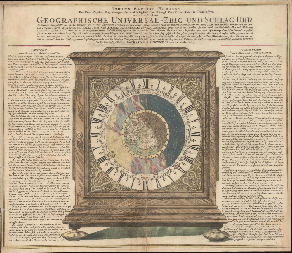
Geographische Universal - Zeig Und Schlag-Uhr.
$600.00
Acquire
- Digital Map Information
- Suitable for large format printing
- DPI: 600
- File Size: 63.8 MB
- File Type: ZIP / TIFF
- ICC color profile embedded
- Delivered instantly via download link
A remarkable c. 1735 Zacharias Landteck and J. B. Homman 'universal clock' with instructions on how to use time to determine longitude at sea - a perennial problem for mariners. The piece advocates for Homann's invention of the universal clock, known as Geographische Universal Zeig und SchlagUhr an (Universal Pointing and Chiming Clock), but this is unverified. (more details)
Oldest of Wonder of the Ancient World.
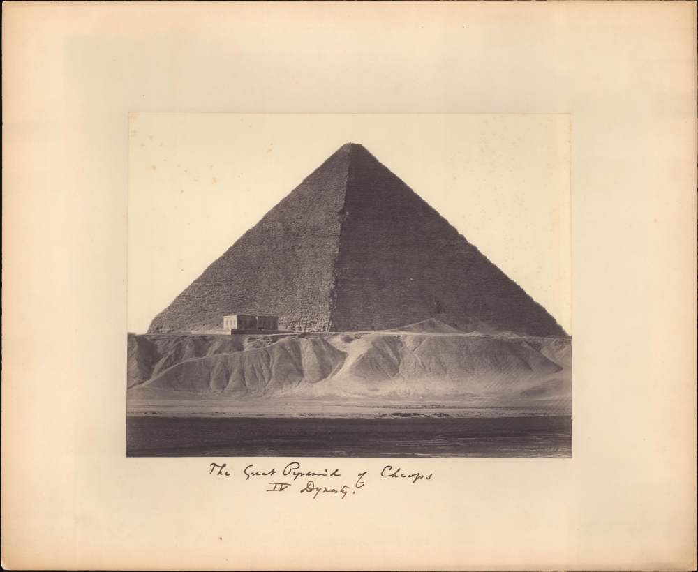
The Great Pyramid of Cheops IV Dynasty.
$500.00
Acquire
- Digital Map Information
- Suitable for large format printing
- File Size: 11.67 MB
- File Type: ZIP / TIFF
- ICC color profile embedded
- Delivered instantly via download link
A c. 1861 Wilhelm Hammerschmidt albumen silver print from a glass negative depicting the Great Pyramid of Khufu (Cheops), Giza, Egypt. The image looks on the images from a point on the Nile - likely during a high-water period. In the midground, a group lounges near stone rubble, possibly a small ruin. This image is number 181 from Hammerschmidt's corpus. (more details)
'The Crown of Horus, bull of victory, Arisen in Thebes...'
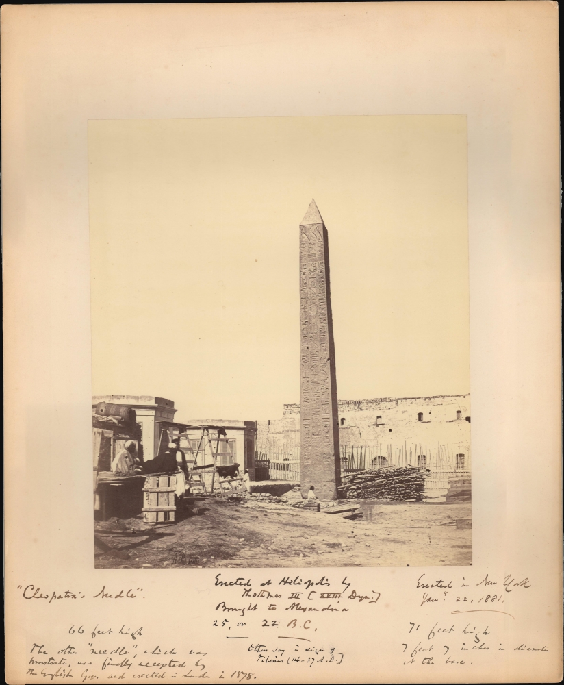
Cleopatra's Needle.
$500.00
Acquire
- Digital Map Information
- Suitable for large format printing
- Full resolution TIFF file
- ICC color profile embedded
- Delivered instantly via download link
This is a c. 1860 Antonio Beato albumen silver print from a glass negative depicting Cleopatra's Needle, Alexandria, Egypt. Here the obelisk is photographed in Alexandria, with surrounding construction and several lounging Egyptians, before it was gifted to the city of New York by the Khedive of Egypt in 1877. This famous obelisk now stands in New York's Central Park. This image has copious annotations in the lower margins, some of which must have been added decades after the photo was acquired - clearly indicating a lingering fascination with the monument. (more details)
'My name is Ozymandias, King of Kings;
Look on my Works, ye Mighty, and despair!' - Shelly
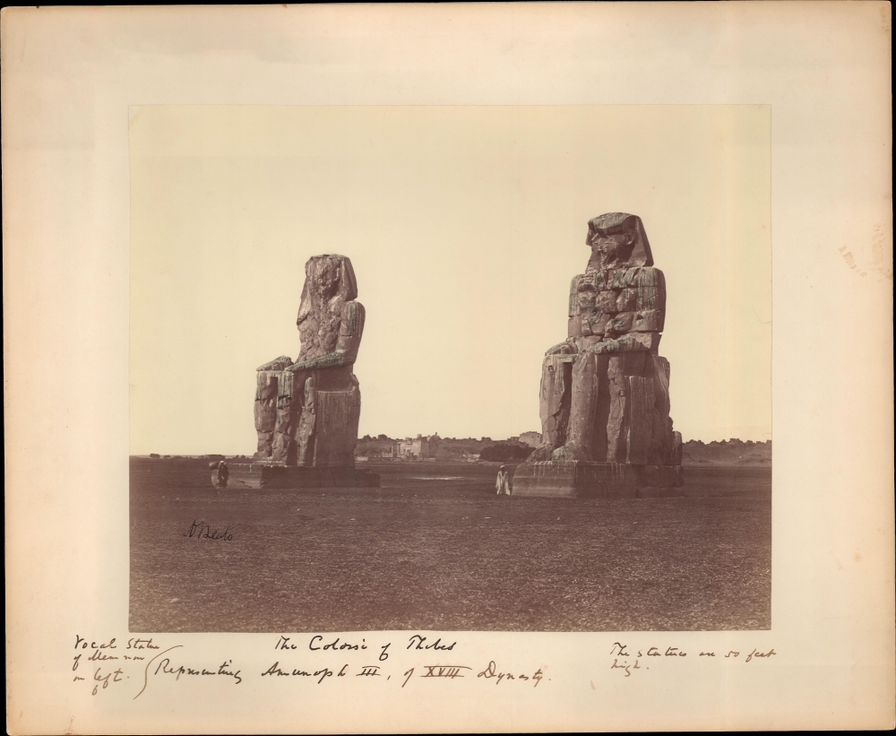
The Colossi of Thebes.
$500.00
Acquire
- Digital Map Information
- Suitable for large format printing
- File Size: 11.04 MB
- File Type: ZIP / TIFF
- ICC color profile embedded
- Delivered instantly via download link
This is a c. 1860 Antonio Beato albumen silver print from a glass negative depicting the Colossi of Memnon, Thebes, Egypt. The great statues of Amenhotep III dominate the images, with an ancient temple in the background. Egyptians stand near each statue, likely intended to provide scale to the 50-foot-high monuments. The owner of the photograph seems to have been particularly fascinated with them and has jotted notes below the image. (more details)
'There are various eyes. Even the Sphinx has eyes: and as a result there are various truths, and as a result there is no truth.' -Nietzsche
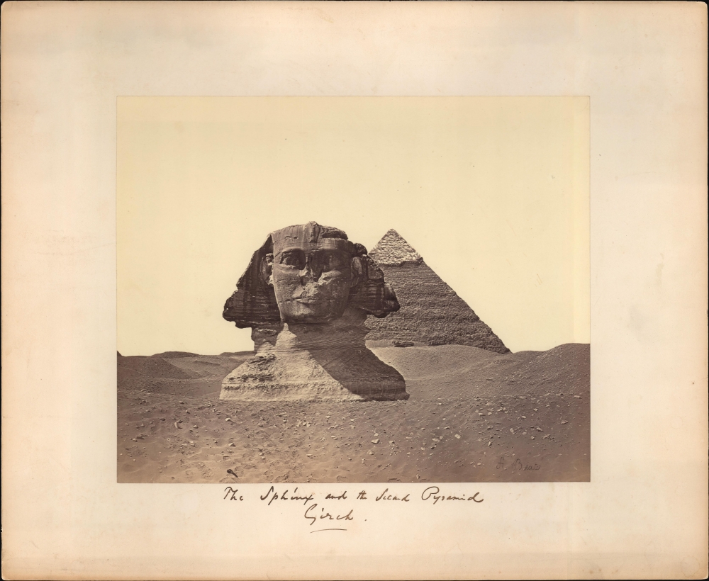
The Sphinx and the Second Pyramid Gizah.
$500.00
Acquire
- Digital Map Information
- Suitable for large format printing
- File Size: 12.36 MB
- File Type: ZIP / TIFF
- ICC color profile embedded
- Delivered instantly via download link
This is a c. 1860 Antonio Beato albumen silver print from a glass negative depicting the Great Sphinx and the Pyramid of Khafre, Giza, Egypt. The mostly buried head and shoulders of the Great Sphinx dominate the image, while Pyramid of Khafre (the second of the three Giza pyramids) fills the background. (more details)
Pyramids of Giza.
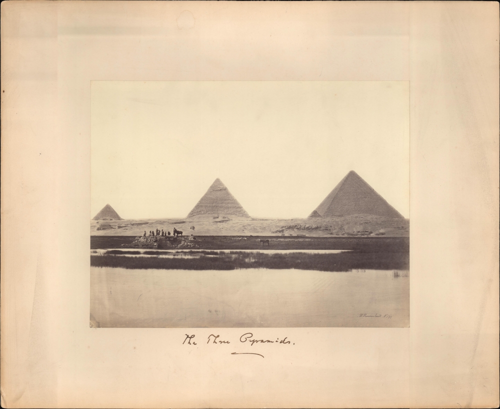
The Three Pyramids (W. Hammerschmidt. N.180).
$500.00
Acquire
- Digital Map Information
- Suitable for large format printing
- File Size: 10.85 MB
- File Type: ZIP / TIFF
- ICC color profile embedded
- Delivered instantly via download link
A c. 1861 Wilhelm Hammerschmidt albumen silver print from a glass negative depicting the Pyramids of Giza, Egypt. The image looks on the Pyramids from a point on the Nile - likely during a high-water period. In the midground, a group lounges near stone rubble, possibly a small ruin. This image is number 180 from Hammerschmidt's corpus. (more details)
Provincialism of 'some' New Yorkers.

A New Yorker's Idea of The United States of America.
sold
- Digital Map Information
- Suitable for large format printing
- File Size: 27.68 MB
- File Type: ZIP / TIFF
- ICC color profile embedded
- Delivered instantly via download link
This is a whimsical 1939 Daniel K. Wallingford pictorial map depicting a New Yorker's idea of the United States. Wallingford presents a humorously distorted view of the United States, wherein New York State, Manhattan and Brooklyn, and other areas frequented by New Yorkers (Florida, Bermuda, etc.), are vastly outsized in proportion to the rest of the country. This edition was issued for the 1939 New York World's Fair, which is illustrated just north of Brooklyn. (more details)
Hamlets along the Hudson.
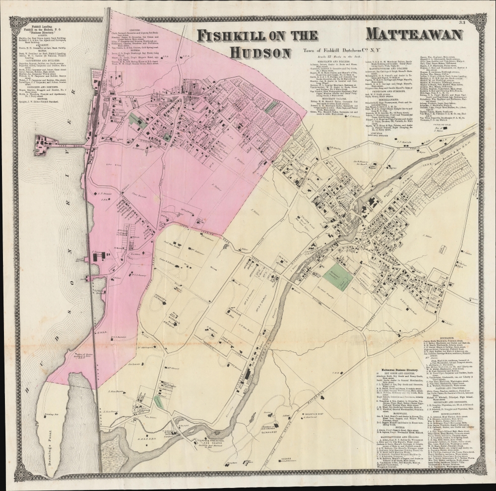
Fishkill on the Hudson / Matteawan.
sold
- Digital Map Information
- Suitable for large format printing
- File Size: 55.29 MB
- File Type: ZIP / TIFF
- ICC color profile embedded
- Delivered instantly via download link
An example of Frederick W. Beers' hand-colored map of Fishkill on the Hudson and Matteawan, consistent with the present-day city of Beacon, New York. The remarkably detailed map provides information on individual properties and businesses, along with their owners, making it an essential source of information on local history. (more details)