

British Isles.
sold
- Digital Map Information
- Suitable for large format printing
- DPI: 300
- File Size: 19.97 MB
- File Type: ZIP / TIFF
- ICC color profile embedded
- Delivered instantly via download link
Pinkerton's extraordinary 1818 map of the British Isles. Includes England, Scotland and Ireland. Covers the entire region in considerable detail with political divisions and color coding at the regional level. Identifies cities, towns, castles, important ... (more details)

Remote British Isles. ⁄ Scilly Isles. ⁄ Shetland Isles. ⁄ Jersey and Guernsey
sold
- Digital Map Information
- Suitable for large format printing
- DPI: 300
- File Size: 17.19 MB
- File Type: ZIP / TIFF
- ICC color profile embedded
- Delivered instantly via download link
Pinkerton's extraordinary 1818 map of the 'Remote British Isles.' Essentially three maps in one, this chart depicts the Scilly Isles, the Shetland Isles and the Jersey and Guernsey Islands. Upper left map depicts the Scilly Isles, naming each, and ... (more details)
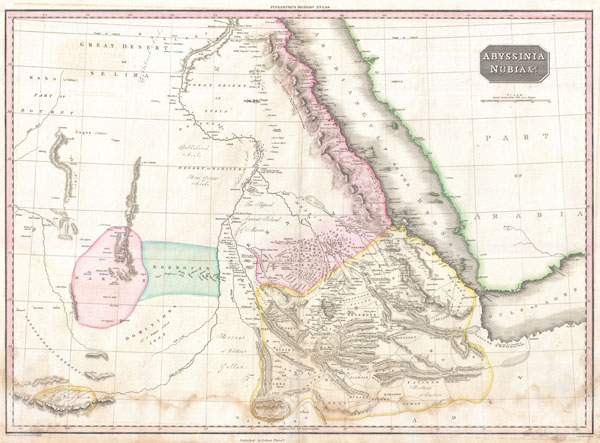
Abyssinia, Nubia & c.
sold
- Digital Map Information
- Suitable for large format printing
- DPI: 300
- File Size: 15.6 MB
- File Type: ZIP / TIFF
- ICC color profile embedded
- Delivered instantly via download link
Pinkerton's extraordinary 1818 map of Nubia and Abyssinia. Covers from Darfur east to the Gulf of Aden and from Aswan south to Gingiro. Includes the modern day countries of Sudan, Ethiopia, and Eretria as well as parts of Djibouti, Kenya, Egypt, ... (more details)
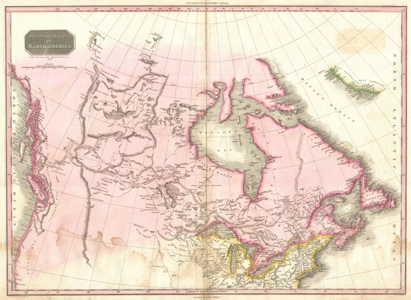
British Possessions in North America.
sold
- Digital Map Information
- Suitable for large format printing
- DPI: 300
- File Size: 19.66 MB
- File Type: ZIP / TIFF
- ICC color profile embedded
- Delivered instantly via download link
Pinkerton's extraordinary 1818 map of the British Possessions in North America. Based on Arrowsmith's historic map of North America, this map covers the continent north of the 40th degree of latitude, including all of the territory currently ... (more details)
Stunning map of an legendary Persian Gulf trade port.
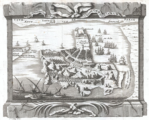
Ormus oude Jerun. ⁄ 't Eiland Ormus, of Jerun.
sold
- Digital Map Information
- Suitable for large format printing
- DPI: 300
- File Size: 3.38 MB
- File Type: ZIP / TIFF
- ICC color profile embedded
- Delivered instantly via download link
I travelled next from the land of 'Oman to the land of Hurmuz. Hurmuz is a city on the sea-coast, and is also called Mughistan. Opposite it in the sea is New Hurmuz, and between them is a sea passage of three farsakhs. We came to New Hurmuz, ... (more details)
A significant advance in the mapping of the Amazon Basin.
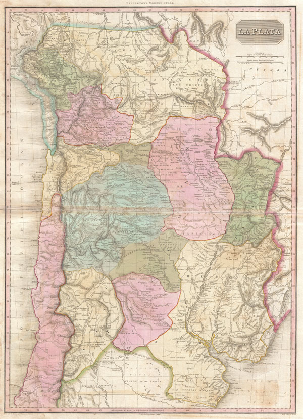
La Plata.
sold
- Digital Map Information
- Suitable for large format printing
- DPI: 300
- File Size: 21.89 MB
- File Type: ZIP / TIFF
- ICC color profile embedded
- Delivered instantly via download link
An altogether extraordinary 1818 map of the southern parts of South America by John Pinkerton. Covers the modern day countries of Argentina, Bolivia, Paraguay, Chile as well as parts of adjacent Brazil and Peru. Pinkerton offers impressive ... (more details)
Fascinating ethnographic commentary.
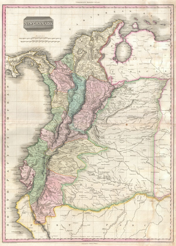
New Granada.
sold
- Digital Map Information
- Suitable for large format printing
- DPI: 300
- File Size: 18.25 MB
- File Type: ZIP / TIFF
- ICC color profile embedded
- Delivered instantly via download link
An altogether extraordinary 1818 map of the northwestern parts of South America by John Pinkerton. Covers the modern day countries of Columbia, Venezuela, Panama, and Ecuador as well as parts of Peru and Brazil. Pinkerton offers impressive ... (more details)
Identifies Lake Parima, supposed site of El Dorado.
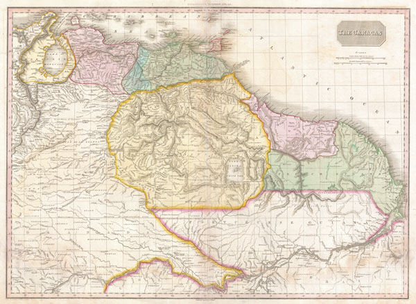
The Caracas.
sold
- Digital Map Information
- Suitable for large format printing
- DPI: 300
- File Size: 20.14 MB
- File Type: ZIP / TIFF
- ICC color profile embedded
- Delivered instantly via download link
This is a stunning, highly detailed, and extremely interesting map of northeastern South America. Covers the modern day countries of Venezuela, British Guyana, French Guyana, Surinam and parts of Brazil. Pinkerton offers impressive detail ... (more details)

Spain and Portugal.
sold
- Digital Map Information
- Suitable for large format printing
- DPI: 300
- File Size: 25.23 MB
- File Type: ZIP / TIFF
- ICC color profile embedded
- Delivered instantly via download link
John Pinkerton's highly decorative map of Spain and Portugal, published 1818. Covers the entire region in considerable detail with political divisions and color coding at the regional level. Includes parts of adjacent France and Africa. ... (more details)
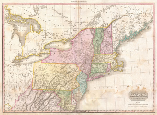
United States of America Northern Part.
sold
- Digital Map Information
- Suitable for large format printing
- DPI: 300
- File Size: 19.63 MB
- File Type: ZIP / TIFF
- ICC color profile embedded
- Delivered instantly via download link
John Pinkerton's highly decorative and important map of the northern parts of the United States, published 1818. Covers from Lake Huron eastward as far as New Brunswick and southwards as far as the Chesapeake Bay. Includes the states of ... (more details)

Hindostan
sold
- Digital Map Information
- Suitable for large format printing
- DPI: 300
- File Size: 18.01 MB
- File Type: ZIP / TIFF
- ICC color profile embedded
- Delivered instantly via download link
John Pinkerton's highly decorative map of India, published 1818. Covers the subcontinent from Tibet to Ceylon (Sri Lanka) and from the mouth of the Indus to the Kingdom of Pegu (Burma or Myanmar). Includes the modern day countries of ... (more details)

China.
sold
- Digital Map Information
- Suitable for large format printing
- DPI: 300
- File Size: 18.02 MB
- File Type: ZIP / TIFF
- ICC color profile embedded
- Delivered instantly via download link
John Pinkerton's highly decorative map of China, published 1818. Covers the China from Chinese Tartary to the kingdom of Tonkin (modern day Vietnam) and from Yunnan to Formosa and Korea. Includes the island of Formosa, alternately ... (more details)

Ireland.
sold
- Digital Map Information
- Suitable for large format printing
- DPI: 300
- File Size: 25.12 MB
- File Type: ZIP / TIFF
- ICC color profile embedded
- Delivered instantly via download link
John Pinkerton's highly decorative map of Ireland, published 1818. Covers the entire Emerald Isle in considerable detail with political divisions and color coding at the county level. Identifies cities, towns, castles, important ... (more details)
The finest commercial map of the American southwest to appear in the early 19th century.
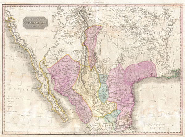
Spanish Dominions in North America Northern Part.
sold
- Digital Map Information
- Suitable for large format printing
- DPI: 300
- File Size: 20.54 MB
- File Type: ZIP / TIFF
- ICC color profile embedded
- Delivered instantly via download link
Possibly the finest commercial map of the American southwest to appear in the early part of the 19th century. Produced by John Pinkerton and based largely on the explorations of Alexander von Humboldt, this map Covers from the ... (more details)
Speculative course of the Niger River w/ apocryphal Mountains of Kong.

Western Africa.
sold
- Digital Map Information
- Suitable for large format printing
- DPI: 300
- File Size: 15.92 MB
- File Type: ZIP / TIFF
- ICC color profile embedded
- Delivered instantly via download link
This fascinating hand colored 1818 map by Edinburgh cartographer John Pinkerton depicts Western Africa. Depicts Africa roughly from the Salve Coast and Gold coast west through the Ivory Coast, Guinea, the Gambia and north past ... (more details)
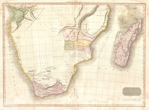
Southern Africa.
sold
- Digital Map Information
- Suitable for large format printing
- DPI: 300
- File Size: 18.14 MB
- File Type: ZIP / TIFF
- ICC color profile embedded
- Delivered instantly via download link
This fascinating hand colored 1818 map by Edinburgh cartographer John Pinkerton depicts Southern Africa. Covers Africa from Angola south to the Cape Colony (modern South Africa) and east to the Kingdom of Mongall (modern day ... (more details)

Northern Italy.
sold
- Digital Map Information
- Suitable for large format printing
- DPI: 300
- File Size: 27.09 MB
- File Type: ZIP / TIFF
- ICC color profile embedded
- Delivered instantly via download link
A stunning map of Northern Italy by John Pinkerton. Depicts from Switzerland to Corsica and from France to Venit Istria. Includes Tuscany, Piedmont, Mont Blanc, Genoa, Luca, Milan, Umbria, and the Venetian States. Offers ... (more details)
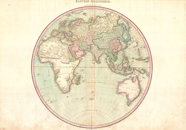
Eastern Hemisphere.
$500.00
Acquire
- Digital Map Information
- Suitable for large format printing
- DPI: 300
- File Size: 19.46 MB
- File Type: ZIP / TIFF
- ICC color profile embedded
- Delivered instantly via download link
A rare and important 1818 map of the Eastern Hemisphere by John Pinkerton. Depicts Asia, Europe, Africa and Australia. This map offers fairly accurate shorelines throughout. In Africa, the interior remains unexplored ... (more details)
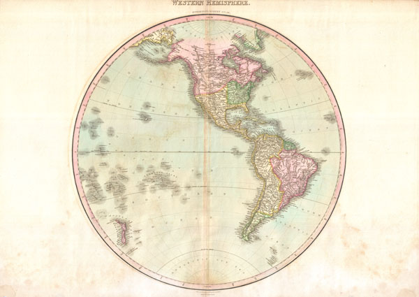
Western Hemisphere.
sold
- Digital Map Information
- Suitable for large format printing
- DPI: 300
- File Size: 18.66 MB
- File Type: ZIP / TIFF
- ICC color profile embedded
- Delivered instantly via download link
A rare and important 1818 map of the Western Hemisphere by John Pinkerton. Depicts North America, Central America and South America as well as parts of Polynesia, Siberia and Greenland. In North America, thanks ... (more details)
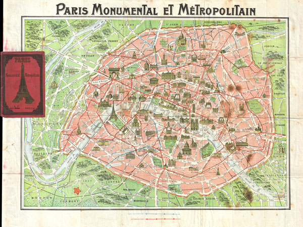
Paris Monumental et Metropolitain.
sold
- Digital Map Information
- Suitable for large format printing
- File Size: 23.28 MB
- File Type: ZIP / TIFF
- ICC color profile embedded
- Delivered instantly via download link
This is an extremely attractive c. 1920 tourist pocket map of Paris, France. Covers the old walled city of Paris and the immediate vicinity. Important buildings are shown in profile, including the Eiffel Tower. ... (more details)