
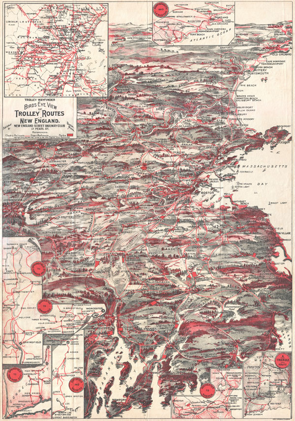
Trolley Wayfinder Birds Eye View of Trolly Routes in New England.
sold
- Digital Map Information
- Suitable for large format printing
- File Size: 14.12 MB
- File Type: ZIP / TIFF
- ICC color profile embedded
- Delivered instantly via download link
A scarce and stunning bird's eye view style pocket map of New England issued in 1908 by the New England Street Railway Club. Reveals New England centered around Boston. Extends north as far as Lewistown, Brunswick and Yarmouth; south to Narraganset Bay, Newport ... (more details)
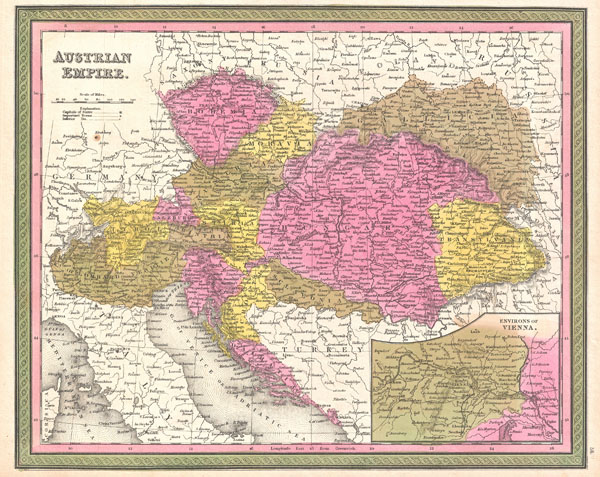
Austrian Empire.
sold
- Digital Map Information
- Suitable for large format printing
- DPI: 300
- File Size: 7.34 MB
- File Type: ZIP / TIFF
- ICC color profile embedded
- Delivered instantly via download link
An extremely attractive example of S. A. Mitchell Sr.'s 1850 map of the Austrian Empire. Includes much of today's Austria, Hungary, Romania, Albania, Serbia and Croatia. Depicts the entire country color coded according to individual states. Lower right quadrant ... (more details)
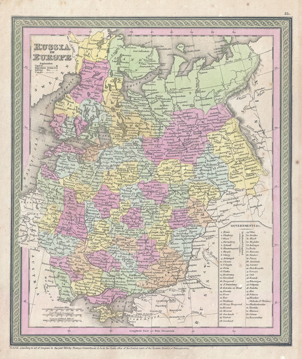
Russia in Europe.
sold
- Digital Map Information
- Suitable for large format printing
- DPI: 300
- File Size: 6.28 MB
- File Type: ZIP / TIFF
- ICC color profile embedded
- Delivered instantly via download link
An attractive example of S. A. Mitchell Sr.'s 1853 map of the Russia in Europe. Includes the European portions of Russia as well as Finland, Ukraine, Latvia, Lithuania and Estonia. Depicts the entire country color coded according to individual regions. ... (more details)
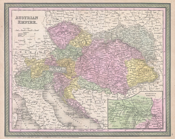
Austrian Empire.
sold
- Digital Map Information
- Suitable for large format printing
- DPI: 300
- File Size: 8.6 MB
- File Type: ZIP / TIFF
- ICC color profile embedded
- Delivered instantly via download link
An attractive example of S. A. Mitchell Sr.'s 1853 map of the Austrian Empire. Includes much of today's Austria, Hungary, Romania, Albania, Serbia and Croatia. Depicts the entire country color coded according to individual states. Lower right quadrant ... (more details)

Map of Europe.
sold
- Digital Map Information
- Suitable for large format printing
- Full resolution TIFF file
- ICC color profile embedded
- Delivered instantly via download link
An attractive example of S. A. Mitchell Sr.'s 1850 map of Europe. Depicts the entire continent color coded according to individual countries. Surrounded by the green border common to Mitchell maps from the 1850s. Prepared by S. A. Mitchell for issued ... (more details)

Carte de la Mer du Sud ou Mer Pacifique Entre l'Equateur et le 39 1.2 de Latitude Septentrionale.
sold
- Digital Map Information
- Suitable for large format printing
- DPI: 300
- File Size: 7.44 MB
- File Type: ZIP / TIFF
- ICC color profile embedded
- Delivered instantly via download link
This is a rare 1750 nautical chart of the Pacific Ocean by the French map publisher N. Bellin. Based on a similar chart in English prepared two years earlier by Seale. Chart depicts the trade routes used by Spanish Galleons from Acapulco, Mexico ... (more details)

The Cyclist's Map of Fifty Miles Round London showing in color all rideable roads and dangerous hills.
sold
- Digital Map Information
- Suitable for large format printing
- File Size: 28.98 MB
- File Type: ZIP / TIFF
- ICC color profile embedded
- Delivered instantly via download link
This is J. Bartholomew's c. 1895 cyclist's may of 50 miles around London. Covers the greater London area from Ricester in the northwest eastwards and southwards as far as the coast. Includes the counties of Buckingham, Hertford, Essex, ... (more details)
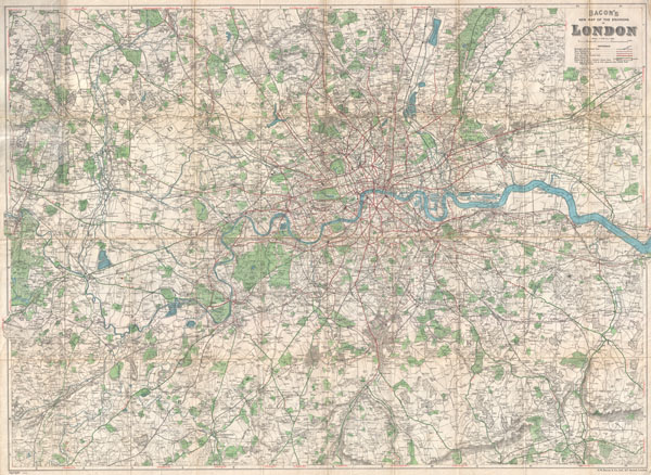
Bacon's New Map of the Environs of London.
sold
- Digital Map Information
- Suitable for large format printing
- File Size: 49.76 MB
- File Type: ZIP / TIFF
- ICC color profile embedded
- Delivered instantly via download link
An extremely attractive folding pocket map of London, England and environs issued in 1920 by Bacon & Co. Covers the greater London area from Amersham in the northwest to Seven Oaks in the southeast and from Worplesdon in the southwest ... (more details)
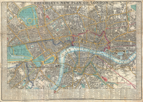
Cruchley's New Plan of London Shewing all the new and intended improvements to the Present Time. / Cruchley's Superior Map of London, with references to upwards of 500 Streets, Squares, Public Places & C. improved to 1848: with a compendium of all Place of Public Amusements also shewing the Railways & Stations.
sold
- Digital Map Information
- Suitable for large format printing
- DPI: 300
- File Size: 19.07 MB
- File Type: ZIP / TIFF
- ICC color profile embedded
- Delivered instantly via download link
This is a very attractive example of G. F. Cruchley's highly desirable 1848 Map of London, England. Covers London from Hyde Park in the west to the London Docks in the east. Extends north to include all of Regents Park and south as ... (more details)

A Diagram Exhibiting the difference of time between the places shown & Washington.
sold
- Digital Map Information
- Suitable for large format printing
- File Size: 4.55 MB
- File Type: ZIP / TIFF
- ICC color profile embedded
- Delivered instantly via download link
A very attractive example of Johnson's 1862 diagram of the world's time zones. Consists of a circular engraving in which numerous clocks are drawn, each representing a major world city. At the center is clock representing the time ... (more details)

Map of The World Illustrating the principal features of the Land and the Co-Tidal Lines. / Map of the World Showing the principal Ocean Currents & Boundaries of River Systems.
sold
- Digital Map Information
- Suitable for large format printing
- File Size: 3.74 MB
- File Type: ZIP / TIFF
- ICC color profile embedded
- Delivered instantly via download link
This is one of the thematic world map sets from the rare 1862 edition of Johnson and Ward's Illustrated Atlas Family Atlas . Features two maps drawn within a single border. The upper map depicts the world's co-tidal lines with ... (more details)

Johnson's New Brunswick, Nova Scotia, Newfoundland and Prince Edward Island.
sold
- Digital Map Information
- Suitable for large format printing
- File Size: 7.39 MB
- File Type: ZIP / TIFF
- ICC color profile embedded
- Delivered instantly via download link
A very beautiful example of Johnson's 1862 map of the Canadian provinces of New Brunswick, Nova Scotia, Prince Edward Island and Newfoundland. Color coded according to county. Shows railways, lakes, rivers and towns. Features ... (more details)

Johnson's Europe.
sold
- Digital Map Information
- Suitable for large format printing
- File Size: 14.76 MB
- File Type: ZIP / TIFF
- ICC color profile embedded
- Delivered instantly via download link
A very beautiful example of Johnson's 1862 map of Europe. This two part map details all of Europe as well as adjacent parts of Asia and Africa. Highly detailed with countless place names. Also shows the starting points and ... (more details)

Johnson's Ireland. / Johnson's Scotland.
sold
- Digital Map Information
- Suitable for large format printing
- File Size: 16.38 MB
- File Type: ZIP / TIFF
- ICC color profile embedded
- Delivered instantly via download link
A very beautiful example of Johnson's 1862 map of Scotland and Ireland. This two part map details all of Scotland and Ireland with insets of the Shetland Islands and the Orkney Islands. Both maps are color coded according ... (more details)

Johnson's Northern Italy. Lombardy, Venice, Sardinia, Tuscany, Parma, Modena, Lucca and the States of the Church. / Johnson's Southern Italy Kingdom of Naples, I. Sardinia & Malta.
sold
- Digital Map Information
- Suitable for large format printing
- File Size: 17.46 MB
- File Type: ZIP / TIFF
- ICC color profile embedded
- Delivered instantly via download link
A very attractive example of Johnson's 1862 map of Italy. Details the entire peninsula as well as Corsica, Sardinia, Malta and Sicily. Color coded according to region. When this map was made Italy was in the midst of its ... (more details)

Johnson's Roman Empire, Imperius Romanorum Latissime Patens.
sold
- Digital Map Information
- Suitable for large format printing
- File Size: 11.28 MB
- File Type: ZIP / TIFF
- ICC color profile embedded
- Delivered instantly via download link
A very attractive example of Johnson's 1862 map of the Roman Empire. Covers all of Europe as well as much of the middle east, Persia and parts of North Africa. Presents the empire at its greatest extant following the ... (more details)

Johnson's Africa.
sold
- Digital Map Information
- Suitable for large format printing
- File Size: 16.48 MB
- File Type: ZIP / TIFF
- ICC color profile embedded
- Delivered instantly via download link
A extraordinary and attractive example of Johnson's 1862 map of Africa. This rare map appeared only in the earliest editions of Johnson's Atlas. Includes all of Africa as well as adjacent parts of Europe and Asia. ... (more details)

Johnson's Mexico.
sold
- Digital Map Information
- Suitable for large format printing
- File Size: 7.7 MB
- File Type: ZIP / TIFF
- ICC color profile embedded
- Delivered instantly via download link
A very attractive example of Johnson's 1862 map of Mexico. Includes all of modern day Mexico as well as most of Texas, Guatemala, Belize, and adjacent regions. Color coded according to Mexican states . Depicts ... (more details)

Johnson's Delaware and Maryland.
sold
- Digital Map Information
- Suitable for large format printing
- Full resolution TIFF file
- ICC color profile embedded
- Delivered instantly via download link
This is A. J. Johnson's 1862 map of Maryland, Delaware and Washington D.C. Covers both states as well as the capital district in considerable detail. This is the most decorative of Johnson's Maryland-Delaware ... (more details)
One of the first renderings of the Carolina colony's interior.

A New Description of Carolina.
sold
- Digital Map Information
- Suitable for large format printing
- Full resolution TIFF file
- ICC color profile embedded
- Delivered instantly via download link
A beautiful example of John Speed's important 1676 map of the Carolina colony. Heavily based upon the explorations of John Lederer and Ogilby's Lords Proprietor's Map of 1674. This seminal map represents one ... (more details)