

Map of Persia, Turkey in Asia, Afghanistan, Beloochistan.
sold
- Digital Map Information
- Suitable for large format printing
- File Size: 3.73 MB
- File Type: ZIP / TIFF
- ICC color profile embedded
- Delivered instantly via download link
A beautiful example of S. A. Mitchell Jr.'s 1864 map of Turkey, Persia, Beloochistan and Afghanistan. Covers the modern day nations of Turkey, Iran, Iraq, Syria, Jordan and Afghanistan. Inset in the lower left quadrant features Palestine or the Holy Land. One of ... (more details)
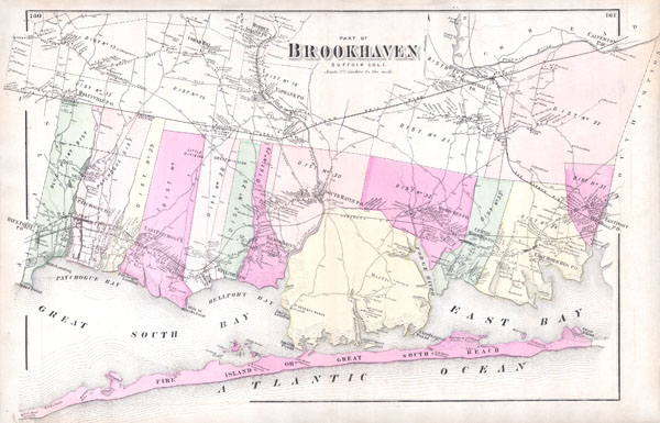
Part of Brookhaven, Sufffolk Co. L.I.
sold
- Digital Map Information
- Suitable for large format printing
- File Size: 5.9 MB
- File Type: ZIP / TIFF
- ICC color profile embedded
- Delivered instantly via download link
A scarce example of Fredrick W. Beers' map of the southern part of Brookhaven, Long Island, New York. Published in 1873, this magnificent map covers Great South Bay and East Bay and along the coast from Blue Point and Patchogue Bay eastward past Bellport, Smith ... (more details)
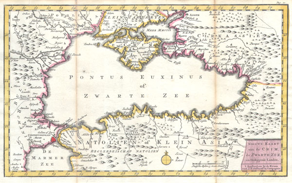
Nieuwe Kaart van de Crim de Zwarte Zee en Omleggende Landen.
sold
- Digital Map Information
- Suitable for large format printing
- Full resolution TIFF file
- ICC color profile embedded
- Delivered instantly via download link
This is an extremely scarce 1747 Ratelband map of the the Black Sea. Details the Black Sea (Pontus Euxinus) and its immediate vicinity, including Crimea, Istanbul (Constantinople), northern Turkey, Circassia, parts of Armenia, and parts of Bulgaria and parts of ... (more details)
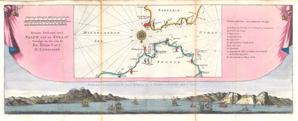
Nieuwe Paskaart Van't Naauw Van de Straat Gevolgt na die van de Ed: Heer Capt: H: Lynslager.
sold
- Digital Map Information
- Suitable for large format printing
- DPI: 300
- File Size: 2.22 MB
- File Type: ZIP / TIFF
- ICC color profile embedded
- Delivered instantly via download link
This is an extremely scarce 1747 map of the Straits of Gibraltar. Depicts the Strait with a southward orientation, Spain being on the bottom of the map and Morocco on the top. Details the Strait of Gibraltar, across to Ceuta on the Barbary coast, and extends ... (more details)
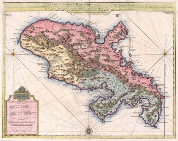
Carte de l'Isle de la Martinique, colonie francoise de l'une des Isles Antilles de l'Amerique. Dressee sur des plans manuscrits entr'autres sur celui de Mr. Houel, Ingenieur du Roy, assujetis a des observations astonomiques et concilies avec des memoires particuliers de feu Mr. Guill. Delisle, Premier Geographe de S. Majeste de l'Academie des Sciences. Et presentee a Monseigneur le Comte de Maurepas, Secretaire d'Etat ayant le departement de la Marine par ... Philippe Buache de l'Academie Royale des Sciences et Gendre du dit Sr. Delisle. A Amsterdam, Chez Jean Covens et Corneille Mortier, Geographes.
sold
- Digital Map Information
- Suitable for large format printing
- DPI: 300
- File Size: 11.81 MB
- File Type: ZIP / TIFF
- ICC color profile embedded
- Delivered instantly via download link
A beautiful example of Covens & Mortier's 1742 map of the French colony of Martinique in the West Indies. Depicts the Island of Martinique divided into three sections, two in the south and one in the north. Includes both political and topographical ... (more details)

Johnson's Russia
sold
- Digital Map Information
- Suitable for large format printing
- File Size: 7.59 MB
- File Type: ZIP / TIFF
- ICC color profile embedded
- Delivered instantly via download link
A beautiful example of Johnson and Ward's 1862 map of Russia. Depicts the European portions of Russia from the Arctic Sea south to the Black Sea and Caspian Sea. Extends west as far as Warsaw and east as far as Orenburg and Perm. Includes the ... (more details)
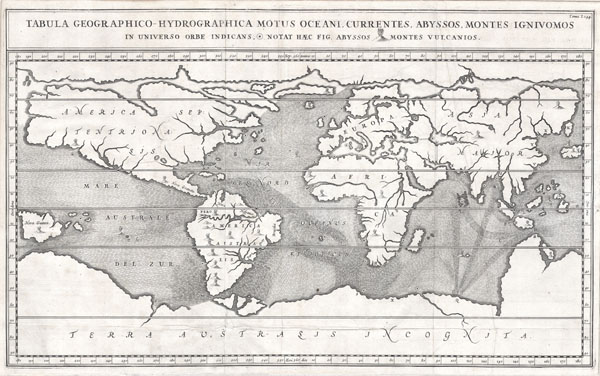
Tabula Geographico-Hydrographica Motus Oceani, Currentes, Abyssos, Montes Igniuomus in Universo Orbe Indicans Notat Haec Fig. Abyssos Montes Vulcanios.
sold
- Digital Map Information
- Suitable for large format printing
- DPI: 300
- File Size: 5.28 MB
- File Type: ZIP / TIFF
- ICC color profile embedded
- Delivered instantly via download link
A rare and spectacular 1665 map of the world by the extraordinary Germany scholar Athanasius Kircher. This is most likely the first world map to depict the oceans currents. Shows the entire world in accordance with Kircher's hydro-geographic ... (more details)

Map of North America showing its Political Divisions, and Recent Discoveries in the Polar Regions.
sold
- Digital Map Information
- Suitable for large format printing
- File Size: 4.12 MB
- File Type: ZIP / TIFF
- ICC color profile embedded
- Delivered instantly via download link
A beautiful example of S. A. Mitchell Jr.'s 1864 map of North America. Depicts the entire continent along with Greenland, Central America, Iceland, and the West Indies. Notes the routes of various arctic explorers including Dr. Kane in the ... (more details)

County Map of Massachusetts, Connecticut, and Rhode Island.
sold
- Digital Map Information
- Suitable for large format printing
- File Size: 4.02 MB
- File Type: ZIP / TIFF
- ICC color profile embedded
- Delivered instantly via download link
A beautiful example of S. A. Mitchell Jr.'s 1864 map of Massachusetts, Connecticut and Rhode Island. Detailed to the county level with attention to towns, geographical features, proposed railroads, and cities. One of the most attractive ... (more details)
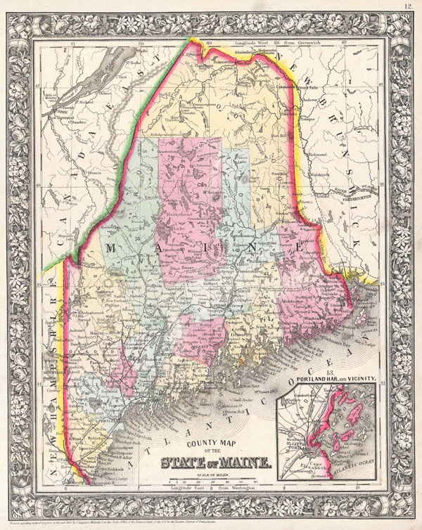
County Map of Maine.
sold
- Digital Map Information
- Suitable for large format printing
- File Size: 3.96 MB
- File Type: ZIP / TIFF
- ICC color profile embedded
- Delivered instantly via download link
A beautiful example of S. A. Mitchell Jr.'s 1864 map of Maine. Detailed to the county level with attention to towns, geographical features, proposed railroads, and cities. Many of the counties in the northern part of the state are ... (more details)

The City of Brooklyn.
sold
- Digital Map Information
- Suitable for large format printing
- File Size: 17 MB
- File Type: ZIP / TIFF
- ICC color profile embedded
- Delivered instantly via download link
A rare example of Fredrick W. Beers' Map Brooklyn, New York. Published in 1873, this map depicts Brooklyn, Greenpoint and Williamsburg. Features detail to the street level showing individual buildings, parks, and street names. ... (more details)

Map of central portions of the cities of New York and Brooklyn.
sold
- Digital Map Information
- Suitable for large format printing
- File Size: 5.97 MB
- File Type: ZIP / TIFF
- ICC color profile embedded
- Delivered instantly via download link
A rare example of Fredrick W. Beers' Map New York City, New York. Published in 1873, this map depicts New York City to 115th Street and parts of Brooklyn and Queens. Features detail to the street level showing individual ... (more details)
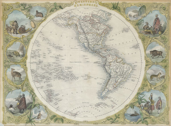
Western Hemisphere.
sold
- Digital Map Information
- Suitable for large format printing
- Full resolution TIFF file
- ICC color profile embedded
- Delivered instantly via download link
This is an extremely attractive full color example of John Tallis' decorative map of the Western Hemisphere. Covers both North and South America as well as parts of Polynesia, Antarctica, and Siberia. Shows Texas as both ... (more details)

Plan of Cincinnati and Vicinity.
sold
- Digital Map Information
- Suitable for large format printing
- File Size: 3.04 MB
- File Type: ZIP / TIFF
- ICC color profile embedded
- Delivered instantly via download link
A beautiful example of S. A. Mitchell Jr.'s 1864 map of Cincinnati, Ohio. Depicts the city of Cincinnati along with parts of Covington and Newport. Offers wonderful detail at the street level including references to the ... (more details)

County Map of Georgia, and Alabama.
sold
- Digital Map Information
- Suitable for large format printing
- File Size: 5.58 MB
- File Type: ZIP / TIFF
- ICC color profile embedded
- Delivered instantly via download link
A beautiful example of S. A. Mitchell Jr.'s 1864 map of Georgia and Alabama. Detailed to the county level with attention towns, geographical features, proposed railroads, and cities. One of the most attractive atlas ... (more details)

Plan of Baltimore.
sold
- Digital Map Information
- Suitable for large format printing
- File Size: 2.82 MB
- File Type: ZIP / TIFF
- ICC color profile embedded
- Delivered instantly via download link
A beautiful example of S. A. Mitchell Jr.'s 1864 map Baltimore, Maryland. Offers wonderful detail at the street level including references to the important buildings, trains, canals, and roads. Colored coded with ... (more details)
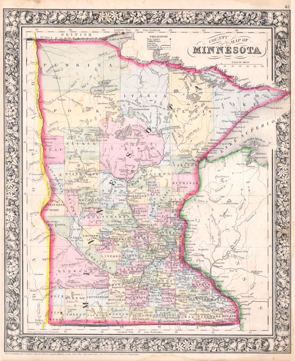
County Map of Minnesota
sold
- Digital Map Information
- Suitable for large format printing
- File Size: 4.04 MB
- File Type: ZIP / TIFF
- ICC color profile embedded
- Delivered instantly via download link
A beautiful example of S. A. Mitchell Jr.'s 1864 map of Minnesota. Detailed to the county level with attention to American Indian tribes, towns, geographical features, proposed railroads, and cities. Many of the ... (more details)
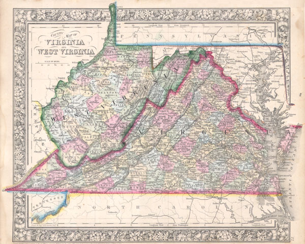
County Map of Virginia and West Virginia
sold
- Digital Map Information
- Suitable for large format printing
- File Size: 4.25 MB
- File Type: ZIP / TIFF
- ICC color profile embedded
- Delivered instantly via download link
A beautiful example of S. A. Mitchell Jr.'s 1864 map of Virginia, West Virginia and Maryland. This map was revised version of Mitchells 1860 map of the same region to accommodate for the separation of Virginia ... (more details)

Map of Oregon, Washington and part of Idaho.
sold
- Digital Map Information
- Suitable for large format printing
- File Size: 3.62 MB
- File Type: ZIP / TIFF
- ICC color profile embedded
- Delivered instantly via download link
A beautiful example of S. A. Mitchell Jr.'s 1864 map of Washington, Oregon and Idaho, with parts of modern day Montana and Wyoming . Washington and Oregon and depicted with defined counties only in the western ... (more details)
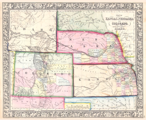
Map of Kansas, Nebraska and Colorado, Showing also the Eastern Portion of Idaho.
sold
- Digital Map Information
- Suitable for large format printing
- File Size: 3.71 MB
- File Type: ZIP / TIFF
- ICC color profile embedded
- Delivered instantly via download link
A beautiful example of S. A. Mitchell Jr.'s 1864 map of Kansas, Nebraska, Colorado and Idaho. Wyoming has yet to appear. Counties cover only the eastern portions of Nebraska and the eastern third of Kansas. ... (more details)