
An extremely rare linen-backed city map or plan of Paris.
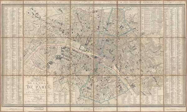
Plan de la Ville de Paris Divisé en 12 Arrondissemens, et 48 Quartiers. Indiquant tous les Changemens faits et Projetés.
sold
- Digital Map Information
- Suitable for large format printing
- DPI: 300
- File Size: 37.85 MB
- File Type: ZIP / TIFF
- ICC color profile embedded
- Delivered instantly via download link
This is an 1844 Xavier Girard city map or plan of Paris, France. The map depicts the city from the Arc de Triomphe to the Place de la Nation (labeled here as the Place du Trône) and from the village of Montmartre to the Place d'Italie. Incredibly detailed, nearly ... (more details)
Rare thematic map illustrating equestrian activty in Maryland.

A Horse Map of Maryland Showing all Pahses of Horse Activity in the State.
sold
- Digital Map Information
- Suitable for large format printing
- File Size: 22.15 MB
- File Type: ZIP / TIFF
- ICC color profile embedded
- Delivered instantly via download link
A rare 1941 thematic map of Maryland illustrating equestrian activity in the state. This map was issued by the Maryland Horse Breeders Association in Townson, Maryland. The map covers the entire state in some detail with insets of Baltimore County and western ... (more details)
From the French edition of one of the foundational works of African studies.

Barbaria Biledulgerid o: Libye et pars Nigritarum Terra.
sold
- Digital Map Information
- Suitable for large format printing
- DPI: 300
- File Size: 4.02 MB
- File Type: ZIP / TIFF
- ICC color profile embedded
- Delivered instantly via download link
This is a 1686 Olfert Dapper map of North Africa. The map depicts the region from the Strait of Gibraltar to Libya and Crete and from southern Spain, Sicily, and the Mediterranean Sea to the Niger River. Highly detailed, myriad locations, particularly along the ... (more details)
Hilarious pictorial map of Yellowstone National Park.

A Hysterical Map of the Yellowstone Park with Apologies to the Park. Smileage Guaranteed.
sold
- Digital Map Information
- Suitable for large format printing
- File Size: 6.45 MB
- File Type: ZIP / TIFF
- ICC color profile embedded
- Delivered instantly via download link
A cheerful 1948 pictorial map of Yellowstone Park, 'hatched and scratched' by the American printer and humorist Jolly Elmer Lindgren. The map depicts the whole of Yellowstone Park with a richly humorous array of vignettes and annotations. The map presents the ... (more details)
Educational WPA Poster Map by the modernist Cleveland artist Fren Rentschler.

The Old Northwest Territory.
sold
- Digital Map Information
- Suitable for large format printing
- File Size: 14.35 MB
- File Type: ZIP / TIFF
- ICC color profile embedded
- Delivered instantly via download link
An uncommon 1937 pictorial map of the old Northwest Territory by Fred Rentschler. The map includes all five of the great lakes and focuses on the modern-day states of Minnesota, Wisconsin, Illinois, Indiana, Michigan, and Ohio. It includes numerous vignette ... (more details)
Labels Vancouver Island and Kodiak Island.
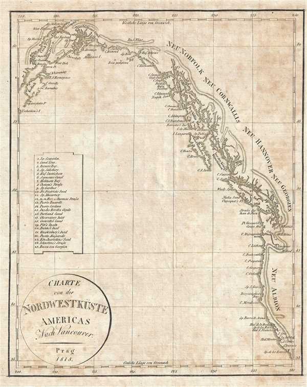
Charte von der Nordwestküste Americas Nach Vancouver.
sold
- Digital Map Information
- Suitable for large format printing
- DPI: 300
- File Size: 2.14 MB
- File Type: ZIP / TIFF
- ICC color profile embedded
- Delivered instantly via download link
This is an 1818 Franz Pluth Map of the Pacific coast of North America. The map depicts the region from Kodiak Island and Cook Inlet in Alaska along the Canadian coastline to Washington, Oregon, and California in the United States. Numerous locations along the ... (more details)
An important Spanish port on the Atlantic coast of Panama - used for sending gold back to Spain!
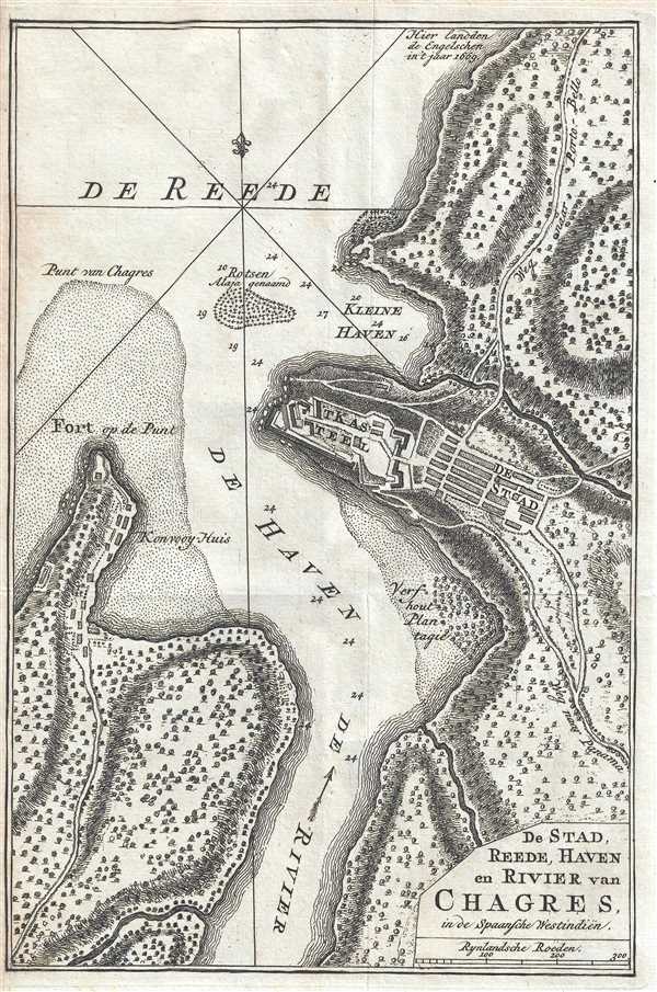
De Stad, Reede, Haven en Rivier van Chagres, in de Spaansche Westindiën.
sold
- Digital Map Information
- Suitable for large format printing
- DPI: 300
- File Size: 2.4 MB
- File Type: ZIP / TIFF
- ICC color profile embedded
- Delivered instantly via download link
This is a 1765 Isaak Tirion map of the region surrounding Chagres, Panama. The map depicts the town of Chagres, Fort San Lorenzo, and the mouth of the Chagres River, all along the Caribbean coast of Panama. Both the town and the fort are labeled, along with a ... (more details)
Labels Savannah, Pensacola, Mobile, and New Orleans.

Louisiana.
sold
- Digital Map Information
- Suitable for large format printing
- DPI: 300
- File Size: 1.73 MB
- File Type: ZIP / TIFF
- ICC color profile embedded
- Delivered instantly via download link
This is a c. 1820 Franz Pluth map of the central United States. The map depicts the region from approximately the Rocky Mountains to the Appalachian Mountains and the Carolinas and from southern Canada to the Rio Grande and the Gulf of Mexico. Several states ... (more details)
A fine overview of Arctic Exploration in the middle part of the 19th century.

Northern Regions.
sold
- Digital Map Information
- Suitable for large format printing
- File Size: 7.26 MB
- File Type: ZIP / TIFF
- ICC color profile embedded
- Delivered instantly via download link
This is an 1857 J. H. Colton map of the North Pole or Arctic. The map depicts from Lake Baikal, the Hudson Bay, the British Isles and Kamchatka with the Pole at the center. This is a historically ephemeral map as the Polar Regions were, as Colton drafted ... (more details)
Labels Mexico City.

México.
sold
- Digital Map Information
- Suitable for large format printing
- File Size: 7.6 MB
- File Type: ZIP / TIFF
- ICC color profile embedded
- Delivered instantly via download link
This is a 1942 Secretaria de Agricultura y Fomento map of the Estado de México, or Mexico State. The map depicts the region from Querétaro and Hidalgo to Guerrero and Morelos and from the Michoacán to Tlaxcala and Puebla. Slightly to the right of center ... (more details)
Labels Kingston.
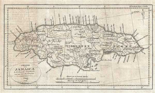
Charte von Jamaica.
sold
- Digital Map Information
- Suitable for large format printing
- DPI: 300
- File Size: 2.68 MB
- File Type: ZIP / TIFF
- ICC color profile embedded
- Delivered instantly via download link
This is an 1822 Franz Pluth map of Jamaica. The map depicts the entire island in wonderful detail, labeling towns and villages, including Kingston, along with parishes and counties. Numerous roads traverse the island. Points along the coastline are also ... (more details)
Illustrates five different spheres used in cartography.

Sphère de Ptolomée.
sold
- Digital Map Information
- Suitable for large format printing
- DPI: 300
- File Size: 5.64 MB
- File Type: ZIP / TIFF
- ICC color profile embedded
- Delivered instantly via download link
This is Rigobert Bonne's 1775 curious decorative chart of the Spheres. The chart features five different spheres used in mapmaking and calculating map projections. From top left, Sphère de Ptolomée (Ptolemaic Sphere), Sphère Droite (Right Sphere), ... (more details)
Illustrates the principal mountain ranges, rivers, tides, and ocean currents.

Map of The World Illustrating the principal features of The Land and The Co-Tidal Lines. Map of The World Showing the principal Ocean Currents and Boundaries of River Systems.
sold
- Digital Map Information
- Suitable for large format printing
- File Size: 4.76 MB
- File Type: ZIP / TIFF
- ICC color profile embedded
- Delivered instantly via download link
This is an 1857 J. H. Colton map of land features, tides, and ocean currents. The map is divided into two parts. The upper map depicts the principle features of land, and the co-tidal lines. Colors coded according to continent, countries in the ... (more details)
Illustrates the range of the principal members of the Animal Kingdom and the productive industries of the countries of the world.
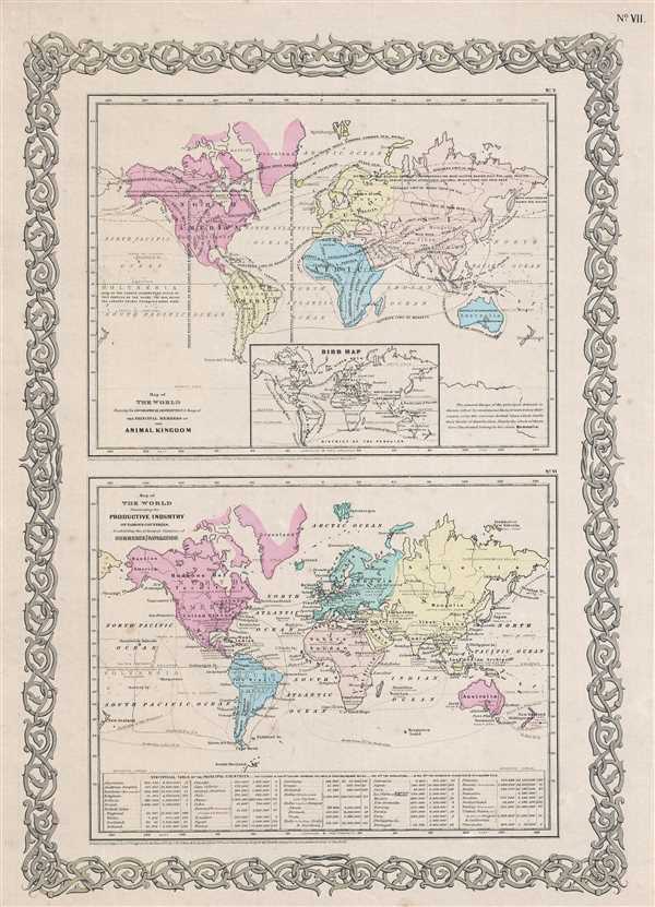
Map of The World Showing the Geographical Distribution and Range of The Principal Members of The Animal Kingdom. Map of The World Illustrating the Productive Industry of Various Countries, and exhibiting the principal features of Commerce and Navigation.
sold
- Digital Map Information
- Suitable for large format printing
- File Size: 4.22 MB
- File Type: ZIP / TIFF
- ICC color profile embedded
- Delivered instantly via download link
This is an 1857 J. H. Colton map of the World's animal kingdom and the productive industries of various countries. The map is actually two maps printed on one sheet. The upper map shows the geographical distribution and range of the principal ... (more details)
Compares the relative size of the world's lakes and islands.

Comparative Size of Lakes and Islands.
sold
- Digital Map Information
- Suitable for large format printing
- File Size: 6.28 MB
- File Type: ZIP / TIFF
- ICC color profile embedded
- Delivered instantly via download link
This is an 1857 J. H. Colton curious topical chart of the world's great islands and lakes. The chart is divided into lakes and islands of the Eastern and Western Hemispheres. Curiously, the chart does not include Greenland - whose northern ... (more details)
Scarce Hartford Map imprint arguing Manifest Destiny.

Map of the United States Compiled from the most Authentic Sources.
sold
- Digital Map Information
- Suitable for large format printing
- DPI: 300
- File Size: 22.92 MB
- File Type: ZIP / TIFF
- ICC color profile embedded
- Delivered instantly via download link
This is a fascinating 1831 wall map of the United States published in Hartford, Connecticut, by Willis Thrall. In an unusual flourish for the time, Thrall's map covers the United States from Coast to Coast, extending from Oregon to the ... (more details)
A Banned Map! Rare woodblock printing of Haishi Shihei's important map of Korea.

Chosen Hachido no Zu (or) Chosen Koko Zenzu (General Map of Korea).
sold
- Digital Map Information
- Suitable for large format printing
- DPI: 300
- File Size: 14.56 MB
- File Type: ZIP / TIFF
- ICC color profile embedded
- Delivered instantly via download link
A banned map! This very rare c. 1785 woodblock map of Korea prepared by Hayashi Shihei. This map was drawn to illustrate Shihei's Sangoku Tsuran Zusetsu (Illustrated General Survey of the Three Countries). It covers all of Korea as ... (more details)
Extremely rare German satirical map of Europe.
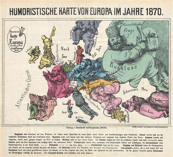
Humoristische Karte von Europa im Jahre 1870.
sold
- Digital Map Information
- Suitable for large format printing
- File Size: 5.85 MB
- File Type: ZIP / TIFF
- ICC color profile embedded
- Delivered instantly via download link
This is an extremely rare 1870 German satirical map of Europe by Arnold Neumann. This map presents Europe allegorically, personifying each country, and uses current events to shape their images. The colors on the map do a fantastic ... (more details)
Rare German view of Sacramento around the time of California's statehood - one of the ships moored along the riverfront flies the Republic of Texas flag!

Sacramento in Californien: Des Auswanderers Hoffnung.
sold
- Digital Map Information
- Suitable for large format printing
- DPI: 300
- File Size: 6.16 MB
- File Type: ZIP / TIFF
- ICC color profile embedded
- Delivered instantly via download link
This is a rare c. 1850 German lithograph view of Sacramento, California. The map depicts the city of Sacramento from the waterfront on the Sacramento River towards the city down J Street. Numerous buildings are illustrated along ... (more details)
One of the most desirable and attractive 17th century maps of Malta.
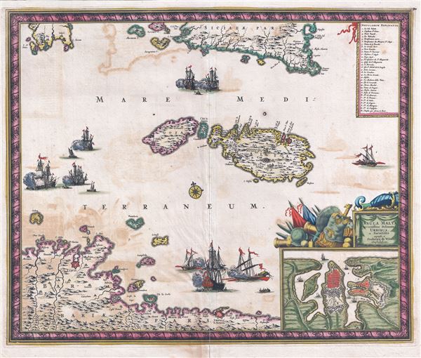
Insula Malta accuratissime Delineata, Urbibus, et Fortalitiis.
$1,575.00
Acquire
- Digital Map Information
- Suitable for large format printing
- DPI: 300
- File Size: 13.71 MB
- File Type: ZIP / TIFF
- ICC color profile embedded
- Delivered instantly via download link
A fine c. 1680 map of Malta and Gozo by the Dutch Golden Age cartography Frederick De Wit. This is one of the most decorative maps of Malta to appear in the 18th century. Centered on Malta and Gozo, it covers the surrounding ... (more details)