
Wonderful early map of South and Southeast Asia.
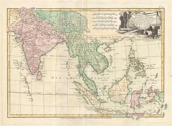
Les Indes Orientales et leur archipel. Assujettie aux observations astronomiq(u)es combinees avec les itineraires anciens et modernes, et avec les routes des navigateurs.
$400.00
Acquire
- Digital Map Information
- Suitable for large format printing
- DPI: 300
- File Size: 6.3 MB
- File Type: ZIP / TIFF
- ICC color profile embedded
- Delivered instantly via download link
A beautiful example of Rigobert Bonne's c.1778 map of India, Southeast Asia and the East Indies. Covers from Kandahar and the Maldives in the west eastward to include all of India, Southeast Asia (modern Burma, Thailand or Siam, Malaysia, Cambodia, Vietnam, Laos), ... (more details)
Amazing old color map of India depicting Goa.
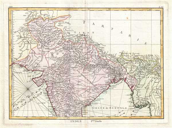
Indes Iere. Feuille.
$250.00
Acquire
- Digital Map Information
- Suitable for large format printing
- DPI: 300
- File Size: 5.29 MB
- File Type: ZIP / TIFF
- ICC color profile embedded
- Delivered instantly via download link
A beautiful example of Rigobert Bonne's 1770 decorative map of northern India. Covers the subcontinent from Kandahar east as far as Burma (Pegu) and south to just past Goa. Names countless important Indian cities, river systems and mines. Rhumb lines appear in ... (more details)
Intriguing map of China and Formosa / Taiwan.

Carte Hydro-Geo-Graphique des Indes Orientales en deca et au dela du Gange avec leur Archipel Dressee et assujettie aux Observations Astronomiques.
sold
- Digital Map Information
- Suitable for large format printing
- DPI: 300
- File Size: 6.02 MB
- File Type: ZIP / TIFF
- ICC color profile embedded
- Delivered instantly via download link
A beautiful example of Rigobert Bonne's 1771 uncommon map of southeastern China. Covers from the Kingdom of Siam (Thailand) to include Laos, Tonkin (northern Vietnam), Cochin Chi (southern Vietnam), the island of Hainan, Formosa (Taiwan) and the Island of Luzon ... (more details)
Attractive map of southern India, Sri Lanka, and the Maldives, an island paradise.

Indes IIe. Feuille.
sold
- Digital Map Information
- Suitable for large format printing
- DPI: 300
- File Size: 4.83 MB
- File Type: ZIP / TIFF
- ICC color profile embedded
- Delivered instantly via download link
A beautiful example of Rigobert Bonne's 1770 decorative map of southern India. Covers both the Malabar and Coromandel coasts as well as the Maldives, Ceylon (Sri Lanka), the Andaman Islands, and parts of Sumatra and Southeast Asia. Rhumb lines throughout. ... (more details)
Map depicting Central Asia from the Black Sea to China.

Carte de la Tartarie Independante qui comprend le Pays de Calmuks, celui des Usbeks, et le Turkestan avec leurs dependances.
sold
- Digital Map Information
- Suitable for large format printing
- DPI: 300
- File Size: 6.29 MB
- File Type: ZIP / TIFF
- ICC color profile embedded
- Delivered instantly via download link
A beautiful example of Rigobert Bonne's 1770 decorative map of Central Asia. Covers from the Black Sea south to China, north to Russia, and south to Persia and India. Includes the modern day nations of Kazakhstan, Uzbekistan, Turkmenistan, Georgia, ... (more details)
Map showing British holdings in America at the time of the American Revolutionary War.

Canada IIe. Feuille.
sold
- Digital Map Information
- Suitable for large format printing
- DPI: 300
- File Size: 4.67 MB
- File Type: ZIP / TIFF
- ICC color profile embedded
- Delivered instantly via download link
Printed in c.1778, in the midst of the American Revolutionary War, this is Bonne's important map of Louisiana and the British claims in North America. Covers from the Grand Banks south to Florida and westward as far as Mexico and Texas. Shows the ... (more details)
Incredible hand colored map of eastern Africa depicting Lake Malawi and Mombasa.

Cote de Zanguebar. Par le Sr. Robert de Vaugondy fils de Mr. Robert Geog. du Roi.
sold
- Digital Map Information
- Suitable for large format printing
- DPI: 300
- File Size: 1.21 MB
- File Type: ZIP / TIFF
- ICC color profile embedded
- Delivered instantly via download link
This is a hand colored 1749 Didier Robert de Vaugondy map of Kenya, Tanzania, Mozambique, and Malawi, and Zanzibar. The map presents the African coast from just north of the Equator to Mozambique and from the 'unknown interior' of the continent ... (more details)
Beautiful hand colored map of Newfoundland.

Isle de Terre-Neuve. Par le Sr. Robert de Vaugondy Fils de Mr. Robert Geog ord. du Roi.
sold
- Digital Map Information
- Suitable for large format printing
- DPI: 300
- File Size: 1.48 MB
- File Type: ZIP / TIFF
- ICC color profile embedded
- Delivered instantly via download link
This is a hand colored 1749 Didier Robert de Vaugondy map of Newfoundland. The map depicts the island of Newfoundland from the Golf of Saint Lawrence to the Atlantic Ocean. Myriad locations along the coast of the island are identified, ... (more details)
Spectacular hand colored map of Majorca and Ibiza, world-famous Mediterranean paradises
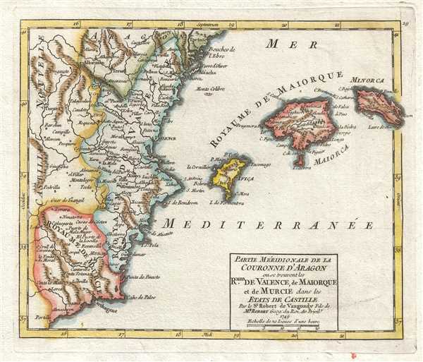
Partie Méridionale de la Couronne d'Aragon ou se trouvent les Royaumes de Valence, de Maiorque et de Murcie dans les Etats de Castille. Par le Sr. Robert de Vaugondy Fils de Mr. Robert Geog. du Roi.
sold
- Digital Map Information
- Suitable for large format printing
- DPI: 300
- File Size: 1.65 MB
- File Type: ZIP / TIFF
- ICC color profile embedded
- Delivered instantly via download link
This is a hand colored 1749 Didier Robert de Vaugondy map of the Balearic Islands. The map depicts from Castile, Spain to Minorca and from Aragon to Murcia. The Kingdoms of New Castile, Aragon, Murcia, and Valencia are depicted in ... (more details)
Brilliant hand colored map of Nova Scotia, depicting Port Royal, the oldest European settlement in Canada.

L'Acadie. Par le Sr. Robert de Vaugondy Fils de Mr. Robert Géogr. ord. du Roy.
sold
- Digital Map Information
- Suitable for large format printing
- DPI: 300
- File Size: 1.59 MB
- File Type: ZIP / TIFF
- ICC color profile embedded
- Delivered instantly via download link
This is a hand colored 1749 Didier Robert de Vaugondy map of Nova Scotia, Canada. With Nova Scotia at its center, the map depicts from New Brunswick ( Nouvelle Ecosse ) to Cape Breton Island ( Ile Royale ). Towns and cities, ... (more details)
Incredible hand colored map of northwestern Africa depicting the Kingdom of Morocco.
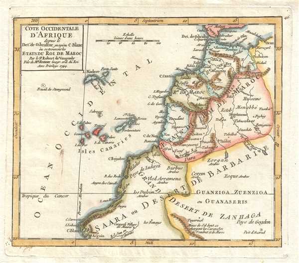
Cote Occidentale d'Afrique depuis le Detroit de Gibraltar jusqu'au C. Blanc où se trouvent les Etats du Roi de Maroc. Par le Sr. Robert de Vaugondy Fils de Mr. Robert Geogr. ord. du Roi.
sold
- Digital Map Information
- Suitable for large format printing
- DPI: 300
- File Size: 1.21 MB
- File Type: ZIP / TIFF
- ICC color profile embedded
- Delivered instantly via download link
This is a hand colored 1749 Didier Robert de Vaugondy map of northwestern Africa, depicting from the Canary Islands to Algeria and from southern Spain and the Strait of Gibraltar to Western Sahara and Mauritania. The map ... (more details)
Stunning hand colored map of the Middle East depicting Jerusalem and Mecca and Medina.
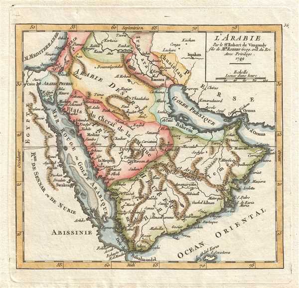
L'Arabie. Par le Sr. Robert de Vaugondy fils de Mr. Robert Geog. ord. du Roi.
sold
- Digital Map Information
- Suitable for large format printing
- DPI: 300
- File Size: 1.37 MB
- File Type: ZIP / TIFF
- ICC color profile embedded
- Delivered instantly via download link
This is a hand colored 1749 Didier Robert de Vaugondy map of the Middle East. The map depicts the region from the Mediterranean and Egypt to Persia (Iran) and from Syria and Iraq to the Indian Ocean and northern Ethiopia ... (more details)
Uncommon hand colored map of the Cape Verde Islands, a popular tourist destination.
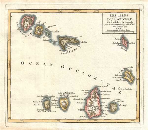
Les Isles du Cap-Verd. Par le Sr. Robert de Vaugondy Fils de Mr. Robert Géog. ord. du Roi.
sold
- Digital Map Information
- Suitable for large format printing
- DPI: 300
- File Size: 1.15 MB
- File Type: ZIP / TIFF
- ICC color profile embedded
- Delivered instantly via download link
This is a hand colored 1749 Didier Robert de Vaugondy map of the Cape Verde Islands, now known as Cabo Verde. The map depicts all 10 islands in the Cape Verde archipelago, which is located 350 miles off the coast of West ... (more details)
Gorgeous hand colored map of southern Africa depicting the Zambeze River.
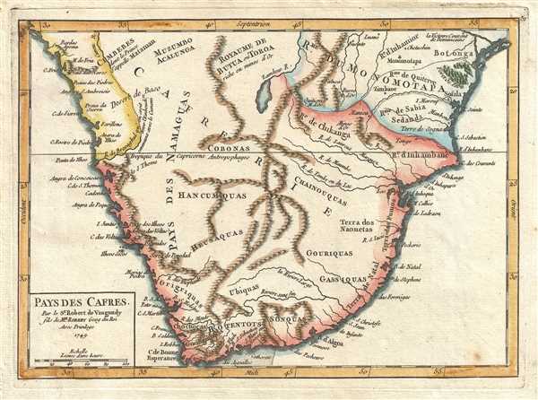
Pays des Cafres. Par le Sr. Robert de Vaugondy fils de Mr. Robert Geog du Roi.
sold
- Digital Map Information
- Suitable for large format printing
- DPI: 300
- File Size: 1.65 MB
- File Type: ZIP / TIFF
- ICC color profile embedded
- Delivered instantly via download link
This is a hand colored 1749 Didier Robert de Vaugondy map of southern Africa. The map depicts the southern half to third of the continent of Africa pre-colonialism. Most the map is dominated by Cafrerie , a ... (more details)
Beautiful hand colored map of southwestern Africa depicting pre-colonial kingdoms.
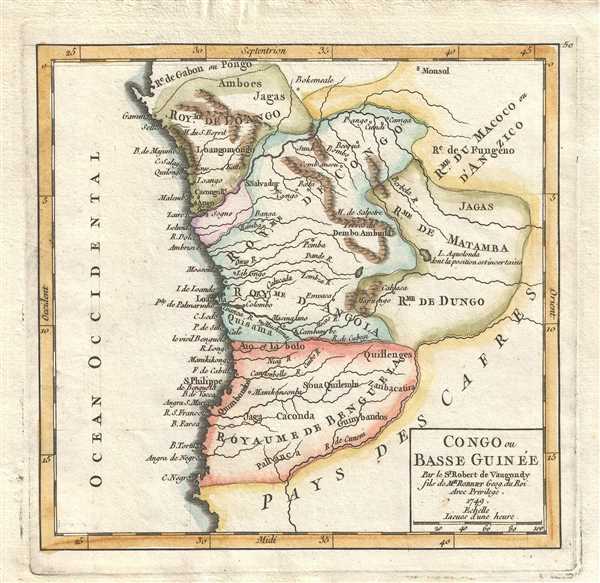
Congo ou Basse Guinée. Par le Sr. Robert de Vaugondy fils de Mr. Robert Geog. du Roi.
sold
- Digital Map Information
- Suitable for large format printing
- DPI: 300
- File Size: 1.38 MB
- File Type: ZIP / TIFF
- ICC color profile embedded
- Delivered instantly via download link
This is a hand colored 1749 Didier Robert de Vaugondy map of southwestern Africa. Stretching along the coastline from Gabon to Angola, the map depicts several pre-colonial African kingdoms. Myriad rivers are ... (more details)
Fantastic hand colored map depicting Estonia, Latvia, Finland and Russia, including St. Petersburg.

Curlande, Livonie, Ingrie et Partie Meridionale de Finlande. Par le Sr. Robert de Vaugondy, fils de Mr. Robert Geogr. ordin. du Roi.
sold
- Digital Map Information
- Suitable for large format printing
- DPI: 300
- File Size: 1.44 MB
- File Type: ZIP / TIFF
- ICC color profile embedded
- Delivered instantly via download link
This is a hand colored 1749 Didier Robert de Vaugondy map of the Baltic countries Estonia and Latvia, southern Finland, and western Russia. The map depicts from the Baltic Seato Lake Ladoga and Novgorod and ... (more details)
Gorgeous hand colored map of Asia depicting Peking and Nanking.
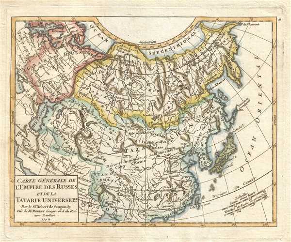
Carte Générale de l'Empire des Russes et de la Tartarie Universelle. Par le Sr. Robert de Vaugondy Fils de M. Robert Geogr. ord. du Roi.
$200.00
Acquire
- Digital Map Information
- Suitable for large format printing
- DPI: 300
- File Size: 2.16 MB
- File Type: ZIP / TIFF
- ICC color profile embedded
- Delivered instantly via download link
This is a hand colored 1749 Didier Robert de Vaugondy map of Asia. The map depicts from Poland and Scandinavia to Kamchatka, Japan, and the Pacific Ocean and from the Arctic Ocean and Nova Zemba (labeled as ... (more details)
Superb hand colored map of India, Sri Lanka, and the Maldives.

Indoustan ou Etats du Mogol. Par le Sr. Robert de Vaugondy fils de Mr. Robert Geog. ord. du Roi.
sold
- Digital Map Information
- Suitable for large format printing
- DPI: 300
- File Size: 1.85 MB
- File Type: ZIP / TIFF
- ICC color profile embedded
- Delivered instantly via download link
This is a hand colored 1749 Didier Robert de Vaugondy map of India. The map depicts the Indian subcontinent from Kashmir (Cachemir) and Tibet to the Indian Ocean, Sri Lanka, and the Maldives and from ... (more details)
Attractive hand colored map of Madagascar depicting Zanzibar, the Seychelles, Réunion, and Mauritius.

Isle du Madagascar ou de St. Laurent et Isles circonvoisines. Par le Sr. Robert de Vaugondy Fils de Mr. Robert Geog. du Roi.
sold
- Digital Map Information
- Suitable for large format printing
- DPI: 300
- File Size: 1.37 MB
- File Type: ZIP / TIFF
- ICC color profile embedded
- Delivered instantly via download link
This is a hand colored 1749 Didier Robert de Vaugondy map of Madagascar. The map depicts from the islands of Zanzibar and Pemba and the African coast (Zanguebar), across Madagascar to Diego Garcia ... (more details)
Beautifully hand colored map of the Spanish colony Tierra Firme, depicting Lake Cassipa.
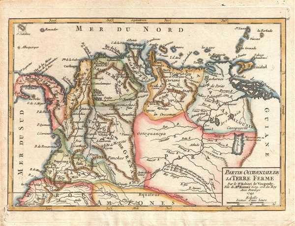
Partie Occidentale de la Terre Ferme. Par le Sr. Robert de Vaugondy, Fils de Mr. Robert Geog. ord. du Roy.
sold
- Digital Map Information
- Suitable for large format printing
- DPI: 300
- File Size: 1.96 MB
- File Type: ZIP / TIFF
- ICC color profile embedded
- Delivered instantly via download link
This is a hand colored 1749 Didier Robert de Vaugondy map of Colombia and Venezuela. The map depicts from Panama to Guiana and from the Caribbean Sea to the Equator. The Province of Tierra Firme ( ... (more details)