
Detialed mid-19th century map of the Napa Wine Region!

Petaluma and Napa Creeks California.
sold
- Digital Map Information
- Suitable for large format printing
- File Size: 15.88 MB
- File Type: ZIP / TIFF
- ICC color profile embedded
- Delivered instantly via download link
This is an uncommon 1861 U.S. Coast Survey nautical chart or map of the Napa River Valley and Petaluma River Valley, California. Essentially two maps on the same sheet, the left hand side of the sheet features a chart of the Petaluma Creek from Petaluma City as it ... (more details)
Nautical sketch depicting progress of Coast Survey near Savannah.

Sketch E. No. 2 Shewing the progress of the Survey in the vicinity of Savannah Georgia.
sold
- Digital Map Information
- Suitable for large format printing
- Full resolution TIFF file
- ICC color profile embedded
- Delivered instantly via download link
This is an attractive hand colored 1851 U.S. Coast Survey triangulation chart or map of Savannah, Georgia and the Savannah River. It shows the progress of the survey work in this area by date annotated sections. Shows navigation marks such as Fort Jackson, Tybee ... (more details)
Coast Survey chart indicating the site for the famous Point Pinos Light - oldest continuously operating lighthouse on the West Coast of the United States.

Sketch J. NO. 4 Indicating proposed sites for a Light-House on Point Pinos Bay, Monterey.
sold
- Digital Map Information
- Suitable for large format printing
- Full resolution TIFF file
- ICC color profile embedded
- Delivered instantly via download link
This is a beautiful 1851 U.S. Coast Survey nautical chart or map of Monterey Bay and Point Pinos, California. Essentially two maps on a single page, the right hand side map was created from surveys made in 1847 and depicts Monterey Bay from Pt. St. Cruz to Point ... (more details)
A uncommon nautical chart of Key West and surroundings.

(Sketch F No. 5) Preliminary Chart of Key West Harbor and Approaches.
sold
- Digital Map Information
- Suitable for large format printing
- DPI: 300
- File Size: 5.64 MB
- File Type: ZIP / TIFF
- ICC color profile embedded
- Delivered instantly via download link
An uncommon 1851 U.S. Coast Survey nautical chart or maritime map of Key West, Florida, and its approaches. Centered on Key West, this map covers from Boca Grande Key eastward to Raccoon Key, north as far as the N.W. Boca Chica Keys and south to W. Dray Rock and ... (more details)
Nautical chart depicting Bull's Bay including sailing instructions.

Sketch E. No. 6 Bull's Bay, Harbor of Refuge, Coast of South Carolina
sold
- Digital Map Information
- Suitable for large format printing
- Full resolution TIFF file
- ICC color profile embedded
- Delivered instantly via download link
This is an attractive 1851 U.S. Coast Survey nautical chart or map of Bull’s Bay and the Harbor of Refuge on the coast of South Carolina. The map shows the reconnaissance work of the coastal survey party under the command of Lieutenant J.N. Maffitt and assisted ... (more details)
Uncommon Coast Survey triangulation chart of the Florida Keys.

Sketch F Showing the Progress of the Survey in Section No VI from Cape Florida to Tortugas Island.
sold
- Digital Map Information
- Suitable for large format printing
- Full resolution TIFF file
- ICC color profile embedded
- Delivered instantly via download link
This is an interesting 1861 sketch of the nautical map or chart of the Florida Keys. The sketch shows the progress of the survey from 1845-1861 and includes triangulation and longitudinal markings. This map covers from Cape Florida to the Tortuga Islands and ... (more details)
Attractive nautical map of Monteray Bay

Preliminary Chart of Monterey Bay California.
sold
- Digital Map Information
- Suitable for large format printing
- File Size: 8.57 MB
- File Type: ZIP / TIFF
- ICC color profile embedded
- Delivered instantly via download link
This is an uncommon 1857 U.S. Coast Survey Chart or Map of Monterey Bay, California Covers from the town and mission of Santa Cruz, south to Monterey City and Point Pinos. Countless depth soundings throughout. Notes on tides, under sea dangers, and ... (more details)
Extremely rare and impressively large 18th century map of Mallorca Spain.

Carta Esferica de la Isla de Mallorca y sus adyacentes. Presentada al Rey N. S. por mano de... Antonio Valdés y construida por... Dn. Vicente Tofiño de S. Miguel, año 1786.
sold
- Digital Map Information
- Suitable for large format printing
- Full resolution TIFF file
- ICC color profile embedded
- Delivered instantly via download link
An extremely rare large scale 1786 Spanish nautical chart detailing the Balearic Island of Mallorca (Majorca) by the famed hydrographers Vincente Tofiño de San Miguel and Antonio Valdés y Fernández Bazán. The map covers Mallorca in full inclusive ... (more details)
Iconic wall sized map of India chronicling the British military campaign in the subcontinent against Tipu Sultan of Mysore.
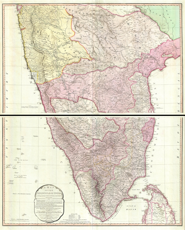
A Map of the Peninsula of India from the 19th Degree North Latitude to Cape Comorin.
$950.00
Acquire
- Digital Map Information
- Suitable for large format printing
- DPI: 300
- File Size: 34.75 MB
- File Type: ZIP / TIFF
- ICC color profile embedded
- Delivered instantly via download link
This is James Rennell's magnificent mapping of the Indian subcontinent, one of the largest and most impressive maps of India to appear in the 18th century. Highly desirable third edition. Presented in two panels, as issued. This chart depicts the ... (more details)
An idyllic fantastical land created by Bernard Sleigh at the end of the Great War and which then stood in sharp juxtaposition to bomb-blasted Europe.
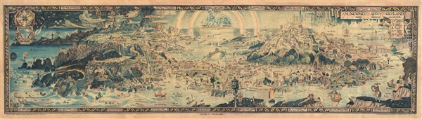
An Anciente Mappe of Fairy Land newly discovered and set forth.
sold
- Digital Map Information
- Suitable for large format printing
- File Size: 30.8 MB
- File Type: ZIP / TIFF
- ICC color profile embedded
- Delivered instantly via download link
An extraordinary 5 foot long edition of Bernard Sleigh's 1918 fantastical map of Fairy Land. This wonderful map offers a wide birds-eye view style panorama of the island of 'Fairy Land' which it describes as 'newly discovered and set forth'. ... (more details)
Striking four part map of India, Southeast Asia, and the East Indies.
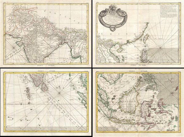
Carte Hydro-Geo-Graphique des Indes Orientales en deca et au dela du Gange avec leur Archipel Dressee et assujettie aux Observations Astronomiques.
sold
- Digital Map Information
- Suitable for large format printing
- DPI: 300
- File Size: 7.78 MB
- File Type: ZIP / TIFF
- ICC color profile embedded
- Delivered instantly via download link
An uncommon example of Rigobert Bonne's 1771 map of the East Indies. Divided into four parts, the map covers from the Arabian Sea to the Philippines, and from Tibet and southern China to Java and Timor (Indonesia). It includes the Kingdom of ... (more details)
Wonderful early map of South and Southeast Asia.

Les Indes Orientales et leur archipel. Assujettie aux observations astronomiq(u)es combinees avec les itineraires anciens et modernes, et avec les routes des navigateurs.
sold
- Digital Map Information
- Suitable for large format printing
- DPI: 300
- File Size: 9.11 MB
- File Type: ZIP / TIFF
- ICC color profile embedded
- Delivered instantly via download link
A beautiful example of Rigobert Bonne's c.1778 map of India, Southeast Asia and the East Indies. Covers from Kandahar and the Maldives in the west eastward to include all of India, Southeast Asia (modern Burma, Thailand or Siam, Malaysia, ... (more details)
Bonne's beautiful depiction of Persia.
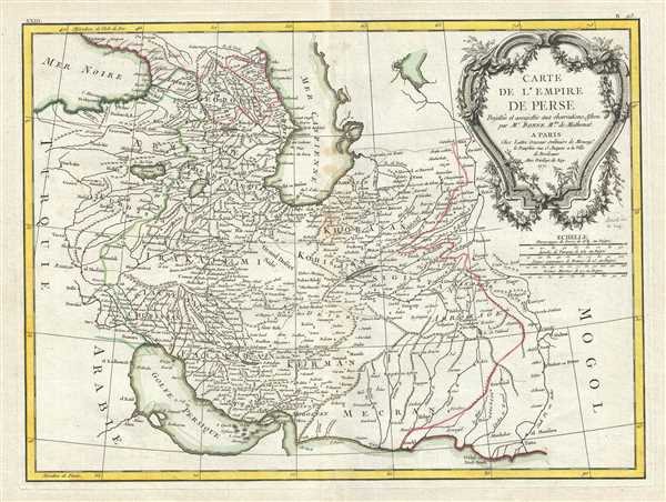
Carte de L'Empire de Perse.
sold
- Digital Map Information
- Suitable for large format printing
- DPI: 300
- File Size: 9.82 MB
- File Type: ZIP / TIFF
- ICC color profile embedded
- Delivered instantly via download link
A beautiful example of Rigobert Bonne's 1771 decorative map of the Persia. Covers from the Black Sea south to the Persian Gulf and east past the Caspian Sa to the Indus Valley. Includes the modern day nations of Iran, Iraq, Kuwait, ... (more details)
Beautiful early map of the Middle-East.
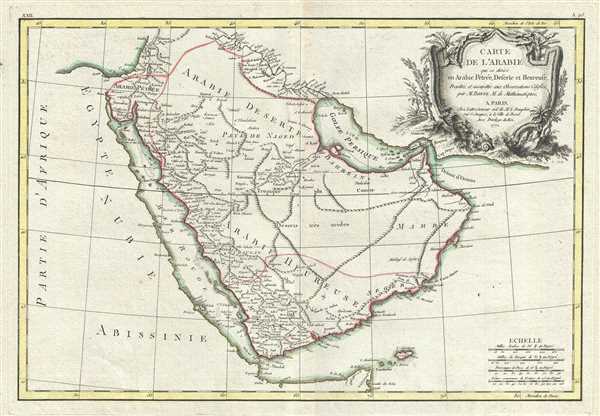
Carte de L'Arabie qui se divise en Arabie Petree, Deserte et Heureuse, Projettee en assujettie aux Observations Celestes.
sold
- Digital Map Information
- Suitable for large format printing
- Full resolution TIFF file
- ICC color profile embedded
- Delivered instantly via download link
This is an appealing 1771 decorative map of the Arabian Peninsula by Rigobert Bonne. Covers from the Mediterranean to the Indian Ocean and from the Red Sea to the Persian Gulf. Includes the modern day nations of Saudi Arabia, ... (more details)
Identifies the Sea of Korea.

l'Asie divisee en ses Principaux Etats.
sold
- Digital Map Information
- Suitable for large format printing
- DPI: 300
- File Size: 9.57 MB
- File Type: ZIP / TIFF
- ICC color profile embedded
- Delivered instantly via download link
This is an attractive example of Jean Janvier's c.1778 map of Asia. It covers from Africa and the Mediterranean east to Bering Strait and south as far as Java and New Guinea. This map is most interesting in its rendering of ... (more details)
Bonne's map of Russia on two sheets.
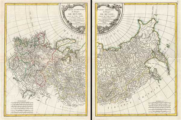
Partie Occidentale de l'Empire de Russie, Extrait de l'Atlas Russien et d'autres Cartes. Partie Orientale de l'Empire de Russie, Extrait de l'Atlas Russien et d'autres Cartes.
sold
- Digital Map Information
- Suitable for large format printing
- DPI: 300
- File Size: 19.36 MB
- File Type: ZIP / TIFF
- ICC color profile embedded
- Delivered instantly via download link
A beautiful example of Rigobert Bonne's 1771 decorative map of Russia. On two sheets, covers from the Baltic Sea to Siberia and the Bering Straits, extends south as far as the Caspian Sea, Sakhalin and Kamchatka, extends ... (more details)
Appealing map of Asia Minor.

Carte de la Turquie D'Asie Presque entiere Contenant l'Anatolie, La Georgie, l'Armenie, Le Curdistan, l'Alge-zira, l'Irak-Arabi, La Syrie etc.
sold
- Digital Map Information
- Suitable for large format printing
- DPI: 300
- File Size: 9.21 MB
- File Type: ZIP / TIFF
- ICC color profile embedded
- Delivered instantly via download link
A lovely example of Rigobert Bonne's c.1778 decorative map of Turkey in Asia. Covers from Egypt north to Crimea and from Crete and the Dardanelles east to the Persian Gulf and Georgia. Includes the modern day nations of ... (more details)
Map of the Mediterranean when the region was a hotbed of piracy.
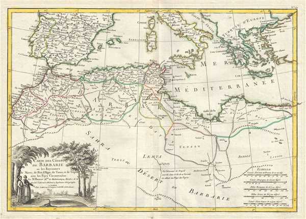
Carte des Cotes de Barbarie ou Les Royaumes de Marco, de Fez, d'Alger, de Tunis, et de Tripoli avec les Pays Circonvoisins.
sold
- Digital Map Information
- Suitable for large format printing
- DPI: 300
- File Size: 8.31 MB
- File Type: ZIP / TIFF
- ICC color profile embedded
- Delivered instantly via download link
A beautiful example of Rigobert Bonne's decorative c.1778 map of the Maghreb or Barbary Coast. Covers northwestern Africa and the western Mediterranean. This region consists of the modern day nations of Tunisia, Libya, ... (more details)
The most attractive map of San Diego Bay to emerge from the work of the U.S. Coast Survey.
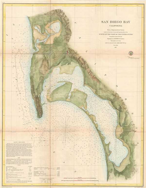
San Diego Bay California.
sold
- Digital Map Information
- Suitable for large format printing
- Full resolution TIFF file
- ICC color profile embedded
- Delivered instantly via download link
This is the most attractive map of San Diego Bay, California, to emerge from the work of the U.S. Coast Survey. Covers the Sand Diego area from False Bay and the Valley of Las Yeguas southward past Mission Valley and ... (more details)
Rare 1895 map illustrating the official Japanese position on Taiwan predating the Treaty of Shimonoseki. Earlier than National Museum of Taiwan example.
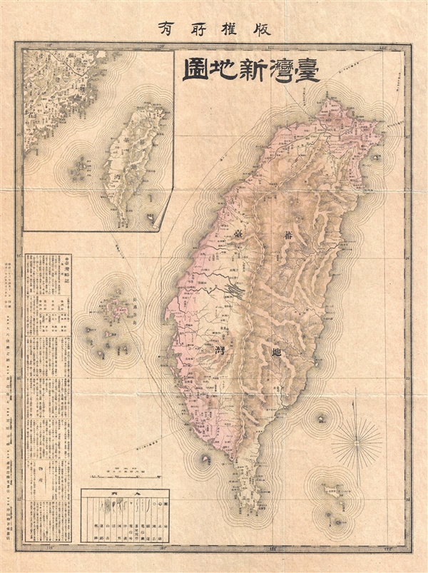
New Map of Taiwan, All Rights Reserved. / 台灣新地圖 版權所有. / Táiwān Xīn Dìtú Bǎnquán Suǒyǒu.
sold
- Digital Map Information
- Suitable for large format printing
- File Size: 8.81 MB
- File Type: ZIP / TIFF
- ICC color profile embedded
- Delivered instantly via download link
A scarce and important Meiji 28, April 10, 1895 map of Taiwan or Formosa drawn shortly before the Treaty of Shimonoseki, which formally ended the First Sino-Japanese War (August 1, 1894 – April 17, 1895). The map ... (more details)