
The finest obtainable Colonial Era map of the Gulf Coast around the Mississippi Delta and Louisiana.

Carte de la Louisiane.
sold
- Digital Map Information
- Suitable for large format printing
- Full resolution TIFF file
- ICC color profile embedded
- Delivered instantly via download link
A fine example of an extraordinary and important 1732/52 map of the Gulf coast and lower Mississippi River Valley by Jean Baptiste Bourguignon d'Anville. D'Anville's map covers from Sabine Pass (Cabo del Norte), Texas, past the Mississippi River Delta, Mobile Bay, ... (more details)
Scarce map of Russia reflecting the work of the short lived but promising Tzar and boy genius, Fyodor II Borisovich Godunov.
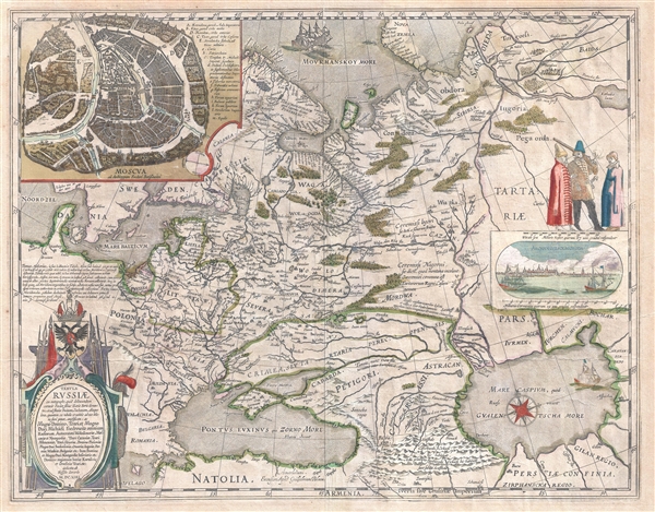
Tabula Russiae ex autographo, quod delineandum curavit Foedor filius Tzaris Boris desumta ... Magno domino, Tzari et magno duci Michäeli Foedrowits omnium Russorum, autocratori ... dedicata ab Hesselo Gerardo.
sold
- Digital Map Information
- Suitable for large format printing
- DPI: 300
- File Size: 14.17 MB
- File Type: ZIP / TIFF
- ICC color profile embedded
- Delivered instantly via download link
A very attractive 1632 old color example of Hessel Gerritsz's important map of Russia. Centered on Moscow, the map covers from the North Sea to the Caspian Sea and from Nova Zembla to Trabzon (Black Sea south coast). There is a large and impressive inset map of ... (more details)
Rare map of New York City geared towards Spanish speaking tourists.

Mapa de la ciudad de Nueva York. / Obsequio del Hotel America. / Irving Place & 15th St. Nueva York.
sold
- Digital Map Information
- Suitable for large format printing
- File Size: 7.03 MB
- File Type: ZIP / TIFF
- ICC color profile embedded
- Delivered instantly via download link
Quite a rare discovery, this 1896 two color lithograph map of New York City was issued by Arturo T. Berutich for use by Spanish speaking guests of the Hotel America. Oriented to the West, the map covers Manhattan south of 96th Street as well as adjacent parts of ... (more details)
Includes the Muller Peninsula in Alaska, an enlarged Australia, and the Sea of the West in North America.
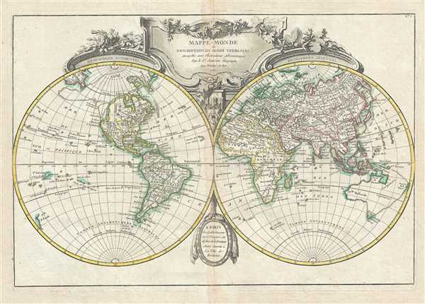
Mappe-Monde ou Description du Globe Terrestre, Assujettie aux Observations Astronomiques.
sold
- Digital Map Information
- Suitable for large format printing
- DPI: 300
- File Size: 9.35 MB
- File Type: ZIP / TIFF
- ICC color profile embedded
- Delivered instantly via download link
A beautiful and impressive map of the world drawn by Jean Janvier in 1762. Depicts the entire world on a double hemisphere projection framed by elaborate baroque cartouche work. North America, particularly the Northwestern quadrants, are exceptionally interesting ... (more details)
Bonne's lovely depiction of the Emerald Isle.

Carte D'Irlande Projelle de assujettie aux Observation Astronomiques.
sold
- Digital Map Information
- Suitable for large format printing
- DPI: 300
- File Size: 8.27 MB
- File Type: ZIP / TIFF
- ICC color profile embedded
- Delivered instantly via download link
This is an appealing example of Rigobert Bonne's 1771 decorative map of Ireland. Includes all of Ireland as well as parts of neighboring England and Scotland. The map shows incredible detail, noting towns, rivers, lakes, and a host of other topographical ... (more details)
Beautiful 18th century map of Scotland.

Carte du Royaume D'Ecosse.
sold
- Digital Map Information
- Suitable for large format printing
- DPI: 300
- File Size: 8.45 MB
- File Type: ZIP / TIFF
- ICC color profile embedded
- Delivered instantly via download link
This is a nice example of Rigobert Bonne's 1771 decorative map of Scotland. Covers All of Scotland including the Shetland, Orkney and Hebrides Islands. Divided by county. The map notes numerous cities, towns, rivers, lakes and topography throughout. A ... (more details)
Map showing one of the earliest obtainable depictions of a harbor in Florida.

Mappa geographica, complectens I. Indiae Occidentalis partem mediam circum Panamensem II. Ipsumq. isthmum III. Ichnographiam praecipuorum locorum & portuum ad has terras pertinentium. / Carte des Isles de L'Amerique et Deplusieurs Pays de Terre Ferme situes su devant de ces Isles & autour de Golfe de Mexique.
sold
- Digital Map Information
- Suitable for large format printing
- DPI: 300
- File Size: 16.11 MB
- File Type: ZIP / TIFF
- ICC color profile embedded
- Delivered instantly via download link
A wonderful example of J. B. Homann's spectacular map of the West Indies. Consists of maps based upon the admirable work of D'Anville compiled into a single sheet. The primary map, attributed to D'Anville's work of 1731, depicts the West Indies from ... (more details)
Map depicts the mythical Northwest Passage.
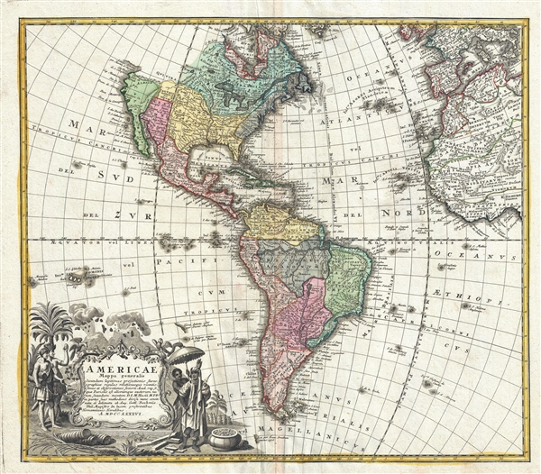
Americae Mappa Generalis.
sold
- Digital Map Information
- Suitable for large format printing
- DPI: 300
- File Size: 16.73 MB
- File Type: ZIP / TIFF
- ICC color profile embedded
- Delivered instantly via download link
A stunning 1746 Homann Heirs hand colored map of both North and South America. This is the second issue of this important map following the earlier edition by J. B. Homann. Map reflects a considerable advancement in American cartography of the time ... (more details)
First map to depict the Spottswood plan for German settlement in the Virginia interior.

Virginia Marylandia et Carolina In America Septentrionali Britannorum industria excultae…
sold
- Digital Map Information
- Suitable for large format printing
- DPI: 300
- File Size: 18.63 MB
- File Type: ZIP / TIFF
- ICC color profile embedded
- Delivered instantly via download link
An exceptionally beautiful example of J. B. Homann's c. 1715 map of Virginia, Carolina, Maryland, and New Jersey; considered one of the most important and decorative maps of is region to appear in the 18th century. This fine decorative map covers ... (more details)
Early map of England and Wales.

Carte du Royaume D'Angleterre.
sold
- Digital Map Information
- Suitable for large format printing
- DPI: 300
- File Size: 8.98 MB
- File Type: ZIP / TIFF
- ICC color profile embedded
- Delivered instantly via download link
A beautiful example of Rigobert Bonne's 1771 decorative map of England and Wales. Covers all of England and Wales as well as parts of adjacent Scotland, Ireland and France. Divided by county. The map notes numerous cities, towns, rivers, lakes ... (more details)
Beautiful map depicting the Polish-Lithuanian Commonwealth prior to the 1772 First Partition.
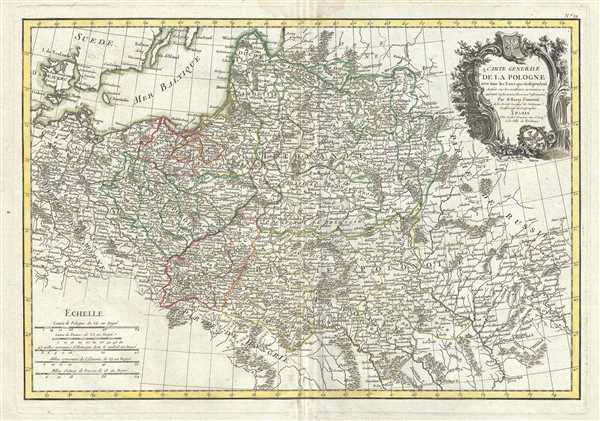
Carte Generale de la Pologne avec tous les Etats qui en dependent.
sold
- Digital Map Information
- Suitable for large format printing
- DPI: 300
- File Size: 10.88 MB
- File Type: ZIP / TIFF
- ICC color profile embedded
- Delivered instantly via download link
This is a beautiful example of Rizzi-Zannoni's c.1778 decorative map of the Poland and its tributaries. It covers from Denmark and Germany eastward to Russia, northwards to Livonia and south to Hungary, including Lithuania, Prussia, Greater ... (more details)
Map depicting Italy before its unification.

L'Italie divisee en ses differents etats Royaumes et Republiques.
sold
- Digital Map Information
- Suitable for large format printing
- DPI: 300
- File Size: 9.16 MB
- File Type: ZIP / TIFF
- ICC color profile embedded
- Delivered instantly via download link
A beautiful example of Le Sieur Janvier's c.1778 decorative map of Italy. Covers from the Gulf of Eyon eastward to include all of Corsica, Sardinia, Italy, the Adriatic, and parts of Hungary and Turkey in Europe. Extends south to ... (more details)
Interesting survey map of San Diego Bey with sailing instructions

General Sketch of San Diego Bay and Los Coronados
sold
- Digital Map Information
- Suitable for large format printing
- Full resolution TIFF file
- ICC color profile embedded
- Delivered instantly via download link
A fine early U.S. Coast Survey chart or map of San Diego Bay. Essentially two maps in one chart separated by a compass rose. The first map shows San Diego bay and Harbor just south of the city of San Diego. The second (right ... (more details)
Beautiful nautical chart of Humboldt Bay on the northern coast of California.

Humboldt Bay California.
sold
- Digital Map Information
- Suitable for large format printing
- Full resolution TIFF file
- ICC color profile embedded
- Delivered instantly via download link
This is an attractive 1851 coastal map or nautical chart of Humboldt Bay, California by the U.S. Coast Survey. It covers from Indian Island and Samoa south to Fields Landing. The cities of Eureka, Humboldt and Bucksport are ... (more details)
Early example of the Coast Survey's work in the San Francisco Bay area.

Sketch J No. 6 San Francisco Bay, California.
sold
- Digital Map Information
- Suitable for large format printing
- Full resolution TIFF file
- ICC color profile embedded
- Delivered instantly via download link
A detailed nautical chart or maritime map of San Francisco Bay from the 1851 U.S. Coast Survey Superintendent's Report . Includes the northern part of San Francisco Bay, San Pedro Bay, and San Francisco.The map has two ... (more details)
Early map of Pensacola and Perdido Bays

Sketch G Showing the Progress of the Survey in Section No. 7. Showing Pensacola and Perdido Bays
sold
- Digital Map Information
- Suitable for large format printing
- Full resolution TIFF file
- ICC color profile embedded
- Delivered instantly via download link
An early example of the 1849 U.S. Coast Survey nautical chart or maritime map of Pensacola and Perdido Bays. This map shows the cost of Florida on the Gulf of Mexico. There are triangulation lines through out the bay ... (more details)
Early triangulation chart of San Francisco Bay.
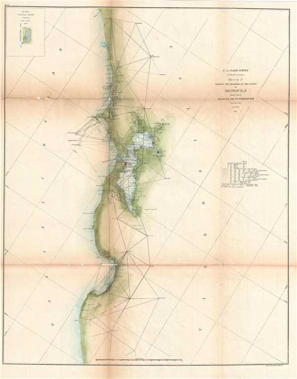
Sketch J Showing the Progress of the Survey in Section No. X (Middle Sheet) from Pt. Sal to Tomales Bay from 1860 to 1861.
sold
- Digital Map Information
- Suitable for large format printing
- Full resolution TIFF file
- ICC color profile embedded
- Delivered instantly via download link
An attractive example of the 1861 U. S. Coast Survey nautical chart or maritime map of San Francisco Bay and vicinity. The map covers from Point Sal to Tomales Bay, inclusive of all of San Francisco Bay. In the ... (more details)
18th century map depicting southwestern Spain.
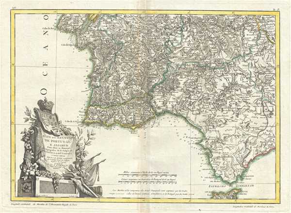
Mapa dos Reynos de Portugal e Algarve.
sold
- Digital Map Information
- Suitable for large format printing
- DPI: 300
- File Size: 9.66 MB
- File Type: ZIP / TIFF
- ICC color profile embedded
- Delivered instantly via download link
A beautiful example of Rizzi-Zannoni's curious c.1778 map of southern Portugal, the Algarve, and southwestern Spain. Covers from Lisbon south to Gibraltar and east as far as Andorra, Spain. Engraved in a highly ... (more details)
18th century map of the Languedoc wine region.
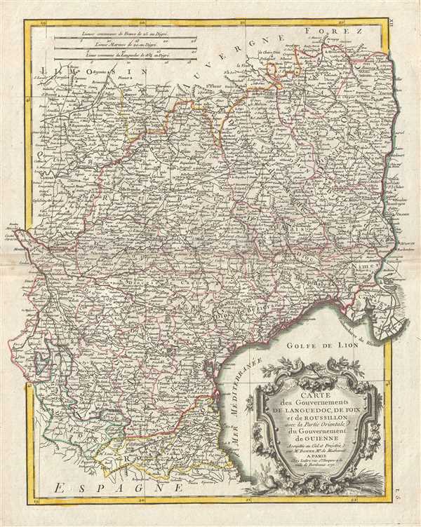
Carte des Gouvernements de Languedoc, de Foix et de Roussillon avec la Partie Oriental du Gouvernement de Guinne.
sold
- Digital Map Information
- Suitable for large format printing
- DPI: 300
- File Size: 10.67 MB
- File Type: ZIP / TIFF
- ICC color profile embedded
- Delivered instantly via download link
A beautiful 1771 example of Rigobert Bonne's decorative map of the French winemaking regions of Languedoc, de Foix and Roussillon. Covers the region in full from Auvergne to the Spain and the Mediterranean. The ... (more details)
Home to Fois Gras and Armagnac and the finest red wines!

Carte du Gouvernement de Guinne et Gascogne, avec celui de Bearn et Basse Navarre.
sold
- Digital Map Information
- Suitable for large format printing
- DPI: 300
- File Size: 8.61 MB
- File Type: ZIP / TIFF
- ICC color profile embedded
- Delivered instantly via download link
A lovely example of Rigobert Bonne's decorative 1771 map of the French regions of Gironde and Gascony. This region is known for its remarkable cuisine and is the home to both Fois Gras and Armagnac. The coastal ... (more details)