
Gerritsz, Hessel

Hessel Gerritsz (1581 – September 4, 1632) was a Dutch engraver, cartographer, and publisher active in Amsterdam during the late 16th and early 17th centuries, among the most preeminent Dutch geographers of the 17th century. He was born in Assum, a town in northern Holland in 1581. As a young man he relocated to Alkmaar to accept an apprenticeship with Willem Jansz Blaeu (1571-1638). He followed Blaeu to Amsterdam shortly afterwards. By 1610 he has his own press, but remained close to Blaeu, who published many of his maps. In October of 1617 he was appointed the first official cartographer of the Vereenigde Oost-Indische Compagnie (Dutch East Indian Company) or VOC. This strategic position offered him unprecedented access to the most advanced and far-reaching cartographic data of the Dutch Golden Age. Unlike many cartographers of his period, Gerritsz was more than a simple scholar and showed a true fascination with the world and eagerness to learn more of the world he was mapping in a practical manner. In 1628 he joined a voyage to the New World which resulted in the production of his seminal maps, published by Joannes de Laet in his 1630 Beschrijvinghe van West-Indien; these would be aggressively copied by both the Blaeu and Hondius houses, and long represented the standard followed in the mapping of the new world. Among his other prominent works are a world map of 1612, a 1613 map of Russia by the brilliant Russian prince Fyodor II Borisovich Godunov (1589 – 1605), a 1618 map of the pacific that includes the first mapping of Australia, and an influential 1630 map of Florida. Gerritsz died in 1632. His position with the VOC, along with many of his printing plates, were taken over by Willem Janszoon Blaeu.
El Dorado.
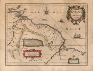
Guiana sive Amazonum Regio.
$750.00
Acquire
- Digital Map Information
- Suitable for large format printing
- Full resolution TIFF file
- ICC color profile embedded
- Delivered instantly via download link
This is an original color example of Willem Blaeu's 1629 map of Guiana in its German Atlas Major edition. The map is noteworthy for its bold depiction of El Dorado and the apocryphal Lake Parima. (more details)
First authenticated European Contact with Australia; best Philippine Mapping to date.
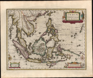
Indiae Orientalis Nova Descriptio.
$3,000.00
Acquire
- Digital Map Information
- Suitable for large format printing
- Full resolution TIFF file
- ICC color profile embedded
- Delivered instantly via download link
This is a gorgeous, original color example of Jan Jansson's 1630 map of the East Indies - the first printed map to present Willem Janszoon's 1606 contact with Australia. It also represents a milestone in the mapping of the Philippines, containing a markedly more precise depiction of the archipelago than any prior printed map. (more details)
A foundational map of the America Southeast and the first to use the term 'Tegesta' to identify peninsular Florida.
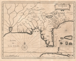
Florida, et Regiones Vicinae.
$3,500.00
Acquire
- Digital Map Information
- Suitable for large format printing
- DPI: 600
- File Size: 8.77 MB
- File Type: ZIP / TIFF
- ICC color profile embedded
- Delivered instantly via download link
One of the great foundational maps of the American southeast, this is Johannes de Laet's 1630 map of Florida. At the time, Florida referred to a vast region extending from Virginia to the Mississippi Valley, and this map correspondingly covers that region. De Laet based the map on a variety of sources, particularly on Cornelius Claesz's 1602 interpretation of Jacques Le Moyne's map of 1591, the Abraham Ortelius-Hieronymo de Chaves map of 1584, and the Mercator-Hondius map of 1606. (more details)
The classic Dutch map of the Balearic Islands.
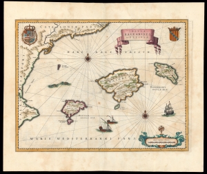
Insulae Balearides et Pytiusae.
$1,500.00
Acquire
- Digital Map Information
- Suitable for large format printing
- DPI: 600
- File Size: 38.95 MB
- File Type: ZIP / TIFF
- ICC color profile embedded
- Delivered instantly via download link
This is a beautiful example of Willem Blaeu's 1634 map of Majorca, Minorca, and Ibiza (Ibiça). It is the first folio atlas map dedicated to the Balearic Islands, and the standard for the mapping of the islands in the Dutch Golden Age. (more details)
A Separately Issued Tierra del Fuego
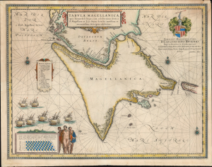
Tabula Magellanica, qua Tierrae del Fuego, cum celeberrimis fretis.
$850.00
Acquire
- Digital Map Information
- Suitable for large format printing
- Full resolution TIFF file
- ICC color profile embedded
- Delivered instantly via download link
This is a beautifully engraved c.1635 map of the Strait of Magellan and Tierra del Fuego by Willem Blaeu, in a likely separate issue lacking verso text. It is the second map in the Blaeu atlases to focus on this region, and brought Blaeu's mapping of the southernmost part of America up to date with the charts of the West India Company produced by Hessel Gerritsz. It is the result of over a century of exploration, revealing the discoveries of Magellan, Le Maire and Schouten, and finally the voyage made by Jacques l'Hermite with the so-called Nassau Fleet between 1623 and 1624. (more details)
Classic Dutch Map of the Caribbean.
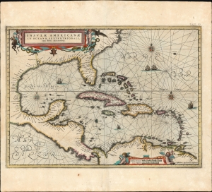
Insulae Americanae in Oceano Septentrionali cum Terris adiacentibus.
$3,000.00
Acquire
- Digital Map Information
- Suitable for large format printing
- Full resolution TIFF file
- ICC color profile embedded
- Delivered instantly via download link
This is a beautiful 1637 example of Jan Jansson's 1636 map of the Caribbean Islands and the adjacent coastlines of North and South America. It is among the most beautiful maps of the region produced in the first half of the 17th century. Moreover, the present example is in superb condition with gorgeous, bright original color. (more details)
A beautifully executed and detailed map of the Dutch trade routes into Russia.
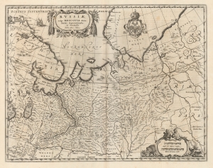
Russiae, vulgo Moscovia dictae, Partes Septentrionalis. Auctore Isaaco Massa.
$1,200.00
Acquire
- Digital Map Information
- Suitable for large format printing
- DPI: 600
- File Size: 51.6 MB
- File Type: ZIP / TIFF
- ICC color profile embedded
- Delivered instantly via download link
This is a superb example of Blaeu's 1640 map of Muscovy north of the Volga, and the northernmost parts of Russia. It represents the best Dutch knowledge of Russia in the first part of the 17th century. (more details)
Bold example of a scarce map of China, Japan and Korea.
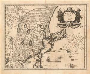
China Veteribus Sinarum Regio nunc Incolis Tame dicta.
$900.00
Acquire
- Digital Map Information
- Suitable for large format printing
- DPI: 600
- File Size: 10.63 MB
- File Type: ZIP / TIFF
- ICC color profile embedded
- Delivered instantly via download link
This is a scarce 1638 Matthais Merian map of China and Japan with an insular Korea. The map is beautifully engraved, decorated with a Chinese junk, a Dutch sailing ship, and a sea monster; the elegant cartouche is flanked by a man and woman in (presumably) Chinese robes. The Great Wall features prominently. The Philippine island of Luzon is shown, as is Formosa (Taiwan.) (more details)
The state of the art of Western Cartography in Russia during the Time of Troubles.
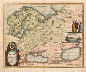
Tabula Russiae ex autographo, quod delineandum curavit Foedor filius Tzaris Boris desumta et ad fluvios Dwinam, Zuchanaw aliaque loca quandum ex tabulis et notitijs ad nos delatis fieri potuit amplificaca alias dicta Moscovia.
$850.00
Acquire
- Digital Map Information
- Suitable for large format printing
- DPI: (600.12890625, 600.12890625)
- File Size: 10.05 MB
- File Type: ZIP / TIFF
- ICC color profile embedded
- Delivered instantly via download link
This is a scarce 1638 Matthias Merian map of Russia. Though an intermediary source may have been Hessel Gerritz, the map is believed to have been ultimately derived from a Russian survey prepared at the orders of the Czar of Muscovy, Boris Godunov. Although this map's information dates to the end of the 16th century, the onset of the Time of Troubles following the death of Boris Godunov would curtail much reliable contact with this part of the world, and so well into the 17th century this map would remain the most up-to-date mapping of Muscovy available. (more details)
Pre-Смутное время plan of Moscow.
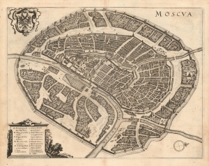
Moscva.
$1,900.00
Acquire
- Digital Map Information
- Suitable for large format printing
- DPI: 600
- File Size: 12.97 MB
- File Type: ZIP / TIFF
- ICC color profile embedded
- Delivered instantly via download link
This is a scarce 1638 Matthais Merian city plan or map of Moscow. Apart from the Braun and Hogenberg, this is the earliest full-sheet edition of the plan, which pre-dates by more than 20 years the version included by Joan Blaeu in his Atlas Maior. (more details)
Beautifully executed map of the Russian Frontier with Sweden.
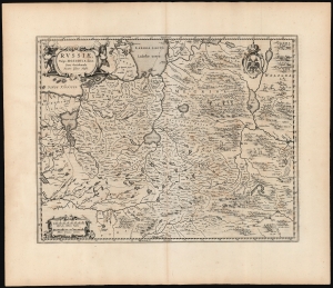
Russiae, vulgo Moscovia dictae, Para Occidentalis. Auctore Isaaco Massa.
$1,500.00
Acquire
- Digital Map Information
- Suitable for large format printing
- DPI: 600
- File Size: 56.46 MB
- File Type: ZIP / TIFF
- ICC color profile embedded
- Delivered instantly via download link
This is a handsome, first edition example of Blaeu's 1662 map covering from Moscow to Estonia, and part of Lithuania, including the frontier with the Swedish Empire. This is among the rarest Blaeu atlas maps of Russia, being one of those first appearing in Joan Blaeu's 1662 Atlas Maior. The map would only appear in the five editions of that atlas before the Blaeu warehouse burned in 1672. (more details)
Landmark of Cyrillic calligraphic printing.
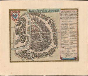
Царствающои град Москва началнои город всех московских государствах. / Carstvajuščoi grad Moskva načalo I gorod všeh Moskovech I carstvach. Urbis Moskvae.
$4,400.00
Acquire
- Digital Map Information
- Suitable for large format printing
- Full resolution TIFF file
- ICC color profile embedded
- Delivered instantly via download link
This is the 1662 Hessel Gerritsz and Willem Janszoon Blaeu city map or plan of Moscow, Russia. The map is significant as the dominant plan of Moscow in the 17th century. It is also significant for its innovative use of Cyrillic calligraphy to name both the city gates and in the map's titling - a first for non-Russian publishers. The Cyrillic calligraphy of the title is especially innovative, revealing the designer as a master of the style. (more details)
Tracking English and French efforts to establish a Caribbean Foothold.
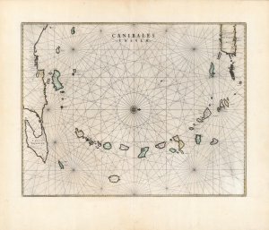
Canibales Insulae.
$1,500.00
Acquire
- Digital Map Information
- Suitable for large format printing
- DPI: 600
- File Size: 54.87 MB
- File Type: ZIP / TIFF
- ICC color profile embedded
- Delivered instantly via download link
This is a handsome, first edition example of Blaeu's 1662 map of the Lesser Antilles, in an attractive original color example in superb condition. It appeared only in the four final editions of Joan Blaeu's Atlas Maior; consequently, it is among the scarcest of the Blaeu Atlas maps. (more details)
Separately-Issued Rarity of the Caribbean.
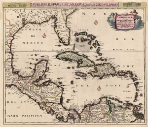
Insulae Americanae, Nempe: Cuba, Hispaniola, Jamaica, Pto Rico, Lucania, Antillae vulgo Caribae, Barlo -Et Sotto - Vento. Etc.
$2,000.00
Acquire
- Digital Map Information
- Suitable for large format printing
- Full resolution TIFF file
- ICC color profile embedded
- Delivered instantly via download link
This is Cornelius Danckerts' rare 1696 map of Florida, the West Indies, Central America, the Caribbean, and the Spanish Main. This map covers from Mexico to the Antilles and from Florida to the Spanish Main, inclusive of Cuba, the Bahamas, Hispaniola, Jamaica, Porto (Puerto) Rico, and the Lesser Antilles. It extends as far north as Georgia and South Carolina, here referred to as 'Florida Gallica'. (more details)
Rare updated chart of Florida's West Coast and Cuba.
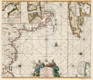
Pas kaart Van de Boght van Florida Met de Canaal Tusschen Florida en Cuba.
$2,500.00
Acquire
- Digital Map Information
- Suitable for large format printing
- DPI: 600
- File Size: 78.13 MB
- File Type: ZIP / TIFF
- ICC color profile embedded
- Delivered instantly via download link
This is a striking, original-color example of Gerard van Keulen's thoroughly updated 1723 version of 'the first sea chart of the eastern portion of the Gulf of Mexico detailing the west coast of Florida' (Burden). It is an exceptionally rare chart that appeared late in the van Keulen record, exhibiting meticulous and important revisions unique to this edition. (more details)