
Important early map of New Orleans.

Grondvlakte van Nieuw Orleans, de hoofdstad van Louisiana. / De uitloop van de Rivier Missisippi. / De oostelyke ingang van de Missisippi, met een plan van het fort, 't welk het kanaal beheerscht.
sold
- Digital Map Information
- Suitable for large format printing
- DPI: 300
- File Size: 9.13 MB
- File Type: ZIP / TIFF
- ICC color profile embedded
- Delivered instantly via download link
A fine example of one of the more beautiful 18th century maps of New Orleans and the Mississippi River Delta. This map, issued in 1769 by Isaak Tirion, is essentially three related maps on a single sheet. The primary map, occupying the left quadrants, is a detail ... (more details)
Early 20th century wall map of the United States showing the various uses of its land.
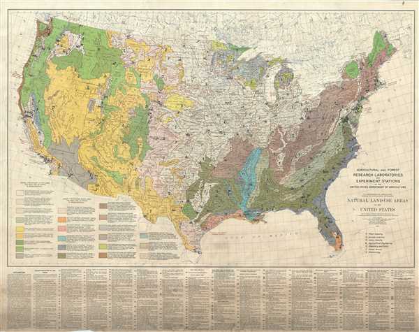
Natural Land-Use Areas of the United States.
sold
- Digital Map Information
- Suitable for large format printing
- File Size: 66.73 MB
- File Type: ZIP / TIFF
- ICC color profile embedded
- Delivered instantly via download link
This in an impressing 1933 map issued by the United States Department of Agriculture. Based on surveys by the U.S. Geological Surveys, the map covers the entire United States in beautiful detail and notes the major used of land throughout the country. The map ... (more details)
Beautiful map of the northern Tanintharyi Region of Burma or Myanmar.
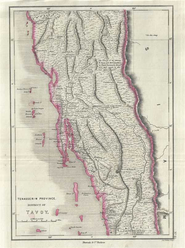
Tenasserim Province, District of Tavoy.
sold
- Digital Map Information
- Suitable for large format printing
- DPI: 300
- File Size: 4.46 MB
- File Type: ZIP / TIFF
- ICC color profile embedded
- Delivered instantly via download link
This is a lovely example of the 1854 Pharoah and Company map of the District of Tavoy or Dawei in Burma (Myanmar). Corresponding to part of the modern day northern Tanintharyi Region, the map covers the region in beautiful detail, noting important towns, ... (more details)
Uncommon map of the southernmost part of Burma or Myanmar under British control.
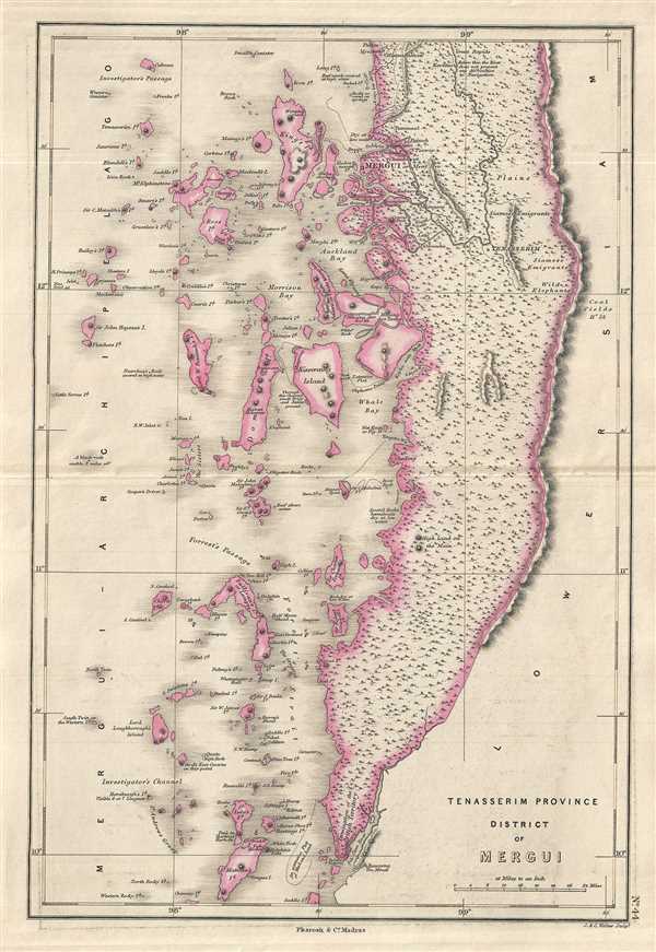
Tenasserim Province, District of Mergui.
sold
- Digital Map Information
- Suitable for large format printing
- DPI: 300
- File Size: 4.48 MB
- File Type: ZIP / TIFF
- ICC color profile embedded
- Delivered instantly via download link
This is a lovely example of the 1854 Pharoah and Company map of the District of Mergui in Burma (Myanmar). Corresponding to part of the modern day southern Tanintharyi Region, the map covers the region in beautiful detail, noting important towns, rivers, ... (more details)
The region of Amherst in Myanmar (Burma) during British rule.
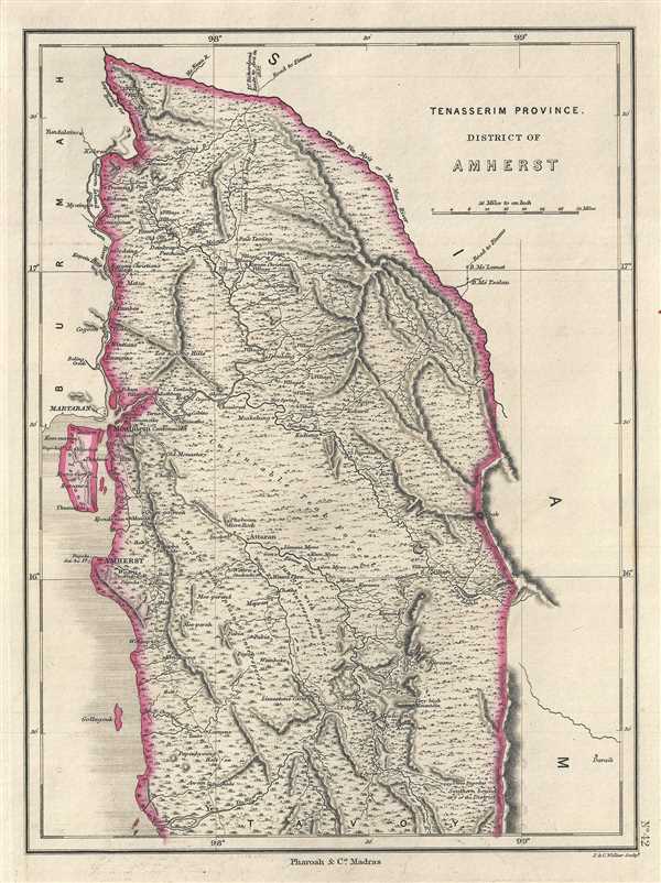
Tenasserim Province, District of Amherst.
sold
- Digital Map Information
- Suitable for large format printing
- DPI: 300
- File Size: 4.11 MB
- File Type: ZIP / TIFF
- ICC color profile embedded
- Delivered instantly via download link
This is a lovely example of the 1854 Pharoah and Company map of the District of Amherst in Burma (Myanmar). Corresponding to part of the modern day states of Mon and Kayin, the map covers the region in beautiful detail, noting important towns, rivers, ... (more details)
Early map of Malacca under the British East India Company.

British Territory of Malacca.
sold
- Digital Map Information
- Suitable for large format printing
- DPI: 300
- File Size: 3.34 MB
- File Type: ZIP / TIFF
- ICC color profile embedded
- Delivered instantly via download link
This is an uncommon 1854 map of the British Territory of Malacca, Malaysia issued by Pharoah and Company. Corresponding to the modern day state of Malacca, the map covers the territory in its entirety including Pulau Besar or the Water Islands. Notes ... (more details)
19th century map of Rameswaram Island, important hindu pilgrmiage destination and the starting point of the mythical Rama's Bridge.
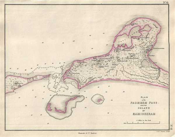
Plan of the Paumbem Pass and the Island of Ramisseram.
sold
- Digital Map Information
- Suitable for large format printing
- DPI: 300
- File Size: 2.23 MB
- File Type: ZIP / TIFF
- ICC color profile embedded
- Delivered instantly via download link
This is a beautiful 1854 Pharoah and Company map or plan of the Pamban Pass and Rameswaram Island on the south east coast of the India. Rameswaram Island is part of the Ranganathapuram district of in the south Indian state of Tamil Nadu located ... (more details)
19th century map of the princely state of Hyderabad during British rule.
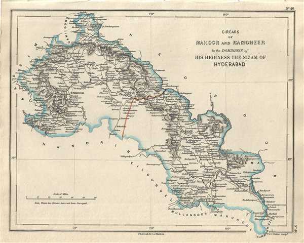
Circars of Mahoor and Ramgheer in the Dominions of His Highness the Nizam of Hyderabad.
$250.00
Acquire
- Digital Map Information
- Suitable for large format printing
- DPI: 300
- File Size: 2.58 MB
- File Type: ZIP / TIFF
- ICC color profile embedded
- Delivered instantly via download link
This is a lovely 1854 Pharoah and Company map of part of the Yavatmal and Adilabad districts in the Indian states of Maharashtra and Telangana. It covers the circars of Mahoor and Ramgheer ruled by the Nizam of Hyderabad under the protection of ... (more details)
Map of part of the Amravati division of Maharashtra, India under the rule of the Nizam of Hyderabad.
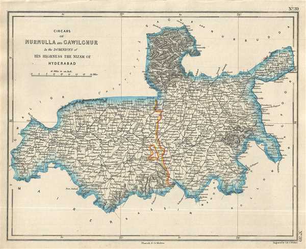
Circars of Nurnulla and Gawilghuk in the Dominions of His Highness the Nizam of Hyderabad.
$250.00
Acquire
- Digital Map Information
- Suitable for large format printing
- DPI: 300
- File Size: 2.71 MB
- File Type: ZIP / TIFF
- ICC color profile embedded
- Delivered instantly via download link
This is a good example of the 1854 Pharoah and Company map of part of the Amravati Division or the districts of Akola, Buldhana and Amravati in the Indian state of Maharashtra. It covers the circars or sarkars of Nurnulla and Gawilghur ruled by ... (more details)
19th century map of the divisions of the princely state of Hyderabad during British rule.
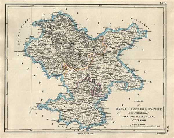
Circars of Maiker, Bassim & Patree in the Dominions of His Highness the Nizam of Hyderabad.
$250.00
Acquire
- Digital Map Information
- Suitable for large format printing
- DPI: 300
- File Size: 2.69 MB
- File Type: ZIP / TIFF
- ICC color profile embedded
- Delivered instantly via download link
This is an uncommon 1854 map of the Buldhana, Washim and Parbhani districts in the Indian state of Maharashtra. The map was issued by Pharoah and Company in 1854 and depicts the region when it was divided into the circars or sarkars of Maiker ... (more details)
Map of the Jalna and Aurangabad districts of Maharashtra, home to the ancient Ajanta and Ellora caves.
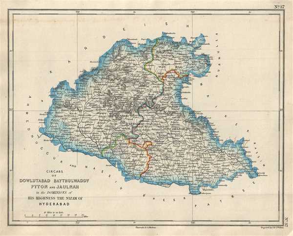
Circars of Dowlutabad Baythulwaddy Pyton and Jaulman in the Dominions of His Highness the Nizam of Hyderabad.
sold
- Digital Map Information
- Suitable for large format printing
- DPI: 300
- File Size: 2.63 MB
- File Type: ZIP / TIFF
- ICC color profile embedded
- Delivered instantly via download link
This is a nice map of the Jalna and Aurangabad districts in the Indian state of Maharashtra. The map was issued by Pharoah and Company in 1854 and depicts the region when it was divided into the circars or sarkars of Daulatabad, Baythulwaddy, ... (more details)
Map of the Bir District of Maharashtra under the Nizam of Hyderabad.
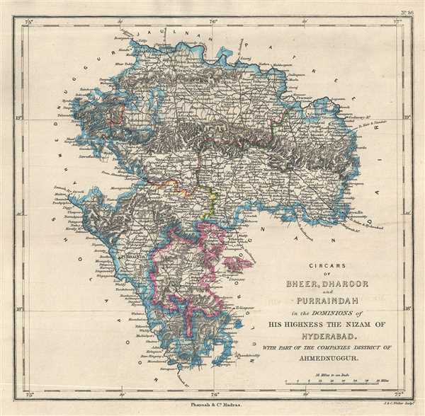
Circars of Bheer, Dharoor and Purraindah in the Dominions of His Highness the Nizam of Hyderabad.
sold
- Digital Map Information
- Suitable for large format printing
- DPI: 300
- File Size: 2.91 MB
- File Type: ZIP / TIFF
- ICC color profile embedded
- Delivered instantly via download link
This is an 1854 map of the Beed or Bir district of Maharashtra, India depicting the region under the dominion of the Nizam of Hyderabad. The map covers the district along with part of the district of Osmanabad and the Ahmednagar district ... (more details)
Map depicting the dominions of the Nizam of Hyderabad in parts of Maharashtra and Telangana, India.
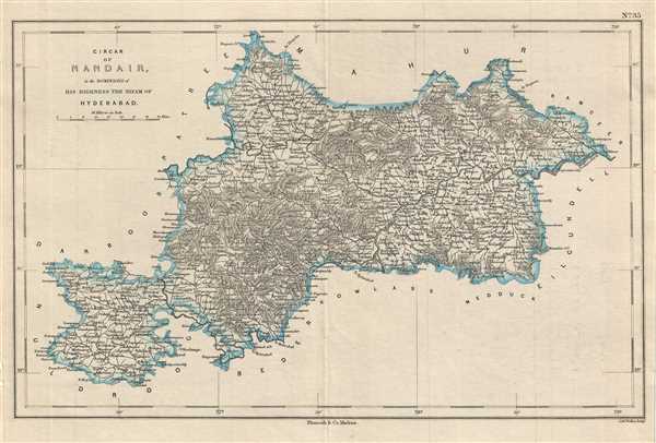
Circar of Nandair in the Dominions of His Highness the Nizam of Hyderabad.
$250.00
Acquire
- Digital Map Information
- Suitable for large format printing
- DPI: 300
- File Size: 3.72 MB
- File Type: ZIP / TIFF
- ICC color profile embedded
- Delivered instantly via download link
This is a lovely map depicting the circar of Nanded under the Nizam of Hyderabad corresponding to parts of the modern day districts of Nanded, Latur in Maharashtra and Nizamabad and Adilabad in Telangana. Issued by Pharoah and Company in ... (more details)
Map of the dominions of the Nizam of Hyderabad when India was under British control.
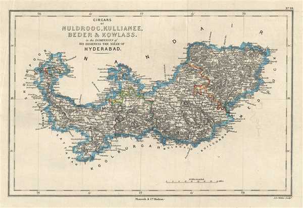
Circars of Nuldroog, Kullianee, Beder and Kowlass in the Dominions of His Highness the Nizam of Hyderabad.
$250.00
Acquire
- Digital Map Information
- Suitable for large format printing
- DPI: 300
- File Size: 3.09 MB
- File Type: ZIP / TIFF
- ICC color profile embedded
- Delivered instantly via download link
This is an attractive 1854 Pharoah and Company map of the Circars of Naldurg, Kalyani, Bidar and Kowlass under the Nizam of Hyderabad. The map extends from Dhoki Town in the modern day Osmanabad District of Maharashtra east past the ... (more details)
19th century map of districts under the Nizam of Hyderabad, now in Telangana state.
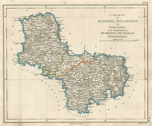
Circars of Eilgundel Mullangoor and Warungel in the Dominions of His Highness the Nizam of Hyderabad.
sold
- Digital Map Information
- Suitable for large format printing
- DPI: 300
- File Size: 2.92 MB
- File Type: ZIP / TIFF
- ICC color profile embedded
- Delivered instantly via download link
This is an 1854 Pharoah and Company map of the Circars of Eilgundel, Mullangoor and Warungul under the Nizam of Hyderabad corresponding roughly to the modern day districts of Warangal and Karimnagar in Telangana, India. It extends ... (more details)
A scarce proof state of the most iconic view of the Battle of Gettysburg ever published.
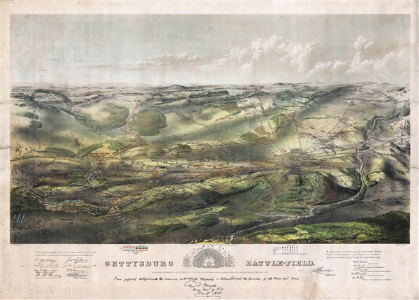
Gettysburg Battle-Field.
sold
- Digital Map Information
- Suitable for large format printing
- File Size: 37.34 MB
- File Type: ZIP / TIFF
- ICC color profile embedded
- Delivered instantly via download link
A remarkable and scarce 1863 proof state of the most iconic view of the American Civil War Battle of Gettysburg printed. This bird's eye view of the Battle of Gettysburg was issued by John Bachelder just months after the actual ... (more details)
One of the more attractive 19th century commercial atlas maps of New York City.

City of New York.
sold
- Digital Map Information
- Suitable for large format printing
- DPI: 300
- File Size: 7.66 MB
- File Type: ZIP / TIFF
- ICC color profile embedded
- Delivered instantly via download link
One of the more attractive atlas maps of New York to appear in the mid-19th century, this is a beautiful example of S. A. Mitchell Junior's 1854 map of southern Manhattan. The map depicts southern Manhattan from 37th street ... (more details)
Uncommon Bird's-Eye View of Chicago just before the Great Fire.

Birds's-Eye View of Chicago as it was Before the Great Fire - Drawn by Theodore R. Davis.
sold
- Digital Map Information
- Suitable for large format printing
- File Size: 12.16 MB
- File Type: ZIP / TIFF
- ICC color profile embedded
- Delivered instantly via download link
An attractive example of Theodore R. Davis' 1871 view of Chicago as it appeared before the Great Chicago fire of October 10, 1871. This view was drawn about 10 days after the fire for publication in October 21, 1871 issue ... (more details)
A scarce view of Venice naming some 56 important locations.
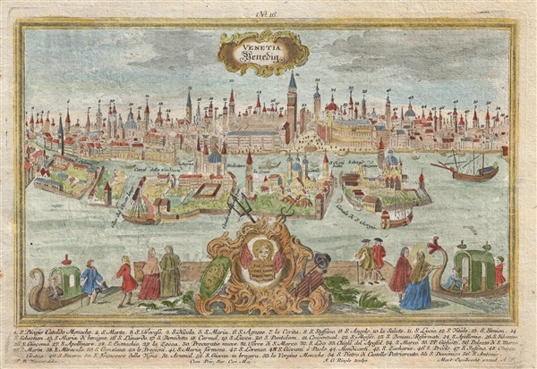
Venetia Venedig.
sold
- Digital Map Information
- Suitable for large format printing
- DPI: 300
- File Size: 3.97 MB
- File Type: ZIP / TIFF
- ICC color profile embedded
- Delivered instantly via download link
A scarce c. 1725-1750 panoramic view of Venice, Italy by Martin Engelbrecht. The view provides an impressive overview of Venice with some 56 individual buildings identified numerically and referenced via a list at the ... (more details)
One of the first scientifically survey's chart's of the Red Sea.
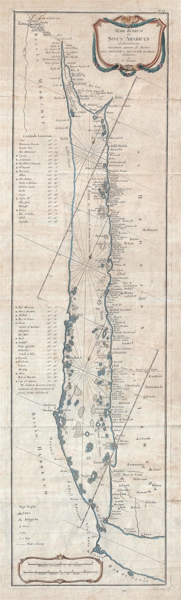
Mare Rubrum seu Sinus Arabicus ad observationes maximam partem ab Auctore annis MDCCLXII et MDCCLXIII institutas delineatus a C. Niebuhr.
sold
- Digital Map Information
- Suitable for large format printing
- DPI: 300
- File Size: 9.29 MB
- File Type: ZIP / TIFF
- ICC color profile embedded
- Delivered instantly via download link
An attractive example of Carsten Neibuhr's important 1774 map of the Red Sea. This long map covers the red sea from Suez to the Gulf of Aden. It offers some maritime detail as well as exceptional notation of the port ... (more details)