
A charming map of British New York from Manhattan to Lake Ontario.

[untitled].
sold
- Digital Map Information
- Suitable for large format printing
- File Size: 3.23 MB
- File Type: ZIP / TIFF
- ICC color profile embedded
- Delivered instantly via download link
A charming map of British New York from Manhattan to Lake Ontario, featuring the British Crest, a hunter shooting a deer, British soldiers in battle formation, towns along the Hudson River and the Mohawk River, all the way to Lake Ontario. It is unclear if the ... (more details)
Map showing the topography of Glacier National Park in British Columbia, Canada.
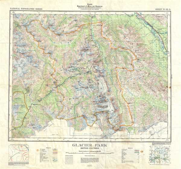
Glacier Park British Columbia.
sold
- Digital Map Information
- Suitable for large format printing
- Full resolution TIFF file
- ICC color profile embedded
- Delivered instantly via download link
This is a nice example of the 1946 topographical survey chart or map of the beautiful Glacier National Park in British Columbia, Canada. The map covers the entire park and its vicinity, famous for large active glaciers and Canada’s largest cave systems, and ... (more details)
Thomson map focusing on the southwestern parts of Europe.
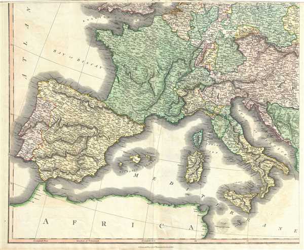
[Europe after the Congress of Vienna].
sold
- Digital Map Information
- Suitable for large format printing
- DPI: 300
- File Size: 19.66 MB
- File Type: ZIP / TIFF
- ICC color profile embedded
- Delivered instantly via download link
This is an attractive 1817 map of southwestern Europe by the Edinburgh cartographer John Thomson. It depicts the whole or part of the modern day nations of Spain, Portugal, France, Italy, Switzerland, Austria, Germany, Belgium and Luxembourg. Rivers, ... (more details)
Exceptional coastal nautical map detailing the waterways around Thomaston Maine.

St. George River and Muscle Ridge Channel Maine.
sold
- Digital Map Information
- Suitable for large format printing
- File Size: 19.57 MB
- File Type: ZIP / TIFF
- ICC color profile embedded
- Delivered instantly via download link
This is an appealing mid-19th century U.S. Coast Survey nautical chart or map of St. Georges River and Muscle Ridge Channel, Maine. The map covers the Maine coastline from Friendship Main eastward to Monroe Island, including Thomaston, South ... (more details)
The important first plans of New York City's Central Park by Viele - predates Olmstead and Vaux.

Map of the Lands Included in The Central Park, from a Topographical Survey, June 17th 1856. Plan for the Improvement of The Central Park, Adopted by the Commissioners, June 3rd 1856.
sold
- Digital Map Information
- Suitable for large format printing
- File Size: 30.04 MB
- File Type: ZIP / TIFF
- ICC color profile embedded
- Delivered instantly via download link
Two extremely rare 1856 pre-Design Competition plans of Central Park drawn by the park project's first engineer-in-Chief egbert Ludovicus Viele. Both plans extend from 59th street to 106th street, taking in the original grounds reserved for ... (more details)
Scarce 19th century cloth hankerchief map of Italy.

Carta Dimostrativa delle Circoscrizioni Militari del Regno D'Italia.
sold
- Digital Map Information
- Suitable for large format printing
- File Size: 18.05 MB
- File Type: ZIP / TIFF
- ICC color profile embedded
- Delivered instantly via download link
A scarce and uncommon 1884 lithograph map of the Kingdom of Italy printed on linen. The map covers all of Italy detailing the country's military situation. A table in the lower left quadrant breaks down Italian military might by region. ... (more details)
Beautiful full color view illustrating Trolley Routes throughout New England.

Trolley Wayfinder Birds Eye View of Trolley Routes in New England.
sold
- Digital Map Information
- Suitable for large format printing
- File Size: 10.06 MB
- File Type: ZIP / TIFF
- ICC color profile embedded
- Delivered instantly via download link
This is a fascinating 1907 bird's-eye view style Trolley Wayfinder pocket map of New England prepared by George Walker and issued by the New England Street Railway Club. This is most likely GeorgeH Walker's most beautiful map and ... (more details)
Scarce pictorial map illustrating Argentine wool production.

LaHusen & Cia. Ltda. Buenos Aires ● Montevideo ● Punta Arenas / Represented by Sturenburg & Co. Inc. 232 Summer Street Boston, Mass ● Wool-Production Season 1953-54.
sold
An interesting and unusual 1954 pictorial map of Argentina and Uruguay intended to promote the wool production of the Lahusen Firm. Numerous vingettes throughout illustrates aspects of Argentine life. The Lahusen wool ... (more details)
One of the first maps to detail the 1788 British colonization of New South Wales, Australia.
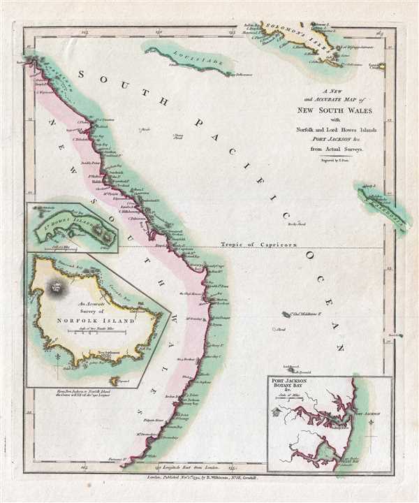
A New and Accurate Map of New South Wales with Norfolk and Lord Howes Islands Port Jackson and C. from Actual Surveys.
sold
- Digital Map Information
- Suitable for large format printing
- DPI: 300
- File Size: 1.41 MB
- File Type: ZIP / TIFF
- ICC color profile embedded
- Delivered instantly via download link
A finely detailed first edition 1794 map of the New South Wales, Australia, by Robert Wilkinson. One of the first maps to detail the British colonization of Australia, Wilkinson’s map covers eastern Australia from the ... (more details)
Very rare example of one of the earliest Satirical Maps.
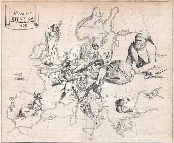
Kaart van Europa 1859.
sold
- Digital Map Information
- Suitable for large format printing
- Full resolution TIFF file
- ICC color profile embedded
- Delivered instantly via download link
This extremely rare Dutch satirical map by Emrik and Binger illustrates the European situation in 1859 during the Franco-Austrian War. This is one of the earliest known maps to use cartoon imagery to express political satire. Unlike later satirical maps in the spirit of Fred Rose, where the map itself takes the form people and caricatures, here the power figures themselves loom large, standing on the map as if on a great continental game board. (more details)
The earliest obtainable map or plan of New Orleans, Louisiana.
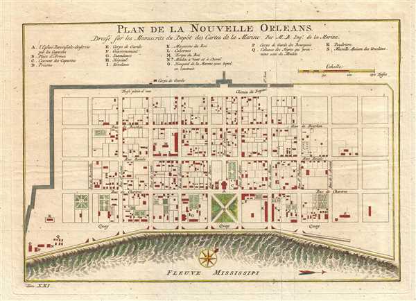
Plan de la Nouvelle Orleans Dresse sur les Manuscrits du Depot des Cartes de la Marine.
sold
- Digital Map Information
- Suitable for large format printing
- DPI: 300
- File Size: 3.41 MB
- File Type: ZIP / TIFF
- ICC color profile embedded
- Delivered instantly via download link
This scarce 1744 map by J. N. Bellin is the earliest obtainable map of New Orleans, Louisiana. Oriented to the northwest, Bellin's map covers the original settlement of New Orleans along the Mississippi River and inland ... (more details)
A rare original example of Rummel's panoramic bird's-eye view of Yale University.

Yale University.
sold
- Digital Map Information
- Suitable for large format printing
- File Size: 15.04 MB
- File Type: ZIP / TIFF
- ICC color profile embedded
- Delivered instantly via download link
A scarce 1906 photogravure bird's-eye view of Yale University drawn by Richard Rummell and published by F. D. Nichols of Boston. The view is centered on Osborne Hall (now demolished and replaced with Bingham Hall) ... (more details)
One of only two known examples outside of China, this rare map illustrates the foreign occupation of Beijing following the Boxer Rebellion.

Jīng Chéng Gè Guó Zàn Fēn Jiè Zhǐ Quán Tú / Full Map of Various Foreign Countries' Temporarily Divided Territory Boundaries within the City of Beijing / 京城各國暂分界址全图
sold
- Digital Map Information
- Suitable for large format printing
- File Size: 25.74 MB
- File Type: ZIP / TIFF
- ICC color profile embedded
- Delivered instantly via download link
A map of considerable importance and rarity, this is a 1900 Chinese issue woodcut map illustrating the yearlong occupation of Beijing (Peking) following the suppression of the Boxer Rebellion / Uprising. The title, ... (more details)
Uncommon large format working nautical chart of Cape Lookout and the intercoastal waterways.
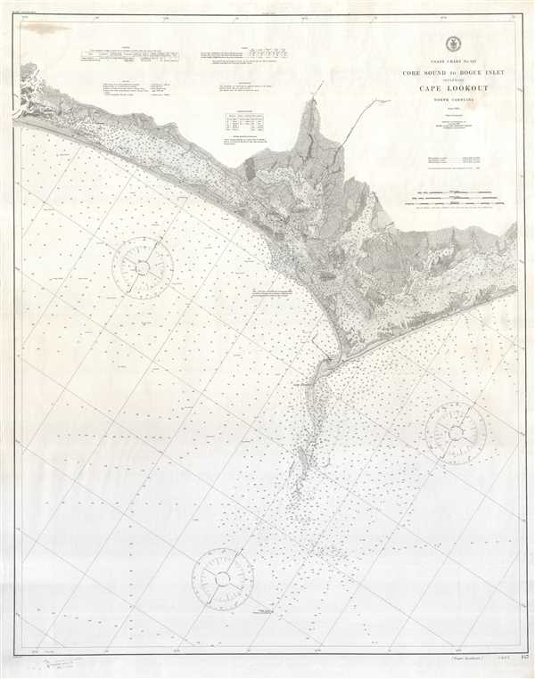
Coast Chart No. 147 Core Sound to Bogue Inlet Including Cape Lookout North Carolina.
sold
- Digital Map Information
- Suitable for large format printing
- Full resolution TIFF file
- ICC color profile embedded
- Delivered instantly via download link
An impressive large format 1910 U.S. Coast and Geodetic Survey nautical chart or maritime map of Cape Lookout, North Carolina. Centered on Cape Lookout, the chart covers from Core Sound to Bogue Inlet. It offers ... (more details)
Very rare Bird's-Eye View of Bangor Maine. Only 3 known examples.

Bird's Eye View of the City of Bangor Penobscot County, Maine, 1875.
sold
- Digital Map Information
- Suitable for large format printing
- Full resolution TIFF file
- ICC color profile embedded
- Delivered instantly via download link
An exceptional 1875 Bird's-Eye View Map of Bangor, Maine, by Augustus Koch. Koch presents Bangor as seen from the south, looking north, with the Franklin, Central , and State Street Bridges over the Kenduskaeg ... (more details)
Very rare Bird's-Eye View of Portland, Maine. Only 4 known examples.

Bird's Eye View of the City of Portland Maine, 1876.
sold
- Digital Map Information
- Suitable for large format printing
- Full resolution TIFF file
- ICC color profile embedded
- Delivered instantly via download link
An exceptional 1876 Bird's-Eye View Map of Portland, Maine, by Joseph Warner. One of only three known views by Warner, this is a dramatic aerial view of Portland as seen from the east looking west. The ... (more details)
A large nautical chart of Boston Bay.

Boston Bay and Approaches Massachusetts.
sold
- Digital Map Information
- Suitable for large format printing
- Full resolution TIFF file
- ICC color profile embedded
- Delivered instantly via download link
This is a large 1905 U.S. Coast and Geodetic Survey nautical chart or maritime map of Boston Bay, Massachusetts and its approaches. It covers the Massachusetts coastline from Marshfield north past ... (more details)
A scarce map of the Massachusetts Bay.

Map of Massachusetts Bay and Shore from Plymouth to Newburyport.
sold
- Digital Map Information
- Suitable for large format printing
- Full resolution TIFF file
- ICC color profile embedded
- Delivered instantly via download link
This is a beautiful and scarce 1898 map of the bay and shore of Massachusetts from Plymouth to Newburyport by George Walker. An uncommon map by Walker, it covers Boston and Vicinity, including the ... (more details)
Beautiful nautical chart of Beautfort Harbor in North Carolina.

D No.5 Preliminary Sketch of Beaufort Harbor North Carolina.
sold
- Digital Map Information
- Suitable for large format printing
- Full resolution TIFF file
- ICC color profile embedded
- Delivered instantly via download link
This is a beautiful example of the 1851 U. S. Coast Survey's nautical chart of Beaufort Harbor in North Carolina. It covers from the town of Beaufort south to the Shackleford Banks and includes ... (more details)
Beautiful veneer made from the wood of the Great Elm celebrates the legacy of the 'veritable and venerable' tree.

The Great Elm on Boston Common.
sold
This beautiful wood veneer by L. Prang and Co. depicts the Great Elm on the Boston Common and dates to 1876. The veneer, made out of the wood from the same Great Elm, includes an image of the ... (more details)