
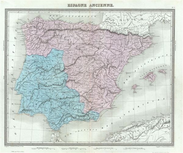
Espagne Ancienne.
sold
- Digital Map Information
- Suitable for large format printing
- Full resolution TIFF file
- ICC color profile embedded
- Delivered instantly via download link
This is a fine example of Conrad Ambroise Tardieu's 1874 map of Ancient Iberia or Spain and Portugal. The map covers all of Iberia under the Roman Republic from the Atlantic Ocean to the Mediterranean Sea. This includes Hispanic Citerior or Tarraconensis, ... (more details)
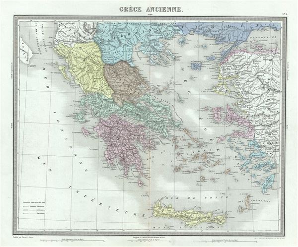
Grece Ancienne.
sold
- Digital Map Information
- Suitable for large format printing
- Full resolution TIFF file
- ICC color profile embedded
- Delivered instantly via download link
This is a fine 1874 map of Ancient Greece by Ambroise Tardieu. This map focuses on Greece under the Roman Empire, covering from the Ionian Sea to Aegean Sea and from Macedonia to the Mediterranean Sea. Details mountains, rivers, cities, roadways, and ... (more details)

Italie Ancienne.
sold
- Digital Map Information
- Suitable for large format printing
- Full resolution TIFF file
- ICC color profile embedded
- Delivered instantly via download link
An uncommon and attractive 1874 map of Italy during ancient Roman times. The map coves from Gaule Transpine to Sicily. Also includes the islands of Corsica and Sardinia. Throughout, the map identifies various cities, towns, rivers and assortment of ... (more details)
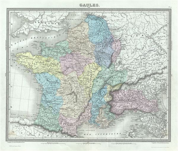
Gaules.
sold
- Digital Map Information
- Suitable for large format printing
- Full resolution TIFF file
- ICC color profile embedded
- Delivered instantly via download link
This is a beautiful 1874 map of Gaul or France in ancient Roman times issued by Ambroise Tardieu. It covers from the English Channel south as far as the Pyrenees Mountains and Hispania. It includes the modern day nations of France, Luxembourg, ... (more details)
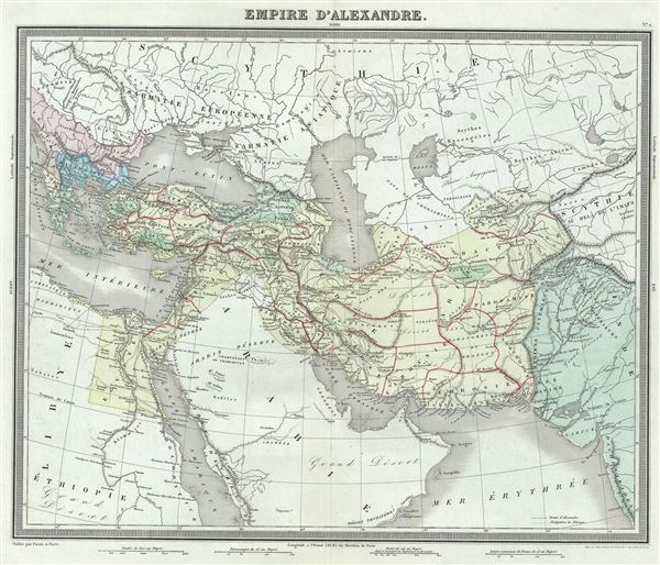
Empire d'Alexandre.
sold
- Digital Map Information
- Suitable for large format printing
- Full resolution TIFF file
- ICC color profile embedded
- Delivered instantly via download link
This is a beautiful 1874 map of the Empire of Alexander the Great by Ambroise Tardieu. It covers from Alexander's homeland in Macedonia eastwards past Asia Minor and Persia as far as India and south to include Egypt. Both the Caspian Sea and the ... (more details)
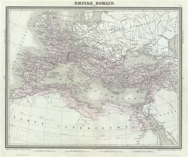
Empire Romain.
sold
- Digital Map Information
- Suitable for large format printing
- Full resolution TIFF file
- ICC color profile embedded
- Delivered instantly via download link
This is a beautiful and uncommon 1874 map of the Roman Empire by Ambroise Tardieu. The map shows the extent of the Roman Empire at its height, and covers most of Europe, the Middle East, Persia and parts of North Africa including Britain, ... (more details)
The oldest known map of Berlin.
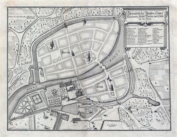
Grundriss der Beyden Churf: Residentz Statte Berlin und Colln an der Spree.
sold
- Digital Map Information
- Suitable for large format printing
- Full resolution TIFF file
- ICC color profile embedded
- Delivered instantly via download link
Drawn in 1652 by Johann Gregor Memhardt, and thus known as the Mamhardt Plan, this is the earliest known map of Berlin. Menhardt prepared this plan while employed by Frederick William, the Great Elector, to restore and rebuild the royal ... (more details)
An enigmatic map and the first specific map of Northern Canada and the Northwest Passage.
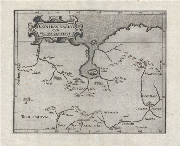
Conibas Regio Cum Vicins Gentibus.
sold
- Digital Map Information
- Suitable for large format printing
- DPI: 300
- File Size: 4.42 MB
- File Type: ZIP / TIFF
- ICC color profile embedded
- Delivered instantly via download link
An intriguing and enigmatic production, this is Cornelis van Wytfliet's uncommon 1597 map of northern central Canada, indeed it is the first specific map to detail this entirely unknown region. The scope of the map, though hard to ... (more details)
An English buccaneer's map of the Philippines.
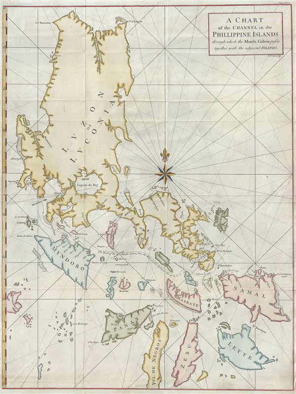
A Chart of the Channel in the Phillippine Islands through which the Manila Galeon passes together with the adjacent Islands.
sold
- Digital Map Information
- Suitable for large format printing
- DPI: 300
- File Size: 18.83 MB
- File Type: ZIP / TIFF
- ICC color profile embedded
- Delivered instantly via download link
Most likely the British buccaneer George Anson's most important published map, this is his important 1748 nautical chart of the Philippine islands (Philippines). The map covers the northern Philippine Islands from Cebu to the ... (more details)
French map issued in the second year of the French and Indian War.
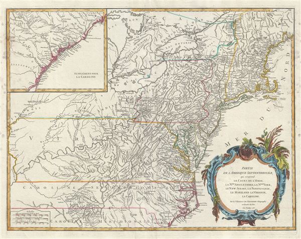
Partie de l'Amerique Septentrionale, qui comprend le Cours de l'Ohio, la Nlle. Angleterre, la Nlle. York, le New Jersey, la Pensylvanie, le Maryland, la Virginie, la Caroline.
sold
- Digital Map Information
- Suitable for large format printing
- DPI: 300
- File Size: 17.72 MB
- File Type: ZIP / TIFF
- ICC color profile embedded
- Delivered instantly via download link
An uncommon first edition first state example of Robert de Vaugondy's 1755 map of the Ohio River Valley and eastern seaboard from Maine to Carolina. The map coves from Lake Huron to Brunswick North Carolina and from the ... (more details)
The first state of Vaugondy's important map of Virginia showing the lands of Lord Fairfax.

Carte de la Virginie et du Maryland.
sold
- Digital Map Information
- Suitable for large format printing
- Full resolution TIFF file
- ICC color profile embedded
- Delivered instantly via download link
This is a fine example of Robert de Vaugondy's 1755 map of the Virginian, Delaware, and Maryland, including the Chesapeake Bay. The map extends from the Allegany Mountains eastward to the Chesapeake Bay, Delaware Bay, ... (more details)
Map of the West Indies from the era of Caribbean privateering.

Partie de la Mer du Nord, ou se trouvent les Grandes et Petites Isles Antilles, et les Isles Lucayes.
sold
- Digital Map Information
- Suitable for large format printing
- DPI: 300
- File Size: 15.92 MB
- File Type: ZIP / TIFF
- ICC color profile embedded
- Delivered instantly via download link
This is a beautiful first edition first state 1750 map of the West by Robert de Vaugondy. It covers the Caribbean from southern Florida south to Trinidad and Tobago. Includes Cuba, the Bahamas, Puerto Rico, Jamaica, ... (more details)
Early map of the East Indies identifying Singapore Strait.

Archipel des Indes Orientales, qui comprend les Isles de la Sonde, Moluques et Philippines, tirees des Cartes du Neptune Oriental.
sold
- Digital Map Information
- Suitable for large format printing
- DPI: 300
- File Size: 15.93 MB
- File Type: ZIP / TIFF
- ICC color profile embedded
- Delivered instantly via download link
This is a beautiful 1750 map of the East Indies and Southeast Asia by Robert de Vaugondy. It covers from Vietnam and the Gulf of Siam eastward to include Malaysia, Sumatra, Indonesia, Philippines and part of New ... (more details)
Remarkable Vaugondy map of North America showing speculative Chinese colony of Fusang and De Fonte's mythical voyages.
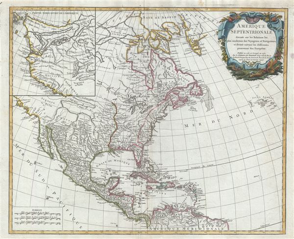
Amerique Septentrionale dressee sur les Relations les puls modernes des Voyageurs et Naviageurs, et divisee suivant les differentes possessions des Europeens.
sold
- Digital Map Information
- Suitable for large format printing
- Full resolution TIFF file
- ICC color profile embedded
- Delivered instantly via download link
An attractive example of Robert De Vaugondy's 1775 map of North America. The map covers from the high arctic and Baffin Bay south to the northern coast of South America. In includes all of modern day Canada, ... (more details)
Remarkably detailed map of Eastern Long Island including Shelter Island, Montauk, and the Hamptons Resort towns.

[Shelter Island, Easthampton, Bridgehampton, Sag Harbor, Greenport, Montauk]
sold
- Digital Map Information
- Suitable for large format printing
- File Size: 19.76 MB
- File Type: ZIP / TIFF
- ICC color profile embedded
- Delivered instantly via download link
The eastern section of a four part 1896 map series by E. Belcher Hyde detailing eastern Long Island from Southampton to Montauk and from Cutchogue to Plum Island, including Shelter Island and Sag Harbor. The ... (more details)
The earliest specific map of Martha's Vineyard.
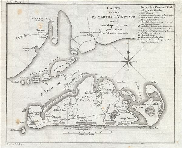
Carte de L'Ile de Martha's Vineyard avec ses dependances, pour les Lettres d'un Culuvateur Ameriquain.
sold
- Digital Map Information
- Suitable for large format printing
- DPI: 300
- File Size: 3.33 MB
- File Type: ZIP / TIFF
- ICC color profile embedded
- Delivered instantly via download link
This attractive map by P. F. Tardieu is the earliest obtainable separate map of Martha's Vineyard. It covers Martha's Vineyard in full as well as parts of the adjacent Elizabeth Islands. The map extends ... (more details)
The earliest map to use the term Great Lakes. Includes four fictional islands in Lake Superior later used to draw the post-Revolutionary War US-Canada border.
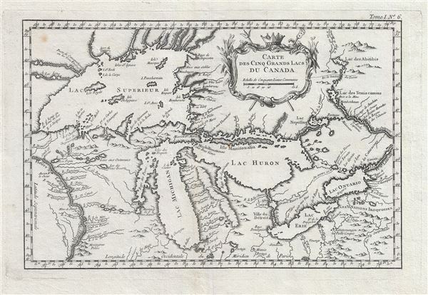
Carte des Cinq Grands Lacs du Canada.
sold
- Digital Map Information
- Suitable for large format printing
- DPI: 300
- File Size: 4.96 MB
- File Type: ZIP / TIFF
- ICC color profile embedded
- Delivered instantly via download link
An unusual 1764 variant edition Jacques-Nicholas Bellin influential map of the Great Lakes. This is the earliest known map to use the term 'Great Lakes'. Cartographically, this map follows Bellin's 1744 ... (more details)
Early and unusual map detailing Central Park, Riverside Park, and the Upper West Side to 154th St.

Map Showing the progress made by the Commissioners of the Central Park in laying out Streets, Roads, Public Squares and Places and new Pier and Bulkhead Lines within the district shown thereon.
sold
- Digital Map Information
- Suitable for large format printing
- File Size: 20.58 MB
- File Type: ZIP / TIFF
- ICC color profile embedded
- Delivered instantly via download link
An altogether extraordinary 1868 map of New York City's Central Park and the Upper West Side prepared and printed for inclusion in the Thirteenth Annual Report of the Board of Commissioners of the ... (more details)
From an ephemeral period after Cook's voyage but before the official maps and accounts were released.
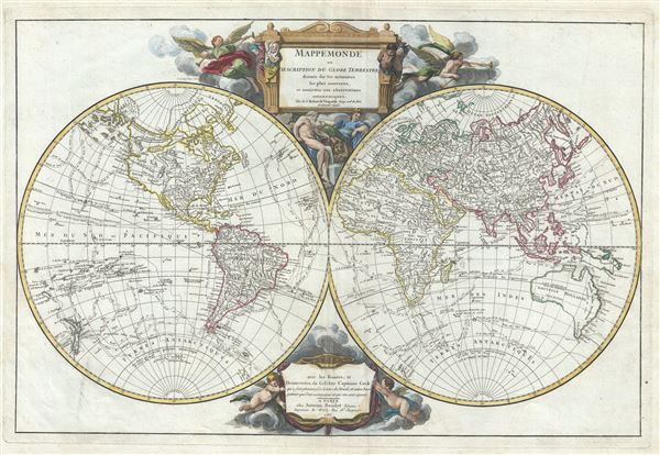
Mappemonde ou Description du Globe Terrestre; dressee sur les memoires les plus nouveaux, et assujettie aux observations astronomiques.
sold
- Digital Map Information
- Suitable for large format printing
- Full resolution TIFF file
- ICC color profile embedded
- Delivered instantly via download link
This is a remarkable 1783 positivist map of the world by Robert de Vaugondy and Antoine Boudet. The map presents the post-Cook world in two hemispheres surmounted by an elaborate engraved title ... (more details)

Carte des Grandes Routes d'Angleterre, d'Ecosse, et d'Irlande.
sold
- Digital Map Information
- Suitable for large format printing
- Full resolution TIFF file
- ICC color profile embedded
- Delivered instantly via download link
This is a beautiful 1757 map of the British Isles by Robert de Vaugondy. Vaugondy's map covers all of England, Wales, Scotland and Ireland and notes several important roadways throughout. ... (more details)