
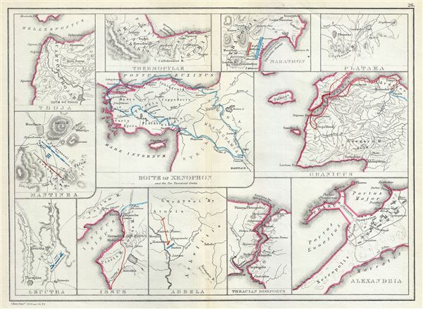
Troja. Thermopylae. Marathon. Plataea. Mantinea. Leuctra. Route of Xenophon and the Ten Thousand Greeks. Granicus. Issus. Arbela. Thracian Bosporus. Alexandria.
sold
- Digital Map Information
- Suitable for large format printing
- File Size: 3.64 MB
- File Type: ZIP / TIFF
- ICC color profile embedded
- Delivered instantly via download link
This is a fascinating 1867 map by William Hughes featuring topographical maps of ancient cities and battle sites. The map essentially contains twelve maps on a single sheet, each focusing on a different city or town, where important ancient battles took place. ... (more details)
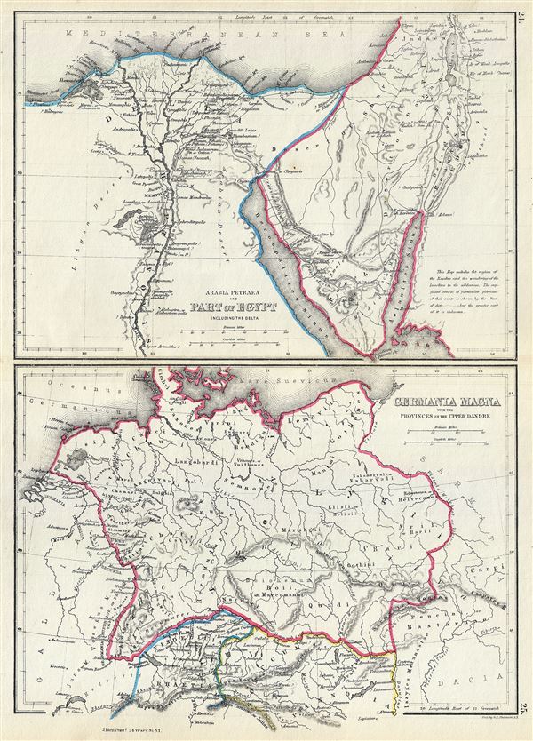
Arabia Petraea and Part of Egypt including the Delta. Germania Magna with the Provinces on the Upper Danube.
sold
- Digital Map Information
- Suitable for large format printing
- File Size: 3.63 MB
- File Type: ZIP / TIFF
- ICC color profile embedded
- Delivered instantly via download link
This is an unusual 1867 map by William Hughes featuring Egypt and Germany in antiquity. Essentially two maps on a single sheet, the top map focuses on Egypt, including the Sinai Peninsula. This map, centered on the Nile Valley, identifies the sites of ancient ... (more details)
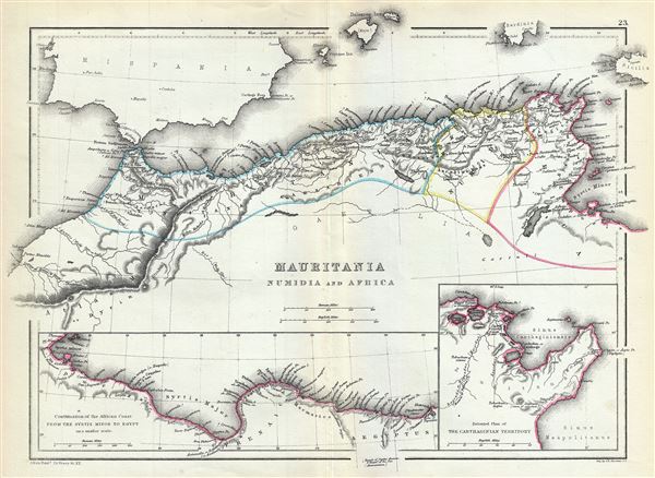
Mauritania Numidia and Africa.
sold
- Digital Map Information
- Suitable for large format printing
- File Size: 3.72 MB
- File Type: ZIP / TIFF
- ICC color profile embedded
- Delivered instantly via download link
This is a beautiful 1867 map of the Barbary Coast or northern Africa in antiquity by William Hughes. The map depicts the ancient empires of Mauritania, Carthage and Numidia or what is today the Barbary Coast. It covers from the Atlas Mountains on the western ... (more details)

Assyria and the Adjacent Countries.
sold
- Digital Map Information
- Suitable for large format printing
- File Size: 3.85 MB
- File Type: ZIP / TIFF
- ICC color profile embedded
- Delivered instantly via download link
An uncommon 1867 map of ancient Assyria and its neighboring countries by William Hughes. The map focuses on the lands between the Black Sea and the Caspian, commonly known as the Caucuses. It covers the modern day countries of Georgia, Armenia, Azerbaijan, ... (more details)
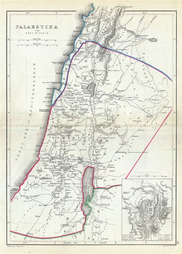
Palaestina with Part of Syria.
sold
- Digital Map Information
- Suitable for large format printing
- File Size: 3.57 MB
- File Type: ZIP / TIFF
- ICC color profile embedded
- Delivered instantly via download link
A scarce 1867 William Hughes Map of Palestine, Israel or the Holy Land in antiquity. Centered on the Jordan River, the map covers the regions between modern day Israel and Lebanon along with parts of Jordan and Syria. An inset in the lower right quadrant ... (more details)
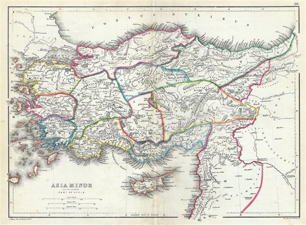
Asia Minor and the Northern Part of Syria.
sold
- Digital Map Information
- Suitable for large format printing
- File Size: 3.97 MB
- File Type: ZIP / TIFF
- ICC color profile embedded
- Delivered instantly via download link
This is a beautiful 1867 map of Turkey or Asia Minor in antiquity by William Hughes. It covers from the Aegean Sea to Mesopotamia and from the Black Sea (Pontus Euxinus) to Cyprus and Lebanon. The map shows the ancient Kingdoms of Asia Minor, many of ... (more details)
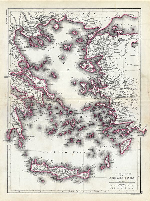
The Coasts and Islands of the Aegean Sea.
sold
- Digital Map Information
- Suitable for large format printing
- File Size: 4.6 MB
- File Type: ZIP / TIFF
- ICC color profile embedded
- Delivered instantly via download link
This is an unusual 1867 map of the islands of the Aegean Sea and the Greek Archipelago, by William Hughes. The map covers the Greek Isles from Thrace south as far as Crete and from the Gulf of Corinth east as far as Lake Ulubat in modern day Turkey. ... (more details)
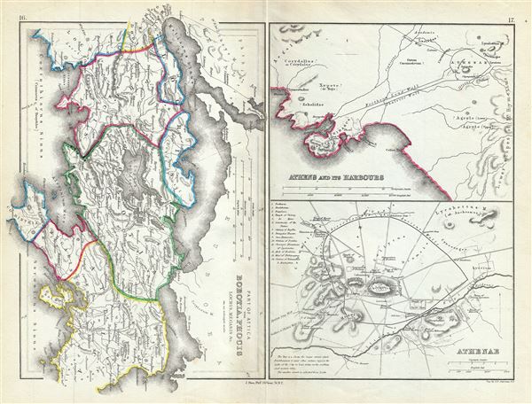
Part of Attica with Boeotia, Phocis Locris, Megaris etc.
sold
- Digital Map Information
- Suitable for large format printing
- File Size: 3.99 MB
- File Type: ZIP / TIFF
- ICC color profile embedded
- Delivered instantly via download link
This is a fascinating 1867 map of Athens along with parts of Attica, including Boeotia and Phocis in ancient Greece, by William Hughes. Essentially three maps on a single sheet, the first map covers Attica in ancient Greece from the Malian Gulf to ... (more details)
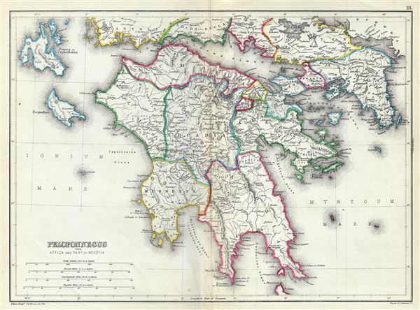
Peloponnesus with Attica and Part of Boeotia.
sold
- Digital Map Information
- Suitable for large format printing
- File Size: 4.41 MB
- File Type: ZIP / TIFF
- ICC color profile embedded
- Delivered instantly via download link
This is a scarce 1867 map of southern Greece during ancient times by William Hughes. The map covers the entire Peloponnese Peninsula including ancient Attica and parts of ancient Boeotia. The map notes several roads, towns and cities and uses ... (more details)
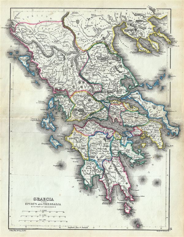
Graecia including Epirus and Thessalia with part of Macedonia.
sold
- Digital Map Information
- Suitable for large format printing
- File Size: 4.51 MB
- File Type: ZIP / TIFF
- ICC color profile embedded
- Delivered instantly via download link
This is a fine 1867 map of ancient Greece by William Hughes. The map focuses on Greece in antiquity, covering from Cythera to Thessaloniea in Macedonia. Ancient Epirus and Thessalia are also included. The map notes several towns and cities ... (more details)
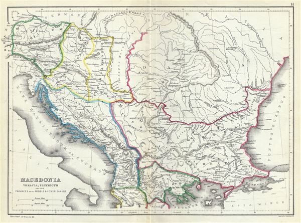
Macedonia Thracia, Illyricum and the Provinces on the Middle and Lower Danube.
sold
- Digital Map Information
- Suitable for large format printing
- File Size: 3.85 MB
- File Type: ZIP / TIFF
- ICC color profile embedded
- Delivered instantly via download link
This is an attractive 1867 map of Macedonia and the Balkans in antiquity by William Hughes. The map depicts Macedonia, Thrace, Illyricum and the provinces on the middle and lower Danube, covering parts of modern day Greece, Macedonia, ... (more details)
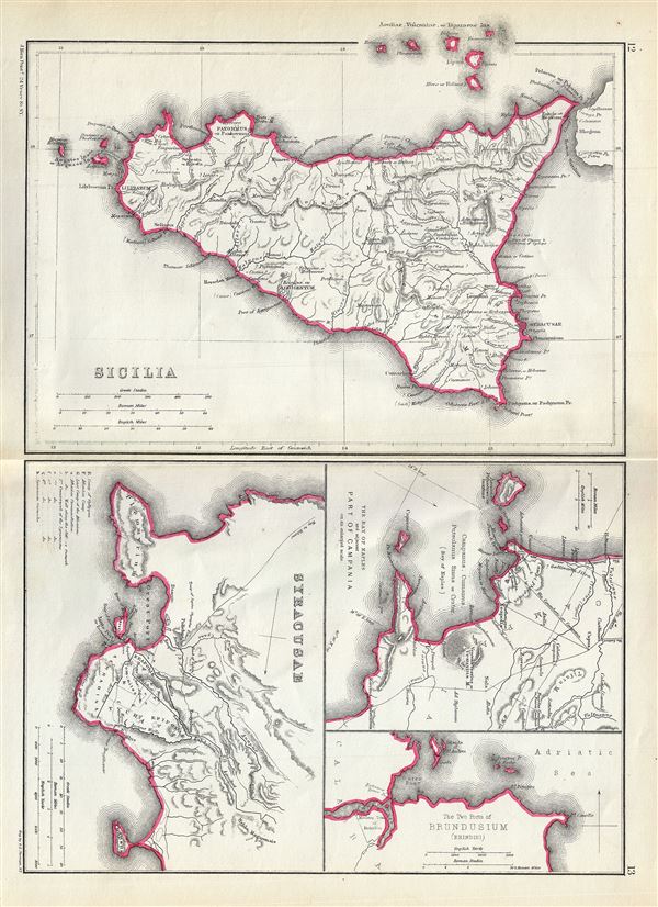
Sicilia. Syracusae. The Bay of Naples and adjacent Part of Campania. The Two Ports of Brundusium (Brindisi).
sold
- Digital Map Information
- Suitable for large format printing
- File Size: 3.68 MB
- File Type: ZIP / TIFF
- ICC color profile embedded
- Delivered instantly via download link
This is a beautiful 1867 map by William Hughes depicting Sicily, Syracuse and important ports in Italy during the Roman period. Essentially four maps on the single sheet, the largest map of Sicily depicts the island during ancient ... (more details)

Britannia.
sold
- Digital Map Information
- Suitable for large format printing
- File Size: 3.86 MB
- File Type: ZIP / TIFF
- ICC color profile embedded
- Delivered instantly via download link
This is a scarce 1867 map of England by William Hughes. The map depicts England under Roman rule and covers all of England (Province of Britannia) as well as parts of Scotland. It features contemporary and ancient place names ... (more details)
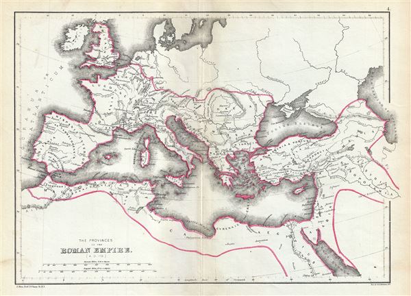
The Provinces of the Roman Empire (A.D. 119).
sold
- Digital Map Information
- Suitable for large format printing
- File Size: 3.5 MB
- File Type: ZIP / TIFF
- ICC color profile embedded
- Delivered instantly via download link
This is a beautiful 1867 map of the Roman Empire by William Hughes. The map shows the extent of the Roman Empire in AD 119, covering most of Europe, the Middle East, Asia Minor and parts of North Africa, including Britain, ... (more details)
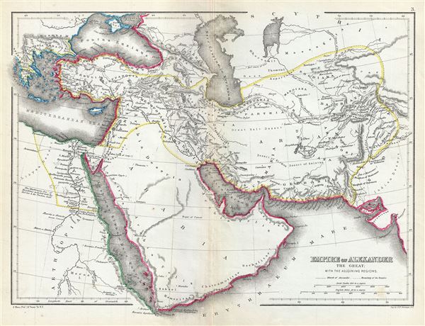
Empire of Alexander the Great with the adjoining regions.
sold
- Digital Map Information
- Suitable for large format printing
- File Size: 3.89 MB
- File Type: ZIP / TIFF
- ICC color profile embedded
- Delivered instantly via download link
This is a fine 1867 map of the Empire of Alexander the Great by William Hughes. The map depicts Alexander's conquests at their fullest extent covering from Alexander's homeland in Macedonia eastwards past Asia Minor and ... (more details)
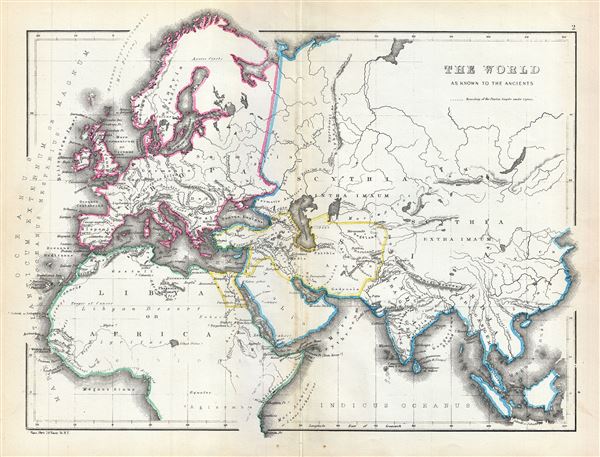
The World as known to the Ancients.
sold
- Digital Map Information
- Suitable for large format printing
- File Size: 3.79 MB
- File Type: ZIP / TIFF
- ICC color profile embedded
- Delivered instantly via download link
This is an interesting 1867 map of the ancient World by William Hughes. The map covers Europe, Asia and Africa during the time of the Ancient Roman Empire. It depicts the world of antiquity from the Atlantic Ocean to ... (more details)

Colton's West Indies.
sold
- Digital Map Information
- Suitable for large format printing
- File Size: 4.17 MB
- File Type: ZIP / TIFF
- ICC color profile embedded
- Delivered instantly via download link
An excellent 1855 example of Colton's map of the West Indies. Like most of Colton's North America maps, this map was derived from an earlier wall map of North America produced by Colton and D. Griffing Johnson. ... (more details)
Scarce view of the Battle of Bunker Hill.

The Battle at Bunker's Hill June 17th 1775.
sold
- Digital Map Information
- Suitable for large format printing
- File Size: 12.59 MB
- File Type: ZIP / TIFF
- ICC color profile embedded
- Delivered instantly via download link
An uncommon 1875 lithograph view of the Battle of Bunker Hill drawn by Henry Atwell Thomas. The view illustrates the landing of British troops at Morton's Point and the subsequent shelling and burning of the ... (more details)
Very rare map of Bermuda, the most sophisticated in its day..

The Bermuda or Somers' Islands
sold
- Digital Map Information
- Suitable for large format printing
- File Size: 8.17 MB
- File Type: ZIP / TIFF
- ICC color profile embedded
- Delivered instantly via download link
A scarce and important map of Bermuda issued in 1868 by Alexander Findlay. Based upon the model laid down by C. Lempriere and Robert Sayer in 1775, this map details the island of Bermuda and its surrounding ... (more details)
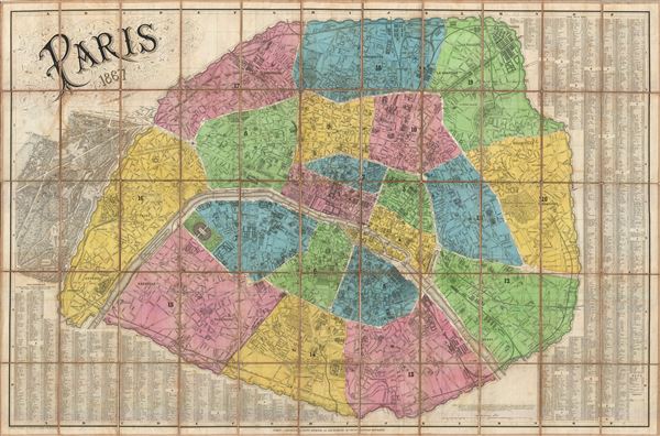
Paris.
sold
- Digital Map Information
- Suitable for large format printing
- File Size: 49.24 MB
- File Type: ZIP / TIFF
- ICC color profile embedded
- Delivered instantly via download link
A dramatic and highly decorative 1867 linen backed case or pocket map of Paris France by Edouard Dumas-Vorzet. Centered on the Seine, this map covers embastilled Paris as contained by the Thiers Wall as well ... (more details)