
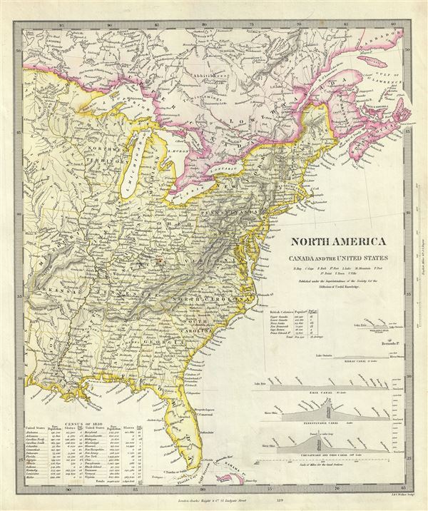
North America Canada and the United States.
sold
- Digital Map Information
- Suitable for large format printing
- DPI: 300
- File Size: 7.03 MB
- File Type: ZIP / TIFF
- ICC color profile embedded
- Delivered instantly via download link
This is a fascinating 1848 full color edition of the S.D.U.K. map of the United States including part of Canada. The map covers the United States east of the Mississippi as well as the Trans-Mississippi territories of Louisiana, Arkansas and Missouri. Several ... (more details)
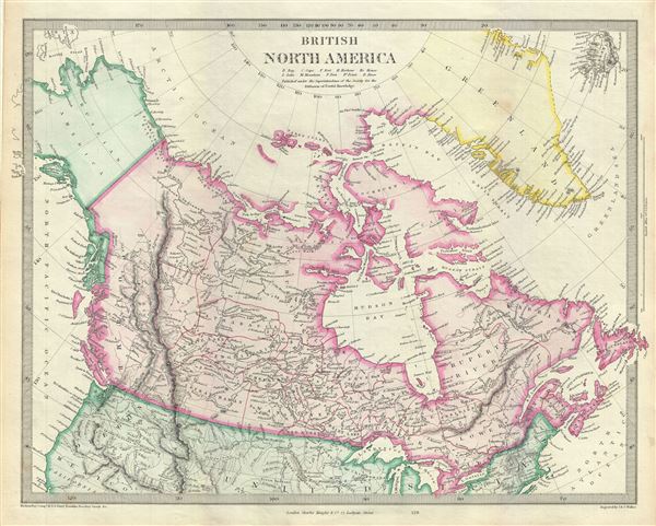
British North America.
sold
- Digital Map Information
- Suitable for large format printing
- DPI: 300
- File Size: 7.9 MB
- File Type: ZIP / TIFF
- ICC color profile embedded
- Delivered instantly via download link
This is an attractive full color 1848 edition of the S.D.U.K. map of British North America or Canada. It depicts the British and Russian holdings in North America. Centered on the Hudson bay, the map covers from modern day Alaska (Russian America) to ... (more details)
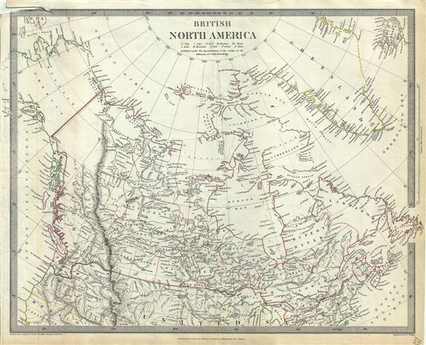
British North America.
sold
- Digital Map Information
- Suitable for large format printing
- DPI: 300
- File Size: 7.95 MB
- File Type: ZIP / TIFF
- ICC color profile embedded
- Delivered instantly via download link
An uncommon 1834 edition of the S.D.U.K. map of British North America or Canada. It depicts the British and Russian holdings in North America. Centered on the Hudson bay, the map covers from modern day Alaska (Russian America) to Greenland and from ... (more details)
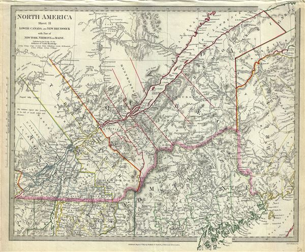
North America Sheet II Lower Canada and New Brunswick with Part of New York, Vermont and Maine.
sold
- Digital Map Information
- Suitable for large format printing
- DPI: 300
- File Size: 9.1 MB
- File Type: ZIP / TIFF
- ICC color profile embedded
- Delivered instantly via download link
A beautiful 1832 map of Lower Canada with parts of Maine and New Brunswick. Centered on the St. Lawrence River, it covers part of Quebec or Lower Canada from Vaudreuil to the Chaleur Bay and south as far as Penobscot Bay. Includes Montreal, Quebec ... (more details)
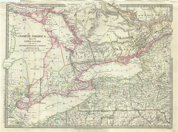
North America Sheet III Upper Canada with Parts of New York, Pennsylvania and Michigan.
sold
- Digital Map Information
- Suitable for large format printing
- DPI: 300
- File Size: 9.86 MB
- File Type: ZIP / TIFF
- ICC color profile embedded
- Delivered instantly via download link
This is an attractive 1832 map of Upper Canada or Ontario issued by the S.D.U.K. Centered on Lake Ontario, the map covers from Drummond Island in the United States to Vaudreuil. Three of the Five Great Lakes, Lake Huron, Lake Ontario and Lake Erie ... (more details)
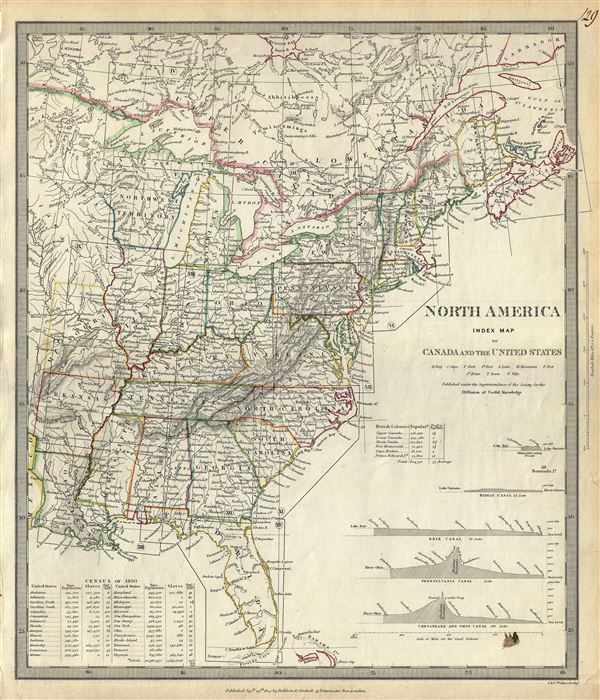
North America Index Map to Canada and the United States.
sold
- Digital Map Information
- Suitable for large format printing
- DPI: 300
- File Size: 8.13 MB
- File Type: ZIP / TIFF
- ICC color profile embedded
- Delivered instantly via download link
An uncommon 1834 map of the United States issued by the S.D.U.K. Parts of Canada are also included. The map covers the United States east of the Mississippi as well as the Trans-Mississippi territories of Louisiana, Arkansas and Missouri. Several ... (more details)
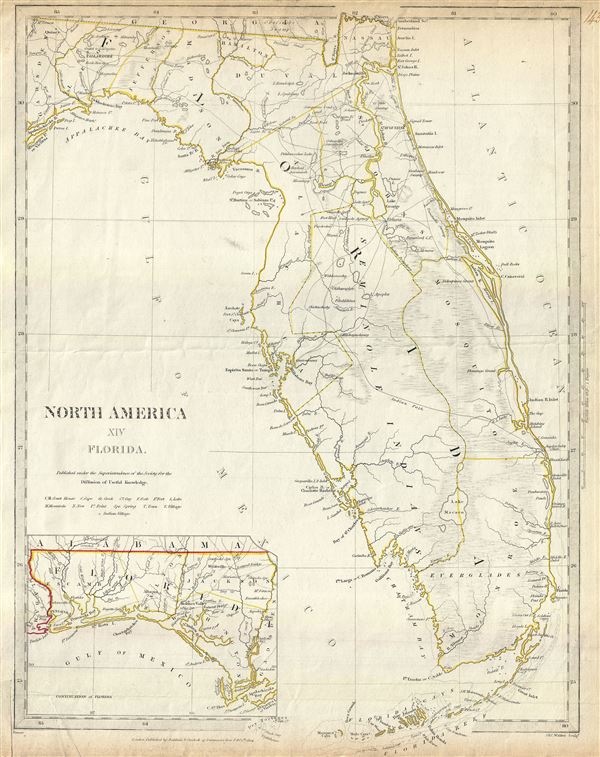
North America XIV Florida.
sold
- Digital Map Information
- Suitable for large format printing
- DPI: 300
- File Size: 6.2 MB
- File Type: ZIP / TIFF
- ICC color profile embedded
- Delivered instantly via download link
This is an uncommon 1834 map of Florida issued by the S.D.U.K. It covers the state of Florida in its entirety with its westernmost portion depicted in an inset in the bottom left quadrant. The map identifies several Indian villages, forts, lakes, ... (more details)

Map of that Part of the City of New York North of 155th Street Showing the progress made in laying out Streets, Roads, Public Squares and Places, by the Commissioners of the Central Park, under Chap. 565 of Laws of 1865 and of new Pier and Bulkhead lines under Chap. 697 of Laws of 1867.
sold
- Digital Map Information
- Suitable for large format printing
- File Size: 20.83 MB
- File Type: ZIP / TIFF
- ICC color profile embedded
- Delivered instantly via download link
A rare and unusual map of upper Manhattan, New York City, prepared and printed for inclusion in the Thirteenth Annual Report of the Board of Commissioners of the Central Park. It depicts the Island of Manhattan north of 155th street including the ... (more details)
Scarce map detailing the California Gold Region offering an early configuration of the American Southwest, particularly Texas and New Mexico.

Vereinigte Staaten von Nord-America: Californien, Texas und die Territorien New Mexico u. Utah.
sold
- Digital Map Information
- Suitable for large format printing
- DPI: 300
- File Size: 4.15 MB
- File Type: ZIP / TIFF
- ICC color profile embedded
- Delivered instantly via download link
An appealing, uncommon and underappreciated 1852 map of the American southwest by Jospeh Grassl and Joseph Meyer. The map covers the greater southwest from the 42nd parallel south to include all of modern day California, Utah, Nevada, Arizona, ... (more details)
The first map of norhtern Syria produced from actual surveys.
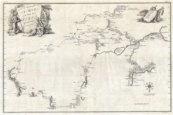
A Map of Part of Syria from an Actual Survey.
sold
- Digital Map Information
- Suitable for large format printing
- DPI: 300
- File Size: 22.03 MB
- File Type: ZIP / TIFF
- ICC color profile embedded
- Delivered instantly via download link
An extremely uncommon 1754 map of Syria by Alexander Drummond. Most likely the earliest scientifically surveyed map of the interior of northern Syria. Oriented to the south, the map is roughly centered on Aleppo, where Drummond was stationed ... (more details)

North America.
sold
- Digital Map Information
- Suitable for large format printing
- DPI: 300
- File Size: 7.69 MB
- File Type: ZIP / TIFF
- ICC color profile embedded
- Delivered instantly via download link
An uncommon 1848 full color edition of the S.D.U.K map of North America. The map covers all of the United States, Canada, Russian America (Alaska) and Mexico shortly following the Mexican American War (1846-1848) and the Treaty of Guadalupe ... (more details)
Scarce pocket map of London in its first edition.
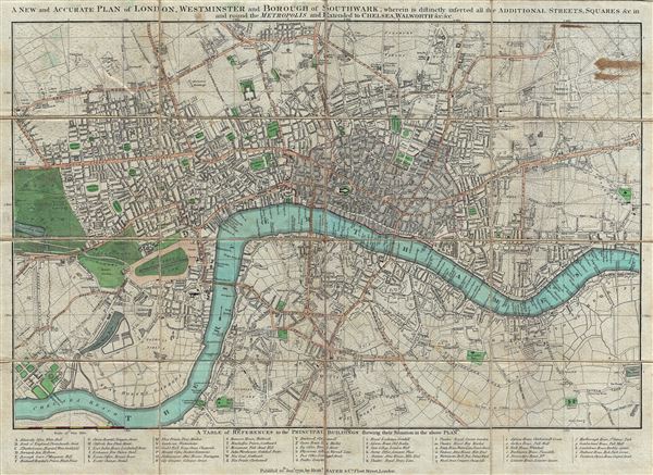
A New and Accurate Plan of London, Westminster and Borough of Southwark; Wherein is Distinctly Inserted All the Additional Streets, Squares and c in and Round the Metropolis and Extended to Chelsea, Walworth …
sold
- Digital Map Information
- Suitable for large format printing
- Full resolution TIFF file
- ICC color profile embedded
- Delivered instantly via download link
A scarce Robert Sayer plan or map of London, England presented here in its 1792 first edition. The map covers from Pentonville to Stepney Church and from Walworth to the Serpentine (Hyde Park). The City of London is highlighted in red ... (more details)
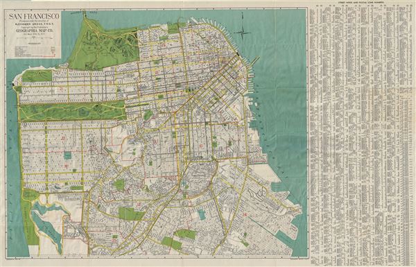
San Francisco.
sold
- Digital Map Information
- Suitable for large format printing
- File Size: 43.26 MB
- File Type: ZIP / TIFF
- ICC color profile embedded
- Delivered instantly via download link
This is a fine 1950s map or plan of the city of San Francisco, California, issued by Alexander Gross. The map covers the city from the Golden Gate Bridge south as far as city limits and the 'Laguna de la Merced. It notes all major ... (more details)

Map of Central Park.
sold
- Digital Map Information
- Suitable for large format printing
- File Size: 3.27 MB
- File Type: ZIP / TIFF
- ICC color profile embedded
- Delivered instantly via download link
This is a rare 1891 map of New York City's Central Park, by Gustav Kobbe. It depicts the park as a whole and includes pathways, lakes, individual buildings, etc. The streets and avenues surrounding the park are labeled as are the ... (more details)

Partie Occidentale de La Russie Polonaise ou se trouvent La Russie, Noire, La Haute, Volhynie, et La Haute. Podolie.
sold
- Digital Map Information
- Suitable for large format printing
- DPI: 300
- File Size: 2.9 MB
- File Type: ZIP / TIFF
- ICC color profile embedded
- Delivered instantly via download link
This is Robert de Vaugondy's beautiful 1749 map of Polish Russia issued in the Atlas Universal . It covers the eastern part of Poland and the western part of Ukraine from Sandomirie to Nazdrict. This map offers splendid detail ... (more details)
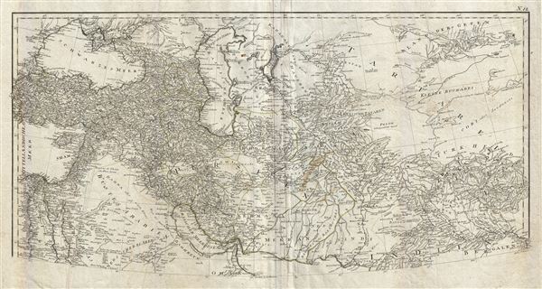
Erster Theil der Karte von Asien welche die Turkei, Arabien, Persien Indien diesseits des Ganges und einen Theil der Tatarei enthalt.
sold
- Digital Map Information
- Suitable for large format printing
- DPI: 300
- File Size: 25.39 MB
- File Type: ZIP / TIFF
- ICC color profile embedded
- Delivered instantly via download link
This is a highly detailed 1786 map of Persia and Arabia by the Austrian cartographer F. A. Scharembl. Representing the upper sheet of a larger map covering India, Persia and Arabia, this map, centered on Persia, covers from the ... (more details)
Exceptional large folding map of Central Park.

Map of the Central Park Showing the progress of the Work up to January 1st 1861.
sold
- Digital Map Information
- Suitable for large format printing
- File Size: 13.12 MB
- File Type: ZIP / TIFF
- ICC color profile embedded
- Delivered instantly via download link
An altogether extraordinary hand colored map of New York City's Central Park prepared and printed for inclusion in the Fourth Annual Report of the Board of Commissioners of the Central Park . This extremely rare variant on the ... (more details)
The final map in this series detailing Poland following its dismemberment in the 1785 Third Partition.
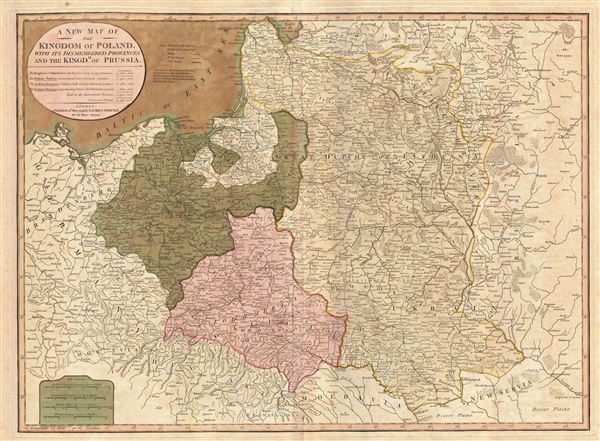
A New Map of the Kingdom of Poland, with its dismembered provinces and the Kingdm. of Prussia.
sold
- Digital Map Information
- Suitable for large format printing
- DPI: 300
- File Size: 24.53 MB
- File Type: ZIP / TIFF
- ICC color profile embedded
- Delivered instantly via download link
This important 1799 map by Laurie and Whittle depicts the Kingdom of Poland following the 1795 Third Partition. The map covers from Brandenburg to Russia and from the Gulf of Livonia to Moldova and Hungary, including all of ... (more details)

Persien nach seinem neuesten Zustande in das Ostliche und Westliche Reich eingeteilt.
sold
- Digital Map Information
- Suitable for large format printing
- DPI: 300
- File Size: 27.03 MB
- File Type: ZIP / TIFF
- ICC color profile embedded
- Delivered instantly via download link
A fascinating 1804 map of Persia by Christian Gottlieb Reichard. It covers from the Black Sea south as far as the Persian Gulf and east as far as Punjab in India, including the modern day nations of Iran, Iraq, Georgia, ... (more details)
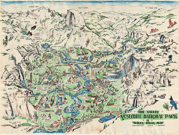
The Valley. Yosemite National Park. A Willy Nilly Map.
sold
- Digital Map Information
- Suitable for large format printing
- File Size: 12.07 MB
- File Type: ZIP / TIFF
- ICC color profile embedded
- Delivered instantly via download link
This is a whimsical 1946 pictorial map of the Yosemite National Park, California by C. Barnes. This beautifully illustrated 'Willy Nilly Map' covers the Yosemite National Park noting several landmarks and places of ... (more details)