
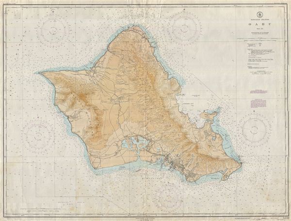
Hawaiian Islands Oahu.
sold
- Digital Map Information
- Suitable for large format printing
- File Size: 50.03 MB
- File Type: ZIP / TIFF
- ICC color profile embedded
- Delivered instantly via download link
This is an uncommon 1948 nautical chart or maritime map of Oahu - the most populous island in the Hawaiian Archipelago. Offers some inland detail as well including topography, rivers, roads, railroad lines, craters, peaks and cities. Includes countless depth ... (more details)

Hawaiian Islands Hawaii.
sold
- Digital Map Information
- Suitable for large format printing
- File Size: 3.32 MB
- File Type: ZIP / TIFF
- ICC color profile embedded
- Delivered instantly via download link
This is an uncommon and desirable 1948 nautical chart of the Hawaii - the largest island in the Hawaiian Archipelago. Offers some inland detail as well including topography, rivers, roads, trails and cities. Includes countless depth soundings in Fathoms. ... (more details)

Hawaiian Islands Hawaii to Oahu.
sold
- Digital Map Information
- Suitable for large format printing
- File Size: 2.71 MB
- File Type: ZIP / TIFF
- ICC color profile embedded
- Delivered instantly via download link
This is an uncommon 1948 nautical chart or maritime map of the Hawaiian Islands from Hawaii to Oahu, including the islands of Maui, Lanai, Molokai, and Oahu, with part of Hawaii. Offers some inland detail as well including topography, rivers, peaks, ... (more details)

Hawaiian Islands.
sold
- Digital Map Information
- Suitable for large format printing
- File Size: 2.83 MB
- File Type: ZIP / TIFF
- ICC color profile embedded
- Delivered instantly via download link
This is an uncommon 1948 nautical chart or maritime map of the Hawaiian Islands, including the full Hawaii Archipelago. Offers some inland detail as well including topography, craters, mountains, rivers, roads, trails and cities. Includes countless ... (more details)

Meiji Shrine.
sold
- Digital Map Information
- Suitable for large format printing
- File Size: 3.95 MB
- File Type: ZIP / TIFF
- ICC color profile embedded
- Delivered instantly via download link
A rare c. 1920 or Taisho 9, Japanese map of the Meiji Shrine. Meiji Shrine (Meiji Jingu), located in Shibuya, Tokyo, is the Shinto shrine that is dedicated to the deified spirits of emperor Meiji and his wife, empress Shoken. When emperor Meiji ... (more details)

Kobe City and Harbor.
sold
- Digital Map Information
- Suitable for large format printing
- File Size: 2.26 MB
- File Type: ZIP / TIFF
- ICC color profile embedded
- Delivered instantly via download link
This is a stunning panoramic view of Kobe city and Harbor, Japan. Prepared in an Art Deco style with silver border and original paper binder. Covers Kobe city, the fifth largest city in Japan and the capital of the Hyogo Prefecture. Founded ... (more details)
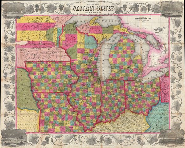
Map of the Western States.
sold
- Digital Map Information
- Suitable for large format printing
- DPI: 300
- File Size: 26.23 MB
- File Type: ZIP / TIFF
- ICC color profile embedded
- Delivered instantly via download link
An attractive example of Thayer's 1853 map of the Western States. Centered on Lake Michigan, Thayer's map covers the states of Ohio, Michigan, Indiana, Illinois, Wisconsin, Iowa, and Missouri, with portions of adjacent Minnesota, Kentucky, ... (more details)

Clason's Guide Map of Denver Colorado.
sold
- Digital Map Information
- Suitable for large format printing
- File Size: 16.94 MB
- File Type: ZIP / TIFF
- ICC color profile embedded
- Delivered instantly via download link
A beautiful example of George Clason's 1919 guidebook and map of Denver, Colorado. This map covers all of Denver from Berkley Lake to englewood and from Sloans Lake to Aurora. An inset in the lower right quadrant details the Denver ... (more details)
Revolutionary Paris just prior to the rise of the Jacobins and the Reign of Terror.

Nouveau Plan Routier de la Ville et Fauxbourgs de Paris.
sold
- Digital Map Information
- Suitable for large format printing
- DPI: 300
- File Size: 31.15 MB
- File Type: ZIP / TIFF
- ICC color profile embedded
- Delivered instantly via download link
A fine 1791 dissected pocket map of Paris issued by esnauts and Rapilly. Centered on the Seine, this map depicts Revolutionary Paris just following the 1789 storming of the Bastille. France at this time was in the early stages of ... (more details)

Kumgangsan.
sold
- Digital Map Information
- Suitable for large format printing
- File Size: 6.37 MB
- File Type: ZIP / TIFF
- ICC color profile embedded
- Delivered instantly via download link
An extremely attractive c. 1930 panoramic railroad map of Kumgangsan or Diamond Mountain, North Korea (Geumgangsan, Geumgang). Also known as Mount Kumgang, Diamond Mountain is an important tourist destination in North Korea. ... (more details)
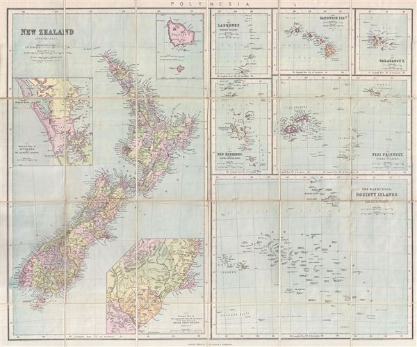
Philips Authentic Map of New Zealand Mounted on Cloth.
sold
- Digital Map Information
- Suitable for large format printing
- File Size: 3.46 MB
- File Type: ZIP / TIFF
- ICC color profile embedded
- Delivered instantly via download link
This is a beautiful example of George Philip's 1888 pocket map of New Zealand and the islands of Polynesia. This is essentially seven maps compiled onto a single sheet. The left map, covering half of the sheet, focuses on ... (more details)

Sketch F No. 2 Showing the progress of the Survey of Cedar Keys, Bahia Honda, Key Biscayne Key West & Dry Tortugas in Section No. VI 1849-51.
sold
- Digital Map Information
- Suitable for large format printing
- DPI: 300
- File Size: 4.12 MB
- File Type: ZIP / TIFF
- ICC color profile embedded
- Delivered instantly via download link
This is an 1851 triangulation chart of Biscayne Bay, Key West, Bahia Honda, the Cedar keys and the Dry Tortugas produced by the U.S. Coast Survey. essentially five maps compiled onto a single sheet. Upper left map focuses ... (more details)

No. 1 Sketch of the Public Surveys in Kansas & Nebraska.
sold
- Digital Map Information
- Suitable for large format printing
- File Size: 8.15 MB
- File Type: ZIP / TIFF
- ICC color profile embedded
- Delivered instantly via download link
This is an attractive example of the 1855 public survey map of Kansas and Nebraska prepared by J. Calhoun, Surveyor General of Kansas and Nebraska. This map covers the platted portions of eastern Nebraska and Kansas. ... (more details)

B Sketch of Public Surveys in New Mexico to Accompany Report of Surveyor General 1855.
sold
- Digital Map Information
- Suitable for large format printing
- File Size: 2.73 MB
- File Type: ZIP / TIFF
- ICC color profile embedded
- Delivered instantly via download link
This is an attractive example of the 1855 public survey map of New Mexico. Centered over Santa Fe, this map covers the area from William's Fishery to the borders of Texas and Mexico in the south, including modern day ... (more details)
Early survey map of Oregon.
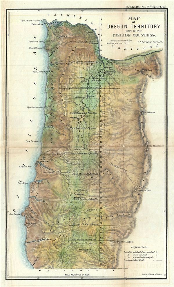
Map of Oregon Territory West of The Cascade Mountains.
sold
- Digital Map Information
- Suitable for large format printing
- File Size: 8.58 MB
- File Type: ZIP / TIFF
- ICC color profile embedded
- Delivered instantly via download link
This is a fine example of the 1855 public survey map of Oregon. Centered over eugene City, covers from the borders of Washington to California. Details the Oregon coastline in the west and the Cascade Mountains in ... (more details)

A Plat Exhibiting the State of the Surveys in the State of Florida with References.
sold
- Digital Map Information
- Suitable for large format printing
- File Size: 18.71 MB
- File Type: ZIP / TIFF
- ICC color profile embedded
- Delivered instantly via download link
An exceptional example of the 1855 Land Survey Map of Florida. This map represents the state of the Land Survey in Florida as of October 1855. Shows the state divided into several hundred numbered plats, some of ... (more details)
Map of a proposed but never built canal connecting Tampa Bay and Lake George.
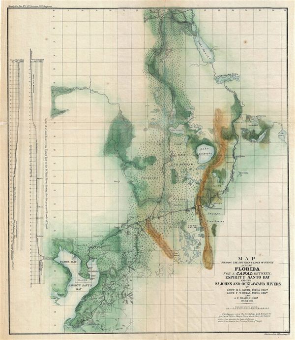
Map Showing the Different Lines of Survey Across Florida for a Canal Between; Espiritu Santo bay and the St. Johns and Ocklawaha Rivers.
sold
- Digital Map Information
- Suitable for large format printing
- File Size: 9.06 MB
- File Type: ZIP / TIFF
- ICC color profile embedded
- Delivered instantly via download link
This is an attractive example of the 1854 public survey map of Florida for the proposed canal across the espiritu Santo Bay and the St. Johns and Ocklawaha Rivers. This beautiful hand colored map covers Florida ... (more details)
Fascinating early map of India.
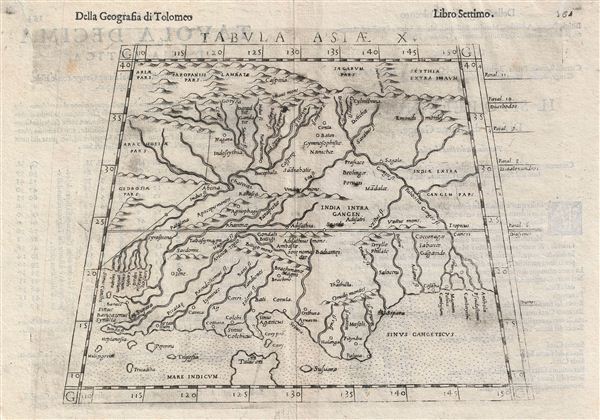
Tabula Asiae X.
sold
- Digital Map Information
- Suitable for large format printing
- DPI: 300
- File Size: 3.58 MB
- File Type: ZIP / TIFF
- ICC color profile embedded
- Delivered instantly via download link
This is an uncommon 1588 Ptolemaic map of India issued for Girolamo Ruscelli's Italian edition of the Geografia di Tolomeo . Cartographically Ruscelli based this map on interpretations of Claudius Ptolemy's ... (more details)
Fascinating 16th century map depicting modern day Afghanistan, Iran, and Pakistan.
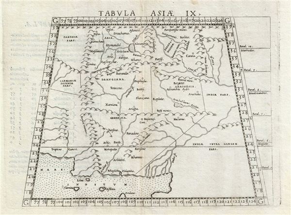
Tabula Asiae IX.
sold
- Digital Map Information
- Suitable for large format printing
- Full resolution TIFF file
- ICC color profile embedded
- Delivered instantly via download link
This is an uncommon 1588 Ptolemaic map of Persia, Afghanistan, and Pakistan issued for Girolamo Ruscelli's Italian edition of the Geografia di Tolomeo . Cartographically Ruscelli based this map on ... (more details)
Fascinating 16th century map depicting modern day Iran and Iraq.
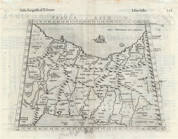
Tabula Asiae V.
sold
- Digital Map Information
- Suitable for large format printing
- DPI: 300
- File Size: 3.61 MB
- File Type: ZIP / TIFF
- ICC color profile embedded
- Delivered instantly via download link
This is an uncommon 1588 Ptolemaic map of Persia issued for Girolamo Ruscelli's Italian edition of the Geografia di Tolomeo . Cartographically Ruscelli based this map on interpretations of ... (more details)