
Hawkesworth, John (sold)
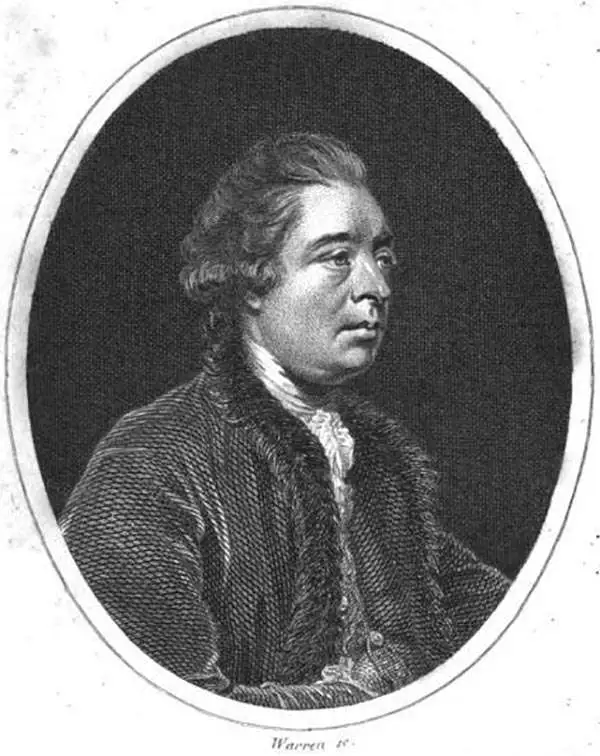
John Hawkesworth (c. 1715 - November 16, 1773) was an English born writer and editor born London. Hawkesworth, who is said to have been self educated, succeeded Samuel Johnson as the parliamentary debate compiler for "Gentleman's Magazine". He was a deeply religious and moral map who brilliant defense of morality earned him an LL. D degree from the Archbishop of Canterbury. Hawkesworth went on to publish a series of scholarly books and essays including a 12 volume edition of Jonathan Swift's work. In 1772 Hawkesworth was commissioned by the Admiralty to compile and edit James Cook's journals. The resultant work An Account of the Voyages undertaken ... for making discoveries in the Southern Hemisphere was one of the first ethnographic account of the South Seas and was widely published in England and abroad. Though highly influential, Hawkesworth's work received heavy criticism from scholars who claim that he liberally altered much of the text in the name of morality.
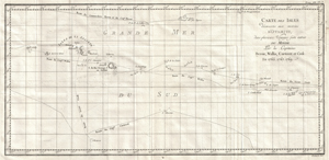
Carte Des Isles Decouvertes Aux Environs D'Otahiti, dans Plusieurs Voyages Faits Autour Du Monde Par Les Capitaines Byron, Wallis, Carteret & Cook. En 1765, 1767,1769.
sold
- Digital Map Information
- Suitable for large format printing
- DPI: 300
- File Size: 18.4 MB
- File Type: ZIP / TIFF
- ICC color profile embedded
- Delivered instantly via download link
This is a fine map shows the explorations of Captain Cook, Captain Byron, Captain Wallis and Captain Carteret in the vicinity of Tahiti and the Society Islands from 1765 to 1769. Extends from Is. Scilly [i.e. the Scilly Islands] in the west and to I. Whitsunday ... (more details)
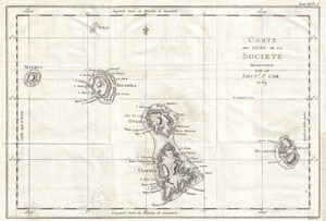
Carte des Isles de la Societe decouvertes parle Lieut. J. Cook. 1769.
sold
- Digital Map Information
- Suitable for large format printing
- DPI: 300
- File Size: 5.37 MB
- File Type: ZIP / TIFF
- ICC color profile embedded
- Delivered instantly via download link
This is a fine example of the first published map of the Society Islands, composed by James Cook on his first voyage. Consists of the islands of Maurua, Tubai, Bolabola, Otaha, Ulietéa and Huaheine. This group was identified by Cook in 1769, when he wrote in ... (more details)
The first official map of Cook's first voyage - the best map of the Australia, the South Pacific, and New Zealand of it time.
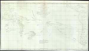
Chart of part of the South Sea, Shewing the Tracts and Discoveries made by His Majesty's Ships Dolphin, Commodore Byron, and Tamer, Captn. Mouat, 1765. Dolphin, Captn., Wallis, and Swallow, Captn. Carteret, 1767. And Endeavour, Lieutenant Cooke, 1769.
sold
- Digital Map Information
- Suitable for large format printing
- File Size: 18.3 MB
- File Type: ZIP / TIFF
- ICC color profile embedded
- Delivered instantly via download link
This is a rare 1773 map of the South Pacific issued to illustrates English voyages of exploration in this region between 1765 and 1769, including the voyages of John Byron (1723 - 1786), Samuel Wallis (1728 - 1795), Philip Carteret (1733 - 1796), and James Cook (1728 - 1779). At the time of publication this was the most accurate extant map of this region, unveiling a wealth of new information to curious Europeans. Coverage extends from Sumatra to South America, and from Baja California and Taiwan to Tierra del Fuego, including all of Australia, Polynesia, New Zealand, the Philippines, Melanesia, and eastern Indonesia. Tasmania or Van Diemen's Land is notably attached to the Australian mainland. Tracks drawn from ship's original logs detail with precision the routes taken by Commodore Byron and Captain Mouat (1765), Captain Carteret (1767), Captain Wallis (1767), and Lieutenant James Cook (1769). (more details)
One of the earliest detailed maps of New Zealand, following Cook's first voyage.
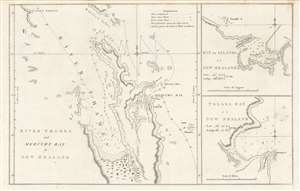
River Thames and Mercury Bay..., Bay of Islands..., Tolaga Bay...
sold
- Digital Map Information
- Suitable for large format printing
- DPI: 600
- File Size: 23.73 MB
- File Type: ZIP / TIFF
- ICC color profile embedded
- Delivered instantly via download link
This is an important map of the bays of northern New Zealand (Mercury, Tolaga, Bay of Islands, and the Firth of Thames) published by John Hawkesworth in his An account of the voyages undertaken, a 1773 book recounting recent British voyages to the Pacific, including the first voyage of Captain James Cook. The map is based on Cook's papers and sketches and constitutes the first detailed map of these bays. (more details)
French Edition of the First Mapping of the Society Islands
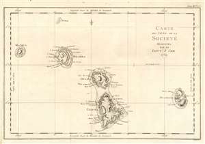
Carte des Isles de la Societé découvertes par le Lieutt. J. Cook 1769.
sold
- Digital Map Information
- Suitable for large format printing
- DPI: 600
- File Size: 10.65 MB
- File Type: ZIP / TIFF
- ICC color profile embedded
- Delivered instantly via download link
This is a 1774 map of the Society Islands - the French edition of the first map revealing the exploration of these islands by then-Lieutenant James Cook during his first Pacific voyage. Now part of French Polynesia, the map shows the islands of Maupiti (Maurua on the map), Tupai (Tubai), Bora Bora (Bolabola),Tahaa (Otaha), Raiatea (Ulieta) and Huaheine. Cook's visit was the Islands' first contact with Europeans; Cook discussed in his journal the naming of the 'Society Islands:
'So call'd by the Natives and it was not thought advisable to give them any other names but these three together with Huaheine, Tubai, and Maurua as they lay contiguous to one another I have named Society Isles .'Topography of each of the islands is shown pictorially, including reefs, mountains, and valleys. Depth soundings and anchorages are shown for Huaheine, Raiatea and Otaha. Engraved by Bernard for the 1774 French edition of John Hawkesworth's Account of the Voyages…, in which this was contained as Plate 1 in Volume III. (more details)
A Chart of Pitcairn Island as Carteret Found It
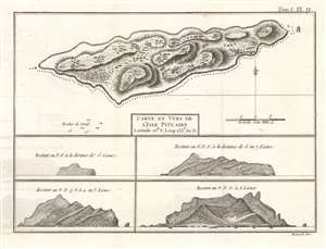
Carte et Vues de l'Isle Pitcairn.
sold
- Digital Map Information
- Suitable for large format printing
- DPI: 600
- File Size: 4.66 MB
- File Type: ZIP / TIFF
- ICC color profile embedded
- Delivered instantly via download link
This is a 1774 map of Pitcairn Island, encountered first by Europeans on Captain Carteret's circumnavigation of 1767. HMS Swallow having been separated from the other ship of the expedition and gripped with scurvy, the opportunity for resupply would have been tantalizing. It was not, however, to be:
We continued our course westward till the evening of Thursday the 2d of July when we discovered land to the northward of us. Upon approaching it the next day, it appeared like a great rock rising out of the sea: it was not more than five miles in circumference, and seemed to be uninhabited; it was, however, covered with trees, and we saw a small stream of fresh water running down one side of it. I would have landed upon it, but the surf, which at this season broke upon it with great violence, rendered it impossible.The island was first spotted by fifteen-year-old midshipman Robert Pitcairn, and so named after him. (The unfortunate middie would die at sea three years later.) As Carteret was unable to survey the island by foot, the interior topography must be construed as speculative, based on the analysis of the views of the island taken from sea. The breakers along the souther shore of the island and the rough coastline that so discouraged the explorer are discernible in the views. (more details)
Fascinating Chart Tracking Four Great Circumnavigators' Passage through the Society Islands
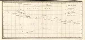
Carte Des Isles Decouvertes Aux Environs D'Otahiti, dans Plusieurs Voyages Faits Autour Du Monde Par Les Capitaines Byron, Wallis, Carteret et Cook. En 1765, 1767,1769.
sold
- Digital Map Information
- Suitable for large format printing
- DPI: 600
- File Size: 10.93 MB
- File Type: ZIP / TIFF
- ICC color profile embedded
- Delivered instantly via download link
This is a 1774 map showing the explorations of Captains Cook, Byron, Wallis and Carteret in the vicinity of Tahiti and the Society Islands from 1765 to 1769. The chart extends from the Scilly Islands in the west to Whitsunday Island in the east, and from Tepoto Island in the north to Oheiroa in the south. Each of the circumnavigators' tracks are shown as they tacked through the islands. Tahiti, Bora Bora, Otaha, Marma, Ulietea, and other islands are named and shown. These voyages represented the first recorded European contacts with many of these remote places. (more details)
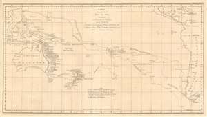
Carte d'une partie de la Mer du Sud Contenant les Découvertes des Vaisseaux de sa Majesté le Dauphin, Commodore Byron, La Tamar, Capit.ne Mouats, 1765. Le Dauphin, Capit.ne Wallis, Le Swallow, Capit.ne Carteret, 1767. et l'Endeavour, lieutenant Cook, 1769.
sold
- Digital Map Information
- Suitable for large format printing
- DPI: 600
- File Size: 20.32 MB
- File Type: ZIP / TIFF
- ICC color profile embedded
- Delivered instantly via download link
This is a 1774 map of the South Pacific Ocean, comparing the routes taken during three great circumnavigations of the 18th century: Byron and Mouat's 1763 journey aboard HMS Dolphin and Tamar; the 1767 circumnavigation of Wallis and Carteret aboard HMS Dolphin and the Swallow; and the 1769 voyage of the Endeavor under then - Lieutenant James Cook. To the East, the map shows the coasts of southern Mexico, part of the Caribbean islands, Central America and South America, including Tierra del Fuego and the Falklands. The western extremes of the map include part of China, Cochinchina, and the East Indies as far as Sumatra. Revealed in the ocean between are the late discoveries in the South Pacific, especially those of Cook, which provided the first detailed charting of Australia and New Zealand since Tasman's 1642 voyage. (more details)
French Edition of some of New Zealand's First European Anchorages.
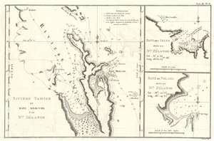
Riviere Tamise de Baye Mercure a la Nle. Zélande/ Baye des Isles dans la Nle. Zélande. / Baye de Tolaga dans la Nle. Zélande.
sold
- Digital Map Information
- Suitable for large format printing
- DPI: 600
- File Size: 8.51 MB
- File Type: ZIP / TIFF
- ICC color profile embedded
- Delivered instantly via download link
This is the 1774 first French edition of the first map of New Zealand's North Island, navigated by then-Lieutenant James Cook during his first voyage of discovery aboard the H.M.S. Endeavor. (more details)
Starting off on the wrong foot.
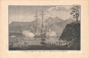
Le Capitaine Wallis est attaqué dans le Dauphin par les Otahitiens.
sold
- Digital Map Information
- Suitable for large format printing
- Full resolution TIFF file
- ICC color profile embedded
- Delivered instantly via download link
This is Robert Benard's view of the ship HMS Dolphin under attack off Tahiti, which appeared in the 1774 French translation of the book, An Account of the Voyages…, published the previous year by John Hawkesworth. Wallis was likely the first European to discover Tahiti (Spanish and Portuguese mariners might have reached it earlier) and, despite this incident, came to regard the island and those around it highly. (more details)