
Hilgard, Julius Erasmus (sold)

Julius Erasmus Hilgard (January 7, 1825 - May 9, 1890) was a German-American engineer and Director of the United States Coast Survey. Born in Zweibrüken, Rhenish Bavaria, he and his family emigrated to the United States in 1835. They arrived in New Orleans on Christmas Day and traveled from there to a farm in Belleville, Illinois. Hilgard went to Philadelphia in 1843 to study engineering. It was in Philadelphia that Hilgard met Professor Alexander Bache, the recently appointed Superintendent of the United States Coast Survey. In 1845, Bache gave Hilgard a position with the Coast Survey, although his official appointment was delayed for some reason until December 28, 1846. Hilgard worked with the Coast Survey off and on for the rest of his life. At the outbreak of the Civil War, Hilgard was engaged in a prominent business enterprise in Paterson, New Jersey, but Bache convinced him to return to the Coast Survey to supplement in the war effort. In 1862, Hilgard 'assumed charge of the Coast Survey office', taking on the duties of Superintendent in lieu of Bache, who had, by this time, become extremely ill. Upon Bache's death in 1867, Hilgard became the de-facto Superintendent as well as the assistant in charge of the office. He served as such until February 1867 when Benjamin Pierce was appointed Superintendent. Hilgard continued to work for the Coast Survey under Pierce as 'assistant in charge of office' until he was formally appointed Superintendent in 1881, a position he held until 1885 when he was forced to resign due to illness. He died 5 years later.
Earliest Coast Survey Chart of Key West.
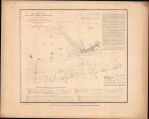
(Sketch F No. 5) Preliminary Chart of Key West Harbor and Approaches.
sold
- Digital Map Information
- Suitable for large format printing
- Full resolution TIFF file
- ICC color profile embedded
- Delivered instantly via download link
This is a rare separately issued example of the U.S. Coast Survey's 1851 nautical chart or map of Key West and environs. The chart was the result of a months-long effort to chart the Florida coast led by naval officer John R. Rodgers, who is credited here. (more details)
First map to show the continental shelf break for a significant portion of the west coast.
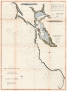
Pacific Coast from Point Pinos to Bodega Head California.
sold
- Digital Map Information
- Suitable for large format printing
- File Size: 100.44 MB
- File Type: ZIP / TIFF
- ICC color profile embedded
- Delivered instantly via download link
This is the 1866 United States Coast Survey map of San Francisco Bay and vicinity from Bodega Head south to Point Pinos and Monterey, California. (more details)
The entire San Francisco Peninsula.
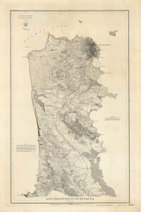
San Francisco Peninsula. U.S. Coast Survey. Benjamin Peirce, Superintendent. 1869. Price $1.50. Verified J.E. Hilgard. Assist Coast Survey. In Charge of Office.
sold
- Digital Map Information
- Suitable for large format printing
- File Size: 31.9 MB
- File Type: ZIP / TIFF
- ICC color profile embedded
- Delivered instantly via download link
A striking heavy stock example of the 1869 U.S. Coast Survey map of the San Francisco Peninsula. This is one of the first maps to focus on the entire peninsula and among the earliest Coast Survey charts to utilize contours to illustrate elevation. (more details)
Entire San Francisco Peninsula.
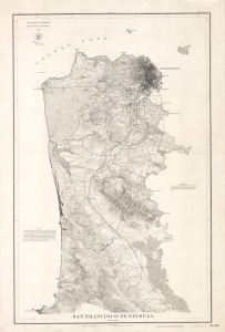
San Francisco Peninsula. U.S. Coast Survey. Benjamin Peirce, Superintendent. 1869. Price $1.50. Verified J.E. Hilgard. Assist Coast Survey. In Charge of Office.
sold
- Digital Map Information
- Suitable for large format printing
- Full resolution TIFF file
- ICC color profile embedded
- Delivered instantly via download link
A striking heavy stock example of the 1869 U.S. Coast Survey map of the San Francisco Peninsula. This is one of the first maps to focus on the entire peninsula and among the earliest Coast Survey charts to utilize contours to illustrate elevation. (more details)
Before the Great Galveston Hurricane.
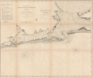
Coast Chart No. 105 Galveston Bay to Oyster Bay Texas.
sold
- Digital Map Information
- Suitable for large format printing
- File Size: 62.38 MB
- File Type: ZIP / TIFF
- ICC color profile embedded
- Delivered instantly via download link
This is the 1870 edition of the U.S. Coast Survey nautical map of Galveston Bay, Texas. When this map was made Galveston was one of the most important American ports on the Gulf of Mexico. In just thirty years, it would be destroyed by the 1900 Great Galveston Hurricane, considered the deadliest natural disaster in United States history and the third-deadliest Atlantic hurricane. (more details)
Rare separate issue nautical chart centered on Hilton Head Island.
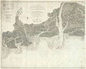
Coast Chart No. 55 Coast of South Carolina and Georgia from Hunting Island to Ossabaw Island Including Port Royal Sound and Savannah River
sold
- Digital Map Information
- Suitable for large format printing
- File Size: 46.29 MB
- File Type: ZIP / TIFF
- ICC color profile embedded
- Delivered instantly via download link
This is a scarce separate issue 1873 working nautical chart or maritime map of the U.S. coast between Savannah and Port Royal. Oriented with northwest at the top and centered on Hilton Head Island, the chart covers from the Vernon River to St. Helena Island, ... (more details)
The culmination of the Coast Survey's work in New York Harbor.
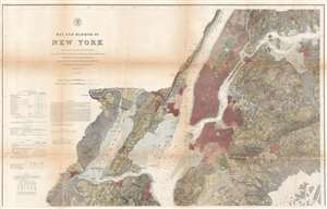
Bay and Harbor of New York.
sold
- Digital Map Information
- Suitable for large format printing
- File Size: 60.9 MB
- File Type: ZIP / TIFF
- ICC color profile embedded
- Delivered instantly via download link
The ultimate expression of the U.S Coast Survey chart of New York City, its harbor, and environs. This nautical chart, dating to 1874, is the culmination of the U.S. Coast Survey's mapping of New York City. Much of New York City as we know it today is illustrated here, including Manhattan, Queens, Brooklyn, the Bronx, and part of Staten Island. The depicted area also includes Jersey City, Newark, and Hoboken. Sumptuous detail is present throughout, with city blocks, important buildings, farms and fields, river ways, streams, swamps, and topographical details. In addition to inland detail, this chart contains a wealth of practical information for the mariner from depth soundings, to notes on harbors, and navigation tips about important channels. Tables detailing light houses and beacons, tides, and magnetic declination, are included as well. (more details)
Traces the coast of the United States from Doboy Sound, Georgia past Jekyll Island to Amelia Island, Florida.
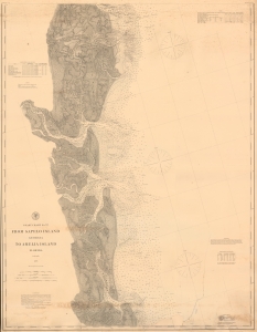
Coast Chart No. 57 From Sapelo Island Georgia to Amelia Island Florida.
sold
- Digital Map Information
- Suitable for large format printing
- File Size: 50.89 MB
- File Type: ZIP / TIFF
- ICC color profile embedded
- Delivered instantly via download link
This is an 1878 U.S. Coast and Geodetic Survey nautical map of the coast of Georgia and Florida. This is the best and most detailed chart of the Georgia coast to appear until the early 20th century. (more details)
South and Mid-Coast Maine.
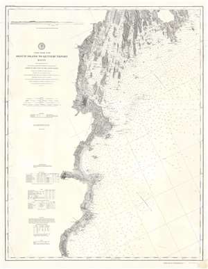
Coast Chart No. 107 Seguin Island to Kennebunkport Maine.
sold
- Digital Map Information
- Suitable for large format printing
- File Size: 34.65 MB
- File Type: ZIP / TIFF
- ICC color profile embedded
- Delivered instantly via download link
This is an 1878 U.S. Coast and Geodetic Survey nautical chart or maritime map of Casco Bay and the southern coast of Maine - the heartland of maritime Maine. Centered roughly on Cape Elizabeth, coverage extends roughly from Seguin Island south past Portland, to Kennebunkport. The coastline and the many coastal islands are illustrated in detail. Most of the coastal islands are identified by name. Ledges, rivers, necks, points, bays, and other nautical features and hazards are illustrated as well. Countless depth soundings appear throughout. Portland, Kennebunkport, and Biddeford are labeled with their street layout evident. The Atlantic and St. Lawrence Railroad hugs the coastline between Portland and Yarmouth Falls Village. (more details)
Live Oaks Plantation.
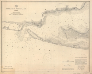
Entrance to Pensacola Bay Florida.
sold
- Digital Map Information
- Suitable for large format printing
- File Size: 47.52 MB
- File Type: ZIP / TIFF
- ICC color profile embedded
- Delivered instantly via download link
This is an 1882 U.S. Coast and Geodetic Survey nautical map of the entrance to Pensacola Bay, Florida. (more details)
Depicts Amelia Island and the St. John's River in detail.
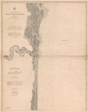
Coast Chart No. 58 From St. Mary's Entrance Southward to Latitude 30 Degrees N.
sold
- Digital Map Information
- Suitable for large format printing
- File Size: 70 MB
- File Type: ZIP / TIFF
- ICC color profile embedded
- Delivered instantly via download link
An incredibly detailed piece, this is an 1882 U.S. Coast and Geodetic Survey nautical chart or maritime map of Amelia Island and St. John's River, Florida. The map depicts the region from Jacksonville to the Atlantic Ocean and from St. Mary's River to 30 degrees north latitude. Myriad depth soundings are indicated throughout, including upstream along most of the region's rivers and creeks. The cities of St. Mary's, Florida, and Jacksonville, Florida are both labeled. Numerous coastal islands are identified, including Amelia Island, Tiger Island, Cumberland Island, and Talbot Island. Islands, points, and creeks are all labeled along the course of the St. John's River from Jacksonville to the river's mouth. Information concerning beacons in the St. John's River, other coastal lighthouses, beacons, and buoys, tides, soundings, and abbreviations used on the chart is all situated along the left border. (more details)
Working nautical chart of Nantucket.
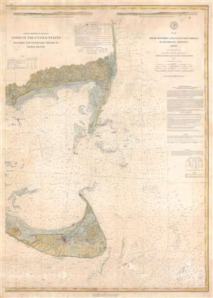
No. 11 From Monomoy and Nantucket Shoals to Muskeget Channel Mass.
sold
- Digital Map Information
- Suitable for large format printing
- File Size: 45.77 MB
- File Type: ZIP / TIFF
- ICC color profile embedded
- Delivered instantly via download link
This is an uncommon 1883 U.S. Coast and Geodetic Survey nautical chart or maritime map of Nantucket, Massachusetts. The map depicts from Hyannis to Chatham Port and south to include most of Nantucket Island to Old Man's Shoal, with the exception of the western-most part of the island, which extends beyond the map's scope. Primarily concerned with coastal information, the map nonetheless offers detail throughout with topography extending several miles inland. Nantucket is illustrated with full topography. Countless depth soundings appear throughout, and the region's lighthouses, bells, and light boats are highlighted. In addition, a wealth of practical information for the mariner is included: sailing instructions, tidal notes, and information concerning lighthouses and beacons. (more details)
Rare separately issued map of Bar Harbor by the United States Coast Survey.
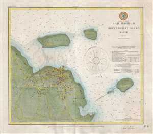
Bar Harbor Mount Desert Island Maine.
sold
- Digital Map Information
- Suitable for large format printing
- File Size: 6.01 MB
- File Type: ZIP / TIFF
- ICC color profile embedded
- Delivered instantly via download link
A scarce 1885 U.S Coast and Geodetic Survey nautical chart or maritime map of Bar Harbor, Mount Desert Island, Maine. Presented on a polyconic projection, this map is centered on the town of Bar Harbor, but covers much of the surrounding area as well as ... (more details)
The Kennebec, St. George's, and Damariscotta Rivers.
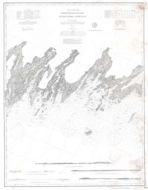
Coast Chart No. 105 From Penobscot Bay to Kennebec Entrance.
sold
- Digital Map Information
- Suitable for large format printing
- File Size: 32.1 MB
- File Type: ZIP / TIFF
- ICC color profile embedded
- Delivered instantly via download link
This is an 1888 United States Coast Survey nautical chart or maritime map of the central coast of Maine. Depicting from Merrymeeting Bay and the Kennebec River to Thomaston on the St. George's River, Maine's iconic coastline, with its bays, necks, islands, and other amazing features, becomes immediately apparent. Nearly all these islands are identified by name, along with the many rivers, coves, bays, and, of course, coastal cities. Among these are Bath, Wiscasset, Newcastle, Damariscotta, and Waldoboro. Numerous buildings (illustrated by small black squares) line the region's roads. Coastal lights, buoys, and other navigation aids are indicated as well. Five coastal views are included along the bottom of the map and are meant to help mariners identify their location while traveling this stretch of coast. (more details)
Traces the coast of the United States from Doboy Sound, Georgia past Jekyll Island to Amelia Island, Florida.
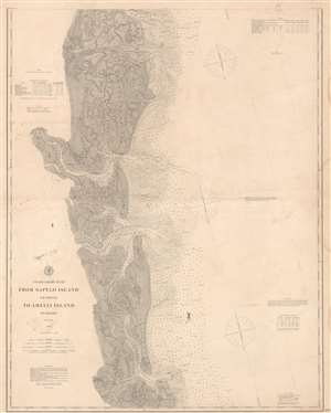
Coast Chart No. 157 From Sapelo Island Georgia to Amelia Island Florida.
sold
- Digital Map Information
- Suitable for large format printing
- File Size: 79.93 MB
- File Type: ZIP / TIFF
- ICC color profile embedded
- Delivered instantly via download link
This is an 1888 U.S. Coast and Geodetic Survey nautical chart of the coast of Georgia and Florida. The map depicts the region from Blythe Island to the Atlantic Ocean and from Doboy Sound to Amelia Island and the Amelia River. Numerous coastal islands are illustrated, including Wolf Island, St. Simon's Island, Jekyll Island, and Cumberland Island. Rivers and creeks along the coast are also indicated, many of which, such as the Altamaha River, the Brunswick River, the Turtle River, and the Satilla River, have depth soundings noted along their courses. Myriad depth soundings are present in the Atlantic and in the sounds along the coastline, which include St. Simon's Sound, Altamaha Sound, Doboy Sound, St. Andrew's Sound, and Cumberland Sound. Information concerning lighthouses and beacons and buoys is situated along the left border, while notes on the tides, soundings, and abbreviations used can be found along the right border. This chart could potentially be joined with another chart available through Geographicus: SavannahSapeloIsland-uscgs-1889. (more details)
Striking depiction of Mount Desert Island.
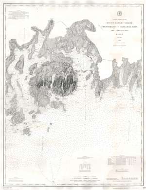
Coast Chart No. 103 Mount Desert Island Frenchman's and Blue Hill Bays and Approaches Maine.
sold
- Digital Map Information
- Suitable for large format printing
- File Size: 60.18 MB
- File Type: ZIP / TIFF
- ICC color profile embedded
- Delivered instantly via download link
This is an 1888 U.S. Coast and Geodetic Survey nautical chart or maritime map of Mount Desert Island, Frenchman's Bay, and vicinity, Maine. With Mount Desert Island situated slightly to the left of center, the map depicts from New Sedgwick and Blue Hill Neck to Pigeon Hill and Pigeon Hill Bay. Mount Desert Island's celebrated topography is illustrated in detail. Roads traverse the island and individual residences are marked but not labeled. Mountain peaks, harbors, points, coves, ponds, and lakes are all identified as well. Other islands throughout are also illustrated, along with harbors, necks, coves, and bays. As this is a nautical chart, countless depth soundings are indicated. (more details)
Illustrates modern-day Dry Tortugas National Park.
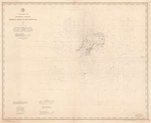
Coast Chart No. 171 Florida Reefs Rebecca Shoal to Dry Tortugas.
sold
- Digital Map Information
- Suitable for large format printing
- File Size: 52.81 MB
- File Type: ZIP / TIFF
- ICC color profile embedded
- Delivered instantly via download link
This is an 1889 U.S. Coast and Geodetic Survey nautical chart of the Dry Tortugas Islands, a group of islands near the end of the Florida Keys. The chart focuses on the Dry Tortugas and depicts the region from west of the island group to Rebecca Shoal. Today, the Dry Tortugas and the surrounding area form the Dry Tortugas National Park. Myriad depth soundings populate the chart, with the greatest concentration about the islands. Each of the keys are labeled, including Loggerhead Key, Long Key, and Bush Key. Fort Jefferson is labeled, as are the light within Fort Jefferson and the light on Loggerhead Key. The channels through the islands are also identified. Information concerning lighthouses, buoys, soundings, and abbreviations used on the chart is situated in the lower left corner. (more details)
Includes Sapelo Island, Turtle Island, Ossabaw Island, Blackbeard Island, and St. Catherine's Island
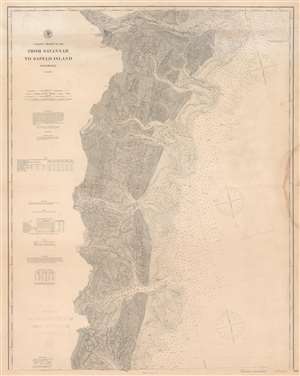
Coast Chart No. 156 From Savannah to Sapelo Island Georgia.
sold
- Digital Map Information
- Suitable for large format printing
- File Size: 96.35 MB
- File Type: ZIP / TIFF
- ICC color profile embedded
- Delivered instantly via download link
This is an 1889 U.S. Coast Survey nautical chart or maritime map of the coast of Georgia. Providing a detailed depiction of the maze of rivers, creeks, and islands that create this portion of the American coast, the map illustrates from Hutchinson's Island in the Savannah River to the Atlantic Ocean and from Turtle Island to Sapelo Island. Islands of varying size are identified all along the coast, including Tybee Island, Skiddaway Island, Wassaw Island, Ossabaw Island, St. Catherine's Island, and Sapelo Island. Myriad depth soundings are provided in the Atlantic and along most of the region's rivers and creeks. Savannah is situated illustrated near the top border with the Central Railroad of Georgia, the Savannah and Tybee Railroad, and the Savannah, Florida, and Western Railroad all illustrated in the immediate vicinity. Information concerning tides, lighthouses, beacons, buoys, and soundings is all included along the left border. This chart could potentially be joined with another chart available through Geographicus: SapeloIslandAmeliaIsland-uscgs-1877. (more details)
Highlight Key West - known for its fantastic snorkeling and scuba diving.
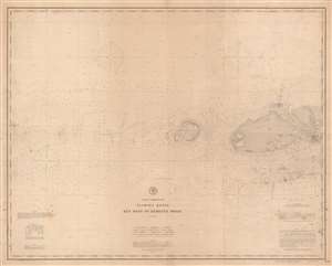
Coast Chart No. 170 Florida Reefs Key West to Rebecca Shoal.
sold
- Digital Map Information
- Suitable for large format printing
- File Size: 66.13 MB
- File Type: ZIP / TIFF
- ICC color profile embedded
- Delivered instantly via download link
This 1889 U.S. Coast and Geodetic Survey nautical chart or maritime map of the Florida Keys depicts this iconic island chain from Key West to Rebecca Shoal. Famous as a tourist destination, Key West is known for its coral reefs and the scuba diving and snorkeling activities associated with the reefs. All the channels heading into Key West are identified, as are the navigation buoys, which are colored and labeled by number. A shipwreck just off Key West is also noted. Numerous other keys, such as Woman Key, Snipe Key, Mule Key, Man Key, and Boca Grande Key, are illustrated west of Key West and labeled. Marquesas Keys is also illustrated and labeled. Myriad depth soundings are indicated throughout, providing important information to the mariner. Information concerning soundings, abbreviations, and buoys is situated in the lower left corner, while notes about the weather signal, the lighthouses, and the tides are included in the lower right corner. (more details)
A separate issue nautical chart centered on Hilton Head Island.
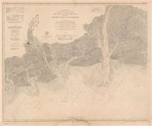
Coast Chart No. 155 Coast of South Carolina and Georgia From Hunting Island to Ossabaw Island Including Port Royal Sound and Savannah River.
sold
- Digital Map Information
- Suitable for large format printing
- File Size: 98.25 MB
- File Type: ZIP / TIFF
- ICC color profile embedded
- Delivered instantly via download link
This is a scarce separate issue 1890 nautical chart or maritime map of the U.S. coast between Savannah, Georgia and Port Royal Sound, South Carolina. Oriented with northwest at the top and centered on Hilton Head Island, the chart covers from the Vernon River to St. Helena Island, including the Port Royal Sound, Hilton Head Island, Tybee Island, the Savanna River, and Savanah itself. Exemplifying the height of U.S.C.S. mapmaking, this chart offers outstanding detail throughout, including Savannah's unique street grid and numerous islands of varying size. The rivers, sounds, and Atlantic Ocean are full of countless depth sounding and shading is employed in indicate shallow areas and shoals. Beaufort, South Carolina is illustrated and labeled, as are several railroads, including the Port Royal Railroad, the Central Railroad of Georgia, and the Savannah, Florida, and Western Railroad. Other communities, such as Bluffton, are also identified. Information concerning tides, lighthouses and beacons, soundings, buosy, and abbreviations used is situated along the left border. (more details)
Depicts the Penobscot River from Belfast to Bangor.
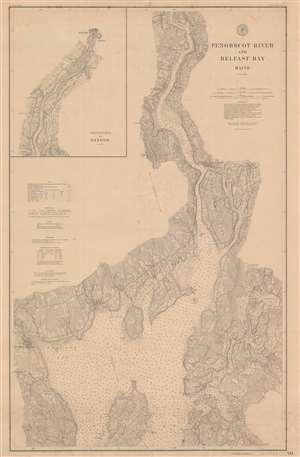
Penobscot River and Belfast Bay Maine.
sold
- Digital Map Information
- Suitable for large format printing
- File Size: 66.29 MB
- File Type: ZIP / TIFF
- ICC color profile embedded
- Delivered instantly via download link
This is an 1892 U.S. Coast and Geodetic Survey nautical chart or maritime map of the Penobscot River and Belfast Bay in Maine. The map depicts the region from Belfast to Northern Bay and Pierce's Pond and from Bald Hill Cove to Sabbath Day Harbor, with an inset situated in the upper left corner illustrating the river from just below Smith's Cove to Bangor. Highly detailed, myriad depth soundings are indicated throughout, including up the Belfast River and the Bagaduce River. Cities and towns throughout the region are labeled, including Bangor, Brewer, Hampden, Winterport, Bucksport, Orland, Stockton, Castine, Searsport, and Belfast. Roads snake their way across the landscape and topography is noted by topographical lines. Points, capes, coves, and bays are labeled all along the coast and the riverbank, allowing for their identification while navigating the river and bay. (more details)
Illustrates West Penobscot Bay near Camden, Maine.
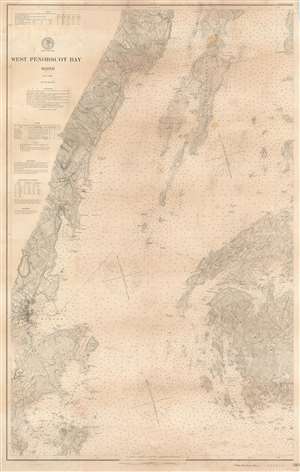
West Penobscot Bay Maine.
sold
- Digital Map Information
- Suitable for large format printing
- File Size: 60.49 MB
- File Type: ZIP / TIFF
- ICC color profile embedded
- Delivered instantly via download link
This is a 1902 U.S. Coast and Geodetic Survey nautical chart or maritime map of West Penobscot Bay, Maine. The map depicts the region from Rockland to Carver's Harbor and Cape Rosier and from Sabbath Day Harbor to Sprucehead Island and Andrew's Island. ... (more details)