
Kircher, Athanasius (sold)

Athanasius Kircher (May 2, 1602 - November 27, 1680) was a 17th century German Jesuit scholar and one of the most respected and remarkable men of his time. A master of languages, mathematics, science, geography, physics and oriental studies, many consider Kircher to be 'the last true Renaissance man.' Kircher attained almost global fame in his lifetime for his numerous scholarly publications. Indeed, Kircher was the first documented scholar able to fully support himself on his own work, which, in his case, included some forty volumes on diverse fields. As a Catholic in Germany, Kircher was frequently at odds with the rising powers of Protestantism. Consequently, in 1628 he joined the priesthood and after extensive world travels eventually settled in Rome. There he was employed as a Professor of Mathematics and Oriental Languages at the Collegio Romano. Inspired by the eruption of Vesuvius in 1637 and the two weeks of earthquakes that shook Calabria in 1638, Kircher turned his considerable intellect to the natural world. Kircher's research into Geography and Oceanography culminated in the postulation that tides and currents were caused by water moving to and from a great subterranean ocean. Kircher published his geographic work in the important 1665 Mundus Subterraneus, which in addition to several world and oceanic charts, included a fascinating map of Atlantis. Kircher is nonetheless, not unimpeachable. One anecdote tells how a rival scholar presented Kircher with a manufactured gibberish manuscript he claimed to be an recently discovered ancient Egyptian text in need of translation. Kircher produced the translation instantly. In addition to his significance as a scholar, Kircher is best known for his invention of the Magic Lantern, precursor to modern cinema. He also founded the Museum Kircherianum in Rome.
One of the first scientific-thematic maps of Southeast Asia - here illustrating the hydro-geographic theories of Athanasius Kircher.
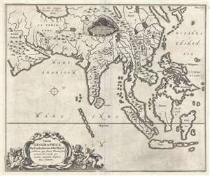
Tabula Geographica Hydrophylacium Asiae Majoris exhibens, quo Omnia Flumina sive proximè sive remotè per occultos meandros Originem suam sortiuntur.
sold
- Digital Map Information
- Suitable for large format printing
- Full resolution TIFF file
- ICC color profile embedded
- Delivered instantly via download link
A fine example of Athanasius Kircher's 1665 map of Asia. Centered on India, this map covers from the Arabian Peninsula to the Philippines and from the Caspian Sea and Japan to java. It is one of several maps prepared by Kircher to illustrate his unique ... (more details)
One of the first scientific-thematic maps of Africa - here illustrating the hydro-geographic theories of Athanasius Kircher.
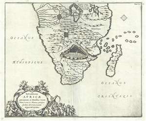
Hydrophylacium Africae precipuum, in Montibus Lunae Situm, Lacus et Flumina praecipua fundens, ubi et nova inventio Originis Nili describitur.
sold
- Digital Map Information
- Suitable for large format printing
- DPI: 300
- File Size: 6.08 MB
- File Type: ZIP / TIFF
- ICC color profile embedded
- Delivered instantly via download link
A fine example of Athanasius Kircher's 1665 map of southern Africa. The map covers Africa roughly from the Congo south to the Cape of Good Hope, including the Island of Madagascar. Cartographically the map is primitive, even for its time, but Sofala ... (more details)
The most complete illustration of Kircher's revolutionary hydro-geographic theories.
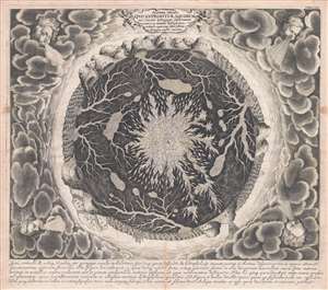
Systema Ideale Qvo Exprimitur, Aquarum per Canales hydragogos subterraneos ex mari et in montium hydrophylacia protrusio, aquarumq. subterrestrium per pyragogos canales concoctus.
sold
- Digital Map Information
- Suitable for large format printing
- DPI: 300
- File Size: 11.39 MB
- File Type: ZIP / TIFF
- ICC color profile embedded
- Delivered instantly via download link
This is one of the 17th century polymath Athanasius Kircher's most iconic and graphically intense maps. This map illustrates the subterranean world and is one of the maps included in Kircher's 1665 cosmography Mundus Subterranous . Inspired by two ... (more details)
The most complete illustration of Kircher's revolutionary hydro-geographic theories.
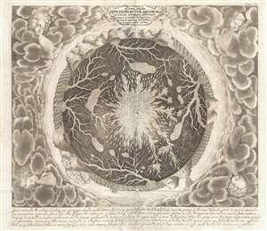
Systema Ideale Qvo Exprimitur, Aquarum per Canales hydragogos subterraneos ex mari et in montium hydrophylacia protrusio, aquarumq. subterrestrium per pyragogos canales concoctus.
sold
- Digital Map Information
- Suitable for large format printing
- DPI: 300
- File Size: 35.14 MB
- File Type: ZIP / TIFF
- ICC color profile embedded
- Delivered instantly via download link
This is one of the 17th century polymath Athanasius Kircher's most iconic and graphically intense maps. This map illustrates the subterranean world and is one of the maps included in Kircher's 1665 cosmography Mundus Subterranous . Inspired by two ... (more details)
The most complete illustration of Kircher's revolutionary hydro-geographic theories.
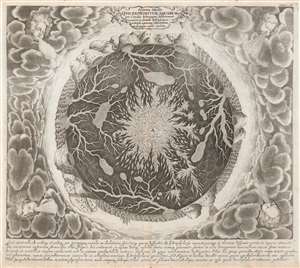
Systema Ideale Qvo Exprimitur, Aquarum per Canales hydragogos subterraneos ex mari et in montium hydrophylacia protrusio, aquarumq. subterrestrium per pyragogos canales concoctus.
sold
- Digital Map Information
- Suitable for large format printing
- DPI: 600
- File Size: 26.53 MB
- File Type: ZIP / TIFF
- ICC color profile embedded
- Delivered instantly via download link
This is one of the 17th century polymath Athanasius Kircher's most iconic and graphically intense maps. Situated amidst dense clouds with Aeolus, or wind heads, at the corners, the Earth appears as a gigantic fiery orb. Around the perimeter, we can recognize the oceans, mountains, land, whirlpools, and even a few sailing ships. The center of the Earth is a great fire. Beyond the flaming core, artery-like networks of subterranean seas and rivers connect great reservoirs hidden under mighty mountains. (more details)
The Italian polymath Kircher's iconic map of the Earth's Volcanic Systems.
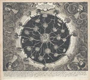
Systema Ideale Pyrophylaciorum Suberraneorum, quorum montes Vulcanii, veluti spiracula quaedam existant.
sold
- Digital Map Information
- Suitable for large format printing
- DPI: 300
- File Size: 13.04 MB
- File Type: ZIP / TIFF
- ICC color profile embedded
- Delivered instantly via download link
This is one of the 17th century polymath Athanasius Kircher's most iconic and graphically intense maps. This map illustrates Earth's volcanic system and is one of the maps included in Kircher's 1665 cosmography Mundus Subterranous . Inspired by ... (more details)
The Italian polymath Kircher's iconic map of the Earth's Volcanic Systems.
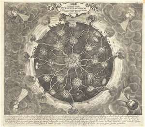
Systema Ideale Pyrophylaciorum Suberraneorum, quorum montes Vulcanii, veluti spiracula quaedam existant.
sold
- Digital Map Information
- Suitable for large format printing
- DPI: 300
- File Size: 12.66 MB
- File Type: ZIP / TIFF
- ICC color profile embedded
- Delivered instantly via download link
This is one of the 17th century polymath Athanasius Kircher's most iconic and graphically intense maps. This map illustrates Earth's volcanic system and is one of the maps included in Kircher's 1665 cosmography Mundus Subterranous . Inspired by ... (more details)
The Italian polymath Kircher's iconic map of the Earth's Volcanic Systems.
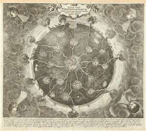
Systema Ideale Pyrophylaciorum Suberraneorum, quorum montes Vulcanii, veluti spiracula quaedam existant.
sold
- Digital Map Information
- Suitable for large format printing
- DPI: 600
- File Size: 31.49 MB
- File Type: ZIP / TIFF
- ICC color profile embedded
- Delivered instantly via download link
This is one of the 17th century polymath Athanasius Kircher's most iconic and graphically intense maps. The map illustrates the interior of the Earth postulates cohesive global volcanic system tied to a fiery core. Situated amidst dense clouds with Aeolus, or wind heads, at the corners, the Earth appears as a gigantic fiery orb. Along the circumference, we can recognize the oceans, mountains, land, and even a few sailing ships. The center of the Earth is a great fire. Beyond the flaming core, artery-like networks of subterranean channels direct the heat of the core to volcanoes on the Earth's surface. (more details)
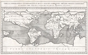
Tabula Geographico-Hydrographica Motus Oceani, Currentes, Abyssos, Montes Igniuomus in Universo Orbe Indicans Notat Haec Fig. Abyssos Montes Vulcanios.
sold
- Digital Map Information
- Suitable for large format printing
- DPI: 300
- File Size: 5.28 MB
- File Type: ZIP / TIFF
- ICC color profile embedded
- Delivered instantly via download link
A rare and spectacular 1665 map of the world by the extraordinary Germany scholar Athanasius Kircher. This is most likely the first world map to depict the oceans currents. Shows the entire world in accordance with Kircher's hydro-geographic ... (more details)
An important map that helped ignite European interest in China during the 17th century.
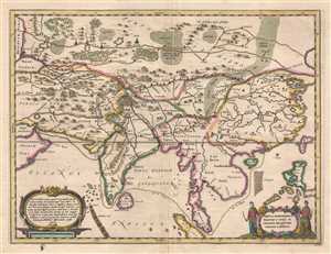
Tabula Geodoborica Itinerum a Varijs in Cataium susceptorum rationem exhibens.
sold
- Digital Map Information
- Suitable for large format printing
- DPI: 300
- File Size: 5.4 MB
- File Type: ZIP / TIFF
- ICC color profile embedded
- Delivered instantly via download link
This is a 1667 Athanasius Kircher map of Asia illustrating several routes from the Middle East to China. The map depicts the continent from the Caspian Sea, Persia, the Persian Gulf, and the Arabian Peninsula to the Pacific Ocean and from ... (more details)
Linking the Human Body with the Heavens.
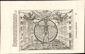
Sciathericon Medicinae Coelestis quo inferiores stella superioribus connexas...
sold
- Digital Map Information
- Suitable for large format printing
- Full resolution TIFF file
- ICC color profile embedded
- Delivered instantly via download link
This is Athanasius Kircher's diagram 'Sciathericon Medicinae Coelestis,' published for his Ars Magna Lucis et Umbrae. The work is characteristic of the thought of Kircher, one of the most original and prolific philosophers of his day, in that it draws on a range of traditions and influences, including mysticism, numerology, and what today would be called astrology. (more details)
The earliest map to attempt the illustration of ocean currents - and the subterranean connections between the world's oceans!
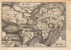
Die Ebbe und Fluth auff einer flachen Landt-Karten fürgestelt.
sold
- Digital Map Information
- Suitable for large format printing
- Full resolution TIFF file
- ICC color profile embedded
- Delivered instantly via download link
This is the rare, 1675 first plate of Eberhard Werner Happel's map of the world. This striking, unique engraving was 'identified as the earliest attempt to trace 'the more important ocean currents of the world' (The World Encompassed). Happel intended this map to illustrate not only the existence of ocean currents, but their causes: underground oceans, rivers, and volcanic activity, surely, were the cause of the baffling movements of the world's waters. To this end the map also illustrates no fewer than eighteen dramatically engraved volcanoes, at least twenty-four whirlpools, and four speculative subterranean connections between major bodies of water via eight titanic maelstroms. (more details)
Kircher's exploration of the unseen world below.
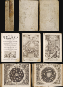
This is the 1678 edition of polymath Athanasius Kircher's celebrated description of the subterranean world, the first serious theoretical exploration of the physical structure of the Earth. Kircher's own experiences of the 1637 eruption of Mount Vesuvius and the catastrophic Calabrian earthquakes of 1638 led him to develop theories regarding the unseen underpinnings of the world. (more details)
The mystery of sunspots.
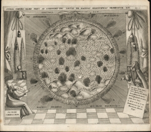
Schema corporis solaris prout ab astronomis hoc saeculo per machinas helioscopicas observatum est.
sold
- Digital Map Information
- Suitable for large format printing
- Full resolution TIFF file
- ICC color profile embedded
- Delivered instantly via download link
A finely engraved 1685 map of the Sun by Athanasius Kircher and Johann Zahn. The map provides a dramatic image of the Sun based upon the revolutionary 1665 work of the Jesuit polymath Athanasius Kircher (1602 - 1680). (more details)