
Mora, Joseph 'Jo' Jancito (sold)
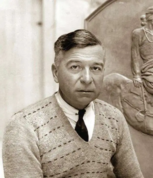
Joseph 'Jo' Jancito Mora (October 22, 1876 – October 10, 1947) was an Uruguayan born artist active in California during the first half of the 20th century. Mora immigrated to California as a young man. He studied art in Boston and, after graduating, worked there briefly before relocating to California. In cartographic circles Mora is known for pioneering the 20th century pictorial map. In a series he referred to as his 'cartes,' published between in 1926 and 1942, Mora developed a pictorial style that combined cartography with colorful cartoonish image of local figures, folklore, history, and natural wonders. His earliest maps were commissioned by the Hotel Del Monte and included California's Playground and The Seventeen Mile Drive. As he matured as a cartographer, his work became increasingly dense, often packed with tiny figures, each expressive of some aspect of regional life. Mora, often called the 'Renaissance man of the West' also worked as an illustrator, muralist, sculptor, photographer, and writer. His masterpiece is considered to be the Father Serra Cenotaph, a bronze and marble sculpture at the Memorial Chapel in El Carmelo Mission, Carmel, California. His map work included Monterey Penninsula (1927), and Seventeen Mile Drive (1927), California (1927), Grand Canyon (1931), Yosemite (1931), Yellowstone (1936), Carmel-By-The-Sea (1942), California (1945) (large and small versions), Map of Los Angeles (1942), among others.
First edition of Mora's First Map.
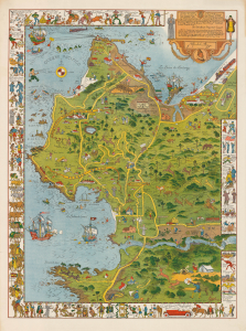
[Monterey Peninsula] / To His Excellency The Count of Monterey: This Limned Map and History of his own Harbour and Peninsula - discovered by Viscaino AD 1602...
sold
- Digital Map Information
- Suitable for large format printing
- File Size: 74.95 MB
- File Type: ZIP / TIFF
- ICC color profile embedded
- Delivered instantly via download link
This is the 1926 first edition of Jo Mora's pictorial map of the Monterey Peninsula - his first map and one of his rarest works. It was illustrated and published on behalf of Del Monte Properties, a resort company that operated numerous concerns throughout Monterey. (more details)
First edition of Mora's First Map.
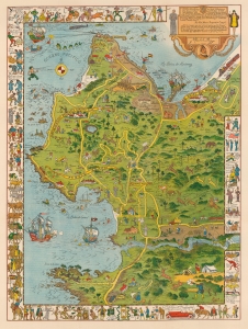
[Monterey Peninsula] / To His Excellency The Count of Monterey: This Limned Map and History of his own Harbour and Peninsula - discovered by Viscaino AD 1602 ...
sold
- Digital Map Information
- Suitable for large format printing
- File Size: 69.66 MB
- File Type: ZIP / TIFF
- ICC color profile embedded
- Delivered instantly via download link
This is the 1926 first edition of Jo Mora's pictorial map of the Monterey Peninsula - his first map and one of his rarest works. It was illustrated and published on behalf of Del Monte Properties, a resort company that operated numerous concerns throughout Monterey. (more details)
Mora's rare 3rd map - large format California.
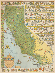
California. This whimsical Carte of Topographic and Historic intention, depicting that fabled isle of Montalvo's dream - the El Dorado of '49 - the glorious California we know and love...
sold
- Digital Map Information
- Suitable for large format printing
- File Size: 82.98 MB
- File Type: ZIP / TIFF
- ICC color profile embedded
- Delivered instantly via download link
A beautiful example of Jo Mora's scarce larger first map of California, issued in 1927 by A. M. Robertson of San Francisco. This is one of Mora's earliest pictorial maps, following on the popularity of his Monterrey Peninsula (1926) and 17-Mile Drive (1927) maps, and as such, is one of his rarest - especially in good condition. (more details)
Rare first edition of Mora's second pictorial map.
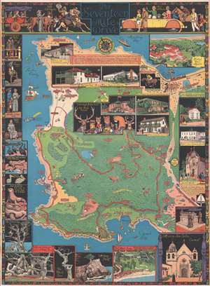
The Seventeen Mile Drive.
sold
- Digital Map Information
- Suitable for large format printing
- File Size: 18.6 MB
- File Type: ZIP / TIFF
- ICC color profile embedded
- Delivered instantly via download link
The rare first edition of Jo Mora's 1927 pictorial map of Monterey Peninsula's Seventeen Mile Drive. This is the second of Mora's iconic pictorial maps, which he called his 'cartes.' The map covers Monterey peninsula in full, detailing the seventeen-mile drive ... (more details)
Mora's second map!
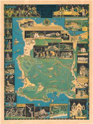
The Seventeen Mile Drive.
sold
- Digital Map Information
- Suitable for large format printing
- File Size: 59.53 MB
- File Type: ZIP / TIFF
- ICC color profile embedded
- Delivered instantly via download link
The rare first edition of Jo Mora's 1927 pictorial map of Monterey Peninsula's Seventeen Mile Drive. This is the second of Mora's iconic pictorial maps, which he called his 'cartes.' The map covers Monterey Peninsula in full, detailing the seventeen-mile drive around the peninsula and the various points of interest along the way. (more details)
Mora's second map!
The Seventeen Mile Drive.
sold
- Digital Map Information
- Suitable for large format printing
- File Size: 151.01 MB
- File Type: ZIP / TIFF
- ICC color profile embedded
- Delivered instantly via download link
The rare first edition of Jo Mora's 1927 pictorial map of Monterey Peninsula's Seventeen Mile Drive. This is the second of Mora's iconic pictorial maps, which he called his 'cartes.' The map covers Monterey Peninsula in full, detailing the seventeen-mile drive around the peninsula and the various points of interest along the way. (more details)
A striking and hilarious map of San Diego by the celebrated cartographic artist Jo Mora.
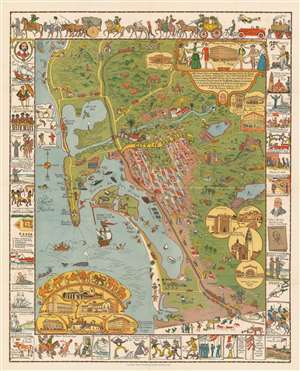
This limned Carte protraying with most exacting fidelity the History, Romance, and Humor of the glorious City of San Diego by the Pacific…
sold
- Digital Map Information
- Suitable for large format printing
- File Size: 59.84 MB
- File Type: ZIP / TIFF
- ICC color profile embedded
- Delivered instantly via download link
This is a 1928 Jo Mora pictorial map of San Diego, California. With San Diego at its center, the map depicts the California coast from La Jolla to Tijuana. Described by Mora as a 'whimsical map and history of a city in California', comical vignettes abound. Mora, as is his style, effortlessly blends the humor with a celebration of the city and The Marston Company, a department store in San Diego whose founder commissioned the map to commemorate the store's Golden Anniversary. Sites around the area, including several army forts, the Naval Air Station, Balboa Park, the zoo, the San Diego De Alcala Mission, and the Point Loma Lighthouse are illustrated. Mission Beach, Pacific Beach, and La Jolla are all labeled, as well as Soledad Mountain, La Mesa Reservoir, Sweetwater Reservoir, and Mt. Helix. Some of the more comic vignettes include a salesman trying to sell land in a subdivision to a young couple, one of which is holding a bag marked 'Iowa', a man running from a swarm of bees, and a drunk using the sign marking Mexico to hold himself up.
Four insets in the lower right corner highlight buildings around San Diego, while others are illustrated in the lower left corner, along with hilarious portraits of seven different 'savage and ferocious beasts of the forest and mountain to be seen at Balboa Park'. A cartouche in the upper right corner is dedicated to celebrating The Marston Company and features full-length portraits of women modeling the evolution of ladies' fashion. Views of all four Marston Company stores are included as well. The whole is surrounded by a border made up of vignettes commemorating San Diego's history from the discovery of San Diego Bay by Juan Rodriguez Cabrillo, to whom this map is dedicated, to the founding of Spanish missions, to the battles of the Mexican-American War which led to the founding of modern-day San Diego. The arrival of the railroads and the Navy are highlighted as well. (more details)
Four insets in the lower right corner highlight buildings around San Diego, while others are illustrated in the lower left corner, along with hilarious portraits of seven different 'savage and ferocious beasts of the forest and mountain to be seen at Balboa Park'. A cartouche in the upper right corner is dedicated to celebrating The Marston Company and features full-length portraits of women modeling the evolution of ladies' fashion. Views of all four Marston Company stores are included as well. The whole is surrounded by a border made up of vignettes commemorating San Diego's history from the discovery of San Diego Bay by Juan Rodriguez Cabrillo, to whom this map is dedicated, to the founding of Spanish missions, to the battles of the Mexican-American War which led to the founding of modern-day San Diego. The arrival of the railroads and the Navy are highlighted as well. (more details)
Beautiful pictorial map of the Grand Canyon by one of the great masters of the genra.
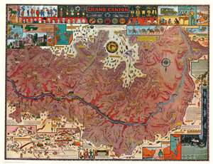
A beautiful c. 1931 / 1957 pictorial map of the Grand Canyon by Jo Mora. Roughly following the Colorado River, the map covers the most visited parts of the Grand Canyon. Many of the Canyon's unique formations, which are named after a variety of figures form mythology, fairly takes, and folklore, are noted with pictorial representations of their namesakes. The borders of the map features numerous inset images that range from historical notes, to cultural illustrations, to humorous cartoon anecdotes. (more details)
Pictorial map of the Grand Canyon by one of the masters of the genre.
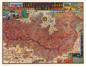
Grand Canyon.
sold
- Digital Map Information
- Suitable for large format printing
- File Size: 95.32 MB
- File Type: ZIP / TIFF
- ICC color profile embedded
- Delivered instantly via download link
A beautiful c. 1931 / 1957 pictorial map of the Grand Canyon by Jo Mora. Roughly following the Colorado River, the map covers the most visited parts of the Grand Canyon. Many of the Canyon's unique formations, which are named after a variety of figures from mythology, fairly takes, and folklore, are noted with pictorial representations of their namesakes. The borders of the map features numerous inset images that range from historical notes, to cultural illustrations, to humorous cartoon anecdotes. (more details)
Cowboy Culture, by a cowboy.
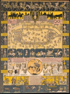
I dedicate this Carte of Evolution to The California Rodeo of Salinas...
sold
- Digital Map Information
- Suitable for large format printing
- Full resolution TIFF file
- ICC color profile embedded
- Delivered instantly via download link
Considered Jo Mora's most iconic image, this is the 1939 'Evolution of the Cowboy.' The image celebrates all things cowboy, from the rodeo to saddles, steers, and chuckwagons. It is worth noting that Mora became a cowboy himself, and his depictions of cowboy life and culture exhibit realism based on experience. (more details)
Cowboy Culture, by a cowboy.
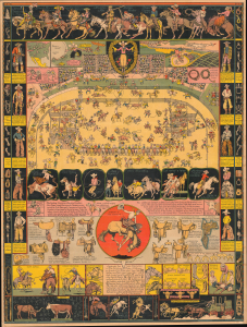
The legendarily rare 1933 first edition of Jo Mora's 'Evolution of the Cowboy' is considered his most iconic and influential work. The image celebrates all things cowboy, from the rodeo to saddles, steers, and chuckwagons. It is worth noting that Mora became a cowboy himself, and his depictions of cowboy life, the Salinas Rodeo, and the surrounding culture exhibit realism grounded in experience. (more details)
One of Mora's scarcest maps.
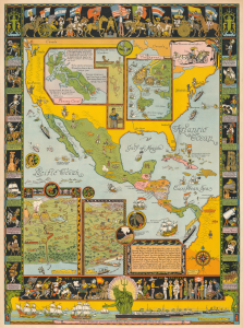
Father Neptune presenteth ye Grace Line fleet to ye olde Spanish Main.
sold
- Digital Map Information
- Suitable for large format printing
- File Size: 66.38 MB
- File Type: ZIP / TIFF
- ICC color profile embedded
- Delivered instantly via download link
This is a rare 1933 Jo Mora pictorial map of Central America commissioned by the Grace Line to celebrate and advertise its newly-launched passenger service from New York City to Seattle via the Panama Canal. It is considered to be among Mora's scarcest and most desirable maps. (more details)
A promotional pictorial map highlighting the Spanish Main and the history of the Americas.
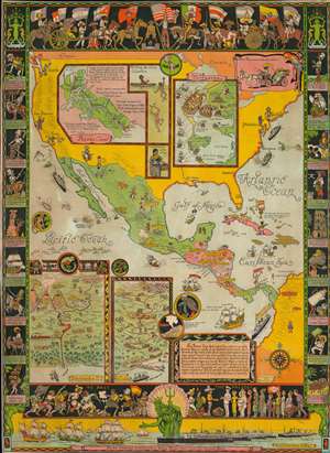
This is a rare 1933 Jo Mora pictorial map of Central America commissioned by the Grace Line to celebrate and advertise its newly-launched passenger service from New York City to Seattle via the Panama Canal. Focused on Central America, the map depicts North, Central, and South America and focuses on ports of call of the Grace Line. The whole map is dedicated to the memory of the Spanish Main, which is referred to as the 'cradle of our Western Civilization'. Mora also includes a disclaimer of sorts just below this dedication, stating 'The informative intent of this carte is Historical and Topographical yet it is rendered in the manner humorous that its perusal may be accomplished rather with the smile of levity than the frown of research'. (more details)
Cruise the Spanish Main with the Grace Line!
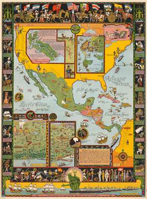
This is a rare 1933 Jo Mora pictorial map of Central America commissioned by the Grace Line to celebrate and advertise its newly-launched passenger service from New York City to Seattle via the Panama Canal. Focused on Central America, the map depicts North, Central, and South America and focuses on ports of call of the Grace Line. The whole map is dedicated to the memory of the Spanish Main, which is referred to as the 'cradle of our Western Civilization'. Mora also includes a disclaimer of sorts just below this dedication, stating
The informative intent of this carte is Historical and Topographical yet it is rendered in the manner humorous that its perusal may be accomplished rather with the smile of levity than the frown of research.(more details)
The Spanish Main with the Grace Line!
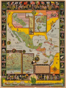
This is a rare 1933 Jo Mora pictorial map of Central America commissioned by the Grace Line to celebrate and advertise its newly-launched passenger service from New York City to Seattle via the Panama Canal. Centered on Central America, the map depicts North, Central, and South America and focuses on ports of call of the Grace Line. The whole is dedicated to the memory of the Spanish Main, which is referred to as the 'cradle of our Western Civilization'. Mora also includes a disclaimer of sorts just below this dedication, stating
The informative intent of this carte is Historical and Topographical yet it is rendered in the manner humorous that its perusal may be accomplished rather with the smile of levity than the frown of research.(more details)
The Spanish Main with the Grace Line!
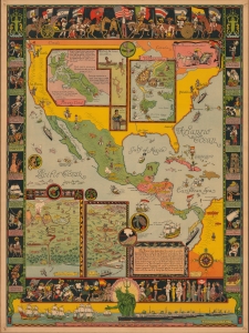
Father Neptune presenteth ye Grace Line fleet to ye olde Spanish Main.
sold
- Digital Map Information
- Suitable for large format printing
- File Size: 59.66 MB
- File Type: ZIP / TIFF
- ICC color profile embedded
- Delivered instantly via download link
This is a rare 1933 Jo Mora pictorial map of Central America commissioned by the Grace Line to celebrate and advertise its newly-launched passenger service from New York City to Seattle via the Panama Canal. (more details)
A wonderfully charming pictorial map of New York City featuring a devil at Hell Gate and a fishbowl for the New York Aquarium.
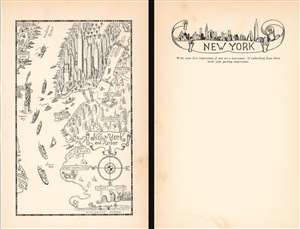
New York and Harbor.
sold
- Digital Map Information
- Suitable for large format printing
- File Size: 3.14 MB
- File Type: ZIP / TIFF
- ICC color profile embedded
- Delivered instantly via download link
This is a delightful 1933 Jo Mora pictorial map of New York City. The map depicts the region from Jersey City to Long Island City and from Central Park to Coney Island and the Atlantic Ocean. True to the aesthetic he cultivated over the course of his career, Mora employs numerous comic vignettes to illustrate this work. The New York Aquarium, then located in Battery Park, is marked simply by a goldfish in a fishbowl. Manhattan's elevated railway, now a thing of the past, curves around Lower Manhattan near Battery Park as well, evoking a note of nostalgia in the modern viewer. Hell Gate, though labeled, is marked by the devil brandishing a pitchfork. All four East River bridges are not illustrated as the wonders of modern engineering that they are, rather as four very simple foot bridges, complete with steps on either end. A man is illustrated fishing off of the Manhattan Bridge, while another figure pushes a wheelbarrow across the Queensboro Bridge.
Mora highlights the Brooklyn Navy Yard, labeled here as simply 'Navy Yard', but doesn't choose to Forth Hamilton in southern Brooklyn is marked by a doughboy (identifiable by his hat) is preparing to fire a cannon into The Narrows, and Coney Island is marked by a carnival barker and a rollercoaster. A very cheerful Statue of Liberty is illustrated greeting the ships entering and exiting the harbor, with an immigrant standing behind her on Ellis Island, then the nation's busiest immigration station.
On a more serious note, Manhattan's iconic, and ever-changing, skyline is highlighted, with the. Empire State Building in the center. Central Park, near the top border, is filled with trees and has a vehicle of some kind illustrated driving through it. Manhattan's many piers along the Hudson River are full, highlighting New York's economic importance and its stature as the largest city in the world. Jersey City and Hoboken are labeled in New Jersey, while the boroughs of Staten Island and Brooklyn are identified in New York.
The verso is mostly blank, but features a wonderful illustration of the New York skyline and a prompt to use the space as a diary entry, 'Write your first impressions if you are a newcomer. If embarking from there write your parting impressions.' (more details)
Mora highlights the Brooklyn Navy Yard, labeled here as simply 'Navy Yard', but doesn't choose to Forth Hamilton in southern Brooklyn is marked by a doughboy (identifiable by his hat) is preparing to fire a cannon into The Narrows, and Coney Island is marked by a carnival barker and a rollercoaster. A very cheerful Statue of Liberty is illustrated greeting the ships entering and exiting the harbor, with an immigrant standing behind her on Ellis Island, then the nation's busiest immigration station.
On a more serious note, Manhattan's iconic, and ever-changing, skyline is highlighted, with the. Empire State Building in the center. Central Park, near the top border, is filled with trees and has a vehicle of some kind illustrated driving through it. Manhattan's many piers along the Hudson River are full, highlighting New York's economic importance and its stature as the largest city in the world. Jersey City and Hoboken are labeled in New Jersey, while the boroughs of Staten Island and Brooklyn are identified in New York.
The verso is mostly blank, but features a wonderful illustration of the New York skyline and a prompt to use the space as a diary entry, 'Write your first impressions if you are a newcomer. If embarking from there write your parting impressions.' (more details)
A charming pictorial map of part of El Salvador between La Libertad and San Salvador.
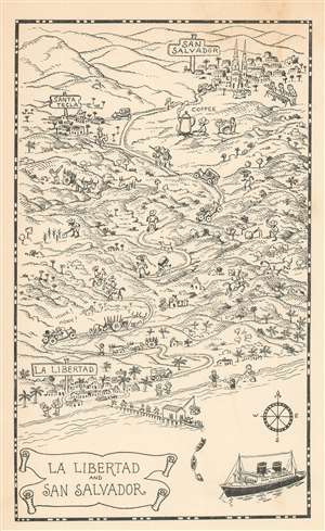
La Libertad and San Salvador.
sold
- Digital Map Information
- Suitable for large format printing
- File Size: 2.87 MB
- File Type: ZIP / TIFF
- ICC color profile embedded
- Delivered instantly via download link
Created for passengers on Grace Line cruises, this is a 1934 Jo Mora pictorial map of El Salvador. La Libertad, El Salvador, served as one of the ports of call on some Grace Line cruises, and passengers were invited to disembark and travel the twenty-six miles to San Salvador, El Salvador's capital. Mora lends his style to this excursion and draws passengers parading down a dock toward cars waiting to ferry them to the city. Locals are also illustrated tending their fields and riding on horseback. One individual is shown stoking a fire under a gigantic coffee pot! (more details)
A scarce and incredibly charming pictorial map of Yellowstone National Park.
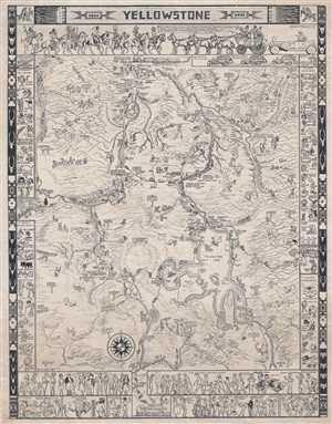
This is a scare 1935 Jo Mora pictorial map of Yellowstone National Park. The map depicts the park in detail from West Yellowstone, Montana to the east entrance to the park and from Gardiner, Montana to the park's south entrance. Signposts included throughout the ... (more details)
A Rich Palette of American Indian Imagery.
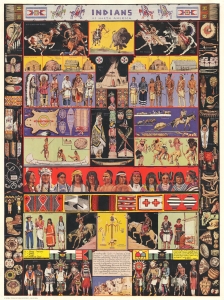
Indians of North America.
sold
- Digital Map Information
- Suitable for large format printing
- File Size: 83.15 MB
- File Type: ZIP / TIFF
- ICC color profile embedded
- Delivered instantly via download link
A striking visual catalog of Americn Indian life composed in 1936 by California-based artist Jo Mora. Mora had a lifelong fascination with Native American culture, especially of the Hopi and Navajo, and early in his career spent several years traveling and living among them in Arizona. (more details)
Cowboy Culture, by a cowboy.
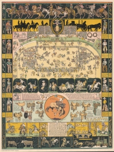
Considered Jo Mora's most iconic image, this is the 1933/39 'Evolution of the Cowboy.' The image celebrates all things cowboy, from the rodeo to saddles, steers, and chuckwagons. It is worth noting that Mora became a cowboy himself, and his depictions of cowboy life and culture exhibit realism based on experience. (more details)
A comical and incredibly charming pictorial map of Yosemite National Park.
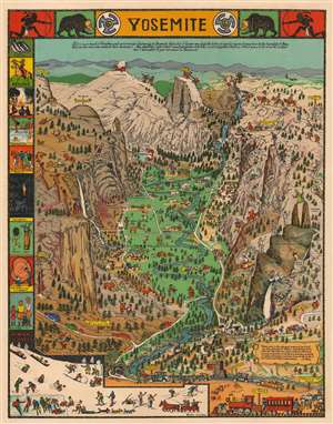
This is a 1941 Jo Mora pictorial map of Yosemite National Park in California. The map centers on Yosemite Valley and identifies several of the granite peaks that surrounds the valley, including Half Dome and El Capitan. Most of these peaks are topped by comical illustrations of their names. A Spanish conquistador, for example, stands atop El Capitan, a cloud lounges in an easy chair at the summit of Clouds Rest (the highest peak around Yosemite Valley), and George Washington appears at the top of Washington Column. A bride in her wedding gown and veil peers over Bridalveil Falls, while a bishop precariously straddles Cathedral Spires. Vernal Falls, Nevada Falls, and Yosemite Falls are all illustrated and labeled.
The valley itself, as well as the granite heights surrounding it, is filled with tourists enjoying their time in the park. People are illustrated picnicking, camping, fishing, swimming in the river, feeding deer, and fleeing bears who have decided to help themselves to their picnic! Another visitor is taking a photographic portrait for a couple of bears. Still others appear on horseback or hiking the steep trails. Cars filled with awe-struck admirers of the landscape travel along the meandering roads toward campsites and lodges. A border featuring vignettes of activities at the park, including swimming, a campfire circle, horseback riding, winter sports, and fishing, is situated along the left side. A text box in the lower right corner bears a dedication to Mora's friend Stephen T. Mather, the first Director of the U.S. National Park Service. (more details)
The valley itself, as well as the granite heights surrounding it, is filled with tourists enjoying their time in the park. People are illustrated picnicking, camping, fishing, swimming in the river, feeding deer, and fleeing bears who have decided to help themselves to their picnic! Another visitor is taking a photographic portrait for a couple of bears. Still others appear on horseback or hiking the steep trails. Cars filled with awe-struck admirers of the landscape travel along the meandering roads toward campsites and lodges. A border featuring vignettes of activities at the park, including swimming, a campfire circle, horseback riding, winter sports, and fishing, is situated along the left side. A text box in the lower right corner bears a dedication to Mora's friend Stephen T. Mather, the first Director of the U.S. National Park Service. (more details)
A comical and incredibly charming pictorial map of Yosemite National Park.
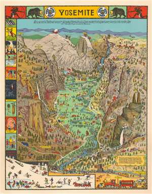
This is a 1941 Jo Mora pictorial map of Yosemite National Park in California. The map centers on Yosemite Valley and identifies several of the granite peaks that surrounds the valley, including Half Dome and El Capitan. Most of these peaks are topped by comical illustrations of their names. A Spanish conquistador, for example, stands atop El Capitan, a cloud lounges in an easy chair at the summit of Clouds Rest (the highest peak around Yosemite Valley), and George Washington appears at the top of Washington Column. A bride in her wedding gown and veil peers over Bridalveil Falls, while a bishop precariously straddles Cathedral Spires. Vernal Falls, Nevada Falls, and Yosemite Falls are all illustrated and labeled.
The valley itself, as well as the granite heights surrounding it, is filled with tourists enjoying their time in the park. People are illustrated picnicking, camping, fishing, swimming in the river, feeding deer, and fleeing bears who have decided to help themselves to their picnic! Another visitor is taking a photographic portrait for a couple of bears. Still others appear on horseback or hiking the steep trails. Cars filled with awe-struck admirers of the landscape travel along the meandering roads toward campsites and lodges. A border featuring vignettes of activities at the park, including swimming, a campfire circle, horseback riding, winter sports, and fishing, is situated along the left side. A text box in the lower right corner bears a dedication to Mora's friend Stephen T. Mather, the first Director of the U.S. National Park Service. (more details)
The valley itself, as well as the granite heights surrounding it, is filled with tourists enjoying their time in the park. People are illustrated picnicking, camping, fishing, swimming in the river, feeding deer, and fleeing bears who have decided to help themselves to their picnic! Another visitor is taking a photographic portrait for a couple of bears. Still others appear on horseback or hiking the steep trails. Cars filled with awe-struck admirers of the landscape travel along the meandering roads toward campsites and lodges. A border featuring vignettes of activities at the park, including swimming, a campfire circle, horseback riding, winter sports, and fishing, is situated along the left side. A text box in the lower right corner bears a dedication to Mora's friend Stephen T. Mather, the first Director of the U.S. National Park Service. (more details)
Mora's rarest and most desirable map.
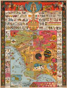
This is a 1942 Jo Mora pictorial map of Los Angeles, California. This is Mora's rarest and most sought-after pictorial map and arguably the best pictorial map of Los Angeles ever issued. It is filled with Mora's unique humor and artistry, which captures Los Angeles' culture, folklore, and history. (more details)
Mora's rarest and most desirable map.
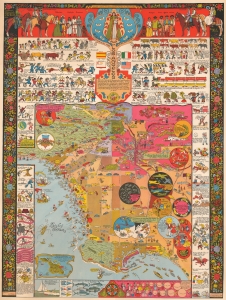
This is a 1942 Jo Mora pictorial map of Los Angeles, California. This is Mora's rarest and most sought-after pictorial map and arguably the best pictorial map of Los Angeles ever issued. It is filled with Mora's unique humor and artistry, which captures Los Angeles' culture, folklore, and history. (more details)
California's most beautiful and iconic town.
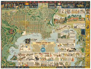
Carmel-by-the-Sea Past and Present.
sold
- Digital Map Information
- Suitable for large format printing
- File Size: 46.14 MB
- File Type: ZIP / TIFF
- ICC color profile embedded
- Delivered instantly via download link
A beautiful example of the scarce 1942 Jo Mora pictorial map of Carmel, California. Located on the southern edge of the Monterey Peninsula, Carmel-by-the-Sea is widely regarded as one of California's most beautiful beach-front communities. (more details)
An iconic map from the Golden Age of Pictorial Cartography.
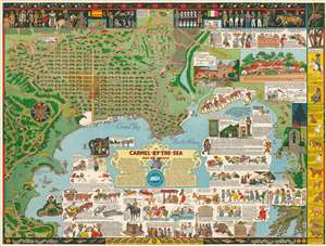
Carmel-by-the-Sea Past and Present.
sold
- Digital Map Information
- Suitable for large format printing
- File Size: 48.12 MB
- File Type: ZIP / TIFF
- ICC color profile embedded
- Delivered instantly via download link
A beautiful example of the scarce 1942 Jo Mora pictorial map of Carmel, California. Located on the southern edge of the Monterey Peninsula, Carmel-by-the-Sea, is widely regarded as one of California's most beautiful beach-front communities. The map is oriented to the East, with Carmel at top and Carmel Bay at the bottom. The Carmel as presented here is very similar to modern-day Carmel, with the street layout clearly recognizable. Throughout, as was Mora's style, the map is rich with pictorial vignettes and other elements illustrating local history, humor, and folklore. Even the canines of Carmel have their place, with 10 famous dogs illustrated along the right border. This map is generally considered to be among the finest of Mora's map pieces. (more details)
One of California's most beautiful and iconic towns.
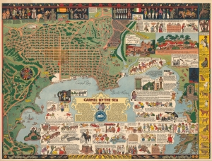
Carmel-by-the-Sea Past and Present.
sold
- Digital Map Information
- Suitable for large format printing
- File Size: 1026.39 MB
- File Type: ZIP / TIFF
- ICC color profile embedded
- Delivered instantly via download link
A beautiful example of the scarce 1942 Jo Mora pictorial map of Carmel, California. Located on the southern edge of the Monterey Peninsula, Carmel-by-the-Sea, is widely regarded as one of California's most beautiful beach-front communities. (more details)
One of California's most beautiful and iconic towns.
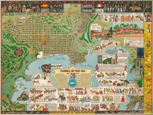
Carmel-by-the-Sea Past and Present.
sold
- Digital Map Information
- Suitable for large format printing
- File Size: 546.9 MB
- File Type: ZIP / TIFF
- ICC color profile embedded
- Delivered instantly via download link
A beautiful example of the scarce 1942 Jo Mora pictorial map of Carmel, California. Located on the southern edge of the Monterey Peninsula, Carmel-by-the-Sea is widely regarded as one of California's most beautiful beach-front communities. (more details)
Pictorial history of California.
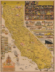
An intricate, beautiful, and playful 1945 pictorial map of California drawn and published by one of the state's greatest artists of the age, Jo Mora. It provides a whimsical and somewhat sanitized history of the state from the pre-colonial period to the date of publication. (more details)