
NEW ACQUISITIONS
One of the last frontiers in the Scramble for Africa.
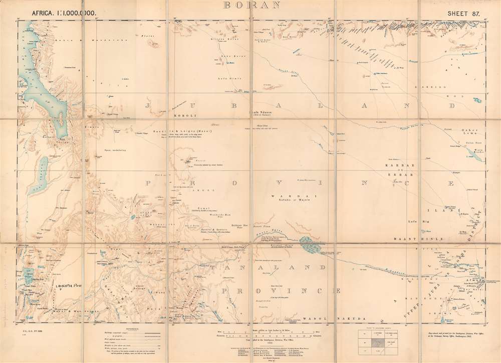
Boran.
$800.00
Acquire
- Digital Map Information
- Suitable for large format printing
- Full resolution TIFF file
- ICC color profile embedded
- Delivered instantly via download link
This is a 1903 British Ordnance Survey / War Office folding map of Boran, today the northeastern portion of Kenya bordering Ethiopia and Somalia. It was made during the 'Scramble for Africa,' when European colonial powers rushed to occupy and claim territory. However, the harsh climate and resistance of local pastoralists to outside rule meant the region long remained a distant frontier to imperial powers. (more details)
Illustrates the Old City and the Temple Mount in detail.
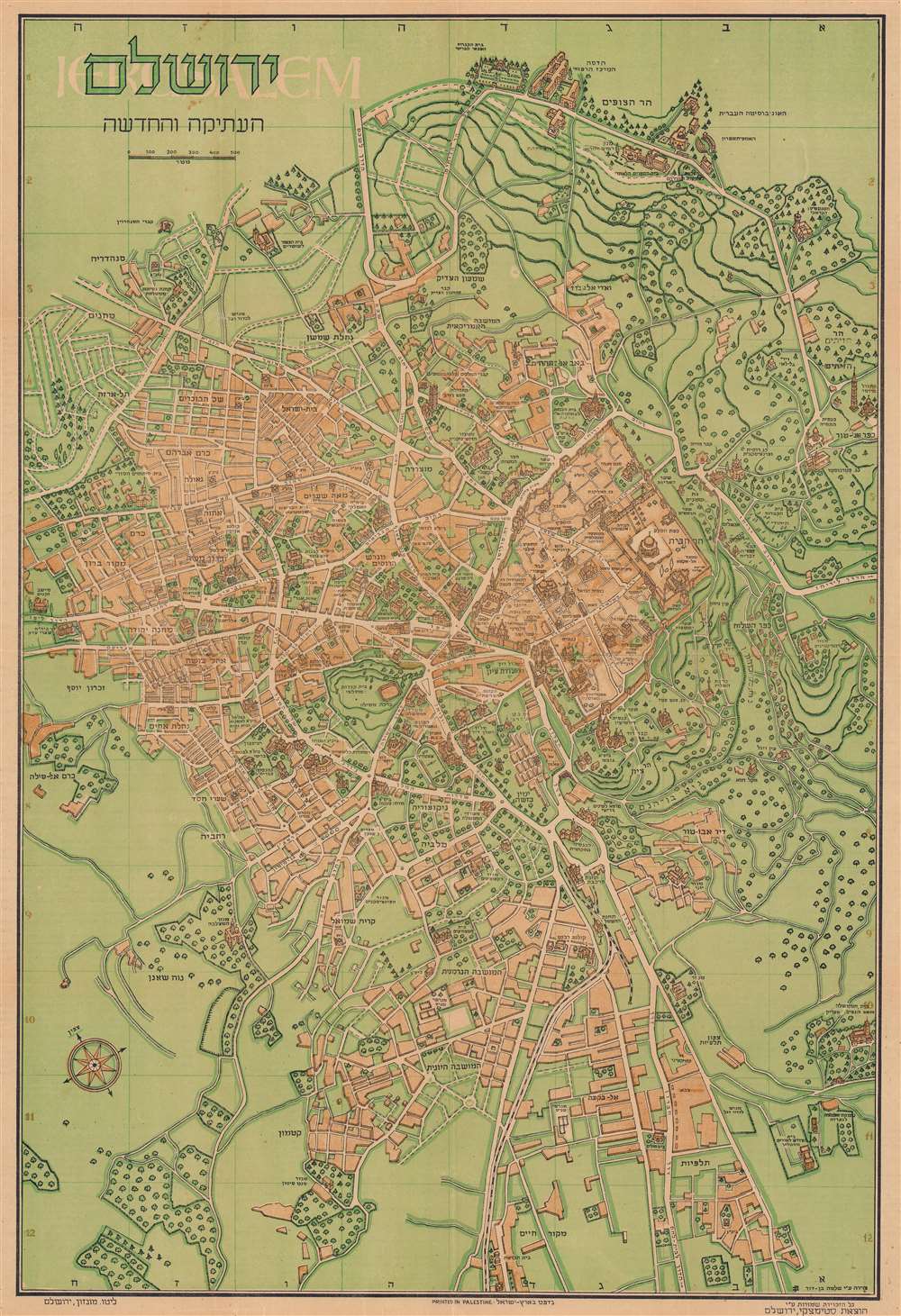
ירושלם העתיקה והחדשה / Jerusalem Old and New.
$600.00
Acquire
- Digital Map Information
- Suitable for large format printing
- Full resolution TIFF file
- ICC color profile embedded
- Delivered instantly via download link
This is a 1942 Steimatzky pictorial map of Jerusalem in Hebrew. The map depicts the city from Karem es Sila to El Tur and the Mount of Olives and from the Hadassa Medical Center, the Hebrew University and Mt. Scopus to Meqor Hayim. Illustrating numerous buildings in profile, the Old City and the Temple Mount act as the focal point. Surrounded by walls, several buildings within the Old City, such as the Holy Sepulcre, St. Anne's, the Supreme Muslim Council, and several gates are labeled. On the Temple Mount, the Dome of the Rock and the Al Aksa Mosque are illustrated. Some of the locations illustrated outside the Old City include the Citadel, the Church of Dormition, the Tomb of the Virgin, the Tombs of the Kings, and several monasteries and convents. Neighborhoods throughout the city are labeled, along with streets and the railway which enters the city near the bottom of the map. (more details)
Manila just after World War II ended.
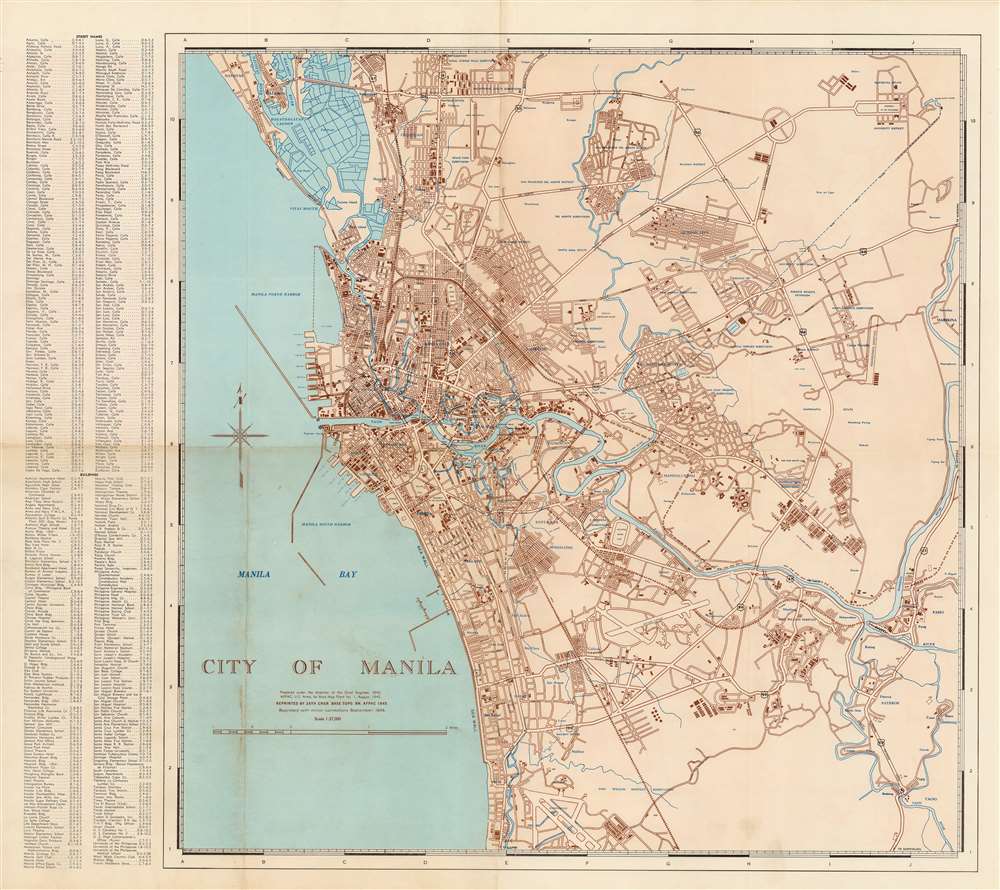
City of Manila.
$550.00
Acquire
- Digital Map Information
- Suitable for large format printing
- File Size: 61.11 MB
- File Type: ZIP / TIFF
- ICC color profile embedded
- Delivered instantly via download link
This is a September 1945 U.S. Army Forces, Pacific (AFPAC) city plan or map of Manila, Philippines. It lists important streets and sites in the capital city, which had just been obliterated by an intense battle between American and Japanese forces, one of the forgotten urban conflicts of the Second World War. (more details)
A rare Spanish-language edition of a beautiful map.
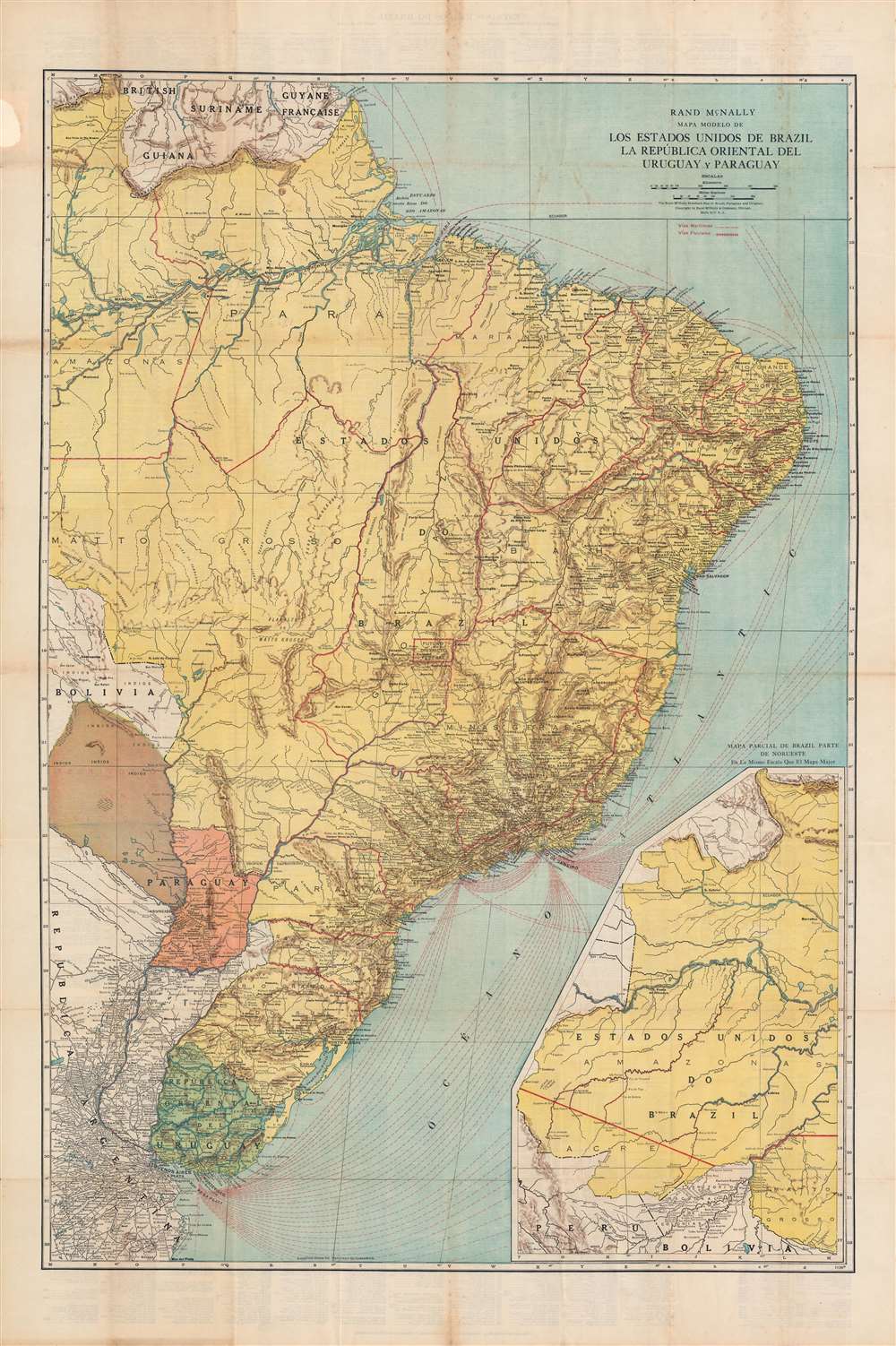
Mapa modelo de los Estados Unidos de Brazil, La República Oriental del Uruguay y Paraguay.
$450.00
Acquire
- Digital Map Information
- Suitable for large format printing
- Full resolution TIFF file
- ICC color profile embedded
- Delivered instantly via download link
This is a very rare Spanish-language c. 1924 Rand McNally map of Brazil, Paraguay, and Uruguay. It depicts the countries as they emerged from the wars and revolutions of the 19th century when they were contending with remnant territorial disputes and new revolutionary political forces. (more details)
Most attractive in appearance…ideally illuminated and scientifically air conditioned!
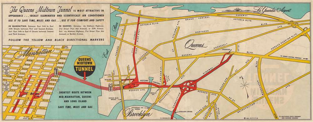
The Queens Midtown Tunnel.
$225.00
Acquire
- Digital Map Information
- Suitable for large format printing
- Full resolution TIFF file
- ICC color profile embedded
- Delivered instantly via download link
This is a 1941 New York City Tunnel Authority map promoting the virtues of the recently opened Queens Midtown Tunnel. Opened to traffic on November 15, 1940, the arteries into and out of the new tunnel are shaded red, with small black arrows indicating the flow of traffic. Major avenues and boulevards in Queens are illustrated in yellow, while Manhattan's famous street grid is shown from 34th Street to 47th Street and from Park Avenue to the East River. A slogan in the upper left corner reads, 'The Queens Midtown Tunnel is most attractive in appearance…ideally illuminated and scientifically air conditioned use it to save time, miles, and gas…use it in comfort and safety'. (more details)
Published the year the East India Docks began operations.
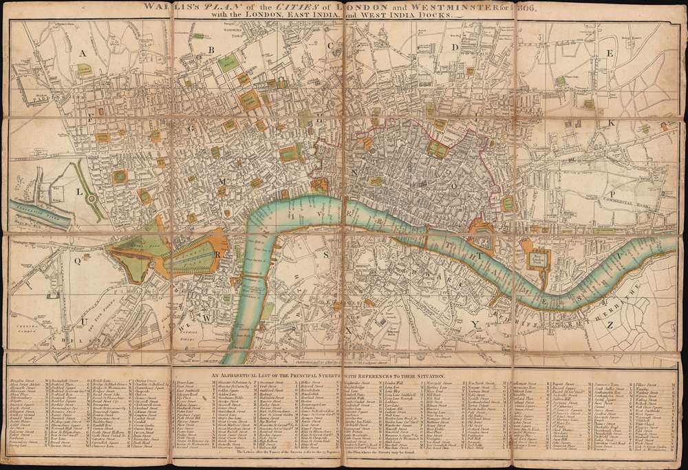
Wallis's Plan of the Cities of London and Westminster for 1806 with the London, East India, and West India Docks.
$950.00
Acquire
- Digital Map Information
- Suitable for large format printing
- DPI: 600
- File Size: 24.24 MB
- File Type: ZIP / TIFF
- ICC color profile embedded
- Delivered instantly via download link
This is an 1806 John Wallis city plan or map of London, England. Focusing on London along the Thames, the map depicts from Paddington to White Horse Street and from Hoxton to Redriff. Hand color emphasizes important locations throughout, including Leicester Square, the Tower of London, St. Paul's Cathedral, and St. James's Park. Buckingham Palace is labeled 'Queen's Palace' (but isn't shaded), as is the British Museum. (more details)
Lourenço Marques and the South African Republic's 'national railway.'
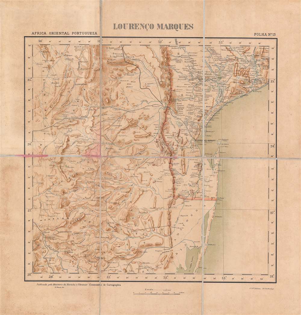
Lourenço Marques.
$800.00
Acquire
- Digital Map Information
- Suitable for large format printing
- File Size: 21.52 MB
- File Type: ZIP / TIFF
- ICC color profile embedded
- Delivered instantly via download link
This is a rare c. 1896 folding map of Lourenço Marques (now Maputo) and its surrounding region in Portuguese East Africa (Mozambique) made by the Comissão de Cartografia das Colónias. The map was produced in the wake of a Portuguese-British struggle for primacy in southeastern Africa and attempts by the South African Republic to maintain its independence by using Lourenço Marques as an outlet to the coast. (more details)
Portugal's dream of a transcontinental African colony.
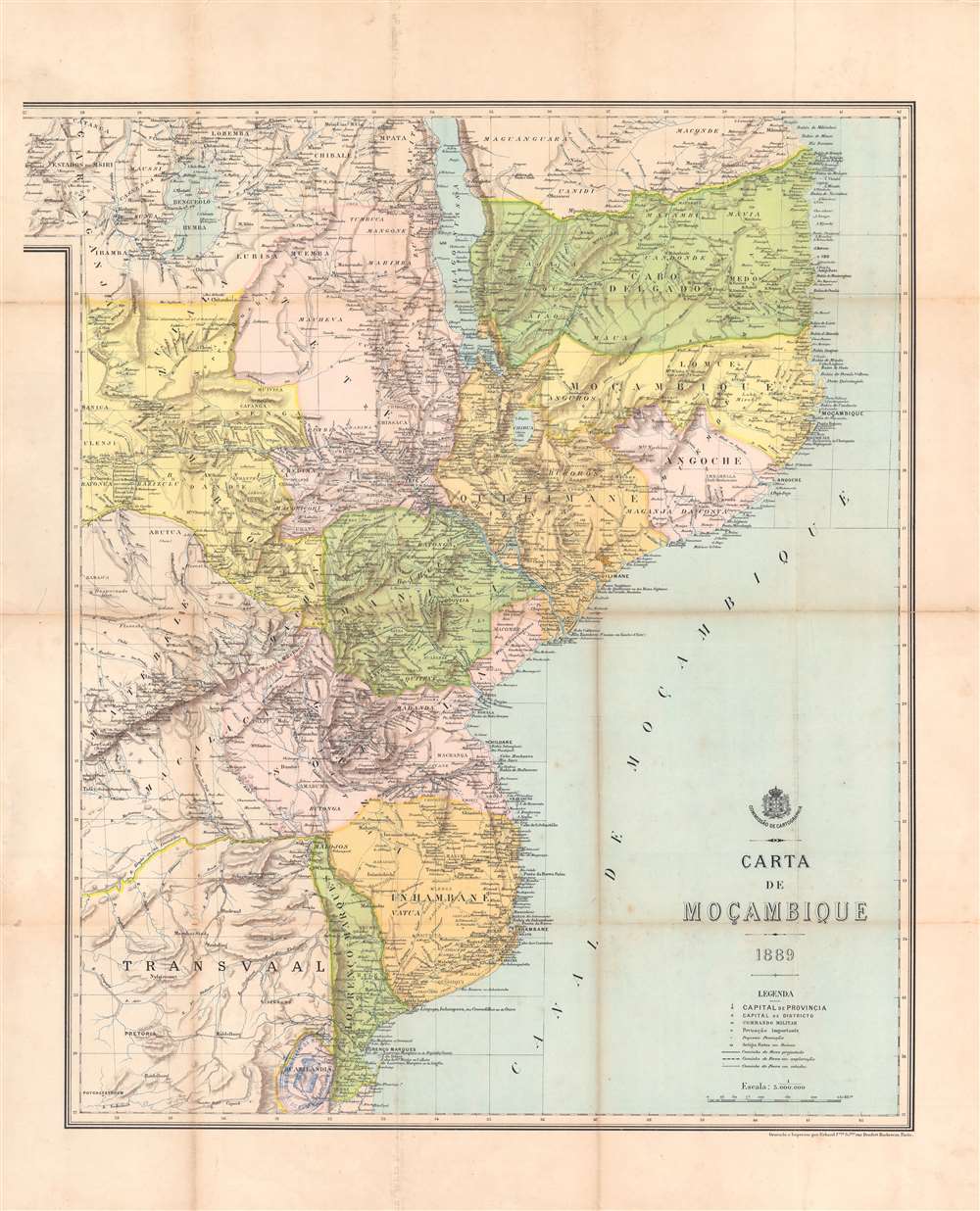
Carta de Moçambique.
$800.00
Acquire
- Digital Map Information
- Suitable for large format printing
- Full resolution TIFF file
- ICC color profile embedded
- Delivered instantly via download link
This is an 1889 map of Mozambique (Portuguese East Africa) made by the Comissão de Cartographia and printed in Paris by Georges Erhard. It was produced at the height of a Portuguese-British competition in central and eastern Africa, part of the 'Scramble for Africa' among European powers. The map reflects territorial claims extending far past areas of Portugal's actual control, a failed attempt to claim sovereign based on the doctrine of 'effective occupation' laid out at the Berlin Conference of 1884 - 1885. (more details)
British and Portuguese struggle for control of central Africa.
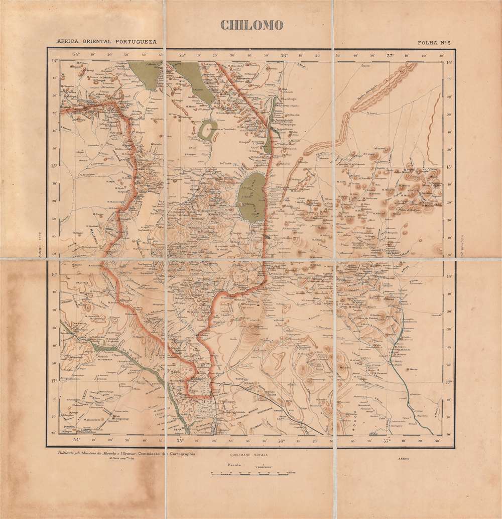
Chilomo - Africa Oriental Portugueza, Folha No. 5.
$800.00
Acquire
- Digital Map Information
- Suitable for large format printing
- File Size: 20.75 MB
- File Type: ZIP / TIFF
- ICC color profile embedded
- Delivered instantly via download link
This is a very rare c. 1896 map of the border region between the British Central Africa Protectorate and Portuguese Mozambique. This area had been hotly contested between the two colonial powers just a few years before and the border only recently settled in a contest that ensured British primacy in central Africa. (more details)
Three years before the Civil War.
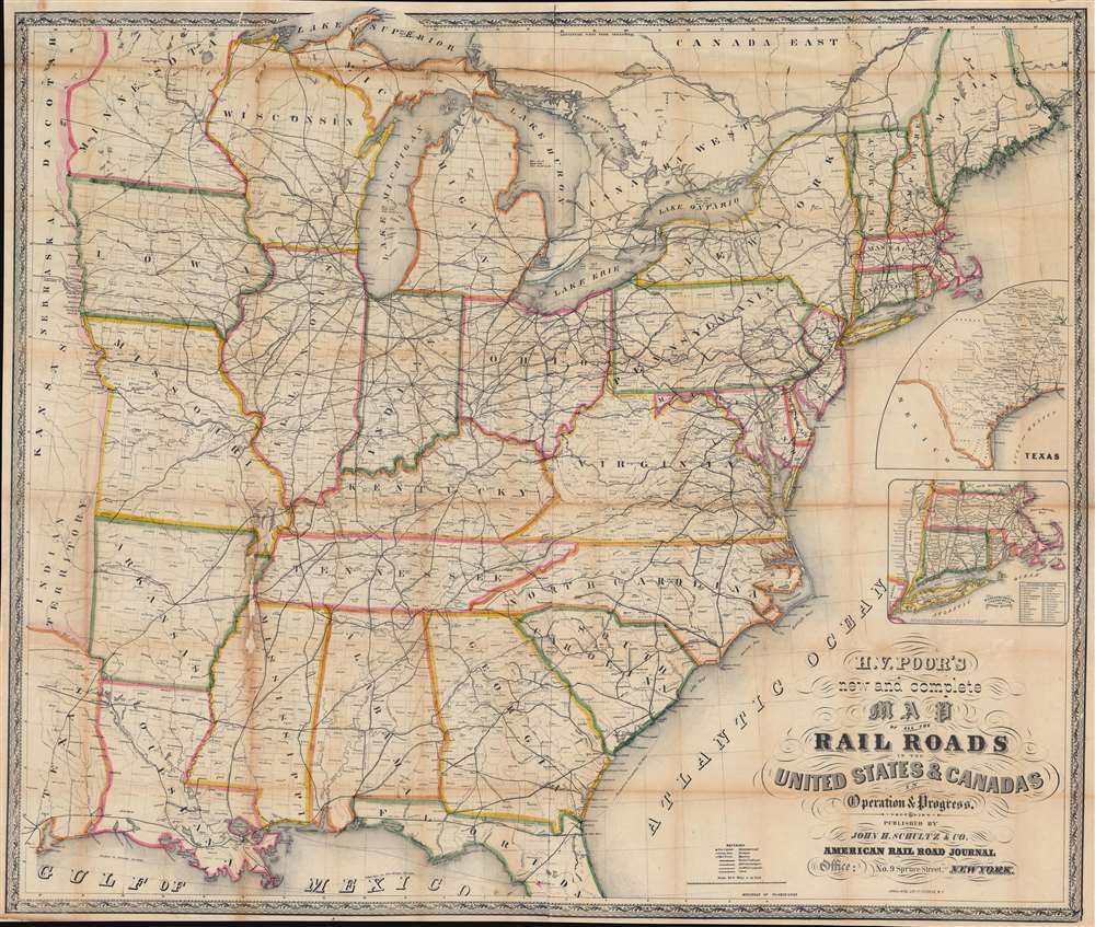
H. V. Poor's new and complete Map of All the Rail Roads in the United States and Canadas in Operation and Progress.
$950.00
Acquire
- Digital Map Information
- Suitable for large format printing
- File Size: 86.11 MB
- File Type: ZIP / TIFF
- ICC color profile embedded
- Delivered instantly via download link
This is a c. 1858 Henry V. Poor railroad wall map of the eastern United States, published just 3 years before the American Civil War (1861 - 1865). Railroads identified by name traverse the country from the Eastern Seaboard the central United States, reaching eastern Nebraska, Kansas, and Texas. (more details)
New York's skyline, Neuschwanstein Castle, and the Hagia Sophia.
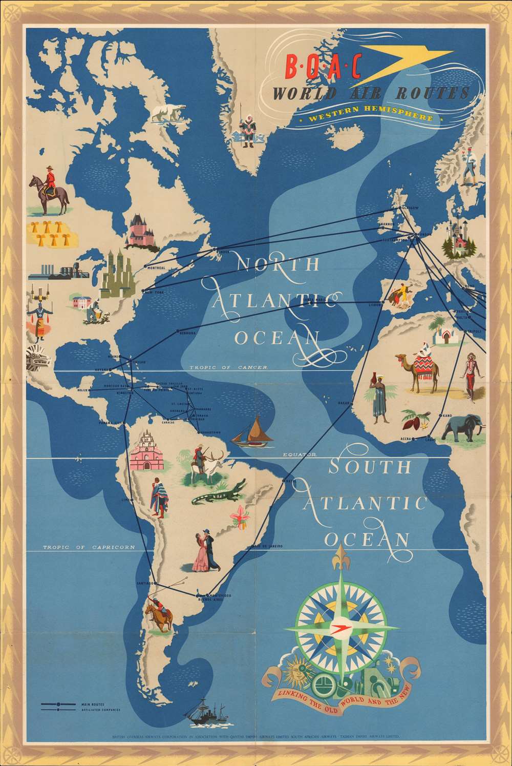
B.O.A.C. World Air Routes Western Hemisphere. B.O.A.C. World Air Routes Eastern Hemisphere.
$850.00
Acquire
- Digital Map Information
- Suitable for large format printing
- Full resolution TIFF file
- ICC color profile embedded
- Delivered instantly via download link
This is a double-sided 1949 E.O. Seymour pictorial air route map of the world in hemispheres for British Overseas Airways Corporation (B.O.A.C.). The Western Hemisphere appears on one side, and the Eastern Hemisphere occupies the other. Black lines trace B.O.A.C. routes and those of affiliated airlines. Pictorial vignettes highlight landmarks throughout the world, many of which fall outside of B.O.A.C.'s network. Neuschwanstein Castle in Germany, the Hagia Sophia in Istanbul, St. Basil's Cathedral in Moscow, New York's world-famous skyline, and Chateau Frontenac in Québec City all adorn this excellent map. Cultural vignettes, many of which portray a given part of the world in the most stereotypical manner possible, also decorate the hemispheres. A bullfight in Spain, individuals in 'traditional dress' throughout Africa and East Asia, a man standing next to a reindeer in Finland, a Mountie in Canada, dancers in Argentina, and an Australian aborigine all make appearances. The B.O.A.C. Speedbird adorns the pseudo-metallic border. (more details)
Imaginary Cartography Meets Actual Exploration.
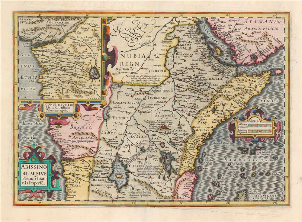
Abissinorum Sive Pretiosi Ioannis Imperiū.
$750.00
Acquire
- Digital Map Information
- Suitable for large format printing
- Full resolution TIFF file
- ICC color profile embedded
- Delivered instantly via download link
This is the 1606 Jodocus Hondius map of Abyssinia or East Africa, showing the headwaters of the Nile, as assumed in antiquity. The region thus depicted encompasses the apocryphal Christian Empire of Prester John. This example is from the first French text edition of the Mercator / Hondius atlas, dating to 1609. Hondius has drawn heavily on what was still the most authoritative take on the mythical kingdom: Abraham Ortelius' 1573 Presbiteri Iohannis, Sive, Abissionrum Imperii Descriptio. (more details)
Empires of the East.
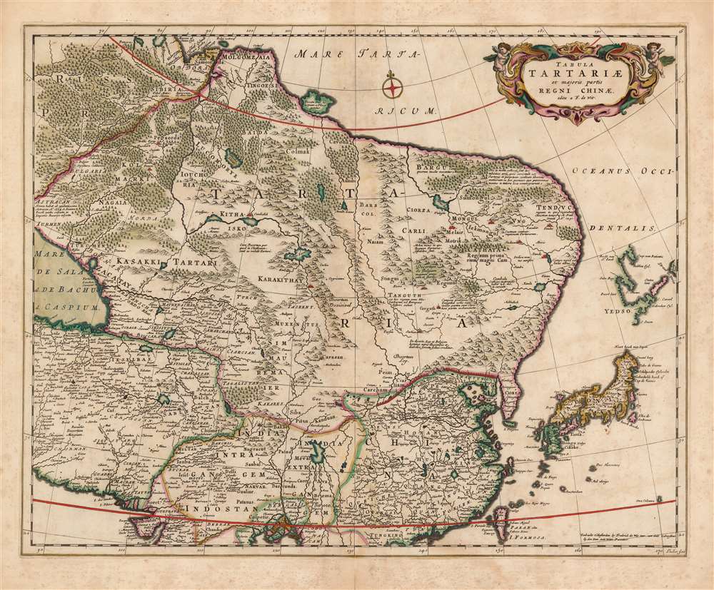
Tabula Tartariae et majoris partis Regni Chinae edita a F. de Wit.
$750.00
Acquire
- Digital Map Information
- Suitable for large format printing
- DPI: 600
- File Size: 51.08 MB
- File Type: ZIP / TIFF
- ICC color profile embedded
- Delivered instantly via download link
This beautifully engraved and colored map is Frederick de Wit's 1680 map of Central Asia and the Far East, including Persia, China, Japan and Siberia. It reaches from the eastern Caspian Sea to the Pacific, and from the mouth of the Ganges in the south to the mouth of the Ob in Siberia. This represented the state of the art of Dutch cartography of northeastern Asia prior to the groundbreaking map of Nicolaas Witsen. The treatment of Japan and Yedso reflects the journey of Maarten Gerritsz Vries and the northeastern bulge evident on the maps of Blaeu and Jansson has been truncated here. The regions of central Asia are replete with descriptive texts, some of which were retained from the 15th century maps of Fra Mauro, and even from the narrative of Marco Polo. These focus particularly on the empire of the Grand Khan, and on various putative Christian kingdoms. The Great Wall of China is depicted. (more details)
History of Ancient Rome in a single map.
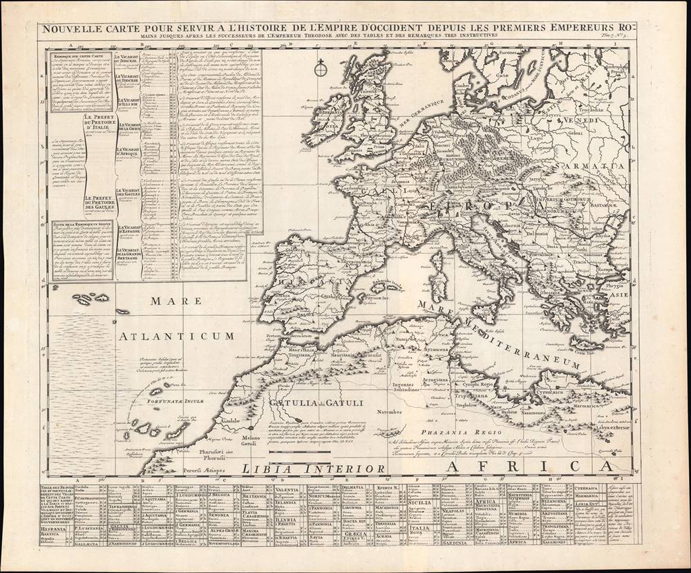
Nouvelle Carte pour servir à l'Histoire de l'Empire d'Occident…
$500.00
Acquire
- Digital Map Information
- Suitable for large format printing
- DPI: 600
- File Size: 26.7 MB
- File Type: ZIP / TIFF
- ICC color profile embedded
- Delivered instantly via download link
This is a superbly engraved 1720 Henri Châtelain map of the Western Roman Empire from Châtelain's Atlas Historique. It is a rich, well-researched source that ambitiously aims to represent some 500 years of Roman history and geography. (more details)
From the final, Spanish edition of the 'Atlas Maior'.
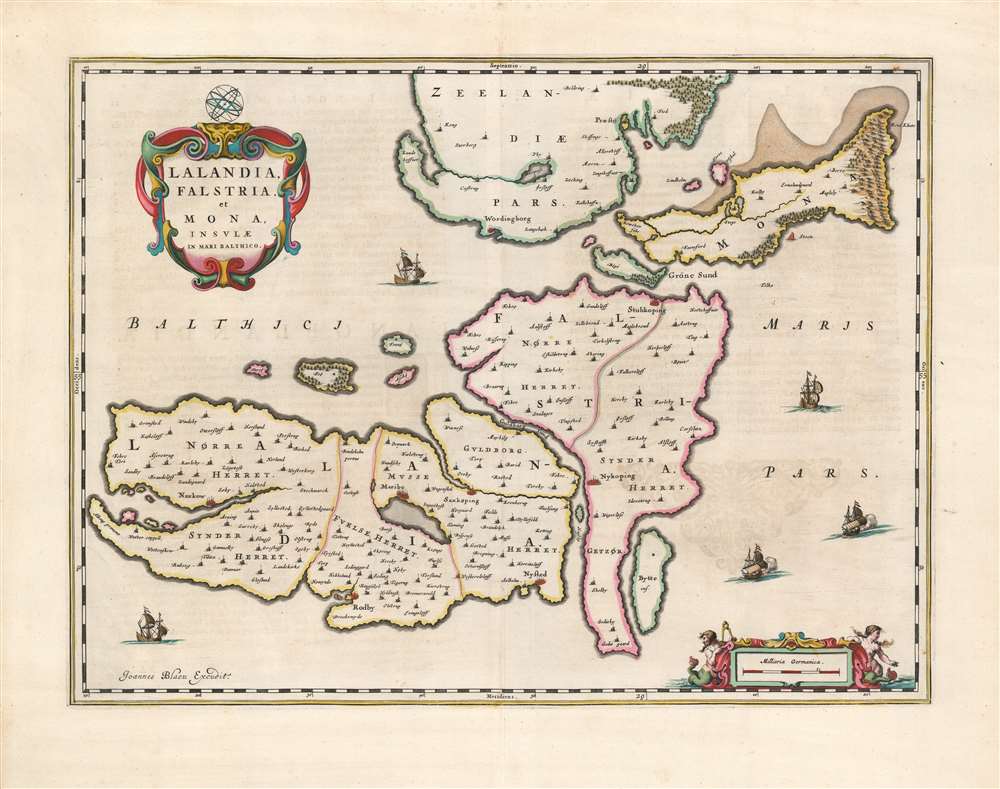
Lalandia, Falstria et Mona Insulae in Mari Balthico.
$450.00
Acquire
- Digital Map Information
- Suitable for large format printing
- DPI: 600
- File Size: 45.31 MB
- File Type: ZIP / TIFF
- ICC color profile embedded
- Delivered instantly via download link
This is Joan Blaeu's 1659 map of the islands of Laaland, Falster, and Møn, the southeastern part of Denmark. It is among the scarcest of Blaeu's maps, appearing in a sole edition of the Novuus Atlas and subsequently only in the Atlas Maior. The map is superbly engraved and colored, with a lovely cartouche and sailing ships: typical of the younger Blaeu's work at its creative peak. (more details)
Veterans Land Board Scandal.
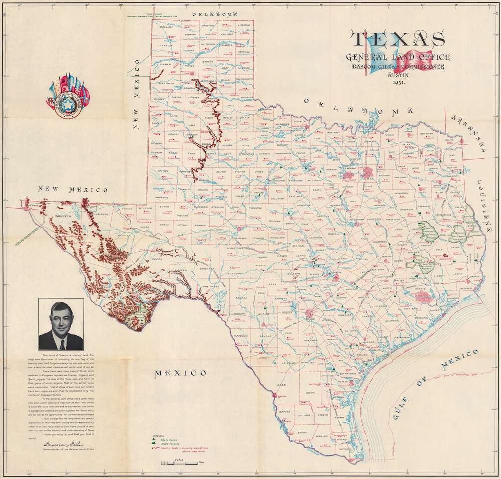
Texas.
$400.00
Acquire
This is a 1954 Texas General Land Office and Eltea Armstrong map of Texas. The map features a portrait of Bascom Giles at the height of his power as head of the Texas Land Office, and just months before his fall in the Veterans Land Board Scandal. Austin, Dallas, Fort Worth, Abilene, Houston, and San Antonio, are emphasized by 'street grids' relating their relative size. Green areas highlight national forests and Big Bend National Park. Mountains in West Texas are illustrated pictorially. State parks and forests are indicated by green pine trees. (more details)
Charting the Spice Islands.
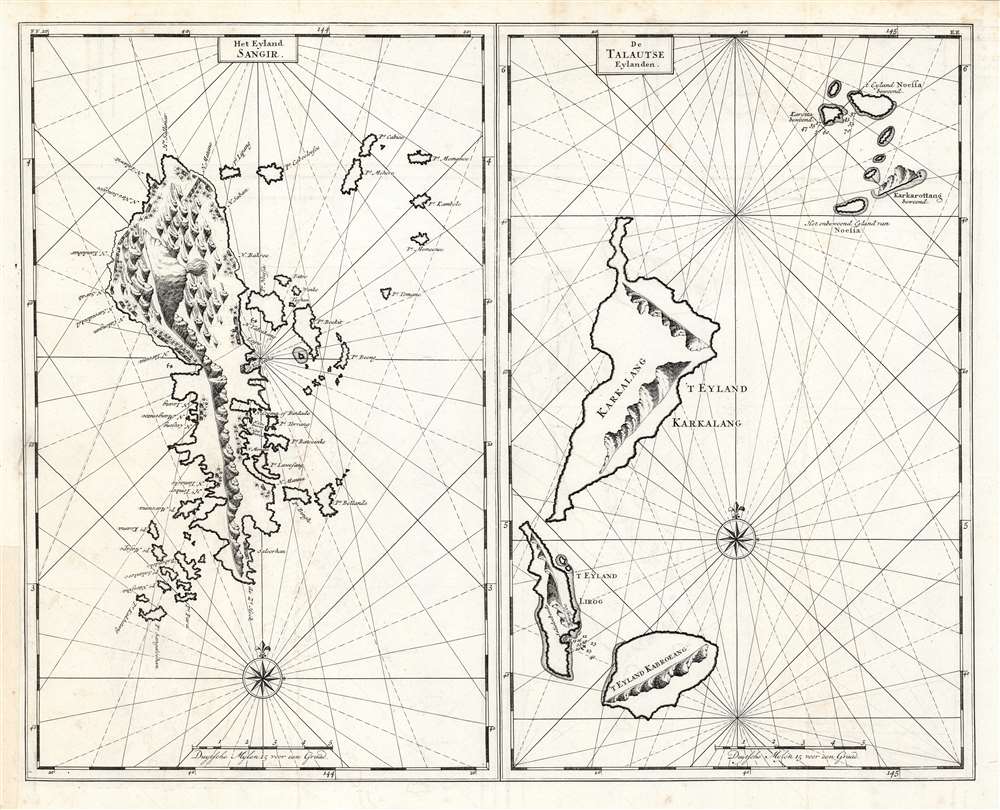
Het Eyland Sangir./ De Talautse Eylanden.
$350.00
Acquire
- Digital Map Information
- Suitable for large format printing
- DPI: 600
- File Size: 48.24 MB
- File Type: ZIP / TIFF
- ICC color profile embedded
- Delivered instantly via download link
This is a 1724 François Valentijn engraving comprised of two nautical charts, one of the Indonesian archipelagos of the Sangihe Islands, and other of the Talaud Islands. The charts are elegantly and simply engraved, with rhumb lines and compass roses. The islands themselves incorporate coastal views oriented to assist in approaches to their anchorages, which are marked as well, along with depth soundings. The island of Sangihe in particular identifies many settlements, along with pictorial forests. Sangihe was a major nutmeg and clove-producing island, making these forests more important than mere decorations. Also marked on Sangihe is the massive stratovolcano Gunung Awu. Although not named here, it is identified with its smoking peak. (more details)
Prospect for gold in Arizona!
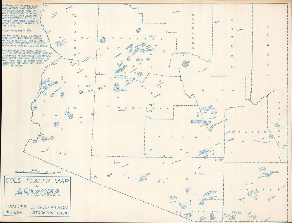
Gold Placer Map of Arizona.
$325.00
Acquire
This is a c. 1956 Walter J. Robertson diazotype map of Arizona placer gold deposits. Circular areas of dots mark placer deposits, some of which are annotated with the value of nuggets discovered. Capital 'G's mark known lodes (which require underground mining and are much less likely to be attractive to prospectors). Although the Arizona gold rushes predate this map by decades, or even a century, prospectors continued to explore to this day. Robertson created this map, along with maps of other states where there were placer gold deposits, for those individuals. (more details)
History and iconic wildlife.
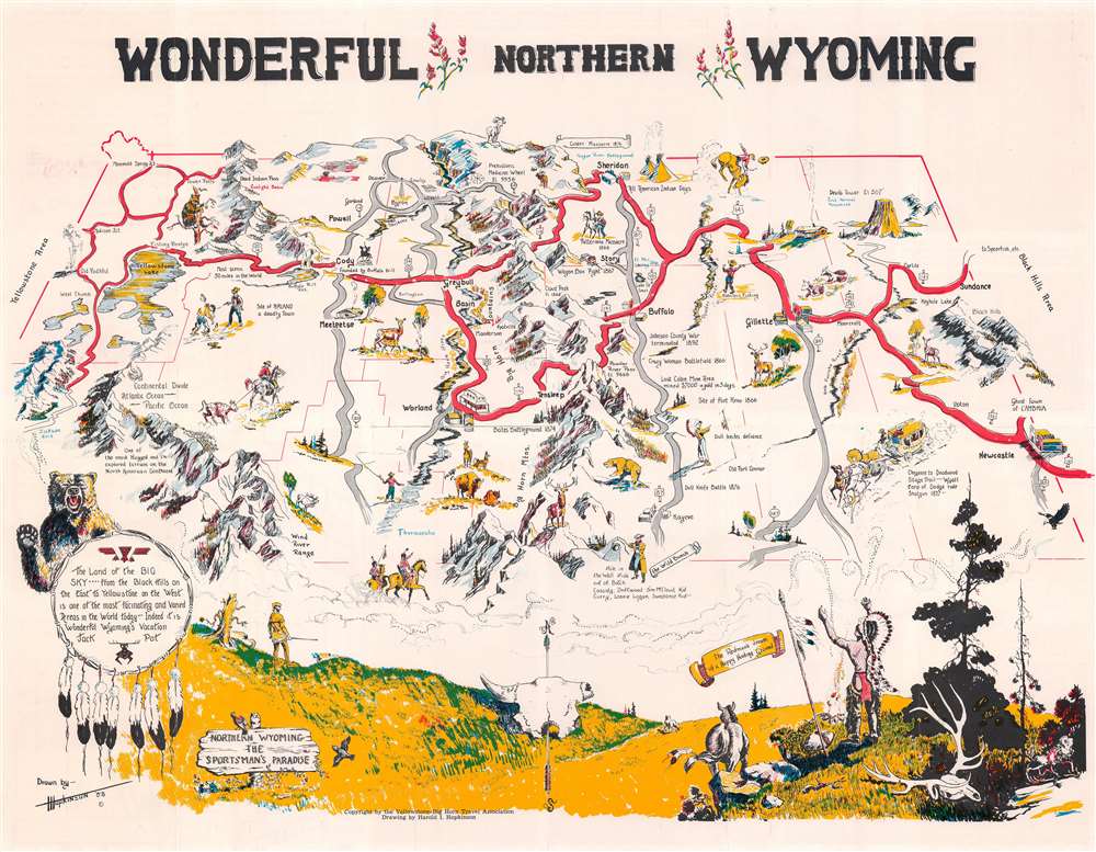
Wonderful Northern Wyoming.
$275.00
Acquire
This is a 1958 Harold Hopkinson pictorial map of northern Wyoming. The map depicts from Old Faithful east to Sundance and the Black Hills and from Mammoth Springs Junction south to Kaycee and Hole in the Wall, the hide out of Butch Cassidy and the Sundance Kid. Yellowstone National Park occupies the upper left, with Yellowstone Lake, Old Faithful, Mammoth Springs, and Madison Junction identified. Buffalo Bill Cody's monument appears just east of the park, and the Big Horn Mountains divide the map almost in half. Devil's Tower is situated in the upper right, not far from Sundance (not where the Sundance Film Festival is held every year - that happens in Park City, Utah) and the Black Hills. Fantastic illustrations of stagecoaches, Native Americans, gunfights, cowboys, and Wyoming's iconic wildlife populate the rest of the map. Prairie landscapes dominates the bottom portion of the map, with a Native American chief creating smoke signals on the right and a frontiersman on the left. (more details)
'One of the most expensive affairs of honor in history.'
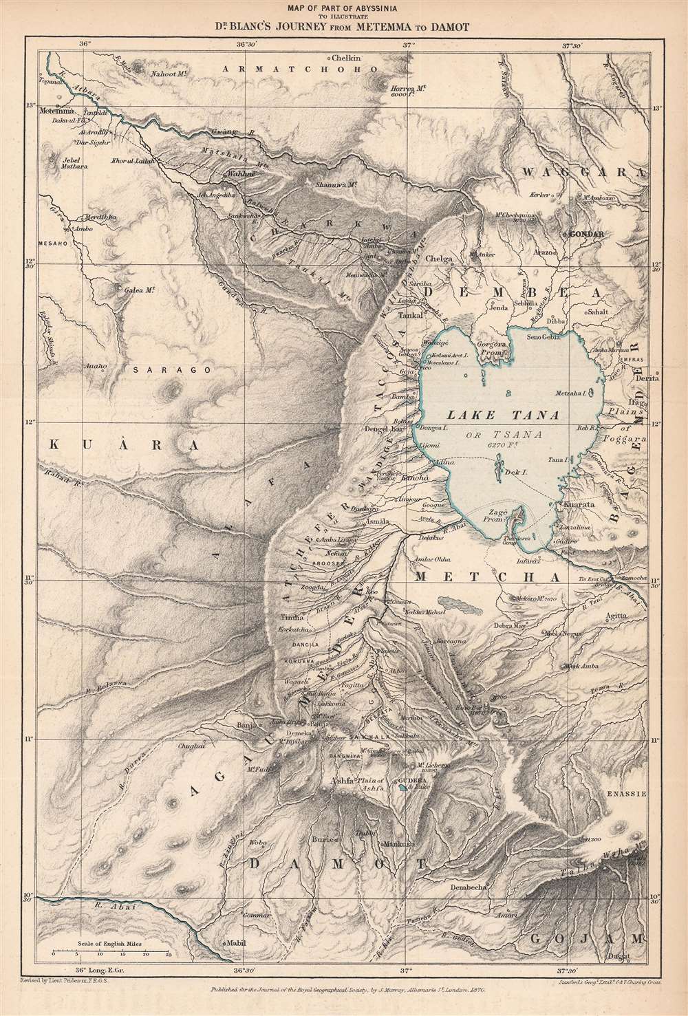
Map of Part of Abyssinia to Illustrate Dr. Blanc's Journey from Metemma to Damot.
$250.00
Acquire
- Digital Map Information
- Suitable for large format printing
- File Size: 7.51 MB
- File Type: ZIP / TIFF
- ICC color profile embedded
- Delivered instantly via download link
This is an 1870 Edward Stanford map of the Amara region of northwestern Abyssinia (Ethiopia) highlighting the route taken by Henry Blanc, one of the British subjects kidnapped by Ethiopian Emperor Tewodros II (r. 1855 - 1868), an act that prompted a punitive expedition by Great Britain in 1867 – 1868. (more details)