
Speed, John (sold)
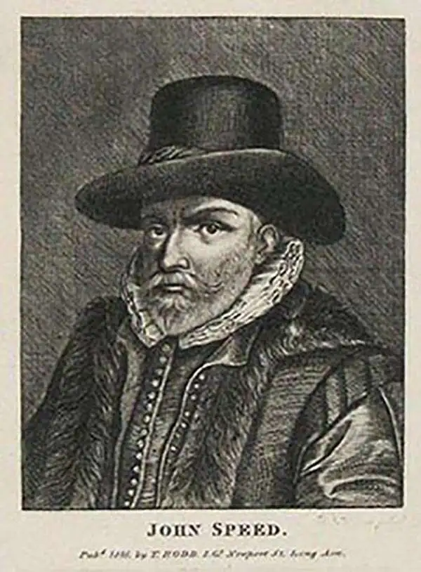
John Speed (1542 - 1629) was an important English historian and cartographer active in the early 17th century. Speed was born in Fardon, Cheshire and apprenticed under his father as a tailor. Though his heart was never in tailoring, Speed dedicated himself to this profession until he was about 50 years old. During all the time, Speed dedicated his spare time to research as amateur historian and mapmaker - even preparing several maps for Queen Elizabeth. In London, Speed's interest in history lead him to join the Society of Antiquaries. Eventually he befriended the wealthy Sir Fulke Greville, who sponsored his researches and eventually freed him from the haberdashery profession. Working with William Camden, Speed eventually published his 1611 Historie of Great Britaine. Though this history itself was amateurish and of minimal importance, Speed's inclusion of numerous maps of British Cities and town was seminal. In many cases these plans were the first maps ever issued of their respective subjects. Later, turning his attention more fully to Geography, Speed published the magnificent atlas Theatre of the Empire of Great Britaine and, just prior to his death, the 1627 A Prospect of the Most Famous Parts of the World. These were the first British world atlases and have a landmark position in the history of cartography. These atlases continued to be published well after Speed's death.
The Most Decorative 17th Century English Map of Asia
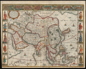
Asia with the Islands adjoyning described...
sold
- Digital Map Information
- Suitable for large format printing
- Full resolution TIFF file
- ICC color profile embedded
- Delivered instantly via download link
This is John Speed's 1626 map of Asia, the first map of the continent printed in English, in its 1676 edition. This beautiful map is one of the most desirable early maps of continent, combining superb engraving, attractive Dutch styling, and entertaining and abundant English text. (more details)
The First English Map of Africa, in its First Edition
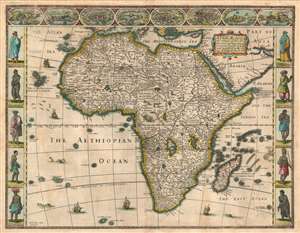
Africae described , the manners of their Habits, and buildings newly done into English by I. S. and published at the charges of G. Humble Ano 1626.
sold
- Digital Map Information
- Suitable for large format printing
- DPI: 600
- File Size: 23.28 MB
- File Type: ZIP / TIFF
- ICC color profile embedded
- Delivered instantly via download link
This is the first state of John Speed's 1626 map of Africa. It is the first English map of the continent, and it is the only edition of this map to be printed during its author's lifetime. This beautiful map is one of the most desirable early maps of Africa, combining superb engraving, attractive Dutch styling, and entertaining and abundant English text. While Speed cannot be accused of innovation as a mapmaker per se, he became an accomplished historian and compiler and his atlases of the British Isles and the World are among the signal cartographic works of the 17th century. The cartography for this mnap is drawn from the maps of Jodocus Hondius (whose student Goos actually engraved the map). Hondius' source was ultimately Willem Blaeu's 1608 wall map of Africa. As is the case with all of these maps, the Speed demonstrates 17th century European geography's detailed knowledge of Africa's coasts wedded to a deep mystification of the interior. The course of the Nile, for example, is shown in substantially the same configuration as was supposed in the second century by Ptolemy. Speed adds descriptive text - for example, noting areas in western and central Africa where gold is said to be found, and indicating areas said to be occupied by Amazons.
Visually, the map shares with Blaeu the decorative elements of key city views along the top border, along with figures to the left and right depicting the denizens of the lands shown. The cities are North African, with the exception of Canaria and Mozambique, and all reflect the coastal limitations of European knowledge of Africa. In addition to the borders, the body of the map as well is richly decorated with sailing ships, sea monsters, flying fish, elephants, ostriches, lions, and a zebra. (more details)
Visually, the map shares with Blaeu the decorative elements of key city views along the top border, along with figures to the left and right depicting the denizens of the lands shown. The cities are North African, with the exception of Canaria and Mozambique, and all reflect the coastal limitations of European knowledge of Africa. In addition to the borders, the body of the map as well is richly decorated with sailing ships, sea monsters, flying fish, elephants, ostriches, lions, and a zebra. (more details)
Riot of Anachronism.
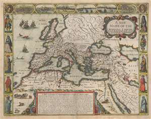
A New Mappe of the Romane Empire newly described by John Speede and are to bee sould in pops head alley by G. Humble 1626.
sold
- Digital Map Information
- Suitable for large format printing
- Full resolution TIFF file
- ICC color profile embedded
- Delivered instantly via download link
This is an attractive example of John Speed's 1626 carte à figures of the Roman Empire at its height. The map uses contemporary geographical knowledge as a framework, applying place names appropriate to the geographical knowledge of the Roman era. The map is bordered with figures and a set of city views, suiting the early seventeenth century fashion. (more details)
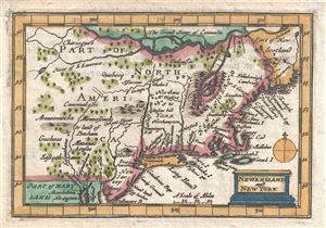
New England and New York.
sold
- Digital Map Information
- Suitable for large format printing
- DPI: 300
- File Size: 0.76 MB
- File Type: ZIP / TIFF
- ICC color profile embedded
- Delivered instantly via download link
An attractive 1675 miniature variant on John Speeds rare miniature map of New England and New York issued by Thomas Bassett and Richard Chiswell. This map was included with the popularly termed 'miniature Speed,' an octavo version of Speeds great folio atlas. ... (more details)
One of the first renderings of the Carolina colony's interior.
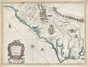
A New Description of Carolina.
sold
- Digital Map Information
- Suitable for large format printing
- Full resolution TIFF file
- ICC color profile embedded
- Delivered instantly via download link
A beautiful example of John Speed's important 1676 map of the Carolina colony. Heavily based upon the explorations of John Lederer and Ogilby's Lords Proprietor's Map of 1674. This seminal map represents one of the earliest attempts to map the Carolina ... (more details)
First edition of John Speed's transitional and influential map of Virginia, Maryland, and the Chesapeake Bay.
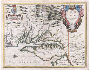
A Map of Virginia and Maryland.
sold
- Digital Map Information
- Suitable for large format printing
- DPI: 300
- File Size: 13.73 MB
- File Type: ZIP / TIFF
- ICC color profile embedded
- Delivered instantly via download link
A fine full color example of Francis Lamb's 1676 map of Virginia, Maryland, and the Chesapeake Bay. Oriented to the west, Lamb's map covers from Albemarle Sound to the Susquehanna River and from the Appalachian Mountains to the Delaware Bay and New ... (more details)
Britain's new acquisition, New York, Revealed.
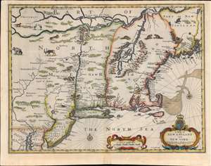
A Map of New England and New York.
sold
- Digital Map Information
- Suitable for large format printing
- Full resolution TIFF file
- ICC color profile embedded
- Delivered instantly via download link
This is beautiful example of the 1676 map of New England engraved by Francis Lamb, to be added to the final edition of John Speed's Prospect of the Most Famous Parts of the World. This was among the maps Bassett and Chiswell commissioned Lamb to produce in order to bring Speed's atlas up to date. The map is a derivative of Jan Jansson's 1651 'prototype', but alters the Dutch topography with English place names. It is notable for a wealth of 'firsts'. This is the first obtainable English map to show the American Northeast's change of hands from Dutch to Britain suzerainty. As such, it emphasizes the potential wealth of the recent British conquest. It is one of the first printed maps to refer to both Manhattan and surrounding region as 'New York.' It is also among the first maps to correctly place Boston. (more details)
Richly Decorative County Map with an Early Depiction of Stonehenge
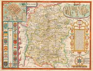
Wilshire.
sold
- Digital Map Information
- Suitable for large format printing
- DPI: 600
- File Size: 18.56 MB
- File Type: ZIP / TIFF
- ICC color profile embedded
- Delivered instantly via download link
This is John Speed's map of the county of Wiltshire in southwestern England. It was included in Speed's The Theatre of the Empire of Great Britaine, which was the first collection of maps of the counties of the British Isles. The map is richly detailed, showing towns, abbeys, castles, forests and parklands. The countryside's hilly terrain is shown pictorially. An inset plan in the upper left details the cathedral city of Salisbury: a key labels the important streets, locations of the town hall, cathedral and other important churches, and the town market. Below the inset are fourteen coats-of-arms, belonging to the Earls of Wilshire and Salisbury. (more details)
The first atlas map to show California as an Island.
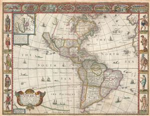
America with those known parts in that unknowne world both people and manner of buildings discribed and inlarged by I.S. Ano 1626.
sold
- Digital Map Information
- Suitable for large format printing
- DPI: 300
- File Size: 10.02 MB
- File Type: ZIP / TIFF
- ICC color profile embedded
- Delivered instantly via download link
A nice example of John Speed's 1626 map of America here in its fourth or 1676 state. One of the most iconic maps of America ever made, this map is surrounded by decorative vignettes illustrating the indigenous peoples and cities of the Americas. ... (more details)
A ground-breaking map of Carolina showing the contentions geography of Jonathan Lederer.
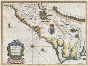
A New Description of Carolina.
sold
- Digital Map Information
- Suitable for large format printing
- Full resolution TIFF file
- ICC color profile embedded
- Delivered instantly via download link
A very attractive example of John Speed's important and rare 1676 map of the Carolina colony - representing the first serious attempts to map the interior of the Carolinas based upon actual exploration. Speed heavily based his cartography of Carolina upon the explorations of John Lederer and Ogilby's Lords Proprietor's Map of 1674. Oriented to the West, map covers from the Spanish colony of St. Augustine, Florida, north to the English colony of Jamestown, Virginia. It extends inland as far as the Appalachian (Apalathean) Mountains. (more details)
Essential Map for the Carolina Collector.
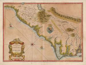
A New Description of Carolina.
sold
- Digital Map Information
- Suitable for large format printing
- Full resolution TIFF file
- ICC color profile embedded
- Delivered instantly via download link
A striking example of the important and scarce map of the Carolina colony engraved by Francis Lamb in 1676, for inclusion in John Speed's atlas. It is one of the earliest early English maps specifically of the colony acquirable by the collector, published just six years after the founding of Charleston. As such, it is a map of seminal importance, and an essential document in the history of the Carolinas specifically, and the British settlements in North America in general. (more details)
An Abundantly Detailed Tudor Map of Ireland
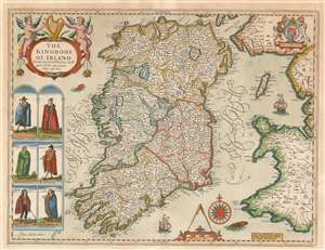
The Kingdome of Irland Devided into Severall Provinces, and thē againe devided into Counties. Newly described.
sold
- Digital Map Information
- Suitable for large format printing
- DPI: 600
- File Size: 19.63 MB
- File Type: ZIP / TIFF
- ICC color profile embedded
- Delivered instantly via download link
This is John Speed's map of Ireland, the first map of Ireland published in an English atlas. Engraved in 1610, It was included in Speed's The Theatre of the Empire of Great Britaine, which was the first collection of maps of the counties of the British Isles. The engraving is the work of Jodocus Hondius, who engraved many of the plates of Speed's atlases. This was fortunate for Speed. Hondius had become familiar with the Irish surveys of Robert Lythe. Lythe, an English surveyor and topographer, had been tasked by the British government between 1567 and 1570 to survey Ireland in the wake of the Tudor Conquest, in order to aid the garrisoning and colonization of the island. Lythe's survey proved a mammoth undertaking. Of it, J. H. Andrews remarked:
Since the number of Lythe’s Irish place-names runs to several thousands (no other Elizabethan surveyor reached four figures) his visit must—on grounds of quantity alone—be accounted the most important event in the cartographic history of sixteenth-century Ireland.Despite these being the most up-to-date surveys of Ireland, they were not well disseminated until the end of the 17th century. Ortelius' maps, for example, were based on Mercator's outdated mapping of the 1560s, and did not benefit from Lythe's contemporaneous surveys. Hondius, on the other hand, had encountered Lythe's work while living in England, and he drew on it while executing Pieter van den Keere's 1592 Hyberniae novissima descriptio as well as the map he engraved for Speed. (The sole known copy of the Kaerius map survives in Linen Hall, Belfast.) (more details)
Beautifully colored map of Poland - with views of Krakow and Breslau!
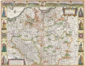
A Newe Mape of Poland.
sold
- Digital Map Information
- Suitable for large format printing
- DPI: 300
- File Size: 11.83 MB
- File Type: ZIP / TIFF
- ICC color profile embedded
- Delivered instantly via download link
This is a 1676 John Speed carte-a-figure map of Poland issued at the end of the Second Polish-Ottoman War. The map depicts from the Baltic Sea and eastern Bohemia to Prussia, Lithuania, and western Russia and from the Baltic to Kraków (Cracow; ... (more details)
Decorative Carte-a-Figure map of Poland!
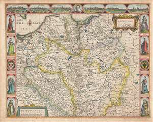
A Newe Mape of Poland.
sold
- Digital Map Information
- Suitable for large format printing
- Full resolution TIFF file
- ICC color profile embedded
- Delivered instantly via download link
This is a 1676 John Speed carte-a-figure map of Poland issued at the end of the Second Polish-Ottoman War. The map depicts from the Baltic Sea and eastern Bohemia to Prussia, Lithuania, and western Russia and from the Baltic to Kraków (Cracow; ... (more details)
Most Visually Engaging Seventeenth Century Map of Russia.
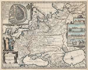
A Map of Russia.
sold
- Digital Map Information
- Suitable for large format printing
- DPI: 600
- File Size: 65.3 MB
- File Type: ZIP / TIFF
- ICC color profile embedded
- Delivered instantly via download link
This is John Speed's scarce 1676 map of Russia, one of the first English maps of Russia and certainly the most decorative. The map is scarce, having appeared only in the latter, Basset and Chiswell edition of the Speed atlas. Centered on Moscow, the map covers from the North Sea to the Caspian Sea and from Nova Zembla to Trabzon (Black Sea south coast). There is a large and impressive inset map of Moscow: this is centered on the Kremlin, Belygorod, and the Kityagorod. Five inset views depict the Emperor's Court in the Kremlin, the vital port of Archangel, the Russian fort at Narva (in modern Estonia and a crucial stronghold on Russia’s western border), bathhouses and a mill. Above the cartouche are figures dressed in 'The Habit of Russians,' one of whom carries the Russian coat of arms. (more details)
First English Atlas Map of the World.
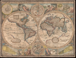
A New and Accurat Map of the World Drawne according to ye truest Descriptions latest Discoveries and best Observations yt have beene made by English or Strangers.
sold
- Digital Map Information
- Suitable for large format printing
- Full resolution TIFF file
- ICC color profile embedded
- Delivered instantly via download link
This is John Speed's 1626 map of the world, in its 1676 Bassett and Chiswell edition. It is the earliest acquirable English world map, and the first world map to appear in an English atlas. It is the earliest acquirable world map to illustrate the California-as-an-island myth. It was also singular in its emphasis on the English colonies in America and is the first world map to mark the settlement of New Plymouth. The map presents the globe in a double-hemisphere format, and is embellished with astronomical diagrams and allegorical representations of the seasons, as well as portraits of famous circumnavigators. (more details)