
Stockdale, John (sold)
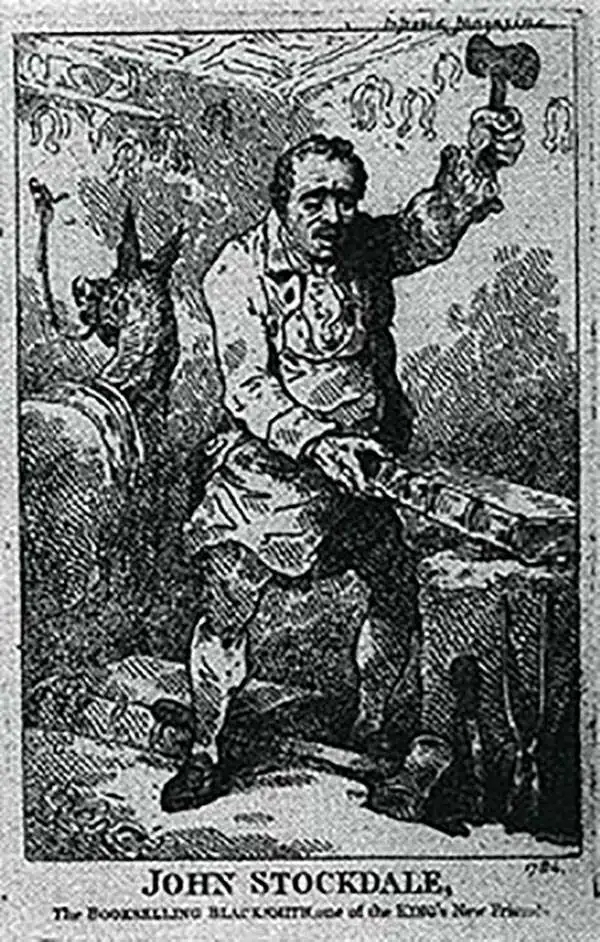
John Stockdale (March 25, 1750 - June 21, 1814) was an English book and map publisher active in London in the late 18th and early 19th centuries. Stockdale, born in Caldbeck, England, was trained by his father in the family trade of blacksmithing. Blacksmithing must not have been his cup of tea, for as soon as he was able, he left this trade in favor of a number of minor service positions, working at various times as a porter and a valet. One such position put him in the service of the bookseller John Almon. Having learnt the book trade by observing Almon, Stockdale opened his own bookshop and began publishing various historic and scientific works. Fellow publishers, perhaps reacting to his social status at birth, wrote of him, "being a man of natural parts, he soon became conspicuous in business in spite of much eccentricity of conduct and great coarseness of manners." Never quite accepted in the trade, Stockdale's fellow London publishers derogatorily referred to him as "The Bookselling Blacksmith". Nonetheless, Stockdale had a number of important works to his name, including several geographies, most notably the 1794American Geography 1794 and, with John Cary, the 1805 New British Atlas.
First printed chart of Port Jackson and Sydney Harbor.
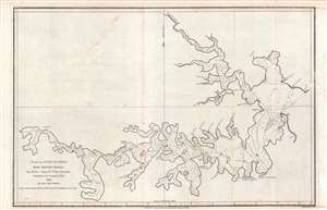
Plan of Port Jackson, New South Wales.
sold
- Digital Map Information
- Suitable for large format printing
- Full resolution TIFF file
- ICC color profile embedded
- Delivered instantly via download link
This is John Hunter's 1789 nautical map of Port Jackson, New South Wales, the first European printed chart of the waters around Sydney Harbor. Hunter surveyed the area as commander of H.M.S. Sirius, flagship of the First Fleet under New South Wales' first Governor, Arthur Phillip. (Hunter himself would become the second Governor.) Hunter's 1788 manuscript survives in the State Library of New South Wales. (more details)
The state of Franklinia. The first map of the United States by a Southerner.
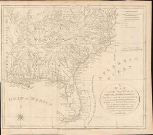
A Map of the States of Virginia, North Carolina, South Carolina and Georgia; Comprehending the Spanish Provinces of East and West Florida: Exhibiting the Boundaries as fixed by the late Treaty of Peace between the United States and the Spanish Dominions.
sold
- Digital Map Information
- Suitable for large format printing
- DPI: 600
- File Size: 242.41 MB
- File Type: ZIP / TIFF
- ICC color profile embedded
- Delivered instantly via download link
This 1792 Joseph Purcell map of the United States recording post-Revolutionary War westward expansion. This is one of the earliest maps to identify the ephemeral pseudo-state of Franklinia, the claims of the Ohio Company of Associates, the lands of the New Jersey and Wabash Companies, the Cumberland Settlement, and the Moravian Settlement. It is moreover, one of the best maps of the American Indian nations in the southeast - benefiting from Purcell's firsthand reconnaissance. Significantly, this is also the first maps of the United States by a southern cartographer. (more details)
Published only a few years after Admiral Nelson's tour of duty in the West Indies.
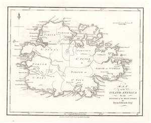
Map of the Island Antigua.
sold
- Digital Map Information
- Suitable for large format printing
- DPI: 600
- File Size: 2.86 MB
- File Type: ZIP / TIFF
- ICC color profile embedded
- Delivered instantly via download link
This is a 1794 Bryan Edwards map of Antigua. Published after Horatio Nelson's tour of duty in the West Indies, Antigua's many forts and coastal batteries underscore the tense situation in the Caribbean. Nelson was in the region enforcing the Navigation Acts, which prohibited trade between British subjects and the newly independent United States of America. Antigua held a prominent place in the Caribbean sugar trade, and Antiguan merchants loathed Nelson and the Navigation Acts for hindering their access to critical American markets. St. John's, the capital of modern-day Antigua and Barbuda, is clearly labeled, and several other settlements occupy coastal land. Bays, points, and other coastal features are also identified, as are many smaller islands. (more details)
Marks plantations and sugar works on the most heavily fortified island in the Caribbean.
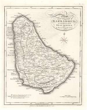
Map of the Island of Barbadoes.
sold
- Digital Map Information
- Suitable for large format printing
- DPI: 600
- File Size: 3.62 MB
- File Type: ZIP / TIFF
- ICC color profile embedded
- Delivered instantly via download link
This is a 1794 Bryan Edwards and John Stockdale map of Barbados, which was then the most heavily fortified island in the Caribbean. (more details)
A map of Grenada long before the 1983 U.S. invasion.
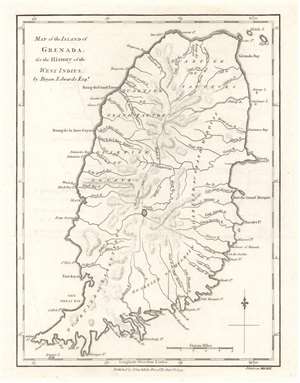
Map of the Island of Grenada.
sold
- Digital Map Information
- Suitable for large format printing
- DPI: 600
- File Size: 2.98 MB
- File Type: ZIP / TIFF
- ICC color profile embedded
- Delivered instantly via download link
This is a 1794 Bryan Edwards and John Stockdale map of Grenada. Grenada was a British colony in 1794 and today is a member of the British Commonwealth. Here, Fort Royal takes the place of the modern-day capital, St. George's. The island's six quartiers are labeled, along with rivers, bays, and points. In American memory, Grenada evokes the U.S. invasion in 1983, when American troops landed on the island to remove a Communist government that was supposedly sympathetic to Cuba and the Soviet Union. (more details)
A member of the British Commonwealth of Nations.
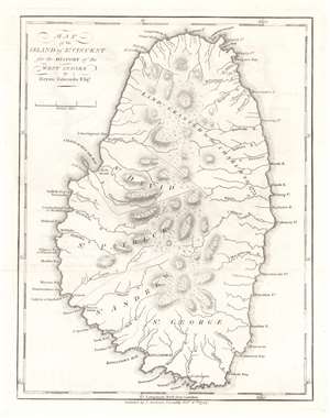
Map of the Island of St. Vincent.
sold
- Digital Map Information
- Suitable for large format printing
- DPI: 600
- File Size: 3.01 MB
- File Type: ZIP / TIFF
- ICC color profile embedded
- Delivered instantly via download link
This is a 1794 Bryan Edwards and John Stockdale map of Saint Vincent. Part of the Winward Islands, Saint Vincent is the largest island in the modern-day country 'Saint Vincent and the Grenadines'. Kingstown, the island's capital, is labeled. Bays and points are marked along the coast, and the island's parishes are identified. The northernmost portion of the island is labeled 'land granted to the Charibs in 1773'. The Caribs are St. Vincent's native peoples, and they repeatedly revolted against British rule in the 18th century. Calm was only restored after a treaty was signed in 1796. Saint Vincent gained its independence in 1979 and is part of the British Commonwealth of Nations to this day. (more details)
Illustrates the Jamaican sugar industry.
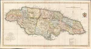
A Map of the Island of Jamaica, Divided into Counties and Parishes, for the History of the British West Indies.
sold
- Digital Map Information
- Suitable for large format printing
- DPI: 600
- File Size: 16.31 MB
- File Type: ZIP / TIFF
- ICC color profile embedded
- Delivered instantly via download link
This is a 1794 Bryan Edwards map of Jamaica. Edwards illustrates and labels all major settlements on Jamaica, including Kingston and Montego Bay. Edwards employs small circles to indicate the many lucrative sugar plantations operating throughout the island. Churches, barracks, forts, ports, and even Bryan Edwards' home are marked. Parishes are shaded to allow for easy differentiation, and a legend explaining the various notations used is included along the bottom border. (more details)
Early map identifying the mythical cities of gold, Quivira and Teguayo.
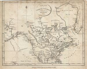
A New Map of North America from the latest and best Authorities.
sold
- Digital Map Information
- Suitable for large format printing
- Full resolution TIFF file
- ICC color profile embedded
- Delivered instantly via download link
This is an appealing 1794 map of North America by John Stockdale. It covers from Baffin's Bay south to Cuba and Mexico and from the Bering (Bhering) Strait east to Greenland. It offers fine detail throughout, noting several rivers, lakes, bays, cities and several ... (more details)
One of the few 18th century specific maps of the Virgin Islands.
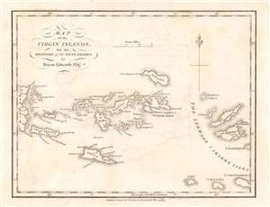
Map of the Virgin Islands, for the History of the West Indies.
sold
- Digital Map Information
- Suitable for large format printing
- DPI: 600
- File Size: 2.22 MB
- File Type: ZIP / TIFF
- ICC color profile embedded
- Delivered instantly via download link
A rare 1794 map of the West Indies by John Stockdale and Bryan Edwards. This is one of the few 18th century specific maps of the Virgin Islands. The map covers from the eastern shores of Porto Rico to Saint Martin and Anguilla, covering all of the Virgin Islands, including St. Thomas, St. Johns, Tortola, Virgin Gorda, an Anagada (Anugada). The eccentric billionaire Sir Richard Branson's, private haven, Necker Islands, appears and is labeled just north of Virgin Gorda. At the northwest tip of Anegada Island, Freebooter's Point is noted - this is the only place on the island free of barrier reefs and a famous rendezvous point for 18th century pirates and buccaneers. (more details)
Labels Spiritu Santo Bay - Tampa Bay.
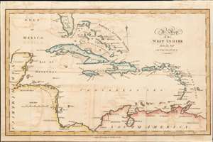
A Map of the West Indies.
sold
- Digital Map Information
- Suitable for large format printing
- DPI: 600
- File Size: 6.19 MB
- File Type: ZIP / TIFF
- ICC color profile embedded
- Delivered instantly via download link
This is a 1799 Bryan Edwards map of the West Indies. Depicting from Florida to northern South America, islands throughout the Caribbean Sea are labeled, including many of the Bahama and the Leeward Islands. Cozumel is identified off the Yucatan coast, and coastal lagoons, islands, and gulfs are named throughout. Very little detail is present in Florida, apart from labeling Martyr's Reef and Spiritu Santo Bay, today's Tampa. (more details)
Extremely scarce large scale map of Hispaniola.
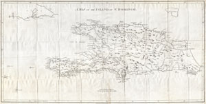
A Map of the Island of St. Domingo.
sold
- Digital Map Information
- Suitable for large format printing
- DPI: 300
- File Size: 15.35 MB
- File Type: ZIP / TIFF
- ICC color profile embedded
- Delivered instantly via download link
A dramatic and important map of the island of St. Domingo (Santo Domingo) or Hispaniola prepared by Bryan Edwards and published by John Stockdale in 1800. Covers the island in full offering significant detail throughout. Edwards includes notations of the ... (more details)
An early 19th century map depicting Austria, Slovakia and the Czech Republic.
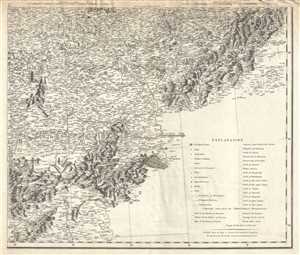
Plate X. [A general map of the Empire of Germany, Holland, the Netherlands, Switzerland, the Grisons, Italy, Sicily, Corsica, and Sardinia].
sold
- Digital Map Information
- Suitable for large format printing
- DPI: 300
- File Size: 26.75 MB
- File Type: ZIP / TIFF
- ICC color profile embedded
- Delivered instantly via download link
This is an 1800 map of eastern Austria, western Slovakia and southern Czech Republic by John Stockdale. This map covers from Voitsberg in Austria to Amschelberg in the Czech Republic and east as far as Zvolen in Slovakia. The map is highly detailed and ... (more details)
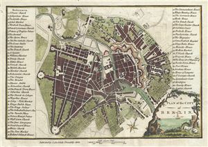
A Plan of the City of Berlin.
sold
- Digital Map Information
- Suitable for large format printing
- DPI: 300
- File Size: 2.94 MB
- File Type: ZIP / TIFF
- ICC color profile embedded
- Delivered instantly via download link
This is an appealing 1800 map or city plan of Berlin, Germany, issued by John Stockdale. It beautifully depicts the capital city of the Kingdom of Prussia at the end of the 18th century. The map is exceptionally detailed, noting churches, streets, ... (more details)
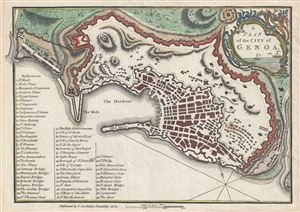
A Plan of the City of Genoa.
sold
- Digital Map Information
- Suitable for large format printing
- DPI: 300
- File Size: 2.82 MB
- File Type: ZIP / TIFF
- ICC color profile embedded
- Delivered instantly via download link
This is an appealing 1800 map or city plan of Genoa, Italy, issued by John Stockdale. It beautifully depicts the coastal city and the capital of Liguria located in north western Italy. The map is exceptionally detailed, noting forts, bridges, ... (more details)