
Cantelli da Vignola, Giacomo (sold)
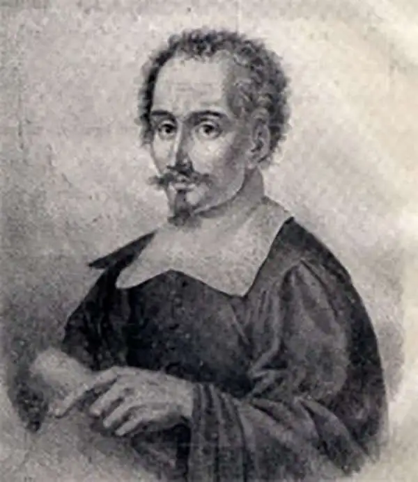
Giacomo Cantelli da Vignola (February 22, 1643 - November 30, 1695) was an important Italian cartographer and engraver active in 17th century Italy. Cantelli was born in Montorsello, near Vignola, Italy to a prominent local family. After studying literature at the University of Bologna, Cantelli took a position as secretary to the Marquis Obizzi de Ferrara. Eventually Cantelli relocated to Venice where he developed an interest in cartography. He later traveled to Paris in the company of the French ambassador where became acquainted with the French cartographer Guillaume Sanson, as well as his contemporaries Jacques-Andre Duval and Michel-Antoin Baudrand. It was most likely the influence of these innovative French cartographers that inspired Cantelli's careful and meticulous approach, in which he based his cartography not just on earlier maps, but also very much in the French style upon accounts written by travelers and merchants regarding actual travel to foreign lands. Back in Italy, Cantelli took service with Count Rinieri Marescotti, with whom he traveled extensively throughout Italy, becoming in the process acquainted with the Italian publisher Giovanni Giacomo de Rossi. It is with Rossi that Cantelli began officially publishing his maps. The earliest maps to bear the Cantelli-Rossi imprint date to 1672 and detail the Holy Land, Persia, and the Ottoman Empire. Around 1680 the duo also began to publish the Mercurio Geografico, a large format atlas illustrating all parts of the world in a splendid Italian baroque detail defined by elaborate finely engraved cartouche work, high quality paper, bold Roman lettering, and dark rich inks. Some have compared his style go that of Giovanni Antonio Magini, another Italian cartographer of the previous generation. Cantelli da Vignola in fact pioneered the Italian style of fine bold engraving that would eventually be embraced and expanded upon by Vincenzo Coronelli. His work drew the attention of Pope Innocent XI and Reggio Francesco II d'Este, the Duke of Modena, both of whom offered him a position as court geographer. Cantelli chose to work with the Duke of Modena, in the service of whom he produced numerous maps and well as two large globes. He died in Modena in November 1695.
Persia: Ancient and Modern.
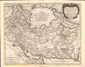
Regno di Persia con le notitie delle Provincie Antiche, che più probabilmente corrispondono alle Divisioni moderne d'esso Regno.
sold
- Digital Map Information
- Suitable for large format printing
- Full resolution TIFF file
- ICC color profile embedded
- Delivered instantly via download link
This is a rare 1682 Cantelli da Vignola map of the Kingdom of Persia, incorporating modern day Iraq, Iran, Afghanistan and Uzbekistan. The map is unusual in its depiction of an eastern border to the Persian empire, here bordering the Mogul Empire. The map overall is notable for Cantelli's attempt to reconcile conflicting classical information of what was an essentially unfamiliar region, with what was at the time up-to-date geographical data. Cantelli synthesizes a variety of travel accounts and early maps, including those of Pietro della Valle (1586 - 1652), and Adam Olearius (1603 - 1671). Throughout the map, contemporary place names are printed alongside historical names, or those used by other peoples: for example, the name for the Caspian Sea is given in Latin, as well as transliterated Russian and Arabic, from the local name. (more details)
Scarce and Elegantly-Engraved Map of the Far East.
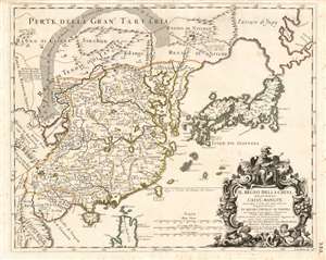
Il Regno Della China detto presentemente Catay e Mangin diviso sopra le Carte piú esatte sue Principali Provincie.
sold
- Digital Map Information
- Suitable for large format printing
- Full resolution TIFF file
- ICC color profile embedded
- Delivered instantly via download link
This is a rare 1682 Cantelli da Vignola map of China, Japan and Korea, presenting a striking and up-to-date view of the Far East benefitting from Jesuit and Dutch reports. Its framework and outline are derived from the 1552 Martino Martini map produced by Blaeu, but this map is significantly updated, at least in part, from the reports of the Jesuits Bento de Góis and Johann Grueber. (more details)
Strikingly decorative map of the East Indies, Philippines, and Australia.
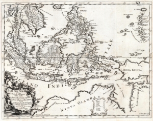
Isole dell'India cio è le Molucche, le Filippine e della Sonda, parte de paesi di nuova scoperta e l'isole de Ladri nel mare del zud / descritte da Giacomo Cantelli de Vignola ; Fran. Donia Messis sculp.
sold
- Digital Map Information
- Suitable for large format printing
- DPI: 600
- File Size: 50.76 MB
- File Type: ZIP / TIFF
- ICC color profile embedded
- Delivered instantly via download link
A rare, highly decorative 1683 map of Southeast Asia and the East Indies by Giacomo Cantelli da Vignola and Giacomo de Rossi. (more details)
A rare, Italian Map of the East Indies, Philippines, and Australia.
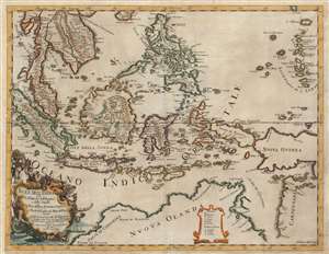
Isole dell'India cio è le Molucche, le Filippine e della Sonda, parte de paesi di nuova scoperta e l'isole de Ladri nel mare del zud / descritte da Giacomo Cantelli de Vignola ; Fran. Donia Messis sculp.
sold
- Digital Map Information
- Suitable for large format printing
- Full resolution TIFF file
- ICC color profile embedded
- Delivered instantly via download link
A rare, highly decorative 1683 map of Southeast Asia by Giacomo Cantelli da Vignola and Giacomo de Rossi. The map shows the Malay Peninsula, Cochinchina, and the kingdom of Siam; Sumatra, Java, Borneo, and the Spice Islands appear to be based primarily on the Dutch maps of the period, as is also the case with the Philippines. Singapore Island is named. The island 'Terfra di Papous' is shown as a separate landmass from 'Nuova Guinea,' an error preserved from Nicolosi's large map of Asia, whose geography this map otherwise improves upon. The southern portion of the map is dominated by Nuova Olanda, that is to say, New Holland aka Australia: much of the detail here appears to be drawn from Thevenot's map based on Tazman, but there are some place names retained from Marco Polo, such as the hypothetical provinces of Lucach and Maletur.
There is a lush cartouche in the lower left-hand quadrant that is surrounded by putti and Mer-men, bearing a wealth of sea-shells and cornucopia filled with spice-pods. (more details)
There is a lush cartouche in the lower left-hand quadrant that is surrounded by putti and Mer-men, bearing a wealth of sea-shells and cornucopia filled with spice-pods. (more details)
First European map to identify polities within the Malay Peninsula.
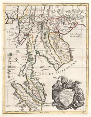
Penisola Dell India di la dal Gange Diusa ne i Regni, che in essasi contengono et accresciuta di varie notizie. Da Giacomo Cantelli da Vignola e conforme le Relationi di alcuni Padri della Compa di Giesu di Monsu Tavernier, Mandeslo e d`altri Illustri Viaggiatori del nostro Secolo . . . 1683.
sold
- Digital Map Information
- Suitable for large format printing
- Full resolution TIFF file
- ICC color profile embedded
- Delivered instantly via download link
A rare, highly decorative, and cartographically significant 1683 map of Southeast Asia by Giacomo Cantelli da Vignola and Giacomo de Rossi. This is one of the first maps of Southeast Asia to incorporate independent polities in Malay based on new information from Johan Albrecht de Mandelslo (1616 - 1644) and Jean-Baptiste Tavernier (1605 - 1689). Centered on modern-day Bangkok, which is noted, this stunning map includes most of modern-day Thailand, all of Malaysia, Laos, Cambodia, Vietnam, and Singapore, and parts of Burma, China, and Sumatra. Bangkok is noted, although when this map was published, it had not yet risen to prominence. Conversely so too is the city of Aracan, which, when this map was issued, was at its height of nearly 160,000 people. Today it is better known as the remote and crumbling ruin of Mrauk U. A large and dramatic cartouche demands attention in the lower right and features two Southeast Asian potentates in postures of aristocratic savoir-faire. The shield itself is surmounted by an impressive snarling leopard. (more details)
First European map to identify polities within the Malay Peninsula.
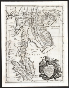
Penisola Dell India di la dal Gange Diusa ne i Regni, che in essasi contengono et accresciuta di varie notizie. Da Giacomo Cantelli da Vignola e conforme le Relationi di alcuni Padri della Compa di Giesu di Monsu Tavernier, Mandeslo e d`altri Illustri Viaggiatori del nostro Secolo . . . 1683.
sold
- Digital Map Information
- Suitable for large format printing
- DPI: 600
- File Size: 51.46 MB
- File Type: ZIP / TIFF
- ICC color profile embedded
- Delivered instantly via download link
A superb example of Giacomo Cantelli da Vignola's scarce, beautiful, and cartographically significant 1683 map of Southeast Asia. This is one of the first maps of Southeast Asia to incorporate independent polities in Malay based on new information from Johan Albrecht de Mandelslo, and to incorporate contemporaneous French travelers' reports of Vietnam. Centered on modern-day Bangkok (named, as is the capital at Ayyuthaya), the map embraces much of modern-day Thailand, all of Malaysia, Laos, Cambodia, and Vietnam, and parts of Burma, China, and Sumatra. Singapore is shown as an island. A large and dramatic cartouche demands attention in the lower right and features two Southeast Asian potentates in postures indicating no discomfiture whatever with the snarling leopard surmounting the cartouche. (more details)
Supposed Aegean Theater of the Morean War.
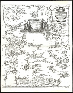
Arcipelago Mar Egeo con le Coste del Medesimo.
sold
- Digital Map Information
- Suitable for large format printing
- File Size: 21.44 MB
- File Type: ZIP / TIFF
- ICC color profile embedded
- Delivered instantly via download link
This is the beautiful 1685 Cantelli da Vignola map of the Greek Islands in the Aegean Sea. It was issued at the beginning of the 1684-1699 Morean War between Venice and the Ottoman Empire. (more details)
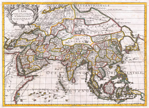
L'Asia Nuovamente Corretta, et Accresiuta, Secondo le Relationi piu Moderne du Guglielmo Sansone…
sold
- Digital Map Information
- Suitable for large format printing
- DPI: 300
- File Size: 20.58 MB
- File Type: ZIP / TIFF
- ICC color profile embedded
- Delivered instantly via download link
A spectacular 1687 map of Asia by the important Italian cartographer Giovanni Giacomo De Rossi. Depicts the entire continent as well as parts of Europe, Africa, and the East Indies. In drawing this map Rossi drew heavily upon Nicholas Sanson's map of Asia in ... (more details)
First detailed, printed map of Albania.
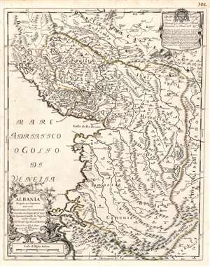
Albania Propria overo Superiore detta anche Macedonia Occidentale descritta, con Disegni fatti sul luogo. . .
sold
- Digital Map Information
- Suitable for large format printing
- DPI: 600
- File Size: 23.16 MB
- File Type: ZIP / TIFF
- ICC color profile embedded
- Delivered instantly via download link
This is a rare 1689 Cantelli da Vignola map of Albania - the first reasonably accurate printed map of Albania. The map incorporates most of modern-day Montenegro and part of Macedonia. This is the only specific map of Albania produced in the 17th century, predated only by the 1572 Camocio map. Lissus on the coast corresponds with modern Lezhë at the mouth of the Drin. The modern capital of Tirana appears here as Terrana. The city of Vlorë appears, using its Italian name Valona (and the Greek Aulon.) To the southwest of Terrana is noted Petrela, a supposed birthplace of Alexander the Great. The mountainous terrain is pictorially depicted, showing in particular the forbidding mountain ranges forming the country's natural borders with Greece, Macedonia, and Kosovo. (more details)
Masterfully engraved map of the Mongol homeland in Northeastern Asia.
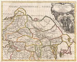
La Gran Tartaria.
sold
- Digital Map Information
- Suitable for large format printing
- DPI: 300
- File Size: 10.89 MB
- File Type: ZIP / TIFF
- ICC color profile embedded
- Delivered instantly via download link
A stunning 1693 map of northeast Asia, or as it was then known, Gran Tartaria by Giacomo Cantelli da Vignola. The map covers northeastern Asia from the Caspian Sea to the Japanese Kurile Islands, and from Nova Zembla to Tibet. The map is derived from the ... (more details)
One of the most beautiful baroque maps of Portugal to appear in the 17th century.
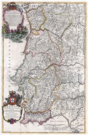
Il Regno di Portogallo.
sold
- Digital Map Information
- Suitable for large format printing
- DPI: 300
- File Size: 28.04 MB
- File Type: ZIP / TIFF
- ICC color profile embedded
- Delivered instantly via download link
An exceptional 1692 map of the Kingdom of Portugal drawn in the Italian baroque style by Giacomo Cantelli da Vignola and Giacomo Giovanni Rossi. This extremely scarce map is without question one of the largest and most beautiful atlas maps of Portugal ever ... (more details)
Remarkable Caucasus Cartography.
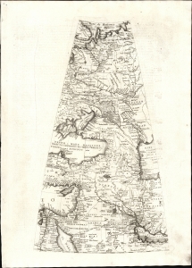
[Globe Gore, Middle East, Caucasus, Russia].
sold
- Digital Map Information
- Suitable for large format printing
- Full resolution TIFF file
- ICC color profile embedded
- Delivered instantly via download link
This is Vincenzo Coronelli's 1688 / 1696 globe gore, spanning from the Barents Sea in the north to the Tropic of Cancer in the south. The map thus embraces the Lower Nile, the northern part of the Arabian Peninsula, and the Persian Gulf; the eastern Mediterranean Sea, Cyprus, the Holy Land, and the Fertile Crescent; the eastern Black Sea, the western Caspian Sea, and Georgia between; the northern Caucasus region, and Russia. It was initially engraved in 1688 for Coronelli's 42-inch (3 1/2 foot) terrestrial globe. Repurposed for publication in Coronlli's 1696 Libro dei Globi and Isolario, the plate was masked off to excise the portion from the Equator to the Tropic of Cancer in order to fit the format of the book. (more details)
The First Major Innovation in the mapping of Italy since Magini.
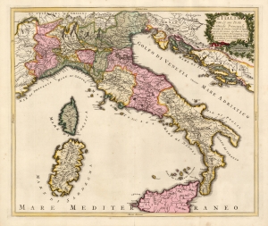
L'Italia con Le sue Poste e Strade Principali descritta da Giacomo Cantelli da Vignola Geografo del Serenis. Sigr. Duca di Moda. Data in luce d Pietro Schenk Intagliator in Rame in Amsterdam con Privilegio delli miei Seci: S le Seci: S: Stati di Hollanda et di West Frisia, il primo di Settembre 'l Anno 1701.
sold
- Digital Map Information
- Suitable for large format printing
- Full resolution TIFF file
- ICC color profile embedded
- Delivered instantly via download link
This is a beautiful example of a scarce, 1701 Peter Schenk map of Italy, focusing specifically on the country's post roads. It is derived from, and credits, the similarly-titled 1695 map produced by the Italian mapmaker Giacomo Cantelli da Vignola. Cantelli's map, printed in the year of that mapmaker's death, was the first significantly updated map of Italy to appear since Magini's 1608 Italia Nuova, which provided the basis for most maps of Italy issued in 17th and early 18th centuries. (more details)
The Dominant Mapping of Italy of the 17th Century, Updated and Amended.
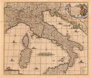
Novissima et Accuratissima totius Italiae, Corsicae et Sardiniae Descriptio Correcta, multis auct Locis et Viis editaque.
sold
- Digital Map Information
- Suitable for large format printing
- Full resolution TIFF file
- ICC color profile embedded
- Delivered instantly via download link
This is an attractive and scarce map of Italy, engraved c. 1680 by Frederik De Wit, but updated in 1721 by the Amsterdam publishers Covens and Mortier. Covens and Mortier added many place names and included the post road system first introduced on a 1695 map of Italy by Giacomo Cantelli da Vignola. The map covers the Italian Peninsula in its entirety including the Dalmatian coast, at the time controlled by the Republic of Venice, as well as the islands of Corsica, Sardinia, and part of Sicily. As with virtually every map of Italy produced in the seventeenth century, De Wit follows the model established by Magini's monumental 1608 Italia Nuova. Magini's map was justifiably influential, rendering the whole of Italy and its islands in magnificent detail with their river systems clearly presented and mountains shown pictorially. (more details)