
Dépôt des Cartes et plans de la Marine
Dépôt des Cartes et Plans de la Marine (fl. 1720 - present), often called the Dépôt Général de la Marine, was a French hydrographic mapping organization founded in 1720 under Charles-Hercule of Albert de Luynes (1674 - 1734). Much like the U.S. Coast Survey, the British Admiralty, and the Spanish Deposito Hydrografico, the Dépôt was initiated as a storehouse and distribution center of existing nautical and marine charts. Eventually the Dépôt initiated its own mapping activities in an attempt to improve and expand upon existing material. Some of the more prominent cartographers and hydrographers associated with the of Dépôt Générale des Cartes were, Philippe Buache, Jacques-Nicholas Bellin, Giovanni Rizzi-Zannoni, Rigobert Bonne, and Jean Nicolas Buache.
Fantastic vexillology chart.
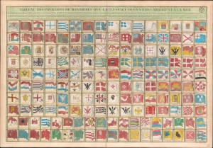
Tableau des Pavillons ou Bannieres Que La Pluspart des Nations Arborent a la Mer.
$1,800.00
Acquire
- Digital Map Information
- Suitable for large format printing
- DPI: 600
- File Size: 60.94 MB
- File Type: ZIP / TIFF
- ICC color profile embedded
- Delivered instantly via download link
This is an exceptional 1756 J. N. Bellin / Dépôt de la Marine vexillology or flag chart illustrating worldwide maritime ensigns. It illustrates a total of 160 flags, most representing European powers, but some representing religious societies, Asian and African nations, and trading companies. (more details)
Sugar Empires and the Seven Years' War.
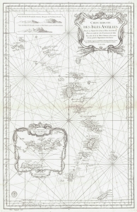
Carte Reduite des Isles Antilles.
$1,100.00
Acquire
- Digital Map Information
- Suitable for large format printing
- File Size: 24.15 MB
- File Type: ZIP / TIFF
- ICC color profile embedded
- Delivered instantly via download link
This is a 1758 Jacques-Nicolas Bellin nautical chart or map of the Lesser Antilles. Published two years into the Seven Years' War (1756 - 1763), this map highlights the rich sugar-producing French, British, and Dutch colonies in the Antilles - all up for grabs in the conflict. (more details)
Bellin puts it all together...
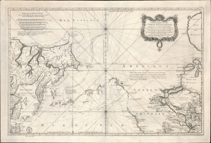
Remarques sur la Carte reduite de l'océan septentrional, compris entre l'Asie et l'Amérique, suivant les découvertes qui ont été faites par les Russes; dressée au Dépôt des cartes et plans de la Marine, pour le service des vaisseaux du roi, par ordre de M. le duc de Praslin, ministre d'etat, ayant le département de la Marine.
$2,750.00
Acquire
- Digital Map Information
- Suitable for large format printing
- File Size: 39.82 MB
- File Type: ZIP / TIFF
- ICC color profile embedded
- Delivered instantly via download link
A beautiful example of Bellin's splendidly engraved 1766 map of the Pacific Northwest, Alaska, the Bering Strait, and Siberia. This map is significant as a reactionary piece to the waves of cartographic speculation about the American Pacific Northwest that defined the first half of the 18th century. Bellin, the premier hydrographer of his generation, here attempts to make sense of it all, bringing together the speculations of the previous generation, his own geographical expertise, and issuing, for the first time on a French map, Frederick Müller's revolutionary cartography relating to the discoveries of Vitus Bering and Aleksei Chirikov. (more details)
Revolutonary War Florida Rarity.
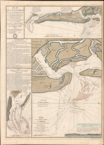
Plan de l'île d'Amelia à la Côte de la Floride Orientale. / Plan de la Barre et et de l'entrée de la Riviere de Nassau. / Plan de la Barre et du port d'Amelia, à la Côte de la Floride Orientale.
$3,850.00
Acquire
- Digital Map Information
- Suitable for large format printing
- Full resolution TIFF file
- ICC color profile embedded
- Delivered instantly via download link
This is a rare 1779 American Revolutionary War map of Amelia Island, Florida, issued by Antoine de Sartine (1729 - 1801) and Jean-Nicholas Buache de Neuville (1741 - 1825). The chart was issued following the 1778 Treaty of Alliance, in which France formally recognized the United States and offered to aid the fledgling country against the British. Early in the war, French aid was primarily maritime. The Dépôt de Marine recognized the need for better nautical charts and began compiling and improving British charts of the North American coastline. (more details)
Jamaica During the Maroon Wars.
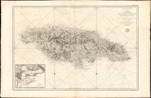
Carte de l'Ile de la Jamaique, extraite des Cartes topographiques Anglaises de T. Craskell... et de J. Simpson. Rédigée en 1786, corrigée et augmentée en 1799.
$1,500.00
Acquire
- Digital Map Information
- Suitable for large format printing
- Full resolution TIFF file
- ICC color profile embedded
- Delivered instantly via download link
This is a rare, large-format 1799 chart and map of Jamaica with an inset of Kingston Harbor. Issued in the wake of the Second Maroon War (1795), and overshadowed by the imminent French loss of Haiti to Toussaint Louverture, this map represents an effort by the French to absorb and utilize the best British information pertinent to Jamaica during a period in which both the British and the French were experiencing slave rebellion in the West Indies. Despite decades of war with each other, the Caribbean territories of these two slave-holding empires found common ground in the face of their respective revolts. British forces fought in Haiti in support of French planters until 1798; it may be that this work was produced in anticipation of returning the favor. (more details)
First modern chart of the Azores.
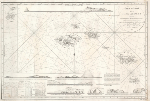
Carte Réduite des Îles Açores dressée Par Ordre du Ministre de la Marine Pour le Service des Vaisseux Français, d'après les Observations faites par M. de Fleurieu, en 1769 et par Don Vicente Tofiño en 1788. / Publiée au Dépôt général des Cartes, Plans et Journaux de la Marine. 1791.
$950.00
Acquire
- Digital Map Information
- Suitable for large format printing
- Full resolution TIFF file
- ICC color profile embedded
- Delivered instantly via download link
This elegant, separately-issued, Depot de la Marine nautical chart / map of the Azores is the first to employ modern nautical surveys using marine chronometers. This chart combines the data of the French hydrographer Charles Pierre Claret, Comte de Fleurieu (1738 - 1810), with that of the Spanish hydrographer Vincente Tofiño de San Miguel (1732 - 1795), whose respective surveys represented the first scientific charting of the Azores. It represents a vast improvement over the 1755 Bellin Carte Réduite des Îles Açores, which, until 1791, was the best French charting of the islands. (more details)
France and the Nguyễn.
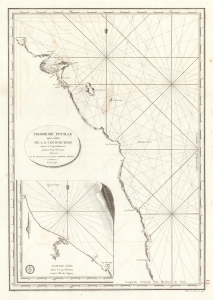
Troisieme Feuille des cotes de la Cochinchine depuis le Cap Boxhornen jusqu'au Cap Choumay.
$300.00
Acquire
- Digital Map Information
- Suitable for large format printing
- Full resolution TIFF file
- ICC color profile embedded
- Delivered instantly via download link
This is a 1798 French Dépôt de la Marine nautical map of southern Vietnam, then the kingdom of Cochinchine. This chart marks the early stages of French involvement in the Tây Sơn Rebellion in support of Nguyễn Ánh, who would become Vietnam's first emperor. (more details)
First English reconnaissance of Spanish settlement in California.
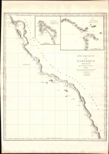
Cote Nord-Ouest de L'Amerique Reconnue par le Cape. Vancouver. 1e Partie.
$1,500.00
Acquire
- Digital Map Information
- Suitable for large format printing
- DPI: 600
- File Size: 24.66 MB
- File Type: ZIP / TIFF
- ICC color profile embedded
- Delivered instantly via download link
One of the great navigator George Vancouver's most important and influential maps, this is his 1799 charting of the California coastline roughly from Santo Domingo, Mexico, to San Francisco Bay. Vancouver's exploration of the California coastline was significant, breaking the Spanish wall of silence and producing the first English reconnaissance on Spanish settlement and colonization of the West Coast. Vancouver's mapping of California generated the finest coastal chart of the region to date. (more details)
At the height of the Haitian Revolution, when a former slave's rise to power that undermined the foundations of the plantation system.
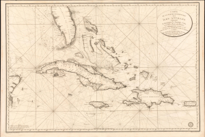
Carte de la Partie Occidentale des Îles Antilles Comprenant St. Domingue, La Jamaique, Cuba et Îles et Bancs de Bahama avec les Débouqumens de toutes ces Îles Dressée d'apres les nouvelles Observations des Espagnols et Publiée Par Ordre du Xontre-Amiral Decrès Ministre de la Marine et des Colonies au Dépôt général de la Marine, en 1801.
$4,000.00
Acquire
- Digital Map Information
- Suitable for large format printing
- Full resolution TIFF file
- ICC color profile embedded
- Delivered instantly via download link
A striking 1801 French Dépôt de la Marine nautical chart of Florida and the Greater Antilles, encompassing Cuba, the Bahamas, Hispaniola, Puerto Rico, and Jamaica. Issued at the height of the Haitian Revolution, the map coincides with the rise of the former slave and revolutionary Toussaint Louverture, who had just unified Hispaniola under his authority, sending shockwaves through the slaveholding societies of the Atlantic world. Published as Napoleon Bonaparte prepared his massive Saint-Domingue Expedition to reclaim France's richest colony, this chart reflects the sudden strategic importance of the Caribbean's sea lanes, making it an artifact of one of history's most transformative revolutions. (more details)
France's fledgling return to the 'China trade.'
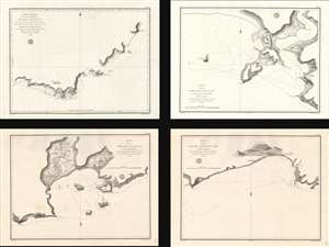
Carte réduite de la Partie Méridionale de l'Île d'Hainan...
$1,800.00
Acquire
- Digital Map Information
- Suitable for large format printing
- Full resolution TIFF file
- ICC color profile embedded
- Delivered instantly via download link
A set of four nautical charts of the southern coast of Hainan Island, China, produced in 1819 by the French Dépôt générale de la Marine. At the time, France was eager to reestablish trade ties with China following the upheavals of the Revolution and Napoleonic Wars, and an accurate understanding of the coastline of Hainan was important to the safe passage of vessels along the coast. (more details)
Increasing French interest in Mexico.
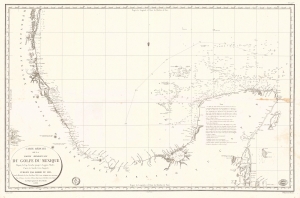
Carte Réduite de la Partie Méridionale du Golfe du Mexique Depuis le Cap Catoche jusqu'à Laguna Madre.
$950.00
Acquire
- Digital Map Information
- Suitable for large format printing
- Full resolution TIFF file
- ICC color profile embedded
- Delivered instantly via download link
This is an 1826 Dépôt de la Marine nautical map of the Gulf Coast of Mexico. The publication of this map in France reflects renewed and growing imperial interest in the New World, which culminated in the French Intervention in Mexico (1838 - 1839). This coast, and the Yucatan specifically, was the most important and wealthiest part of Mexico. The Yucatan was the only place in the world where sisal could be farmed from Henequen agave - the source of most of the world's nautical rope until the invention of synthetics. (more details)
Early French nautical chart of the southeast coast of Vietnam including Saigon.
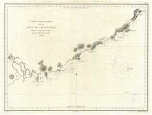
Carte Particuliere de la Cote de Cochinchine Depuis le Cap Saint Jacques jusqu'an Faux Cap Varelle.
$500.00
Acquire
- Digital Map Information
- Suitable for large format printing
- DPI: 300
- File Size: 9.67 MB
- File Type: ZIP / TIFF
- ICC color profile embedded
- Delivered instantly via download link
This is an impressive c.1830 example of the French Depot-General de la Marine nautical chart or maritime map of the coast of Vietnam. It covers from Saigon (modern day Ho Chi Minh City) northward as far as Cam Ranh. Offers extraordinary detail both inland and at ... (more details)
A rare nautical chart of the French overseas collective St. Pierre.
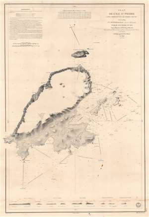
Plan de l'Ile St. Pierre (Côte Méridionale de Terre Neuve).
$450.00
Acquire
- Digital Map Information
- Suitable for large format printing
- DPI: 600
- File Size: 81.96 MB
- File Type: ZIP / TIFF
- ICC color profile embedded
- Delivered instantly via download link
This is an 1834 Jules de la Roche-Poncié and Dépot de la Marine nautical chart or maritime map of St. Pierre Island, part of the French overseas collective, ('collectivité d'outre-mer'), St. Pierre and Miquelon. St. Pierre dominates the sheet, and its coastlines appear in impressive detail. Coves, points, bays, and other coastal locations are labeled. The Ile aux Chiens, Ile aux Vainqueurs, the Ile aux Pigeons, and Grand Colombier are illustrated and labeled, along with numerous smaller coastal islands. Depth soundings, navigation directions, and other notations provide mariners with navigational assistance. Nine coastal views appear along the bottom border to further aid navigation. (more details)
Early, gorgeous chart of the East Indies.
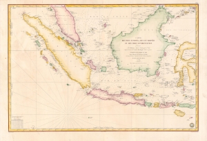
Carte des Iles Sumatra, Java et Borneo et des mers Environnantes...
$1,000.00
Acquire
- Digital Map Information
- Suitable for large format printing
- Full resolution TIFF file
- ICC color profile embedded
- Delivered instantly via download link
A beautiful and rare 1839 French Depot-General de la Marine nautical chart or maritime map of the East Indies or Insular Southeast Asia - including Singapore. The size and level of detail is impressive, reflecting the importance of the chart as representing the pinnacle of hydrographical knowledge at the time. (more details)
French colonial interest in the Philippines. Also, rectification of charts.
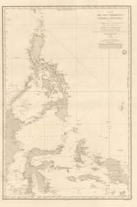
Carte des Iles Philippines, Célèbes et Moluques.
$4,500.00
Acquire
- Digital Map Information
- Suitable for large format printing
- Full resolution TIFF file
- ICC color profile embedded
- Delivered instantly via download link
A spectacular 1840 / 1852 map of the Philippines by Pierre Daussy and the French Dépot-général de la Marine. This map is significant as it reflects growing French interest in the Far East and coincides with the first French attempt to seize the Philippine island of Basilan as a base to counterbalance British power in Hong Kong. It is also part of the French Bureau des Longitudes' ongoing effort to revise its Table des Positions Géographiques des Principaux Lieux du Globe to conform to the most up-to-date measurements made possible by advances in hydrography, including widespread early 19th century adoption in the marine chronometer. Daussy published dozens of new charts, including this one, to reflect the significant corrections. (more details)
Challenging British Hegemony in the Indian Ocean.
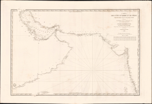
Carte des côtes d'Arabie, et de Perse, comprenant depuis l'Ile Socotra jusqu'à Bombay.
$2,500.00
Acquire
- Digital Map Information
- Suitable for large format printing
- File Size: 39.57 MB
- File Type: ZIP / TIFF
- ICC color profile embedded
- Delivered instantly via download link
This is a rare, large-format 1840 nautical chart of the Arabian Sea and Persian Gulf prepared by the French Dépôt Général de la Marine. At the time it was produced, France was trying to match Britian's growing dominance of the Indian Ocean, presenting itself to indigenous rulers as an alternative trading partner. (more details)
Largest Atoll Structure in the World.
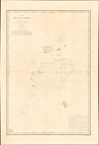
Carte des Iles Chagos. No. 945.
$1,200.00
Acquire
- Digital Map Information
- Suitable for large format printing
- File Size: 28.38 MB
- File Type: ZIP / TIFF
- ICC color profile embedded
- Delivered instantly via download link
This is a scarce, large-format 1841 French Dépôt-général de la marine nautical chart of the Chagos Archipelago in the Indian Ocean. It was produced at a time when Britain and France were vying for influence in the Indian Ocean, part of a wider, cautious global imperial competition in the wake of the Napoleonic Wars. (more details)
Second earliest, and earliest obtainable scientific map of the Galapagos.
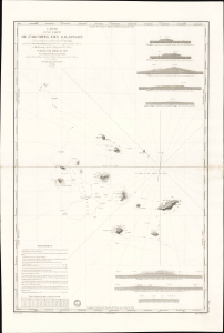
Carte d'une Partie de L'Archipel des Galapagos Levée et dressée en 1838 à bord de la Vénus...
$7,500.00
Acquire
- Digital Map Information
- Suitable for large format printing
- File Size: 2032.23 MB
- File Type: ZIP / TIFF
- ICC color profile embedded
- Delivered instantly via download link
An extraordinary discovery, this is Urbain Dortet de Tessan's 1842 nautical map of the Galapagos Islands, considered the second scientific map of the Galapagos. The map is the result of survey work performed in July of 1836 on the westward circumnavigation of the Vénus under Admiral Abel Aubert Dupetit-Thouars. The Vénus's visit to the Galapagos followed Darwin by just one year, and thus Beagle hydrographer Robert Fitzroy's contemporaneous mapping of the archipelago. This chart, published in 1842, and Fitzroy's chart, published in 1841, constitute the first comprehensive nautical overview of the islands and are comparable in both rarity and significance. (more details)
The French set their eyes on Singapore.
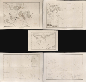
Carte des Atterrages de Singapore. / Carte Particulière des détroits de Singapore, Durian et Rhio. / Carte des Détroits de Singapore, Durian et Rhio et des Parages Environnants. / Carte du Détroit del Malacca Partie Septentrionale. / Carte du Détroit de Malacca Partie Méridionale.
$22,000.00
Acquire
- Digital Map Information
- Suitable for large format printing
- Full resolution TIFF file
- ICC color profile embedded
- Delivered instantly via download link
An exceptional set of five rare 1840s nautical maps/charts detailing Singapore, Malaya, and the Straits of Malacca and Singapore compiled by Urban Dortet de Tessan for the French Dépôt-Général de la Marine. The charts correspond to the Lagrené Mission, a French attempt to establish a colonial presence in East and Southeast Asia that challenged British regional hegemony. (more details)
Capital of the Seychelles.
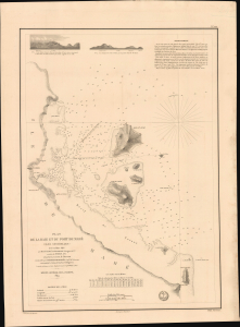
Plan de la Baie et du Port de Mahé (Îles Seychelles). No. 1211.
$1,500.00
Acquire
- Digital Map Information
- Suitable for large format printing
- File Size: 20.23 MB
- File Type: ZIP / TIFF
- ICC color profile embedded
- Delivered instantly via download link
This is a rare 1849 French Dépôt-général de la marine nautical chart of the island of Mahé in the Seychelles Islands. It was produced at a time when Britain and France were vying for influence in the Indian Ocean, part of a wider, cautious global imperial competition in the wake of the Napoleonic Wars. (more details)
Sinking paradise.
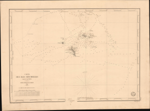
Carte des Iles Seychelles. No. 1205.
$1,500.00
Acquire
- Digital Map Information
- Suitable for large format printing
- File Size: 17.83 MB
- File Type: ZIP / TIFF
- ICC color profile embedded
- Delivered instantly via download link
This is a rare 1849 French Dépôt-général de la marine nautical chart of the Seychelles Islands in the Indian Ocean. It was produced at a time when Britain and France were vying for influence in the Indian Ocean, part of a wider, cautious global imperial competition in the wake of the Napoleonic Wars (1803 - 1815). (more details)
Two significant rarities - Saigon and Shanghai - back to back.
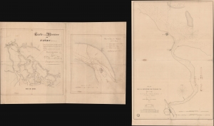
Carte de la Rivière de Saigon (Cochinchine). / Plan du Band de Corail (rivière de Saigon). / Plan de al Rivière de Woosung Levé en 1842 Par les Capitaines H. Kellet and R. Collinson, de la Marine Anglaise.
$7,500.00
Acquire
- Digital Map Information
- Suitable for large format printing
- Full resolution TIFF file
- ICC color profile embedded
- Delivered instantly via download link
This is a remarkable set of back-to-back maps - both are significant in different ways. The most interesting is a finely-executed c. 1860 manuscript chart detailing river approaches to Saigon (Ho Chi Min City). On the verso (or recto, depending) is an 1850 printed nautical chart of the approaches to Shanghai based on the cartography of the First Opium War (1839 - 1842). Both maps are significant, with the manuscript taking primacy as, in all likelihood, it is the first modern hydrographic survey of the Song Sai Gon Estuary. (more details)
Main Trade Route of the Caribbean.
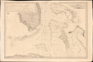
Carte des Canaux de la Providence et de Bahama. D'après la Carte en deux feuilles de E. Blunt de 1847.
$4,000.00
Acquire
- Digital Map Information
- Suitable for large format printing
- Full resolution TIFF file
- ICC color profile embedded
- Delivered instantly via download link
This is a large-format 1851 nautical chart or map of southern Florida and the Bahamas, focusing on the Bahama Banks, produced by the French Dépôt de la Marine. Based on a 1847 chart by American hydrographer Edmund Blunt, the chart represents the most detailed hydrographic information on these notoriously tricky waters available at the time. The map marks a point of rising French trade and activity in the Gulf under the Second Empire. (more details)
Main Waypoint in the Atlantic.
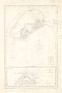
Iles Bermudas, d'après les travaux les plus récents.
$850.00
Acquire
- Digital Map Information
- Suitable for large format printing
- Full resolution TIFF file
- ICC color profile embedded
- Delivered instantly via download link
This is an 1852 nautical chart or map of Bermuda issued by the French Dépôt général de la Marine. It presents the island when it had become the primary waypoint between Europe and the Americas, as well as one of Britain's most important strategic holdings globally. (more details)
France and the China Trade.
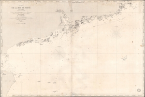
Carte de la Mer de Chine (3ème Feuille) d'Hainan à Namoa.
$750.00
Acquire
- Digital Map Information
- Suitable for large format printing
- Full resolution TIFF file
- ICC color profile embedded
- Delivered instantly via download link
This is an 1853 French Dépôt de la Marine nautical map of the coast of China from Hainan to Nan'ao Island (Namao), including Macao, Hong Kong, and Guangzhou (Canton). The chart was issued to support growing French trade with China in the Treaty Port Era. (more details)
An incredible detailed chart of Guanabara Bay - including many of its islands.
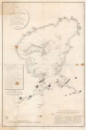
Plan de la Baie de Rio - Janeiro.
$1,000.00
Acquire
- Digital Map Information
- Suitable for large format printing
- File Size: 66.1 MB
- File Type: ZIP / TIFF
- ICC color profile embedded
- Delivered instantly via download link
This is an 1866 edition of the Dépôt de la Marine nautical chart or map of Guanabara Bay, Rio de Janeiro, Brazil. Rio de Janeiro appears near the mouth of the bay, with numerous buildings illustrated but not labeled. The only identified building is the Chateau S. Cristovaô (situated outside the city) which is marked as the Residence of the Emperor. The Ile do Governador (Ilha do Governador - today the site of Rio de Janeiro's Galeão - Antônio Carlos Jobim International Airport) is prominently illustrated, with its coastline appearing in detail. Numerous smaller islands throughout the bay are depicted as well. Smaller bays, capes, points, and even beaches are labeled around the bay. Depth soundings fill the bay, providing a more detailed understanding of its navigability. (more details)
The bay and fortifications of Saint Martin.
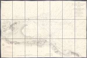
Plan de la Rade de Saint Martin et de ses Environs. (Ile de Ré).
$650.00
Acquire
- Digital Map Information
- Suitable for large format printing
- File Size: 38.53 MB
- File Type: ZIP / TIFF
- ICC color profile embedded
- Delivered instantly via download link
This is an 1867 French Dépôt de la Marine nautical chart or maritime map of Saint Martin Bay, Ile de Ré, France. Depicting the north shore of the Ile de Ré from Loix to La Flotte, hundreds of depth soundings populate the bay. Saint Martin appears at bottom center, with the city's fortifications illustrated in detail. (more details)
French in Singapore.
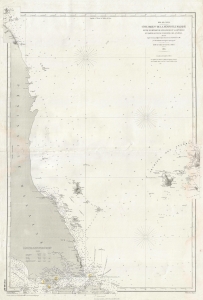
Côte Orientale de la Péninsule Malaise entre le Détroit de Singapoure de la Grande Redan et Partie Occidentale de l'Archipel des Anambas.
$950.00
Acquire
- Digital Map Information
- Suitable for large format printing
- File Size: 18.78 MB
- File Type: ZIP / TIFF
- ICC color profile embedded
- Delivered instantly via download link
This is an 1888 Dépot des Cartes et Plans de la Marine nautical map of the Malay Peninsula and Singapore. The map reflects growing French influence in and around Singapore, a major trading partner for French Indochina. (more details)