
Dépôt des Cartes et plans de la Marine (sold)
Dépôt des Cartes et Plans de la Marine (fl. 1720 - present), often called the Dépôt Général de la Marine, was a French hydrographic mapping organization founded in 1720 under Charles-Hercule of Albert de Luynes (1674 - 1734). Much like the U.S. Coast Survey, the British Admiralty, and the Spanish Deposito Hydrografico, the Dépôt was initiated as a storehouse and distribution center of existing nautical and marine charts. Eventually the Dépôt initiated its own mapping activities in an attempt to improve and expand upon existing material. Some of the more prominent cartographers and hydrographers associated with the of Dépôt Générale des Cartes were, Philippe Buache, Jacques-Nicholas Bellin, Giovanni Rizzi-Zannoni, Rigobert Bonne, and Jean Nicolas Buache.
Southwest Africa and the Cape of Good Hope.
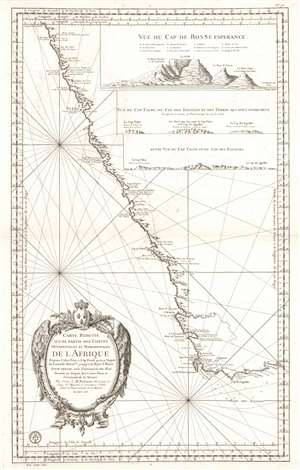
Carte Reduite d'Une Partie des Costes Occidentales et Meridionales de L'Afrique...
sold
- Digital Map Information
- Suitable for large format printing
- Full resolution TIFF file
- ICC color profile embedded
- Delivered instantly via download link
This is the 1754 Jacques Nicolas Bellin nautical map of the southwest coast of Africa and the Cape of Good Hope. The map depicts the region from Cape Fria in Namibia to Cape Agulhas (Cape of the Needles) and the Bay of St. Blaise, including the Cape of Good Hope. Capes, bays, and topographical features including mountains, rivers, and coastal features are illustrated with elevation rendered in profile. Three profile views appear in the top right, 'Vue Du Cap de Bonne Esperance' (Cape of Good Hope), 'Vue Du Cap Falso, Du Cap Des Eguilles et des Terres Qui sont Entre deux' and 'Autre Vue Du Cap Falso et Du Cap Des Eguilles'. Cape Town, Constance (Constantia), Stellenbosch and Hangklip are accurately identified. (more details)
The new reality in the wake of the 1755 Earthquake.
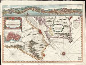
Plan du Port de Lisbonne et es Costes Voisines.
sold
- Digital Map Information
- Suitable for large format printing
- Full resolution TIFF file
- ICC color profile embedded
- Delivered instantly via download link
A scarce 1756 J. N. Bellin nautical map of Lisbon, reflecting the aftermath of the disastrous 1755 mega-earthquake that all but destroyed golden-age Lisbon and the surrounding lands. Oriented to the East - as a ship world approach the Tage - the map depicts the city of Lisbon and entrances to the port on both sides of the Tage River, extending south to Setuval and north beyond Colares. A dramatic view of Lisbon as it would have appeared just before the earthquake surmounts the map. An inset near the rococo title cartouche details the walled city of Lisbon - as it appeared before the quake, but as this is primarily a nautical chart, such would not have affected navigation. (more details)
Important French colony.
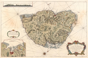
Carte de l'Isle de France Dressée au Dépost des Cartes et Plans de la Marine Pour le Service des Vaisseaux du Roy Par Ordre de M. le Duc de Choiseul Colonel Général des Suisses et Grisons Ministre de la Guerre et de la Marine.
sold
- Digital Map Information
- Suitable for large format printing
- DPI: 600
- File Size: 73.01 MB
- File Type: ZIP / TIFF
- ICC color profile embedded
- Delivered instantly via download link
This is a 1763 Jacques-Nicolas Bellin map of Mauritius. It was issued near the peak of French colonial power, before the French Revolution and the Napoleonic Wars. Mauritius is here represented as the darling of French colonial power in the Indian Ocean. Not only was Isle de France a critical stopping point on the East India Trade (and not just for the French), under management of the French East India Company, it was also a highly productive agrarian colony. (more details)
Includes one of the most stunning depictions of Florida as an archipelago in cartographic history.
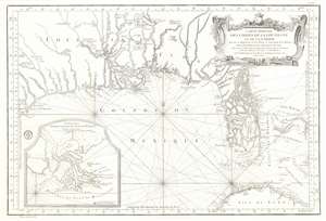
Carte Reduite des Costes de la Louisiane et de la Floride.
sold
- Digital Map Information
- Suitable for large format printing
- DPI: 600
- File Size: 32.79 MB
- File Type: ZIP / TIFF
- ICC color profile embedded
- Delivered instantly via download link
This is a 1764 Jacques-Nicolas Bellin map of the Gulf Coast of the United States featuring an exceptional depiction of Florida as an archipelago. Illustrating the Gulf region from Galveston Bay (Baye St. Louis) to the Bahamas and from the southern United States to Cuba, numerous coastal useful for navigation are incorporated. Coastal islands, capes, bays, and river mouths are all noted, including Mobile Bay, the St. John's River, and the Mississippi Delta. Depth soundings are present where they have been taken. St. Augustine and New Orleans are labeled, as are several coastal forts. Indian villages are identified in the interior, as are rivers and a lead mine in modern-day Texas. Rhumb lines appear throughout, and Dry Tortugas in the Florida Keys and individual islands in the Bahamas are notated. An inset map in the lower left corner illustrates the mouth of the Mississippi River. (more details)
Bellin puts it all together...

Remarques sur la Carte reduite de l'océan septentrional, compris entre l'Asie et l'Amérique, suivant les découvertes qui ont été faites par les Russes; dressée au Dépôt des cartes et plans de la Marine, pour le service des vaisseaux du roi, par ordre de M. le duc de Praslin, ministre d'etat, ayant le département de la Marine.
sold
- Digital Map Information
- Suitable for large format printing
- DPI: 600
- File Size: 38.06 MB
- File Type: ZIP / TIFF
- ICC color profile embedded
- Delivered instantly via download link
A beautiful example of Bellin's splendidly engraved 1766 map of the Pacific Northwest, Alaska, the Bering Strait and Siberia. This map is significant as a reactionary piece to the waves of cartographic speculation about the American Pacific Northwest that defined the first half of the 18th-century. Bellin, the premier hydrographer of his generation, here attempts make sense of it all, bringing together the speculations of the previous generation, his own geographical expertise, and issuing, for the first time on a French map, Frederick Muller's revolutionary cartography relating to the discoveries of Vitus Bering and Aleksei Chirikov. (more details)
Rare Italian edition of an important French nautical chart.
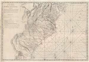
Carte Réduite Des Côtes Orientales Del'Amérique Septentrionale Contenant Partie du Nouveau Jersey, la Pen-sylvanie, le Mary-land, la Virginie, la Caroline Septentrionale, la Caroline Méridionale et la Géorgie.
sold
- Digital Map Information
- Suitable for large format printing
- Full resolution TIFF file
- ICC color profile embedded
- Delivered instantly via download link
A most unusual 1799 Rome imprint of the important 1788 Sartine / Dépôt des Cartes et Plans de la Marine map of the American Mid-Atlantic seaboard. Coverage extends from New Jersey and Pennsylvania southward through Maryland and Virginia, then along the Carolina coast to Georgia and Florida. While this map was originally by the French 'Dépôt General de la Marine' in 1778, the present example bears a 1799 Rome imprint. Although a nautical chart, this map features a magnificent wealth of inland detail as far west as the Appalachian Mountains and the Ohio River. (more details)
Revolutionary War Map of Amelia Island.
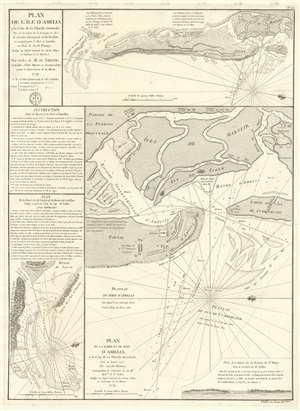
Plan de l'île d'Amelia à la Côte de la Floride Orientale. / Plan de la Barre et et de l'entrée de la Riviere de Nassau. / Plan de la Barre et du port d'Amelia, à la Côte de la Floride Orientale.
sold
- Digital Map Information
- Suitable for large format printing
- DPI: 600
- File Size: 24.35 MB
- File Type: ZIP / TIFF
- ICC color profile embedded
- Delivered instantly via download link
This is a rare 1779 American Revolutionary War map of Amelia Island, Florida, issued by Antoine de Sartine (1729 - 1801) and Jean-Nicholas Buache de Neuville (1741 - 1825). The chart was issued following the 1778 Treaty of Alliance, in which France formally recognized the United States and offered to aid the fledgling country against the British. Early in the war, French aid was primarily maritime, so the Depot de Marine recognized the need for better nautical charts and began to compile and improve British charts of the North American coastline. (more details)
Created for the French Navy during the American Revolutionary War.
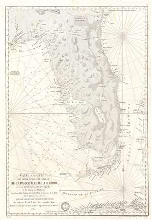
Carte Réduite des Côtes et de l'Interieur de la Presqu'île de la Floride, avec le Détroit de cette Presqu'Île et le Canal de Bahama.
sold
- Digital Map Information
- Suitable for large format printing
- DPI: 600
- File Size: 22.8 MB
- File Type: ZIP / TIFF
- ICC color profile embedded
- Delivered instantly via download link
This is a 1780 Antoine de Sartine nautical map of Florida, issued for French Naval use during the American Revolutionary War. (more details)
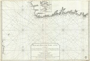
Plan des Cotes de Terre Neuve IIIe. Feuille Contenant la Partie Meridionale depuis les Iles de Bergeo jusqu au Cap de Raye, avec l'Entrée du Golfe de St. Laurent comprise entre ce Cap et le Cap de Nord de l'Ile Royale.
sold
- Digital Map Information
- Suitable for large format printing
- DPI: 300
- File Size: 32.57 MB
- File Type: ZIP / TIFF
- ICC color profile embedded
- Delivered instantly via download link
A scarce 1794 map of the southwest coast of Newfoundland, Canada, issued by the Depot de la Marine and surveyed by Captain Cook. This map, the third in this series, covers from Cape Anguille on the Gulf of St. Lawrence, southwards to Channel-Port aux Basques, then ... (more details)
Red Sea and French attempts to sieze control of the India Ocean.
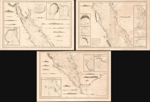
Carte Générale de la Mer Rouge...
sold
- Digital Map Information
- Suitable for large format printing
- Full resolution TIFF file
- ICC color profile embedded
- Delivered instantly via download link
This is a c. 1799 set of three nautical maps or charts covering the Red Sea, produced by the French Dépôt Général de la Marine. At the time, the Red Sea had become a key strategic waterway due to Napoleon's invasion of Egypt and the wider geopolitical struggles of the French Revolutionary Wars, prompting significant remapping. (more details)
Cornerstone map of Australian discovery and colonization.
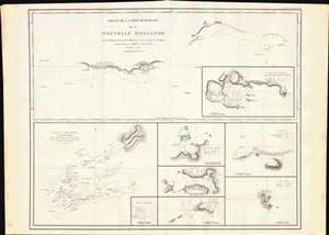
Partie de la Cote Sud-Ouest de la Nouvelle Hollande avec les Routes de la Corvette la Decouverte et sa conserve le Chatham commandes par Georges Vancouver en l'Annee 1791.
sold
- Digital Map Information
- Suitable for large format printing
- DPI: 600
- File Size: 29.25 MB
- File Type: ZIP / TIFF
- ICC color profile embedded
- Delivered instantly via download link
One of the great navigator George Vancouver's most important and influential maps, this is Vancouver's 1799 mapping of southwestern Australia and New Zealand. Though less well known than his historic mapping of the Pacific Northwest, Vancouver's work in Australia and New Zealand is no less significant. (more details)
First printed mapping of the Columbia river and Puget Sound.
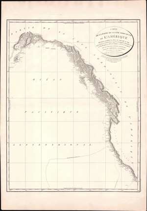
Carte de la Partie de la Cote Nord-Ouest de L'Amerique Reconnue pendant Etes de 1792, 1793, et 1794.
sold
- Digital Map Information
- Suitable for large format printing
- Full resolution TIFF file
- ICC color profile embedded
- Delivered instantly via download link
One of George Vancouver's most influential maps, this is the 1799 general reconnaissance of the west coast of America from San Diego to Kodiak Island, Alaska. This beautifully engraved map features several notable firsts, including the first published mapping of the Puget Sound, the first mapping of Vancouver as an island, the first mapping of the Johnston Strait, the first detailed mapping of Cook Inlet, and the first published map of the Columbia River. In general, this represents the finest mapping of the American west coast to appear for nearly 40 years from its publication. Vancouver's tracks in 1792, 1793, and 1794 are noted. (more details)
First printed charting of the Columbia river and Puget Sound.
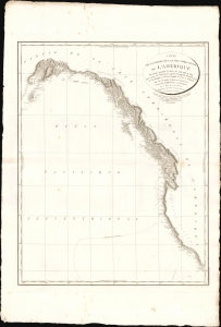
Carte de la Partie de la Cote Nord-Ouest de L'Amerique Reconnue pendant Etes de 1792, 1793, et 1794.
sold
- Digital Map Information
- Suitable for large format printing
- File Size: 26.04 MB
- File Type: ZIP / TIFF
- ICC color profile embedded
- Delivered instantly via download link
One of George Vancouver's most influential maps, this is the 1799 general reconnaissance of the west coast of America from San Diego to Kodiak Island, Alaska. This beautifully engraved chart features several notable firsts, including the first published mapping of the Puget Sound, the first mapping of Vancouver as an island, the first mapping of the Johnston Strait, the first detailed mapping of Cook Inlet, and the first published map of the Columbia River. In general, this represents the finest mapping of the American west coast to appear for nearly 40 years from its publication. Vancouver's tracks in 1792, 1793, and 1794 are noted. (more details)
1800 Depot de la Marine Nautical Chart or Map of the Rio de la Plata (Argentina, Buenos Aires, Monte
Finely engraved chart of the Rio de la Plata.
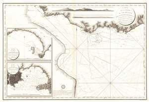
Carte de La Riviere de La Plata depuis son Embouchure jusqu'a Buenos-Ayres d'apres les Plans leves en 1789 et 1794.
sold
- Digital Map Information
- Suitable for large format printing
- Full resolution TIFF file
- ICC color profile embedded
- Delivered instantly via download link
This is an extremely scarce large format c. 1800 French nautical chart or maritime map of the Rio de la Plata, Argentina and Uruguay. The chart is noteworthy for the extraordinary engraving mastery it exhibits - a hallmark of the engraver Charles-Étienne Collin (1770 - 1840). This elegantly presented map covers the entire estuary from Los Cerros de San Juan to the Laguna de Rocha and extends south to approximately 55 degrees south latitude. The chart includes the important ports of Buenos Aires, Sacramento, Montevideo, and Maldonado, among others. The detail is primarily coastal, extending only about 10 miles inland, but the terrestrial detail offered throughout, including topography rendered in hachure, is extraordinary. Nautically, the map offers a multitude of soundings and outlines several shoals. Two large inset maps offer extraordinary detail focused on the ports of Maldonado and Montevideo, both in modern-day Uruguay. Shore profiles line the top of the map. (more details)
Most trafficked and contested part of the West Indies.
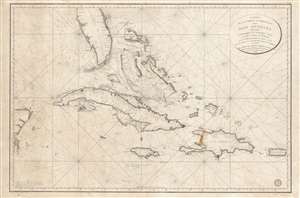
Carte de la Partie Occidentale des Îles Antilles Comprenant St. Domingue, La Jamaique, Cuba et Îles et Bancs de Bahama avec les Débouqumens de toutes ces Îles Dressée d'apres les nouvelles Observations des Espagnols et Publiée Par Ordre du Xontre-Amiral Decrès Ministre de la Marine et des Colonies au Dépôt général de la Marine, en 1801.
sold
- Digital Map Information
- Suitable for large format printing
- DPI: 600
- File Size: 39.35 MB
- File Type: ZIP / TIFF
- ICC color profile embedded
- Delivered instantly via download link
A scarce and elegantly engraved 1801 nautical map of Florida and the Greater Antilles, including Cuba, the Bahamas, Santo Domingo, Puerto Rico, and Jamaica, issued by the official French hydrographic office, the Dépôt de Marine. The map covers from the eastern Yucatan to Puerto Rico and from just north of Cape Canaveral, Florida, to the banks south of Jamaica - thus embracing the most heavily trafficked and contested waters in the West Indies. (more details)
First accurate triangulation of the Faroes.
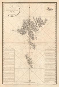
Plan des íles Ferøë Levé Géométriquement de 1790 à 1795...
sold
- Digital Map Information
- Suitable for large format printing
- DPI: 600
- File Size: 76.51 MB
- File Type: ZIP / TIFF
- ICC color profile embedded
- Delivered instantly via download link
This large and striking map is the 1820 French Dépôt des Cartes edition of the seminal 1806 Born survey of the Faroe Islands. This is the first map of the Faroes based on actual triangulation. Although formatted as a nautical chart, the map has little hydrographic detail, with the focus instead being on land-side topography and coastal settlements. (more details)
Renewed French imperialist interest in the Americas.
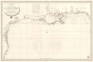
Carte Réduite de la Partie Septentrionale du Golfe du Mexique Depuis Laguna Madre jusqu'à la Côte de la Floride.
sold
- Digital Map Information
- Suitable for large format printing
- Full resolution TIFF file
- ICC color profile embedded
- Delivered instantly via download link
This is an 1826 French Dépôt de la Marine nautical chart or maritime map of the Gulf Coast. The publication of this map for French audiences reflects renewed and growing imperial interest in the New World on the part of France. (more details)
The Earliest Acquirable, Detailed Chart of Port Jackson and Sydney Harbor.
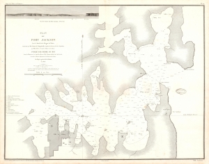
Plan du Port Jackson : Levé à bord de la Frégate la Thétis par M. le Baron de Bougainville.
sold
- Digital Map Information
- Suitable for large format printing
- Full resolution TIFF file
- ICC color profile embedded
- Delivered instantly via download link
This 1828 Bougainville nautical map of Port Jackson, Sydney, Australia is the earliest acquirable, detailed chart of Port Jackson and the approaches to Sydney, in New South Wales. It appeared in the circumnavigator Bougainville's Journal de la Navigation autour du Globe de la Fregate la Thetis et la Corvette l'Esprance Execute pendant les Annees 1824, 1825 et 1826. (more details)
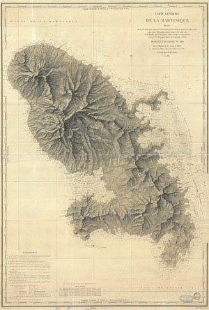
Carte Generale de la Maritinique.
sold
- Digital Map Information
- Suitable for large format printing
- DPI: 300
- File Size: 32.79 MB
- File Type: ZIP / TIFF
- ICC color profile embedded
- Delivered instantly via download link
A beautiful French nautical chart or map of Martinique issued in 1831 by the Depot de la Marine. Offers sumptuous detail both inland at sea. There are countess depth soundings as well as notes on undersea features such as banks and shoals. Equally impressive ... (more details)
Early Chart of the Montevideo Road it its First Edition.
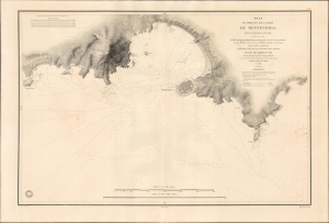
Plan du Port et de la Rade de Montevideo, dans Le Rio de la Plata, Leve en 1831, Par Mr. Lebourguignon Duperre, Ingenieur-Hydrographe, Chevalier de la Legion d'Honneur... 1833
sold
- Digital Map Information
- Suitable for large format printing
- File Size: 38.37 MB
- File Type: ZIP / TIFF
- ICC color profile embedded
- Delivered instantly via download link
This is a rare first-edition first-state of the Depot de la Marine nautical chart or map of Montevideo and its approaches, printed in 1833 based on the 1831 surveys of Cyprien-Gabriel Le Bourguignon-Duperré. Executed just after Uruguay's 1830 ratification of its first constitution, this state-of-the-art survey provided navigators with a vital tool as the new nation opened its doors to international maritime trade. (more details)
Early Chart of the Montevideo Road it its First Edition.
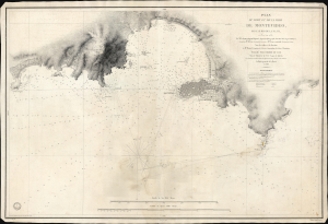
Plan du Port et de la Rade de Montevideo, dans Le Rio de la Plata, Leve en 1831, Par Mr. Lebourguignon Duperre, Ingenieur-Hydrographe, Chevalier de la Legion d'Honneur... 1833.
sold
- Digital Map Information
- Suitable for large format printing
- File Size: 35.51 MB
- File Type: ZIP / TIFF
- ICC color profile embedded
- Delivered instantly via download link
This is a scarce Depot de la Marine nautical chart or map of Montevideo and its approaches, printed in about 1880 to update the first edition, which was published in 1833 and based on the 1831 surveys of Cyprien-Gabriel Le Bourguignon-Duperré. This state-of-the-art survey's updated detail reflects the bustling activity of the port and the rapid growth of Uruguay's new capital. (more details)
Scarce French nautical chart of the East Coast from New York to Florida.
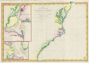
Carte de la Cote Orientale de l'Amerique Septentrionale Partie Comprise Entre New York et la Riviere Saint Jean.
sold
- Digital Map Information
- Suitable for large format printing
- DPI: 300
- File Size: 29.4 MB
- File Type: ZIP / TIFF
- ICC color profile embedded
- Delivered instantly via download link
This is a highly scarce 1834 map of the eastern coast of the United States. The map covers the entire coastline from New York City to the St. John River in Florida, inclusive of the Chesapeake Bay, the Outer Banks, and the Carolina, Virginia, and Georgia ... (more details)
The French-American cotton trade.
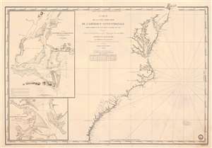
Carte de la Côte Orientale de l'Amérique Septentrionale Partie Comprise Entre New York et la Rivière Saint Jean.
sold
- Digital Map Information
- Suitable for large format printing
- Full resolution TIFF file
- ICC color profile embedded
- Delivered instantly via download link
This is an 1834 French Dépôt-général de la Marine nautical chart or maritime map of the east coast of the United States. The map appeared at the height of the U.S.-French textile trade, which it was likely published to support. Southern ports in Virginia, Carolina, and Georgia provided the bulk of cotton for the French textile industry - a fact that would become a major point of contention during the Civil War (1861 - 1865), leading to the Cotton Famine (1863 - 1863). Depicting from New York City south to the mouth of the St. Johns River in Florida, coastal detail abounds. Depth soundings are indicated along the entire coastline, along with inlets, capes, banks, and coastal islands. The Delaware River is charted to Philadelphia. The Chesapeake Bay is detailed as far as Charlestown and Elkstown. The Potomac River (labeled here as Potomack) is illustrated to Washington, D.C., and the Rappahannock River (labeled here as Rappanahock) runs to Fredericksburg. Both Richmond and Petersburg are labeled along the James River, as is Norfolk. Albemarle and Pamlico Sounds are detailed in North Carolina, and Cape Hatteras, Cape Lookout, and Cape Fear are labeled. Both Charleston and Savannah are identified. (more details)
How might Brazil retake Colonia?
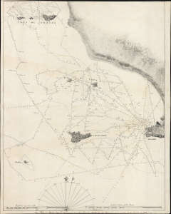
[Chart of the approaches to Colonia, Uruguay.]
sold
- Digital Map Information
- Suitable for large format printing
- Full resolution TIFF file
- ICC color profile embedded
- Delivered instantly via download link
This is a beautifully executed manuscript chart / map of the approaches to Colonia, Uruguay, on the north shore of the Rio de la Plata. It was executed on January 21, 1839, by Brazilian Midshipman (Guarda Maronja do Armada) Carlos Augusto Nascentes de Azambuja. The chart is a meticulous copy of the 1833 Plan Des Mouillages De La Colonia Et Des Iles De Hornos, Dans Le Rio De La Plata published by the French Depot General de la Marine, which would certainly have been the finest available printed chart of these waters. (more details)
On the cusp of greatness.
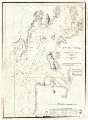
Plan du Port de Bombay.
sold
- Digital Map Information
- Suitable for large format printing
- Full resolution TIFF file
- ICC color profile embedded
- Delivered instantly via download link
This is a rare 1840 / 1843 nautical chart or maritime map of Bombay / Mumbai harbor, India. The map covers from Salsette to Kundaree Island. Detail focuses heavily on the inner harbor, where thousands of depth soundings in meters and trigonometric survey lines are included. This chart, compiled from the survey work of India Navy Lieutenant Robert Cogan represents the first major scientific survey of Bombay Harbor since the late 18th-century work of Captain John Watson. (more details)
Earliest obtainable modern chart of the Maldives.
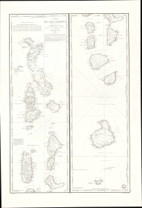
Carte des Iles Maldives. No. 942.
sold
- Digital Map Information
- Suitable for large format printing
- File Size: 28.83 MB
- File Type: ZIP / TIFF
- ICC color profile embedded
- Delivered instantly via download link
This is a rare large-format 1841 French Dépôt-général de la Marine nautical chart of the Maldives Islands in the Indian Ocean. Based on a now-unobtainable 1838 British chart by Robert Moresby, the first modern hydrographic survey of the islands, this is the earliest obtainable specific modern chart of the Maldives. (more details)
French interest in the Caribbean and a Nicaragua Canal.
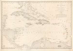
Carte des Antilles Dressée par M. Keller, Ingénieur Hydrographe de 2e Classe, d'après les travaus les plus récents.
sold
- Digital Map Information
- Suitable for large format printing
- DPI: 600
- File Size: 35.02 MB
- File Type: ZIP / TIFF
- ICC color profile embedded
- Delivered instantly via download link
This is the 1862 edition of the Dépôt de la Marine / Francois-Antoine-Edouard Keller nautical chart of the West Indies. It is the most general of Keller's West Indies charts reflecting the full scope of his definitive surveys - the coverage embracing the full Caribbean Basin from the Yucatan to Barbados and from Florida to Panama and the mouths of the Orinoco. This chart reflects French interest in the region relating to a possible Nicaragua Canal. (more details)
Exceptional highly detailed French cart of the Malacca Strait and Singapore.
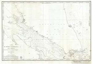
Carte du Détroit de Malacca Partie Méridionale comprenant depuis le Mont Parcelar jusqu'a Singapoure.
sold
- Digital Map Information
- Suitable for large format printing
- Full resolution TIFF file
- ICC color profile embedded
- Delivered instantly via download link
A rare French Dépôt Général de la Marine nautical chart or maritime map of Singapore and the southern part of the Strait of Malacca. The map covers from the Malay Peninsula roughly near Kuala Lumpur south to the islands of Bantan and Bintan, just ... (more details)
Scarce French mapping of Penang and the Malacca Strait.
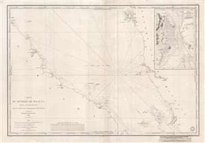
Carte Du Détroit de Malacca Partie Septentrionale comprenant depuis Poulo Penang jusqu'au Mont Parcelar.
sold
- Digital Map Information
- Suitable for large format printing
- DPI: 300
- File Size: 16.89 MB
- File Type: ZIP / TIFF
- ICC color profile embedded
- Delivered instantly via download link
An uncommon 1843 first edition French chart of the Strait of Malacca with an inset of the island of Penang in the vicinity of George Town. The chart covers the Strait of Malacca and the Malaysian coastline from Pulau Penang (Poulo Penang) to the Klang ... (more details)
Remarkable early French map of Singapore representing the forefront of scientific mapping of the region I the 1840s.
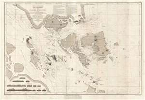
Carte Particulière des Détroits de Singapore, Durian et Rhio.
sold
- Digital Map Information
- Suitable for large format printing
- DPI: 300
- File Size: 22 MB
- File Type: ZIP / TIFF
- ICC color profile embedded
- Delivered instantly via download link
An exceptionally rare nautical chart of Singapore and vicinity issued by Urban Dortet de Tessan, under the patronage of Louis Philippe I of France. French nautical charts of the Singapore region have long been overlooked by collectors and scholars in ... (more details)
Early French nautical chart of the East Indies, including Singapore, based upon the work of Horsburgh.
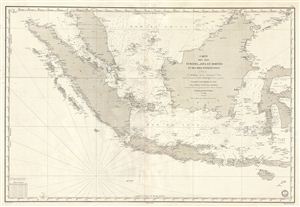
Carte des Iles Sumatra, Java et Borneo et des mers Environnates.
sold
- Digital Map Information
- Suitable for large format printing
- DPI: 300
- File Size: 26.14 MB
- File Type: ZIP / TIFF
- ICC color profile embedded
- Delivered instantly via download link
An uncommon and impressive 1848 French Depot-General de la Marine nautical chart or maritime map of the east Indies. Based upon the earlier work of the British hydrographer James Horsburgh, this map covers Sumatra, Java, and Borneo in full, as well ... (more details)
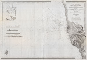
Carte Particuliere Des Cotes d'Italie Grand Duche de Toscane partie comprise entre l'embouchure de L'Arno et le Cap Castiglioncello.
sold
- Digital Map Information
- Suitable for large format printing
- Full resolution TIFF file
- ICC color profile embedded
- Delivered instantly via download link
A beautiful French nautical chart or map issued in 1852 by the Depot de la Marine. Covers the Tuscan coastline from the mouth of the Arno River (Embouchure de L'Arno) to Cape Castiglioncello (just north of Pisa) with a focus on Livorno (Livourne or ... (more details)
Rare French mapping of Singapore.
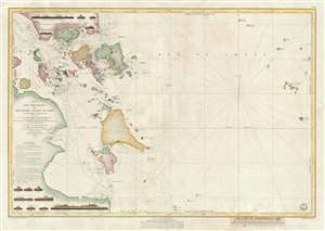
Carte Des Detroits de Singapore, Durian et Rhio et des parages environnants; Dressee d'aprees les cartes d'Horsburgh et celle de l'Amirante Anglaise en 1840 et d'apres la carte Hollandaise du Detroit du Rhio . . . par M. M. Dittlof Tjarssens, Bloijs, Van Treslong, Prins et Van Gogh.
sold
- Digital Map Information
- Suitable for large format printing
- DPI: 300
- File Size: 15.81 MB
- File Type: ZIP / TIFF
- ICC color profile embedded
- Delivered instantly via download link
An exceptionally rare 1852 nautical chart of Singapore and vicinity issued by Urban Dortet de Tessan, under the patronage of Louis Philippe I of France. French nautical charts of the Singapore region have long been overlooked by collectors and ... (more details)
The earliest scientific survey of Korea's coastlines.
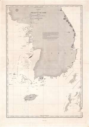
Carte de la presqu'île de Corée.
sold
- Digital Map Information
- Suitable for large format printing
- File Size: 136.55 MB
- File Type: ZIP / TIFF
- ICC color profile embedded
- Delivered instantly via download link
This is a fine potentially unique example of the 1859 edition of Ferdinand de la Roche-Poncié's chart of Korea, the first scientifically surveyed chart of the southern half of the peninsula. It depicts the Korean coastline from the Ongjin Peninsula on the western side of the peninsula to Mt. Kumgang (here as Siedlovaia) on the eastern side. (more details)

Mer Mediterranee Egypte Port D'Alexandrie.
sold
- Digital Map Information
- Suitable for large format printing
- File Size: 20.22 MB
- File Type: ZIP / TIFF
- ICC color profile embedded
- Delivered instantly via download link
This is a rare French nautical chart or map of Alexandria, Egypt dating to 1867 (updated to 1882). Prepared by the French Depot des Cartes et Plans de la Marine , this map offers extraordinary detail both inland and at sea. In the harbor ... (more details)
Issued in response to headhunters in South Formosa.
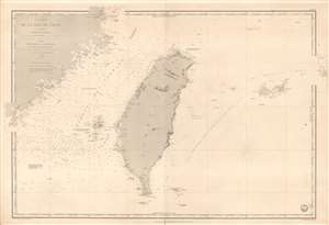
Carte de la Mer de Chine (4eme. Feuille) Détroit de Formose.
sold
- Digital Map Information
- Suitable for large format printing
- File Size: 43.78 MB
- File Type: ZIP / TIFF
- ICC color profile embedded
- Delivered instantly via download link
This is a rare 1873 French Depot de Marine nautical chart of Taiwan / Formosa and vicinity. The map is centered on Taiwan, but includes parts of Fujian, China, the Pescadores / Penghu Islands, and the Yaeyama Islands (Iles Majico Sima). This map was issued at a time when Taiwan was heavily in the news - headhunters of coruse - which can account for the issue and reissue of this chart from 1867 through the present 1873 edition. (more details)
Innovative composite of quantitative and qualitative wind data.
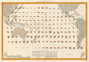
Océan Pacific - Cartes de la Direction et de l'Intensité Probables des Vents. Juillet Août Septembre.
sold
- Digital Map Information
- Suitable for large format printing
- File Size: 49.88 MB
- File Type: ZIP / TIFF
- ICC color profile embedded
- Delivered instantly via download link
This is an 1880 Léon Brault significant map of Pacific Ocean winds. The map is innovative in its expression of both quantitative and qualitative data in relation to wind direction, intensity, and frequency - presaging the work of Matthew Fontaine Maury (1806 - 1873) in the mid-19th century. (more details)
Rare map of Cambodia first issued just after the establishment of the French protectorate in 1863.
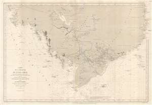
Carte de la Presqu'ile de l'Indo-Chine, depuis le port de Qui- Nhon dans le mer de Chine jusqu'à l'entrée de la Rivière de Bang-Kok dans le Golfe de Siam.
sold
- Digital Map Information
- Suitable for large format printing
- File Size: 24.51 MB
- File Type: ZIP / TIFF
- ICC color profile embedded
- Delivered instantly via download link
An extremely uncommon 1880 nautical chart or maritime map of Cambodia by the French hydrographic service, the Dépot des Cartes et Plans de la Marine. First issued in 1865, with updates to 1880, this map is roughly centered on the ... (more details)
'An orientalist's fantasy...'
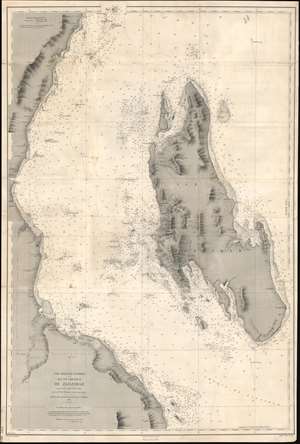
Côte Orientale d'Afrique. Ile et Chenaux de Zanzibar d'aprés le levé exécuté en 1873 et 1874.
sold
- Digital Map Information
- Suitable for large format printing
- File Size: 40.13 MB
- File Type: ZIP / TIFF
- ICC color profile embedded
- Delivered instantly via download link
An extremely rare 1891 French spice trade nautical chart or maritime map of Zanzibar Island or Unguja, off the coast of modern-day Tanzania. This is among the most detailed 19th century maps focusing on Zanzibar we have encountered. Coverage embraces the entire island as well as, the Zanzibar Channel, and the modern-day Tanzania coast from just south of Pemba Island to just north of Dar es Salaam. The largest town shown on the Africa coast is Bagamoyo. On the island, spice plantations are marked by clusters of palm trees and buildings. There are some manuscript updates and revisions around Stone Town. (more details)
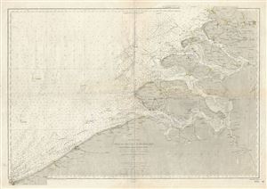
Mer du Nord Cotes de Belgique et de Hollande (Entre la Frontiere Francaise et Hoek van Holland).
sold
- Digital Map Information
- Suitable for large format printing
- File Size: 36.24 MB
- File Type: ZIP / TIFF
- ICC color profile embedded
- Delivered instantly via download link
This is a rare and beautiful nautical chart or map of Holland and Belgium issued in 1887 by the Depot de la Marine. It covers the coast of Holland and Belgium from Dunkirk on the French border to Hoek van Holland. The chart offers ... (more details)
Very rare nautical chart of Cape Breton Island - notes lighthouses and lightboats!
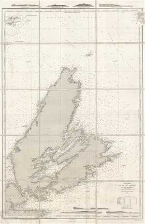
Océan Atlantique Nord. Golfe St. Laurent. Ile du Cap Breton.
sold
- Digital Map Information
- Suitable for large format printing
- File Size: 27.59 MB
- File Type: ZIP / TIFF
- ICC color profile embedded
- Delivered instantly via download link
This is a 1905 Dépôt des Cartes et Plans de la Marine nautical chart or maritime map of Cape Breton Island, Canada. It is extremelyt difficult to find any specific maps of Cape Breton Island, this being only the second we have ... (more details)
Uncommon French nautical chart of the Virgin Islands.
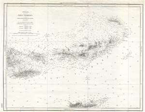
Antilles. Iles Vierges.
sold
- Digital Map Information
- Suitable for large format printing
- File Size: 8.27 MB
- File Type: ZIP / TIFF
- ICC color profile embedded
- Delivered instantly via download link
An uncommon French Dépôt de la Marine nautical chart or maritime map of the Virgin Islands. The map covers the entirety of the Virgin Islands from Porto Rico to I. Anegada and extends as far south as St. Croix. This map was ... (more details)