
Dripps, Matthew (sold)

Matthew Dripps (1812 – April 9, 1896) was an Irish-born American mapmaker active in Philadelphia and New York during the second half of the 19th century. Dripps was born in Gracefield, Ireland. In Ireland, probably Belfast, he worked as a grocer. Dripps immigrated to American from Belfast on the Patrick Henry in 1849, arriving in Philadelphia, where he connected with the Reformed Presbyterian Church and worked briefly as a tax collector. His earliest recorded maps, depicting Philadelphia, appeared during this period. Dripps relocated to Brooklyn, New York in 1850, setting up shop as a map publisher. His two largest maps were published in the following years, 1850 and 1851, and combine to form an enormous map of Manhattan. These gained him the attention of the City Council, who used his maps for census and government work. Afterwards, he issued other large format New York City and Brooklyn maps as well as smaller maps for the New York City Clerk's office. He was married to Ameila Millar Dripps with whom he had six children, among them Amelia Dripps and the clergyman Joseph Frederick. Dripps is interred at Greewood Cemetery, Brooklyn.
One of the earliest maps to illustrate Brooklyn after its 1855 consolidation.
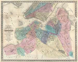
Map of the City of Brooklyn (as consolidated January 1st 1855).
sold
- Digital Map Information
- Suitable for large format printing
- File Size: 18.57 MB
- File Type: ZIP / TIFF
- ICC color profile embedded
- Delivered instantly via download link
This is a scarce 1856 map of Brooklyn, New York City by Matthew Dripps. The map follows the 1855 consolidation of Brooklyn, Williamsburg, Bushwick, and Greenpoint into a single city - as such it is one of the first maps to show Brooklyn much as we know it today - in fact, it is the earliest obtainable map we are aware of to do so. The map extends southwards roughly to 60th street, eastwards to Evergreen Cemetery, and northwards to Newtown creek. Parts of adjacent Manhattan (as far north as 40th Street), Queens (Long Island City), and Jersey City are illustrated. Many modern neighborhoods are not specifically named, such as Red Hook, Bedford Stuyvesant, Fort Green, etc. but are nonetheless present and identifiable. The Brooklyn Navy Yard is clearly represented with individual buildings recognizable. Sunset Park, although not identified, is apparent via the hachuring used to render elevation. Prospect Park, not yet conceived, is notably absent. (more details)
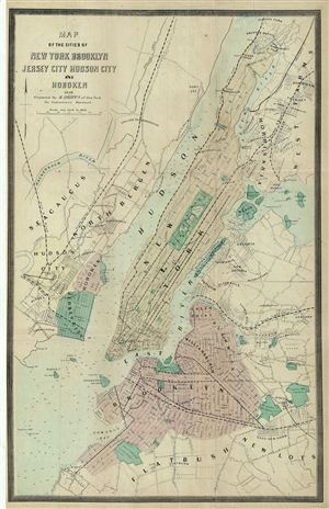
Map of the Cities of New york brooklyn Jersey City Hudson City and Hoboken.
sold
- Digital Map Information
- Suitable for large format printing
- File Size: 8.83 MB
- File Type: ZIP / TIFF
- ICC color profile embedded
- Delivered instantly via download link
This is a fine example of the 1859 Dripps map of the cities of New York, Brooklyn, Jersey City, and Hoboken, issued for Valentine's Manual of the Corporation of New York . The map covers the entirety of New York City, including Governors Island, ellis Island and ... (more details)
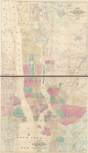
Map of the Five Cities of New York, Brooklyn, Jersey City, Hoboken & Hudson City.
sold
- Digital Map Information
- Suitable for large format printing
- File Size: 46.93 MB
- File Type: ZIP / TIFF
- ICC color profile embedded
- Delivered instantly via download link
This is an uncommon example of Matthew Dripps' two panel 1860 map of New York, Brooklyn, Jersey City, and Hoboken. Issued as a set of two maps (plate 1 and 2), with plate 1 covering from Westchester to 63nd street in Manhattan and from Bergen to College Point. ... (more details)
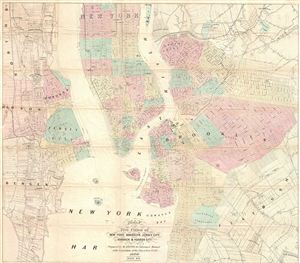
Map of the Five Cities of New York, Brooklyn, Jersey City, Hoboken & Hudson City.
sold
- Digital Map Information
- Suitable for large format printing
- File Size: 19.52 MB
- File Type: ZIP / TIFF
- ICC color profile embedded
- Delivered instantly via download link
A beautiful example of M. Dripps' map of New York City, Brooklyn, Jersey City, Hoboken and Hudson County, published as plate 2 in the 1860 edition of Valentine's Manual. A great source for understanding what Brooklyn and Jersey City/Hoboken looked like in he ... (more details)
Scarce map of Brooklyn on a vertical projection.
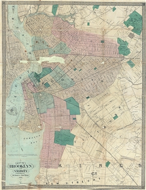
Map of Brooklyn and Vicinity.
sold
- Digital Map Information
- Suitable for large format printing
- File Size: 16.82 MB
- File Type: ZIP / TIFF
- ICC color profile embedded
- Delivered instantly via download link
An uncommon 1862 map of Brooklyn, New York, by Matthew Dripps. Presented on a north-south axis, which for Brooklyn was uncommon at the time, this map covers form Newtown Creek to New Utrecht and from Manhattan to East New York. Brooklyn at the time ... (more details)
Uncommon map illustrating all of Manhattan in 1864.
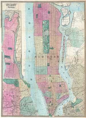
New-York City County, and Vicinity.
sold
- Digital Map Information
- Suitable for large format printing
- File Size: 14.75 MB
- File Type: ZIP / TIFF
- ICC color profile embedded
- Delivered instantly via download link
This is an uncommon large format 1864 map of New York City by Matthew Dripps. The map covers the entire island of Manhattan as well as parts of Brooklyn, Queens, Hoboken and Jersey City. The whole is rendered in considerable detail with all streets ... (more details)

New York City, County, and Vicinity.
sold
- Digital Map Information
- Suitable for large format printing
- File Size: 18.1 MB
- File Type: ZIP / TIFF
- ICC color profile embedded
- Delivered instantly via download link
This is a rare large format 1864 map of New York City by Matthew Dripps. The map covers the entire island of Manhattan as well as parts of Brooklyn, Queens, Hoboken and Jersey City. The whole is rendered in considerable detail with all streets and ... (more details)
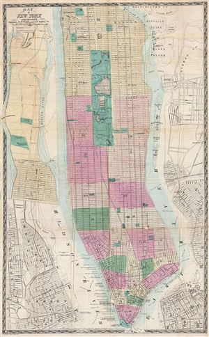
Map of New York and Vicinity.
sold
- Digital Map Information
- Suitable for large format printing
- File Size: 21.76 MB
- File Type: ZIP / TIFF
- ICC color profile embedded
- Delivered instantly via download link
This is a rare large format 1865 folding map of New York City by Matthew Dripps. Covers the entire island of Manhattan as well as parts of Brooklyn, Queens, Hoboken and Jersey City. Shows the city in considerable detail with all streets and, in ... (more details)
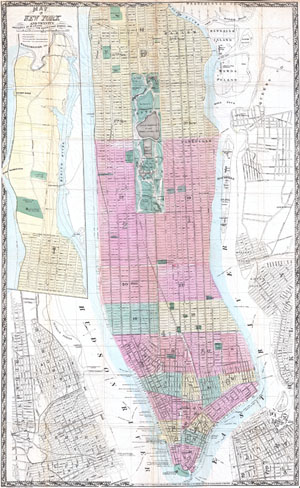
Map of New York and Vicinity.
sold
- Digital Map Information
- Suitable for large format printing
- File Size: 18.41 MB
- File Type: ZIP / TIFF
- ICC color profile embedded
- Delivered instantly via download link
This is a rare large format 1865 folding map of New York City by Matthew Dripps. Covers the entire island of Manhattan as well as parts of Brooklyn, Queens, Hoboken and Jersey City. Shows the city in considerable detail with all streets and, in ... (more details)
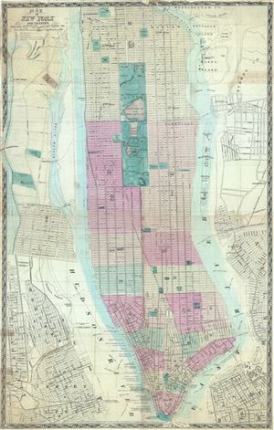
Map of New York and Vicinity.
sold
- Digital Map Information
- Suitable for large format printing
- File Size: 21.47 MB
- File Type: ZIP / TIFF
- ICC color profile embedded
- Delivered instantly via download link
This is a rare large format 1865 map or plan of New York City by Matthew Dripps. It covers the entire island of Manhattan as well as parts of Brooklyn, Queens, Hoboken and Jersey City. Shows the city in considerable detail with all streets ... (more details)
An exceptionally detailed map of New York City just after the Civil War.
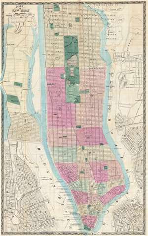
Map of New York and Vicinity.
sold
- Digital Map Information
- Suitable for large format printing
- File Size: 14.94 MB
- File Type: ZIP / TIFF
- ICC color profile embedded
- Delivered instantly via download link
This is a scarce large format 1865 map or plan of New York City by Matthew Dripps. It covers the entire island of Manhattan as well as parts of Brooklyn, Queens, Hoboken and Jersey City. The map shows the city in considerable detail with ... (more details)
New York City just after the Civil War.
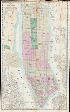
Map of New York and Vicinity.
sold
- Digital Map Information
- Suitable for large format printing
- File Size: 42.73 MB
- File Type: ZIP / TIFF
- ICC color profile embedded
- Delivered instantly via download link
This is a scarce large format 1865 map or plan of New York City by Matthew Dripps. It depicts the island of Manhattan as well as parts of Brooklyn, Queens, Hoboken, and Jersey City. The map illustrates the city in considerable detail with all streets and, in Manhattan, block numbers clearly identified. An inset along the left border details the northern portion of Manhattan. The map labels most of the piers in lower Manhattan and shows numerous individual buildings with identifying numbers. Where Columbia University now stands, this map reveals a 19th century Lunatic Asylum. In Queens, Dripps labels Hunters Point and shows the beginnings of the Long Island Railroad. Astoria is delineated. Central Park is mapped in detail exhibiting the fully glory of Olmsted's plan. (more details)
New York City just after the Civil War.
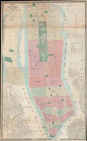
Map of New York and Vicinity.
sold
- Digital Map Information
- Suitable for large format printing
- File Size: 48.1 MB
- File Type: ZIP / TIFF
- ICC color profile embedded
- Delivered instantly via download link
This is a scarce large format 1865 plan or map of New York City by Matthew Dripps. It depicts the island of Manhattan as well as parts of Brooklyn, Queens, Hoboken, and Jersey City. The map illustrates the city in considerable detail with all streets and, in Manhattan, block numbers clearly identified. An inset along the left border details the northern portion of Manhattan. The map labels most of the piers in lower Manhattan and shows numerous individual buildings with identifying numbers. Where Columbia University now stands, this map reveals a 19th century Lunatic Asylum. In Queens, Dripps labels Hunters Point and presents the beginnings of the Long Island Railroad. Astoria is delineated. Central Park is mapped in detail exhibiting the fully glory of Olmsted's plan. (more details)
Uncommon map illustrating all of Manhattan in 1866.
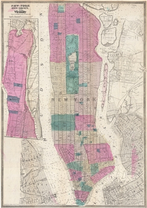
New-York City County, and Vicinity.
sold
- Digital Map Information
- Suitable for large format printing
- File Size: 10.87 MB
- File Type: ZIP / TIFF
- ICC color profile embedded
- Delivered instantly via download link
This is an uncommon large format 1866 map of New York City by Matthew Dripps. The map covers the entire island of Manhattan as well as parts of Brooklyn, Queens, Hoboken and Jersey City. The whole is rendered in considerable detail with ... (more details)
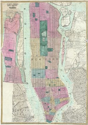
New - York City County, and Vicinity.
sold
- Digital Map Information
- Suitable for large format printing
- File Size: 14.7 MB
- File Type: ZIP / TIFF
- ICC color profile embedded
- Delivered instantly via download link
This is a rare 1866 map or plan of New York City by Matthew Dripps. It covers the entire island of Manhattan as well as parts of Brooklyn, Queens, Hoboken and Jersey City. Shows the city in considerable detail with all streets and, in ... (more details)
First obtainable map of the Upper West Side.
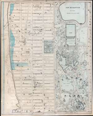
[Central Park and the Upper West Side.]
sold
- Digital Map Information
- Suitable for large format printing
- File Size: 24.32 MB
- File Type: ZIP / TIFF
- ICC color profile embedded
- Delivered instantly via download link
A scarce map of New York City's Upper West Side, including the southern half of Central Park, issued in 1867 by Matthew Dripps. This is likely the earliest obtainable specific map of the Upper West Side, predating the maps of Egbert Vielé (1868), John Bute Holmes (1874), and Herman Knickerbocker Vielé (1879). Moreover, as the map predates most major development on the Upper West Side, its ichnographic qualities - showing the layout of numerous individual buildings - are of the utmost historical significance. For example, no doubt one of these homes was where Edgar Allen Poe (84th and Broadway) composed The Raven. Coverage extends from West 91st Street to 59th Street and from 5th Avenue to the Hudson River. Cartographically, this map is based upon the 18th century farm surveys of John Randel Jr. (1787 - 1865) and Blackwell, with updates and revisions by the civil engineer John F. Harrison (1824 - 1891). (more details)
One of the earliest maps of Brooklyn to adopt a north-south orientation.
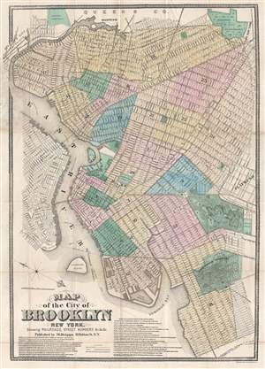
Map of the City of Brooklyn New York.
sold
- Digital Map Information
- Suitable for large format printing
- File Size: 14.98 MB
- File Type: ZIP / TIFF
- ICC color profile embedded
- Delivered instantly via download link
A rare 1873 map of Brooklyn New York by Matthew Drips. Unlike most maps of Brooklyn from this period, which were oriented to the west, Dripps adopts a more modern convention by orienting his map no the north – and in doing so ... (more details)
One of the first general maps of Brooklyn to include a completed Prospect Park.
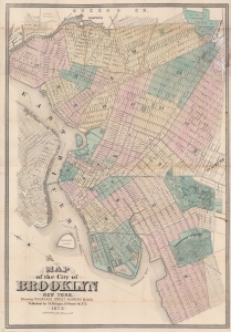
Map of the City of Brooklyn New York.
sold
- Digital Map Information
- Suitable for large format printing
- File Size: 68 MB
- File Type: ZIP / TIFF
- ICC color profile embedded
- Delivered instantly via download link
A rare 1873 map of Brooklyn, New York by Matthew Dripps. A rare 1873 map of Brooklyn, New York by Matthew Dripps. This is one of the first general maps of Brooklyn to include Prospect Park, which was completed in 1873, after 4 years of continuous construction. Moreover, unlike most earlier maps of Brooklyn, which were oriented to the west per the 1852 Brooklyn Commissioner's Plan (see Geographicus BrooklynWilliamsburg-colton-1852), Dripps adopts a more modern convention by orienting his map to the north - and in doing so established a revolutionary new convention followed by most subsequent Brooklyn mapmakers. (more details)
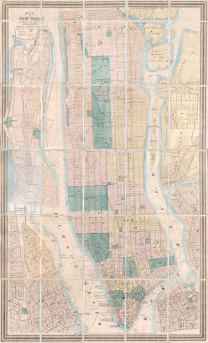
Map of New York City and Vicinity.
sold
- Digital Map Information
- Suitable for large format printing
- File Size: 17.89 MB
- File Type: ZIP / TIFF
- ICC color profile embedded
- Delivered instantly via download link
This is a rare pocket map of New York City by M. Dripps. Covers the entire island of Manhattan as well as parts of Brooklyn, Queens, Hoboken and Jersey City. Shows the city in considerable detail with all streets and, in ... (more details)
Combines work of land surveyors and the U.S. Coast Survey.
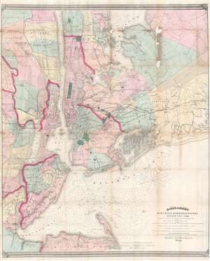
Asher and Adams' Map of the Bays, Harbors and Rivers Around New York: Showing the Channels, Soundings, Lighthouses, Buoys etc. and the Complete Topography of the Surrounding Country: including Hempstead, Sandy-Hook, South-Amboy, Newark, Yonkers, N. Rochelle and Glenn Cove.
sold
- Digital Map Information
- Suitable for large format printing
- Full resolution TIFF file
- ICC color profile embedded
- Delivered instantly via download link
This is a visually striking and rare 1874 Matthew Drips and Asher and Adams map of the greater New York City area. Innovatively combining detailed land surveys with the work of the U.S. Coast Survey, the map depicts the New York City area from Sandy Hook and Monmouth County, north to include Staten Island, Newark, Manhattan and Yonkers. Coverage extends eastward into Long Island as far as Hicksville, Jericho and Freeport. All of Brooklyn, Jamaica Bay, and Queens are illustrated, along with parts of Westchester and much of northeastern New Jersey. The farmlands, islands, swamps, and parks of the region are also illustrated. The Croton Aqueduct appears as a thin black line in Westchester and the Bronx. Nautically, this map is heavily based upon the 1856 U.S. Coast survey of the same region compiled under the direction of A. D. Bache. It includes thousands of depth soundings and notes channels, buoys, and lighthouses where appropriate. (more details)
The only known example of this interesting broadside Brooklyn street directory and map of Prospect Park
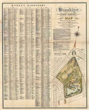
Brooklyn Street Directory Showing Width & Location of Streets & c. with Map o Prospect Park and Horse Car & Elevated Rail Roads Routes.
sold
- Digital Map Information
- Suitable for large format printing
- File Size: 12.78 MB
- File Type: ZIP / TIFF
- ICC color profile embedded
- Delivered instantly via download link
An extremely 1880 rare pocket map of Prospect Park, Brooklyn, with a street directory of Brooklyn by Mathew Dripps. The directory, which occupy the left 2/3rd of the map features a list of all Brooklyn streets and the ... (more details)
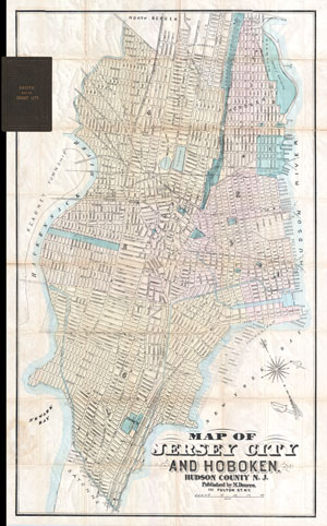
Map of Jersey City and Hoboken Hudson County N. J.
sold
- Digital Map Information
- Suitable for large format printing
- File Size: 6.34 MB
- File Type: ZIP / TIFF
- ICC color profile embedded
- Delivered instantly via download link
A map of exceeding rarity. This is the only known example of Matthew Dripps' pocket map of Jersey City and Hoboken. While this map is undated, the combination of the map's attribution, printing style, and the ... (more details)