
General Land Office (sold)

The General Land Office (GLO) (1812 - 1946) was an independent agency of the United States government responsible for public domain lands in the United States. Created in 1812, it took over functions previously conducted by the Department of the Treasury. The GLO oversaw the surveying, platting, and sale of public lands in the western United States. It also administered the Preemption Act of 1841, which allowed individuals who were already living on federal land to purchase up to 160 acres of land before it was offered for sale to the general public, if they met certain requirements. Following the passage of the Homestead Act in 1862, which was also administered by the GLO, claims under the Preemption Act sharply decreased. The GLO became a part of the newly-created Department of the Interior in 1849. In 1891 Grover Cleveland and Congress created 17 forest reserves, due to public concern over forest conservation, which were initially managed by the GLO, until they were transferred to the Forest Service in 1905. In 1946 the Government Land Office was merged with the United States Grazing Service to become the Bureau of Land Management. Today the Bureau of Land Management administers the roughly 246 million acres of public land remaining under federal ownership.
Evolution of Missouri's borders.
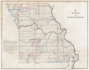
H Diagram of the State of Missouri.
sold
- Digital Map Information
- Suitable for large format printing
- Full resolution TIFF file
- ICC color profile embedded
- Delivered instantly via download link
This is an 1845 Frederick R. Conway Land Office survey map of Missouri. The state has been platted into townships, with letters 's', 'z', 'o', and 'x' indicating the status of each township's survey. Districts within the state are labeled, and cities and towns are identified, including St. Louis, Palmyra, and Hannibal. The evolution of Missouri's borders is traced as well, with lines marking the 'Old Indian Boundary Line', the 'north boundary of the State if Missouri as established by the state commissioners in 1837', and the 'old west boundary of the State of Missouri.' (more details)
Highlights Clark's Grant and the Donation Lands east of Vincennes.
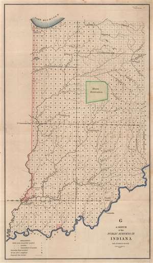
G. A Sketch of Public Surveys in Indiana.
sold
- Digital Map Information
- Suitable for large format printing
- Full resolution TIFF file
- ICC color profile embedded
- Delivered instantly via download link
This is an 1845 General Land Office map of Indiana. The entirety of Indiana is platted into townships, with the exception of Clark's Grant, the Miami Reservation, and the 'Donation Tract' (east of the Wabash River and north of the White River in western Indiana just east of Vincennes). Jeffersonville, Fort Wayne, Winimac, Indianapolis, Vincennes, and Crawfordsville are labeled. Creeks and rivers are illustrated throughout. (more details)
Arkansas townships.
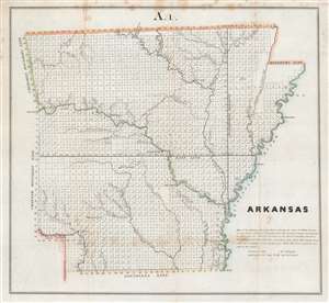
Arkansas.
sold
- Digital Map Information
- Suitable for large format printing
- Full resolution TIFF file
- ICC color profile embedded
- Delivered instantly via download link
This is an 1845 William Pelham map of Arkansas illustrating state has platted into neat square townships. The township was created as the measure of the Public Land Survey System, which was first widely implemented to survey the Northwest Ordinance. The Public Land Survey System allowed for the systematic surveying and mapping of any territory gained by the United States. Cities and towns are labeled, including Little Rock, Hot Springs, and Pine Bluff. Rivers and creeks are illustrated and labeled. (more details)
Native American cessions in Alabama.
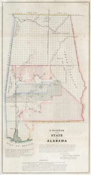
A Diagram of the State of Alabama.
sold
- Digital Map Information
- Suitable for large format printing
- Full resolution TIFF file
- ICC color profile embedded
- Delivered instantly via download link
This is an 1841 James Weakley General Land Office map of Alabama, representing the work of the Alabama Land Survey as of November 1845. The state is divided into townships, many of which in southern Alabama were already sold or under contract. Various rivers and cities are also identified, including Florence, Huntsville, Sparta, and Wetumka, among others. (more details)
Surveys and Minerals.
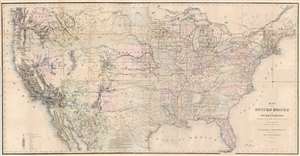
Map of the United States and Territories, Showing the extent of Public Surveys and other details, Constructed from the Plats and official sources of the General Land Office.
sold
- Digital Map Information
- Suitable for large format printing
- File Size: 103.75 MB
- File Type: ZIP / TIFF
- ICC color profile embedded
- Delivered instantly via download link
This is an 1867 Joseph S. Wilson and Joseph Gorlinsky map of the United States illustrating the progress of U.S. government land surveys from coast to coast. The map depicts the entire United States from the Pacific Ocean to the Atlantic Ocean and from Canada to Mexico. (more details)
Culmination of 60 years of GLO surveying.
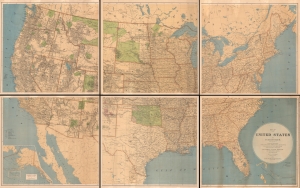
Map of the United States and Territories showing the extent of Public Surveys, Indian and Military Reservations, Land Grant R.R., Railroads, Canals, and other details, compiled from the official surveys of the General Land Office, and other authentic sources, under the direction of the Hon. J. A. Williamson, Commissioner, 1876.
sold
- Digital Map Information
- Suitable for large format printing
- File Size: 238.16 MB
- File Type: ZIP / TIFF
- ICC color profile embedded
- Delivered instantly via download link
An impressive and rare 1876 wall map of the United States drafted by Charles Roeser and issued by the General Land Office under James A. Williamson. The culmination of 60 years of GLO survey work, this map is the state-of-the-art cartographic representation of the United States in the late 19th century. (more details)
Indian Wars, gold and silver discoveries, and the construction of the Northern Pacific Railroad.
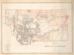
Montana Territory.
sold
- Digital Map Information
- Suitable for large format printing
- File Size: 77.64 MB
- File Type: ZIP / TIFF
- ICC color profile embedded
- Delivered instantly via download link
An impressive large scale 1879 map of Montana during its territorial period. It is one of the earliest obtainable maps of Montana Territory, covering its formative period during various Indian Wars, gold and silver discoveries, and the construction of the Northern Pacific Railroad. (more details)
An incredible large format map of Washington State - illustrates Mount Rainier National Park six years after it was established.
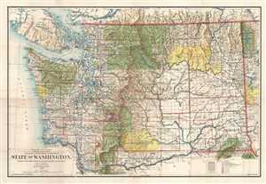
State of Washington.
sold
- Digital Map Information
- Suitable for large format printing
- File Size: 24.95 MB
- File Type: ZIP / TIFF
- ICC color profile embedded
- Delivered instantly via download link
This is a 1905 Frank Bond and General Land Office map of Washington. The map depicts the region from Vancouver Island and the Pacific Ocean to Idaho and from Canada to Oregon. Meticulously detailed, the state's organization is presented at several different levels. ... (more details)
A comprehensive and detailed map of Oregon at the beginning of the 20th century - marks Crater Lake National Park four years after it was established.
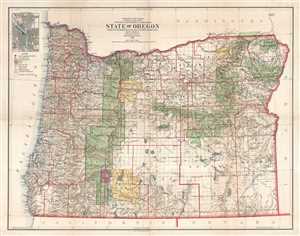
State of Oregon.
sold
- Digital Map Information
- Suitable for large format printing
- File Size: 30.8 MB
- File Type: ZIP / TIFF
- ICC color profile embedded
- Delivered instantly via download link
This is a 1906 Frank Bond and General Land Office map of Oregon. The map depicts the state from the Pacific Ocean to Idaho and from Washington to California. Meticulously detailed, the state's organization is presented at several different levels. At a statewide ... (more details)
Explorer's Routes and National Roads.
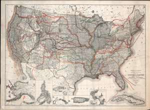
United States Showing Routes of Principal Explorers and Early Roads and Highways.
sold
- Digital Map Information
- Suitable for large format printing
- File Size: 62.87 MB
- File Type: ZIP / TIFF
- ICC color profile embedded
- Delivered instantly via download link
A most fascinating production, this is a fine example of the 1907 first edition of the Berthrong / Bond map of the United States showing exploratory routes and improved roads. The base map is a reduction of the General Land Office map of the United States issued annually from 1899 to illustrate the extending and progress of the Public Surveys. That map has here been overlayed with color-coded routes illustrating the most prominent explorations from the 1500s through the mid-19th century. In addition, it shows important roads then in being built or improved, including the National highway, Braddock Road, the Great Trail. The map was intended to demonstrate the current state of geographical knowledge and underscore the fact that - by 1907, little was left unexplored. (more details)
Explorer's Routes and National Roads.
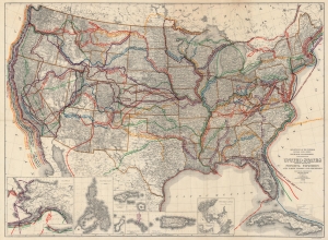
United States Showing Routes of Principal Explorers and Early Roads and Highways.
sold
- Digital Map Information
- Suitable for large format printing
- File Size: 143.92 MB
- File Type: ZIP / TIFF
- ICC color profile embedded
- Delivered instantly via download link
A most fascinating work, this is the 1908 edition of the Berthrong / Bond map of the United States, showing exploratory routes and improved roads. (more details)
Spanish-Era Land Grants in New Mexico.
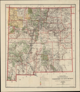
Reduced Reproduction Map of Territory of New Mexico compiled from the official Records of the General Land Office and other sources.
sold
- Digital Map Information
- Suitable for large format printing
- Full resolution TIFF file
- ICC color profile embedded
- Delivered instantly via download link
An engrossing map of the Territory of New Mexico produced three years before statehood in 1909 by I. P. Berthrong and his colleagues at the U.S. Government's General Land Office. As the title indicates, it is based on an earlier larger-format map of the territory, which was continually updated by the G.L.O. in the late 19th and early 20th century. (more details)
Arizona after statehood.
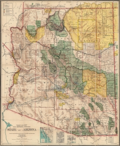
State of Arizona.
sold
- Digital Map Information
- Suitable for large format printing
- Full resolution TIFF file
- ICC color profile embedded
- Delivered instantly via download link
This is the 1912 Ithamar Berthrong and Daniel O'Hare map of Arizona - among the first official U.S. government maps Arizona as a state. (more details)
Outlines and labels the calderas of the Hawaiian volcanoes!
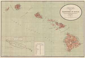
Map of the Territory of Hawaii.
sold
- Digital Map Information
- Suitable for large format printing
- File Size: 8.95 MB
- File Type: ZIP / TIFF
- ICC color profile embedded
- Delivered instantly via download link
This is a 1915 I. P. Berthrong map of Hawaii. The map depicts eight of the Hawaiian Islands: Hawaii, Maui, Kahoolawe, Lanai, Molokai, Oahu, Kauai, and Nihau. Hawaii, Maui, Oahu, and Kauai are divided into regions. On the island of Hawaii, both Kilauea and Mauna Loa are labeled, as well as the Crater of Moku'āweoweo, the summit caldera of Mauna Loa. Several lava flows are illustrated. Rivers and towns are depicted on all the islands, as well as bays and harbors along their coasts. An inset map of the Hawaiian Archipelago is situated at the bottom left. This inset labels the Hawaiian Islands Bird Reservation, which includes all the smaller islands in the archipelago except for Midway Island. A table with distances to the 'principal ports of the Pacific' is placed next to the inset, and includes distances to San Francisco, San Diego, Nome, Wellington, Sydney, Hong Kong, Yokohama, and Manila, among others. (more details)
Preserving Alaska's wilderness.
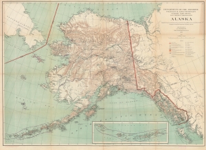
Alaska.
sold
- Digital Map Information
- Suitable for large format printing
- File Size: 83.79 MB
- File Type: ZIP / TIFF
- ICC color profile embedded
- Delivered instantly via download link
This is a 1917 I. P. Berthrong and General Land Office map of Alaska. It highlights wildlife reservations, emphasizing the U.S. government's conservation efforts. (more details)