
Gray, Ormando Wyllis (sold)

Ormando Wyllis Gray (March 3, 1829 – July 6, 1912) was a mid to late 19th century map publisher with offices in New York City, Philadelphia, PA, and Danielsonville, Connecticut. Born in Townshend, Vermont, he attended Norwich College where he studied civil engineering and became a civil engineer and surveyor. Gray's first commercial atlas was an 1869 survey of Windhamd and Toland counties, Connecticut. His most important work seems to have been done in conjunction with other, more prominent map publishers, including Henry Walling and G.W. and C.B. Colton. Gray is best known for his state and county atlases, though did, with his sons, also independently issue at least two national atlases in the late 1870s. He retired from the map publishing business in 1890. He died at home in Bernardston, Massachusetts. He married Roxcena L. Arnold in 1851, with whom he had three daughters and one son.
Monumental map of Boston.
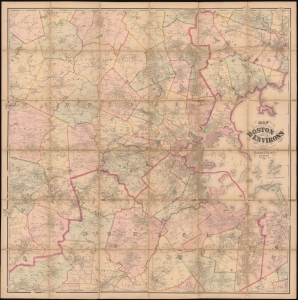
Map of the City of Boston and its Environs.
sold
- Digital Map Information
- Suitable for large format printing
- Full resolution TIFF file
- ICC color profile embedded
- Delivered instantly via download link
This is an 1867 Henry Francis Walling and Ormando W. Gray map of Boston, Massachusetts, and environs. Boston appears to the right of center, with East Boston and South Boston both labeled. Boston Common and the Public Garden are labeled in Boston, along with streets, wharves, railroad lines, and a handful of buildings. Outside Boston, the map depicts from Wilmington, Danvers, and North Beverly south to West Medway and Walpole Centre and from Ashland Center east to Marblehead, Salem, and Beverly. Hundreds (if not thousands) of private residences are identified by the owner's name throughout, along with banks, schools, railroad stations, churches, and cemeteries. Roads, railroads, hills, lakes, rivers, and other physical features are noted. (more details)
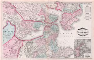
Walling & Gray's Map of the Compact Portions of Boston and the adjacent Cities and Towns.
sold
- Digital Map Information
- Suitable for large format printing
- File Size: 15.93 MB
- File Type: ZIP / TIFF
- ICC color profile embedded
- Delivered instantly via download link
A fine 1871 map of Boston, Massachusetts, published by Ormando Gray based upon the cartographic work of Henry S. Walling. The map covers central Boston as well as the adjacent cities and suburbs of South Boston, Brookline, east Boston, Charlestown, Cambridge, ... (more details)
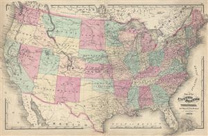
Map of the United States and Territories.
sold
- Digital Map Information
- Suitable for large format printing
- File Size: 15.11 MB
- File Type: ZIP / TIFF
- ICC color profile embedded
- Delivered instantly via download link
An attractive 1871 map of the United States issued by Henry Walling and Ormando Gray. This map covers the entire United States from Atlantic to Pacific, Canada to Mexico. It is color coded to identify all states. Important transnational rail routes are ... (more details)
Published only five years after the completion of the first transcontinental railroad and during an era of rail expansion in the United States.
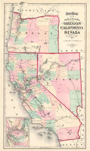
Gray's Atlas New Railroad and County Map of the States of Oregon California and Nevada.
sold
- Digital Map Information
- Suitable for large format printing
- File Size: 21.87 MB
- File Type: ZIP / TIFF
- ICC color profile embedded
- Delivered instantly via download link
This is an 1873 Ormando Gray Map of California, Nevada, and Oregon. The map depicts the region from the Pacific Ocean to Idaho, Utah, and Arizona, and from Washington to Mexico. Published near the height of railroad expansion, the rail lines take center stage. The routes of the Central Pacific, Eastern Nevada, Southern Pacific, Atlantic and Pacific, Texas and Pacific, San Francisco and Northern Pacific, Napa Valley, Oregon and California, Oregon Central, and Northern Pacific Railroads are all illustrated and labeled. The Central Pacific Railroad, begun in 1862, constructed the western portion of the first transcontinental railroad, when it met the Union Pacific at Promontory Summit in the Utah Territory in 1869. Thus, rail travel at the forefront of the popular imagination when this map was published. Stops along all the routes are identified and distances between then are provided. Counties in California, Nevada, and Oregon are illustrated and labeled as well. They are also shaded different colors to allow for easy differentiation. An inset map of the vicinity of San Francisco and Sacramento is situated in the lower left corner. Much like the larger map, the inset map highlights the rail network in the area, complete with a most, if not all, of the stops along each route and the distances between them. (more details)
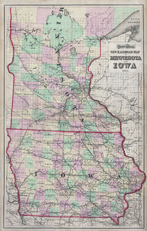
Gray's Atlas New Railroad Map of Minnesota and Iowa 1873.
sold
- Digital Map Information
- Suitable for large format printing
- File Size: 23.76 MB
- File Type: ZIP / TIFF
- ICC color profile embedded
- Delivered instantly via download link
This is Gray's uncommon railroad map of Minnesota and Iowa, dated 1873. Covers the area in considerable detail with special attention to the railroad lines that were rapidly being built to accommodate this developing region. Divided and color coded ... (more details)
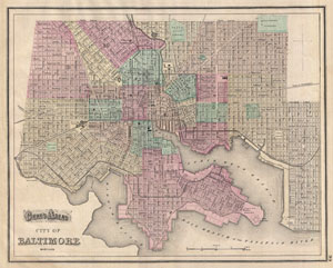
Gray's Alas City of Baltimore Maryland.
sold
- Digital Map Information
- Suitable for large format printing
- File Size: 8.07 MB
- File Type: ZIP / TIFF
- ICC color profile embedded
- Delivered instantly via download link
A fine map of Baltimore from Gray's 1874 Atlas of the United States. Covers the entire city from Gwinn's Falls to Seventh Street and from Green Mountain Cemetery to the Patapsco River. Shows proposed landfills along the water's edge. Important ... (more details)
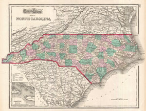
Gray's Atlas Map of North Carolina.
sold
- Digital Map Information
- Suitable for large format printing
- File Size: 8.62 MB
- File Type: ZIP / TIFF
- ICC color profile embedded
- Delivered instantly via download link
A very attractive 1874 map of North Carolina by O. Gray. This map covers the entire state in considerable detail with vivid hand coloring at the county level. Notes roads, railways, towns and cities, and some topographical detail. An inset map ... (more details)
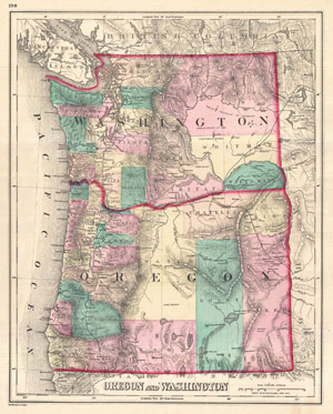
Oregon and Washington.
sold
- Digital Map Information
- Suitable for large format printing
- File Size: 9.02 MB
- File Type: ZIP / TIFF
- ICC color profile embedded
- Delivered instantly via download link
A visually stunning 1875 map of Oregon and Washington by Ormando Gray. Offers beautiful engraving and vivid hand color at the county level. Shows cities and railways as well as topographical features such as lakes, rivers, valleys and ... (more details)
Details the expanding railroad network in Texas.
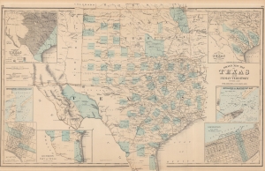
Gray's New Map of Texas and the Indian Territory.
sold
- Digital Map Information
- Suitable for large format printing
- File Size: 57.61 MB
- File Type: ZIP / TIFF
- ICC color profile embedded
- Delivered instantly via download link
This is an 1876 Frank A. Gray map of Texas and the Indian Territory (Oklahoma) detailing the railroad network during an era of expansion. (more details)
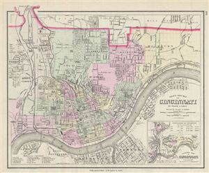
Gray's New Map of Cincinnati.
sold
- Digital Map Information
- Suitable for large format printing
- File Size: 6.72 MB
- File Type: ZIP / TIFF
- ICC color profile embedded
- Delivered instantly via download link
A fine 1877 map of Cincinnati, Ohio by O. W. Gray and Sons. It covers the city from Fairmount to Columbia south across the Ohio River to Covington in Kentucky. The map is extremely detailed, showing individual buildings, major and ... (more details)
Uncommon map featuring the city of Richmond, Virginia.
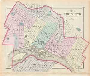
Gray's New Map of Richmond Henrico County, Virginia.
sold
- Digital Map Information
- Suitable for large format printing
- Full resolution TIFF file
- ICC color profile embedded
- Delivered instantly via download link
This is an uncommon map of the city of Richmond, Virginia by Ormando Gray issued in 1878. It covers the city from Manchester (now Old Town Manchester), past the James River and downtown Richmond north as far as Jackson Ward and ... (more details)
Early plan of San Francisco City, California.
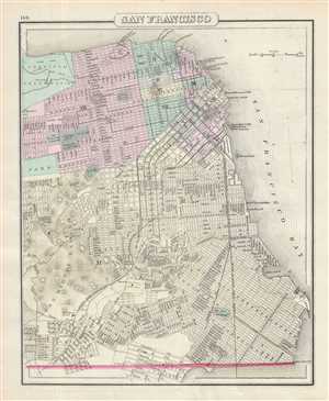
San Francisco.
sold
- Digital Map Information
- Suitable for large format printing
- Full resolution TIFF file
- ICC color profile embedded
- Delivered instantly via download link
This is a beautiful 1878 Gray map or plan of the city of San Francisco, California. It covers the entire city from Visitation Valley north to Presidio Park. The map is extremely detailed, showing individual streets, important ... (more details)
The first modern world map incorporating a comparative mountains and rivers chart.
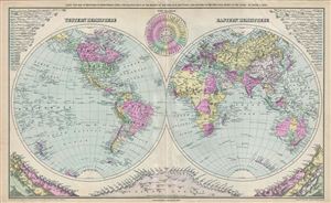
Gray's New Map of the World in Hemispheres, with Comparative Views of the Heights of the Principal Mountains and Lengths of the Principal Rivers on the Globe.
sold
- Digital Map Information
- Suitable for large format printing
- File Size: 16.73 MB
- File Type: ZIP / TIFF
- ICC color profile embedded
- Delivered instantly via download link
This is a beautiful example of Frank A. Gray's 1879 map of the world on a hemispherical projection. This map is significant as, in addition to a world map, it must be considered the first modern comparative mountains and ... (more details)