
First French Chart of Magnetic Variations.

Carte des variations de la boussole et des vents généraux que l'on trouve dans les mers les plus frequentées...
sold
- Digital Map Information
- Suitable for large format printing
- File Size: 35.83 MB
- File Type: ZIP / TIFF
- ICC color profile embedded
- Delivered instantly via download link
This is a beautiful example of J. N. Bellin's 1765 nautical chart of the world, displaying the magnetic variations measured in the Atlantic and Indian Oceans. This is the first French chart to have done so. (more details)
Manuscript color highlights the loss of Alsace and Lorraine.
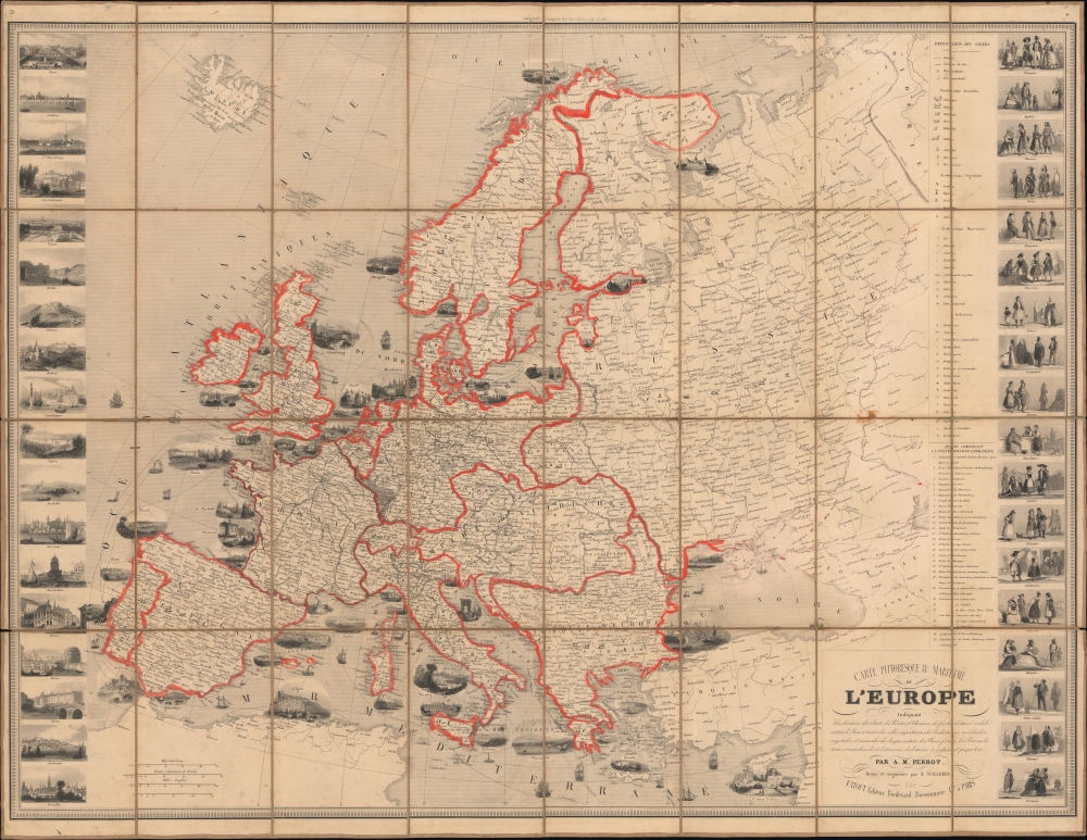
Carte Pittoresque et Maritime de l'Europe Indiquant La division des Etats, let Routes et Chemins de fer...
sold
- Digital Map Information
- Suitable for large format printing
- File Size: 98.04 MB
- File Type: ZIP / TIFF
- ICC color profile embedded
- Delivered instantly via download link
This is a striking 1847 Alexandre Vuillemin and Aristide-Michel Perrot pictorial map of Europe. The map has been updated in orange and gray manuscript to reflect the 1871 treaties that ended the Franco-Prussian War (1870 - 1871). (more details)
Orlando before Disney World.
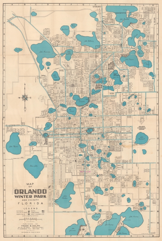
Map of Orlando Winter Park and Vicinity Florida.
sold
This is a c. 1961 Frank Dolph city plan or map of Orlando and Winter Park, Florida. The map captures the calm before the storm when the region was developing a modest tourism industry but before the explosive changes wrought by Disney World (W.D. purchased the land for Disney World in 1965, and construction began in 1969). (more details)
Fortifying the western frontier.

Map Illustrating the plan of the defences of the Western Frontier, as proposed by Maj. Gen. Gaines, in his plan dated Feby. 28th 1838.
sold
- Digital Map Information
- Suitable for large format printing
- File Size: 13.99 MB
- File Type: ZIP / TIFF
- ICC color profile embedded
- Delivered instantly via download link
This is an 1838 David Burr map of part of the central United States created to illustrate Major General Edmund P. Gaines' plan to protect the United States' Western border. The map reflects the tenuous political situation in North America after the 1803 Louisiana Purchase but before the Mexican-American War (1846 - 1848). American Indians and Mexican expansion were seen as the primary threats to U.S. sovereignty, and a secure border was considered essential to westward expansion. (more details)
World Wide Web.

Carte générale des grandes communications télégraphiques du monde.
sold
- Digital Map Information
- Suitable for large format printing
- File Size: 25.02 MB
- File Type: ZIP / TIFF
- ICC color profile embedded
- Delivered instantly via download link
This is an 1893 map of the world's telegraph network, prepared by the Berne Bureau International des Administrations Télégraphiques. (more details)
One year after Pearl Harbor.

Remember Pearl Harbor.
sold
- Digital Map Information
- Suitable for large format printing
- Full resolution TIFF file
- ICC color profile embedded
- Delivered instantly via download link
This is Edwin Sundberg's December 6, 1942, map of the world summarizing the first year of the American involvement in World War II (1939 - 1945). (more details)
Fishtory.

The Cape Ann Trail.
sold
- Digital Map Information
- Suitable for large format printing
- Full resolution TIFF file
- ICC color profile embedded
- Delivered instantly via download link
A lovely 1930 pictorial map of Cape Ann, Massachusetts, including Rockport and Gloucester, illustrated by the artist 'Mons' and published by the Gloucester Chamber of Commerce. It outlines a trail around the peninsula that hits its best-known attractions and historical sites, most of which relate to the colonial era or the area's nautical orientation, including its famous fishing industry. (more details)
By the 'world's fastest cartoonist'.

A MAD Pictorial Map of the United States.
sold
This is a 1981 Sergio Aragonés pictorial map of the United States created for Mad Magazine. Comical illustrations of people populate the map. Many of our favorites are comic scenes, including a hunter sneaking up on a herd of bison wearing a bison costume only to be spotted and confronted by one of the bison or a ship captain yelling at someone who unplugged the lighthouse, blaming him for his ship sinking. Another is a McDonald's fan proposing a second arch in St. Louis! A rocket launches from Cape Canaveral, and the Wright Flyer appears over Kitty Hawk. Famous landmarks also make appearances, including the Golden Gate Bridge and San Francisco's legendary fog, the Space Needle in Seattle, and Mount Rushmore. Aragonés included himself in the piece. He is illustrated standing next to the title banner holding a pen. With all the detail present here, every look will provide the opportunity to create a new story! (more details)
One of the Earliest Acquirable Views of Philadelphia.
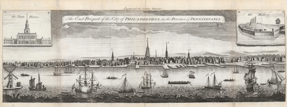
The East Prospect of the City of Philadelphia, in the Province of Pennsylvania.
sold
- Digital Map Information
- Suitable for large format printing
- Full resolution TIFF file
- ICC color profile embedded
- Delivered instantly via download link
This is a superb example of the 1761 London Magazine edition of the famous Heap and Scull view of Philadelphia, one of the earliest acquirable and most important views of the city. (more details)
First edition of Mora's First Map.

[Monterey Peninsula] / To His Excellency The Count of Monterey: This Limned Map and History of his own Harbour and Peninsula - discovered by Viscaino AD 1602 ...
sold
- Digital Map Information
- Suitable for large format printing
- File Size: 69.66 MB
- File Type: ZIP / TIFF
- ICC color profile embedded
- Delivered instantly via download link
This is the 1926 first edition of Jo Mora's pictorial map of the Monterey Peninsula - his first map and one of his rarest works. It was illustrated and published on behalf of Del Monte Properties, a resort company that operated numerous concerns throughout Monterey. (more details)
French-Printed Carte á Figures.
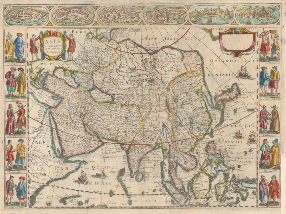
Asia recens summa cura delineata Auct: Iud Hondio.
$2,950.00
Acquire
- Digital Map Information
- Suitable for large format printing
- DPI: 600
- File Size: 54.48 MB
- File Type: ZIP / TIFF
- ICC color profile embedded
- Delivered instantly via download link
This is a beautiful Nicolas Picart edition of the Hondius carte-á-figures map of Asia. It was composed by Jodocus Hondius as early as 1623 and first appeared in the 1630 Hondius atlas. In this case, the map is an entirely new plate engraved in Paris in 1644 by Nicolas Picart. These French editions are beautiful and desirable rarities. (more details)
Modernizing Public Transit in Tashkent.

[Map of the City of Tashkent] / ПЛАНЪ ГОРОДА ТАШКЕНТА.
sold
- Digital Map Information
- Suitable for large format printing
- File Size: 52.29 MB
- File Type: ZIP / TIFF
- ICC color profile embedded
- Delivered instantly via download link
This is a rare 1913 map of Tashkent (Toshkent), the capital of today's Uzbekistan and a former Silk Road city, then the capital of Russian Turkestan and a major hub on the Trans-Caspian Railway. The map, likely administrative, was issued to illustrate Tashkent's electric tram system, launched in 1913. (more details)
Long Island Land Scam.
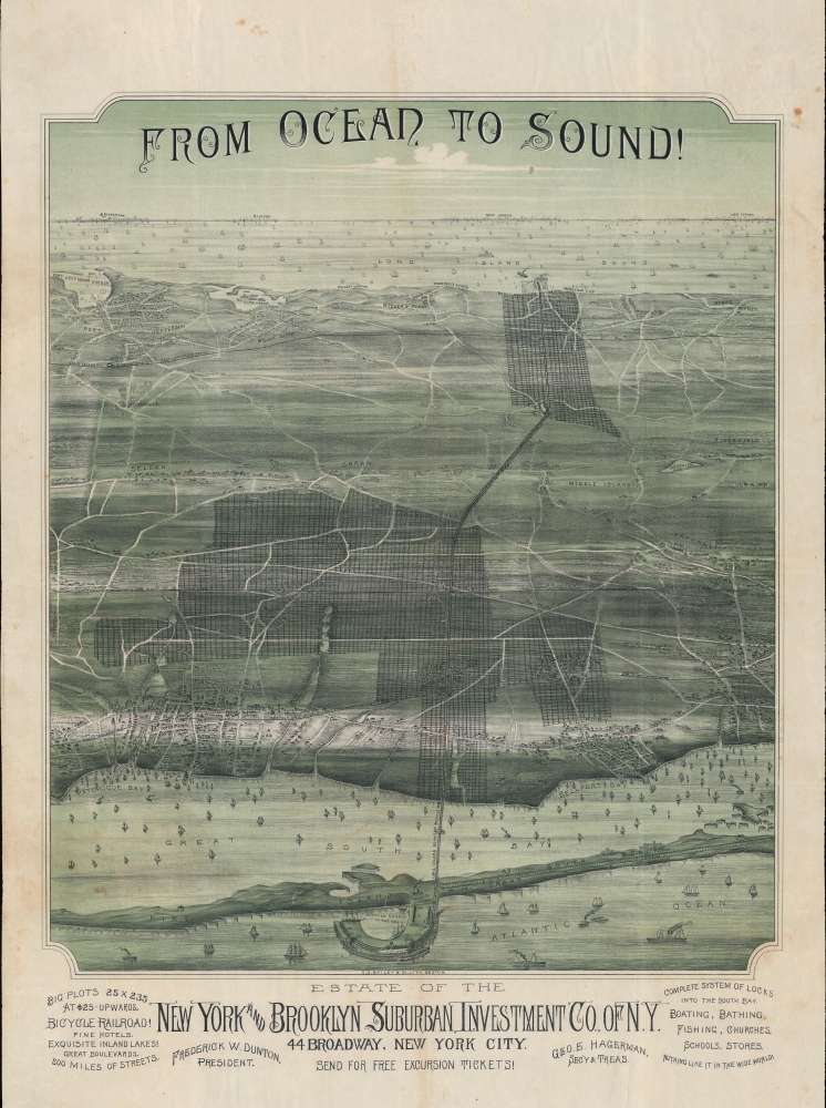
From Ocean to Sound!
sold
- Digital Map Information
- Suitable for large format printing
- File Size: 55.9 MB
- File Type: ZIP / TIFF
- ICC color profile embedded
- Delivered instantly via download link
A stunning 1892 Oakley H. Bailey chromolithograph bird's-eye view of a portion of Suffolk County, Long Island. Bailey issued the view for the New York and Brooklyn Suburban Investment Company. The view is a striking artifact charting urbanization. It is also associated with the rash of land speculation scams that plagued Long Island in the late 19th century. (more details)
Stunningly dense classic blueback.

[The English Channel] To the Right Honorable the Master, Wardens and Elder Bretheren of the Trinity House, This Chart of the English Channel, is by Permission Most Respectfully Dedicated by their Obliged and Grateful Servant, JW Norie, Hydrographer.
$2,000.00
Acquire
- Digital Map Information
- Suitable for large format printing
- File Size: 138.97 MB
- File Type: ZIP / TIFF
- ICC color profile embedded
- Delivered instantly via download link
A stunning, enormous, and rare 1842 nautical map of the English Channel by John William Norie. (more details)
Expanding British influence in Malaya; early mention of Kuala Lumpur.
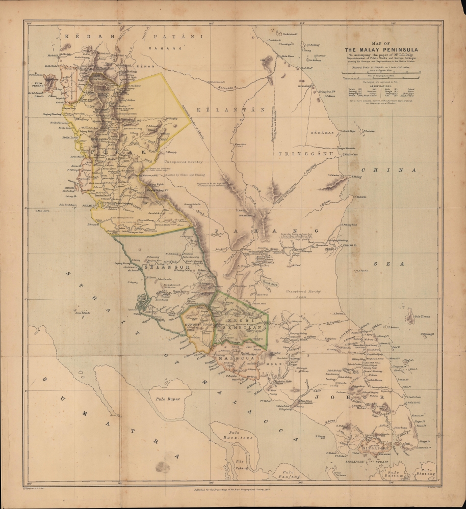
Map of the Malay Peninsula. To accompany the paper of Mr. D.D. Daly...
$1,100.00
Acquire
- Digital Map Information
- Suitable for large format printing
- File Size: 16.98 MB
- File Type: ZIP / TIFF
- ICC color profile embedded
- Delivered instantly via download link
An important map of the Malay Peninsula by Dominic Daniel Daly, lithographed by Edward Weller and published in 1882 in the Proceedings of the Royal Geographical Society. Daly's surveys of portions of the peninsula were the first scientific surveys conducted there. The map depicts the peninsula as British influence over the indigenous sultanates was expanding rapidly, aided by a boom in tin mining. (more details)
One of California's most beautiful and iconic towns.

Carmel-by-the-Sea Past and Present.
sold
- Digital Map Information
- Suitable for large format printing
- File Size: 546.9 MB
- File Type: ZIP / TIFF
- ICC color profile embedded
- Delivered instantly via download link
A beautiful example of the scarce 1942 Jo Mora pictorial map of Carmel, California. Located on the southern edge of the Monterey Peninsula, Carmel-by-the-Sea is widely regarded as one of California's most beautiful beach-front communities. (more details)
Graphic illustration of the Slave Trade.

Tractus Littorales Guineae a Promontorio Verde usque ad Sinum Catenbelae.
$950.00
Acquire
- Digital Map Information
- Suitable for large format printing
- File Size: 21.83 MB
- File Type: ZIP / TIFF
- ICC color profile embedded
- Delivered instantly via download link
This is Frederic De Wit's c. 1675 nautical chart of western Africa, extending from modern-day Mauritania to Angola. The map foregrounds the mouth of the River Congo in the south while detailing the complicated coastline between the Rivers Senegal, Gambia, and a 'Rio Grande,' probably the Geba in modern Guinea-Bissau. The whole of this region, and that of Senegal in the north, is historically the Slave Coast: a prime source of African people sold into slavery as part of the Atlantic Slave Trade. (more details)
Irritating the British.

The American Colossus of Rhodes.
sold
- Digital Map Information
- Suitable for large format printing
- File Size: 8.27 MB
- File Type: ZIP / TIFF
- ICC color profile embedded
- Delivered instantly via download link
This dramatic depiction of Uncle Sam as an 'American Colossus of Rhodes' was drawn by Frank Beard for the January 10, 1885 issue of The Judge, in boisterous support of the 'Nicaragua Canal Treaty' between the United States and the Central American nation towards the construction of a canal from the Atlantic to the Pacific. The prospective canal, seen as an essential link between the Atlantic and Pacific, was proposed as a natural extension of U.S. power in the context of the Monroe Doctrine, and was embraced by those - The Judge's editorial staff among them - eager to see the U.S. policies in the hemisphere unfettered by European concerns. (more details)
Arabian Sea and the Indian Ocean from the finest 17th Century Globemaker.

Avvertimento Al Navigli Che Partono Da Goa Per Andare Al Capo Di Buona Speranza Per Il Di Fuori Di Madagascar.
sold
- Digital Map Information
- Suitable for large format printing
- File Size: 7.84 MB
- File Type: ZIP / TIFF
- ICC color profile embedded
- Delivered instantly via download link
This is Vincenzo Coronelli's 1688 / 1696 globe gore, presenting a map of western India, coastal Persia, and the eastern extreme of the Arabian Peninsula. It was initially engraved in 1688 for Coronelli's 42-inch (3 1/2 foot) terrestrial globe but was repurposed for publication in Coronlli's 1696 Libro dei Globi and Isolario. (more details)
First passenger rail line in France!

Le Chemin de Fer.
sold
- Digital Map Information
- Suitable for large format printing
- Full resolution TIFF file
- ICC color profile embedded
- Delivered instantly via download link
Created to celebrate the first dedicated passenger train in France, this c. 1840 Imagerie Pellerin broadside is a view and map of the rail line between Paris and St.-Germain, the first rail line in the Île de France. Launched on August 24, 1837, the train traversed its 12-mile of track in about twenty-eight minutes. The royal family, including Queen Marie-Amélie attended the opening, although King Louis-Philippe was notably absent - his handlers were concerned about the 'risks' involved and dissuaded him from participating. Over 18,000 Parisians rode the train on the first day. Travelers and newspapers announced the accomplishment with fanfare, stating that the day before getting to St.-Germain would have been 'a trip', whereas the day the rail line opened, it was no more difficult than 'leaving your house.' Indeed, before the rail line, a trip to St.-Germain from the Tuileries by horse-drawn coach would have taken 5-6 hours. (more details)