
Shows Lake Parima on whose mythical shores legend situated the golden city of El Dorado.
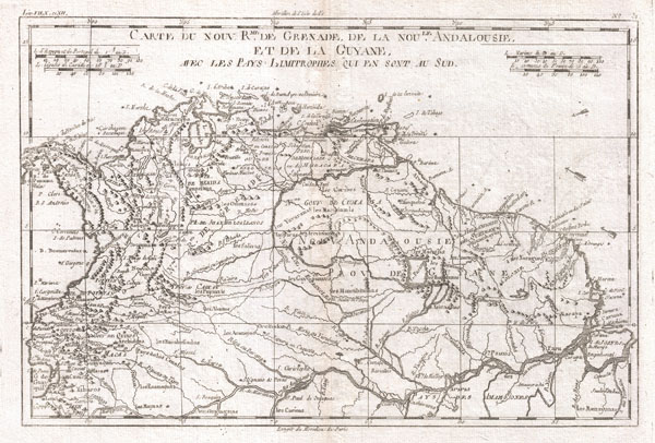
Carte Du Nord Rme. De Grenade De La Nou Le. Andalouise Et De La Guyane.
sold
- Digital Map Information
- Suitable for large format printing
- DPI: 300
- File Size: 4.26 MB
- File Type: ZIP / TIFF
- ICC color profile embedded
- Delivered instantly via download link
A fine example of Rigobert Bonne and Guilleme Raynal's 1780 map of Northern South America. This map includes the area stretching from modern day Ecuador, Panama, and Columbia, to Venezuela, Guyane, Surinam, and the northern portion of Brazil. Highly detailed ... (more details)

Oahu, Hawaiian Islands.
sold
- Digital Map Information
- Suitable for large format printing
- File Size: 15.2 MB
- File Type: ZIP / TIFF
- ICC color profile embedded
- Delivered instantly via download link
This vary large, rare, and extraordinary 1902 map of the island of Ohau, Hawaii, was prepared for the 1906 Report of the Governor of the Territory of Hawaii to the Secretary of the Interior. The areas of Honolulu, Pearl Harbor, Diamond Head, Koko Head and ... (more details)

Hawaii, Hawaiian Islands.
sold
- Digital Map Information
- Suitable for large format printing
- File Size: 16.33 MB
- File Type: ZIP / TIFF
- ICC color profile embedded
- Delivered instantly via download link
This rare and extraordinary 1901 map of the island of Hawaii was prepared for the 1906 Report of the Governor of the Territory of Hawaii to the Secretary of the Interior. Though the cartographic work that produced this map was started in 1878, during the ... (more details)
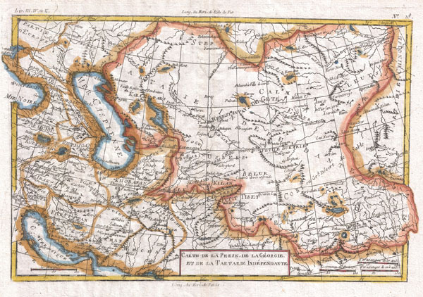
Carte De La Perse, De Ka Georgie, Et De La Tartarie Independante
sold
- Digital Map Information
- Suitable for large format printing
- DPI: 300
- File Size: 4.9 MB
- File Type: ZIP / TIFF
- ICC color profile embedded
- Delivered instantly via download link
A fine example of Rigobert Bonne and Guilleme Raynal's 1780 map of Central Asia. Focuses on the region once known as Tartarie Indépendante or Independent Tartary. This name was given to the great tract of land by Europeans in the middle ages, and ... (more details)
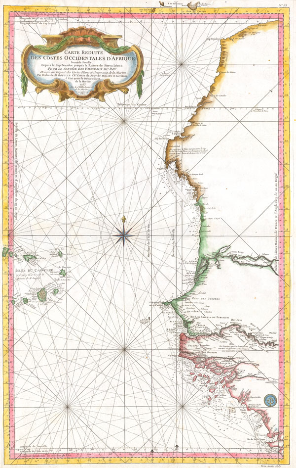
Carte Reduite Des Costes Occidentales D’Afrique.
sold
- Digital Map Information
- Suitable for large format printing
- Full resolution TIFF file
- ICC color profile embedded
- Delivered instantly via download link
This large nautical chart of Western African was produced by the French Cartographer Jacques-Nicolas Bellin. Depicts Western Africa from The Canary Islands South through Western Sahara, Senegal, Guinea-Bissau, the Gambia, Guinea, and Sierra Leone. ... (more details)
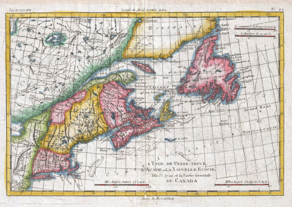
L'Isle De Terre-Neuve, L'Acadie ou La Nouvelle Ecosse
sold
- Digital Map Information
- Suitable for large format printing
- DPI: 300
- File Size: 5.23 MB
- File Type: ZIP / TIFF
- ICC color profile embedded
- Delivered instantly via download link
A fine example of Rigobert Bonne and Guilleme Raynal's 1780 map of the Northeast United States and Eastern Canada. This highly detailed map covers the eastern coast of the United States from a portion of New Jersey and New York in the south as far ... (more details)
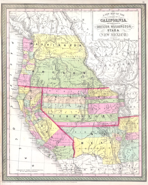
A New Map of the State of California, the Territories of Oregon, Washington, Utah & New Mexico.
sold
- Digital Map Information
- Suitable for large format printing
- Full resolution TIFF file
- ICC color profile embedded
- Delivered instantly via download link
An extremely important 1853 map of the western United States by S. A. Mitchell Sr. Based upon Mitchell's own seminal 1846 Map of Texas and California. Depicts the United States west of the Rocky Mountains and predates the Gadsden Purchase. ... (more details)

A Map of the New Governments, of East & West Florida.
sold
- Digital Map Information
- Suitable for large format printing
- DPI: 300
- File Size: 1.37 MB
- File Type: ZIP / TIFF
- ICC color profile embedded
- Delivered instantly via download link
Featured here is a rare and important map of Florida issued for Gentleman's Magazine in 1763 to describe the new territories of British Florida. The map depicts the provinces of East and West Florida as they emerged following the Treaty of ... (more details)

Carte De La Partie Superieure De L'Inde En De Cadu Gange
sold
- Digital Map Information
- Suitable for large format printing
- DPI: 300
- File Size: 4.52 MB
- File Type: ZIP / TIFF
- ICC color profile embedded
- Delivered instantly via download link
A fine example of Rigobert Bonne and Guilleme Raynal's 1780 map of northern India. Covers the northern part of India from Kandahar (Candahar) and Kashmir (Cachemire) south as far as Decan. Includes the areas claimed by the Mogol Empire, ... (more details)

Australasia
sold
- Digital Map Information
- Suitable for large format printing
- DPI: 300
- File Size: 13.86 MB
- File Type: ZIP / TIFF
- ICC color profile embedded
- Delivered instantly via download link
This fascinating hand colored 1818 map by Edinburgh cartographer John Pinkerton depicts Australia (as New Holland with Van Diemen's land no longer attached), New Zealand (depicts only two islands), and parts of Micronesia and Polynesia ... (more details)

Hollandt comitatus Vtricht episcope
sold
- Digital Map Information
- Suitable for large format printing
- Full resolution TIFF file
- ICC color profile embedded
- Delivered instantly via download link
A rare and beautiful 1606 map of Holland ( Netherlands ) by Gerard Mercator. Amsterdam appears at the center and the map extends south as far as Harderwyck and west as far as Rhenen and Rotterdam. The Zunder Zee, now a damned inland ... (more details)
Home of the Barbary Pirates!
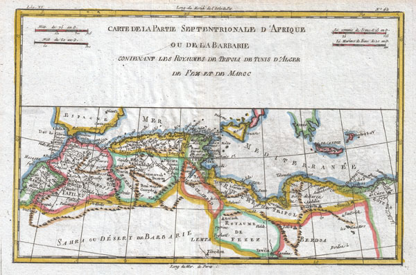
Carte De La Partie Septtrionale D'Afrique
sold
- Digital Map Information
- Suitable for large format printing
- DPI: 300
- File Size: 4.53 MB
- File Type: ZIP / TIFF
- ICC color profile embedded
- Delivered instantly via download link
A fine example of Rigobert Bonne and Guilleme Raynal's 1780 map of northwestern Africa or the Barbary Coast. Includes the modern day countries of Morocco, Algeria, Tunisia, Libya, and parts of adjacent Spain, Italy and Greece. This ... (more details)

Capitanata olim Mesapiae et Iapygiae pars.
sold
- Digital Map Information
- Suitable for large format printing
- Full resolution TIFF file
- ICC color profile embedded
- Delivered instantly via download link
This is a magnificent c. 1630 map by Willem Blaeu represents the Capitanata or Puglia Tableland in eastern Italy. This area is often associated with the 'spur of the boot.' This highly decorative map in a fine example of the Blaeu ... (more details)
Outstanding map of southern Scotland, including Edinburgh and Glasgow.
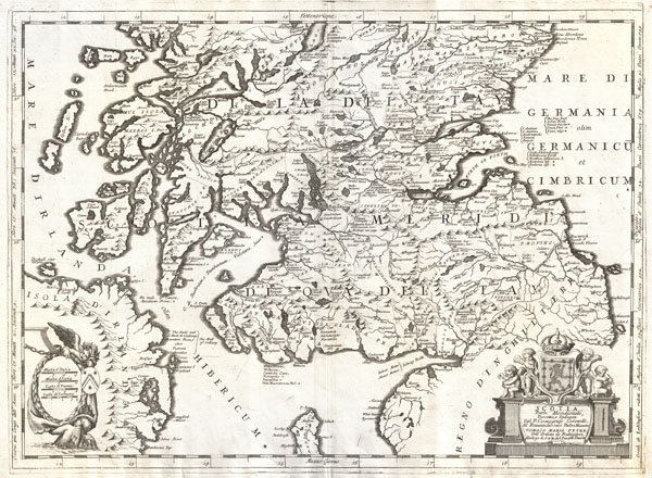
Scotia, Parte Meridionale …
sold
- Digital Map Information
- Suitable for large format printing
- Full resolution TIFF file
- ICC color profile embedded
- Delivered instantly via download link
This is Vincenzo Maria Coronelli's 1690 map of southern Scotland. Covers the southern part of Scotland from New Aberdone and Kiltre south as far as the Isle of Man, including adjacent parts of England and Ireland. The major cities ... (more details)
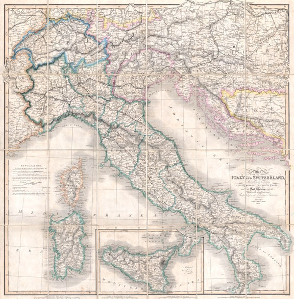
Map of Italy and Switzerland Particularly distinguishing the Different Travelling Roads and the Post Stations; with the number of posts between each Station. Compiled from the most recent Authorities.
sold
- Digital Map Information
- Suitable for large format printing
- File Size: 23.26 MB
- File Type: ZIP / TIFF
- ICC color profile embedded
- Delivered instantly via download link
A rare and beautiful case format map of Italy and Switzerland from 1859. Produced by London cartographer Charles Smith. Covers from Geneva in the west as far east as Turkey and Dalmatia, north to Vienna, and south to include ... (more details)
Stunning two part map of Holland.

Contado d'Ollanda Parte Settentrionale. - Contado d'Ollanda Parte Meridionale.
sold
- Digital Map Information
- Suitable for large format printing
- Full resolution TIFF file
- ICC color profile embedded
- Delivered instantly via download link
A spectacular example of Coronelli's two part map of Holland or the Netherlands. The upper sheet covers from Friesland to Amsterdam including all of the Zuyder Zee. The southern map covers from the Haarlem Meer south to ... (more details)
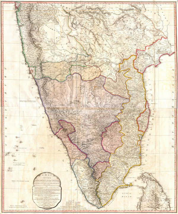
A Map of the Peninsula of India.
sold
- Digital Map Information
- Suitable for large format printing
- DPI: 300
- File Size: 29.68 MB
- File Type: ZIP / TIFF
- ICC color profile embedded
- Delivered instantly via download link
One of the largest and most impressive maps of India to appear in the 18th century. Depicts the subcontinent from Bombay ( Mumbai ) and Aurungabad, south including the northern half of Sri Lanka ( Ceylon ). Printed in ... (more details)
Rare and important Ino Tadataka Atlas of the Tokugawa Era.
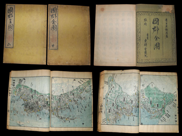
Kokugun Zenzu
sold
Entitled Kokugun Zenzu and printed c. 1839 (Tenpo 10), this is an early Japanese atlas of exceptional rarity, beauty and importance. Compiled by Motonobu Aoo and Toshiro Eirakayu based upon the works of Japan's 18th ... (more details)

Insuale Islandiae
sold
- Digital Map Information
- Suitable for large format printing
- Full resolution TIFF file
- ICC color profile embedded
- Delivered instantly via download link
This is a rare and spectacular 1761 Homann Heirs map depicting Iceland. Fine map of this region compiled according to Danish surveys. Lovers of Icelandic sagas will recognize many of the towns and cities ... (more details)

Corso delli Fiumi Drino, e Boiana nella Dalmatia, descrito dal P. Mro Coronelli Cosmografo della Seren. Republica di Venezia dedicato - Agli Em; e Reu; Signori Cardinali della Sacra congregatione de Propaganda Fide.
sold
- Digital Map Information
- Suitable for large format printing
- DPI: 300
- File Size: 14.01 MB
- File Type: ZIP / TIFF
- ICC color profile embedded
- Delivered instantly via download link
This is Vincenzo Maria Coronelli's 1690 map of Montenegro. Covers the Dalmatian coast from Dubrovnik to Gjiri i Drinit, including all of modern day Montenegro as well as parts of adjacent Croatia, ... (more details)