
Unique view of the Bund from Broadway Mansions.

Shanghai.
sold
A striking 1987 L. C. Baron impressionist watercolor view of the Shanghai Bund. The view looks south on the Bund from a high point just to the north, across the Wusong River - likely from a high floor in the Broadway Mansions building. Many of the Bund's most famous buildings, including the Peace Hotel and the Bank of China Building, are recognizable. The Huangpu River is full of traditional Chinese Junks. We have been unable to trace the undeniably skilled artist. A Chinese seal appears in the lower left. (more details)
Steam packets routes and global steam navigation companies.
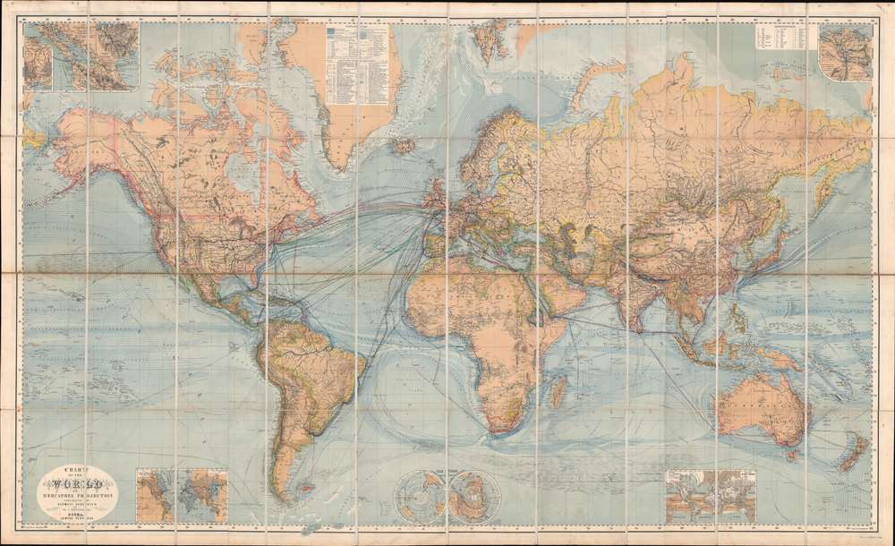
Chart of the World on Mercators Projection.
sold
- Digital Map Information
- Suitable for large format printing
- Full resolution TIFF file
- ICC color profile embedded
- Delivered instantly via download link
This is a c. 1870 Hermann Berghaus large-scale map of the world. Typical of German maps production in the late 19th century, this map is both cartographically and informationally dense, featuring a wealth of detail and data systematically organized for easy digestion. This ranges from land and sea transportation networks to climatological data, topography, political distinctions, communication infrastructure (telegraph lines), oceanographic content, and more. Of particular interest is Berghaus' focus on global ocean steam navigation companies and steam packet communication. (more details)
The early days of St. Petersburg.
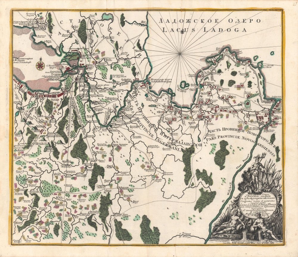
Ладожское озеро [Lake Ladoga], Conspectus recens et accuratus magnae partis Lacus Ladogae et Sinus Finnici.
$1,800.00
Acquire
- Digital Map Information
- Suitable for large format printing
- Full resolution TIFF file
- ICC color profile embedded
- Delivered instantly via download link
A scarce c. 1760 Russian-language map of Lake Ladoga, St. Petersburg, and environs, produced by Johann Elias Grimmel, based on an original published by Matthäus Seutter. It depicts the region as St. Petersburg was growing considerably and attracting intellectuals from throughout Europe, including Grimmel. (more details)
One of the greatest and rarest California pictorial maps.

Map of the United States as Californians See It.
sold
- Digital Map Information
- Suitable for large format printing
- File Size: 21.98 MB
- File Type: ZIP / TIFF
- ICC color profile embedded
- Delivered instantly via download link
This scarce 1947 pictorial map of California was drawn by Charlene Bisch to promote Oren Arnold's book California Brags. It is among the greatest and rarest California pictorial maps and one of the archetypal 'brag' maps of the era - one that sparked a responsive 'Florida Brags' map. (more details)
Unrecorded and Visually Striking Map of Tokyo.

改正東亰實測全圖 / [Complete Survey Map of Tokyo].
sold
- Digital Map Information
- Suitable for large format printing
- Full resolution TIFF file
- ICC color profile embedded
- Delivered instantly via download link
This is an 1890 folding survey map of Tokyo, Japan, by Ishijima Yae and Yamanaka Yoshisaburō. Its primary purpose is to highlight recent administrative changes in Tokyo, namely the creation of Tokyo Municipality (東京市), composed of 15 wards (區) within the larger Tokyo Prefecture (東京府). (more details)
The first generation of Meiji Maps drawn from Western sources.

東半球 / Eastern Hemisphere.
$1,200.00
Acquire
- Digital Map Information
- Suitable for large format printing
- File Size: 74.36 MB
- File Type: ZIP / TIFF
- ICC color profile embedded
- Delivered instantly via download link
A rare 1873 or Meiji 6 wall map of the Eastern Hemisphere by the Japanese geographer Gaiko Oya (大屋 愷敆). The map follows the early Meiji Restoration convention of copying cartography from western sources. The practice was intended to modernize Japanese geographical conceptions and place Japan into a geographically accurate global reference. (more details)
Speculative proto-Alaskan Muller Peninsula.
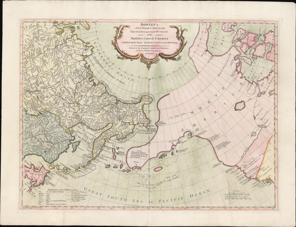
Bowles's New Pocket Map of the Discoveries made by the Russians on the North West Coast of America Published by the Royal Academy of Sciences at Petersburg.
sold
- Digital Map Information
- Suitable for large format printing
- Full resolution TIFF file
- ICC color profile embedded
- Delivered instantly via download link
An attractive example of Carrington Bowles' 1780 map of the North Pacific, including parts of Alaska, the Pacific Northwest, and Northeast Asia. Most dramatically, the map includes a large speculative pre-Cook peninsula extending westward from North America toward Asia. This is generally known as the Muller Peninsula after Gerhard Muller, who hypothesized it in 1754. The map is also notable for its unusual bulbous promontory in northern Siberia, an interpretation of the Witsen Peninsula, which is a mismapping of the Chukchi Peninsula. (more details)
A Fabulous Pictorial Map of Formosa.
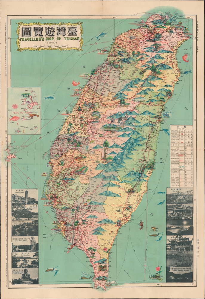
台灣遊覽圖 / Traveller's Map of Taiwan.
sold
A 1969 (Minguo 58) bilingual pictorial map of Taiwan, as vibrant as the island itself, edited by Ch'en I-jen, drawn by Chou I-li, and published by Nan-hua Publishing House in Taipei. (more details)
A House Divided...

Carte générale du théâtre de la guerre.
sold
- Digital Map Information
- Suitable for large format printing
- Full resolution TIFF file
- ICC color profile embedded
- Delivered instantly via download link
This is Ernest Dumas-Vorzet's 1890 map of the United States, prepared for Histoire de la Guerre Civile en Amérique. It was the first map in the atlas volume accompanying the book. (more details)
The Bloodiest Day in U.S. Military History.

Cedar Mountain (Virginie). Harpers Ferry et South Mountain. Antietam (Maryland).
sold
- Digital Map Information
- Suitable for large format printing
- Full resolution TIFF file
- ICC color profile embedded
- Delivered instantly via download link
This is Ernest Dumas-Vorzet's map of the 1862 Civil War Battles of Cedar Mountain, Harpers Ferry, and Antietam, issued to illustrate the 1890 book Histoire de la Guerre Civile en Amérique. (more details)
Envisioning the McMillan Plan.

The Ultimate Washington.
sold
- Digital Map Information
- Suitable for large format printing
- File Size: 21.2 MB
- File Type: ZIP / TIFF
- ICC color profile embedded
- Delivered instantly via download link
A lovely 1915 bird's eye view of Washington, D.C., originally drawn by architect Francis L. V. Hoppin and republished in National Geographic. Among other features, it presents a view of the nation's capital (here dubbed 'Ultimate Washington') as envisioned by the McMillan Plan, a never-fully-realized scheme to remake and beautify the city. (more details)
Details plans to rejuvenate the National Mall and the surrounding area.

The Mall. Washington D.C. Plan Showing Building Development to 1915 in Accordance with the Recommendations of the Park Commission of 1901.
sold
- Digital Map Information
- Suitable for large format printing
- File Size: 14.5 MB
- File Type: ZIP / TIFF
- ICC color profile embedded
- Delivered instantly via download link
This is a 1915 National Geographic Society city map of the National Mall in Washington, D.C. Depicting the region from Arlington National Cemetery to the Library of Congress and from Lafayette Square to where the Thomas Jefferson Memorial is today. Twenty-one buildings are illustrated around the Mall. Some, including the White House (No. 2), the Capitol Building (No. 1), the Library of Congress (No. 6), and recently constructed House and Senate office buildings, are shaded red, indicating that they had been built before 1901 or had been built between 1901 and 1915. Other buildings, such as buildings for the Departments of Justine, States, Commerce, and Labor, were proposed as part of the McMillan Plan, upon which this map was based. (more details)
Geographical Reader for Dixie Children.
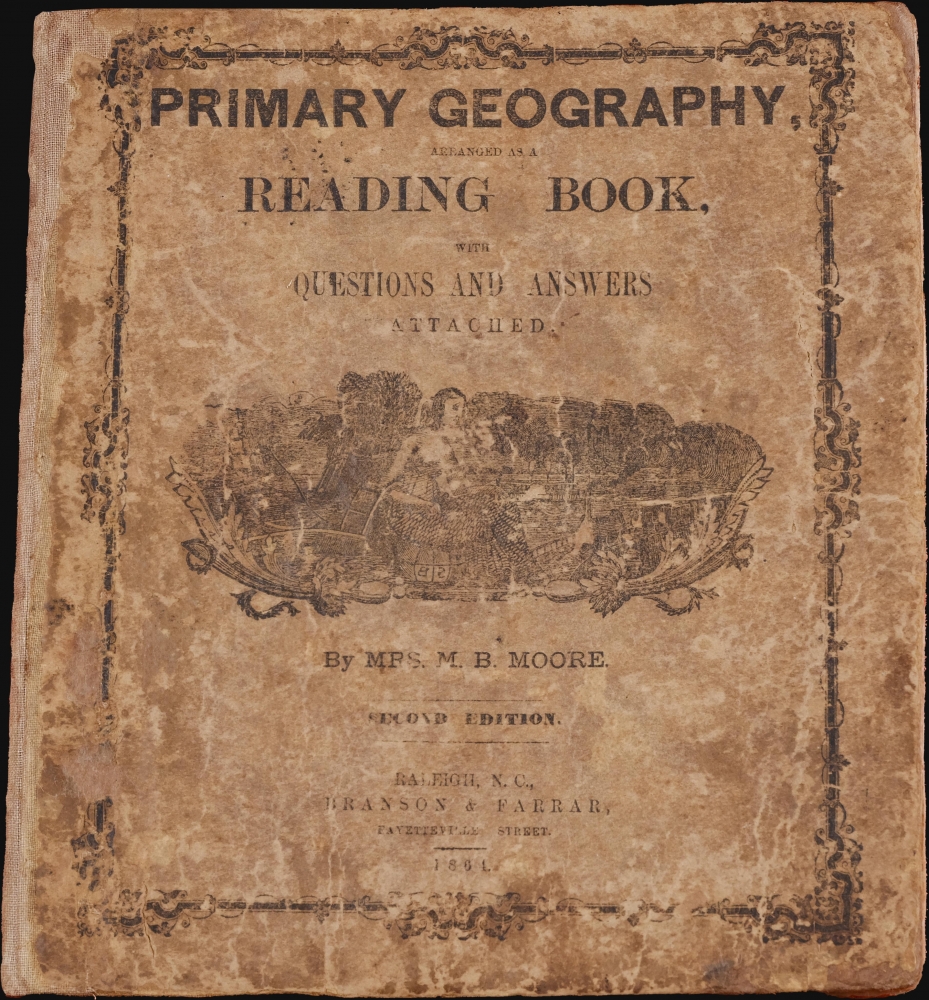
Primary Geography Arranged as a Reading Book, with Questions and Answers Attached.
sold
- Digital Map Information
- Suitable for large format printing
- Full resolution TIFF file
- ICC color profile embedded
- Delivered instantly via download link
This is a rare 1864 geographical atlas by Marinda Branson Moore prepared for Confederate children. Published during the American Civil War (1861 - 1865), the work only maps the Confederate States and contains historically relevant, if racially offensive, text critical of the Union. The work, as expressed by historians O. L. Davis, Jr. and Serena Rankin Parks, addresses the concerns of Southern schoolteachers who saw existing published textbooks as 'blighted with by Yankee biases and inaccuracies.' (more details)
First flight over Antarctica.

Wilkins-Hearst Antarctic Expedition 1928-1929. Map of the Antarctic.
$5,000.00
Acquire
- Digital Map Information
- Suitable for large format printing
- Full resolution TIFF file
- ICC color profile embedded
- Delivered instantly via download link
A rare 1929 American Geographical Society wall map of Antarctica issued to celebrate the 1928-29 Wilkins-Hearst Expedition (1928 - 29), wherein George Hubert Wilkins (1888 - 1958) accomplished the first Antarctic flight, revealing some 1000 miles of uncharted territory. (more details)
Possibly the first ship-to-shore diagram?
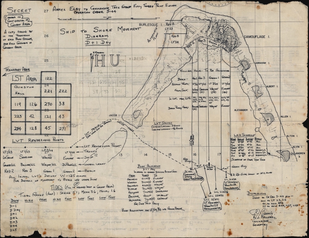
Annex Easy to Commander Task Group Fifty Three Point Eleven Operation Order 3-44. Ship to Shore Diagram D + 1 Day. / Appendix One to Annex Easy to Commander Task Group Fifty Three Point Eleven Operation Order No 3-44. Detailed Diagram of Typical Assault Boat Group.
sold
- Digital Map Information
- Suitable for large format printing
- Full resolution TIFF file
- ICC color profile embedded
- Delivered instantly via download link
An exceptional discovery, this is a 1944 Ship-to-Shore diagram map of the landings on Roi and Namur in Kwajalein Atoll in the Marshall Islands. It is possibly the first printed ship-to-shore diagram issued by the U.S. military - and is certainly the earliest known. Such diagrams were introduced during World War II when amphibious assault doctrine was initially developed. The only other known World War II ship-to-shore diagrams relate to subsequent operations, among them the June 6, 1944, D-Day landings and the invasion of Iwo Jima. (more details)
Best and largest pictorial map of San Francisco.

Map of San Francisco Showing Principal Streets and Places of Interest.
sold
- Digital Map Information
- Suitable for large format printing
- File Size: 61.66 MB
- File Type: ZIP / TIFF
- ICC color profile embedded
- Delivered instantly via download link
This is a 1927 Harrison Godwin pictorial map of San Francisco, California - considered the best genre illustration of that city. The map offers a wealth of unique detail that only a local would know - the balloon over the Presidio, a well-known homeless character in Richmond, criminal activity in Sutro Forest, and more. (more details)
The deliberately forgotten 'Japanese Lindbergh'.

北太平洋橫斷飛行要圖 / [Map of North Pacific Transverse Flight].
sold
- Digital Map Information
- Suitable for large format printing
- Full resolution TIFF file
- ICC color profile embedded
- Delivered instantly via download link
This is an unrecorded 1932 or Showa 7 Hōchi Shimbun diazotype map of the northern Pacific with hand-written annotations tracing the proposed transpacific route of Seiji Yoshihara (吉原清治), the 'Japanese Lindbergh,' from Oakland, California, to Tokyo. The flight was Yoshihara's second attempt, and the repeated failure dishonored him in the eyes of the Japanese public and government, crashing his promising aviation career. The map is accompanied by two period press photos, one of Yoshihara and the other of his crashed plane at Oakland Airport. Both have annotations on the verso. (more details)
'A city undaunted by tragedy, audaciously innovative, rising to meet the challenges of the day.'
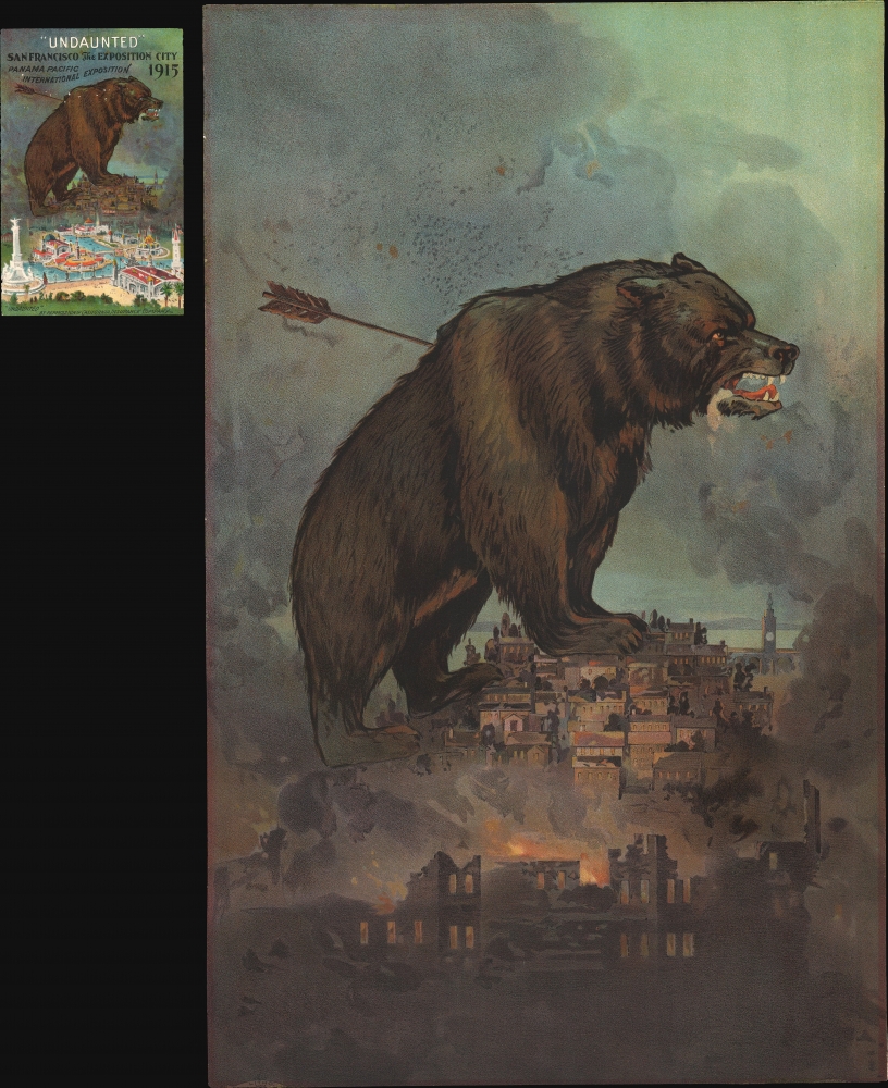
'Undaunted'.
$2,250.00
Acquire
- Digital Map Information
- Suitable for large format printing
- File Size: 62.39 MB
- File Type: ZIP / TIFF
- ICC color profile embedded
- Delivered instantly via download link
This is a rare 1911 Britton and Rey chromolithograph view of San Francisco, issued to promote the city's resurgent spirit following the 1906 San Francisco Fire. A titanic grizzly bear represents the spirit of San Francisco, 'a city undaunted by tragedy, audaciously innovative, rising to meet the challenges of the day.' (more details)
The Jesuit Reports of the Far East.
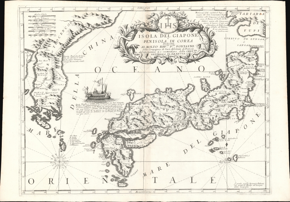
Isola Del Giapone e Penisola Di Corea.
sold
- Digital Map Information
- Suitable for large format printing
- Full resolution TIFF file
- ICC color profile embedded
- Delivered instantly via download link
This is the 1692 Vincenzo Coronelli map of Japan and Korea. With bold engraving typical of Coronelli, this is among the most visually distinctive maps of the Japanese Islands produced in the 17th century. Moreover, it introduces unique new cartographic knowledge derived from the most up-to-date Jesuit sources. (more details)
The Great Pyramid predicts the End of Days.

Passage System of the Great Pyramid of Giza in the Land of Egypt June - July 1909.
sold
- Digital Map Information
- Suitable for large format printing
- File Size: 321.48 MB
- File Type: ZIP / TIFF
- ICC color profile embedded
- Delivered instantly via download link
This is a c. 1910 monumental waxed linen banner illustrating the interior of the Great Pyramid of Giza, Egypt. The banner results from the 1909 studies of Morton Edgar and his brother John Edgar. Bother Edgars were dedicated pyramidologists who believed they could, through studies of the Great Pyramid, discern essential theological truths. Morton was obsessed with the theories of Jehovah's Witness founder Charles Taze Russell (1852 - 1916), who advocated the theory that the Great Pyramid was a mystical artifact deeply connected to the End of Days and the events predicted in Revelations. (more details)