
Dramatic view of one of America's greatest natural disasters - drawn and printed in Dayton!

Birds-Eye View of the business Section of Dayton, Ohio. Sketched March 26, 1913. Looking East from Williams St.
sold
- Digital Map Information
- Suitable for large format printing
- File Size: 52.09 MB
- File Type: ZIP / TIFF
- ICC color profile embedded
- Delivered instantly via download link
This is a dramatic 1913 George Ring chromolithographic view of Dayton, Ohio, in the midst of the Great Dayton Flood of 1913 - one of the worst natural disasters in United States history. As a product of lithography, this is a rare example of a lithographic city view printed outside one of the great centers of American lithography by otherwise little-known makers. (more details)
Ides, not Izmailov.

Generalis totius imperii Moscovitici...
$750.00
Acquire
- Digital Map Information
- Suitable for large format printing
- File Size: 23.27 MB
- File Type: ZIP / TIFF
- ICC color profile embedded
- Delivered instantly via download link
This is Eberhard Isbrand Ides' map of the Russian Empire in Asia, revised and engraved in 1707 by Johann Baptist Homann. Ides produced the map in 1704 to accompany the travelogue of his experiences in 1692 as an envoy sent by Peter the Great to Kangxi China in the wake of the 1689 Treaty of Nerchinsk. Although Ides credited his map to Nicolaes Witsen, the present work is more reflective of Russian cartography at the end of the 17th century than Witsen's cartography. Homann's revision of the map - placing it on a conic projection, a sophistication lacking in the Ides - sets this map apart both from its source and from other contemporaneous maps of the region. (more details)
Follow an ammunition supply battalion across Europe.

262 Ordnance Battalion (AM) in the European Theatre of Operations. Lt. Col. H.C. Holman Commanding.
sold
- Digital Map Information
- Suitable for large format printing
- Full resolution TIFF file
- ICC color profile embedded
- Delivered instantly via download link
This is an artistic World War II pictorial route map highlighting the campaign of the 262nd Ordnance Ammunition Battalion drawn by Walter Leonard. (more details)
One of the Most Culturally Significant Sites in China.

世界第一名勝西湖全圖 / [Complete View of the World's Most Famous Scenic Spot West Lake].
sold
- Digital Map Information
- Suitable for large format printing
- File Size: 21.65 MB
- File Type: ZIP / TIFF
- ICC color profile embedded
- Delivered instantly via download link
A c. 1925 view of West Lake in Hangzhou, China, a UNESCO World Heritage site and one of the most culturally significant places in Chinese and East Asian civilization. While an ancient attraction, the map also reflects the changing image of West Lake in the popular imagination, as tourism became more commercialized and accessible. (more details)
Around the World in how many days?

Il Giro del Mondo.
sold
- Digital Map Information
- Suitable for large format printing
- File Size: 35.24 MB
- File Type: ZIP / TIFF
- ICC color profile embedded
- Delivered instantly via download link
A rare c. 1890 Italian chromolithograph 'Snakes and Ladders' or 'Game of Goose' board inspired by Jules Verne's Around the World in 80 Days. The board forms a traditional spiral with a dual-powered steam and sail ship. The game substitutes the genre's traditional Kabalistic-inspired 63 squares with a Verne-inspired 80 squares. Instructions and interpretations of the icons appear in each corner. (more details)
Will there be a 4th?
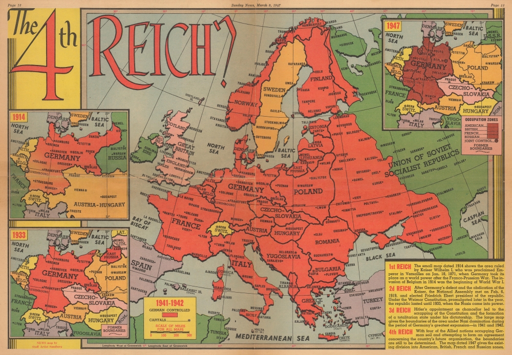
The 4th Reich?
sold
- Digital Map Information
- Suitable for large format printing
- Full resolution TIFF file
- ICC color profile embedded
- Delivered instantly via download link
This is a March 1947 Edwin Sundberg map of Europe and German Empires published by the Sunday News. The map questions whether a fourth Germanic empire might one day arise from the ashes of the Third Reich. (more details)
'... of the utmost typographical and historical importance' - Stevens

Extracto de los autos de diligencias, y reconocimientos de los rios, lagunas, vertientes, y desagues de la capital Mexico, y su valle.
sold
An essential, groundbreaking work of Mexican geography, this is Joseph Francisco Cuevas Aguirre y Espinosa's foundational 1748 study of the drainage of the region around Mexico City. It is the earliest systematic study of flooding endemic to the Mexican capital. The work contains the first printed version of Carlos Sigüenza y Gongora's map of the area encompassing 90 miles surrounding Mexico City, the first printed map of the region not derived from the 1524 Cortez map, and the first map of the region produced by a Mexican. It has long been recognized for its importance - even the 19th-century bookseller and bibliophile Henry Stevens proclaimed, 'This book is of the utmost typographical and historical importance' both in terms of its content and its superb production. The work is also significant for being printed by a woman, Rosa Maria Teresa de Poveda (c. 1710 - 1755), the widow of deceased printer Jose Bernardo de Hogal. (more details)
Lafreri-school Map of Crete.
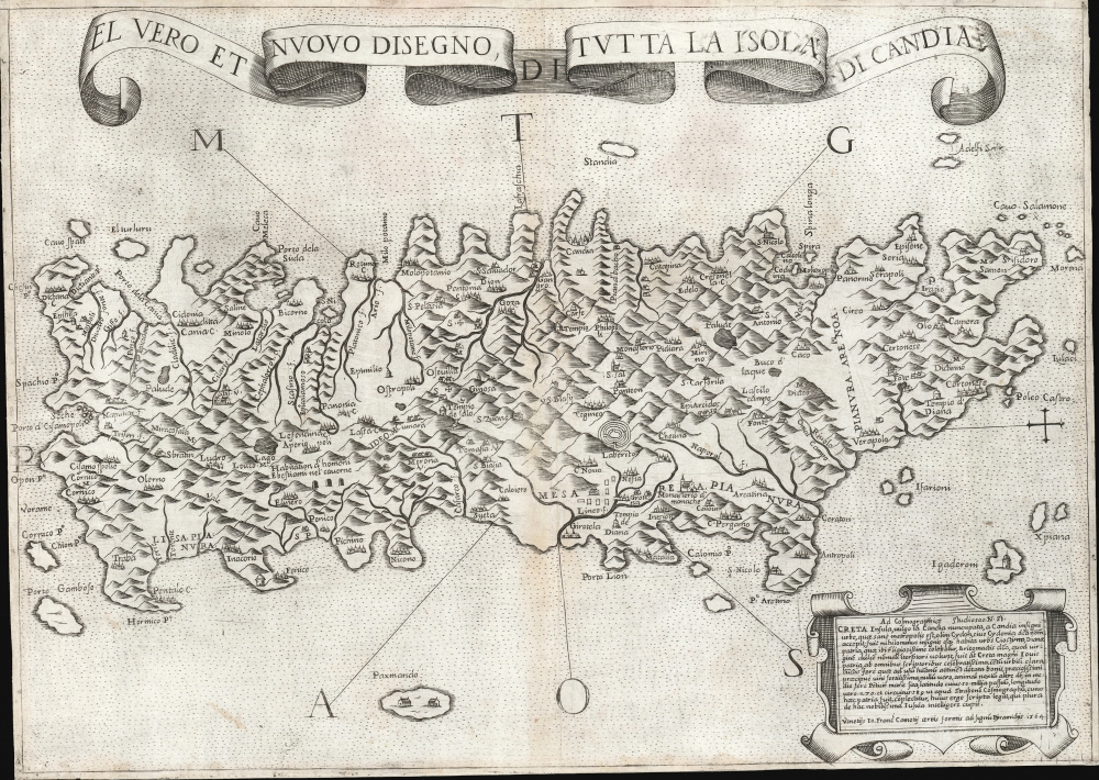
El Vero et Nuovo Disegno di Tutto la Isola di Candia.
sold
- Digital Map Information
- Suitable for large format printing
- DPI: 600
- File Size: 24.36 MB
- File Type: ZIP / TIFF
- ICC color profile embedded
- Delivered instantly via download link
This is a 1564 first-state Lafreri School map of Crete, engraved by Paolo Forlani and published by Giovanni Camocio. This north-oriented map illustrates the island's topography based on the late model exhibited first in the 1513 Waldseemüller map and introduced to Venice via Matteo Pagano's 1538 map. Waldseemüller's model was sufficiently authoritative to make it the prototype for all maps of the island until the 1563 map of the Cretan Calapoda became available. (more details)
The steam age.
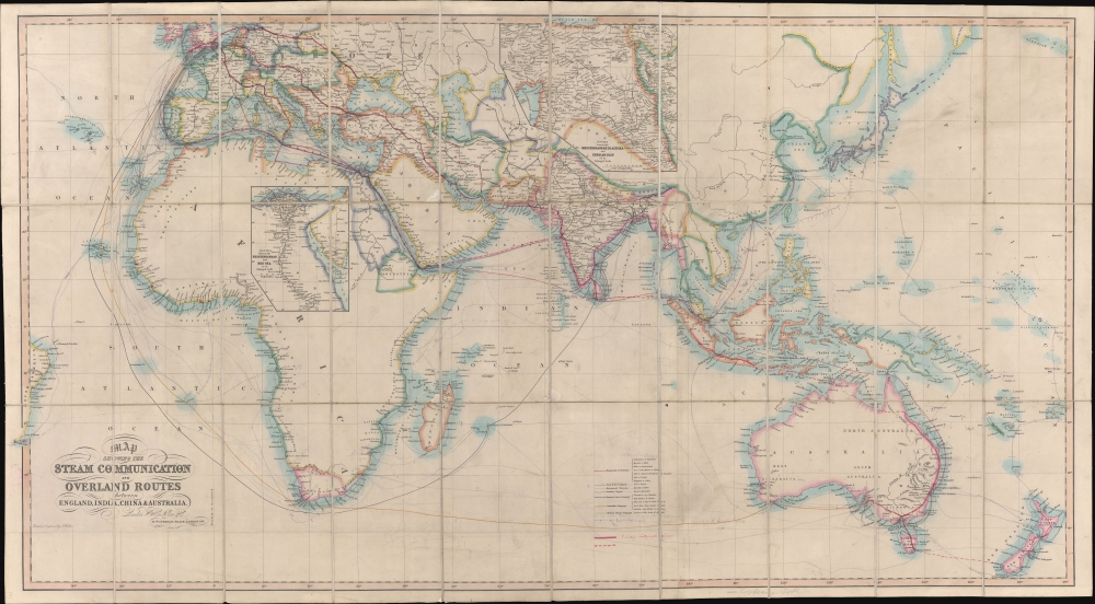
Map Showing the Steam Communication and Overland Routes between England, India, China and Australia.
sold
- Digital Map Information
- Suitable for large format printing
- Full resolution TIFF file
- ICC color profile embedded
- Delivered instantly via download link
A striking 1853 large-scale map by W. H. Allen detailing both overland and steamship routes between England, India, Australia, and East Asia. It illustrates the height of the steamship trade between far-flung British colonies in the decades before the construction of the Suez Canal. The present example features numerous manuscript updates, some in pencil, tracing additional steamship lines run by Oriental-Lloyds-Shanghai and Eastern Atlantic. In addition, further highlighting in red illustrates telegraph lines. (more details)
Unique proof state of a survey of Honolulu with connections to the Hawaiian Revolution.
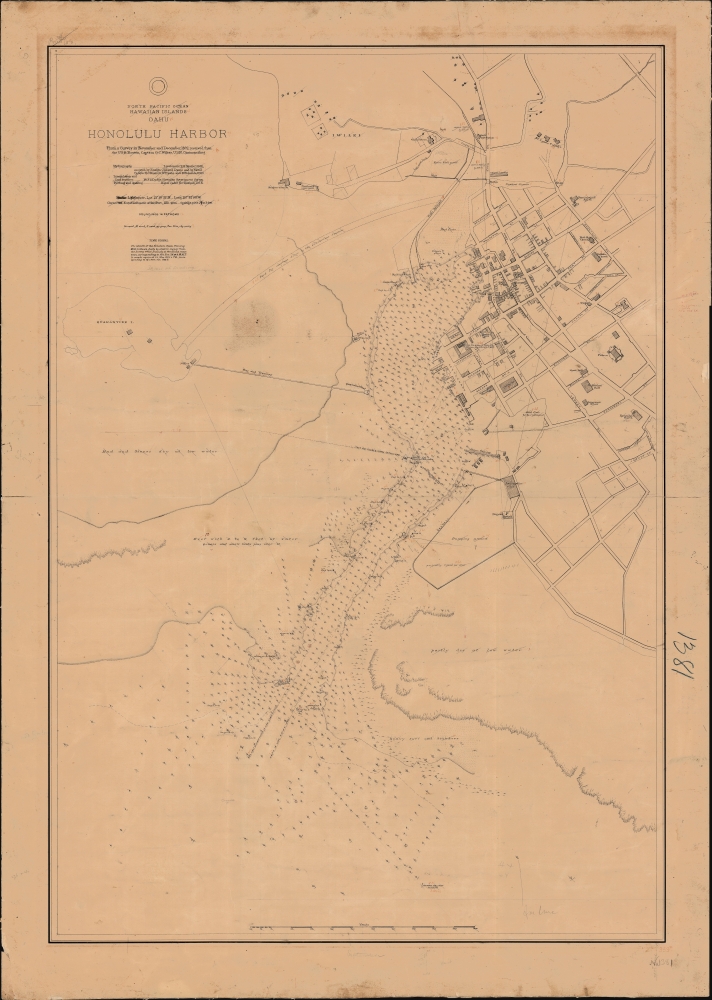
North Pacific Ocean, Hawaiian Islands, Oahu, Honolulu Harbor.
sold
- Digital Map Information
- Suitable for large format printing
- File Size: 1595.22 MB
- File Type: ZIP / TIFF
- ICC color profile embedded
- Delivered instantly via download link
A fascinating 1892 proof-state of the first U.S. survey of Honolulu Harbor, Hawaii, completed under Captain Gilbert Wiltse in 1892. Replete with manuscript corrections and annotations, this map offers unique insight into the processes behind U.S. Navy Hydrographic office survey publication. Historically, this map appeared within the context of potential U.S.-Hawaiian Annexation and the 1893 Hawaiian Revolution - in which Wiltse played a role. (more details)
First Atlas Map of the Caribbean, and Northwestern Mexico.
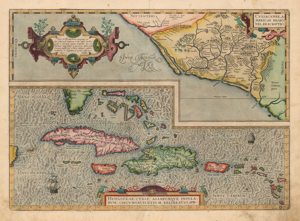
Culiacanae, America Regionis Descriptio./ Hispaniolae, Cubae, Aliarumque Insularum Circumiacentium, Delineatio./ Cum Imp. et Regio./ privilegio decennali 1579.
sold
- Digital Map Information
- Suitable for large format printing
- Full resolution TIFF file
- ICC color profile embedded
- Delivered instantly via download link
This is a beautiful, original color example of Ortelius' 1579 map of Cuba and the Caribbean, combined with his map of the Viceroyalty of Culiacan in Northwestern Mexico. Moreover, this is a Vrients edition of the map: maps from Vrients editions typically exhibit finer quality color than those printed during Ortelius' lifetime and are consequently very desirable. (more details)
Dutch interests in America including New Amsterdam (New York). From an unrecorded 1668 French edition of Doncker's Atlas.
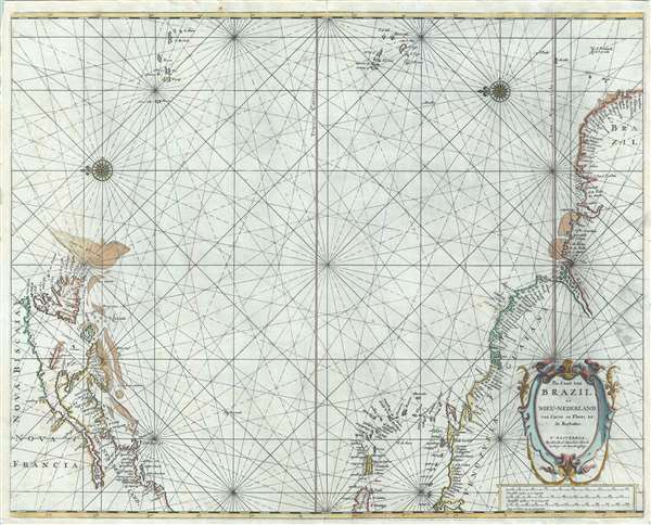
Pas Caart van Brazil en Nieu-Nederland van corvo en Flores tot de Barbados.
sold
- Digital Map Information
- Suitable for large format printing
- Full resolution TIFF file
- ICC color profile embedded
- Delivered instantly via download link
A rare 1668 nautical chart or maritime map depicting the northern Atlantic Ocean by Hendrick Doncker. The map captures, on one sheet, the two centers of Dutch influence in the Americas - New Amsterdam (New York) and Dutch Brazil. (more details)
Transformative moment in global gastronomy.
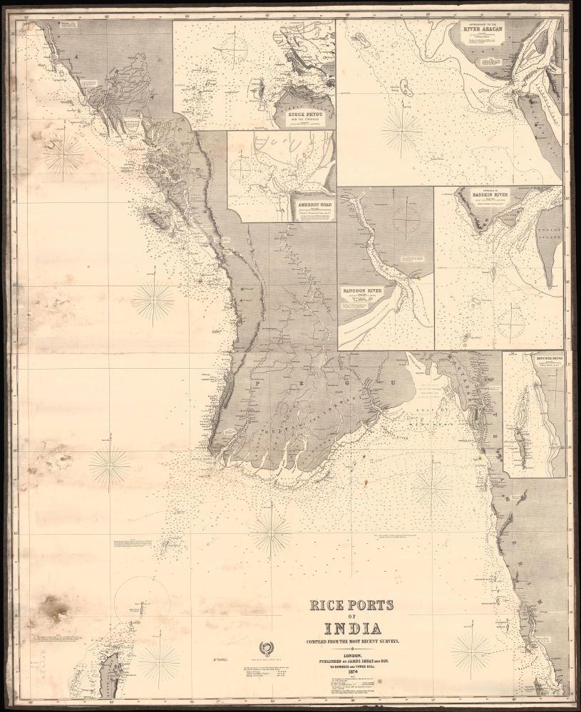
Rice Ports of India compiled from the most recent surveys.
$850.00
Acquire
- Digital Map Information
- Suitable for large format printing
- File Size: 25.84 MB
- File Type: ZIP / TIFF
- ICC color profile embedded
- Delivered instantly via download link
A fascinating 1874 James Imray nautical chart or maritime map of the cost of Myanmar / Burma when that territory was the world's largest rice exporter. Burma's rise as a rice center transformed global gastronomy by democratizing rice consumption. (more details)
Engineer Battalion in WWII.

Travels of the 289th.
sold
- Digital Map Information
- Suitable for large format printing
- Full resolution TIFF file
- ICC color profile embedded
- Delivered instantly via download link
This is a 1945 John Louis Bartolomeo World War II pictorial route map of the 289th Combat Engineer Battalion in Western Europe. Pictorial vignettes highlight battles, the defeat of Germany, occupation duty, encounters with women, and parties. (more details)
Superb Original Color.

Regni Daniae in quo sunt Ducatus Holsatia et Slesvicum, Insulae Danicae Provinciae Iutia Scania Blekingia etc. Nova Tabula edita á Io. Baptista Homanno Noribergae.
sold
- Digital Map Information
- Suitable for large format printing
- File Size: 24.05 MB
- File Type: ZIP / TIFF
- ICC color profile embedded
- Delivered instantly via download link
A beautiful, original color example of Johann Baptist Homann's 1702 map of Denmark. One of Homann's earliest works, this was probably engraved by the Johann Baptist Homann himself during his brief apprenticeship under David Funcke. It is a bold and elegant engraving typical of the elder Homann. (more details)
Psy-ops WWII propaganda centered on Manila.

マニラ陥落の意義は / [The Significance of the Fall of Manila.]
sold
- Digital Map Information
- Suitable for large format printing
- Full resolution TIFF file
- ICC color profile embedded
- Delivered instantly via download link
An extraordinary example of psychological warfare operations in the closing days of World War II, this leaflet-map of East Asia was prepared c. March 1945 by the U.S. Army to flaunt the retaking of Manila and demoralize Japanese troops. (more details)
Changing Times in the Ancient City.

Ереван Иллюстрированная панорамная схема / Ереван туристская схема. [Yerevan Illustrated Panoramic Map / Yerevan Tourist Map].
sold
An impressive and scarce pictorial view of Yerevan, Armenia, published by the Main Administration of Geodesy and Cartography (GUGK) of the Soviet Union in 1985. Though designed for tourists, the map boasts interesting aesthetic qualities while also reflecting changing Soviet policies on national identity and religion in the 1980s. (more details)
Zurich tourism.

Zurich.
sold
- Digital Map Information
- Suitable for large format printing
- Full resolution TIFF file
- ICC color profile embedded
- Delivered instantly via download link
This is a c. 1950 Otto M. Müller pictorial map of Zurich, Switzerland, published by the department store Jelmoli. (more details)
French bid for California.
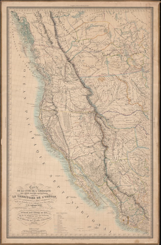
Carte De La Cote De L'Amerique Sur L'Ocean Pacifique Septentrional Le Territoire De L'Oregon, Les Californies, La Mer Vermeille, Partie des Territoires de la Compagnie de la Baie d'Hudson, Et De L'Amerique Russe. Dressee par Mr. Duflot de Mofras, Attache a la Legation de France a Mexico; Pour servir a l'intelligence de son Voyage d'exploration Publie Par Ordre Du Roi, sous les Auspices De Mr. Le Marechal Duc De Dalmatie, Mr. Le Ministre Des Affaires Etrangeres.
sold
- Digital Map Information
- Suitable for large format printing
- DPI: 600
- File Size: 1130.13 MB
- File Type: ZIP / TIFF
- ICC color profile embedded
- Delivered instantly via download link
Published in 1844, this is one of the most interesting and important maps of California, Oregon, and the American West predating the Mexican-American War (1846 - 1848). This map, prepared by the French diplomat and spy, Eugène Duflot de Mofras, was drawn in anticipation of a French bid for California in light of a crumbling and bankrupt Mexican state. (more details)
Signed multiple times by Tribunal.
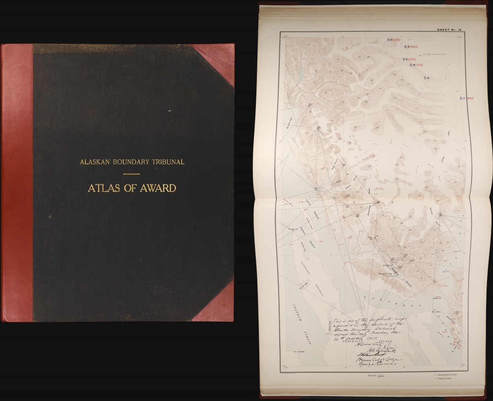
Atlas of Award Twenty-five sectional maps and index map showing the line fixed by the Tribunal / Senate Document No. 162. 58th Congress, 2d Session.
sold
An exceptional item, this atlas recounting the work and decision of the 1903 Alaska Boundary Tribunal is signed multiple times by the members of the tribunal. The dispute, instigated by the Klondike Gold Rush, was a sore spot in Canada-U.S. relations for years. Its resolution in favor of the U.S., with the deciding vote cast by a British member of the tribunal, simultaneously resolved the conflict and improved Anglo-American relations. (more details)