
One of the few specific maps of Puerto Rico from the early 19th century.
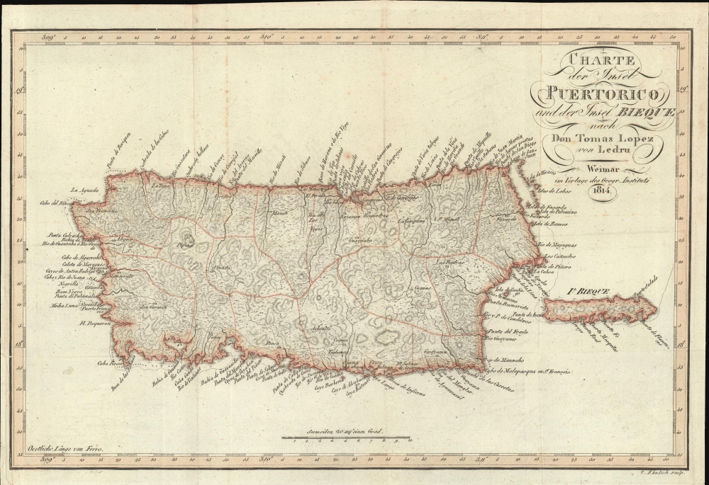
Charte der Insel Puerto Rico und der Bieque nach Don Thomas Lopez von Ledru.
sold
- Digital Map Information
- Suitable for large format printing
- File Size: 6.43 MB
- File Type: ZIP / TIFF
- ICC color profile embedded
- Delivered instantly via download link
This is a rare 1814 Thomas Lopez and Andree Pierre Ledru map of Puerto Rico, one of the few specific maps of this island dating to the early 19th century. (more details)
The American South by rail.

Railroad and Steamboat Connections of the Ocean Steamship Co. of Savannah and New England and Savannah Steamship Co.
sold
- Digital Map Information
- Suitable for large format printing
- Full resolution TIFF file
- ICC color profile embedded
- Delivered instantly via download link
This is an 1895 Rand McNally railroad map of the southern United States. The map highlights the railroad connections with the New England and Savannah Steamship Company and a few of its competitors, detailing routes to Atlanta, Augusta, Tampa, Chattanooga, and St. Louis. (more details)
Bird's-eye view of the White Mountains advertising rail service.

Bird's Eye Map of the White Mountains Reached by Boston and Maine Railroad.
sold
- Digital Map Information
- Suitable for large format printing
- File Size: 10.36 MB
- File Type: ZIP / TIFF
- ICC color profile embedded
- Delivered instantly via download link
This is an 1896 Boston and Maine Railroad bird's-eye view map of the White Mountains promoting their service to tourists. (more details)
Street souk in Rabat, Morocco.

Un Souk Rabat Morocco 1917.
sold
- Digital Map Information
- Suitable for large format printing
- File Size: 10.14 MB
- File Type: ZIP / TIFF
- ICC color profile embedded
- Delivered instantly via download link
This is a 1917 Henri Camax view of a souk (market) in Rabat, Morocco. Camax illustrates a crowd milling about one of the souk's roads, with buildings lining both sides of the narrow street. The minaret of the Old Mosque in the Kasbah appears in the background. (more details)
Sportsman's Paradise.

Supplement to Hubbards Map of Moosehead Lake and Northern Maine. Embracing the headwaters of the St. John and Aroostook Rivers.
sold
- Digital Map Information
- Suitable for large format printing
- File Size: 11.24 MB
- File Type: ZIP / TIFF
- ICC color profile embedded
- Delivered instantly via download link
An intriguing 1882 map of the northernmost portion of Maine, covering much of Aroostook County, prepared by Lucien Hubbard for Hubbard's Guide to Moosehead Lake and Northern Maine. Hubbard's maps and guides played an important role in popularizing inland Maine for travelers seeking a rustic retreat from coastal city living. (more details)
Teaching schoolchildren about the Dominican Civil War.

Headline Focus Wall Map 2. Haiti and the Dominican Republic.
sold
This is a 1965 Civic Education Service wall map of Haiti and the Dominican Republic, which occupy the island of Hispaniola. This map was produced to educate schoolchildren about the Dominican Civil War and the continued dictatorship in Haiti. (more details)
Foundational map of the Nile Delta and the basis of all subsequent regional maps.

كهاريطات الءواجه الءباحاري ليلأقاليم الءميصريياه / [Map of the Egyptian Regions facing the Sea].
sold
- Digital Map Information
- Suitable for large format printing
- File Size: 168.02 MB
- File Type: ZIP / TIFF
- ICC color profile embedded
- Delivered instantly via download link
A striking, important, and rare Arabic-language chromolithographed map of the Nile Delta, prepared in 1872 by Mahmoud Bey al-Falaky. Aside from its aesthetic qualities, it also represented the most accurate map of the region when it was produced, combining the most up-to-date cartographic methods with extensive research on local placenames, terrain, and topography. As this map replaced French benchmark maps of the region from the early 19th century, it became the new gold standard and was continually used as the basis for most subsequent maps. (more details)
Uniquely useful unbiased large-scale railroad map of the Golden Age of American Rails.

Colton's Intermediate Railroad Map of the United States.
sold
- Digital Map Information
- Suitable for large format printing
- Full resolution TIFF file
- ICC color profile embedded
- Delivered instantly via download link
A striking large-format 1882 railroad map of the United States consisting of four folding sheets, produced by G.W. and C.B. Colton in New York, here dissected and mounted for the European market. It is the largest and most ambitious unbiased third-party railroad map of the 19th century - a monumental achievement. Given its impressive size, Colton almost certainly intended the map for in-station display. It likely failed to find its intended market as stations were controlled by the railroads directly (hence a 'Union Station' in every railroad town west of the Mississippi), and they would have preferred their own more promotional station maps, thus somewhat accounting for the extreme rarity of this piece. As such, it is nonetheless uniquely helpful in understanding the full scope of the Golden Age of American Rail. (more details)
First edition to name the United States.
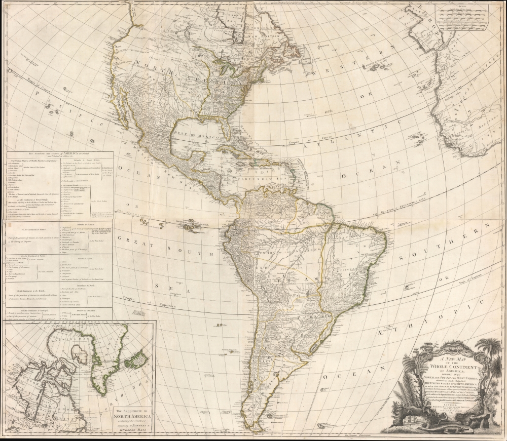
A New Map of the Whole Continent of America, divided into North and South and West Indies, wherein are exactly Described the United States of North America as well as the Several European Possessions according to the Preliminaries of the Peace singed at Versailles Jan. 20 1783.
sold
- Digital Map Information
- Suitable for large format printing
- DPI: 600
- File Size: 97.78 MB
- File Type: ZIP / TIFF
- ICC color profile embedded
- Delivered instantly via download link
A scarce 1783 Sayer and Bennett wall map of America issued shortly after the American Revolutionary War (1775 - 1783). This map followed closely on the Treaty of Versailles, which ended the Revolutionary War and established British recognition of the independent United States. This is the first issue of this map to name the United States - here, including all territory north of Florida, South of the Great Lakes (except Michigan), and east of the Mississippi. (more details)
Pre-Invasion British Intelligence reconnaissance of Rangoon.

HIND 1036 Rangoon Sheet 2. Third Edition.
sold
- Digital Map Information
- Suitable for large format printing
- File Size: 40.31 MB
- File Type: ZIP / TIFF
- ICC color profile embedded
- Delivered instantly via download link
A unique survivor, this is an April 1945 Allied Land Forces South East Asia (ALFSEA) World War II pre-invasion intelligence map of Rangoon, Burma, identifying enemy locations. ALFSEA overprinting anticipates the May 1945 British assault on Rangoon, highlighting 122 key locations one month before the British retook the city: Indian National Army barracks and camps, Japanese military installations, Burmese government offices, a prisoner-of-war camp, and the barracks and headquarters of the Rani of Jhansi Regiment, the only women's regiment of the Indian National Army. (more details)
Speculative Pacific Cartography, w/ California as an Island.

Mare del Svd, detto altrimenti Mare Pacifico.
sold
- Digital Map Information
- Suitable for large format printing
- Full resolution TIFF file
- ICC color profile embedded
- Delivered instantly via download link
An exceptional 1691 nautically styled map of the Pacific Ocean by the Venetian cartographer Vincenzo Maria Coronelli. The map features much of note, including a presentation of California as an Island, an illustration of a speculative Terra de Yesso (Hokkaido), and early speculative mappings of Australia, Tasmania, New Zealand, and New Guinea. (more details)
Most important early 19th century map of Java, by the founder of Singapore.
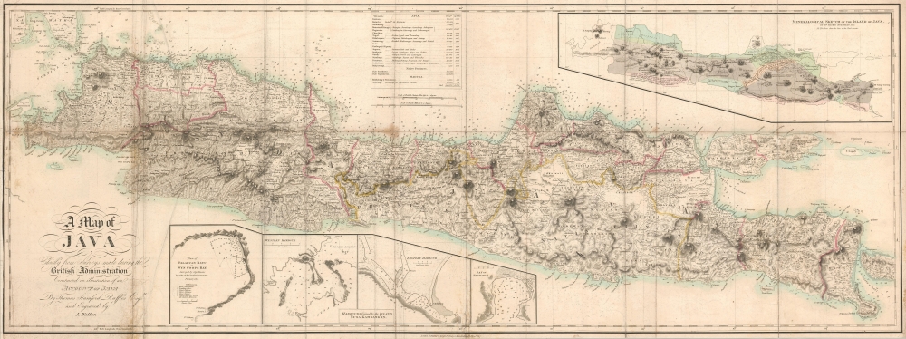
A Map of Java Chiefly from Surveys made during the British Administration Constructed in illustration of an Account of Java By Thomas Stamford Raffles Esquire and Engraved by J. Walker.
sold
- Digital Map Information
- Suitable for large format printing
- DPI: 600
- File Size: 39.96 MB
- File Type: ZIP / TIFF
- ICC color profile embedded
- Delivered instantly via download link
A rare 1817 map of Java by Thomas Stamford Raffles, the founder of Singapore. This map is considered to be the first scientifically surveyed map of the island. (more details)
Earliest AMC Map of the White Mountains.
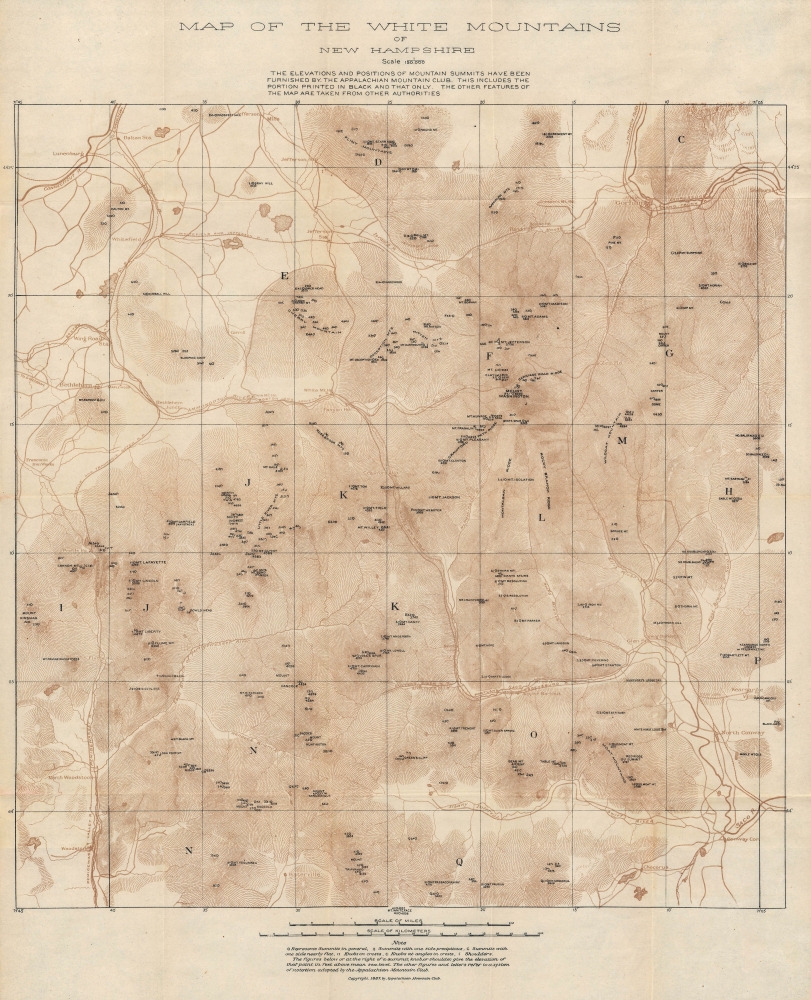
Map of the White Mountains of New Hampshire.
sold
- Digital Map Information
- Suitable for large format printing
- Full resolution TIFF file
- ICC color profile embedded
- Delivered instantly via download link
This is the Appalachian Mountain Club's (AMC) earliest map of the White Mountains in New Hampshire, published in 1887. It is a seminal map produced by an organization synonymous with hiking in the White Mountains. (more details)
Pageant of life on Earth.
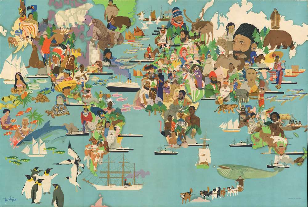
[Map of the World].
sold
- Digital Map Information
- Suitable for large format printing
- File Size: 63.93 MB
- File Type: ZIP / TIFF
- ICC color profile embedded
- Delivered instantly via download link
This is a 1950 Jan Wijga pictorial map of the world. Presenting a dynamic mix of the world's people and wildlife, the map depicts the world divided into hemispheres. Although unaccompanied by its index, 150 different people and animals are illustrated. Portraits portray the pageant of humanity. For example, a cowboy and a Native American are illustrated in North America, along with a member of the Royal Canadian Mounted Police near Vancouver, and a fisherman in Newfoundland. Portraits in South America and Africa focus on tribal societies. Asians wear traditional costumes and jewelry. The world's great architecture is also on display, from the skyscrapers of America's East Coast to the iconic onion domes of Saint Basil's Cathedral in Moscow, the Pyramids at Giza, and the Taj Mahal. Large illustrations of a bear, wolf, camel, reindeer and kangaroo are among the fauna illustrated. The whole is a wonderful summary of life on Earth. (more details)
Courting industrial development along the Erie Railroad trunk line.
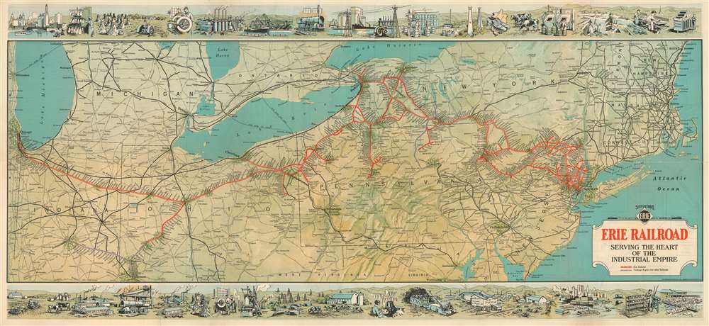
Erie Railroad Serving the Heart of the Industrial Empire.
sold
- Digital Map Information
- Suitable for large format printing
- Full resolution TIFF file
- ICC color profile embedded
- Delivered instantly via download link
This is a highly graphic 1930 Whitney-Graham railroad map of the northeastern United States issued to promote industrial development along the Erie Railroad. (more details)
One of the Most Architecturally Distinctive Cities in America.
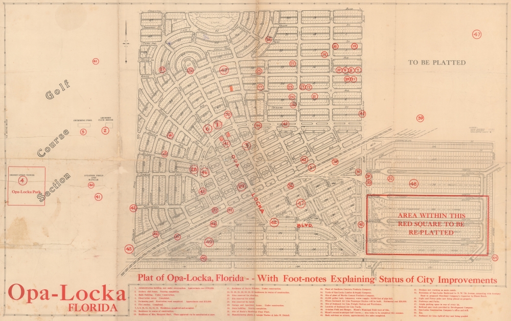
Opa-Locka Florida.
sold
- Digital Map Information
- Suitable for large format printing
- File Size: 29.13 MB
- File Type: ZIP / TIFF
- ICC color profile embedded
- Delivered instantly via download link
A one-of-a-kind planning plat map of Opa-Locka, Florida, a planned community spearheaded by aviation pioneer Glenn Curtiss, produced in tandem with the city's founding in 1926. It provides a fascinating look into the process of the city's development, including its highly distinctive 'Moorish Revival' architecture and nomenclature, based on the classic tales of the Arabian Nights. (more details)
Contributing to the War Effort.

Boys of New England.
sold
- Digital Map Information
- Suitable for large format printing
- File Size: 53.01 MB
- File Type: ZIP / TIFF
- ICC color profile embedded
- Delivered instantly via download link
An ephemeral 1917 poster map of New England promoting the World War I Era Y.M.C.A. Red Triangle War Work program's fundraising 'Money Marathon'. The map is a grey outline of New England over which a red sun rises. Arrows point towards Boston, where the planned march took place on November 17, 1917. (more details)
Best British Chart of the St. Lawrence on the Eve of the American Revolution.

An Exact Chart of the River St. Laurence from Fort Frontenac to the Island of Anticosti shewing the Soundings, Rocks, Shoals and c with Views of the Lands and all necessary Instructions for navigating that River to Quebec.
sold
- Digital Map Information
- Suitable for large format printing
- File Size: 2028.51 MB
- File Type: ZIP / TIFF
- ICC color profile embedded
- Delivered instantly via download link
This significant 1775 chart of the St. Larence River appeared in Thomas Jefferys' The American Atlas, the most important 18th-century atlas for America. (more details)
Early surveying expedition to the American West.

Map of a Reconnaissance between Fort Leavenworth and the Missouri River, and the Great Salt Lake in the Territory of Utah, made in 1849 and 1850…
sold
- Digital Map Information
- Suitable for large format printing
- File Size: 35.01 MB
- File Type: ZIP / TIFF
- ICC color profile embedded
- Delivered instantly via download link
This is Howard Stansbury's seminal 1852 map of the lands between Fort Leavenworth, Kansas, and Pilot Peak (now Nevada), west of the Great Salt Lake. It was published as part of the Stansbury Report presented to the U.S. Congress. (more details)
One of the Cold War's Most Curious Alliances.

阿尔巴尼亚 / [Albania].
sold
An interesting piece of Cold War persuasive cartography, this Chinese-language map of Albania was produced in 1968 by the China Cartographic Publishing House. It is a relic of the oddly bizarrely close Cold War alliance between Mao Zedong's People's Republic of China and Enver Hoxha's People's Republic of Albania. (more details)