
Shows Creek, Cherokee, Choctaw, and Chickasaw territories before the Trail of Tears.
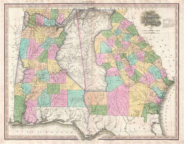
Georgia and Alabama by H. S. Tanner.
sold
- Digital Map Information
- Suitable for large format printing
- DPI: 300
- File Size: 16 MB
- File Type: ZIP / TIFF
- ICC color profile embedded
- Delivered instantly via download link
A rare and important map of Georgia and Alabama by H. S. Tanner. This elephant folio map covers all of Georgia and Alabama as well as, in less detail, adjacent parts of Florida, Mississippi and South Carolina. The map shows rivers, topography by hachure, cities, ... (more details)
Utilizes ancient Biblical nomenclature when labeling locations around the region.
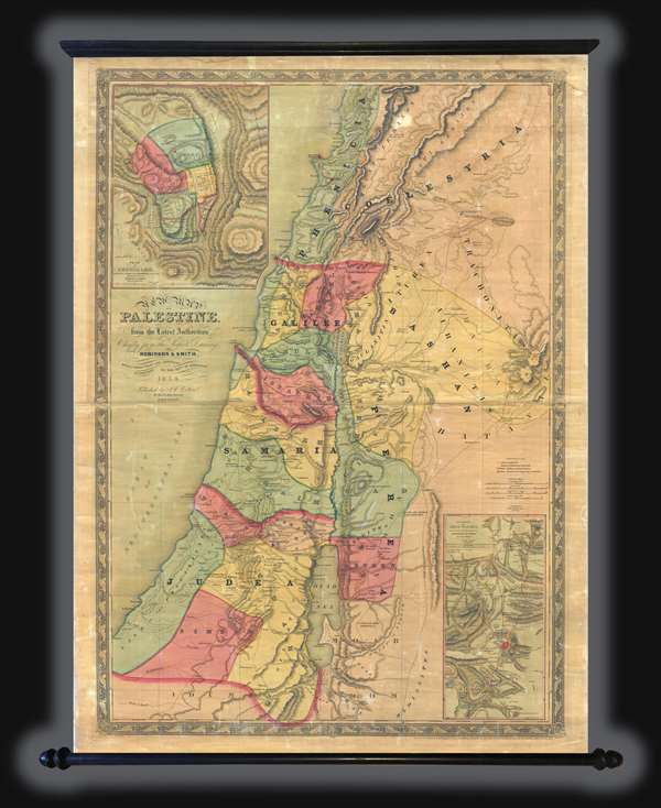
New Map of Palestine.
sold
This is an 1858 Joseph Hutchins Colton wall map of Israel, Palestine, or the Holy Land. The map depicts the region from modern-day Lebanon and Syria to southern Israel and from the Mediterranean Sea to western Jordan. The clear majority of the labels employed on ... (more details)
Hand colored map of Woods Hole, Cape Cod - near Martha's Vineyard!

The Harbor of Wood's Hole Massachusetts.
sold
- Digital Map Information
- Suitable for large format printing
- File Size: 6.69 MB
- File Type: ZIP / TIFF
- ICC color profile embedded
- Delivered instantly via download link
This is a hand colored 1857 U.S. Coast Survey nautical chart or maritime map of Woods Hole, Massachusetts, near Martha's Vineyard. The map depicts the southwestern tip of Barnstable County, Nonameseset Island, and parts of nearby Naushon Island. Exceptional ... (more details)
Exceptional and whimsical silk sampler map of the Western Hemisphere.

[Western Hemisphere]
sold
- Digital Map Information
- Suitable for large format printing
- DPI: 300
- File Size: 18.2 MB
- File Type: ZIP / TIFF
- ICC color profile embedded
- Delivered instantly via download link
An whimsical late 18th or early 19th century silk sampler map of the Western Hemisphere. Embroidered with great skill onto silk, this map covers the Western Hemisphere from pole to pole and from New Zealand to the Cape Verde Islands. The voyages of Captain ... (more details)
An important year in South America - Brazil recognized as an independent nation by Portugal, the Cisplatine War began which would lead to the creation of Uruguay, and Simón Bolívar elected the first president of Colombia.

South America.
sold
- Digital Map Information
- Suitable for large format printing
- DPI: 300
- File Size: 20.54 MB
- File Type: ZIP / TIFF
- ICC color profile embedded
- Delivered instantly via download link
This is an 1825 Henry Schenck Tanner map of South America. The map depicts the continent of South America from Panama to Tierra del Fuego and from the Pacific Ocean to the Atlantic Ocean. The Florida Keys and the West Indies from Cuba and the Bahamas to ... (more details)
An attractive and detailed map of the South Pacific - refers to the exploration of Australia!
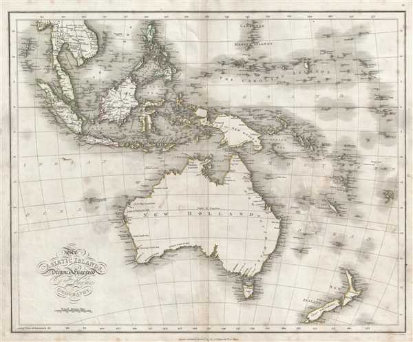
The Asiatic Islands.
sold
- Digital Map Information
- Suitable for large format printing
- DPI: 300
- File Size: 11.87 MB
- File Type: ZIP / TIFF
- ICC color profile embedded
- Delivered instantly via download link
This is an 1814 James Playfair map of the South Pacific, including Australia, New Zealand, Melanesia, Micronesia, and Indonesia. The map depicts from the Indochinese peninsula, the Philippines, and the Mariana Islands to Australia (New Holland) and New ... (more details)
One of the finest maps of Brooklyn to appear in the second half of the 19th century.
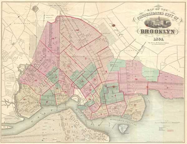
Map of the Consolidated City of Brooklyn.
sold
- Digital Map Information
- Suitable for large format printing
- File Size: 10.36 MB
- File Type: ZIP / TIFF
- ICC color profile embedded
- Delivered instantly via download link
This is an 1864 Henry McCloskey pocket map of the city of Brooklyn, New York. The map depicts from Newtown Creek to 59th Street and New Utrecht and from Ridgewood and the Cemetery of the Evergreens to the East River. In the mid-19th century, fueled by ... (more details)
Both Saint Simon's Island and Jekyl Island are celebrated for their fantastic beaches.

Preliminary Chart of St. Simon's Sound and Brunswick Harbor Georgia.
sold
- Digital Map Information
- Suitable for large format printing
- File Size: 7.5 MB
- File Type: ZIP / TIFF
- ICC color profile embedded
- Delivered instantly via download link
This is an 1857 U.S. Coast Survey maritime map or nautical chart of Brunswick Harbor and St. Simon's Sound, Georgia. The map depicts from Blythe Island to St. Simon's Island and Jekyl Island. Buzzard's Roost Island and Colonel's Island also are ... (more details)
From Portsmouth, Maine to Provincetown, Cape Cod, Massachusetts!
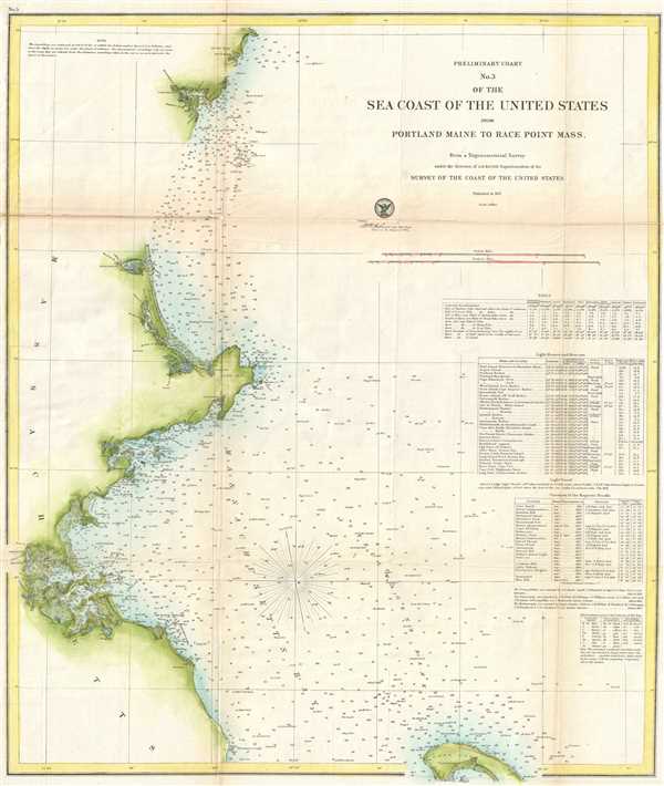
Preliminary Chart No. 3 of the Sea Coast of the United States from Portland Maine to Race Point Massachusetts.
sold
- Digital Map Information
- Suitable for large format printing
- File Size: 7.7 MB
- File Type: ZIP / TIFF
- ICC color profile embedded
- Delivered instantly via download link
This is an 1857 U.S. Coast Survey map or nautical chart of a northern section of the east coast of the United States. The map depicts from just north of Portsmouth, Maine to Dorchester, Massachusetts and from the coast out into Massachusetts Bay ... (more details)
The easternmost point in Georgia - and where the U.S. Air Force accidentally dropped a nuclear bomb.

Sketch E No. 5 Reconnaissance of the Entrance of Savannah River Georgia.
sold
- Digital Map Information
- Suitable for large format printing
- DPI: 300
- File Size: 4.35 MB
- File Type: ZIP / TIFF
- ICC color profile embedded
- Delivered instantly via download link
This is an 1851 U.S. Coast Survey map or nautical chart of the entrance of Savannah River in Georgia. The map depicts from Cockspur Island and Tybee Island to the Atlantic Ocean. Fort Pulaski, Tybee Beacon and the Tybee Lighthouse are ... (more details)
Navigational chart of Frying Pan Shoals - famous for its shipwrecks!

Sketch of Frying-Pan Shoals and Cape Fear River.
sold
- Digital Map Information
- Suitable for large format printing
- DPI: 300
- File Size: 4.4 MB
- File Type: ZIP / TIFF
- ICC color profile embedded
- Delivered instantly via download link
This is an1851 U. S. Coast Survey map or nautical chart of the Frying Pan Shoals and the Cape Fear River in North Carolina. It depicts from the Federal Point Lighthouse on the southern tip of Pleasure Island to the Frying Pan Shoals ... (more details)
A delightful mix between a view and a city plan - what a great map!
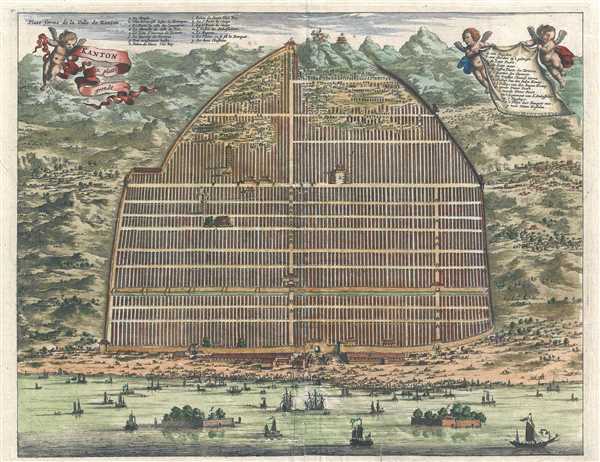
Kanton. In Platte Grondt. / Plate forme de la Ville de Kanton.
sold
- Digital Map Information
- Suitable for large format printing
- DPI: 300
- File Size: 6.31 MB
- File Type: ZIP / TIFF
- ICC color profile embedded
- Delivered instantly via download link
This is a hand colored c. 1670 Pieter van der Aa map or plan of Guangzhou, formerly romanized as Canton, China. Depicted as a hybrid between a view and a plan, the Zhujiang River traverses the bottom of the map, and the amount of ... (more details)
A view of post-Qing conquest Tianjin.
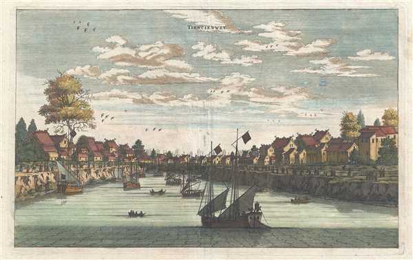
Tiencienwey.
sold
- Digital Map Information
- Suitable for large format printing
- DPI: 300
- File Size: 3.77 MB
- File Type: ZIP / TIFF
- ICC color profile embedded
- Delivered instantly via download link
This is a 1670 Pieter van der Aa map or view of Tianjin, formerly romanized as Tientsin or Tiencienwey, China. The main focal point is the river, which dominates the center of the piece. Traditional Chinese Junks, an ancient kind ... (more details)
Incredible view of Guangzhou only a few years after the Qing conquest.

Kanton.
sold
- Digital Map Information
- Suitable for large format printing
- DPI: 300
- File Size: 3.58 MB
- File Type: ZIP / TIFF
- ICC color profile embedded
- Delivered instantly via download link
This is a hand colored c. 1670 Pieter van der Aa map or view of Guangzhou, formerly romanized as Canton, China. Seen from the harbor on the Zhujiang River, Guangzhou's position as a major trading port is emphasized by the amount ... (more details)
One of the earliest obtainable European views of China.

Xaocheu ou Sucheu.
sold
- Digital Map Information
- Suitable for large format printing
- DPI: 300
- File Size: 3.61 MB
- File Type: ZIP / TIFF
- ICC color profile embedded
- Delivered instantly via download link
This is a hand colored c. 1670 Pieter van der Aa map or view of Suzhou, China. The map depicts Suzhou viewed from the Yangtze River. The city walls are easily distinguished, along with a tower on the banks of the river. ... (more details)
A popular summer camp destination!
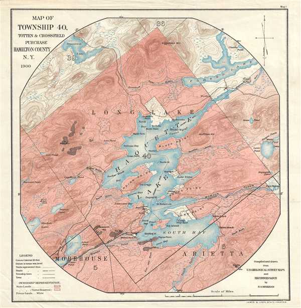
Map of Township 40, Totten and Crossfield Purchase. Hamilton County, N.Y.
sold
- Digital Map Information
- Suitable for large format printing
- File Size: 2.73 MB
- File Type: ZIP / TIFF
- ICC color profile embedded
- Delivered instantly via download link
This is a 1900 H.S. Meekham map of Raquette Lake in Hamilton County, New York. The map depicts Township 40 from its borders with Townships 39 and 36 to its borders with Townships 5 and 6 and from Township 41 and 5 to ... (more details)
Large attractive map of San Francisco.
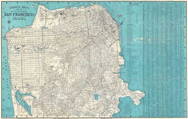
Thomas Bros Map of the City and County of San Francisco.
sold
- Digital Map Information
- Suitable for large format printing
- File Size: 20.46 MB
- File Type: ZIP / TIFF
- ICC color profile embedded
- Delivered instantly via download link
This is a 1952 pocket map or plan of the city of San Francisco by Thomas Bros. It depicts the city of San Francisco from the Golden Gate Bridge to Lake Merced and from the Pacific Ocean to Hunter's Point. Highly ... (more details)
A landmark - a great cartographical achievement … -Wheat
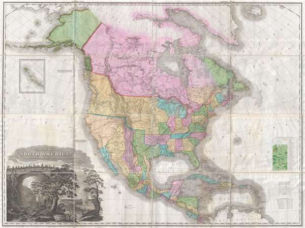
A Map of North America Constructed According to the Latest Information by H. S. Tanner.
sold
- Digital Map Information
- Suitable for large format printing
- DPI: 300
- File Size: 70.48 MB
- File Type: ZIP / TIFF
- ICC color profile embedded
- Delivered instantly via download link
An attractive example of Henry Schenk Tanner's remarkable 1825 landmark map of North America, considered to be the most important map of North America of the 19th century. Revolutionary in countless ways, this is ... (more details)
Rare map of Shanghai illustrating early development of Yangpu District.

最新大上海地圖 / The New Map of Great Shanghai. / Saishin dai Shanhai chizu.
sold
- Digital Map Information
- Suitable for large format printing
- File Size: 44.54 MB
- File Type: ZIP / TIFF
- ICC color profile embedded
- Delivered instantly via download link
This is a scarce 1940 Shōwa 15 Fusazō Sugie Japanese issue map of Shanghai, China. The map follows the course of the Hunagpu River from Baoshan and its convergence with the Yangtze south to, roughly, Dama ... (more details)
Bears manuscript field strategy notes relating to the 1932 January 28 Incident (Shanghai Incident).

上海閘北區地圖 / Map of Shanghai Zhabei District.
sold
- Digital Map Information
- Suitable for large format printing
- File Size: 45.45 MB
- File Type: ZIP / TIFF
- ICC color profile embedded
- Delivered instantly via download link
A rare and historically significant 1932 field commander's map of Zhabei District, Shanghai, with manuscript strategy annotations relating to the January 28th Incident of Shanghai Incident of 1932. The map ... (more details)