
The final state of the landmark Ebert-Gilpin map of Colorado.
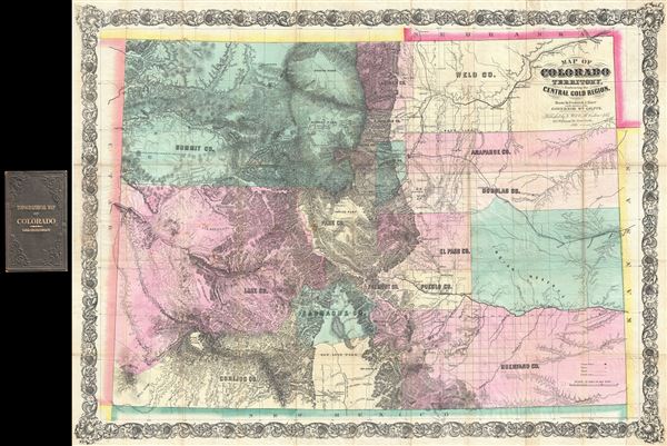
Map of Colorado Territory, Embracing the Central Gold Region.
sold
- Digital Map Information
- Suitable for large format printing
- File Size: 37.2 MB
- File Type: ZIP / TIFF
- ICC color profile embedded
- Delivered instantly via download link
An exceptional discovery, this is the 1870 Colton issue of the famous Ebert-Gilpin plan of Colorado. The Ebert-Gilpin Map, as it is commonly known, was first issued in 1862 and is considered to be the first commercially published map of Colorado Territory, a map ... (more details)
Rare map of North Carolina from the 2nd earliest American Atlas published.
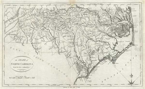
The State of North Carolina from the best Authorities.
sold
- Digital Map Information
- Suitable for large format printing
- Full resolution TIFF file
- ICC color profile embedded
- Delivered instantly via download link
A fine example of John Reid’s scarce and important 1796 map of North Carolina. The map covers roughly the territory of modern day North Carolina, running along the Atlantic coast from Currituck to Little River and inland as far as Buncombe County. Beautifully ... (more details)
The Carrigain Map' is the most important American map of New Hampshire ever published.

New Hampshire by Recent Survey Made Under the Supreme Authority and Published according to Law by Philip Carrigain Consellor at Law and late Secretary of the State. / New Hampshire To his Excellency Jon Taylor Gilman Esq. and to the Honourable the Legislature of the State of New Hampshire this Map commenced under their Auspices and matured by their Patronage is most respectfully inscribed by their Obliged Servant Philip Carrigain.
sold
- Digital Map Information
- Suitable for large format printing
- Full resolution TIFF file
- ICC color profile embedded
- Delivered instantly via download link
A scarce and monumental cartographic achievement, this is Philip Carrigain's 1816 map of New Hampshire. Carrigain's map is without a doubt the largest and most important specific map of New Hampshire ever published. This vast and beautifully produced map ... (more details)
Unusual map of the United States showing embossed relief.

Relief Model of United States.
sold
- Digital Map Information
- Suitable for large format printing
- File Size: 1.37 MB
- File Type: ZIP / TIFF
- ICC color profile embedded
- Delivered instantly via download link
This is an unusual 1911 embossed relief map of the United States issued by the Denoyer-Geppert Company. It covers the entire country including parts of Canada and Mexico. State boundaries are noted. The map also notes several important cities, rivers, lakes ... (more details)
Beautiful city plan of Paris, France.
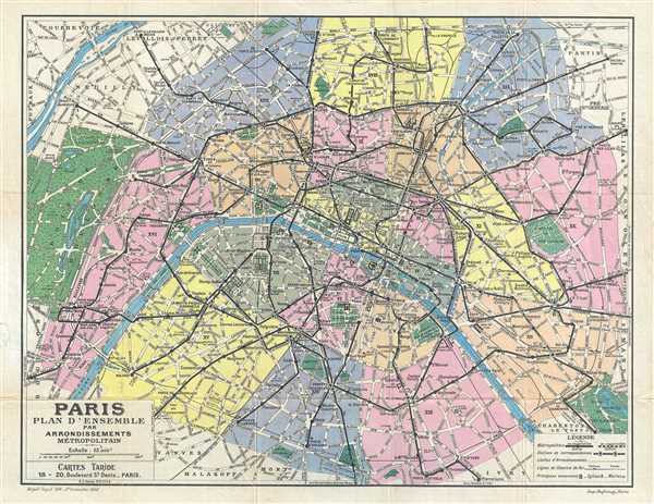
Paris Plan d'Ensemble par Arrondissements Metropolitain.
sold
- Digital Map Information
- Suitable for large format printing
- File Size: 7.8 MB
- File Type: ZIP / TIFF
- ICC color profile embedded
- Delivered instantly via download link
This is a beautiful 1947 Plan or Map of the city of Paris, France by the Taride firm. The map, centered on the Seine River, covers the heart of modern Paris from the Bois de Boulogne in the west to the Bois de Vincennes in the east. Although ostensibly ... (more details)
Exceptional map of Asia showing both East Sea and Sea of Korea.
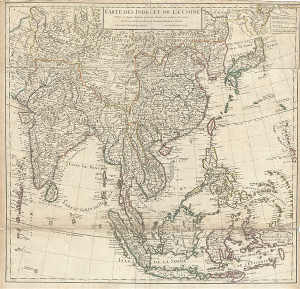
Carte des Indes et de la Chine.
sold
- Digital Map Information
- Suitable for large format printing
- DPI: 300
- File Size: 27.22 MB
- File Type: ZIP / TIFF
- ICC color profile embedded
- Delivered instantly via download link
An exceptional 1705 map of the East India Islands by Delisle. Centered on China, Delisle’s map covers from the Caspian Sea to the semi-mythical Terre de la Compagnie and India to New Guinea. It provides extraordinary detail throughout with topography ... (more details)
Plan of the city of Tiruchirapalli in Tamil Nadu, India during British rule.
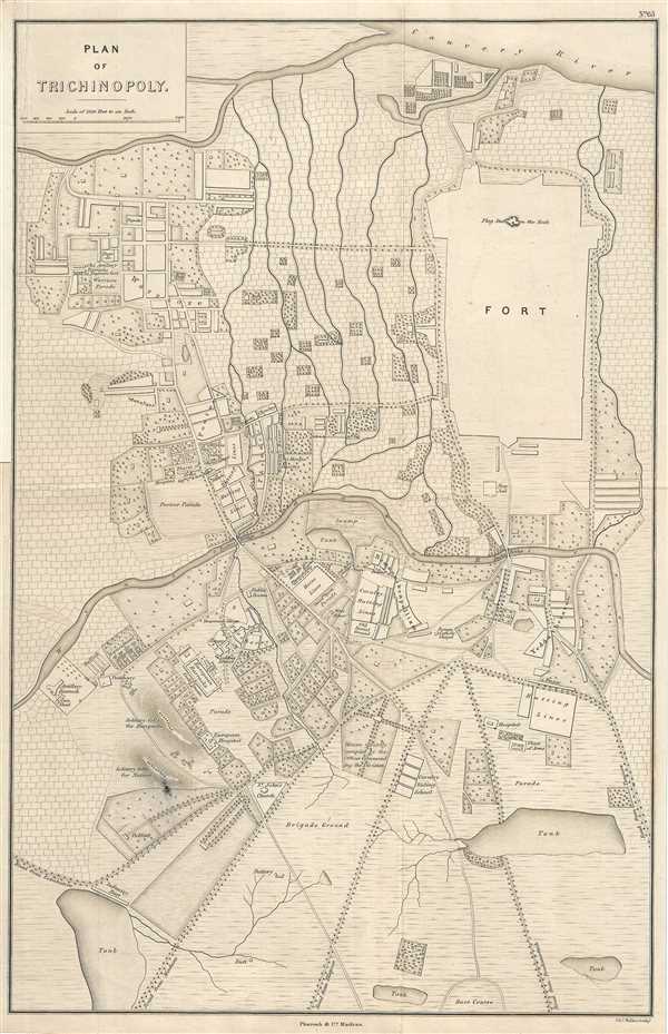
Plan of Trichinopoly.
sold
- Digital Map Information
- Suitable for large format printing
- DPI: 300
- File Size: 9.49 MB
- File Type: ZIP / TIFF
- ICC color profile embedded
- Delivered instantly via download link
This is an uncommon 1854 Pharoah and Company map of the city of Tiruchirapalli or Trichy in the Indian state of Tamil Nadu. Centered on the Uyyakondan Channel, it covers the capital city of the district of Trichinopoly, part of the Madras Presidency of ... (more details)
Beautiful Delisle map of southern South America depicting several explorer's discoveries.
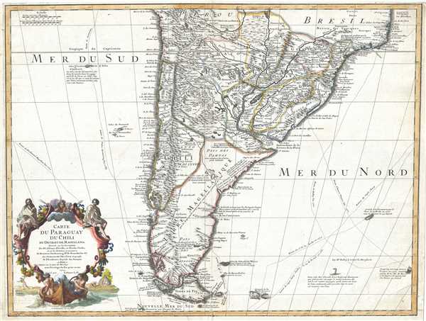
Carte du Paraguay du Chili du Detroit de Magellan etc.
sold
- Digital Map Information
- Suitable for large format printing
- DPI: 300
- File Size: 14.43 MB
- File Type: ZIP / TIFF
- ICC color profile embedded
- Delivered instantly via download link
This is an extraordinary example of Guillaume Delisle's magnificent 1703 map of southern South America. It covers roughly from 18 degrees south latitude south to Tierra del Fuego, and includes the modern day nations of Paraguay, Chile, Uruguay and ... (more details)
A beautiful wine map of Gironde locating vineyards.

Carte Vinicole du Departement de la Gironde.
sold
- Digital Map Information
- Suitable for large format printing
- File Size: 9.8 MB
- File Type: ZIP / TIFF
- ICC color profile embedded
- Delivered instantly via download link
This is a wonderful 1921 map of the Department of Gironde, France, published y Feret and Fils. It depicts the Gironde on a grand scale with color coding according to wine region and type. The map also notes several important towns, villages, ... (more details)
Beautiful map depicting the Bellari District of Karnataka, India.
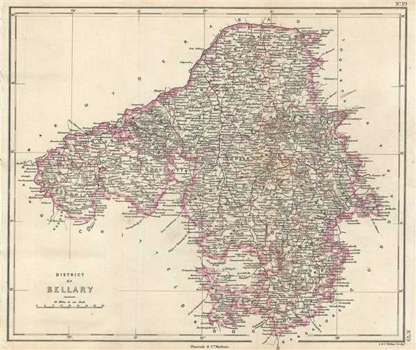
District of Bellary.
$250.00
Acquire
- Digital Map Information
- Suitable for large format printing
- DPI: 300
- File Size: 4.45 MB
- File Type: ZIP / TIFF
- ICC color profile embedded
- Delivered instantly via download link
This is an uncommon 1854 Pharoah and Company map of the district of Bellary in Karnataka, India. The map covers the district from Hyderabad south to Bangalore and from Dharwar east to Cuddapah. At the time this map was made the district was ... (more details)
Mitchell's plan of the city of Chicago, Illinois.
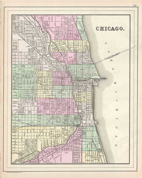
Chicago.
sold
- Digital Map Information
- Suitable for large format printing
- File Size: 5.2 MB
- File Type: ZIP / TIFF
- ICC color profile embedded
- Delivered instantly via download link
This hand colored map or plan of the city of Chicago dates to 1890 and was issued by the important American map publisher Samuel Augustus Mitchell, the younger. It covers from thirty first street northward to Fullerton Avenue. The map ... (more details)
Rare geographical card game complete and unplayed.

Game of Population No. 1110.
sold
Fireside Game Company (fl. 1895 -1900) of Cincinnati, Ohio was active from 1895 to 1900. During this period it issued 31 different card games, each numerically identified starting with, Strange People , game number 1100. With regard ... (more details)
Rare map showing existing and proposed Electrical Street Lights in Washington D.C. as of June o 1891.
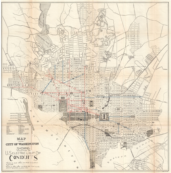
Map of the City of Washington Showing Location of U. S. Electric Light Cos. Conduits.
sold
- Digital Map Information
- Suitable for large format printing
- File Size: 16.57 MB
- File Type: ZIP / TIFF
- ICC color profile embedded
- Delivered instantly via download link
A fascinating 1891 map of Washington D.C. illustrating electrical conduit lines. This large map covers from the Rock Creek Cemetery to Haines Point and from Georgetown to the Anacostia River. City Blocks are identified numerically. ... (more details)
Rare oversized map of Washington D.C. showing early electrical wiring conduits.
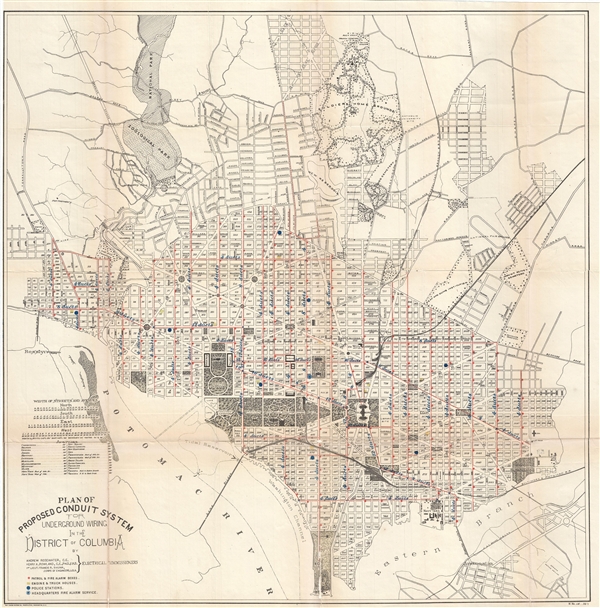
Plan of Proposed Conduit System for Underground Wiring in the District of Columbia.
sold
- Digital Map Information
- Suitable for large format printing
- File Size: 15.42 MB
- File Type: ZIP / TIFF
- ICC color profile embedded
- Delivered instantly via download link
A fascinating 1891 map of Washington D.C. illustrating electrical conduit lines. This large map covers from the Rock Creek Cemetery to Haines Point and from Georgetown to the Anacostia River. City Blocks are identified numerically. ... (more details)
Uncommon map of San Francisco by the artist Arthur Reichert.

Map of The City and County of San Francisco.
sold
- Digital Map Information
- Suitable for large format printing
- File Size: 8.14 MB
- File Type: ZIP / TIFF
- ICC color profile embedded
- Delivered instantly via download link
An unusual two-color 1917 map of San Francisco drawn by Arthur Reichert. The map was issued by J. Munsell Chase and sold by the Holmes Book Company of 152 Kerney Street and 70 Third Street, San Francisco. The map names all streets, ... (more details)
Attractive WWII era pictorial map of Washington D.C.
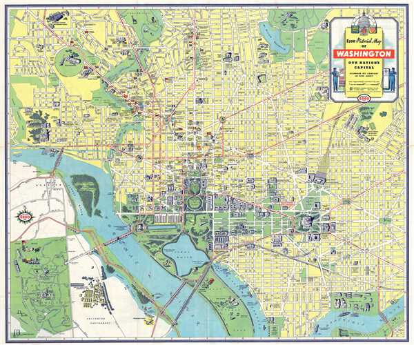
Esso Pictorial Map of Washington Our Nation's Capital.
sold
- Digital Map Information
- Suitable for large format printing
- File Size: 16.78 MB
- File Type: ZIP / TIFF
- ICC color profile embedded
- Delivered instantly via download link
This is a beautiful 1941 map or plan of Washington D.C. by the General Drafting Company. It covers the nation's capital from Arlington Cemetery and the Washington National Airport north to Soldiers' home (Armed Forces Retirement ... (more details)
City plan of Nairobi, Kenya's capital and largest city.
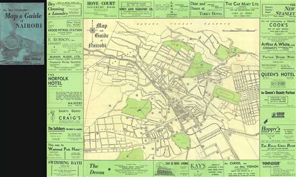
Map and Guide of Nairobi.
sold
- Digital Map Information
- Suitable for large format printing
- File Size: 13.1 MB
- File Type: ZIP / TIFF
- ICC color profile embedded
- Delivered instantly via download link
This is an uncommon map or plan of the city of Nairobi in Kenya, Africa. Surrounded by advertisements by local businesses, the map covers the capital city of Kenya from the Golf Course near Ngong Road north to the Karura Forest ... (more details)
Beautiful map of San Francisco made in the same year as the 1906 San Francisco Earthquake.
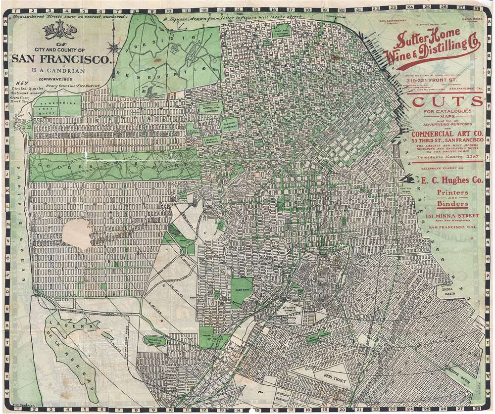
Map of City and County of San Francisco.
sold
- Digital Map Information
- Suitable for large format printing
- File Size: 12.57 MB
- File Type: ZIP / TIFF
- ICC color profile embedded
- Delivered instantly via download link
This is an appealing 1906 pocket map of San Francisco, California, by H. A. Candrian. Issued in the same year as the 1906 San Francisco earthquake which destroyed a majority of the city, this map covers from Presidio Park as ... (more details)
Large attractive map of San Francisco.
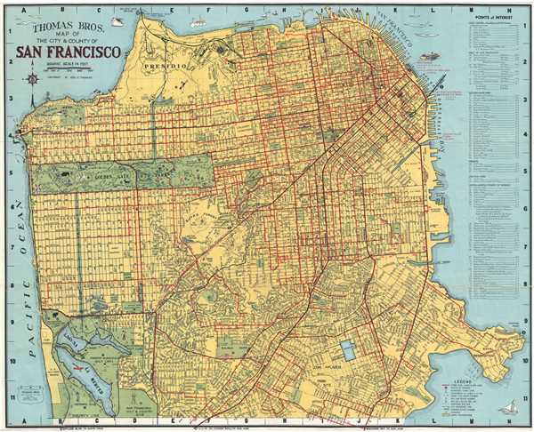
Thomas Bros. Map of The City and County of San Francisco.
sold
- Digital Map Information
- Suitable for large format printing
- File Size: 21.46 MB
- File Type: ZIP / TIFF
- ICC color profile embedded
- Delivered instantly via download link
This is a fine 1945 pocket map or plan of the city of San Francisco by Thomas Bros. It covers San Francisco City from Lake Merced in the south to the Golden Gate Bridge in the north and from Great Highway in the west to ... (more details)
Jansson's edition of Ortelius' map of Morocco.
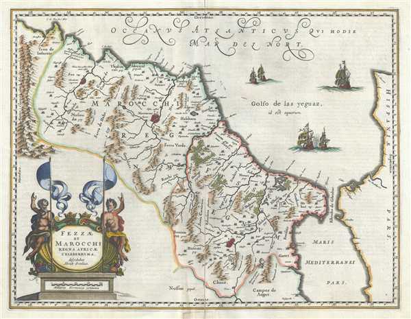
Fezzae et Marocchi Regna Africae Celeberrima.
sold
- Digital Map Information
- Suitable for large format printing
- Full resolution TIFF file
- ICC color profile embedded
- Delivered instantly via download link
This is a beautiful 1653 map of Morocco on the Barbary Coast of northern Africa by Jan Janssonius. Oriented with north on the right, the map covers Morocco and the Kingdom of Fez from the Atlas Mountains north to the ... (more details)