
19th century map of North Canara or Uttara Kannada in Karnataka, India.

District of North Canara.
sold
- Digital Map Information
- Suitable for large format printing
- DPI: 300
- File Size: 2.64 MB
- File Type: ZIP / TIFF
- ICC color profile embedded
- Delivered instantly via download link
This is an uncommon 1854 map of the District of North Canara or Uttara Kannada in Karnataka, India issued by the Pharoah and Company. It extends from Kundapur north as far as Haliyal and just north of the Supa Dam Reservoir. Notes important towns, roads, lakes, ... (more details)
Pharoah map of Coorg, Karnataka, India.

District of Coorg.
sold
- Digital Map Information
- Suitable for large format printing
- DPI: 300
- File Size: 2.02 MB
- File Type: ZIP / TIFF
- ICC color profile embedded
- Delivered instantly via download link
This is a beautiful 1854 map of the Coorg or Kodagu District in Karnataka India. Issued by Pharoah and Company, it covers the entire district with the capital Mercara or Madikeri identified. Notes important towns, roads, lakes, rivers and topography. The ... (more details)
Map of modern day Shimoga District and surroundings, Karnataka, India.
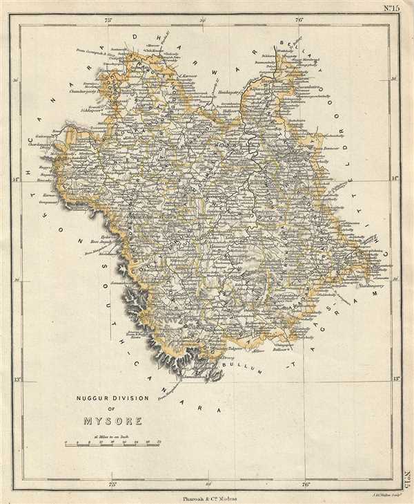
Nuggur Division of Mysore.
sold
- Digital Map Information
- Suitable for large format printing
- DPI: 300
- File Size: 2.98 MB
- File Type: ZIP / TIFF
- ICC color profile embedded
- Delivered instantly via download link
This is a lovely 1854 map of the Nuggur Division of Mysore by Pharoah and Company. It extends from Harihar south to Kudremukh and the Western Ghats and includes the city of Shimoga. Notes important towns, roads, lakes, rivers and topography. The Kingdom ... (more details)
Map of the Chittaldroog Division of Mysore Kingdom.
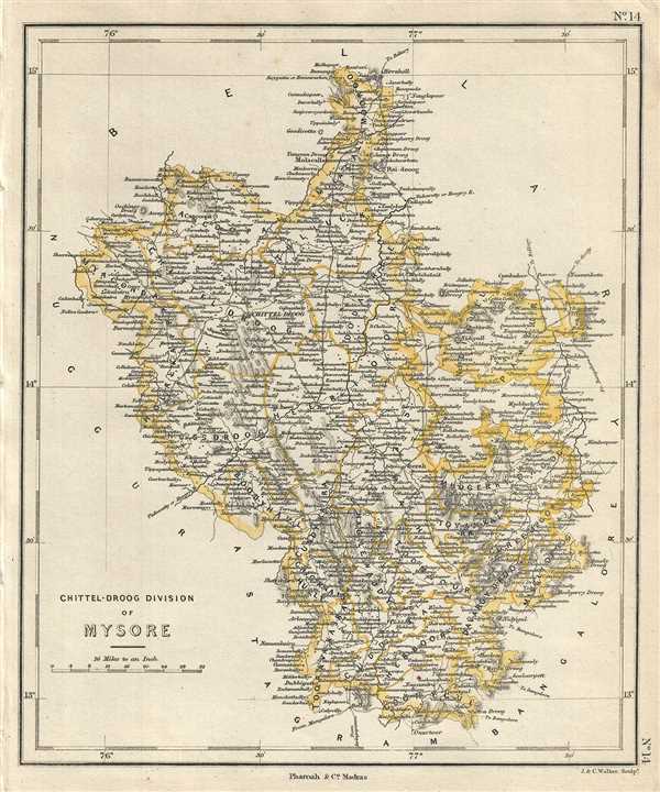
Chittel-Droog Division of Mysore.
sold
- Digital Map Information
- Suitable for large format printing
- DPI: 300
- File Size: 3.23 MB
- File Type: ZIP / TIFF
- ICC color profile embedded
- Delivered instantly via download link
This is a lovely 1854 map of the Chittaldroog Division of Mysore by Pharoah and Company. It extends from Kunigal to D. Hirehal near Ballari and includes the city of Chitel-Droog (Chitradurga). Notes important towns, roads, lakes, rivers and topography. ... (more details)
Map of the Bangalore Division of the Mysore Kingdom.
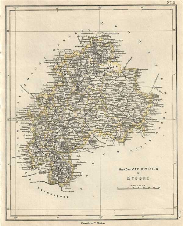
Bangalore Division of Mysore.
sold
- Digital Map Information
- Suitable for large format printing
- DPI: 300
- File Size: 2.96 MB
- File Type: ZIP / TIFF
- ICC color profile embedded
- Delivered instantly via download link
This is a lovely example of the 1854 Pharoah and Company map of the Bangalore Division of Mysore. It extends from the Cauvery River north to Mohammadabad and notes important towns, roads, lakes, rivers and topography. Bangalore city is identified. The ... (more details)
Map of the Ashtagram Division of Mysore - former Patna Ashtagram and Maisur Ashtagram.
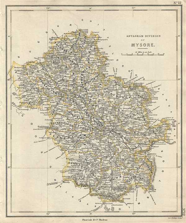
Astagram Division of Mysore.
sold
- Digital Map Information
- Suitable for large format printing
- DPI: 300
- File Size: 3.22 MB
- File Type: ZIP / TIFF
- ICC color profile embedded
- Delivered instantly via download link
This is a nice 1854 example of the Pharoah and Company map of the Astagram Division of Mysore. It covers from Bandipur north to Haranhalli and notes important towns, roads, lakes, rivers and topography. Mysore city is identified. The Kingdom of Mysore ... (more details)
Map of South Arcot including Puducherry and Fort St. David.
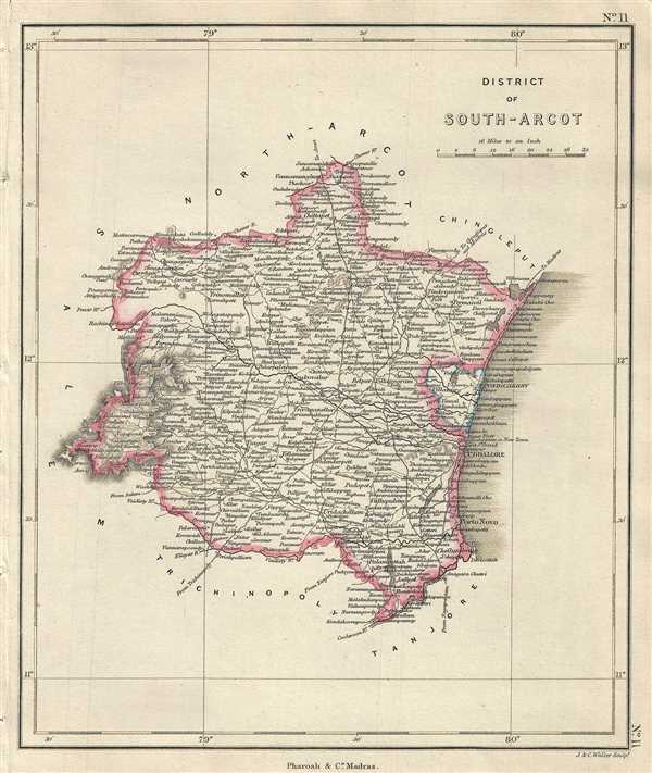
District of South-Arcot.
sold
- Digital Map Information
- Suitable for large format printing
- DPI: 300
- File Size: 2.66 MB
- File Type: ZIP / TIFF
- ICC color profile embedded
- Delivered instantly via download link
This is an example of the 1854 Pharoah and Company map of the South Arcot district in Tamil Nadu, India. It extends from the Kollidam River north to Chetpet and the Cheyyar River and includes Pondicherry or Puducherry. Includes important towns, roads, ... (more details)
Map of the North-Arcot district notes the town of Tirupati, one of the holiest sites in the Hindu religion.
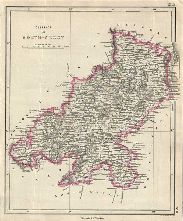
District of North-Arcot.
$250.00
Acquire
- Digital Map Information
- Suitable for large format printing
- DPI: 300
- File Size: 2.97 MB
- File Type: ZIP / TIFF
- ICC color profile embedded
- Delivered instantly via download link
This is an 1854 map of the district of North Arcot in Tamil Nadu, India. Issued by Pharoah and Company, it covers from Vandavasi north to Mettu and the Swarnamukhi River in the modern day state of Andhra Pradesh. Includes important towns, roads, ... (more details)
Uncommon map of the Salem District of Tamil Nadu, India.
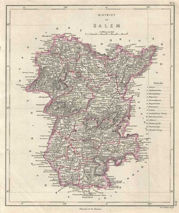
District of Salem.
sold
- Digital Map Information
- Suitable for large format printing
- DPI: 300
- File Size: 3.3 MB
- File Type: ZIP / TIFF
- ICC color profile embedded
- Delivered instantly via download link
This is an uncommon 1854 map of the district of Salem in Tamil Nadu, India. The map is issued by Pharoah and Company and covers from the Cauvery River north to Vaniyambadi. Includes important towns, roads, lakes, rivers and topography. The ... (more details)
Map of the Coimbatore District under the British East India Company.
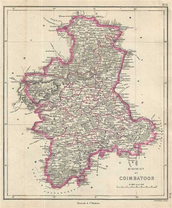
District of Coimbatoor.
sold
- Digital Map Information
- Suitable for large format printing
- DPI: 300
- File Size: 3.09 MB
- File Type: ZIP / TIFF
- ICC color profile embedded
- Delivered instantly via download link
This is a lovely 1854 map of the district of Coimbatore in the modern day state of Tamil Badu, India. Issued by Pharoah and Company, it covers from Ootakamund (Ooty) to Caroor (Karur) and from Shivanasamudra south to Sholayar Dam City. ... (more details)
Map of the states of Cochin and Travancore in British India.

Travancore and Cochin States.
sold
- Digital Map Information
- Suitable for large format printing
- DPI: 300
- File Size: 3.03 MB
- File Type: ZIP / TIFF
- ICC color profile embedded
- Delivered instantly via download link
This is an uncommon 1854 map of the Travancore and Cochin States in the modern day state of Kerala, India. Issued by Pharoah and Company, it covers from Cape Cormorin (Kanyakumari) north along the western coast to Ponany (Ponnani). ... (more details)
Europe in Aruthurian times.
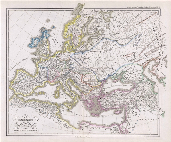
Europa im Anfange des VI Jahruhundert's.
sold
- Digital Map Information
- Suitable for large format printing
- DPI: 300
- File Size: 3.82 MB
- File Type: ZIP / TIFF
- ICC color profile embedded
- Delivered instantly via download link
This is Karl von Spruner’s 1854 map of Europe at the end of the 5th and the beginning of the 6th century. The map covers all of Europe as it appeared in the dark years following the fall of the Roman Empire. The whole is ... (more details)
Mostly likely the finest commercially published Civil War Era map of the Mississippi River.
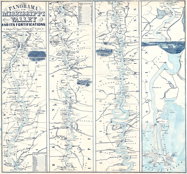
Panorama Of The Mississippi Valley And Its Fortifications.
sold
- Digital Map Information
- Suitable for large format printing
- File Size: 6.28 MB
- File Type: ZIP / TIFF
- ICC color profile embedded
- Delivered instantly via download link
An exceptionally scarce 1863 Charles Magnus Civil War era broadside map of the Mississippi River valley from St. Louis to the Delta of the Mississippi. This map, or as it is called 'panorama', is presented in strip format ... (more details)
Map of the Trichinopoly district in British India.
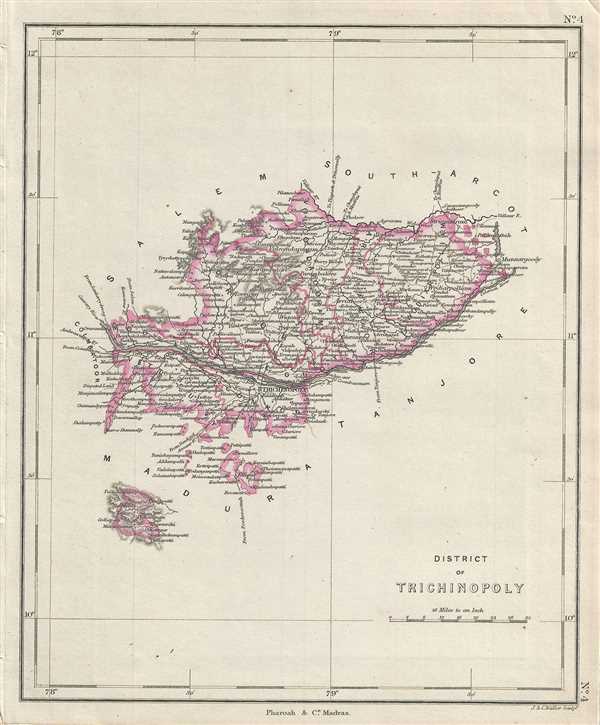
District of Trichinopoly.
$250.00
Acquire
- Digital Map Information
- Suitable for large format printing
- DPI: 300
- File Size: 2.3 MB
- File Type: ZIP / TIFF
- ICC color profile embedded
- Delivered instantly via download link
This is a nice example of the 1854 map of the District of Trichinopoly in the modern day state of Tamil Nadu, India, issued by Pharoah and Company. It covers from Karur east to Chidambaram. Includes important towns, roads, ... (more details)
Beautiful map of the Tajore district in Tamil Nadu, India, home of the Tanjore paintings.
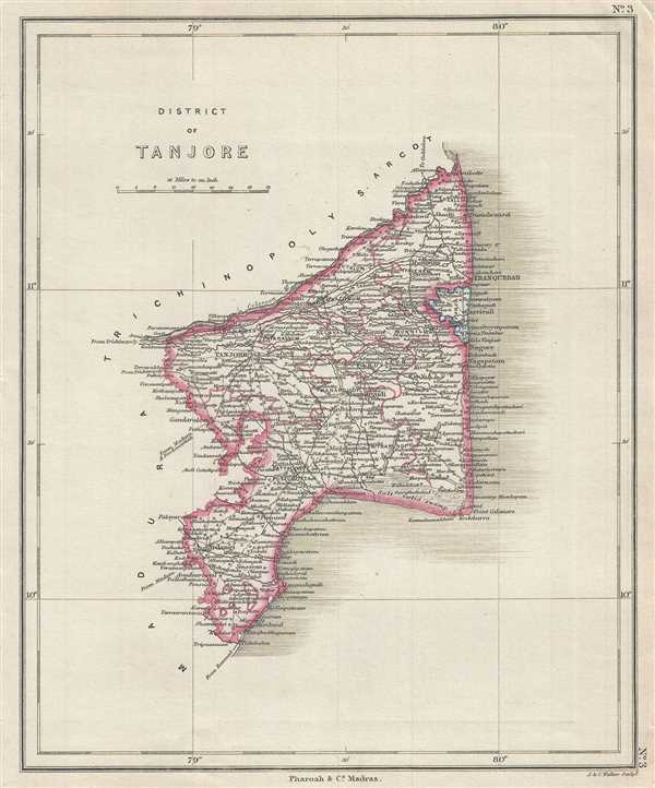
District of Tanjore.
$250.00
Acquire
- Digital Map Information
- Suitable for large format printing
- DPI: 300
- File Size: 2.55 MB
- File Type: ZIP / TIFF
- ICC color profile embedded
- Delivered instantly via download link
This is a nice example of the 1854 map of the District of Tanjore in the modern day state of Tamil Nadu, India, issued by Pharoah and Company. It covers from Mimbesel (Mimisal) north to Pazhaiyar or the entrance of the ... (more details)
District of Madura in British India, home of the historic Meenakshi Amman Temple and Thirumali Nayak Palace, Madurai, Tamil Nadu.

District of Madura.
sold
- Digital Map Information
- Suitable for large format printing
- DPI: 300
- File Size: 3.56 MB
- File Type: ZIP / TIFF
- ICC color profile embedded
- Delivered instantly via download link
This is an lovely 1854 map of the District of Madura in the modern day state of Tamil Nadu, India, issued by Pharoah and Company. It depicts the district from Shorungoody (Surangudi) north to Coimbatore District. ... (more details)
Pharoah map depicting part of the state of Tamil Nadu, India.
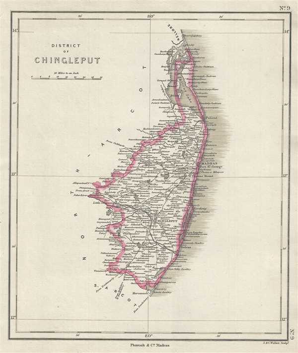
District of Chingleput.
$250.00
Acquire
- Digital Map Information
- Suitable for large format printing
- DPI: 300
- File Size: 2.3 MB
- File Type: ZIP / TIFF
- ICC color profile embedded
- Delivered instantly via download link
This is an interesting 1854 map of the District of Chingleput in the modern day state of Tamil Nadu, India, issued by Pharoah and Company. It depicts the district from the Pulicat Lake south to Marcanum ... (more details)
Map of the southern part of Tamil Nadu, India.
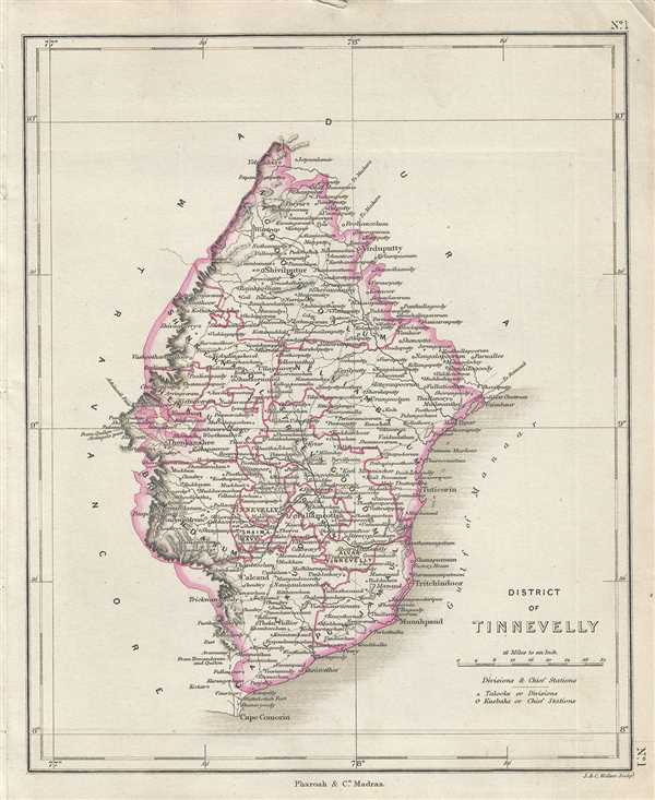
District of Tinnevelly.
sold
- Digital Map Information
- Suitable for large format printing
- Full resolution TIFF file
- ICC color profile embedded
- Delivered instantly via download link
This is an interesting 1854 map of the District of Tinnevelly in the modern day state of Tamil Nadu, India, issued by Pharoah and Company. It depicts the district from Cape Comorin (Kanyakumari) north ... (more details)
Map of the Malabar District on British India

District of Malabar.
sold
- Digital Map Information
- Suitable for large format printing
- DPI: 300
- File Size: 2.72 MB
- File Type: ZIP / TIFF
- ICC color profile embedded
- Delivered instantly via download link
This is an uncommon 1854 map of the District of Malabar in the modern day state of Kerala, India, issued by Pharoah and Company. It depicts the district from Cannanore (Kunnur) south to Cochin ... (more details)
Large folding map of Central Park

Map of the Central Park Showing the progress of the Work on January 1st 1866.
sold
- Digital Map Information
- Suitable for large format printing
- File Size: 9.94 MB
- File Type: ZIP / TIFF
- ICC color profile embedded
- Delivered instantly via download link
An altogether extraordinary hand colored map of New York City's Central Park prepared and printed for inclusion in the Tenth Annual Report of the Board of Commissioners of the Central Park . ... (more details)