

Boston Harbor.
sold
- Digital Map Information
- Suitable for large format printing
- Full resolution TIFF file
- ICC color profile embedded
- Delivered instantly via download link
This is an uncommon 1925 example of a George H. Walker's aquatint view of Boston Harbor. Centered on South Boston, the view covers Boston Harbor from East Boston and Nahant eastward as far as Squantum and Slate Island. The bustling harbor is shows full of ships and ... (more details)
A fun New York City cartographic curiosity.

The Regal Shoe.
sold
- Digital Map Information
- Suitable for large format printing
- File Size: 4.11 MB
- File Type: ZIP / TIFF
- ICC color profile embedded
- Delivered instantly via download link
A fun cartographic curiosity, this is an 1898 shoe advertisement set against and backdrop of New York City. The view, prepared in 1897 by Moses King, has here been coopted to demonstrate the prosperity of the Regal Shoe Company. The caption describes how, if all ... (more details)
One of Fred Rose's most iconic Serio-Comic caricature maps.
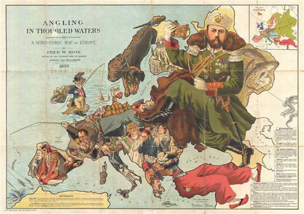
Angling in Troubled Waters A Serio-Comic Map of Europe by Fred. W. Rose Author of the 'Octopus Map of Europe'
sold
- Digital Map Information
- Suitable for large format printing
- File Size: 21.89 MB
- File Type: ZIP / TIFF
- ICC color profile embedded
- Delivered instantly via download link
One of Frederick W. Rose's most iconic caricature or satirical maps, this is the 1899 Angling in Troubled Waters . The map presupposes that the reader will recognize the familiar shape of Europe and its constituent nations, which have here been replaced by ... (more details)
Rare map detailing 'All-American' route to the Klondike Gold Fields.
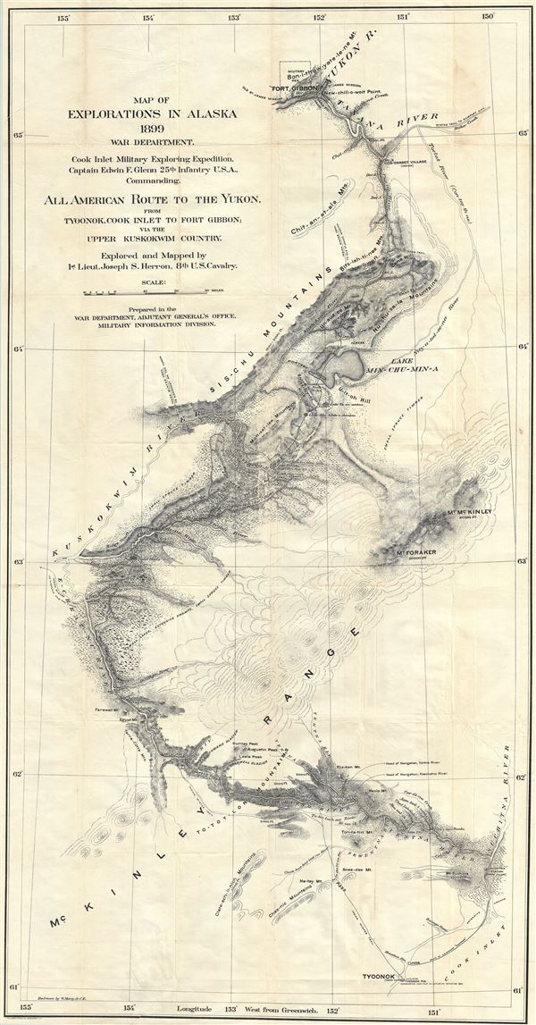
Map of explorations in Alaska, 1899 : all American route to the Yukon from Tyoonok, Cook Inlet to Fort Gibbon via the Upper Kuskokwim Country.
sold
- Digital Map Information
- Suitable for large format printing
- File Size: 37.72 MB
- File Type: ZIP / TIFF
- ICC color profile embedded
- Delivered instantly via download link
An extremely scarce 1899 Yukon Gold Rush map exhibiting an overland river route from Tyoonok, on Alaska's Cook Inlet to Fort Gibbon as mapped by Joseph S. Herron and the Cook Inlet Exploring Expedition, commanded by Captain Edwin F. Glenn. The route ... (more details)

Plan de Paris Monumental. Nouveau Plan de Paris.
sold
- Digital Map Information
- Suitable for large format printing
- Full resolution TIFF file
- ICC color profile embedded
- Delivered instantly via download link
This is a scarce 1903 tourist pocket map of Paris, France. It covers the old walled city of Paris and its immediate vicinity. It reflects the transformation and modernization of Paris under Napoleon III and Georges-Eugene Haussmann. Major streets, ... (more details)
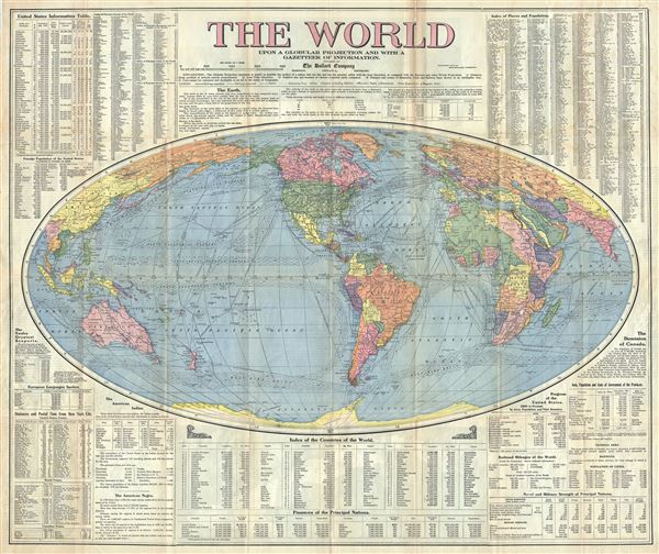
The World Upon a Globular Projection and with a Gazatteer of Information.
sold
- Digital Map Information
- Suitable for large format printing
- Full resolution TIFF file
- ICC color profile embedded
- Delivered instantly via download link
This is a large 1910 Bullard Company Gazetteer map of the World. Centered on North America and South America, it covers the entire world on a globular projection. The map is highly detailed, noting numerous cities, towns, islands, railways, rivers, ... (more details)
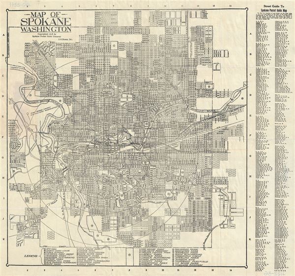
Map of Spokane Washington.
sold
- Digital Map Information
- Suitable for large format printing
- Full resolution TIFF file
- ICC color profile embedded
- Delivered instantly via download link
This is a 1915 map or city plan of Spokane, Washington by D. M. Faires. It covers the city of Spokane and vicinity. Shows the Spokane River passing through the city. The map is highly detailed, noting individual streets, bridges, cemeteries, etc. ... (more details)
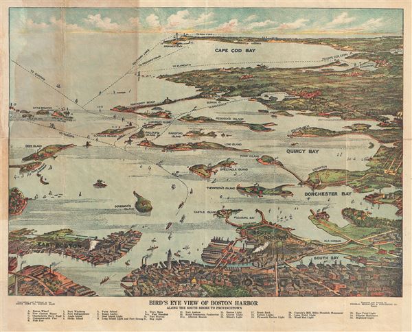
Bird's Eye View of Boston Harbor Along the South Shore to Provincetown.
sold
- Digital Map Information
- Suitable for large format printing
- File Size: 14.05 MB
- File Type: ZIP / TIFF
- ICC color profile embedded
- Delivered instantly via download link
This is a remarkable 1920 chromolithograph map and view of the Boston Harbor from Boston to Provincetown. It covers all of Cape Cod Bay, Quincy Bay and Dorchester Bay with the communities of Boston, east Boston, south Boston, Dorchester, Quincy, ... (more details)

Plan de Paris des Magasins du Bon Marche.
sold
- Digital Map Information
- Suitable for large format printing
- Full resolution TIFF file
- ICC color profile embedded
- Delivered instantly via download link
This is an attractive decorative c.1893 map of Paris, France intended to promote the Magasins du Bon Marche . Centered on the Seine, this map covers the embastilled center of Paris showing all major roads, monuments, rail lines, bridges, and ... (more details)
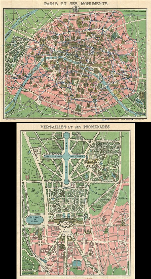
Paris et ses Monuments.
sold
- Digital Map Information
- Suitable for large format printing
- Full resolution TIFF file
- ICC color profile embedded
- Delivered instantly via download link
This is an extremely attractive c.1925 tourist pocket map of Paris, France. It covers the old walled city of Paris and the immediate vicinity. Drawn in a lavish art deco style with important buildings shown in profile, including the Eiffel ... (more details)
Uncommon Geological Survey Map of Martha's Vineyard and Nantucket.
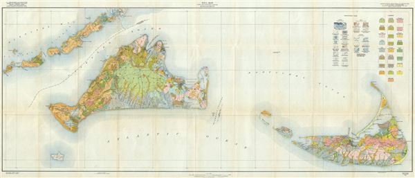
Soil Map Dukes and Nantucket Counties Massachusetts.
sold
- Digital Map Information
- Suitable for large format printing
- File Size: 32.37 MB
- File Type: ZIP / TIFF
- ICC color profile embedded
- Delivered instantly via download link
An uncommon 1925 geological map of Martha's Vineyard and Nantucket, Massachusetts. It also extends to include Wood's Hole and the Elizabeth Islands. Based on surveys completed by the U.S. Geological Survey, this map was compiled, ... (more details)
Uncommon Geological Survey Map of Martha's Vineyard and Nantucket.

Soil Map Dukes and Nantucket Counties Massachusetts.
sold
- Digital Map Information
- Suitable for large format printing
- Full resolution TIFF file
- ICC color profile embedded
- Delivered instantly via download link
An uncommon 1925 geological map of Martha's Vineyard and Nantucket, Massachusetts. It also extends to include Wood's Hole and the Elizabeth Islands. Based on surveys completed by the U.S. Geological Survey, this map was compiled, ... (more details)

Indexed Map of Boston.
sold
- Digital Map Information
- Suitable for large format printing
- File Size: 22.66 MB
- File Type: ZIP / TIFF
- ICC color profile embedded
- Delivered instantly via download link
This is a beautiful c.1925 map or plan of the city of Boston, Massachusetts and its surroundings, by the Walker Lith. and Pub. Co. It covers the city and suburbs of Boston from Forest Hills and Franklin Field north to Charleston ... (more details)

Philips' Clear Print Popular Plan on London.
sold
- Digital Map Information
- Suitable for large format printing
- Full resolution TIFF file
- ICC color profile embedded
- Delivered instantly via download link
This is a beautiful c.1930 map or plan of London, England by George Philip and Sons. It covers from Acton Park east to West India Docks and from Hackney Downs south as far as Clapham Common. The map is exceptionally detailed, ... (more details)

Korea.
sold
- Digital Map Information
- Suitable for large format printing
- File Size: 25.35 MB
- File Type: ZIP / TIFF
- ICC color profile embedded
- Delivered instantly via download link
This is a scarce c.1930 Japanese map of Korea (Corea). The map covers all of peninsular Korea including North Korea and South Korea. It notes several geographical and topographical features details including shipping lines, ... (more details)
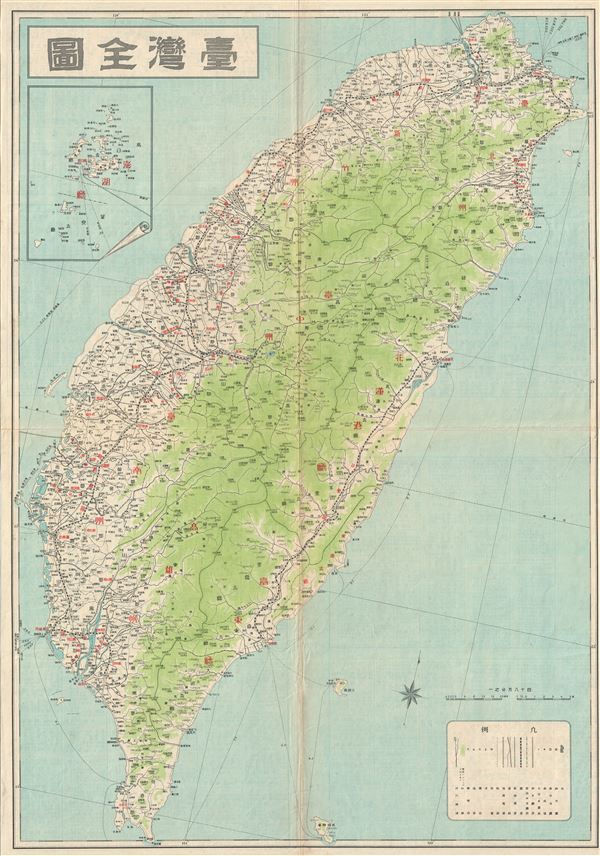
Taiwan.
sold
- Digital Map Information
- Suitable for large format printing
- File Size: 18.09 MB
- File Type: ZIP / TIFF
- ICC color profile embedded
- Delivered instantly via download link
This is a beautiful c.1930 Japanese map of Taiwan or Formosa. It covers the entire island and notes cities, towns, rivers, roads, railways, shipping lines and a host of additional topographical features. An inset of Penghu ... (more details)
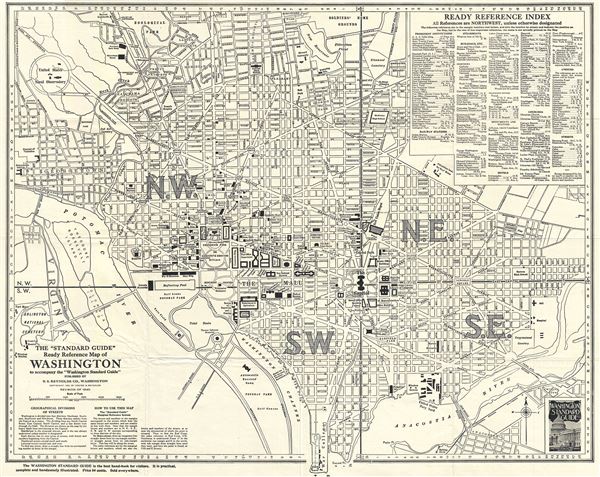
The 'Standard Guide' Ready Reference Map of Washington to accompany the 'Washington Standard Guide'.
sold
- Digital Map Information
- Suitable for large format printing
- Full resolution TIFF file
- ICC color profile embedded
- Delivered instantly via download link
This is an appealing 1940 map or plan of Washington D.C. by the Foster and Reynolds Company of Washington. It covers Washington D.C. from the Arlington National Cemetery eastward as far as 28th Street and the Congressional ... (more details)
Post WWII pictorial map of London celebrating the British fighting spirit.

London The Baston of Liberty.
sold
- Digital Map Information
- Suitable for large format printing
- File Size: 56.58 MB
- File Type: ZIP / TIFF
- ICC color profile embedded
- Delivered instantly via download link
An enormous and remarkable Lee Kerry pictorial map of London drawn to celebrate the rebuilding of that city following the destruction of World War II. The map honors the British fighting spirit with Winston Churchill's ... (more details)
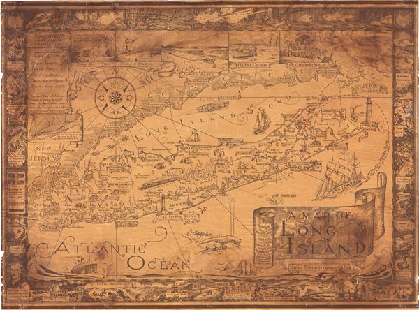
A Map of Long Island.
sold
- Digital Map Information
- Suitable for large format printing
- Full resolution TIFF file
- ICC color profile embedded
- Delivered instantly via download link
This is a charming 1961 pictorial map of Long Island by Courtland Smith. This historical map covers from New London in Connecticut and Fishers Island south as far as the Lower New York Bay and Staten Island. Long Island ... (more details)
An iconic American World War II propaganda broadside map 'targeting' Berlin, then the capital of the Third Reich.
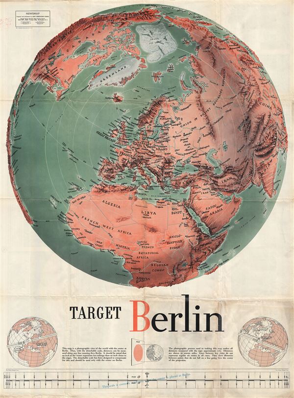
Target Berlin / Newsmap. Monday, October 25, 1943, Vol. II No. 27
sold
- Digital Map Information
- Suitable for large format printing
- File Size: 73.87 MB
- File Type: ZIP / TIFF
- ICC color profile embedded
- Delivered instantly via download link
One of the most iconic American World War II propaganda maps, this is F. E Manning's 1943 propaganda broadside map 'Target Berlin.' The focus of the broadside is a dramatic shaded panoptic view centered on Berlin, then ... (more details)