
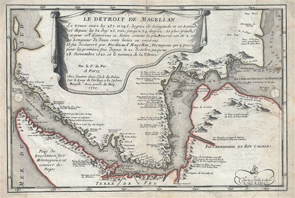
Le Detroit de Magellan.
sold
- Digital Map Information
- Suitable for large format printing
- Full resolution TIFF file
- ICC color profile embedded
- Delivered instantly via download link
This is a scarce 1700 map of the Straits of Magellan, South America by Nicholas De Fer. It covers the important strait located at the southern tip of the South American mainland, just north of Tierra del Fuego. The map renders the region in detail, noting the ... (more details)
Prepared to capitalize on British civilian interest in the First Boer War.
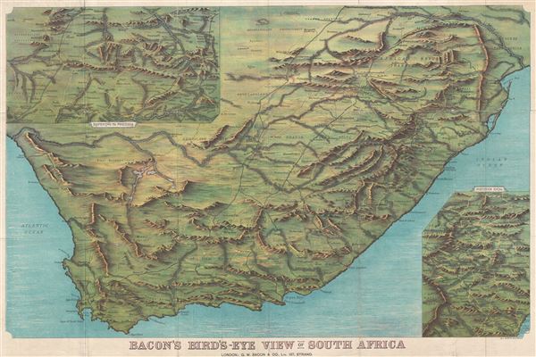
Bacon's Bird's-Eye View of South Africa.
sold
- Digital Map Information
- Suitable for large format printing
- File Size: 47.46 MB
- File Type: ZIP / TIFF
- ICC color profile embedded
- Delivered instantly via download link
An impressive c. 1890 chromolithograph view and map of South Africa extending from the Limpopo River to Cape Agulhas and from the Atlantic to the Indian Oceans. The view details roadways, rivers, towns and cities, rivers, mountains, and other political and ... (more details)
Possibly the most detailed single map of European Russia to appear in the early 19th century.
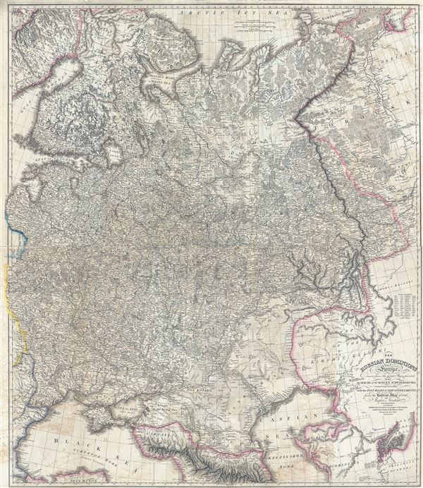
The Russian Dominions in Europe, drawn from the latest Maps, printed by the Academy of Sciences, St. Petersburg; revised and corrected, with the Post Roads & New Governments, from the Russian Atlas of 1806.
sold
- Digital Map Information
- Suitable for large format printing
- DPI: 300
- File Size: 62.38 MB
- File Type: ZIP / TIFF
- ICC color profile embedded
- Delivered instantly via download link
A remarkable large format map first edition 1808 map of Russia by Jaspar Nantiat and William Faden. This exceptional map covers from the Artic Sea to the Black and Caspian Seas and from East Prussia and Moldova to the Aral Sea and Tobolsk. In addition to ... (more details)
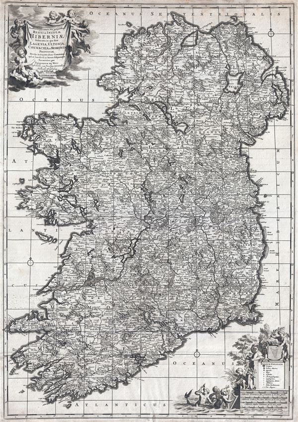
Novissima ac prae caeteris alus accuratissima Regni et Insulae Hiberniae delineatio in qua sunt Lagenia, Ultonia, Connachia et Momonia Provinciae divisae in triginta duos Comitatus qui et sunt divisi in omnes subjacentes Baronnatus.
sold
- Digital Map Information
- Suitable for large format printing
- DPI: 300
- File Size: 24.73 MB
- File Type: ZIP / TIFF
- ICC color profile embedded
- Delivered instantly via download link
An uncommon large format map of Ireland by Frederik de Witt. This is the c. 1721 Covens and Mortier edition of a map originally issued in 1690. The map covers the entirety of insular Ireland in considerable detail. Counties, roadways, rivers, swamps, ... (more details)
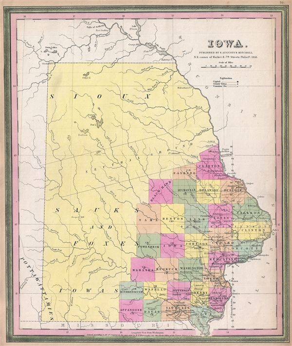
Iowa.
sold
- Digital Map Information
- Suitable for large format printing
- DPI: 300
- File Size: 5.96 MB
- File Type: ZIP / TIFF
- ICC color profile embedded
- Delivered instantly via download link
A scarce first edition example of S. A. Mitchell and H. N Burrough's 1846 map of Iowa. This map was prepared by H.N. Burroughs as plate no. 16 in the 1846 edition of Mitchell's New General Atlas . The map covers all of modern day Iowa though county ... (more details)
Rare first edition of Mitchell's map of Philadelphia.

Philadelphia.
sold
- Digital Map Information
- Suitable for large format printing
- DPI: 300
- File Size: 8.33 MB
- File Type: ZIP / TIFF
- ICC color profile embedded
- Delivered instantly via download link
This is a scarce first edition example of S. A. Mitchell and H. N. Burrough's 1846 plan or map of Philadelphia, Pennsylvania. This hand colored lithographic engraving depicts the city of Philadelphia in superb detail at the street level including ... (more details)
Rare first edition of Mitchell's map of Virginia.
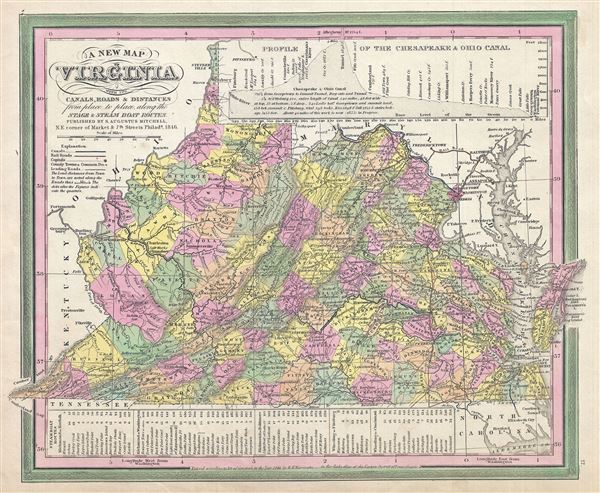
A New Map of Virginia with its Canals, Roads and Distances from place to place, along the Stage and Steam Boat Routes.
sold
- Digital Map Information
- Suitable for large format printing
- DPI: 300
- File Size: 7.38 MB
- File Type: ZIP / TIFF
- ICC color profile embedded
- Delivered instantly via download link
This is a scarce first edition example of S. A. Mitchell and H. N. Burrough's 1846 map of Virginia, including West Virginia. This hand colored lithographic map predates the 1862 separation of Virginia and West Virginia, and so contains both ... (more details)
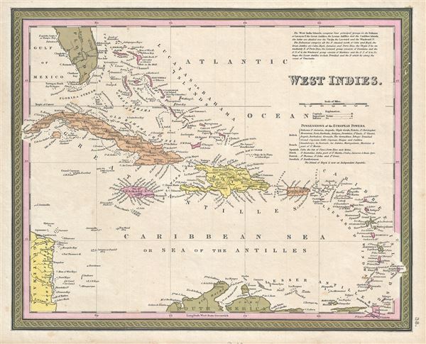
West Indies.
sold
- Digital Map Information
- Suitable for large format printing
- DPI: 300
- File Size: 5.48 MB
- File Type: ZIP / TIFF
- ICC color profile embedded
- Delivered instantly via download link
This is a fine example of Thomas Cowperthwait and S. A. Mitchell's 1850 map of the West Indies. It covers from Florida and the Bahamas south through the Caribbean islands of Cuba and Hispaniola (Haiti & the Dominican Republic) to the ... (more details)

Sclovonia Croatia Bosnia cum Dalmatiae Parte.
sold
- Digital Map Information
- Suitable for large format printing
- Full resolution TIFF file
- ICC color profile embedded
- Delivered instantly via download link
This is a scarce map of Croatia, Slovenia, Serbia and Bosnia and Herzegovina by Gerard Mercator dating to c.1628. It covers the western part of the Balkans from Varazdin, Croatia south to Brac and from the Adriatic Sea and Arbe east ... (more details)
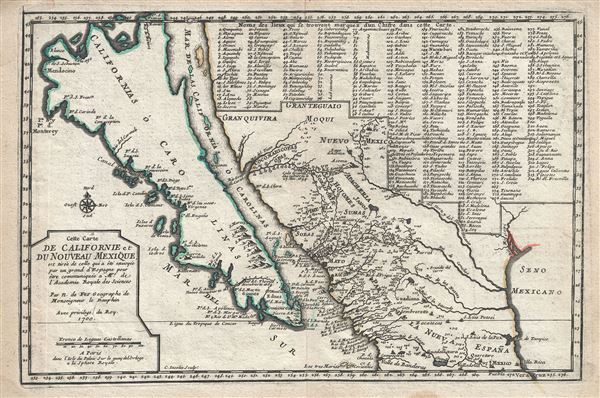
Cette Carte de Californie et du Nouveau .
sold
- Digital Map Information
- Suitable for large format printing
- Full resolution TIFF file
- ICC color profile embedded
- Delivered instantly via download link
A landmark 1700 map showing California as an island and the first published dissemination of Fr. Eusebio Frabcusci Kino's groundbreaking explorations in New Mexico and California. Drawn by Nicolas de Fer, official Geographe de ... (more details)
Rare first edition of Mitchell's map of Washington D.C.

City of Washington.
sold
- Digital Map Information
- Suitable for large format printing
- DPI: 300
- File Size: 6.5 MB
- File Type: ZIP / TIFF
- ICC color profile embedded
- Delivered instantly via download link
A scarce first edition example of S. A. Mitchell and H. N Borrough's 1846 map or plan of Washington D.C. Given that most of Washington D.C. was under construction when this map was drawn, Mitchell's plan is a remarkable ... (more details)
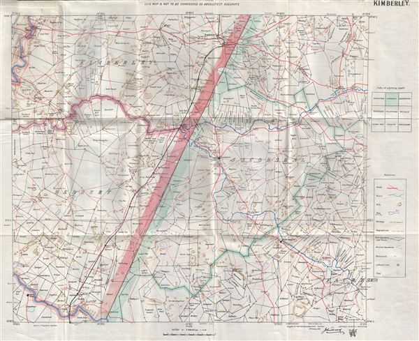
Kimberley.
sold
- Digital Map Information
- Suitable for large format printing
- Full resolution TIFF file
- ICC color profile embedded
- Delivered instantly via download link
This is a fine 1900 map of Kimberley and vicinity, South Africa by John I Wood. Centered on Jacobsdal, it covers from Kimberley to Fauresmith. Compiled for the Field Intelligence Department, Cape Town, this map 'is not ... (more details)
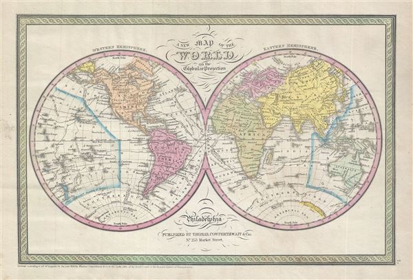
A New Map of the World in the Globular Projection.
sold
- Digital Map Information
- Suitable for large format printing
- DPI: 300
- File Size: 5.45 MB
- File Type: ZIP / TIFF
- ICC color profile embedded
- Delivered instantly via download link
This is a beautiful hand colored map of the world published by S. A. Mitchell Sr. in 1850. Depicts the world on hemispherical projection and offers a fascinating snapshot of the world during a period of rapid ... (more details)

Georgetown and the City of Washington The Capital of the United States of America.
sold
- Digital Map Information
- Suitable for large format printing
- File Size: 8.29 MB
- File Type: ZIP / TIFF
- ICC color profile embedded
- Delivered instantly via download link
A beautiful 1856 example of Colton's map of Washington D.C. and Georgetown. Like most of Colton's state maps, this map was derived from an earlier wall map of North America produced by Colton and D. Griffing ... (more details)

Carte de la Kharismie.
sold
- Digital Map Information
- Suitable for large format printing
- Full resolution TIFF file
- ICC color profile embedded
- Delivered instantly via download link
This is a scarce c. 1808 map of Khwarezm or Chorasima on the Amu Darya river delta in Uzbekistan. It covers this large oasis region in western central Asia from the Aral Sea (formerly a large lake that has ... (more details)
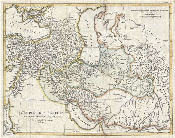
L'Empire des Parthes, pour l'Histoire des Empereurs Romains.
sold
- Digital Map Information
- Suitable for large format printing
- Full resolution TIFF file
- ICC color profile embedded
- Delivered instantly via download link
This is a scarce 1749 map of the Parthian or Arsacid Empire by J. B. B. D'Anville. Centered on the ancient Arsacid Empire in ancient Persia or Iran, it covers from Cyprus and Ankara in modern day Turkey ... (more details)
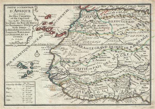
Partie Occidentale D'Afrique ou se trouve les Isles Canaries, et du Cap Ver dans la Mer Atlantique les Etats du Roy de Maroc, des Royaumes d'Alger et de Tunis, de Biledulgerid, et le Saara, en Barbarie, La Nigritie, et la Guinee.
sold
- Digital Map Information
- Suitable for large format printing
- Full resolution TIFF file
- ICC color profile embedded
- Delivered instantly via download link
This is a scarce 1701 map of western Africa by Nicholas De Fer. It covers the northwestern part of Africa from the Mediterranean Sea to the Gulf of Guinea and the Bight of Benin, and from the Cape Verde ... (more details)
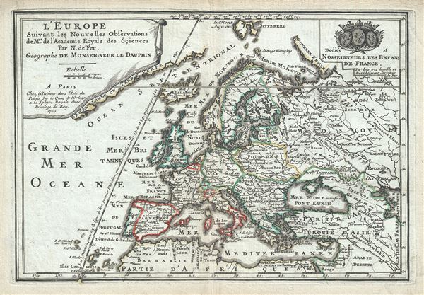
L'Europe.
sold
- Digital Map Information
- Suitable for large format printing
- Full resolution TIFF file
- ICC color profile embedded
- Delivered instantly via download link
This is a beautiful 1700 map of Europe by Nicholas De Fer. It covers the entire continent including Iceland and the northern coast of Africa, Asia Minor and parts of the Middle East. The map renders ... (more details)
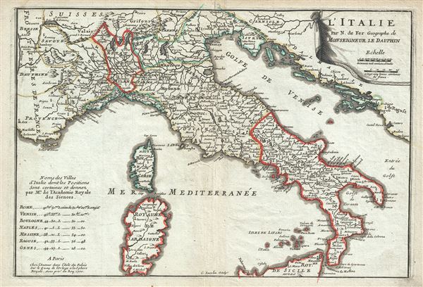
L'Italie.
sold
- Digital Map Information
- Suitable for large format printing
- Full resolution TIFF file
- ICC color profile embedded
- Delivered instantly via download link
This is an attractive 1700 map of Italy by Nicholas De Fer. It covers from Tirol in Austria south to the northern part of Sicily and includes the Islands of Sardinia and Corsica. The map renders the ... (more details)
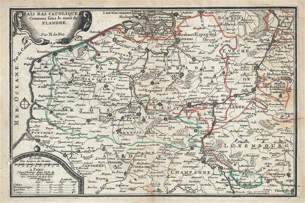
Pais Bas Catoliques Connues sous le nom de Flandre.
sold
- Digital Map Information
- Suitable for large format printing
- Full resolution TIFF file
- ICC color profile embedded
- Delivered instantly via download link
This is an attractive 1701 map of Flanders by Nicholas De Fer. The map depicts modern day Belgium and Luxemburg along with parts of Germany, France and Holland, a region commonly called Flanders at ... (more details)