
Covers the historic Gascony region in southwest France.
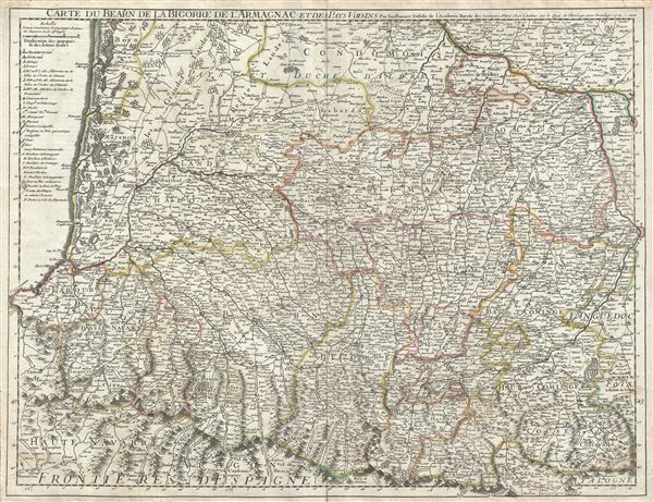
Carte du Bearn de la Bigorre de l'Armagnac et des Pays Voisins.
sold
- Digital Map Information
- Suitable for large format printing
- DPI: 300
- File Size: 20.73 MB
- File Type: ZIP / TIFF
- ICC color profile embedded
- Delivered instantly via download link
This is a fine example of the 1712 Guillaume De L'isle map of the Bearn, Bigorre and Armagnac regions of France. It covers the southwest portion of France from Bazas south to Canfranc in Spain and from Pamplona east as far as Toulouse and includes parts of the ... (more details)

L'Espagne.
sold
- Digital Map Information
- Suitable for large format printing
- DPI: 300
- File Size: 16.2 MB
- File Type: ZIP / TIFF
- ICC color profile embedded
- Delivered instantly via download link
A beautiful example of Guillaume De L'isle's 1701 map of Spain and Portugal. It covers the Iberian Peninsula as well as adjacent parts of France and Africa and prominently displays the Balearic Islands of Majorca, Minorca, and Ibiza. The map renders the ... (more details)
Covers the Burgundy Wine Regions and Champagne Regions of Northeast France.
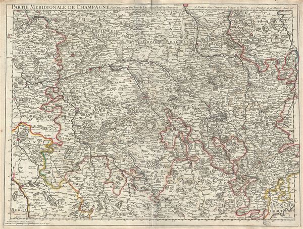
Partie Meridionale de Champagne.
sold
- Digital Map Information
- Suitable for large format printing
- DPI: 300
- File Size: 20.15 MB
- File Type: ZIP / TIFF
- ICC color profile embedded
- Delivered instantly via download link
A beautiful 1713 map of the southern part of the Champagne Region in France by Guillaume De L'isle. It covers the Champagne-Ardenne and the Ile-de-France regions in northeast France. The map covers from Nemours east to Vaucouleurs and from Chalons south ... (more details)
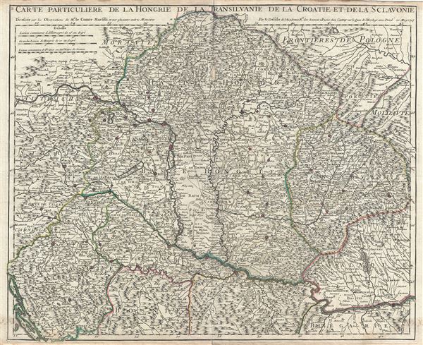
Carte Particuliere de la Hongrie de la Transilvanie de la Croatie et de la Sclavonie.
sold
- Digital Map Information
- Suitable for large format printing
- DPI: 300
- File Size: 19.97 MB
- File Type: ZIP / TIFF
- ICC color profile embedded
- Delivered instantly via download link
This is a fine example of the 1717 Guillaume De L'isle map of Hungary, Transylvania (Romani), Slovakia and Croatia. It includes the modern day nations of Hungary and Slovakia, as well as parts of Austria, Czech Republic, Croatia, Serbia, Ukraine, Poland, ... (more details)
Covers the Burgundy Wine Regions of Cote de Nuits, Cote de Beaune, and Cote Chalonnaise and Maconnais.
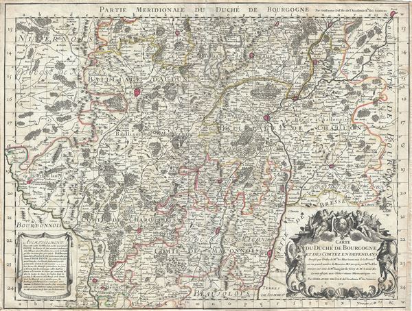
Carte du Duche de Bourgogne et des Comtez en Dependans.
sold
- Digital Map Information
- Suitable for large format printing
- DPI: 300
- File Size: 21.02 MB
- File Type: ZIP / TIFF
- ICC color profile embedded
- Delivered instantly via download link
An attractive 1709 map of Burgundy (Bourgogne), France by Guillaume De L'isle. Covers the southern part of the Burgundy region of France from Dole south as far as Pont-de-Veyle and west as far as Bourbon-Lancy. The map renders the entire region in ... (more details)
Rare map offering an unexplored Pacific Northwest.
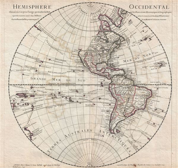
Hemisphere Occidental.
sold
- Digital Map Information
- Suitable for large format printing
- DPI: 300
- File Size: 13.32 MB
- File Type: ZIP / TIFF
- ICC color profile embedded
- Delivered instantly via download link
An attractive 1724 map of the Western Hemisphere, or the Americas by the well-respected French cartographer Guillaume Delisle. Centered on North and South America, this map covers the Western Hemisphere from Pole to Pole and from the New Hebrides ... (more details)
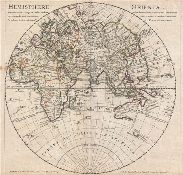
Hemisphere Oriental.
sold
- Digital Map Information
- Suitable for large format printing
- DPI: 300
- File Size: 13.73 MB
- File Type: ZIP / TIFF
- ICC color profile embedded
- Delivered instantly via download link
An attractive 1724 map of the Eastern Hemisphere by the well-regarded French cartographer Guillaume Delisle. The map covers the Eastern Hemisphere from Pole to Pole and, along the Equator, from Western Africa to Eastern Australia, including all ... (more details)
Uncommon map illustrating nascent French colonial expansionism before the French and Indian War.
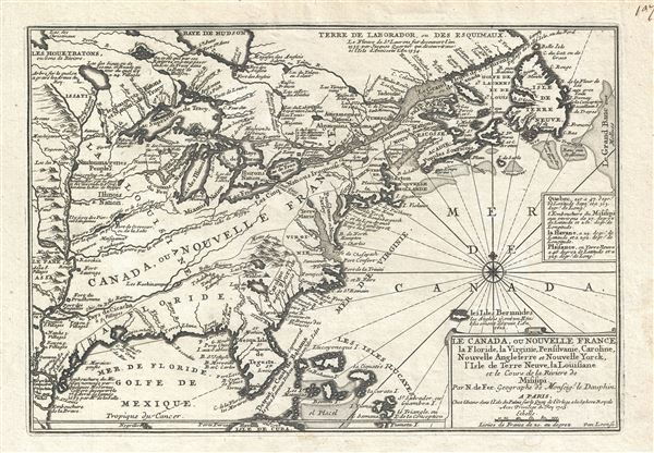
Le Canada, ou Nouvelle France La Floride, La Virginie, Pensilvanie, Caroline, Nouvelle Angleterre et Nouvelle Yorck, I'Isle de Terre Neuve, La Louisiane et le Courss de la Riviere de Misisipi.
sold
- Digital Map Information
- Suitable for large format printing
- DPI: 300
- File Size: 5.76 MB
- File Type: ZIP / TIFF
- ICC color profile embedded
- Delivered instantly via download link
This is a 1705 map of North America east of the Mississippi River by French cartographer Nicolas De Fer. Centered roughly on the Great Lakes and the Hudson Valley, this map depicts from the Mississippi River east to Newfoundland and the Grand ... (more details)
Scarce 1707 American 'captivity narrative' with accompanying map and other illustrations.
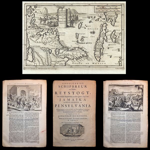
Jonathan Dickensons Ramspoedige Reystogt van Jamaika na Pensylvia nagespoord.
sold
- Digital Map Information
- Suitable for large format printing
- DPI: 300
- File Size: 3.58 MB
- File Type: ZIP / TIFF
- ICC color profile embedded
- Delivered instantly via download link
An exceptionally unusual and very rare 1707 folio 51 page captivity narrative and accompanying 1706 map of the east coast of America prepared by the Dutch cartographer Pieter van der Aa. The map was prepared to illustrate the accompanying ... (more details)
Scarce first edition of a very influential map of the Windward Isles.
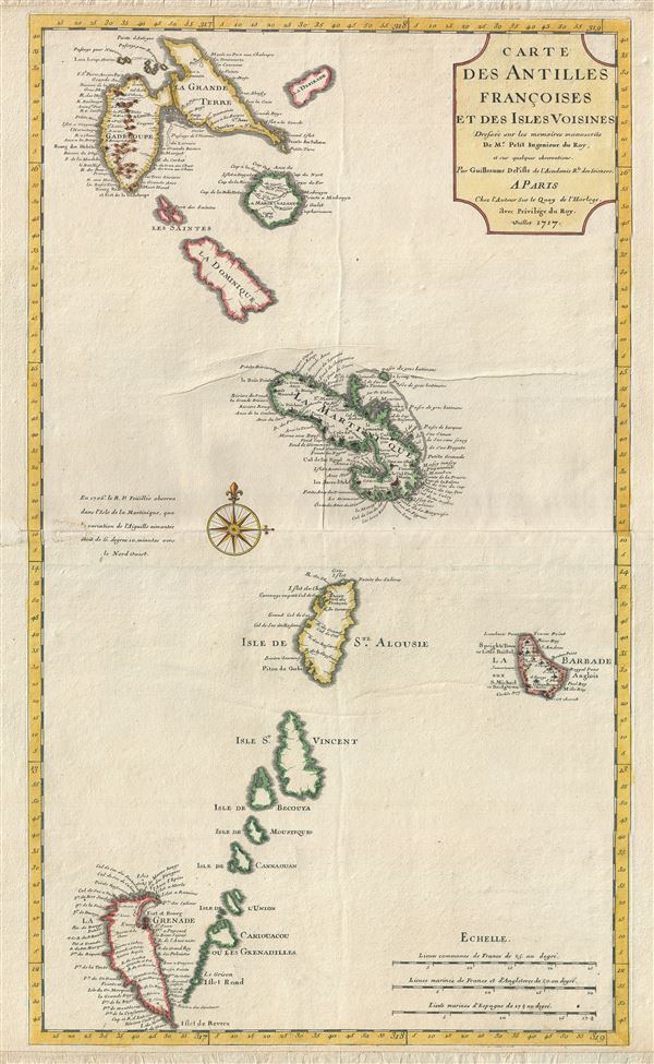
Carte des Antilles Francoises et Des Isles Voisines.
sold
- Digital Map Information
- Suitable for large format printing
- DPI: 300
- File Size: 13.91 MB
- File Type: ZIP / TIFF
- ICC color profile embedded
- Delivered instantly via download link
A scarce and influential 1717 first state first edition map of the Lesser Antilles, West Indies, by Guillaume Delisle. This map covers the predominately French portion of the West Indies from Guadeloupe to Grenada, including the ... (more details)
A sarce and beautiful map of Paris, France.
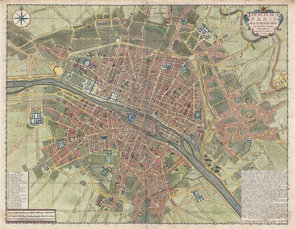
Le Plan de Paris ses Faubourgs et ses Environs.
sold
- Digital Map Information
- Suitable for large format printing
- DPI: 300
- File Size: 25.62 MB
- File Type: ZIP / TIFF
- ICC color profile embedded
- Delivered instantly via download link
A fine example of De Fer's scarce and beautiful 1717 map of Paris, France. Centered on the Seine River, the map covers from Ile aux Cygnes to Mont Louis, and from Les Porcherons to Le Gaubourg Saint-Marceau. All streets, ... (more details)
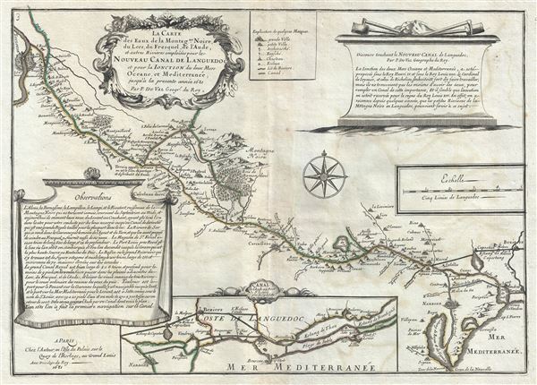
La Carte des Eaux de la Montagne Noire, du Lers, du Fresquel, de l'Aude, et autres Rivieres emploiees pour le Nouveau Canal de Languedoc et pour la Ionction des deux Mers Oceane, et Mediterranee, jusqu'a la presente annee 1681.
sold
- Digital Map Information
- Suitable for large format printing
- DPI: 300
- File Size: 9.12 MB
- File Type: ZIP / TIFF
- ICC color profile embedded
- Delivered instantly via download link
This is a scarce 1681 Pierre Du Val map of the Canal du Mudi or the Canal Royal en Languedoc. It covers from the Mediterranean and Etang-de Bages-Sigean westward to Toulouse. The map was drawn to show the waters of the ... (more details)
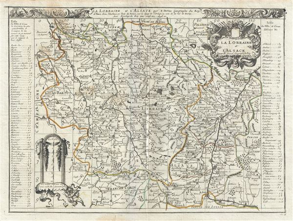
La Lorraine et l'Alsace.
sold
- Digital Map Information
- Suitable for large format printing
- DPI: 300
- File Size: 13.37 MB
- File Type: ZIP / TIFF
- ICC color profile embedded
- Delivered instantly via download link
This is a beautiful 1676 map of the French wine making region of Lorraine and Alsace by Pierre Du Val. It covers the north east portion of France along with parts of neighboring Germany and Luxemburg from Luxemburg City ... (more details)
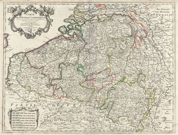
Carte des Pays Bas Catholiques.
sold
- Digital Map Information
- Suitable for large format printing
- Full resolution TIFF file
- ICC color profile embedded
- Delivered instantly via download link
This is a beautiful 1702 map by Guillaume De L'isle depicting the area now covered by the southern Netherlands, Belgium and Luxembourg. Also includes parts of neighboring Germany and France. The map extends from ... (more details)
Identifies the Isle of the Blessed or St. Branden's Island west of the Canary Islands and postulates a communication between the Niger and the Nile.

Carte de la Barbarie de la Nigritie et de la Guinee.
sold
- Digital Map Information
- Suitable for large format printing
- DPI: 300
- File Size: 20.43 MB
- File Type: ZIP / TIFF
- ICC color profile embedded
- Delivered instantly via download link
This is an excellent example of Guillaume De L'isle's influential 1707 map of western Africa. It covers the Barbary Coast and the Kingdoms of Fez, Tunis, and Tripoli southwards to the Gulf of Guinea and the Bight ... (more details)

Carte du Piemont et du Monferrat.
sold
- Digital Map Information
- Suitable for large format printing
- DPI: 300
- File Size: 21.75 MB
- File Type: ZIP / TIFF
- ICC color profile embedded
- Delivered instantly via download link
This is a beautiful 1707 map of Piedmont, Italy by Guillaume De L'isle. It covers the northwestern part of Italy as well as parts of France from Alagna Valsesia south to Carignano and from Valloire in France ... (more details)

Partie Septentrionale du Duche de Bourgogne.
sold
- Digital Map Information
- Suitable for large format printing
- DPI: 300
- File Size: 19.85 MB
- File Type: ZIP / TIFF
- ICC color profile embedded
- Delivered instantly via download link
An attractive 1709 map of Burgundy (Bourgogne), France by Guillaume De L'isle. Covers the northern part of the Burgundy region of France from Bar-sur-Seine south as far as Arnay-le-Duc and from Auxerre east ... (more details)
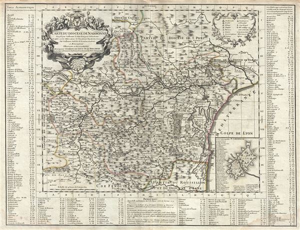
Carte du Diocese de Narbonne.
sold
- Digital Map Information
- Suitable for large format printing
- DPI: 300
- File Size: 18.18 MB
- File Type: ZIP / TIFF
- ICC color profile embedded
- Delivered instantly via download link
This is a beautiful 1704 map of Narbonne, France by Guillaume De L'isle. It covers the region from Aunat east as far as the Mediterranean and from Saint Pons south as far as Rivesaltes. Includes the French ... (more details)

Carte de Normandie ou sont marquez exactement Les Pays ou Contrees enfermees dans cette Province aussi bien que les Villes, Bourgs, Paroisses et autres lieux.
sold
- Digital Map Information
- Suitable for large format printing
- DPI: 300
- File Size: 22.4 MB
- File Type: ZIP / TIFF
- ICC color profile embedded
- Delivered instantly via download link
An attractive 1716 map of Normandy, France by Guillaume De L'Isle. It depicts the former French Duchy of Normandy and includes all or part of the departments of Calvados, Manche, Orne, Seine-Maritime and ... (more details)
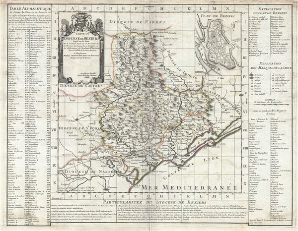
Carte du Diocese de Beziers.
sold
- Digital Map Information
- Suitable for large format printing
- DPI: 300
- File Size: 16.4 MB
- File Type: ZIP / TIFF
- ICC color profile embedded
- Delivered instantly via download link
This is an attractive 1708 Guillaume De L'isle map of the Diocese of Beziers and the Department of Herault. The map covers part of the Languedoc-Roussillon region in southern France from the Orb River ... (more details)