
Identifies the Sea of Korea.
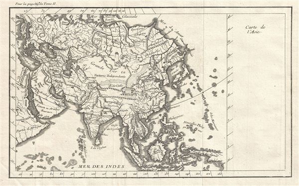
Carte de l'Asie.
$350.00
Acquire
- Digital Map Information
- Suitable for large format printing
- DPI: 300
- File Size: 5.18 MB
- File Type: ZIP / TIFF
- ICC color profile embedded
- Delivered instantly via download link
This is a fascinating late 18th century map of Asia of unknown origins. It covers the entire continent from the Mediterranean Sea and Africa east to Japan and New Guinea. This map is most interesting in its rendering of the largely unexplored extreme northeast of ... (more details)
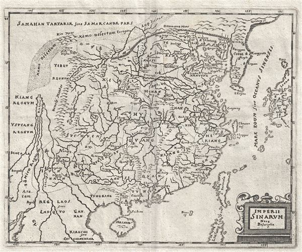
Imperii Sinarum Nova Descriptio.
sold
- Digital Map Information
- Suitable for large format printing
- DPI: 300
- File Size: 3.24 MB
- File Type: ZIP / TIFF
- ICC color profile embedded
- Delivered instantly via download link
This is an uncommon c.1680 map of China by Philip Cluver. The map covers China from Laos east as far as Japan and from the Great Wall south as far as Hainan and northern Philippines. Taiwan is also noted. Though based on an earlier map by Joan Blaeu with the ... (more details)
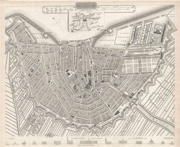
Amsterdam.
sold
- Digital Map Information
- Suitable for large format printing
- DPI: 300
- File Size: 8.09 MB
- File Type: ZIP / TIFF
- ICC color profile embedded
- Delivered instantly via download link
This is an attractive 1835 map or plan of the city of Amsterdam, Netherlands, prepared for publication by the Society for the Diffusion of Useful Knowledge, or S.D.U.K. It covers the capital city of the Netherlands from the IJ southward. It depicts the entire ... (more details)
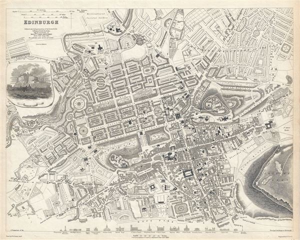
Edinburgh.
sold
- Digital Map Information
- Suitable for large format printing
- DPI: 300
- File Size: 8.16 MB
- File Type: ZIP / TIFF
- ICC color profile embedded
- Delivered instantly via download link
This is a beautiful 1834 map or plan of the city of Edinburgh, Scotland by the Society for the Diffusion of Useful Knowledge. Centered on Old Town, it covers the city of Edinburgh, known as the 'Athens of the North' in exceptional detail, noting individual ... (more details)

Australia.
sold
- Digital Map Information
- Suitable for large format printing
- File Size: 35.4 MB
- File Type: ZIP / TIFF
- ICC color profile embedded
- Delivered instantly via download link
This is an attractive 1942 or Showa 17 Japanese World War II era map of Australia and New Guinea issued by the Imperial Japan Land Survey Bureau. It covers Australia in its entirety, including Tasmania, as well as the islands of New Guinea, the Maluku ... (more details)
Identifies the Sea of Korea.
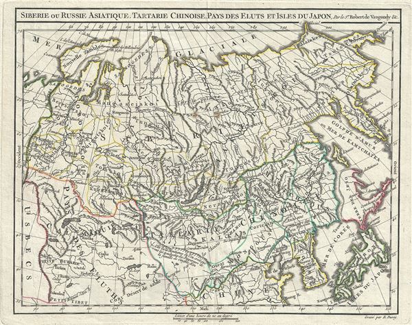
Siberie ou Russie Asiatique, Tartarie Chinoise, Pays des Eluts et Isles du Japon.
sold
- Digital Map Information
- Suitable for large format printing
- DPI: 300
- File Size: 4.97 MB
- File Type: ZIP / TIFF
- ICC color profile embedded
- Delivered instantly via download link
This is a rare and attractive 1778 map of Northern Asia, comprising Asian Russia, Siberia, Chinese Tartary, Korea, and Japan by Robert de Vaugondy. It covers the vast expanse of northern Asia from Novaya Zembla eastward as far as the Kamchatka ... (more details)

Tartary.
sold
- Digital Map Information
- Suitable for large format printing
- DPI: 300
- File Size: 16.47 MB
- File Type: ZIP / TIFF
- ICC color profile embedded
- Delivered instantly via download link
This fascinating hand colored 1814 map of central and East Asia, covering southern Tartary, Tibet (Tibet), Mongolia, and generally the whole of Central Asia. The area is named after the 'Tartars,' the Turkic and Mongol peoples of the Mongol ... (more details)
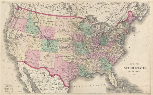
Map of the United States of America 1873.
sold
- Digital Map Information
- Suitable for large format printing
- File Size: 11.29 MB
- File Type: ZIP / TIFF
- ICC color profile embedded
- Delivered instantly via download link
An attractive 1873 map of the United States issued by Fredrick Beers. This map covers the entire United States from Atlantic to Pacific, Canada to Mexico. It is color coded to identify all states. Important transnational rail routes are ... (more details)
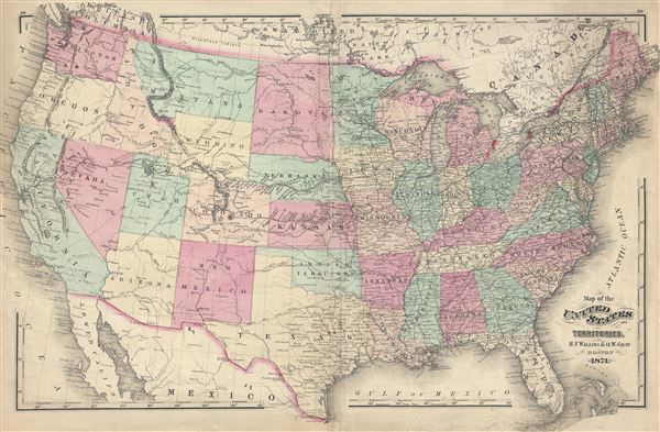
Map of the United States and Territories.
sold
- Digital Map Information
- Suitable for large format printing
- File Size: 15.11 MB
- File Type: ZIP / TIFF
- ICC color profile embedded
- Delivered instantly via download link
An attractive 1871 map of the United States issued by Henry Walling and Ormando Gray. This map covers the entire United States from Atlantic to Pacific, Canada to Mexico. It is color coded to identify all states. Important transnational ... (more details)

Preliminary Chart of Hampton Roads and Elizabeth River Virginia.
sold
- Digital Map Information
- Suitable for large format printing
- File Size: 7.24 MB
- File Type: ZIP / TIFF
- ICC color profile embedded
- Delivered instantly via download link
An attractive 1857 U.S. Coast Survey maritime map or nautical chart of Hampton Roads, Virginia. The map covers from Hampton Virginian south along the Elisabeth River to Norfolk Virginia. Hampton Roads in . Hampton Roads comprises the ... (more details)

Norfolk Harbor Virginia.
sold
- Digital Map Information
- Suitable for large format printing
- File Size: 6.85 MB
- File Type: ZIP / TIFF
- ICC color profile embedded
- Delivered instantly via download link
An attractive 1857 U.S. Coast Survey maritime map or nautical chart of Norfolk Harbor, Virginia. Centered on the Elizabeth River, this map covers the adjacent towns of Norfolk and Portsmouth Virginia. It includes the Portsmouth Navy ... (more details)
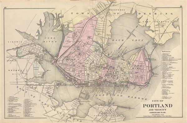
City of Portland and Vicinity Cumberland Co. Me.
sold
- Digital Map Information
- Suitable for large format printing
- File Size: 3.56 MB
- File Type: ZIP / TIFF
- ICC color profile embedded
- Delivered instantly via download link
An uncommon 1885 map of Portland Maine by Gorge N. Colby and his partner J. H. Stuart. The map covers most of downtown Portland and Portland Harbor. Includes adjacent towns of Deering, Cape Elizabeth, Cash Corner, and Ligonia. ... (more details)
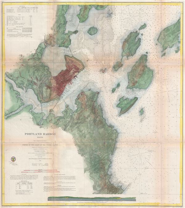
Portland Harbor, Maine.
sold
- Digital Map Information
- Suitable for large format printing
- File Size: 24.03 MB
- File Type: ZIP / TIFF
- ICC color profile embedded
- Delivered instantly via download link
A beautiful example of the U.S. Coast Survey's 1866 nautical chart or maritime map of Portland Harbor, Maine. Centered on the city of Portland, this map covers from Westbrook to Long Island and from the mouth of the Presumpscot ... (more details)
One of the last French maps to use the term 'Sea of Korea'.
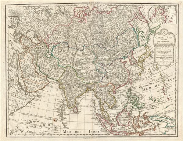
Carte D'Asie dressee pour L'Instruction…
sold
- Digital Map Information
- Suitable for large format printing
- DPI: 300
- File Size: 20.59 MB
- File Type: ZIP / TIFF
- ICC color profile embedded
- Delivered instantly via download link
A rare and attractive 1800 map of Asia by Guillaume Delisle and Philippe Buache. Centered on Independent Tartary, this map covers the entire continent from Africa and the Mediterranean east to the Bering Sea and south as far as ... (more details)
A stunning overview of Africa on the cusp of European exploration into the interior.

Afrique divisee en ses principaux Empires et Royaumes.
sold
- Digital Map Information
- Suitable for large format printing
- DPI: 300
- File Size: 20.65 MB
- File Type: ZIP / TIFF
- ICC color profile embedded
- Delivered instantly via download link
An important an unusual c. 1795 folding pocket map of Africa by Robert de Vaugondy. Vaugondy first issued this map in 1749 and it went through at least seven states with editions appearing as late as 1810. Issued on the cusp of ... (more details)
Detailed map of Africa by the pre-eminent British cartographer of his day.
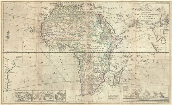
To the Right Honourable Charles Earl of Peterborow, and Monmouth, and C. This map of Africa, According to ye Newest and Most Exact Observation is humbly Dedicated by your Lordship's most Humble Servant H. Moll Geographer.
sold
- Digital Map Information
- Suitable for large format printing
- DPI: 300
- File Size: 30.9 MB
- File Type: ZIP / TIFF
- ICC color profile embedded
- Delivered instantly via download link
An impressive c. 1732 map of Africa by Herman Moll. One of the largest and most detailed maps of Africa to appear in the early 18th century, Moll's masterpiece covers the entire continent of Africa, as well as portions of the ... (more details)
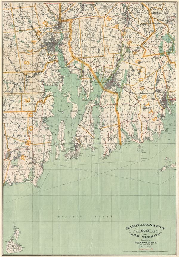
Narragansett Bay and Vicinity.
sold
- Digital Map Information
- Suitable for large format printing
- File Size: 20.49 MB
- File Type: ZIP / TIFF
- ICC color profile embedded
- Delivered instantly via download link
This is an uncommon and attractive 1892 map of Narragansett Bay and vicinity, Rhode Island by the Boston map publisher George H. Walker. It covers the entirety of Narragansett Bay from Block Island to Providence extending ... (more details)

Johnson's New Map of the State of Texas.
sold
- Digital Map Information
- Suitable for large format printing
- File Size: 14.76 MB
- File Type: ZIP / TIFF
- ICC color profile embedded
- Delivered instantly via download link
This is an exceptional example of A. J. Johnson's highly desirable 1863 map of Texas. Created during the American Civil War, this extraordinary folio map details the state of Texas in full. Identifies the elevated Table ... (more details)

The United States of America.
sold
- Digital Map Information
- Suitable for large format printing
- File Size: 16.25 MB
- File Type: ZIP / TIFF
- ICC color profile embedded
- Delivered instantly via download link
An excellent 1855 first edition example of Colton's rare map of the United States. Like most of Colton's regional maps, this map was derived from an earlier wall map of North America produced by Colton and D. Griffing ... (more details)
Identifies the Sea of Korea.
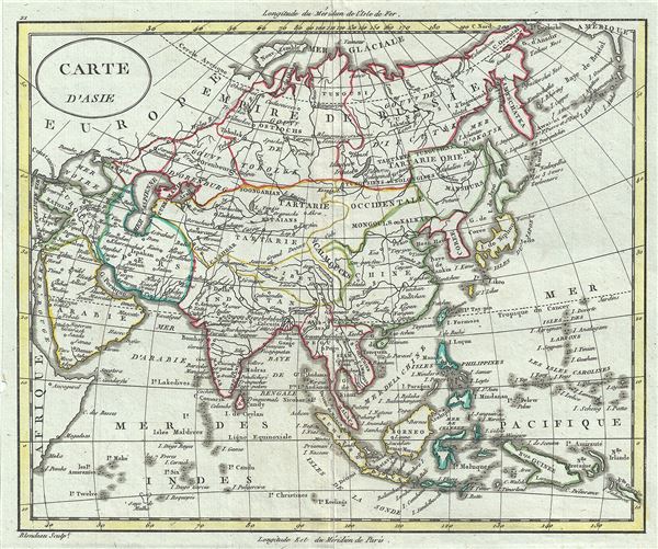
Carte d'Asie.
sold
- Digital Map Information
- Suitable for large format printing
- DPI: 300
- File Size: 2.78 MB
- File Type: ZIP / TIFF
- ICC color profile embedded
- Delivered instantly via download link
This is a fine c.1800 map of Asia by Alexandre Blondeau. It covers the entire continent from Africa and the Mediterranean east to the Bering Sea and south as far as Java and New Guinea. This map is most interesting in ... (more details)