
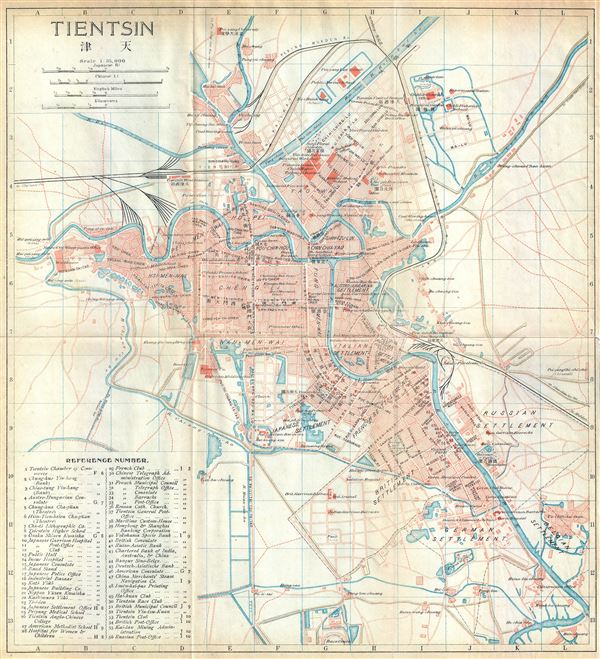
Tientsin.
sold
- Digital Map Information
- Suitable for large format printing
- File Size: 3.93 MB
- File Type: ZIP / TIFF
- ICC color profile embedded
- Delivered instantly via download link
This is an appealing 1915 bi-lingual railway map if Tientsin or Tianjin, China, issued by the Imperial Japanese Government Railways. The map depicts Tianjin, the fourth most populous city in China, in great detail. Several streets, individual buildings, rivers, ... (more details)
Early and unusual map detailing Central Park, Riverside Park, and the Upper West Side to 154th St.

Map Showing the progress made by the Commissioners of the Central Park in laying out Streets, Roads, Public Squares and Places and new Pier and Bulkhead Lines within the district shown thereon.
sold
- Digital Map Information
- Suitable for large format printing
- File Size: 27.11 MB
- File Type: ZIP / TIFF
- ICC color profile embedded
- Delivered instantly via download link
An altogether extraordinary 1868 map of New York City's Central Park and the Upper West Side prepared and printed for inclusion in the Thirteenth Annual Report of the Board of Commissioners of the Central Park . This is an extremely rare variant on the map of ... (more details)
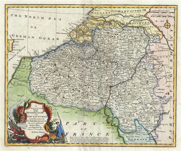
A New and Accurate Map of the Netherlands or Low Countries.
sold
- Digital Map Information
- Suitable for large format printing
- DPI: 300
- File Size: 10.65 MB
- File Type: ZIP / TIFF
- ICC color profile embedded
- Delivered instantly via download link
This is a beautiful 1747 map of Belgium by the British cartographer Emanuel Bowen. The map depicts Belgium and Luxembourg along with parts of Germany, France and Holland. The map notes several towns, cities, rivers, lakes, roads and a host of additional ... (more details)
Uncommon presentation of Texas and highlighting of the California Gold Region.

Vereinigte Staaten von Nord-America: Californien, Texas und die Territorien New Mexico u. Utah.
sold
- Digital Map Information
- Suitable for large format printing
- DPI: 300
- File Size: 4.57 MB
- File Type: ZIP / TIFF
- ICC color profile embedded
- Delivered instantly via download link
This is an uncommon and appealing 1852 map of the American southwest by Joseph Meyer. The map covers the greater southwest from the 42nd parallel south to include all of modern day California, Utah, Nevada, Arizona, New Mexico, Texas, Colorado, and ... (more details)
Identifies the Sea of Korea.
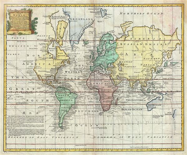
A New and Accurate Chart of the World.
sold
- Digital Map Information
- Suitable for large format printing
- DPI: 300
- File Size: 11.23 MB
- File Type: ZIP / TIFF
- ICC color profile embedded
- Delivered instantly via download link
This is an extremely attractive 1744 map of the World by the English cartographer Emanuel Bowen. This beautiful map presents the entire world on Mercator's projection as it was understood in the middle part of the 18th century, before the landmark ... (more details)
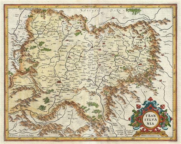
Transylvania.
sold
- Digital Map Information
- Suitable for large format printing
- DPI: 300
- File Size: 9.82 MB
- File Type: ZIP / TIFF
- ICC color profile embedded
- Delivered instantly via download link
This is a beautiful 1606 map of Transylvania (present day Romania) by Gerard Mercator. It covers what is today the northern part of Romania and from the Kerezbanya east as far as Totros. The map notes several towns, rivers, forests, mountains and ... (more details)
The largest and most dramatic pocket map of Long Island to appear in the 19th century.
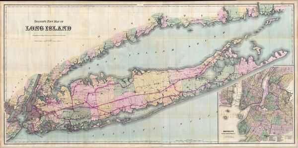
Colton's New Map of Long Island.
sold
- Digital Map Information
- Suitable for large format printing
- File Size: 76.2 MB
- File Type: ZIP / TIFF
- ICC color profile embedded
- Delivered instantly via download link
This is Colton's 1884 'New Map of Long Island,' possibly the largest and most dramatic map of Long Island to appear in the 19th century. Colton's map covers the region from Newark, Staten Island, and New York City eastward as far as Montauk and ... (more details)
An extremely scarce manifest-destiny era wall map of the United States with an inset of the newly admitted Texas.
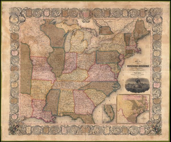
Map of the United States from the Best Authorities.
sold
- Digital Map Information
- Suitable for large format printing
- DPI: 300
- File Size: 74.47 MB
- File Type: ZIP / TIFF
- ICC color profile embedded
- Delivered instantly via download link
A scarce 1846 wall map of the United States by Horace Thayer and Edward Ensign. This remarkable map covers the United Stated from Texas and the Upper Mississippi Valley eastward to the Atlantic and from Lake Superior to the Gulf of Mexico. ... (more details)

Firestone. Map Puzzle.
sold
This is an attractive and unusual c. 1928 jigsaw puzzle map by Ernest Clegg. This puzzle, issued by Bert Fisher and Benjamin Pohl of the Firestone Tire and Rubber Company, is created from the original print advertisement of 1928 for ... (more details)
Map showing the ephemeral Republic of Texas.
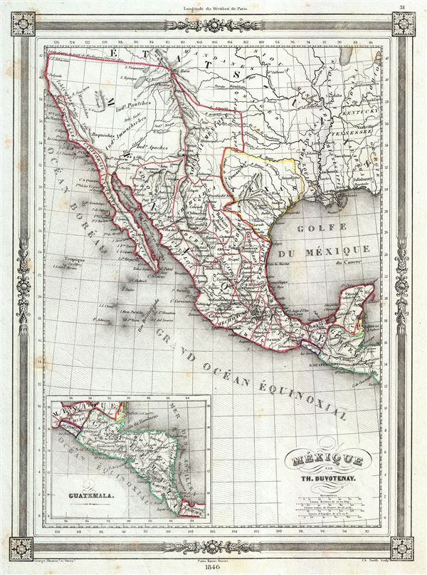
Mexique.
sold
- Digital Map Information
- Suitable for large format printing
- Full resolution TIFF file
- ICC color profile embedded
- Delivered instantly via download link
This is a highly desirable 1846 map of Mexico by Thunot Duvotenay. Duvotenay published several different editions of this Mexico map - this being the most desirable due to its depictions of the ephemeral Republic of Texas. The map ... (more details)
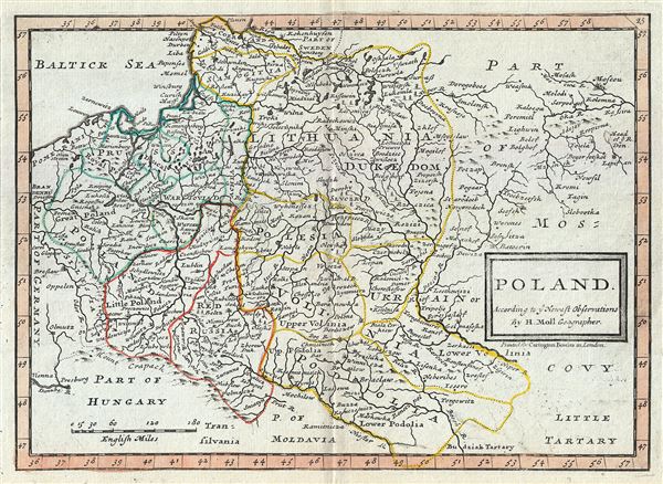
Poland According to ye Newest Observations by Herman Moll Geographer.
sold
- Digital Map Information
- Suitable for large format printing
- Full resolution TIFF file
- ICC color profile embedded
- Delivered instantly via download link
This is a beautiful 1784 map of Poland by Herman Moll, issued by Carrington Bowles. The map covers Poland and Lithuania as well as parts of Germany, the Russian Empire, Hungary, Transylvania (Romania), and Latvia. Several ... (more details)
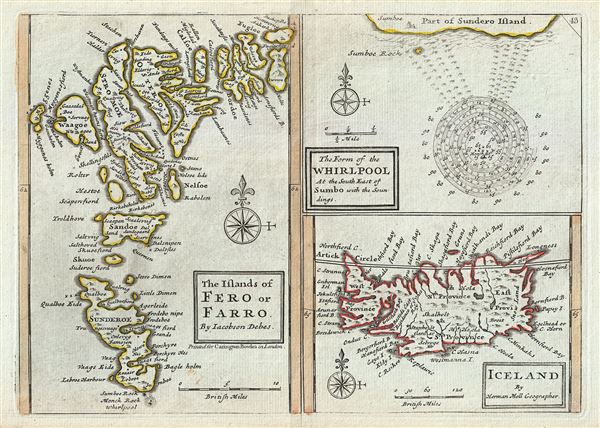
The Islands of Fero or Farro by Jacobson Debes. The Form of the Whirlpool At the South East of Sumbo with the Soundings. Iceland by Herman Moll Geographer.
sold
- Digital Map Information
- Suitable for large format printing
- Full resolution TIFF file
- ICC color profile embedded
- Delivered instantly via download link
This is a singularly fascinating 1784 map of Iceland and the Faroe Islands issued by Carrington Bowles. Essentially a compilation of three maps on a single sheet, this map of the North Atlantic islands is festooned with ... (more details)
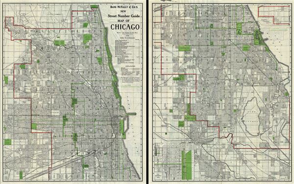
Rand McNally and Co.'s New Street Number Guide Map of Chicago
sold
- Digital Map Information
- Suitable for large format printing
- Full resolution TIFF file
- ICC color profile embedded
- Delivered instantly via download link
This is an uncommon 1916 pocket map or city plan of Chicago, Illinois by Rand McNally and Company. The Rand McNally Company issued this enormous pocket map to illustrate their home city in incredible detail. The map is ... (more details)

A New and Accurate Map of Scandinavia or the Northern Crowns of Sweden, Denmark and Norway. A Map of Spitzbergen or Greenland, Iceland and some part of Groenland etc.
sold
- Digital Map Information
- Suitable for large format printing
- DPI: 300
- File Size: 4.76 MB
- File Type: ZIP / TIFF
- ICC color profile embedded
- Delivered instantly via download link
This is a fascinating 1747 map of Scandinavia by the British cartographer Emanuel Bowen. It covers Denmark, Norway, Sweden, Finland (shown as part of Sweden) and parts of the Russian Empire. The map notes several ... (more details)
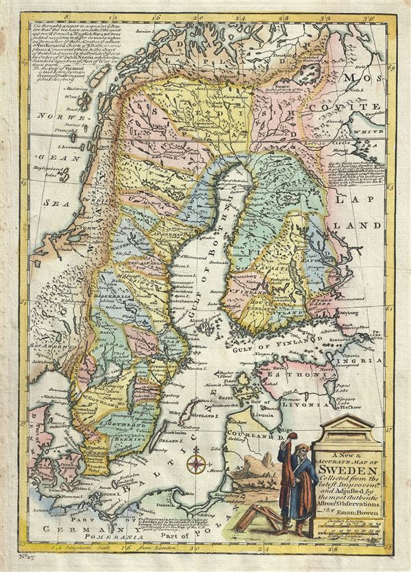
A New and Accurate Map of Sweden.
sold
- Digital Map Information
- Suitable for large format printing
- DPI: 300
- File Size: 5.07 MB
- File Type: ZIP / TIFF
- ICC color profile embedded
- Delivered instantly via download link
This is an attractive 1747 map of Sweden by the British cartographer Emanuel Bowen. It covers Sweden and Finland (shown as part of Sweden) as well as parts of modern day Estonia, Latvia, Denmark and Poland. It ... (more details)
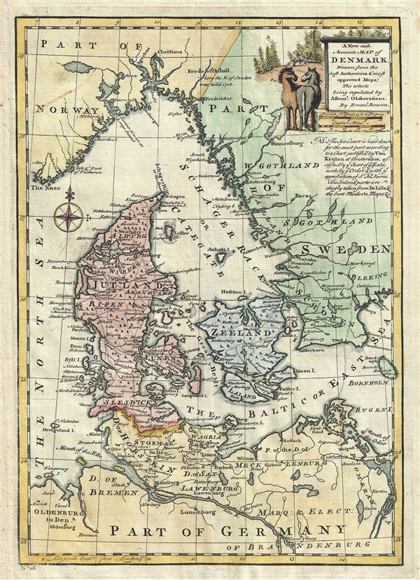
A New and Accurate Map of Denmark.
sold
- Digital Map Information
- Suitable for large format printing
- DPI: 300
- File Size: 4.15 MB
- File Type: ZIP / TIFF
- ICC color profile embedded
- Delivered instantly via download link
This is a beautiful 1747 map of Denmark by the British cartographer Emanuel Bowen. It covers all of Jutland and the islands of Zealand, Funen and Lolland. Parts of Sweden and Germany are also included. ... (more details)

Hong Kong and Lema Islands
sold
- Digital Map Information
- Suitable for large format printing
- File Size: 20.88 MB
- File Type: ZIP / TIFF
- ICC color profile embedded
- Delivered instantly via download link
This is a rare 1958 topographic chart or map of Hong Kong and the Lema Islands, China, issued by the British War Office and Air Ministry. It covers Hong Kong Island (with most of the urban development), ... (more details)
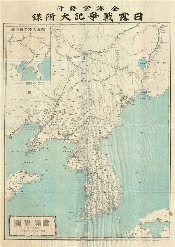
Korea and Manchuria.
sold
- Digital Map Information
- Suitable for large format printing
- File Size: 19.78 MB
- File Type: ZIP / TIFF
- ICC color profile embedded
- Delivered instantly via download link
This is an unusual and appealing large format map of Korea (Corea) and Manchuria dating to 1904 or Meiji 37. This map, made in the 37th year of the Emperor Meiji's reign, covers all of peninsular Korea ... (more details)

Historical Map of the World.
sold
- Digital Map Information
- Suitable for large format printing
- Full resolution TIFF file
- ICC color profile embedded
- Delivered instantly via download link
This is a fascinating 1813 historical map of the world on hemispherical projection by R. Juigne. This early 19th century map was designed to illustrate the activities of important explorers of the ... (more details)

Africa Interior.
sold
- Digital Map Information
- Suitable for large format printing
- Full resolution TIFF file
- ICC color profile embedded
- Delivered instantly via download link
A very curious map of central Africa dating to approximately 1730 by Henry H. Toms. It covers the mid-section of Africa roughly from the Gulf of Guinea and the Atlantic eastward to the Red Sea and ... (more details)